18th Century Maps
to
1,513
1,845
17
1,864
26
1
1
2,929
2,257
475
3
290
34
10
126
10
37
9
2
5
4
3
3
1,851
19
11
3
1
157
45
43
38
26
1,864
1,864
1,864
21
13
12
11
11
Period: 18th Century
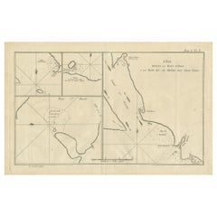
Antique Map of York's Bay, Haven of the Three Islands and Surroundings
Located in Langweer, NL
Antique map titled 'Baye St. David (..)'. Charts of York's Bay, Haven of the Three Islands, St. David's Bay, and Elizabeth's Bay. This map originates from the French edition of 'An A...
Category
Antique 18th Century Maps
Materials
Paper
$311 Sale Price
20% Off
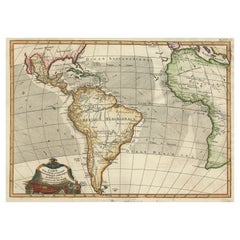
Antique Map of South American, The West Indies & Most of Africa, Ca.1775
Located in Langweer, NL
Antique map titled 'Carte pour Servir a l' Histoire Philosophique et Politique des Etablissemens et du Commerce des Europeens dans les deux Indes'.
This map is roughly centered o...
Category
Antique 18th Century Maps
Materials
Paper
$718 Sale Price
20% Off
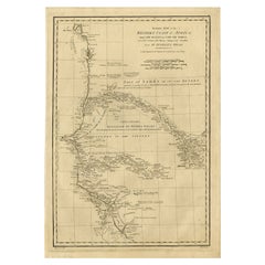
Map of the West African coast from the North of Mauretania to Guinee, 1788
Located in Langweer, NL
Antique map titled 'Particular Map of the Western Coast of Africa, from Cape Blanco to Cape de Verga, and of the Course of the Rivers Senega and Gambia.'
Map of the African coast...
Category
English Antique 18th Century Maps
Materials
Paper
$359 Sale Price
20% Off
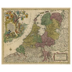
Large Antique Map of the Netherlands with Original Hand Coloring
Located in Langweer, NL
Original antique map titled 'Belgica Foederata complectens septem Provincias Ducatum Geldriae (..)". Large map of the Netherlands. Title a...
Category
Antique 18th Century Maps
Materials
Paper
$774 Sale Price
20% Off
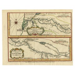
Antique Map of the Sanaga River, Senegal, 1747
Located in Langweer, NL
Antique map titled 'Cours De La Riviere De Sanaga Ou Senegal (..) - Kaart van den Loop der Riviere Sanaga (..)'. Attractive double map of the Sanaga River, Senegal, Africa. This map ...
Category
Antique 18th Century Maps
Materials
Paper
$321 Sale Price
20% Off
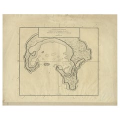
Antique Map of Christmas Island by Cook, 1784
Located in Langweer, NL
Antique map Kiribati titled 'Christmas Island (..)'. Antique map of Christmas Island, also known as Kiritimati. Originates from an edition of Cook's Voyages.
Artists and Engravers...
Category
Antique 18th Century Maps
Materials
Paper
$103 Sale Price
20% Off
Antique Map of Mozambique and Cape of Good Hope with Kingdom Monomotapa, 1780
Located in Langweer, NL
Antique map titled 'Carte Du Canal De Mozambique.' The main map, on the right, covers from the Cape of Good Hope north as far as Zanzibar and modern day Kenya, focusing on the gold r...
Category
Antique 18th Century Maps
Materials
Paper
$496 Sale Price
20% Off
Antique Map of Guadeloupe, Island in the Caribbean, c.1757
Located in Langweer, NL
Antique map titled 'Carte de L'Isle de la Guadeloupe'.
A very decorative map of Guadeloupe in the Caribbean, adorned with rhumb lines, fleur-de-lys, and two decorative rococo-style...
Category
Antique 18th Century Maps
Materials
Paper
$623 Sale Price
20% Off
Antique Map of present-day North-Rhine Westphalia, Germany
Located in Langweer, NL
Antique map titled 'Nova et Accurata Ducatus Cliviae et Comitatus Marchiae (..)'. Detailed regional map of Germany showing the region bounded by the Maas River in the west and to par...
Category
Antique 18th Century Maps
Materials
Paper
$500 Sale Price
20% Off
Antique Map of Juan Fernandez, Chile, c.1740
Located in Langweer, NL
Antique map titled 'l'Ile de Juan Fernandes dans la Mer du Sud (..)'.
This map depicts Juan Fernandez Island in the Southern Sea. Source unknown, to be determined.
Artists and En...
Category
Antique 18th Century Maps
Materials
Paper
$179 Sale Price
20% Off
Large Antique Sea Chart of the South-Eastern Coast of Sumatra, Indonesia
Located in Langweer, NL
Antique map titled 'Carte pour aller du Détroit de la Sonde ou de Batavia, au Détroit de Banca'. This uncommon sea chart shows northern Java and eastern Sumatra along with an inset of the small islands in the Detroit Sound. The handsome chart provides detailed navigational information, including the route of Julien Crozet in April 1772, who led a French expedition to the South Pacific after the voyage's commander, Marion De Fresne, and 26 crew members were killed (and allegedly eaten) by a Maori tribe in the Bay of Islands off the coast of New Zealand. With title upper left corner and small inset map of the small isles nearby the south-eastern coast of Sumatra.
J. B. d'Apres de Mannevillette, from his atlas "Neptune orientale". French sailor...
Category
Antique 18th Century Maps
Materials
Paper
$444 Sale Price
20% Off
Antique Map of the Lorraine Region 'France' (c.1735)
Located in Langweer, NL
Antique map titled 'Carte du Duche de Lorraine - Kaart van Lotharingen'. A detailed map of the Duchy of Lorraine. The map is surrounded by thirteen vignette bird-eye view of fortifie...
Category
Antique 18th Century Maps
Materials
Paper
$259 Sale Price
20% Off
Set of 2 Antique Maps covering part of modern-day Czech Republic
Located in Langweer, NL
Set of two antique maps titled 'Marchionatus Moraviae circulus Preroviensis'. Two individual sheets covering part of modern-day Czech Republic. Cities included are Opava, Fulnek, Lip...
Category
Antique 18th Century Maps
Materials
Paper
Old Engraving of the Ruins of the Palace of Cleopatra in Old Egypt, Africa
Located in Langweer, NL
This plate shows views of the ruins of the Palace of Cleopatra, Egypt. Source unknown, to be determined. Artists and Engravers: Cornelis de Bruijn (also spelled Cornelius de Bruyn, p...
Category
Antique 18th Century Maps
Materials
Paper
Antique Print of the City of Ten-Tchoo-Foo, China, 1796
Located in Langweer, NL
Antique print titled 'View of the City of Ten-Tchoo-Foo from the Anchorage of the Hindostan in the Strait of Mi-a-Tau Bearing South-West'. Together on a sheet with 'Cape Maccartney and Cape Gower'.
The top two views depict coastal profile views of local islands named after important people in the Embassy, including Macartney, Staunton, and Gower. Below, a view of the city of Ten-Tchoo-Foo taken from aboard the Hindostan, one of the ships on the mission. These land approach views appeared in the account of George Macartney's travels to China, published by George Nicol. Macartney was Britain's first envoy to China, and was tasked with convincing Emperor Qianlong to ease restrictions on trade between Great Britain and China by allowing the British to have a permanent embassy in the country. Sir George Staunton prepared the official report, 'An Authentic Account of an Embassy from the King of Great Britain to the Emperor of China', which included charts and views based on manuscript sketches and drawings by Sir John Barrow...
Category
Antique 18th Century Maps
Materials
Paper
$652 Sale Price
20% Off
Antique Decorative French Map of Java, Indonesia, 1718
Located in Langweer, NL
Antique map of Java titled 'Carte de l'Ile de Java: Partie Occidentale, Partie Orientale, Dressee tout Nouvellement (..)'.
Decorative large format map...
Category
Antique 18th Century Maps
Materials
Paper
$2,504 Sale Price
20% Off
Antique Map of Asia Minor with Cyprus, Syria and Turkey and the Black Sea, 1747
Located in Langweer, NL
Antique map Middle East titled 'A New and accurate map of Anatolia or Asia Minor, with Syria and such other provinces of the Turkish Empire (.....
Category
Antique 18th Century Maps
Materials
Paper
$425 Sale Price
20% Off
Antique Map of Northern Germany by M. Seutter, circa 1730
Located in Langweer, NL
Antique map titled 'Saxoniae Inferioris Circulus'. Old map of the northern part of Germany by M. Seutter. Covering the area of Lower Saxony, Mecklenburg-Vorpommern and Schleswig-Hols...
Category
Antique 18th Century Maps
Materials
Paper
$557 Sale Price
20% Off
Map of Northern India and Pakistan 'Mogol', Showing Kabul, Delhi Etc., 1758
Located in Langweer, NL
Antique map titled 'Mogol'.
Map of Northern India and Pakistan ('Mogol'), showing Kabul, Delhi and surroundings. This map originates from 'Kort begrip der Oude en Nieuwe Staatkun...
Category
Antique 18th Century Maps
Materials
Paper
$349 Sale Price
20% Off
Antique Map of Ambon and Boero by Valentijn, 1726
By F. Valentijn
Located in Langweer, NL
Untitled map of the western part of the island Amboina with Boero, Indonesia. This print originates from 'Oud en Nieuw Oost-Indiën' by F. Valentijn.
Category
Dutch Antique 18th Century Maps
Materials
Paper
$472 Sale Price
20% Off
Antique Map of New Ireland, 1774
Located in Langweer, NL
Antique print titled 'Neu Irrland (..)'. Antique map of New Ireland with 7 coastal profiles, Papua New Guinea. Originates from 'Geschichte der See-Reisen u...
Category
Antique 18th Century Maps
Materials
Paper
$274 Sale Price
20% Off
Antique Hand-Colored Map of France by J.B. Elwe, 1792
Located in Langweer, NL
Antique map titled 'Carte Nouvelle du Royaume de France'. Beautiful antique map of France, including the Southern part of England. Decorated with cartouche and 12 coats of arms.
Category
Antique 18th Century Maps
Materials
Paper
$803 Sale Price
20% Off
Antique Map of France at the End of the Reign of Jean II by Zannoni, 1765
Located in Langweer, NL
Antique map France titled 'La France sous la fin du Regne de Jean II (..)'. Beautiful old map of France. This map originates from 'Atlas Historique de la France Ancienne et Moderne' ...
Category
Antique 18th Century Maps
Materials
Paper
$150 Sale Price
20% Off
Antique Map of Switzerland by Homann Heirs, c.1732
Located in Langweer, NL
Antique map titled 'Potentissimae Helvetiorum Reipublicae (..)'. Beautiful detailed map of Switzerland, showing the 13 cantons. The large title cartouche showing 13 coat of arms of t...
Category
Antique 18th Century Maps
Materials
Paper
$371 Sale Price
20% Off
Antique Map of the Siege of Groningen by Le Clerc, 1730
Located in Langweer, NL
Plate : 'Het Belegh der Stadt Groningen in den Jaere MDXCIV '. (The siege of Groningen in the year 1594.) This plate shows the fortified city of Groningen, The Netherlands. With legend. This attractive original old antique print / plate was published in several works by Hugo de Groot ('Nederlandtsche Jaerboeken' published in 1681.), P.C. Hooft ('Nederlandsche Historien ...', published 1703-1704.), P.C. Bor ('Oorsprongk, begin, en vervolgh der Nederlandsche oorlogen', published in 1680.)or Jean Le Clerc...
Category
Antique 18th Century Maps
Materials
Paper
$141 Sale Price
20% Off
Original Antique Bird's Eye View Plan of Hoorn, The Netherlands by Blaeu, c.1700
Located in Langweer, NL
Antique map titled 'Horna vulgo Hoorn'.
Bird's eye view plan of Hoorn, The Netherlands. With title cartouche, coats of arms and key. From an atlas published by De Wit, ca. 1698-1...
Category
Antique 18th Century Maps
Materials
Paper
$888 Sale Price
20% Off
Antique Map of the Maluku Islands or Moluccas, Indonesia
Located in Langweer, NL
Antique map titled 'Carte Particuliere des Isles Moluques'. This map depicts the islands of Herij, Ternate, Tidor, Pottebackers, Timor, Machian and Bachian. The Moluccan islands were...
Category
Antique 18th Century Maps
Materials
Paper
$141 Sale Price
20% Off
Antique Map of the Region of Fulda by Homann, c.1730
Located in Langweer, NL
Antique map titled 'S.R.I. Principatus Fuldensis in Buchonia'. Rare edition of the large JB Homann map of the principality of Fulda, Germany.
Artists and Engravers: Johann Baptist...
Category
Antique 18th Century Maps
Materials
Paper
$184 Sale Price
20% Off
Antique Map of Sumatra, Indonesia 'c.1780'
Located in Langweer, NL
Antique map titled 'Neue Karte von der Insel Sumatra'. Extremely rare map of Sumatra, Indonesia. Published circa 1780.
Category
Antique 18th Century Maps
Materials
Paper
$2,480 Sale Price
40% Off
Antique Map of the South Part of Great Britain by Tirion, c.1750
By Isaak Tirion
Located in Langweer, NL
Antique map titled 'Nieuwe Kaart van 'T Zuider Gedeelte van Groot Britannie behelzende Het Koningryk Engeland (..).'
Attractive map showing the south part of Great Britain; the K...
Category
Antique 18th Century Maps
Materials
Paper
$425 Sale Price
20% Off
Original Antique Map of the Bay and the Island of Arguin, Mauritania, 1747
Located in Langweer, NL
Antique map titled ’Plan de la Baye et Isle d'Arguim (..) - Oppervlakte van de Baai en 't Eiland van Arguin (..)'.
Original antique map of the bay and the island of Arguin. This ...
Category
Antique 18th Century Maps
Materials
Paper
$245 Sale Price
20% Off
Original Antique Map of the Region Between the Gulf of Lybia and the Red Sea
Located in Langweer, NL
Original antique map titled 'Aegyptus et Cyrene'. Detailed ancient map of the region between the Gulf of Lybia and the Red Sea, with marvelous detail along the Mediterranean Coastline and the Nile, Egypt. This map originates from 'Philippi Cluveri Introductionis in universam geographiam (..)' by P. Clüver. Published 1729.
Philipp Clüver was an Early Modern German geographer and historian. Cluver's Geography was one of the most enduring works of the 17th & 18th Centuries, issued by several different publishers with many different sets of maps...
Category
Antique 18th Century Maps
Materials
Paper
$396 Sale Price / item
20% Off
Antique Map of the Santa Cruz Islands with Inset of Carteret and Gower Islands
Located in Langweer, NL
Antique map titled 'Isles de la Reine Charlotte (..)'. A detailed chart of the Santa Cruz islands, to the north of the New Hebrides, with Carteret's track in "Swallow"; including an ...
Category
Antique 18th Century Maps
Materials
Paper
$283 Sale Price
20% Off
Antique Print of a Section of the Kew Gardens, London, England, c.1785
Located in Langweer, NL
Antique print titled 'Coupe sur la longueur d'une partie de la Galerie des Antiques dans les jardins de Kew'.
Copper engraving showing a section of the Royal Botanic...
Category
Antique 18th Century Maps
Materials
Paper
$340 Sale Price
20% Off
Antique Map of the Island of Java, Indonesia
Located in Langweer, NL
Antique map titled 'Nouvelle Carte de l'Isle de Java (..) - Nieuwe Kaart van het Eiland Java (..)'. Chart of the island of Java, depicting soundings around the coast, all principal h...
Category
Antique 18th Century Maps
Materials
Paper
$425 Sale Price
20% Off
Antique Frontispiece of an Old Dutch Book Depicting Globe Makers, 1717
Located in Langweer, NL
Antique frontispiece titled 'Iets voor Allen'. This print originates from 'Iets voor Allen, zijnde een Verhandeling en Verbeelding Van allerhande Standen, Studien, Konsten, Wetenscha...
Category
Antique 18th Century Maps
Materials
Paper
Antique Map of the Region of Zeitz in Germany, 1749
By Schreiber
Located in Langweer, NL
Antique map titled 'Das Stifft Zeitz (..)'. Map of the region of Zeitz, Germany. Zeitz is a town in the Burgenlandkreis district, in Saxony-Anhalt, Germany. It is situated on the riv...
Category
Antique 18th Century Maps
Materials
Paper
$311 Sale Price
20% Off
Cemetery on Amsterdam Island, French Territory in the Indian Ocean, ca.1785
Located in Langweer, NL
Antique print titled 'Begraafplaats op het eiland Amsterdam'.
Engraved view of a local cemetery on Amsterdam Island, a small French territory in the southern Indian Ocean. Origin...
Category
Antique 18th Century Maps
Materials
Paper
$274 Sale Price
20% Off
Old Map of Region Champagne-Ardenne with Reims, Troyes & Épernay in France, 1759
Located in Langweer, NL
Antique map titled 'Tabula Geographica Campaniae (..).'
Detailed map of the Champagne region in France by J. B. Homann, covering the region Champagne-Ardenne with Reims, Troyes a...
Category
Antique 18th Century Maps
Materials
Paper
$694 Sale Price
30% Off
Antique Map of Western Germany with part of the Netherlands
Located in Langweer, NL
Antique map titled 'Ducatus Iuliacensis Cliviensis et Montensis (..)'. Original old map of Western Germany with part of the Netherlands. Published by M. Seutter, circa 1750.
George...
Category
Antique 18th Century Maps
Materials
Paper
$425 Sale Price
20% Off
Antique Map of the Area centered on the Rhine River, Germany
Located in Langweer, NL
Antique map titled 'Uterque Rheni Circulus Superior (..)'. Fine old color map of the area centered on the Rhine River, from Strassbourg to Wesel and Duisburg, Germany. With cities hi...
Category
Antique 18th Century Maps
Materials
Paper
$623 Sale Price
20% Off
Antique Map of the Region of Namur by De Lat, 1737
Located in Langweer, NL
Untitled map of the region of Namur, Charlemont, Rochefort and surroundings, Belgium. This map originates from 'Nieuw en beknopt Kaart-Boekje vertoonende de XVII. Nederlandse Provint...
Category
Antique 18th Century Maps
Materials
Paper
$120 Sale Price
20% Off
Antique Print of Gibraltar, c.1720
Located in Langweer, NL
Antique print titled 'Gibraltar verovert door de Pr. van Hessen Darmstadt (..)'. Copper engraving of the capture of the fortified town of Gibraltar in 1704 during the War of the Span...
Category
Antique 18th Century Maps
Materials
Paper
$415 Sale Price
20% Off
Engraving of Idols of Secotam Village in Virginia 'or now North Carolina', 1721
Located in Langweer, NL
Two religious images on one plate. Upper image 'Kiwasa idole des Virginiens'.
Kiwasa, this Idol is placed in the temple of the town of Secotam, as the keeper of the king's dead c...
Category
Antique 18th Century Maps
Materials
Paper
$415 Sale Price
20% Off
Antique Map of the Course of the Rhine from Philippsburg to Duisburg, Germany
Located in Langweer, NL
Antique map titled 'Synopsis Circuli Rhenani Inferioris sive Electorum Rheni (..)'. This map shows the course of the Rhine from Philippsburg to Duisburg, as well as the course of the...
Category
Antique 18th Century Maps
Materials
Paper
$529 Sale Price
20% Off
Antique Map of Europe by Keizer & de Lat, 1788
Located in Langweer, NL
Antique map titled 'Kaartje van Europa (..)'. Uncommon original antique map of Europe. This map originates from 'Nieuwe Natuur- Geschied- en Handelkundige Zak- en Reisatlas' by Gerri...
Category
Antique 18th Century Maps
Materials
Paper
$377 Sale Price
20% Off
Original Copper-Engraving of Westergo, Part of Friesland, the Netherlands, 1744
Located in Langweer, NL
Antique map titled 'Westergo'.
Original antique map of Westergo, part of the province of Friesland, the Netherlands. Published 1744.
Artists and engravers: Isaak Tirion (1705 ...
Category
Antique 18th Century Maps
Materials
Paper
$604 Sale Price
20% Off
Miniature Map of England and Wales with Hand Coloring
Located in Langweer, NL
Antique map titled 'England and Wales'. An attractive miniature map of England and Wales enhanced with hand coloring. Originates from Cary's 'Traveller'...
Category
Antique 18th Century Maps
Materials
Paper
$245 Sale Price
20% Off
Antique Map of Western Tartary and the Gobi Desert of the Russian Empire, c.1750
Located in Langweer, NL
Antique map titled 'A Map of Western Tartary Drawn from the Survey of the Jesuits and Mr. Kyrillow's Map of the Russian Empire'. Map of the Gobi Desert and the eastern portion of the...
Category
Antique 18th Century Maps
Materials
Paper
$330 Sale Price
20% Off
Antique Map of Saldanha Bay 'Near Cape Town, South Africa' by Bellin, 1750
Located in Langweer, NL
Antique map titled ‘Carte De La Baye De Saldana ou Saldane Dressee sur les Remarques des Navigateurs’. Detailed plan of Saldanha Bay, northwest of Cape Town, South Africa. This map o...
Category
Antique 18th Century Maps
Materials
Paper
Antique Map of the Eastern Part of the World by Tirion, 1755
By Isaak Tirion
Located in Langweer, NL
Antique map titled 'Nieuwe Kaart van het Oostelykste Deel der Weereld, dienende tot Aanwyzing van de Scheepstogten der Nederlanderen naar Oostindië'. Australia (Nieuw Holland) shown ...
Category
Dutch Antique 18th Century Maps
Materials
Paper
$519 Sale Price
26% Off
Original Engraved Antique Map of the World, Colorful and Decorative, C.1780
Located in Langweer, NL
Antique map titled 'Mappemonde en Deux Hemispheres ou l'on a Indique les Nouvelles Decouvertes' - This handsome double hemisphere map presents a ...
Category
Antique 18th Century Maps
Materials
Paper
$444 Sale Price
20% Off
Antique Map of the Rhine centered on Cologne, Germany, with original coloring
Located in Langweer, NL
Antique map titled 'Archiepsiscopatus et Electoratus Coloniensis (..)'. Original antique map of the Rhine river, centered on Cologne, Germany. The Rhine River cuts across this map fr...
Category
Antique 18th Century Maps
Materials
Paper
$510 Sale Price
20% Off
Antique Map of the Coast of Guinea from, Cape Apollonia to the Volta River
Located in Langweer, NL
Antique map titled 'Suite de la Coste de Guinée (..) - Vervolg van de Kust van Guinée (..)'. Decorative map of the coast of Guinea from, Cape Apollonia to the Volta River. Engraved b...
Category
Antique 18th Century Maps
Materials
Paper
$340 Sale Price
20% Off
Antique Optica Print of Amsterdam from the Old Rampart, Netherlands, C.1760
Located in Langweer, NL
Antique print titled 'A view of Amsterdam tacken from the Old Rampart'. Beautiful view of Amsterdam, the Netherlands. This is an optical print, also called 'vue optique' or 'vue d'op...
Category
Antique 18th Century Maps
Materials
Paper
$415 Sale Price
20% Off
Antique Map of Africa with French Cartouche and Scale, c.1780
Located in Langweer, NL
Antique map titled 'L'Afrique'. Original antique map of Africa. With beautiful title cartouche and scale. Source unknown, to be determined.
Artists and Engravers: Gilles Robert de...
Category
Antique 18th Century Maps
Materials
Paper
$330 Sale Price
20% Off
Old Engraving of Batavia 'Jakarta, Indonesia' with Map and Harbour View, 1750
Located in Langweer, NL
Antique map titled 'Carte des environs de Batavia '. French map of the Batavia area (Jakarta) in Indonesia. With cartouche, scale and compass rose. Published circa 1750.
The map i...
Category
Antique 18th Century Maps
Materials
Paper
$519 Sale Price
20% Off
Old Print of VOC Ships in the Sea Near Batavia (Jakarta, Indonesia), 1779
Located in Langweer, NL
Antique print Batavia titled 'De Reede van Batavia'.
Beautiful view of the sea near Batavia (Jakarta, Indonesia), with several ships lying at anchor.
Artists and Engravers: Ma...
Category
Antique 18th Century Maps
Materials
Paper
$737 Sale Price
20% Off
Antique Map of Delfland by Cruquius, 1712
Located in Langweer, NL
Map no. 25 of a large wall map of Delfland, The Netherlands. The map covers the region of Polder Berkel. To the right, coat of arms of 'De Staten van Ho...
Category
Antique 18th Century Maps
Materials
Paper
$699 Sale Price
20% Off
Antique Map of Eastern Tartary as Surveyed by the Jesuits, 1746
Located in Langweer, NL
Antique map titled 'A Map of Eastern Tartary as Surveyed by the Jesuits in 1709, 10 & 11'. The map covers much of the course of the Amur River or Heilong Jiang, the world's tenth lon...
Category
Antique 18th Century Maps
Materials
Paper
$274 Sale Price
20% Off
