17th Century Collectibles and Curiosities

to
806
1,131
152
1,291
91
3
2
1
1
1
4,473
6,761
13,474
2,713
3,527
4,674
3,081
513
301
607
748
482
900
879
902
661
594
1,055
121
115
40
33
355
82
64
54
51
1,291
1,291
1,291
63
12
11
11
6
Period: 17th Century
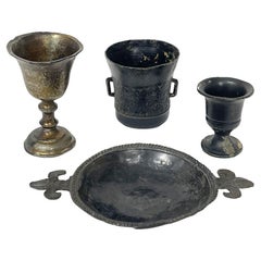
Collection of Dutch miniature dollhouse pewter, 17th - 18th century
Located in Delft, NL
Collection of Dutch miniature dollhouse pewter, 17th - 18th century A collection of 4 pieces of antique miniature pewter from the periods 17th century and 18th century A porringer ...
Category

Dutch Antique 17th Century Collectibles and Curiosities

Materials

Pewter

Exploring Ancient Persia: Ptolemaic Map of Iran and Iraq by Ptolemy and Mercator
Located in Langweer, NL
Claudius Ptolemy was a mathematician, astronomer and geographer who worked in Alexandria, then a part of the Roman Empire, in the 2nd century AD. One of the most learned and influent...
Category

Antique 17th Century Collectibles and Curiosities

Materials

Paper

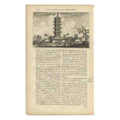
Original Antique Engraving of the Quangguamiau Pagoda in China, 1665
Located in Langweer, NL
Antique print titled 'Pagoda Quangguamiau'. Old print depicting the 'Quangguamiau' pagoda, China. This print originates from 'Het gezantschap der Nee^rlandtsche Oost-Indische Compagn...
Category

Antique 17th Century Collectibles and Curiosities

Materials

Paper

1627 Hendrik Hondius Map Entitled "Vltoniae Orientalis Pars, " Ric.a009
Located in Norton, MA
1627 Hendrik Hondius map entitled "Vltoniae orientalis pars," Ric.a009 Title: Vltoniae orientalis : pars Title (alt.) : Ultoniae orientalis pars Creator: Mercator, Gerh...
Category

Dutch Antique 17th Century Collectibles and Curiosities

Materials

Paper

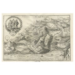
Antique Print of Unterwalden, South of Lake Lucerne in Switzerland, 1654
Located in Langweer, NL
Antique print titled 'Underwaldia - Das Landt Underwalden'. View of the city of Unterwalden, the old name of a forest-canton of the Old Swiss Confederacy in central Switzerland, south of Lake Lucerne...
Category

Antique 17th Century Collectibles and Curiosities

Materials

Paper

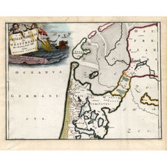
Antique Map of Westfriesland in Ancient Times by Alting, 1697
Located in Langweer, NL
Antique map titled 'Frisiae Liberae quae Westfresia Post eluviones seculi XIII'. Map of Westfriesland in ancient times. This copper engraved map shows part of Holland as it was in an...
Category

Antique 17th Century Collectibles and Curiosities

Materials

Paper

Original Antique Map of the Area of Bremen and Lower Saxony
Located in Langweer, NL
Antique map titled 'Ducatus olim Episcopatus Bremensis et ostiorum Albis et Visurgis Fluviorum novissima Descriptio'. Original old map of the area of ??Bremen and Lower Saxony. Uncom...
Category

Antique 17th Century Collectibles and Curiosities

Materials

Paper

Engraving of Dutch Attacking the Portuguese Fleet off Bantam, Indonesia, 1644
Located in Langweer, NL
Antique print titled 'Bantam'. Copper engraving of the Dutch attack on the Portuguese fleet off Bantam in 1601 depicted as the victory of Admiral Wolfert Harmensz and his 5 ships over 30 Portuguese ships. The ships in the battle include the Sultan of Bantam’s war galleys (ghali); ocean-going craft with sails, oars and a prow battering ram built according to Mediterranean standards learnt from Portuguese renegades and Turkish shipwrights. They were built to allow them to shoot the large cannon...
Category

Antique 17th Century Collectibles and Curiosities

Materials

Paper

Old Print of Ascension Island with Ships, a Whale and Flying Fish, 1601
Located in Langweer, NL
Antique print, titled: 'Vera effigies et delineato Insulae Ascenstio …' - Bird's eye view of Ascension Island. Five large sailing ships in the background and flying fish and waterfowl in the foreground. On the rear an image of four ships sailing towards a whale, accompanied by fowl, flying fish and dolphins. From 'Indiae Orientalis', 1598-1604. Artists and Engravers: Made by an anonymous engraver after 'Jean Theodore de Bry...
Category

Antique 17th Century Collectibles and Curiosities

Materials

Paper

2 Large 17th century forged iron keys
Located in Bilzen, BE
2 Forged iron keys from the 17th century Uncleaned condition, old patina Length 13 and 15.5 cm, width 3.8 and 4 cm
Category

Industrial Antique 17th Century Collectibles and Curiosities

Materials

Iron

America Septentrionalis by Carroli Allard (1648-1709) Copper Plate Engraving
Located in San Francisco, CA
"Recentissuma Novi Orbis Sive Americae Septentrionale et Meriodionalis" A hand-colored copper plate engraving of North and South America by Carel Allard depicting recent discoveries...
Category

Dutch Antique 17th Century Collectibles and Curiosities

Materials

Paper

Antique Map of Mar del Sur, Chile, Peru, New Guinea and Tierra del Fuego, 1621
Located in Langweer, NL
Uncommon and rare map of Mar del Sur and the coast of Peru. With inset maps of part of New Guinea and Tierra del Fuego. This map originates from 'Miroir Oost &...
Category

Antique 17th Century Collectibles and Curiosities

Materials

Paper

Antique Map of Stavoren by Priorato, 1673
Located in Langweer, NL
Antique map titled 'Staveren'. Original antique map of the city of Stavoren, Friesland, the Netherlands. This map orginates from 'Teatro del Belgio (..)', published in Frankfurt am Main in 1673 by Gualdo Priorato. Artists and Engravers: Author: Galeazzo Gualdo Priorato (1606-1678) entered military service at a very young age and served in Flanders under the Prince of Orange. After his retirement, he authored several historical accounts including the Teatro del Belgio, which described the Catholic/Protestant wars in Belgium and Netherlands during the seventeenth century. His superb plans do not show the internal layout of the cities, except for showing the locations of the major churches. Instead the emphasis is on the fortification, as well as on the surrounding site, rivers and canals...
Category

Antique 17th Century Collectibles and Curiosities

Materials

Paper

Cartographic Treasures: A Journey Through the Gascogne and Guyenne Regions, 1680
Located in Langweer, NL
The antique map titled "Gouvernement de La Guienne & Gascogne" depicts the region of Gascogne and Guyenne, known for their wine production, in France. This map is a rare edition, u...
Category

Antique 17th Century Collectibles and Curiosities

Materials

Paper

Old Detailed Trade Route and Shipping Map from Italy to the Low Countries, c1671
Located in Langweer, NL
Antique map of Italy titled 'Carta Nova accurata del Passagio et strada dalli Peis Bassi per via de Allemgna per Italia et per via di Pesi Suizeri a Geenea, Lione et Roma (..)'. Detailed trade route and shipping map...
Category

Antique 17th Century Collectibles and Curiosities

Materials

Paper

Cartographic Elegance of Touraine: A 17th-Century Map Showing French Heritage
Located in Langweer, NL
"Ducatus Turonensis - Touraine," is a original antique historical map of the Touraine region, which is located in the heart of France, centered...
Category

Antique 17th Century Collectibles and Curiosities

Materials

Paper

Loudun and Mirebeau: A Cartographic Masterpiece of 17th Century France by Blaeu
Located in Langweer, NL
Cartography, 17th century. Willem (1571-1638) and Joan Blaeu (1596-1673), Theatrum Orbis Terrarum sive Atlas Novus..., 1635. Figure: Loudonois. Laudunum (Loudun); Mirebalais (Mirebea...
Category

Antique 17th Century Collectibles and Curiosities

Materials

Paper

Lyonnais, Beaujolais, Forez, Mâconnais: A 1644 Depiction of France's Provinces
Located in Langweer, NL
An original antique map from 1644, depicting the French provinces of Lyonnais, Beaujolais, Forez, and Mâconnais. In this map, north is oriented to the right, which is a cartographic ...
Category

Antique 17th Century Collectibles and Curiosities

Materials

Paper

Asia Minor – Antique Map of Natolia by Ortelius, Theatrum Orbis Terrarum c.1600
Located in Langweer, NL
Asia Minor – Antique Map of Natolia by Ortelius, Theatrum Orbis Terrarum c.1600 This beautifully hand-colored antique map titled Natoliae quae olim Asia Minor nova descriptio presen...
Category

European Antique 17th Century Collectibles and Curiosities

Materials

Paper

Antique Map of the Province of Overijssel, the Netherlands
Located in Langweer, NL
Original antique map titled 'Ditio Trans-Isulana'. Original old map of the province of Overijssel, the Netherlands. With coat of arms and two decorative cartouches. Published by J. J...
Category

Antique 17th Century Collectibles and Curiosities

Materials

Paper

Antique Map of the Region of Valois by Hondius, circa 1630
Located in Langweer, NL
Antique map titled 'Le Pais de Valois'. Old map of the historic region of Valois, France. It corresponds to the southeastern quarter of the modern département of Oise, with an adjace...
Category

Antique 17th Century Collectibles and Curiosities

Materials

Paper

1656 "La Souverainete de Sedan et de Raucourt, et la Prevoste de Doncheri Ric004
Located in Norton, MA
1656 map entitled "La Souverainete de Sedan et de Raucourt, et la Prevoste de Doncheri," Hand Colored Ric0004. Description: Lovely map centered on Sedan and Doncheri an...
Category

Dutch Antique 17th Century Collectibles and Curiosities

Materials

Paper

Rare Engravings of Council of War in Bantam and Javanese Local Traders, 1614
Located in Langweer, NL
One leaf with an engraving on each site and text in old Dutch. One side shows the War Council of the locals in Bantam and the other side show some vegetables traders of Bantam. B...
Category

Antique 17th Century Collectibles and Curiosities

Materials

Paper

Antique Map of the Iberian Peninsula with two decorative Cartouches
Located in Langweer, NL
Antique map titled 'Hispaniae et Portugalliae Regna'. Original old map of the Iberian peninsula showing Spain, Portugal and the Balearic Islands. Two beautiful cartouches with severa...
Category

Antique 17th Century Collectibles and Curiosities

Materials

Paper

Antique Map of the City of Leeuwarden by Leti, 1690
Located in Langweer, NL
Antique map titled 'Leovardia.' A plan of Leeuwarden in Friesland, the Netherlands. With two coats of arms, the title in a scroll and an index of 30 buildings in the lower right. Fro...
Category

Antique 17th Century Collectibles and Curiosities

Materials

Paper

Rare Print of Genesis in the Old Testament; Adam and Eve Eating the Apple, 1674
Located in Langweer, NL
Antique print, titled: 'Lussa dei sumpto violantur ab arbore pomo, Efficit hoc tacitis vipera saeua dolis.' This original antique print shows a scene from Genesis in the Old Test...
Category

Antique 17th Century Collectibles and Curiosities

Materials

Paper

Cartographic Elegance: The Art and Science of 17th-Century Asian Maps, ca.1681
Located in Langweer, NL
This original antique map is an artifact from a pivotal era in cartography, reflecting not only the geographical knowledge of its time but also the intertwining of art and science in...
Category

Antique 17th Century Collectibles and Curiosities

Materials

Paper

Jacques Callot "Misères Et Malheurs De La Guerre" Collection of Engraving 17th
Located in Beuzevillette, FR
“Les Misères Et Les Malheurs De La Guerre” (“The misfortunes of war”) more commonly called “the great miseries of war” (“The great miseries of war”) is a major work by the 17th centu...
Category

French Louis XIII Antique 17th Century Collectibles and Curiosities

Materials

Paper

Antique Miniature Map of Java by Bertius '1618'
Located in Langweer, NL
Antique miniature map titled 'Iava Maior'. Rare miniature map of Java, Indonesia. This map originates from 'Tabularum Geographicarum Contractarum Libri s...
Category

Antique 17th Century Collectibles and Curiosities

Materials

Paper

Edmund BOLTON. Nero Caesar, or Monarchie Depraved - FIRST EDITION - 1624
Located in Hillsborough, NJ
AUTHOR: BOLTON, Edmund. TITLE: Nero Caesar, or Monarchie Depraved. An Historical Worke.... By the Translator of Lucius Florus. PUBLISHER: London: by T. S. for Thomas Walkly, 1624....
Category

British Antique 17th Century Collectibles and Curiosities

Materials

Leather

Antique Map of the Province of Kilan by Olearius '1662'
Located in Langweer, NL
Antique map titled 'A Map of ye Province of Kilan as it lies on ye Caspian Sea'. Rare map of the province of Kilan, near the Caspian Sea. Originates from 'The voyages and travells of the Ambassadors sent by Frederick Duke of Holstein, to the Great Duke of Muscovy, and the King of Persia...
Category

Antique 17th Century Collectibles and Curiosities

Materials

Paper

Antique Map of the Region of Touraine in France by Janssonius, 1657
Located in Langweer, NL
Antique map titled 'Touraine - Turonensis Ducatus'. Decorative map of the Touraine region. This map originates from 'Atlas Novus, Sive Theatrum Orbis Orbis Terrarum: In quo Galli...
Category

Antique 17th Century Collectibles and Curiosities

Materials

Paper

Antique Map of Pannonia and Illyria by Cluver, 1685
Located in Langweer, NL
Antique map titled 'Pannonia et Illyricum.' Charming miniature map of Pannonia and Illyria, from the pocket atlas 'Introductionis in Universam Geographiam tam Veterem quam novam .. A...
Category

Antique 17th Century Collectibles and Curiosities

Materials

Paper

Antique Map of Cheshire, North West England
Located in Langweer, NL
Antique map titled 'Cestria comitatus Palatinus'. Original old map of Cheshire, Northwest England. Published circa 1665 by J. Blaeu. Willem Jansz. Blaeu and his son Joan Blaeu are th...
Category

Antique 17th Century Collectibles and Curiosities

Materials

Paper

Antique Map of Macedonia, Northern Greece and part of Turkey in Europe
Located in Langweer, NL
Antique map titled 'Macedonia Epirus et Achaia'. Original old map of Macedonia, northern Greece, and part of Turkey in Europe. Published by W.J. Blaeu, circa 1640. Willem Janszoon ...
Category

Antique 17th Century Collectibles and Curiosities

Materials

Paper

Old Engraving of A Panoramic Bird's Eye View of Miaco 'Kyoto', Japan, 1669
Located in Langweer, NL
Description: Antique print, titled: 'Miako.' - A panaromic bird's eye view of Miaco (Kyoto). Arnoldus Montanus' "Gedenkwaerdige Gesantschappen der Oost-Indische Maatschappy in 't Ver...
Category

Antique 17th Century Collectibles and Curiosities

Materials

Paper

Antique Map of the Duchy of Lüneburg, Lower Saxony, Germany
Located in Langweer, NL
Antique map titled 'Ducatus Luneburgensis (..)'. Map of the Duchy of Lüneburg in Lower Saxony, Germany. Published by J. Janssonius, circa 1664. Jan Janssonius (also known as Johann ...
Category

Antique 17th Century Collectibles and Curiosities

Materials

Paper

Antique Map of Germany and Central Europe
Located in Langweer, NL
Antique map titled 'S. Imperium Romano-Germanicum oder Teutschland mit seinen angrantzenden Königreichen und Provincien'. Original antique map of Germany...
Category

Antique 17th Century Collectibles and Curiosities

Materials

Paper

Antique Map of Northern Germany, showing the area of Mecklenburg-Vorpommern
Located in Langweer, NL
Antique map titled 'Meklenburg Ducatus'. Attractive map of northern Germany, showing the area of Mecklenburg-Vorpommern. Published by J. Janssonius, circa 1630. Jan Janssonius (als...
Category

Antique 17th Century Collectibles and Curiosities

Materials

Paper

Old Map of Morocco, The Canary Islands, Madeira, Inset of Penon de Velez, 1605
Located in Langweer, NL
Antique map titled 'Fessae et Marocchi Regna'. Original antique map of Morocco, extending south to Cape Bojador and , north to the Spanish Coast. Inset of Penon de Velez. Artists and...
Category

Antique 17th Century Collectibles and Curiosities

Materials

Paper

Antique Map centered on Nuremberg, Germany
Located in Langweer, NL
Antique map titled 'Territorium Norimbergense'. Beautiful map centered on Nuremberg, Germany. With decorative title cartouche and inset plan of the city. Published by W. Blaeu, circa...
Category

Antique 17th Century Collectibles and Curiosities

Materials

Paper

Antique Map of Asia Minor, showing Turkey, Cyprus and the Islands in the Aegean
Located in Langweer, NL
Antique map titled 'Natolia, quae olim Asia Minor'. Decorative map of Asia Minor, showing Turkey, Cyprus and the Islands in the Aegean. This attractive map shows all of Turkey, Cyprus and the Aegean Islands to a relatively high degree of accuracy. At the time the entire region was under the rule of the Ottoman Empire (Cyprus was conquered in 1571 from the Venetians). A maritime battle...
Category

Antique 17th Century Collectibles and Curiosities

Materials

Paper

1640 Flandriae Partes Duae Quarum Altera Proprietaria, Ric0016
Located in Norton, MA
1640 Willem and Joan Blaeu map entitled "Flandriae Partes duae quarum altera Proprietaria, altera Imperialis vulgo dictur," Ric0016 (Mounted on Carboard) Willem Janszoon Blaeu...
Category

Dutch Antique 17th Century Collectibles and Curiosities

Materials

Paper

Small Original Antique Map of the Lower Alsace region, Germany
Located in Langweer, NL
Antique map titled 'Alsatia Inferior'. Small original antique map of the Lower Alsace region, Germany. This map originates from 'Atlas minor Gerardi Mercatoris a I. Hondio plurimis a...
Category

Antique 17th Century Collectibles and Curiosities

Materials

Paper

17th Century Toulouse, Savve, Sommieres Topographical Map by Iohan Peeters
Located in New York, NY
Fine topographical 17th century map of Toulouse, Savve and Sommieres by Iohan Peeters Beautiful engraving of the capital of France's Occitanie Region, Toulouse, called La Ville Rose- the Pink City, for the terracotta bricks used in its many buildings, giving the city a distinct apricot-rose hue. An important cultural and educational center, the city's residents included Nobel Prize winners and world renown artists- Henri de Toulouse-Lautrec, Henri Martin, Jean-Auguste-Dominique Ingres, Antonin Mercie, Alexandre Falguiere and more recently Cyril Kongo...
Category

Dutch Antique 17th Century Collectibles and Curiosities

Materials

Paper

Old Map Showing Info Related to the Ottoman Wars including Conflict Dates, c1690
Located in Langweer, NL
"Corso del Danubio da Vienna Sui a Vicopoli, e Paesi Adiacenti - Northwestern Sheet", Coronelli, Vincenzo Maria Subject: Central Europe, Danube River Period: 1690 (circa) Publicatio...
Category

Antique 17th Century Collectibles and Curiosities

Materials

Paper

1620 Map of Artois Entitled "Artesia Comitatvs Artois, " by Bleau, Ric.a012
Located in Norton, MA
1640 map of Artois entitled "Artesia Comitatvs Artois," by Bleau Colored A-012. Detailed map of the northern province of Artois, France on the border with Belgium. Feature...
Category

Dutch Antique 17th Century Collectibles and Curiosities

Materials

Paper

Original Map of the Military Situation After the Dutch Blockade of Antwerp, 1648
Located in Langweer, NL
Antique map titled 'Tabula Castelli ad Sandflitam (..)'. This map depicts the complex military situation that had developed after the Dutch blockade of Antwerp. All entrenchment'...
Category

Antique 17th Century Collectibles and Curiosities

Materials

Paper

Antique Map of Madagascar by N. Sanson, circa 1680
Located in Langweer, NL
Antique map titled 'Isle de Madagascar ou de St. Laurens. Tiree de Sanutu &c'. Antique map of Madagascar, first published by Sanson in 1657. Sanson n...
Category

Antique 17th Century Collectibles and Curiosities

Materials

Paper

Old Print of Standia, a Greek Island 'Heraklion, Crete, Greece, Balkans', 1688
Located in Langweer, NL
Antique print Greece titled 'Het Eilant Standia'. Old print of the island Standia, near Crete, Greece. This print originates from 'Nauwkeurige Bes...
Category

Antique 17th Century Collectibles and Curiosities

Materials

Paper

Antique Map of the Region of Étampes and Sens by Janssonius, c.1650
Located in Langweer, NL
Antique map titled 'Gastinois et Senonois'. Old map of the region of Étampes and Sens, France. It shows the cities of Sens, Melun, Étampes, Orleans, Fontainebleau, Montargis and othe...
Category

Antique 17th Century Collectibles and Curiosities

Materials

Paper

Antique Map of the Region of Nivernais by Janssonius, 1657
Located in Langweer, NL
Antique map of France titled 'Carte du Païs et Duché de Nivernois'. Decorative map of the Nivernais region, part of Burgundy, France. This map originates from 'Atlas Novus, Sive Thea...
Category

Antique 17th Century Collectibles and Curiosities

Materials

Paper

Antique Map of the City of Brielle 'The Netherlands' by L. Guicciardini, 1625
Located in Langweer, NL
Plan of Brielle, Briel, Den Briel in the Province of Zuid-Holland, The Netherlands, Holland. This map originates from the 1625 edition of 'Discrittione di tutti i Paesi Bassi', by L....
Category

Antique 17th Century Collectibles and Curiosities

Materials

Paper

17th Century Topographical Map, Champagne-Ardenne, Marsal, Maubert Iohan Peeters
Located in New York, NY
Fine topographical 17th century map by Iohan Peeters of Marsal and Maubert Fontaine in the Champagne-Ardennes Region of North Eastern France. Fabulous period engraving for a Wine Ce...
Category

Dutch Antique 17th Century Collectibles and Curiosities

Materials

Paper

Map of East Friesland, The Netherlands & the Area Emden & Norden, Germany, 1635
Located in Langweer, NL
Antique map titled 'Typus Frisiae Orientalis.' Map of East Friesland and the area around Emden and Norden. Large inset map of the mouth of the Amasis River. The map is decorated with a large title cartouche and two large coats of arms...
Category

Antique 17th Century Collectibles and Curiosities

Materials

Paper

Antique Map of the Archdiocese of Cologne, Germany
Located in Langweer, NL
Antique map titled 'Archevesche et Eslectorat de Cologne avec ses Enclaves'. Original old map of the Archdiocese of Cologne with the course of the Rhine from Andernach to Wesel with ...
Category

Antique 17th Century Collectibles and Curiosities

Materials

Paper

Antique Map of the Region involved in the Conquest of Cyrus the Great
Located in Langweer, NL
Antique map titled 'Tabula Itineris Decies Mille (..)'. This historical map illustrates the region involved in the conquest of Cyrus the Great (558-528 BC), the founder of the Persia...
Category

Antique 17th Century Collectibles and Curiosities

Materials

Paper

Antique Map of Celtic Europe by Cluver, 1678
Located in Langweer, NL
Antique map Europe titled 'Europam sive Celticam Veterem'. Rare map of Celtic Europe. Made after A. Ortelius, originates from 'Introductionis in uni...
Category

Antique 17th Century Collectibles and Curiosities

Materials

Paper

Map of the Region of Basel and Northern Switzerland by Ortelius, circa 1603
Located in Langweer, NL
Two original antique maps on one sheet titled 'Basiliensis Territorii Descriptio Nova [with] Circulus sive Liga Sueviae'. The first centers on Basel, Switzerland, located on the Rhine River...
Category

Antique 17th Century Collectibles and Curiosities

Materials

Paper

Antique Map of the Rhineland and Alsace Region with Original Hand Coloring
Located in Langweer, NL
Antique map titled 'Palitinat du Rhein, Alsace, et partie de Souabe de Franconie (..)'. Double-page engraved map of the Rhineland and Alsace with original/contemporary hand coloring....
Category

Antique 17th Century Collectibles and Curiosities

Materials

Paper

Read More

Medal-Worthy Memorabilia from Epic Past Olympic Games

Get into the games! These items celebrate the events, athletes, host countries and sporting spirit.

Ahoy! You’ve Never Seen a Collection of Sailor Art and Kitsch Quite Like This

French trendsetter and serial collector Daniel Rozensztroch tells us about his obsession with objects related to seafaring men.

Pamela Shamshiri Shares the Secrets behind Her First-Ever Book and Its Effortlessly Cool Interiors

The sought-after designer worked with the team at Hoffman Creative to produce a monograph that beautifully showcases some of Studio Shamshiri's most inspiring projects.

Moroccan Artworks and Objects Take Center Stage in an Extraordinary Villa in Tangier

Italian writer and collector Umberto Pasti opens the doors to his remarkable cave of wonders in North Africa.

Montecito Has Drawn Royalty and Celebrities, and These Homes Are Proof of Its Allure

Hollywood A-listers, ex-pat aristocrats and art collectors and style setters of all stripes appreciate the allure of the coastal California hamlet — much on our minds after recent winter floods.

Whaam! Blam! Pow! — a New Book on Pop Art Packs a Punch

Publishing house Assouline and writer Julie Belcove have teamed up to trace the history of the genre, from Roy Lichtenstein, Andy Warhol and Yayoi Kusama to Mickalene Thomas and Jeff Koons.

The Sparkling Legacy of Tiffany & Co. Explained, One Jewel at a Time

A gorgeous new book celebrates — and memorializes — the iconic jeweler’s rich heritage.

What Makes a Gem-Encrusted Chess Set Worth $4 Million?

The world’s most opulent chess set, weighing in at 513 carats, is literally fit for a king and queen.
Recently Viewed

View All