Historic Maps
3
to
24
302
191
214
153
145
99
91
65
55
40
37
34
30
27
25
19
17
16
15
13
11
10
9
8
8
8
8
7
7
6
5
5
4
4
4
4
4
3
3
3
3
3
2
2
2
2
2
2
2
1
1
1
1
1
1
42
42
23
16
10
Sort By
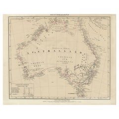
Detailed German Map of Australia Including Statistics of 1841, Published in 1854
Located in Langweer, NL
Title: "Detailed Map of Austral Land - 1854"
This historic map, titled "Australland," was
Category
Antique 1850s Maps
Materials
Paper
Free Shipping
H 14.06 in W 17.52 in D 0 in
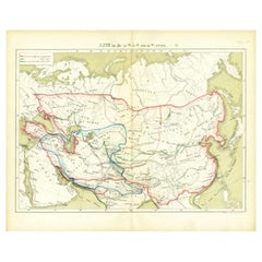
Antique Map of Asia in the 12th, 13th and 14th Century, 1877
Located in Langweer, NL
). Historic map of Asia. This original antique map originates from: 'Historisch-Geographische Atlas der
Category
Antique 19th Century Maps
Materials
Paper
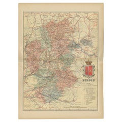
Burgos 1902: Geographic Map of Castile's Historic Heartland in Spain
Located in Langweer, NL
The map of the province of Burgos in the autonomous community of Castile and León in Spain, dated
Category
Antique Early 1900s Maps
Materials
Paper
Free Shipping
H 14.77 in W 20.08 in D 0 in
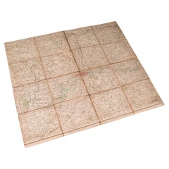
Antique Folding London Map, English, Cartography, Historic, Georgian, Dated 1783
Located in Hele, Devon, GB
This is an antique folding London map. An English, paper on linen cartographical study of the
Category
Antique Late 18th Century British Georgian Maps
Materials
Linen, Paper
H 6.3 in W 6.11 in D 0.6 in
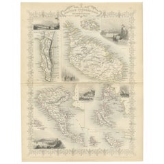
Old Map of British Mediterranean Territories with Images of Historic Sites, 1851
Located in Langweer, NL
John Tallis & Company was a British map-making firm that gained widespread acclaim in the 19th
Category
Antique 1850s Maps
Materials
Paper
H 14.26 in W 10.71 in D 0 in
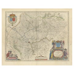
Mapping the Heart of France: Willem Blaeu's 17th Century Île-de-France, ca.1650
Located in Langweer, NL
the kings of France.
It is a historic map from "Theatrum Orbis Terrarum" by Willem Blaeu, based in
Category
Antique 1650s Maps
Materials
Paper
Free Shipping
H 20.08 in W 24.02 in D 0 in
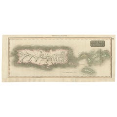
1817 Map of Puerto Rico and the Virgin Islands with Original Hand Coloring
Located in Langweer, NL
early 19th century atlas, dated 1817, featuring original hand coloring. This historic map showcases the
Category
Antique Early 19th Century Maps
Materials
Paper
Free Shipping
H 25.99 in W 11.03 in D 0 in
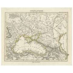
Old Map of the Black Sea, The Krim, Ukraine, Russia, etc in Historic Times, 1848
Located in Langweer, NL
Antique map titled 'Pontus Euxinus'. Old map of the black Sea and surroundings originating from
Category
Antique 1840s Maps
Materials
Paper
H 9.77 in W 12.52 in D 0 in
Beira Baixa: A Cartographic Portrait of Portugal's Historic Frontier in 1903
Located in Langweer, NL
The uploaded image is a historical map of the Beira Baixa region in Portugal. The map details the
Category
Antique Early 1900s Maps
Materials
Paper
Free Shipping
H 20.08 in W 14.77 in D 0 in
Antique Map of Berkshire, South East England
By Joan (Johannes) Blaeu
Located in Langweer, NL
Antique map titled 'Bercheria vernacule Barkshire'. Original old map of Berkshire, a historic
Category
Antique Mid-17th Century Maps
Materials
Paper
Antique Map Colton's United States of America
Located in Langweer, NL
Antique map titled 'Colton's United States of America'. Show railroads, canals, state capitals
Category
Antique Mid-19th Century Maps
Materials
Paper
Colorful Detailed Antique Map of England and Wales, 1882
Located in Langweer, NL
Explore the Historic Splendor of 'England and Wales' with this Antique Map! Part of a distinguished
Category
Antique 1880s Maps
Materials
Paper
Antique Map of The German Empire (East Sheet), 1882
Located in Langweer, NL
Step into history with an authentic Antique Map of The German Empire (East Sheet) from the esteemed
Category
Antique 1880s Maps
Materials
Paper
Antique Map of Tarn and Garonne in France, 1854
By Victor Levasseur
Located in Langweer, NL
Antique map titled 'Dépt. de Tarn et Garonne'. Map of the French department of Tarn et Garonne
Category
Antique Mid-19th Century Maps
Materials
Paper
Antique Geographical, Historical and Statistical Map of Massachusetts, 1822
Located in Langweer, NL
This attractive map of Massachusetts presents a finely detailed overview of the state in the first
Category
Antique 1820s Maps
Materials
Paper
H 17.13 in W 21.46 in D 0 in
Antique Map of Greece from Ortelius's Theatrum Orbis Terrarum, 1595
Located in Langweer, NL
enthusiasts of historical maps:
1. **Athens (Athenae)** - The historic city-state, known for its rich
Category
Antique 16th Century Maps
Materials
Paper
Free Shipping
H 17.92 in W 21.86 in D 0 in
Vintage Reproduction 17th Century Map of Europe, American, Cartography, Blaeuw
Located in Hele, Devon, GB
This is a vintage reproduction map of Europe. An American, paper stock cartography print in frame
Category
Late 20th Century Central American Mid-Century Modern Maps
Materials
Glass, Wood, Paper
H 30.32 in W 38.39 in D 1.38 in
Vintage Map of Nantucket Town by Ruth Haviland Sutton, 1946
Located in Nantucket, MA
Vintage Map of Nantucket Town by Ruth Haviland Sutton, 1946, a classic vintage tourist map of
Category
Vintage 1940s American Other Maps
Materials
Paper
Antique Map of Westfriesland in Ancient Times by Alting, 1697
Located in Langweer, NL
Antique map titled 'Frisiae Liberae quae Westfresia Post eluviones seculi XIII'. Map of
Category
Antique 17th Century Maps
Materials
Paper
Antique Italian Map of Viaggio da Roma a Napoli 1775
Located in Roma, IT
An original print from 1775 showing an early route map of the journey from Rome to Naples. This
Category
Antique 1770s Italian Maps
Materials
Parchment Paper
Antique Map of Alentejo: Land of Tradition and Tranquility, 1903
Located in Langweer, NL
The image is a historical original antique map of the Alentejo region in Portugal. This map
Category
Antique Early 1900s Maps
Materials
Paper
Free Shipping
H 20.08 in W 14.77 in D 0 in
Girona 1902: Geographic and Infrastructural Map of Catalonia’s Northern Province
Located in Langweer, NL
The map provided is of the province of Girona (in Catalan, Girona), located in the northeast of
Category
Antique Early 1900s Maps
Materials
Paper
Free Shipping
H 14.77 in W 20.08 in D 0 in
Map of Soria Province, 1901: Detailed Cartography of Northeastern Spain
Located in Langweer, NL
The map is a historical map of the province of Soria from 1901.
A decorative coat of arms
Category
Antique Early 1900s Maps
Materials
Paper
Free Shipping
H 14.77 in W 20.08 in D 0 in
Old Map of the Bourbonnais Region of France, ca.1630
Located in Langweer, NL
Antique map titled 'Bourbonois - Borbonium Ducatus'.
Old map of the Bourbonnais region of
Category
Antique 1630s Maps
Materials
Paper
Colorful Detailed Antique Map of England and Wales (South Part), 1882
Located in Langweer, NL
Map! This map provides a vivid portrayal of the captivating landscapes and cultural heritage of the
Category
Antique 1880s Maps
Materials
Paper
Large Map of Castile's Southern Realms - Granada, Andalusia, and Murcia, 1652
Located in Langweer, NL
This antique map, titled 'Les Etats de la Couronne de Castille', represents the southern regions of
Category
Antique Mid-17th Century Maps
Materials
Paper
H 17.64 in W 23.75 in D 0.02 in
Antique Map of the Region of Valois by Hondius, circa 1630
Located in Langweer, NL
Antique map titled 'Le Pais de Valois'. Old map of the historic region of Valois, France. It
Category
Antique Mid-17th Century Maps
Materials
Paper
1644 Janssonius Original Wine Regions Map: The Ducal and Comital Burgundy
Located in Langweer, NL
This authentic handcolored map is a detailed 17th-century depiction of the Burgundy region
Category
Antique 1640s Maps
Materials
Paper
Free Shipping
H 19.1 in W 22.84 in D 0 in
Antique Engraved Map with Original Hand Colour of French Guiana, 1876
Located in Langweer, NL
The 1876 map of French Guiana from the "Grand Atlas Départemental de la France de L'Algérie et des
Category
Antique Late 19th Century Maps
Materials
Paper
Authentic 1644 Janssonius Map of the Champagne Region (Campania) in France
Located in Langweer, NL
"1644 Janssonius Map of Champagne, France"
This meticulously detailed original antique map
Category
Antique 1640s Maps
Materials
Paper
Free Shipping
H 21.86 in W 25.99 in D 0 in
Detailed Antique Map of Asia Minor & Cyprus with Historical Notes, 1732
Located in Langweer, NL
Antique map titled 'Carte De L'Asie Inferieure Selon Les Auteurs Anciens (..)'. Detailed map of
Category
Antique 18th Century Maps
Materials
Paper
Antique Map of Southern Germany by F. de Wit, circa 1680
Located in Langweer, NL
This antique map depicts a portion of southern Germany that included the historic regions of
Category
Antique Late 17th Century Maps
Materials
Paper
Original Copper Engraving of a Map of Syria and Lebanon, 1698
Located in Langweer, NL
Antique map titled 'Syriae, sive Soriae, Nova et Accurata Descriptio.'
Map of Syria and Lebanon
Category
Antique 1690s Maps
Materials
Paper
Free Shipping
H 12.41 in W 14.45 in D 0 in
Hand Colored Antique Map of the Department of Tarn Et Garonne, France
By Victor Levasseur
Located in Langweer, NL
Antique map titled 'Dépt. de Tarn et Garonne'. map of the French department of Tarn et Garonne
Category
Antique Mid-19th Century Maps
Materials
Paper
Antique Map of the Region of Zutphen, Netherlands by Janssonius, c.1680
By Johannes Janssonius
Located in Langweer, NL
region around Zutphen in the historic Duchy Gelre in the Netherlands. Cities included in this map are
Category
Antique 17th Century Maps
Materials
Paper
Almería 1901: Coastal Contours and Landscapes in a Map of Southeastern Spain
Located in Langweer, NL
An original antique map of the province of Almería, Spain, from the year 1901.
The Mediterranean
Category
Antique Early 1900s Maps
Materials
Paper
Free Shipping
H 14.77 in W 20.08 in D 0 in
Antique Map with Details of Berings' Expedition into Russians' Far East, 1737
Located in Langweer, NL
Antique map titled 'Carte Des Pays traverses par le Capne. Beerings depuis la Ville de Tobolsk
Category
Antique 1730s Maps
Materials
Paper
H 12.96 in W 22.64 in D 0 in
Navarra in Cartographic Detail: A 1902 Map of the Crossroads of Northern Spain
Located in Langweer, NL
The original antique map for sale shows the Spanish province of Navarra as it was in 1902. Here's a
Category
Antique Early 1900s Maps
Materials
Paper
Free Shipping
H 14.77 in W 20.08 in D 0 in
Original Engraved Map of Saint Lucia in the West Indies by Bellin, 1758
Located in Langweer, NL
Hydrographer and engineer of the French Navy, is a remarkable antique map showcasing the intricate details of
Category
Antique 1750s Maps
Materials
Paper
Authentique Map by Pilon of The French Colonies in The West Indies, 1876
Located in Langweer, NL
The 1876 map titled "Carte des Colonies Françaises aux Antilles" represents a significant
Category
Antique Late 19th Century Maps
Materials
Paper
H 14.38 in W 16.54 in D 0 in
Antique Detailed Map of Jerusalem in Israël with Extensive Key and Scale, 1698
Located in Langweer, NL
Antique map titled 'Jerusalem.'
Plan of the ancient city of Jerusalem. With extensive key and
Category
Antique 17th Century Maps
Materials
Paper
H 15.16 in W 12.01 in D 0 in
Engraving by Tallis and Rapkin of Map of the West Indies in The Caribbean, 1851
Located in Langweer, NL
John Tallis' 1851 map of the West Indies stands as a striking example of his renowned cartographic
Category
Antique Mid-19th Century Maps
Materials
Paper
H 10.44 in W 14.57 in D 0 in
Engraved Map by Bellin of Saint Lucia or Sainte Lucie in the West Indies, 1764
Located in Langweer, NL
Hydrographer and engineer of the French Navy, is a remarkable antique map showcasing the intricate details of
Category
Antique Late 19th Century Maps
Materials
Paper
No Reserve
H 9.65 in W 14.57 in D 0 in
L'isle De La Martinique Caribbean Copper Engraving Original Handcoloring, 1704
Located in Langweer, NL
The original hand-colored map titled "Isle de la Martinique," published in 1704 and part of De
Category
Antique Late 19th Century Maps
Materials
Paper
H 10.63 in W 15.56 in D 0 in
Levasseur's 1852 Cartographic Portrait of Gironde: Celebrating the Bordeaux Wine
Located in Langweer, NL
This original hand-colored map is from the "Atlas National Illustré," a work by Victor Levasseur, a
Category
Antique 1850s Maps
Materials
Paper
H 20.67 in W 14.06 in D 0 in
Original Engraving of the West Indies, Gulf of Mexico, Antilles, Caribbean, 1780
Located in Langweer, NL
Rigobert Bonne and G. Raynal's 1780 map of the West Indies, Gulf of Mexico, Antilles, and the
Category
Antique Late 18th Century Maps
Materials
Paper
H 9.85 in W 15.16 in D 0 in
1902 Cartographic View of Salamanca: The Golden Province of Spain
Located in Langweer, NL
This map showcases the province of Salamanca in the year 1902. Salamanca is located in the
Category
Antique Early 1900s Maps
Materials
Paper
Free Shipping
H 14.77 in W 20.08 in D 0 in
Minho: A Legacy of Lush Landscapes and Living Traditions in Portugal, 1903
Located in Langweer, NL
Ths authentic print is a historical map of the Minho region in the northwestern part of Portugal
Category
Antique Early 1900s Maps
Materials
Paper
Free Shipping
H 20.08 in W 14.77 in D 0 in
Antique Plan of the Battle of Marengo, Near Alexandria, Italy, 1852
Located in Langweer, NL
This antique battle map, titled "Battle of Marengo 14. June 1800 Sheet I," depicts the plan of the
Category
Antique Mid-19th Century Maps
Materials
Paper
Huesca 1901: A Geographic Overview of Aragon's Northern Frontier in Spain
Located in Langweer, NL
The map provided is of the province of Huesca, located in the northeastern part of Spain, within
Category
Antique Early 1900s Maps
Materials
Paper
Free Shipping
H 20.08 in W 14.77 in D 0 in
Badajoz 1901: A Cartographic Record of Extremadura's Largest Province in Spain
Located in Langweer, NL
This original antique map for sale is of the province of Badajoz, part of the autonomous community
Category
Antique Early 1900s Maps
Materials
Paper
Free Shipping
H 14.77 in W 20.08 in D 0 in
Colonial Crossroads: Angola and Mozambique in 1903
Located in Langweer, NL
The image for sale is an original historical map from 1903 that shows the Portuguese colonies of
Category
Antique Early 1900s Maps
Materials
Paper
Teruel 1901: A Cartographic Depiction of Heritage and Natural Splendor in Spain
Located in Langweer, NL
Original antique map of Teruel in Spain, with highlighted gold. The province of Teruel, located in
Category
Antique Early 1900s Maps
Materials
Paper
Free Shipping
H 14.77 in W 20.08 in D 0 in
Topographical and Administrative Cartography of Segovia in Spain, 1902
Located in Langweer, NL
An original old map of the province of Segovia from the year 1902. Segovia is a historic area
Category
Antique Early 1900s Maps
Materials
Paper
Free Shipping
H 14.77 in W 20.08 in D 0 in
Old Print of the Spanish Conquest of Cusco or Cuzco, Capital of the Incas, c1750
Located in Langweer, NL
was the historic capital of the Inca Empire from the 13th century until the 16th-century Spanish
Category
Antique 1750s Maps
Materials
Paper
H 9.65 in W 7.29 in D 0 in
Panoramic Antique View of Bandar-Abbas 'Formerly Gamron, Persia' in Iran, 1714
Located in Langweer, NL
depicted the scenes around him, he was especially interested in places of antiquity or historic interest
Category
Antique 1710s Maps
Materials
Paper
H 6.7 in W 15.16 in D 0 in
17th Century Topographical Engraving Nantes & St. Malo, France, by Iohan Peeters
Located in New York, NY
its production of fine Muscadet wine. It is also home to historic cathedrals, beautiful gardens and
Category
Antique 17th Century Dutch Maps
Materials
Paper
H 12.38 in W 15 in D 0 in
View of Frankenberg: Braun & Hogenberg's Historic Bird's-Eye Map, 1599
Located in Langweer, NL
maps and views from the late 16th century.
**Key Characteristics of the Print:**
1. **Bird's-Eye View
Category
Antique 16th Century Prints
Materials
Paper
H 15.16 in W 20.08 in D 0.02 in
GUCCI F/W 2016 Pink Multicolor Historic Garden Aerial Map Pleated Midi Skirt
By Gucci, Alessandro Michele
Located in Thiensville, WI
GUCCI F/W 2016 Pink Multicolor Historic Garden Aerial Map Print Pleated Midi Skirt
Brand
Category
2010s Italian A-Line Skirts
Birds Eye View of Cheshire Connecticut 1882 lithograph pub. by O. H. Bailey
Located in Paonia, CO
to be, including street names and old landmarks. Beautifully colored historic map of Cheshire, CT in
Category
1880s Other Art Style Landscape Prints
Materials
Lithograph
- 1
Get Updated with New Arrivals
Save "Historic Maps", and we’ll notify you when there are new listings in this category.
Historic Maps For Sale on 1stDibs
There is a broad range of historic maps for sale on 1stDibs. Finding the perfect modern, contemporary or Old Masters examples of these works for your space is difficult — today, we have a vast range of variations and more on offer. There are many variations of these items available, from those made as long ago as the 18th Century to those made as recently as the 21st Century. You can search the historic maps that we have for sale on 1stDibs by color — popular works were created in bold and neutral palettes with elements of gray, beige, black and brown. Many versions of these artworks are appealing in their rich colors and composition, but Christos J. Palios, (after) Henri Matisse, Henri Matisse, Don Pollack and Andrew Moore produced especially popular works that are worth a look. The range of these distinct pieces — often created in archival pigment print, pigment print and lithograph — can elevate any room of your home.
How Much are Historic Maps?
Prices for pieces in our collection of historic maps start at $21 and top out at $150,000 with the average selling for $2,200.
More Ways To Browse
Super Memphis Milano
Flatware Milano
Clifford Smith
Biblical Maps
British Isles Antique Map
Maps Of Ireland Large
Seto Vase
Chinese Ceramic Water Carries
Sports Illustrated Posters
Pottery Antique Sake
Vintage Lady Golfer
Vintage Lady Golfers
The Invisible Man
Antique Storage Book Box
Wooden Mermaid
Thomas Wilson
Antique Map Chicago
Antique Chicago Maps
