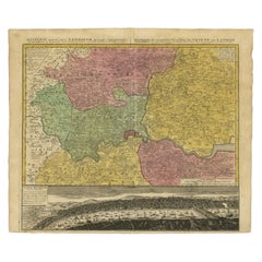
Map Of London
to
16
135
42
67
54
50
34
27
22
21
17
13
11
11
10
10
9
9
8
6
6
6
5
4
4
4
4
4
3
3
3
3
2
2
2
2
2
2
2
2
2
1
1
1
1
1
1
1
11
9
4
3
3
Sort By
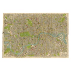
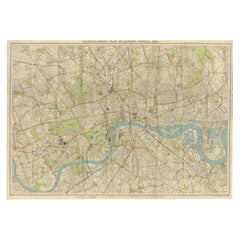
Vintage Map of London – Phillips’ Tape Indicator Map of Central London, c.1930
Located in Langweer, NL
Phillips Tape Indicator Map of London c.1930 – Antique City Plan
This large and detailed map of
Category
Early 20th Century Scottish Maps
Materials
Paper
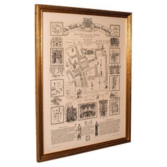
Vintage Barrister's Map of London, English, Framed, Inner, Middle Temple, C.1970
Located in Hele, Devon, GB
Our Stock # 24730
This is a vintage barrister's map of London. An English, annotated Inner and
Category
Late 20th Century British Mid-Century Modern Maps
Materials
Glass, Wood, Paper
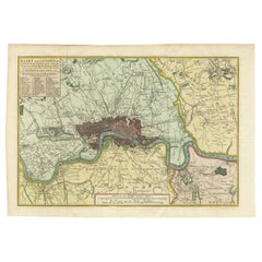
Antique Map of London by Tirion '1754'
Located in Langweer, NL
Antique map titled 'Kaart van Londen enz. en van het naby gelegen land ruim een Uur gaans rondsom
Category
Antique Mid-18th Century Maps
Materials
Paper
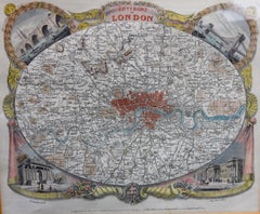
Antique Map of London by Thomas Moule and William Schmollinger
Located in Rochester, NY
Decorative engraved map of London by William Schmollinger for Moule's English County maps. Hand
Category
Antique Early 19th Century English Prints
Materials
Paper
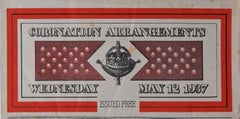
Coronation Arrangements Leaflet Map of London 1937 Vintage Transport map poster
Located in London, GB
Anon.
Coronation Arrangements - Map of London
1937
45x60cm (unfolded)
Lithograph
Published for
Category
1930s Modern More Prints
Materials
Lithograph
Vintage Map of London – Bartholomew’s Plan of Central London, c.1929
Located in Langweer, NL
London Central Map c.1929 – Bartholomew Antique City Plan
This detailed city plan, titled
Category
Early 20th Century Scottish Maps
Materials
Paper
1800 'Map of London, Southwark, and parts adjacent' by Darton and Harvey
Located in London, GB
Darton and Harvey (publisher)
Map of London, Southwark, and parts adjacent (1800)
Engraving
42 x 56
Category
Early 1800s Prints and Multiples
Materials
Paper, Engraving
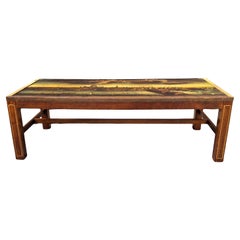
Regency Brass Inlaid Mahogany Map of London Printed Top Coffee Table, Circa 1930
Located in Germantown, MD
A Regency style Brass Inlaid Mahogany Map of London. Brass inlays. Map insert protected with Glass
Category
Early 20th Century American Edwardian Coffee and Cocktail Tables
Materials
Brass
Antique Map of London Showing the Area from Essex to Surrey, England, 1741
Located in Langweer, NL
map showing the area from Essex to Surrey and shows a lovely view of London with a high level of
Category
Antique 18th Century Maps
Materials
Paper
London Underground Map of London Christmas poster by Clifford and Rosemary Ellis
By Clifford & Rosemary Ellis
Located in London, GB
message if you cannot find the poster you want.
Clifford and Rosemary Ellis
London Underground Map
Category
1930s Modern More Prints
Materials
Lithograph
London Underground Map of London Christmas poster by Clifford and Rosemary Ellis
By Clifford & Rosemary Ellis
Located in London, GB
message if you cannot find the poster you want.
Clifford and Rosemary Ellis
London Underground Map
Category
1930s Modern More Prints
Materials
Lithograph
Wonderground Map of London by MacDonald 'Max' Gill c. 1924 original poster
By "Leslie MacDonald ""Max"" Gill"
Located in London, GB
Map of London Town.’
In 1917 he joined the Imperial War Graves Commission’s headstone design
Category
1920s Modern Landscape Prints
Materials
Lithograph
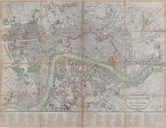
Antique Folding London Map, English, Cartography, Historic, Georgian, Dated 1783
Located in Hele, Devon, GB
This is an antique folding London map. An English, paper on linen cartographical study of the
Category
Antique Late 18th Century British Georgian Maps
Materials
Linen, Paper
Antique Road Map, London to Hythe, Kent, English, Cartography, John Ogilby, 1675
Located in Hele, Devon, GB
This is an antique Road Map from London to Hythe, Kent. An English, cartographic atlas excerpt by
Category
Antique 17th Century British Queen Anne Maps
Materials
Glass, Paper
Antique Map of the United Kingdom and Ireland, c.1873
Located in Langweer, NL
, with inset maps of London and factory districts of the UK. This map originates from 'School-Atlas van
Category
Antique 19th Century Maps
Materials
Paper
$118 Sale Price
20% Off
Large Scale Map of the London Metropolis
Located in Dallas, TX
The product is a large scale map of the London Metropolis, specifically focusing on the city in
Category
Mid-20th Century English Maps
Materials
Paper
Antique Map of England with Inset Maps of the Region of Liverpool and London
Located in Langweer, NL
Liverpool and London. This map originates from Tanner's 'Universal Atlas'. Published by Carey & Hart, 1842.
Category
Antique Mid-19th Century Maps
Materials
Paper
$360 Sale Price
20% Off
Antique Map of the City of London by Balbi '1847'
Located in Langweer, NL
Antique map titled 'London'. Original antique map of the city of London. This map originates from
Category
Antique Mid-19th Century Maps
Materials
Paper
$189 Sale Price
20% Off
1953 Coronation Map for London Transport
Located in London, GB
."
Coronation Arrangements – Map of London (1953)
Lithograph
45 x 60 cm (unfolded)
Published by London
Category
1950s Landscape Prints
Materials
Lithograph
Road Map, John Ogilby, No 54, London, Yarmouth, Britannia
By John Ogilby
Located in BUNGAY, SUFFOLK
& Maldon). Of the sixth volume, on London, only the general map appeared in print, and that after Ogilby's
Category
Antique 1670s English Baroque Maps
Materials
Paper
Original Antique Map of the Road from London to Bensington
Located in Langweer, NL
Antique map titled 'The Road from London to St. Davids in com: Pembroke (..)'. A strip map of the
Category
Antique Late 17th Century Maps
Materials
Paper
$512 Sale Price
20% Off
1937 Coronation Map for London Transport
Located in London, GB
."
Coronation Arrangements – Map of London (1937)
Lithograph
45 x 60 cm (unfolded)
Published by London
Category
1950s Landscape Prints
Materials
Lithograph
Road Map Britannia 1675/6 No 5 Road London to Barwick, London Stilton Grey Frame
By John Ogilby
Located in BUNGAY, SUFFOLK
sixth volume, on London, only the general map appeared in print, and that after Ogilby's death. In fact
Category
Antique Late 17th Century British Charles II Maps
Materials
Paper
London 1744 Published Watercolour Antique Map of East Africa by Eman Bowen
Located in West Sussex, Pulborough
We are delighted to offer for sale this New and Accurate Map of Nubia & Abissinia, together with
Category
Antique 1740s English George III Maps
Materials
Paper
Map Road Strip Britannia Sheet 2 John Ogilby London Aberistwith Islip Bramyard
By John Ogilby
Located in BUNGAY, SUFFOLK
encouraged to continue the projects. Morgan completed the map of London, but despite attempts to Revive the
Category
Antique 17th Century English Baroque Maps
Materials
Paper
Road Map No43 London to Kings Lynn, Royston to Downham, John Ogilby, Britannia
By John Ogilby
Located in BUNGAY, SUFFOLK
). Of the sixth volume, on London, only the general map appeared in print, and that after Ogilby's death
Category
Antique Late 17th Century British Charles II Maps
Materials
Paper
Road Map John Ogilby London St David's Britannia No 15 Abingdon Monmouth Framed
By John Ogilby
Located in BUNGAY, SUFFOLK
). Of the sixth volume, on London, only the general map appeared in print, and that after Ogilby's death
Category
Antique 1670s English Baroque Maps
Materials
Paper
England and London Government Map with Allegorical Vignettes, ca. 1720
Located in Langweer, NL
England and London Government Map with Allegorical Vignettes, ca. 1720
Description:
This highly
Category
Antique Early 18th Century French Maps
Materials
Paper
Antique Map of England and London with Two Large Allegorical Views, c.1720
Located in Langweer, NL
Antique map titled 'Nouvelle Carte du gouvernement civil d'Angleterre (..)'. Old plan of London
Category
Antique 18th Century Maps
Materials
Paper
Original Old Map of South East England Incl London, Oxford, Cambridge, Etc, 1633
Located in Langweer, NL
'.
Old map of south east England. Includes London, Salisbury, Oxford, Cambridge, Leicester and Norwich
Category
Antique 1630s Maps
Materials
Paper
$1,091 Sale Price / item
20% Off
1876 Map of the United States: Detailing the Railroads and Unsettled Territories
Located in Langweer, NL
accuracy and detail. He is particularly noted for:
- Stanford’s Library Map of London (1862): This map was
Category
Antique 1870s Maps
Materials
Paper
Road Map Britannia No 32 the Road from London to Barnstable John Ogilby Framed
By John Ogilby
Located in BUNGAY, SUFFOLK
collector with no 15 London to St Davids. Framed as a pair.
Measures: Black Linear Border around Map
Category
Antique Late 17th Century English Charles II Maps
Materials
Paper
Road Map Britannia No 15 London to St Davids John Ogilby Brown Gilt Frame
By John Ogilby
Located in BUNGAY, SUFFOLK
). Of the sixth volume, on London, only the general map appeared in print, and that after Ogilby's death
Category
Antique Late 17th Century British Charles II Maps
Materials
Paper
Road Map Britannia No 25 London to the Lands End, John Ogilby Brown Gilded Frame
By John Ogilby
Located in BUNGAY, SUFFOLK
). Of the sixth volume, on London, only the general map appeared in print, and that after Ogilby's death
Category
Antique Late 17th Century British Charles II Maps
Materials
Paper
Antique Map of the Coromandel Peninsula, 1754
Located in Langweer, NL
Coromandel printed for the London Magazine.
Artists and Engravers: This map is not attributed, so it may
Category
Antique 18th Century Maps
Materials
Paper
Large Decorative Colonial-Era Map of South India – Peninsula of India, 1800
Located in Langweer, NL
Antique Map of South India – “A Map of the Peninsula of India,” London 1800
This large and
Category
Antique Early 19th Century English Maps
Materials
Linen, Paper
Antique Map of the Southern Hemipshere by Lowry '1852'
Located in Langweer, NL
Antique map titled 'Perspective Projection of The World on the horizon of London'. Original map of
Category
Antique Mid-19th Century Maps
Materials
Paper
$142 Sale Price
20% Off
Antique Map of the Northern Hemisphere by Lowry, '1852'
Located in Langweer, NL
Antique map titled 'Perspective Projection of the World on the horizon of London'. Original map of
Category
Antique Mid-19th Century Maps
Materials
Paper
$142 Sale Price
20% Off
Antique Map of the Pacific Ocean by Anson, 1765
Located in Langweer, NL
capture of the Nostra the treasures were paraded through the streets of London. The map shows the pacific
Category
Antique 18th Century Maps
Materials
Paper
20thC Leather Cased Collection Of Bartholomew Maps Of Great Britain c.1920
Located in Royal Tunbridge Wells, Kent
Ltd of London. One volume features a map of the entire British Isles, divided into numbered squares
Category
20th Century British Other Maps
Materials
Leather, Paper
Antique Copper Engraving of Folding Plan of London, Published in 1804
Located in Langweer, NL
This rare map comes originally from the publication: Modern London: Being the History and Present
Category
Antique Early 1800s Maps
Materials
Paper
Large Antique Lithography Map of Kent, English, Cartography, Robert Morden, 1700
Located in Hele, Devon, GB
This is a large antique lithography map of Kent. An English, framed atlas engraving of
Category
Antique Early 18th Century British Queen Anne Maps
Materials
Glass, Wood, Paper
Antique Map of the Asiatic Archipelago by E. Stanford, circa 1910
Located in Langweer, NL
Antique folding map titled 'London Atlas Map of the Asiatic Archipelago'. Centered on the
Category
20th Century English Maps
Materials
Paper
$771 Sale Price
35% Off
Map Road John Ogilby Britannia No 74 Ipswich to Norwich Cromer Framed
By John Ogilby
Located in BUNGAY, SUFFOLK
mapped (Kent, Middlesex & Essex; and Canterbury, Ipswich & Maldon). Of the sixth volume, on London, only
Category
Antique 1670s English Baroque Maps
Materials
Paper
Road Map John Ogilby No 75 Kings Lyn Harwich, Britannia Framed Wallhanging
By John Ogilby
Located in BUNGAY, SUFFOLK
& Maldon). Of the sixth volume, on London, only the general map appeared in print, and that after Ogilby's
Category
Antique 1670s European Baroque Maps
Materials
Paper
Antique Map of Germany c.1830 by Thomas Kelly – Hand-Coloured Copper Engraving
Located in Langweer, NL
Antique Map of Germany by Thomas Kelly, London, circa 1830, with hand colouring
Finely engraved
Category
Antique 1830s Maps
Materials
Paper
1633 Map Entitled "Beauvaisis Comitatus Belova Cium, Ric.0002
Located in Norton, MA
1633 map entitled
"Beauvaisis Comitatus Belova Cium,"
Hand Colored
Ric.0002
Description
Category
Antique 17th Century Dutch Maps
Materials
Paper
Pair of Miniature Globes Lane’s on Tripod Bases, London post 1833, ante 1858
By Lane's
Located in Milano, IT
Pair of miniature globes
Lane’s, London, post 1833, ante 1858
Papier-mâché, wood and paper
Category
Antique 1840s English Early Victorian Maps
Materials
Paper, Wood
Original Vintage Advertising Poster Rank Xerox Copy Bureaux London Map Thames
Located in London, GB
10 York Road SE1 Head Office & Night Service - featuring a map of London showing the company's office
Category
Vintage 1960s British Posters
Materials
Paper
Original Vintage Travel Map Poster Visitors London Transport Underground UK
Located in London, GB
Original vintage London Transport travel map poster - Visitor's London - featuring bus routes and
Category
Vintage 1960s British Posters
Materials
Paper
Ceiling plan of Crosby Hall, Bishopsgate Street
Located in Middletown, NY
outside of the image area.
From the set of illustrated maps of London neighborhoods and building plans
Category
Early 19th Century English School Landscape Prints
Materials
Handmade Paper, Engraving, Watercolor
Made in London, Mychael Barratt, Contemporary Pop Art, Cityscape London Art
By Mychael Barratt
Located in Deddington, GB
well-known characters and themes literature and art. This map of London reveals itself more the the
Category
2010s Contemporary Landscape Prints
Materials
Paper, Screen
Harrods of London Brass Bound Campaign Mapped Globe Nesting Tables & Glass Tops
By Kennedy Furniture For Harrods London
Located in Reading, Berkshire
Kennedy for Harrods of London.
A set of 3 Brass Bound Military Campaign Nesting Coffee Tables With
Category
Vintage 1980s British Campaign Coffee and Cocktail Tables
Materials
Brass
$2,680 Sale Price / set
30% Off
Pair of 19th Century Cruchley Terrestrial Library Globes with Compasses
By G.F. Cruchley
Located in Dallas, TX
. Cruchley was also known for creating detailed maps of London.
In very good condition.
No obvious
Category
Antique Mid-19th Century British Globes
Materials
Glass, Wood
A Map of the Colne Valley Cloth District, West Yorkshire by Max Gill
Located in London, GB
entered maps into competitions in boys’ magazines.
In 1903 he moved to London as assistant to the
Category
1940s Prints and Multiples
Materials
Lithograph
Vicinity of London, England, United Kingdom. Century Atlas antique map
Located in Melbourne, Victoria
'The Century Atlas. Vicinity of London, England, United Kingdom.'
Original antique map, 1903
Category
Early 20th Century Victorian More Prints
Materials
Lithograph
Antique Map of the Royal Botanic Garden & Arboretum Kew in London, England
Located in San Diego, CA
A very nice antique map of the Royal Botanic Garden & Arboretum in London, England, circa 1880s
Category
Antique Late 19th Century English Prints
Materials
Paper
$900 Sale Price
25% Off
- 1
Get Updated with New Arrivals
Save "Map Of London", and we’ll notify you when there are new listings in this category.
Map Of London For Sale on 1stDibs
At 1stDibs, there are many versions of the ideal map of london for your home. Frequently made of paper, wood and glass, every map of london was constructed with great care. If you’re shopping for a map of london, we have 106 options in-stock, while there are 5 modern editions to choose from as well. Whether you’re looking for an older or newer map of london, there are earlier versions available from the 18th Century and newer variations made as recently as the 21st Century. A map of london, designed in the Victorian, Georgian or Baroque style, is generally a popular piece of furniture. You’ll likely find more than one map of london that is appealing in its simplicity, but John Ogilby, Kerry Lee and Ekta Kaul produced versions that are worth a look.
How Much is a Map Of London?
A map of london can differ in price owing to various characteristics — the average selling price 1stDibs is $1,398, while the lowest priced sells for $30 and the highest can go for as much as $1,042,875.
Questions About Map Of London
- What is a London blue topaz?1 Answer1stDibs ExpertFebruary 22, 2021London blue topaz is actually not from London. London refers to a specific shade of blue that London blue topaz bears. It's lighter than aquamarine but darker than a rich sapphire stone.
- Is Liberty of London worth it?1 Answer1stDibs ExpertSeptember 27, 2024Yes, many furniture lovers believe that Liberty of London is worth it. The Liberty of London department store, located in the fashionable West End of London in the United Kingdom, has been selling luxury items since 1875. From leather footstools in the shape of a hippo to elegantly hand-carved Moroccan coffee tables, there’s something to please every discerning collector. The original Liberty & Co. was a pivotal force in the development of the Aesthetic, Art Nouveau and Arts and Crafts movements. As an enduring champion of eclectic design, Liberty continues to collaborate with designers to produce covetable interior pieces and accessories. However, whether or not it’s worth investing in Liberty of London furniture is totally subjective! At 1stDibs, we believe in buying what you love. Our shopping experience enables discovery and learning, whether you are a seasoned connoisseur or just beginning your collection. Find a range of Liberty of London furniture on 1stDibs.
- Is Yoko London real pearls?1 Answer1stDibs ExpertAugust 29, 2024Yes, Yoko London is real pearls. The British luxury fashion house uses cultured freshwater pearls in its jewelry. Cultured pearls are real pearls that come from mollusks, but humans assist in the development process. Since naturally occurring pearls are very rare, most fine pearl jewelry features cultured pearls. Explore a collection of Yoko London pearl jewelry on 1stDibs.
- Is Links of London real silver?1 Answer1stDibs ExpertMay 30, 2024Yes, Links of London is real silver. Keep in mind that this doesn't mean its pieces are solid silver. The British maker produces many items out of sterling silver, which consists of 92.5% pure silver and 7.5% copper and other base metals. Find a variety of Links of London jewelry on 1stDibs.
- 1stDibs ExpertApril 5, 2022The font used on London street signs is usually Univers Bold Condensed. However, local councils have the freedom to choose their own fonts, so you may see variations from the usual typeface in some places. You'll find a large collection of typographic art on 1stDibs.
- 1stDibs ExpertJanuary 27, 2025Several famous artists’ first exhibitions were held in London. Among the best-known is Damien Hirst, whose first exhibition, a group show called "Freeze," was held in a vacant London warehouse in 1988. Other notable artists whose first solo exhibitions were held in London include KAWS, Tracey Emin, Lauren Halsey, Mire Lee, Firelei Báez, Dominic Chambers, Krysia Nowak and Anthony Caro. Shop a collection of contemporary art on 1stDibs.
More Ways To Browse
1971 Dresses
Framed World Map
Lords Cricket
Original London Underground Maps
Sports Rings
Ipswich Antique Furniture
Bear Baiting
Irish Flags
Map Drawers
Leather Map Case
Map Chest
Vintage Map Drawers
Theodolite Used
Vintage Grape Decor
Vintage Hockey
Vintage Hollywood Glamour Furniture
Vintage Indian Block Print
Vintage Juice Glasses Set
