Early 18th Century More Furniture and Collectibles

11
420
to
117
346
71
420
420
420
24
16
6
5
1
1
1
1
5,294
10,569
31,611
14,717
6,988
13,722
6,447
905
640
1,172
1,398
1,097
2,949
2,961
2,501
1,146
811
308
72
43
14
13
141
26
26
26
23
12
11
3
2
2
Period: Early 18th Century
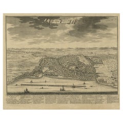
Large Antique Panoramic View on Batavia, Present Day Jakarta, Indonesia, 1726
Located in Langweer, NL
Antique print Indonesia titled 'Batavia in 't Verschiet'. Large panoramic view on Batavia, present day Jakarta, Indonesia. Originates from 'Oud en Nieuw Oost-Indiën (..)' by Fran...
Category

Antique Early 18th Century More Furniture and Collectibles

Materials

Paper

Antique Engraving of the Story of Jephthah’s Daughter, 1728
Located in Langweer, NL
Antique religion print titled 'Jephthah's daughter meets him at the door of his house'. The story of Jephthah’s Daughter (Judges 11) tells us that Jephthah the Gileadite made a v...
Category

Antique Early 18th Century More Furniture and Collectibles

Materials

Paper

Religion Print Titled 'Susanna Resisteth the Temptation of The two Judges', 1728
Located in Langweer, NL
Antique religion print titled 'Susanna resisteth the temptation of the two Judges'. She said to her maids, "Bring me oil and ointments, and shut the garden doors so that I may ba...
Category

Antique Early 18th Century More Furniture and Collectibles

Materials

Paper

Sea Chart Titled 'Baya de Saldanha' with Robben Island in South Africa, 1726
Located in Langweer, NL
Antique map titled 'Baya de Saldanha'. Sea chart covering the South African coast from the Cape of Good Hope to Saldanha Bay. This print originates from 'Oud en Nieuw Oost-Indiën...
Category

Antique Early 18th Century More Furniture and Collectibles

Materials

Paper

Antique Engraving Depicting the Confession & the Anointing of the Sick, 1724
Located in Langweer, NL
Two religious images on one sheet. The upper images depicts the confession and the lower image depicts the anointing of the sick. This print originates from 'Ceremonies et costumes R...
Category

Antique Early 18th Century More Furniture and Collectibles

Materials

Paper

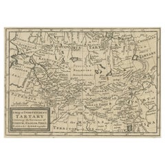
Old Map of Tartary with Persia, Siberia, the Mogul Territories & China, ca.1717
Located in Langweer, NL
Antique map titled 'A Map of Independent Tartary, containing the territories of Usbeck, Gasgar, Tibet, Lassa & c'. Old map depicting east of the Caspian Sea with parts of Persia, Siberia, the Mogul territories and on to western China...
Category

Antique Early 18th Century More Furniture and Collectibles

Materials

Paper

Map of the Mozambique and Tanzania Coast & Inset Map of Anjouan Island, ca.1700
Located in Langweer, NL
Antique map titled 'Carte particuliere des Costes de l'Afrique'. Depicts the coasts of Mozambique and Tanzania. With an inset map of Anjouan Island. Artists and engravers: Pub...
Category

Antique Early 18th Century More Furniture and Collectibles

Materials

Paper

Beautiful Original Print of The Creation of the World According to Moses, 1725
Located in Langweer, NL
Antique map, titled: 'De Schepping der Wereldt volgens de Beschryving van Mozes.' Two separate maps on one sheet showing the creation of the world according to Moses. The upper dep...
Category

Antique Early 18th Century More Furniture and Collectibles

Materials

Paper

Original Antique Map of the Netherlands Incl Amsterdam, Leiden and Haarlem, 1700
Located in Langweer, NL
Antique map titled ‘Rhinolandiae Amsterlandiae et circumjacent (..)’. Map of the regions of Rijnland and Amstelland in the Netherlands, including the cities of Amsterdam, Leiden ...
Category

Antique Early 18th Century More Furniture and Collectibles

Materials

Paper

Beautiful Antique Map of the French Coast, from St. Valeri to Dieppe, 1720
Located in Langweer, NL
Antique map France titled 'Les Embouchures de la Somme et de Bresle Riv. ou est St. Valeri, Eu et Dieppe'. Beautiful map of the French coast, fr...
Category

Antique Early 18th Century More Furniture and Collectibles

Materials

Paper

Two Charts of The English Channel, Each Adorned with Nice Compass Roses, ca.1700
Located in Langweer, NL
Antique map titled 'Hydrographia Canalis Marini Inter Angliam et Galiiam de Fluentis.' Sheet with with two charts of the English Channel, each adorned with beautiful compass rose...
Category

Antique Early 18th Century More Furniture and Collectibles

Materials

Paper

Antique Engraving of Thomas Müntzer, a Reformation-Era German Theologian, 1701
Located in Langweer, NL
Antique portrait titled 'Thomas Muntzer'. Portrait of Thomas Müntzer. Thomas Müntzer was an early Reformation-era German theologian, who became a rebel leader during the Peasants' War. He turned against Luther with several anti-Lutheran writings, and supported the Anabaptists. In the Battle of Frankenhausen, Müntzer and his followers were defeated. He was captured, tortured and decapitated. This print originates from 'Historie der kerken en ketteren van den beginne des Nieuwen Testaments tot aan het jaar onses Heeren 1688 ... In het Neederduyts vertaald' by G. Arnold. Artists and Engravers: Gottfried Arnold (1666 – 1714) was a German Lutheran...
Category

Antique Early 18th Century More Furniture and Collectibles

Materials

Paper

Remarkable Map of the Alsace Region and Nova Zembla, Russia, ca.1700
Located in Langweer, NL
Antique map titled 'Chorographia Alsatiae.' Map of the Alsace region and Nova Zembla, printed for Scherer's 'Atlas Novus' (1702-1710). Scherer's 'Atlas Novus' forms an important ...
Category

Antique Early 18th Century More Furniture and Collectibles

Materials

Paper

Antique Double Hemisphere World Map with California as an Island, 1710
Located in Langweer, NL
Description: Antique map titled 'De Werelt Caart'. First state (out of three) antique double hemisphere world map from a Dutch bible by Cornelis D...
Category

Antique Early 18th Century More Furniture and Collectibles

Materials

Paper

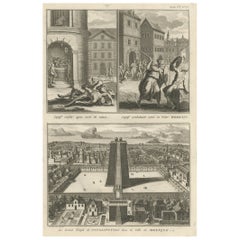
The Great Temple of Vitsliputsli in Mexico City and a Few Murder Scenes, 1722
Located in Langweer, NL
Antique print titled 'Captif ecorché apres avoir eté vaincu (..)'. Three images on one sheet. The first image shows a captive being flayed after he was killed, the second image shows...
Category

Antique Early 18th Century More Furniture and Collectibles

Materials

Paper

Map of Northern India & Surrounding Regions, incl Kabul, Candahar & Bhutan, 1710
Located in Langweer, NL
Antique map titled 'Magni Mogolis Imperium de Novo Correctum et Divisum Per F. de Witt Amstelodami.' Map of Northern India and surrounding regions. This includes Kabul and Candah...
Category

Antique Early 18th Century More Furniture and Collectibles

Materials

Paper

Large Antique Detailed Map of a Part of the Spice Islands, Indonesia, 1726
Located in Langweer, NL
Antique matitled 'De Landvoogdy der Moluccos met de aangrenzende Eylanden'. Large detailed map of a part of the Spice Islands. It includes Baru (Boero), Ambon, Seram and part of Ma...
Category

Antique Early 18th Century More Furniture and Collectibles

Materials

Paper

Highly Detailed Antique Map of Brabant, Province of the Netherlands, ca.1700
Located in Langweer, NL
Antique print, titled: 'Brabantiae Batavae Pars Occidentalis : sive Antuerpiensis Tetrarchiae Pars Septentrionalis comprehendens Baroniam Bredanam, Marchionatum Bergensem ad Zoman al...
Category

Antique Early 18th Century More Furniture and Collectibles

Materials

Paper

Emperor Vespian Besieging and Conquering Iotapata 'Yodfat', 1725
Located in Langweer, NL
Antique print titled 'Vespasiaan belegert en verovert Iotapata'. Emperor Vespian besieging and conquering Iotapata (Yodfat). This print originates from 'Het algemeen groot historisch, oordeelkundig, chronologisch, geografisch, en letterlyk naam- en woord-boek, van den gantschen H. Bijbel (..)' by A. Calmet. The Siege of Yodfat (Hebrew: ????????, also Jotapata, Iotapata, Yodefat) was a 47-day siege by Roman forces of the Jewish town of Yodfat which took place in 67 CE, during the Great Revolt. Led by Roman General Vespasian and his son Titus, both future emperors, the siege ended with the sacking of the town, the deaths of most of its inhabitants and the enslavement of the rest. It was the second bloodiest battle of the revolt, surpassed only by the Siege of Jerusalem...
Category

Antique Early 18th Century More Furniture and Collectibles

Materials

Paper

Antique Map of the Islands of Banda, Indonesia from a Very Rare Edition, 1725
Located in Langweer, NL
Antique map titled 'Les Iles de Banda (..).' (The islands of Banda, Indonesia.) Extremely rare in this edition. This plate originates from the very scarse: 'La galerie agreable d...
Category

Antique Early 18th Century More Furniture and Collectibles

Materials

Paper

Small Early 18th Century Map of Banten Bay on the Island Java, Indonesia, c.1725
Located in Langweer, NL
A small early 18th century map of Banten Bay showing the islands of Pulo Dua and Pulo Batto together with soundings within the Bay and profiles of hills on the islands published by C...
Category

Antique Early 18th Century More Furniture and Collectibles

Materials

Paper

Original Antique Map Southeast of the Banda or Spice Islands, Indonesia, 1726
Located in Langweer, NL
Antique map titled 'Kaart van de Zuyd-Ooster Eylanden van Banda'. Map of the southeastern part of the Banda islands. This map originates from 'Oud en Nieuw Oost-Indiën' by F. Valen...
Category

Antique Early 18th Century More Furniture and Collectibles

Materials

Paper

View of the Salon and Dining Room of Wilton House in Salisbury, Wiltshire, 1717
Located in Langweer, NL
Antique print titled 'Section of the Salon, one end of the great dining room (..)'. View of the salon ('Single Cube Room') and great dining room of Wilton House, also known as th...
Category

Antique Early 18th Century More Furniture and Collectibles

Materials

Paper

Early Bird's-Eye View of Rio Di Janeiro and Guanabara Bay, Brazil, 1702
Located in Langweer, NL
Antique print titled 'Rio Janeiro'. Bird's-eye view of Rio di Janeiro and Guanabara Bay, Brazil. From the French edition (translation by Renneville) of Commelin's 'Recueil des Vo...
Category

Antique Early 18th Century More Furniture and Collectibles

Materials

Paper

Old Map Covering All of Southeast Asia from Persia to the Timor Island, 1712
Located in Langweer, NL
Description: Antique map titled 'A New Map of the East Indies'. Old map covering all of Southeast Asia from Persia to the Timor Island, inclusive of the modern day nations of India, ...
Category

Antique Early 18th Century More Furniture and Collectibles

Materials

Paper

Antique Engraving of Circus Flaminius, a Circular Area in Ancient Rome, 1704
Located in Langweer, NL
Description: Antique print, titled: 'Circus Flaminius (…)' - This original old antique print shows a reconstruction of Circus Flaminius, a large, circular area in ancient Rome, l...
Category

Antique Early 18th Century More Furniture and Collectibles

Materials

Paper

Original Antique Engraving of Kannur 'or Cannanore', Kerala, India, 1726
Located in Langweer, NL
Antique print, titled: 'Cananor' - This is a print of a view of Kannur (or Cannanore), Kerala, India. From the monumental: "Oud en Nieuw Oost-Indiën ..." by François Valentyn / Valen...
Category

Antique Early 18th Century More Furniture and Collectibles

Materials

Paper

Religious Antique Print of The Ten Divine Transformation, 1727
Located in Langweer, NL
Description: Untitled print, ten images on one plate. This plate deals with the ten divine transformations according to Indian religion. This print originates from 'Naaukeurige b...
Category

Antique Early 18th Century More Furniture and Collectibles

Materials

Paper

Map of the Southeastern Part of the Banda Islands, Incl Northern Australia, 1726
Located in Langweer, NL
Antique map titled 'Kaart van de Zuyd-Ooster Eylanden van Banda.' Map of the southeastern part of the Banda islands. This map originates from 'Oud en Nieuw Oost-Indiën' by Franço...
Category

Antique Early 18th Century More Furniture and Collectibles

Materials

Paper

Map of Tapi or Tapti River in Central India and Along the Arabian Sea, 1726
Located in Langweer, NL
Description: Antique map titled 'De Rivier van Suratta'. This chart shows the Tapti or Tapi River in Central India and the Indian coast along the Arabian Sea, into which the rive...
Category

Antique Early 18th Century More Furniture and Collectibles

Materials

Paper

Old Engraving of the Trarbach Battle in Rhineland-Palatinate, Germany, c.1710
Located in Langweer, NL
Rare antique print titled 'Plan de la Ville et Chateau Traarbach (..)'. Battle plan of Trarbach, Rhineland-Palatinate, Germany. Published circa 1710 b...
Category

Antique Early 18th Century More Furniture and Collectibles

Materials

Paper

Antique Religion Print Showing Rituals & Ceremonies for the Death of a Pope 1724
Located in Langweer, NL
Antique religion print depicting rituals and ceremonies for the death of the Pope. Originates from 'Ceremonies et coutumes Religieuses...' , by A. Moubach. Artists and Engrave...
Category

Antique Early 18th Century More Furniture and Collectibles

Materials

Paper

Old Map of Persia, incl the Caspian Sea and Part of the Arabian Peninsula, 1726
Located in Langweer, NL
Antique map of Persia. It covers from the Gulf of Suez eastward to Ahmedabad (Amadabad) in modern day western India. This map, centered on Persia, includes the Caspian Sea and part of the Arabian...
Category

Antique Early 18th Century More Furniture and Collectibles

Materials

Paper

Spectacular Large Map of Upper and Lower Austria between Passau and Wien, c.1700
Located in Langweer, NL
Antique map titled 'Austriae Archiducatus pars superior in omnes ejusdem (..).' Spectacular large map of Upper and Lower Austria between Passau and Wien with figurative cartouche a...
Category

Antique Early 18th Century More Furniture and Collectibles

Materials

Paper

Map of the Electorate of Bavaria, Incl Lake Constance, by Jesuit Scherer, c.1700
Located in Langweer, NL
Antique map titled 'Electorat Bavariae.' Map of the Electorate of Bavaria by the Jesuit Heinrich Scherer. The lower map shows the Lake Constance. Source unknown, to be determined. ...
Category

Antique Early 18th Century More Furniture and Collectibles

Materials

Paper

Antique Engraving of Majorinus, Bishop of Carthage of the Donatist Sect, 1701
Located in Langweer, NL
Antique print, titled: 'Majorinus Numida' Majorinus was a bishop of Carthage in dispute with Ceacilianus. He favored the so-called Donatist sect. Het died ca. 329 AD. The background to the controversy was the wave of persecutions of Christians by the Roman Emperor Diocletian. At that time some Church leaders - unwilling to endure torture or death and become martyrs - had been ready to take such acts as worshipping the gods of the old pantheon, considered idols by Christians, or surrendering church books and property to the imperial authorities. Such people became known as 'traditors' ("surrenderers"). One of these "traditors", named Caecilian, had returned to the fold of the Church once the persecutions ended, and was consecrated Bishop of Carthage and Primate of North Africa. Those of the faithful who refused to accept the authority of such a spiritual leader raised Majorinus as a rival bishop; however, Majorinus died shortly after being consecrated, and it fell to Donatus to take his place and continue the struggle. This rare print originates from: 'Historie der Kerken en Ketteren van den beginne des Nieuwen Testaments tot aan het Jaar onses Heeren 1688. Onzydig in 't Hoogduytsch beschreeven, door den Hoog-geleerden Heer Godfried Arnold, Voor deezen Hoog-Leeraar in de Historien tot Giesen. In het Neederduyts vertaald. Vercierd met verscheyde Koopere Plaaten door den Heer Romeyn de Hooghe.' (transl.: History of Churches and Heretics from the start of the New Testament until the year of our lord 1688 ...), by Godfried Arnold, Dutch edition published by Sebastiaan Petzold, Amsterdam 1701. This edition contains portraits of heretic figures, etched by the reknown Romeyn de Hooghe. Artists and Engravers: Made by 'Romeyn de Hooghe' after an anonymous artist. Gottfried Arnold (pseud. Christophorus Irenaeus) was an important representative of the so-called radical Pietism, publicist, church historian and chants writer (so he was believed to have written the well-known Church song 'O Durchbrecher aller Bande'). Arnold studied theology in Wittenberg. From the Lutheran Orthodoxy he converted, through writings of Spener, to Pietism, associating later into a circle around the court preacher Sprögel, who was influenced by Jakok Böhm. Many medieval mystics were later re-issued by him. In addition he was clearly influenced by Grotius and the early enlightenment. His quest for the 'true' Christianity rightly brought him in the early Church. So he arranged an edition containing the sermons of the desert father Macarius. Arnold was a skilled patristicus, although he did not escape from the creation of an ideal image of the Christian life in the early Church, in his view a flowering time which ended with the reign of Constantine. His first study of the early Church ('Die erste Liebe der Gemeinen Jesu Christi') provided him a professor position in Gießen, a post which he soon left, disappointed by what he called the 'Ruhmsachtige Vernunftwesen des akademischen Lebens'. He continued as an individual scientist and he published books and poems. His main work is 'Unparteiischen Kirchen- und Ketzerhistorie' (1699-1700), of which this is the Dutch translation. He adapts in this study the reformatory decay theory, where the censure lies no longer with Constantine, but the post-Apostolic time. The decay is temporarily lifted with the Reformation, but occurres again soon, so that even the contemporary institutional Protestantism lies under the fire of his criticism. On the other hand he favours the 'Church of the spirit' that existed in all times (invisible) and is characterised by avoiding the world and asceticism. Not the orthodoxy, but the subjectivity of religious man...
Category

Antique Early 18th Century More Furniture and Collectibles

Materials

Paper

Old Religion Print Showing Six Roman Catholic Habits, Rituals & Ceremonies, 1723
Located in Langweer, NL
Antique religion print depicting six Roman Catholic habits, rituals and ceremonies. Degradation of a Bishop, excommunication, rehabilitation of someone ...
Category

Antique Early 18th Century More Furniture and Collectibles

Materials

Paper

Regional Map of Germany, inc Hamburg, Luneberg, Hannover, Braunsweig etc, c.1720
Located in Langweer, NL
Antique map titled 'Ducatus Luneburgici et Comitatus Dannebergensis accurata Descriptio.' This detailed regional map includes Hamburg, Luneberg, and as far south as Hannover, Bra...
Category

Antique Early 18th Century More Furniture and Collectibles

Materials

Paper

Antique Map of Luzon of Luconia in the Philippines, 1726
Located in Langweer, NL
Description: Antique map titled 'Lucon of Luconia'. Luzon is the largest and most populous island in the Philippines. It is ranked 15th largest in the world by land area. Located i...
Category

Antique Early 18th Century More Furniture and Collectibles

Materials

Paper

Antique Print Depicting the Divorce Customs of the Jews, ca.1725
Located in Langweer, NL
Description: Antique religion print titled 'Gewoonten der Jooden wegens de brieven van Echtscheiding'. This print depicts divorce customs of the Jews. This print originates from ...
Category

Antique Early 18th Century More Furniture and Collectibles

Materials

Paper

Attractive Original Map of the Province of Overijssel, the Netherlands, Ca.1700
Located in Langweer, NL
Antique print, titled: 'Transisalania Provincia vulgo Over-yssel.' Attractive original handcoloured map of the province of Overijssel, The Netherlands. With beautiful title carto...
Category

Antique Early 18th Century More Furniture and Collectibles

Materials

Paper

Old Map of the Bangka Belitun Islands, Greater Sunda Islands, Indonesia, 1705
Located in Langweer, NL
Antique map Sunda Islands titled 'De Eilanden van Sunda, waar onder zyn Sumatra, Java, Borneo enz'. Old map of the Bangka Belitun Islands, part of the Greater Sunda Islands, incl...
Category

Antique Early 18th Century More Furniture and Collectibles

Materials

Paper

18th Century Russian Shabbat Candlesticks
Located in New York, NY
Early pair of brass Sabbath candlesticks Hand-turned, of very heavy construction, each resting on four peg feet. Russia, circa 1700. For the Je...
Category

Russian Antique Early 18th Century More Furniture and Collectibles

Materials

Brass

Detailed Original Antique Map of India, Southeast Asia and the Far East, 1719
Located in Langweer, NL
Antique map titled 'Carte des Indes, de la Chine & des Iles de Sumatra, Java & c'. Detailed map of India, Southeast Asia and the Far East, extending from Gujerat to the supposed "T...
Category

Antique Early 18th Century More Furniture and Collectibles

Materials

Paper

Antique Print of a Funeral Procession of the Kings of Vietnam or Tonkin, 1725
Located in Langweer, NL
Description: Antique print, titled: 'Pompe Funebre des Rois de Tunquin' - This plate shows a funeral procession of the Kings of Vietnam (formerTunquin or Tonk...
Category

Antique Early 18th Century More Furniture and Collectibles

Materials

Paper

Rare Old English Sea Chart of Part of Indonesia with Java, Madura and Bali, 1711
Located in Langweer, NL
Antique map titled 'A Large Draught of the East End of Java and Madura shewing the Streights of Bally.' Rare early example of this working English Sea Chart of part of Indonesia ...
Category

Antique Early 18th Century More Furniture and Collectibles

Materials

Paper

Rare Sea Chart of the East Frisian Islands or Watten and the North Sea, c.1700
Located in Langweer, NL
Description: Antique map titled 'Paskaarte van de rievier de Elve streckende van Oldenbroek tot Hamburgh.' Rare and interesting chart of the East Frisian Islands (or Watten) and ...
Category

Antique Early 18th Century More Furniture and Collectibles

Materials

Paper

Original Old Map East of Stockholm, the Island Ljusterö and Värmdö, Sweden, 1720
Located in Langweer, NL
Antique map titled 'Accurate Carte der Upländischen Scheren mit der Situation und Gegend umb die Konigle Schwedisch Haupt und Residentz Stadt Stockholm.' Map of the area east of ...
Category

Antique Early 18th Century More Furniture and Collectibles

Materials

Paper

Original Antique Map of the Province of Utrecht, the Netherlands, ca.1720
Located in Langweer, NL
Antique map titled ‘Tabula Nova Provinciae Ultrajectinae (..)’. Original antique map of the province of Utrecht, the Netherlands. It shows the region of Amsterdam, Utrecht, Gouda, ...
Category

Antique Early 18th Century More Furniture and Collectibles

Materials

Paper

Antique Print of An Ancient Roman Tomb and a Floor Plan in Rome, Italy, 1704
Located in Langweer, NL
Description: Antique print, untitled. This original old antique print shows an ancient Roman tomb and a floor plan in Rome, Italy. This original old ant...
Category

Antique Early 18th Century More Furniture and Collectibles

Materials

Paper

Antique Map of Southern Asia with India, the Maldives, Ceylon and Arabia, c.1700
Located in Langweer, NL
Stunning Old Map of Asia. Description: Two-sheet map of Asia, joined. The left part of this antique map is titled 'Partie occidentale d'une partie d'Asie ou sont les Isles de Zoco...
Category

Antique Early 18th Century More Furniture and Collectibles

Materials

Paper

Unique Antique Projection of the World with Twice California as an Island, c1703
Located in Langweer, NL
Description: Antique map of the world. Printed for Scherer's 'Atlas Novus' (1702-1710). On this old engraving you can find California as an Island twice! Rare! Artists and Eng...
Category

Antique Early 18th Century More Furniture and Collectibles

Materials

Paper

Antique Print Stating That Law is Given by Moses, Mercy and Truth by Jesus, 1725
Located in Langweer, NL
Antique print titled 'De wet is door Mozes gegeven, de genade en de waarheid is door Jesus Christus geworden.' The law is given by Moses, Mercy and Truth established by Jesus Christ....
Category

Antique Early 18th Century More Furniture and Collectibles

Materials

Paper

Early 18th Century Map of Denmark in Old Coloring, Published in 1706
Located in Langweer, NL
Denmark. Schenk (Petrus), Dania Regnum Ducatus Holsatia. et Slesvicum Insulae Danicae et Provinciae Jutia Scania etc. Amsterdam, 1706, engraved reticulated map on thick paper with co...
Category

Antique Early 18th Century More Furniture and Collectibles

Materials

Paper

Antique Miniature Map of the Maluku Islands by Lasor a Varea, 1713
Located in Langweer, NL
Antique map titled 'Isole Molucche'. Rare miniature map of the Maluku Islands or the Moluccas, Indonesia. This map originates from 'Universus Terrarum Orbis...
Category

Antique Early 18th Century More Furniture and Collectibles

Materials

Paper

Beautiful Large Scale Map of Spain and Portugal Published by Herman Moll in 1711
Located in Langweer, NL
Title: A New and Exact Map of Spain & Portugal Author: Herman Moll Date: 1711 Medium: ?Hand-colored copperplate engraving Condition: Very good - light age toning, light wear and discoloration along issued quatrefolds, surface dirt, minor creasing throughout,. Large engraved map on two conjoined sheets, contemporary outline colouring with some later enhancement inches. Herman Moll (c. 1654-1732) was one of the most important London mapmakers in the first half of the eighteenth century. Moll was probably born in Bremen, Germany, around 1654. He moved to London to escape the Scanian Wars. His earliest work was as an engraver for Moses Pitt on the production of the English Atlas, a failed work which landed Pitt in debtor's prison. Moll also engraved for Sir Jonas Moore, Grenville Collins, John Adair, and the Seller & Price firm. He published his first original maps in the early 1680s and had set up his own shop by the 1690s. Moll's work quickly helped him become a member of a group which congregated at Jonathan's Coffee House at Number 20 Exchange Alley, Cornhill, where speculators met to trade stock. Moll's circle included the scientist Robert Hooke...
Category

Antique Early 18th Century More Furniture and Collectibles

Materials

Paper

Scandinavia & Portions of Eastern Europe: 18th Century Hand-Colored Homann Map
Located in Alamo, CA
An early 18th century hand-colored copper-plate map entitled "Regni Sueciae in omnes suas Subjacentes Provincias accurate divisi Tabula Generalis" by Johann Baptist Homann (1663-1724...
Category

German Antique Early 18th Century More Furniture and Collectibles

Materials

Paper

Early Map of Australasia, Marking The Route of Abel Tasman in 1642 'Publ. 1726'
Located in Langweer, NL
Description: Antique map titled 'Kaart der Reyse van Abel Tasman volgens syn eygen opstel'. Rare and early map of Australasia, marking the route of Abel Tasman's voyage from Mauritius to Batavia in 1642, on which he discovered Tasmania and New Zealand and proved that Australia was not part of the Great Southern...
Category

Antique Early 18th Century More Furniture and Collectibles

Materials

Paper

Read More

Pamela Shamshiri Shares the Secrets behind Her First-Ever Book and Its Effortlessly Cool Interiors

The sought-after designer worked with the team at Hoffman Creative to produce a monograph that beautifully showcases some of Studio Shamshiri's most inspiring projects.

Moroccan Artworks and Objects Take Center Stage in an Extraordinary Villa in Tangier

Italian writer and collector Umberto Pasti opens the doors to his remarkable cave of wonders in North Africa.

Montecito Has Drawn Royalty and Celebrities, and These Homes Are Proof of Its Allure

Hollywood A-listers, ex-pat aristocrats and art collectors and style setters of all stripes appreciate the allure of the coastal California hamlet — much on our minds after recent winter floods.

Whaam! Blam! Pow! — a New Book on Pop Art Packs a Punch

Publishing house Assouline and writer Julie Belcove have teamed up to trace the history of the genre, from Roy Lichtenstein, Andy Warhol and Yayoi Kusama to Mickalene Thomas and Jeff Koons.

The Sparkling Legacy of Tiffany & Co. Explained, One Jewel at a Time

A gorgeous new book celebrates — and memorializes — the iconic jeweler’s rich heritage.

What Makes a Gem-Encrusted Chess Set Worth $4 Million?

The world’s most opulent chess set, weighing in at 513 carats, is literally fit for a king and queen.

Tauba Auerbach’s Geometric Pop-Up Book Is Mighty Rare, Thanks to a Hurricane

This sculptural art book has an epic backstory of its own.

Step inside the Storied Mansions of Palm Beach’s Most Effervescent Architect

From Spanish-style courtyards to fanciful fountains, these acclaimed structures abound in surprising and elegant details.

Recently Viewed

View All