
Antique Cartography

to
729
2,319
101
1,296
1,015
755
425
332
249
168
162
161
153
149
120
114
113
113
86
59
49
43
39
36
35
33
33
30
29
23
22
21
20
18
18
17
16
15
11
10
10
10
10
10
9
9
8
7
6
5
4
3
2
61
31
20
14
11
Antique Devon County Map, English, Framed 17th Century Atlas Cartography, C.1650

Antique Devon County Map, English, Framed 17th Century Atlas Cartography, C.1650

Located in Hele, Devon, GB

the 17th century and later, circa 1650. A fascinating and highly decorative cartographic work

Category

17th Century British Charles II Antique Cartography

Materials

Glass, Paper

Antique Map of Surrey, English, Framed County Cartography, After Blaeu, C.1690

Antique Map of Surrey, English, Framed County Cartography, After Blaeu, C.1690

Located in Hele, Devon, GB

This is an antique map of Surrey. An English, framed cartography engraving by Willem Janszoon Blaeu

Category

1690s British William and Mary Antique Cartography

Materials

Glass, Paper

1806 John Cary Map of Hindoostan – Detailed British Cartography of India

1806 John Cary Map of Hindoostan – Detailed British Cartography of India

$513Sale Price|20% Off

H 21.26 in W 24.41 in D 0 in

1806 John Cary Map of Hindoostan – Detailed British Cartography of India

Located in Langweer, NL

Title: 1806 John Cary Map of Hindoostan – Detailed British Cartography of India This highly

Category

Early 1800s Antique Cartography

Materials

Paper

Rare 1681 Map of Batavia: Detailed Dutch Colonial Era Cartography, 1681

Rare 1681 Map of Batavia: Detailed Dutch Colonial Era Cartography, 1681

$5,615Sale Price|20% Off

H 21.07 in W 24.41 in D 0.01 in

Rare 1681 Map of Batavia: Detailed Dutch Colonial Era Cartography, 1681

Located in Langweer, NL

became the center of Dutch political and military control in the region. Cartographic Significance 1

Category

1680s Antique Cartography

Materials

Paper

Antique Town Plan Map, Poole, English, Framed Cartography, Georgian, Circa 1780

Antique Town Plan Map, Poole, English, Framed Cartography, Georgian, Circa 1780

$687Sale Price|20% Off

H 19.49 in W 16.74 in D 0.99 in

Antique Town Plan Map, Poole, English, Framed Cartography, Georgian, Circa 1780

Located in Hele, Devon, GB

the 18th century and later. Fascinating cartography with annotated streets and places Displaying a

Category

Late 18th Century British George III Antique Cartography

Materials

Glass, Wood, Paper

Antique County Map of Cheshire, Dutch, Framed, Cartography, Janssonius, C.1660

Antique County Map of Cheshire, Dutch, Framed, Cartography, Janssonius, C.1660

$1,822Sale Price|20% Off

H 22.05 in W 25.99 in D 0.99 in

Antique County Map of Cheshire, Dutch, Framed, Cartography, Janssonius, C.1660

Located in Hele, Devon, GB

antique county map of Cheshire, with superb detail and 17th century cartographic interest. Delivered ready

Category

Mid-17th Century Dutch Charles II Antique Cartography

Materials

Glass, Wood, Paper

Cartographic Elegance of Touraine: A 17th-Century Map Showing French Heritage

Cartographic Elegance of Touraine: A 17th-Century Map Showing French Heritage

Located in Langweer, NL

cartographic detail and artistic presentation. Their work represents a high point in the Golden Age of Dutch

Category

1630s Dutch Antique Cartography

Materials

Paper

Antique Plan de l'Historie Universelle World Map, Framed Cartography, Circa 1730

Antique Plan de l'Historie Universelle World Map, Framed Cartography, Circa 1730

Located in Hele, Devon, GB

order Wonderful period cartography piece, set within a later glazed frame Compiled by Chatelain with

Category

1730s Dutch George II Antique Cartography

Materials

Glass, Paper

Imperii Persici Delineatio: A 1722 Cartographic Masterpiece of Persia by Schenk

Imperii Persici Delineatio: A 1722 Cartographic Masterpiece of Persia by Schenk

Located in Langweer, NL

. - Reputation: Schenk was part of a family of mapmakers and had a significant influence on the cartographic and

Category

1720s Dutch Antique Cartography

Materials

Paper

Vintage Cartographic Collection Set of India Explored - W. G. Blackie's 1859

Vintage Cartographic Collection Set of India Explored - W. G. Blackie's 1859

$380Sale Price / set|20% Off

H 14.57 in W 21.26 in D 0.02 in

Vintage Cartographic Collection Set of India Explored - W. G. Blackie's 1859

Located in Langweer, NL

by W. G. Blackie, 1859. The "Vintage Cartographic Collection: India Explored - W. G. Blackie's 1859

Category

Mid-19th Century Antique Cartography

Materials

Paper

Antique Suffolk County Map, Dutch, Atlas Novus, Joan Blaeu, Cartography, C.1645

Antique Suffolk County Map, Dutch, Atlas Novus, Joan Blaeu, Cartography, C.1645

Located in Hele, Devon, GB

is a fascinating antique county map of Suffolk, with superb detail and mid-17th century cartographic

Category

1640s Dutch Charles II Antique Cartography

Materials

Glass, Paper

Old Map of Vaucluse, France: A Cartographic Celebration of Viticulture, 1852

Old Map of Vaucluse, France: A Cartographic Celebration of Viticulture, 1852

Located in Langweer, NL

National Illustré' is celebrated for its combination of cartographic detail and artistic embellishment

Category

1850s Antique Cartography

Materials

Paper

Empire of the Parthians: Historical Cartographic Masterpiece by d'Anville, 1819

Empire of the Parthians: Historical Cartographic Masterpiece by d'Anville, 1819

Located in Langweer, NL

Description: Ancient map of the Parthian Empire (19th century), original engraving extracted from the atlas of the history of the emperors from 1819, based on the history of the Rom...

Category

1810s Antique Cartography

Materials

Paper

Cuenca 1901: A Historical Cartographic Detailing of High Plains and Mountains

Cuenca 1901: A Historical Cartographic Detailing of High Plains and Mountains

Located in Langweer, NL

The original antique map displays the province of Cuenca, located in the autonomous community of Castilla-La Mancha in central Spain, as of 1901. Here are some of its features: It i...

Category

Early 1900s Antique Cartography

Materials

Paper

Guadalajara 1902: A Cartographic Image of Castilla-La Mancha's Northern Province

Guadalajara 1902: A Cartographic Image of Castilla-La Mancha's Northern Province

Located in Langweer, NL

The map illustrates the province of Guadalajara, part of the autonomous community of Castilla-La Mancha in Spain, as of 1902. The map includes various geographic and infrastructural ...

Category

Early 1900s Antique Cartography

Materials

Paper

Badajoz 1901: A Cartographic Record of Extremadura's Largest Province in Spain

Badajoz 1901: A Cartographic Record of Extremadura's Largest Province in Spain

Located in Langweer, NL

This original antique map for sale is of the province of Badajoz, part of the autonomous community of Extremadura in Spain, dated 1901. It illustrates several important features: Th...

Category

Early 1900s Antique Cartography

Materials

Paper

León 1903: A Cartographic Detailing of Castilla y León's Mountainous Province

León 1903: A Cartographic Detailing of Castilla y León's Mountainous Province

Located in Langweer, NL

The map depicts the province of León, which is located in the northwest of Spain and forms part of the autonomous community of Castilla y León, as of 1903. Notable features of the ma...

Category

Early 1900s Antique Cartography

Materials

Paper

Beira Baixa: A Cartographic Portrait of Portugal's Historic Frontier in 1903

Beira Baixa: A Cartographic Portrait of Portugal's Historic Frontier in 1903

$275Sale Price|20% Off

H 20.08 in W 14.77 in D 0.01 in

Beira Baixa: A Cartographic Portrait of Portugal's Historic Frontier in 1903

Located in Langweer, NL

The uploaded image is a historical map of the Beira Baixa region in Portugal. The map details the topography, including mountain ranges and river systems, as well as the transportati...

Category

Early 1900s Spanish Antique Cartography

Materials

Paper

Cartographic Heritage: The 1901 Map of the Vizcaya Province in Spain

Cartographic Heritage: The 1901 Map of the Vizcaya Province in Spain

$304Sale Price|20% Off

H 14.77 in W 20.08 in D 0 in

Cartographic Heritage: The 1901 Map of the Vizcaya Province in Spain

Located in Langweer, NL

This is a historical map of the province of Vizcaya (Biscay) in Spain, dated 1901. The title on the map is "VIZCAYA. 1901." It shows the topographical details of the region with cont...

Category

Early 1900s Antique Cartography

Materials

Paper

Gipuzkoa 1902: A Cartographic Snapshot of the Basque Coastline and Highlands

Gipuzkoa 1902: A Cartographic Snapshot of the Basque Coastline and Highlands

Located in Langweer, NL

The map showcases the province of Gipuzkoa (also known as Guipúzcoa in Spanish), which is part of the autonomous community of the Basque Country in northern Spain, as of the year 190...

Category

Early 1900s Antique Cartography

Materials

Paper

Lugo 1901: A Cartographic Chronicle of Galicia's Ancient Roman Walled City

Lugo 1901: A Cartographic Chronicle of Galicia's Ancient Roman Walled City

$294Sale Price|20% Off

H 20.08 in W 14.77 in D 0 in

Lugo 1901: A Cartographic Chronicle of Galicia's Ancient Roman Walled City

Located in Langweer, NL

The map presents the province of Lugo, located in the autonomous community of Galicia in northwestern Spain, as it was in 1901. Notable features include: - **Topography**: The provi...

Category

Early 1900s Antique Cartography

Materials

Paper

Lleida 1902: A Cartographic Perspective of Catalonia's Gateway to the Pyrenees

Lleida 1902: A Cartographic Perspective of Catalonia's Gateway to the Pyrenees

Located in Langweer, NL

The map for sale shows the province of Lleida, located in the western part of Catalonia, Spain, as of 1902. Here are the key features depicted on the map: - **Topography**: The map ...

Category

Early 1900s Antique Cartography

Materials

Paper

Cartographic Treasures: A Journey Through the Gascogne and Guyenne Regions, 1680

Cartographic Treasures: A Journey Through the Gascogne and Guyenne Regions, 1680

Located in Langweer, NL

The antique map titled "Gouvernement de La Guienne & Gascogne" depicts the region of Gascogne and Guyenne, known for their wine production, in France. This map is a rare edition, u...

Category

Late 17th Century Antique Cartography

Materials

Paper

Cartographic Elegance: The British Raj's India, 1882 Atlas by Blackie and Son

Cartographic Elegance: The British Raj's India, 1882 Atlas by Blackie and Son

Located in Langweer, NL

a window into the era's cartography and the geopolitical landscape as perceived by the British.

Category

1880s British Antique Cartography

Materials

Paper

Ancient Gaul: A Cartographic Overview of Gallic Tribes and Roman Provinces, 1880

Ancient Gaul: A Cartographic Overview of Gallic Tribes and Roman Provinces, 1880

Located in Langweer, NL

ancient Gaul during the Roman era. It is a testament to the cartographic and historical knowledge of the

Category

1880s Antique Cartography

Materials

Paper

Colonial Cartography: The Banda Islands - the Epicenter of the Spice Trade, 1818

Colonial Cartography: The Banda Islands - the Epicenter of the Spice Trade, 1818

Located in Langweer, NL

Antique map titled 'Kaart der Bandasche Eilanden' with a view titled 'Gezigt van het Eiland Neira en de Goening Api'. Rare and attractive map of the Banda Islands with a large view o...

Category

Early 19th Century Antique Cartography

Materials

Paper

The Principality of Dombes: A 17th-Century Cartographic Jewel by Jan Jansson

The Principality of Dombes: A 17th-Century Cartographic Jewel by Jan Jansson

Located in Langweer, NL

The text on the map "La principaute de Dombes; J. van den Eynde sculpit.; La Principavte de Dombes" indicates that it is a map of the principality of Dombes, engraved by J. van den E...

Category

1630s Antique Cartography

Materials

Paper

Castellón de la Plana 1901: A Cartographic Perspective of the Valencian Coast

Castellón de la Plana 1901: A Cartographic Perspective of the Valencian Coast

Located in Langweer, NL

The authentic map depicts the province of Castellón de la Plana, often referred to simply as Castellón, situated in the eastern part of Spain in the Valencian Community, and the map ...

Category

Early 1900s Antique Cartography

Materials

Paper

Teruel 1901: A Cartographic Depiction of Heritage and Natural Splendor in Spain

Teruel 1901: A Cartographic Depiction of Heritage and Natural Splendor in Spain

Located in Langweer, NL

Original antique map of Teruel in Spain, with highlighted gold. The province of Teruel, located in the region of Aragon in eastern Spain, is known for several unique features: 1. **...

Category

Early 1900s Antique Cartography

Materials

Paper

Ciudad Real 1902: A Detailed Cartographic Survey of La Mancha in Spain

Ciudad Real 1902: A Detailed Cartographic Survey of La Mancha in Spain

$323Sale Price|20% Off

H 14.77 in W 20.08 in D 0 in

Ciudad Real 1902: A Detailed Cartographic Survey of La Mancha in Spain

Located in Langweer, NL

This original antitque map presents the province of Ciudad Real, located in the autonomous community of Castilla-La Mancha in central Spain, as of 1902. It includes several notable f...

Category

Early 1900s Antique Cartography

Materials

Paper

Trás-os-Montes: A Cartographic Exploration of Portugal's Hidden Province in 1903

Trás-os-Montes: A Cartographic Exploration of Portugal's Hidden Province in 1903

Located in Langweer, NL

This print is an original historical map of the Trás-os-Montes region in the northeastern part of Portugal, dated 1903. Trás-os-Montes is often translated as "behind the mountains," ...

Category

Early 1900s Spanish Antique Cartography

Materials

Paper

Cartographic Elegance: The Art and Science of 17th-Century Asian Maps, ca.1681

Cartographic Elegance: The Art and Science of 17th-Century Asian Maps, ca.1681

Located in Langweer, NL

This original antique map is an artifact from a pivotal era in cartography, reflecting not only the

Category

1680s Antique Cartography

Materials

Paper

Map of Tartary by Isaak Tirion: Detailed Cartography of Northern Asia, ca.1740

Map of Tartary by Isaak Tirion: Detailed Cartography of Northern Asia, ca.1740

Located in Langweer, NL

demonstrates the cartographic skills of Isaak Tirion and his contribution to European knowledge of Asia during

Category

1740s Antique Cartography

Materials

Paper

Cartographic Elegance of the Mughal Dominion in a Hand-Colored Antique Map, 1705

Cartographic Elegance of the Mughal Dominion in a Hand-Colored Antique Map, 1705

Located in Langweer, NL

cartographic community. These maps would have been used for navigation, trade, and also to assert political

Category

Early 1700s Antique Cartography

Materials

Paper

Navarra in Cartographic Detail: A 1902 Map of the Crossroads of Northern Spain

Navarra in Cartographic Detail: A 1902 Map of the Crossroads of Northern Spain

Located in Langweer, NL

The original antique map for sale shows the Spanish province of Navarra as it was in 1902. Here's a brief description and a potential title for the map: Description: - The map detai...

Category

Early 1900s Antique Cartography

Materials

Paper

Antique Blaeu Map of Gâtinais & Sénonais France, c. 1642 Hand Color

Antique Blaeu Map of Gâtinais & Sénonais France, c. 1642 Hand Color

Located in Langweer, NL

cartography. Rich in decorative detail and densely filled with towns, forests, rivers, and regional boundaries

Category

Mid-17th Century Dutch Antique Cartography

Materials

Paper

Antique Blaeu Map of Reims & Rethel Champagne France, c. 1642

Antique Blaeu Map of Reims & Rethel Champagne France, c. 1642

Located in Langweer, NL

, engraved and published by Willem and Joan Blaeu during the Dutch Golden Age of cartography. The map forms

Category

Mid-17th Century Dutch Antique Cartography

Materials

Paper

Rare 16th Century Holy Land Woodcut Map by Heinrich Bünting, circa 1581

Rare 16th Century Holy Land Woodcut Map by Heinrich Bünting, circa 1581

Located in Langweer, NL

Jerusalem. His maps combine late Renaissance cartographic traditions with strong theological and symbolic

Category

16th Century German Antique Cartography

Materials

Paper

Antique Blaeu Map of Bresse & Dombes, Eastern France – Hand-Colored, c.1642

Antique Blaeu Map of Bresse & Dombes, Eastern France – Hand-Colored, c.1642

Located in Langweer, NL

originates from Blaeu's celebrated atlas series, among the most admired cartographic works of the Dutch

Category

Mid-17th Century Dutch Antique Cartography

Materials

Paper

18th Century Dutch Map of the Seventeen Provinces by Isaak Tirion, circa 1750

18th Century Dutch Map of the Seventeen Provinces by Isaak Tirion, circa 1750

Located in Oud Beijerland, NL

, and decorative cartographic elements characteristic of mid-18th-century Dutch mapmaking. Printed on

Category

1750s Dutch Louis XV Antique Cartography

Materials

Glass, Wood, Paper

Antique Map of Japan, Korea & the Chinese Coast by Bellin, circa 1755

Antique Map of Japan, Korea & the Chinese Coast by Bellin, circa 1755

Located in Langweer, NL

balance characteristic of early 19th-century Italian cartography. Barbiellini’s engraving style combines

Category

Mid-18th Century Italian Antique Cartography

Materials

Paper

Antique Map of Japan & Coast of Korea named “Giappone” by Barbiellini, 1807

Antique Map of Japan & Coast of Korea named “Giappone” by Barbiellini, 1807

Located in Langweer, NL

balance characteristic of early 19th-century Italian cartography. Barbiellini’s engraving style combines

Category

Early 19th Century Italian Antique Cartography

Materials

Paper

1930s Framed Antique Japanese Nautical Chart Shimabara Kaiwan

1930s Framed Antique Japanese Nautical Chart Shimabara Kaiwan

Located in Marbella, ES

combines cartographic value with decorative appeal, making it ideal for collectors of antique maps, classic

Category

Early 20th Century Japanese Antique Cartography

Materials

Paper

Blaeu's Dombes, Lyonnais and Bresse, France – Original 1642 Map

Blaeu's Dombes, Lyonnais and Bresse, France – Original 1642 Map

Located in Langweer, NL

among the greatest achievements of seventeenth-century cartography. Willem Janszoon Blaeu (1571–1638

Category

Mid-17th Century Dutch Antique Cartography

Materials

Paper

Antique Blaeu Map of Champagne France, Campania Comitatus, c. 1642

Antique Blaeu Map of Champagne France, Campania Comitatus, c. 1642

Located in Langweer, NL

published by Willem and Joan Blaeu during the Dutch Golden Age of cartography. Richly detailed and

Category

Mid-17th Century Dutch Antique Cartography

Materials

Paper

Antique Blaeu Map of Beauce & Perche France, c. 1642 Hand Color

Antique Blaeu Map of Beauce & Perche France, c. 1642 Hand Color

Located in Langweer, NL

and published by Willem and Joan Blaeu during the Dutch Golden Age of cartography. Richly detailed and

Category

Mid-17th Century Dutch Antique Cartography

Materials

Paper

Antique Blaeu Map of Castile Spain, Castilla León Madrid Toledo, 1642

Antique Blaeu Map of Castile Spain, Castilla León Madrid Toledo, 1642

Located in Langweer, NL

Blaeu during the Dutch Golden Age of cartography, the map originates from the celebrated atlas Toonneel

Category

Mid-17th Century Dutch Antique Cartography

Materials

Paper

Rare 1683 Mallet Miniature Map of Japan “Iaponia” with German Text

Rare 1683 Mallet Miniature Map of Japan “Iaponia” with German Text

Located in Langweer, NL

collectors of early Asia-related cartography. The engraving possesses a refined Baroque aesthetic with

Category

Late 17th Century French Antique Cartography

Materials

Paper

Antique Blaeu Holy Land Map – Terra Sancta Palestina, 1629

Antique Blaeu Holy Land Map – Terra Sancta Palestina, 1629

Located in Langweer, NL

Land maps produced during the Dutch Golden Age of cartography. The map depicts the geography of

Category

Early 17th Century Dutch Antique Cartography

Materials

Paper

Antique Map of Japan with Tokyo Inset, Black’s General Atlas, 1885

Antique Map of Japan with Tokyo Inset, Black’s General Atlas, 1885

Located in Langweer, NL

delicately hand-colored antique map of Japan, published by the respected Scottish cartographic firm A. & C

Category

Late 19th Century British Antique Cartography

Materials

Paper

17th Century Woodcut Map of Jerusalem from Abraham Saur’s Städte-Buch, 1658

17th Century Woodcut Map of Jerusalem from Abraham Saur’s Städte-Buch, 1658

Located in Langweer, NL

, creating a visually powerful image that combines cartography, theology, and symbolic urban representation

Category

Mid-17th Century German Antique Cartography

Materials

Paper

Antique Caribbean Map, Jamaica Cuba Saint-Domingue, Tardieu, c.1775

Antique Caribbean Map, Jamaica Cuba Saint-Domingue, Tardieu, c.1775

Located in Langweer, NL

elegant French cartographic style, the map combines geographic precision with refined engraving and

Category

Late 18th Century French Antique Cartography

Materials

Paper

  • 1
  • ...
Get Updated with New Arrivals
Save "Antique Cartography", and we’ll notify you when there are new listings in this category.

Antique Cartography For Sale on 1stDibs

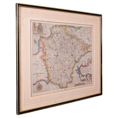
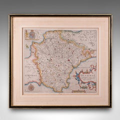
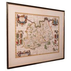
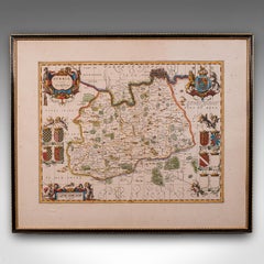
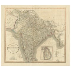
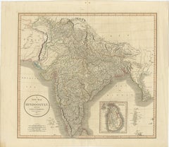
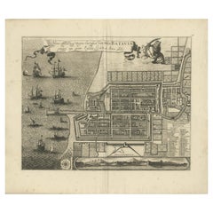
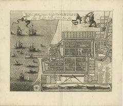
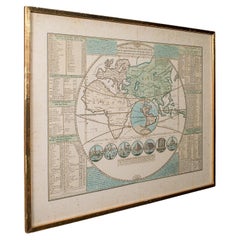
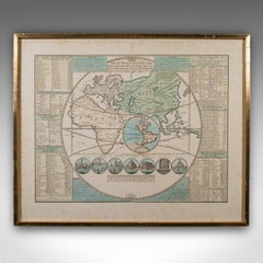
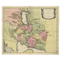
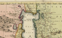
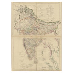
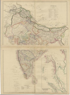
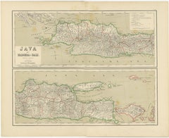
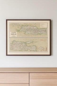
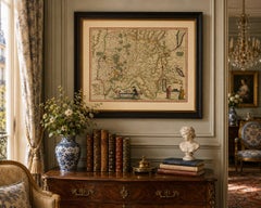
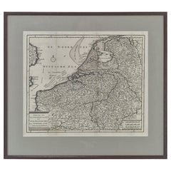
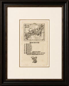
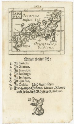
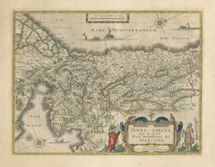
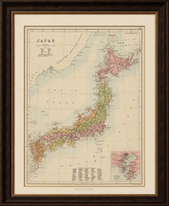
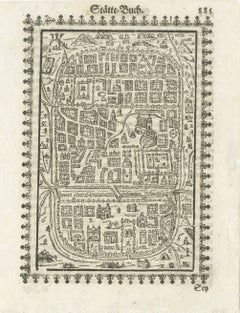
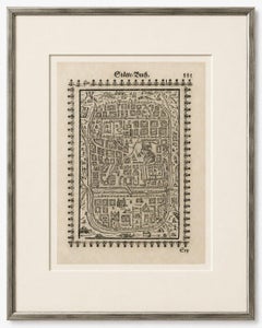
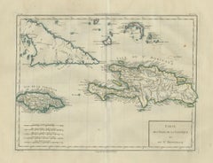
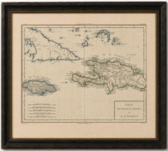
Find many varieties of an authentic antique cartography available at 1stDibs. An antique cartography — often made from paper, wood and metal — can elevate any home. You’ve searched high and low for the perfect antique cartography — we have versions that date back to the 18th Century alongside those produced as recently as the 20th Century are available. An antique cartography, designed in the Empire, Louis XVI or Art Nouveau style, is generally a popular piece of furniture. You’ll likely find more than one antique cartography that is appealing in its simplicity, but 
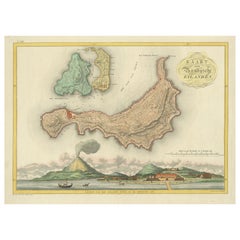
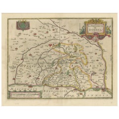
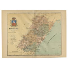
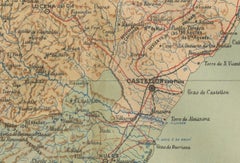
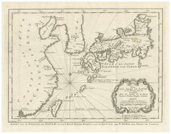
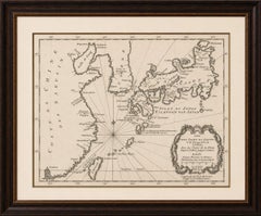
Jacques-Nicolas Bellin, Nicolas Sanson and Jakob van der Schley produced versions that are worth a look.

How Much is a Antique Cartography?

An antique cartography can differ in price owing to various characteristics — the average selling price 1stDibs is $253, while the lowest priced sells for $52 and the highest can go for as much as $238,935.