Blaeu Maps

to
42
181
12
193
187
133
23
12
5
5
4
4
2
2
2
1
1
1
1
1
1
9
6
1
1
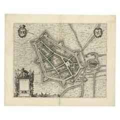
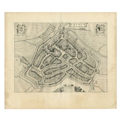
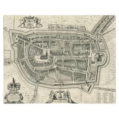
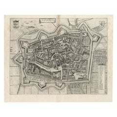
Antique Map of the City of Geldern by Blaeu, 1649

Antique Map of the City of Geldern by Blaeu, 1649

Located in Langweer, NL

Joan became the official cartographer of the Dutch East India Company. Around 1649 Joan Blaeu published a collection of Dutch city maps named Tooneel der Steeden (Views of Cities).

Category

Antique 17th Century Maps

Materials

Paper

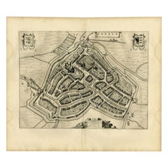
Antique Map of the City of Sneek by Blaeu, 1652

Antique Map of the City of Sneek by Blaeu, 1652

Located in Langweer, NL

Joan became the official cartographer of the Dutch East India Company. Around 1649 Joan Blaeu published a collection of Dutch city maps named Tooneel der Steeden (Views of Cities).

Category

Antique 17th Century Maps

Materials

Paper

Antique Map of the City of Sneek by Blaeu, 1649

Antique Map of the City of Sneek by Blaeu, 1649

Located in Langweer, NL

This map originates from 'Toneel der Steeden' published by Joan Blaeu, 1649.

Category

Antique 17th Century Maps

Materials

Paper

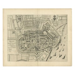
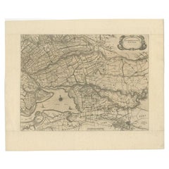
Antique Map of the City of Tiel by Blaeu, 1649

Antique Map of the City of Tiel by Blaeu, 1649

Located in Langweer, NL

Joan became the official cartographer of the Dutch East India Company. Around 1649 Joan Blaeu published a collection of Dutch city maps named Tooneel der Steeden (Views of Cities).

Category

Antique 17th Century Maps

Materials

Paper

Antique Map of the City of Workum by Blaeu, 1649

Antique Map of the City of Workum by Blaeu, 1649

Located in Langweer, NL

Joan became the official cartographer of the Dutch East India Company. Around 1649 Joan Blaeu published a collection of Dutch city maps named Tooneel der Steeden (Views of Cities).

Category

Antique 17th Century Maps

Materials

Paper

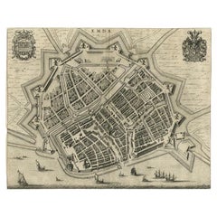
Antique Map of the City of Emden by Blaeu, 1649

Antique Map of the City of Emden by Blaeu, 1649

Located in Langweer, NL

Joan became the official cartographer of the Dutch East India Company. Around 1649 Joan Blaeu published a collection of Dutch city maps named Tooneel der Steeden (Views of Cities).

Category

Antique 17th Century Maps

Materials

Paper

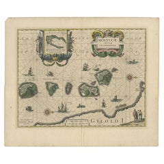
Antique Map of the Maluku Islands by Blaeu, c.1640

Antique Map of the Maluku Islands by Blaeu, c.1640

Located in Langweer, NL

He studied with the famous Danish astronomer Tycho Brahe, with whom he honed his instrument and globe making skills. Blaeu set up shop in Amsterdam, where he sold instruments and glo...

Category

Antique 17th Century Maps

Materials

Paper

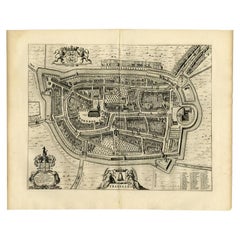
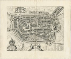
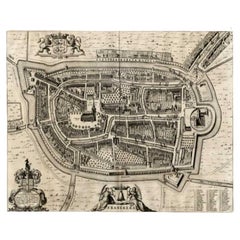
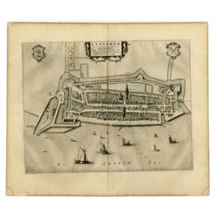
Antique Map of the City of Franeker by Blaeu, 1652

Antique Map of the City of Franeker by Blaeu, 1652

Located in Langweer, NL

Also shows two cartouches, coats of arms and legend. This map originates from a Latin edition of the town atlas 'Toneel der Steden', published by Joan Blaeu, Amsterdam: 1652.

Category

Antique 17th Century Maps

Materials

Paper

Antique Map of the City of Franeker by Blaeu, 1652

Antique Map of the City of Franeker by Blaeu, 1652

Located in Langweer, NL

Also shows two cartouches, coats of arms and legend. This map originates from a Latin edition of the town atlas 'Toneel der Steden', published by Joan Blaeu, Amsterdam: 1652.

Category

Antique 17th Century Maps

Materials

Paper

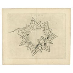
Antique Map of the City of Coevorden by Blaeu, 1649

Antique Map of the City of Coevorden by Blaeu, 1649

Located in Langweer, NL

Joan became the official cartographer of the Dutch East India Company. Around 1649 Joan Blaeu published a collection of Dutch city maps named Tooneel der Steeden (Views of Cities).

Category

Antique 17th Century Maps

Materials

Paper

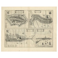
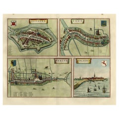
Antique Map of Sloten, IJlst, Workum & Hindeloopen by Blaeu, 1652

Antique Map of Sloten, IJlst, Workum & Hindeloopen by Blaeu, 1652

Located in Langweer, NL

The plans show the Frisian cities Sloten, IJlst, Workum and the view shows Hindeloopen. This map originates from the town atlas 'Toneel der Steden', published by Joan Blaeu, Amsterdam.

Category

Antique 17th Century Maps

Materials

Paper

Antique Map of the City of Franeker by Blaeu, 1649

Antique Map of the City of Franeker by Blaeu, 1649

Located in Langweer, NL

Joan became the official cartographer of the Dutch East India Company. Around 1649 Joan Blaeu published a collection of Dutch city maps named Tooneel der Steeden (Views of Cities).

Category

Antique 17th Century Maps

Materials

Paper

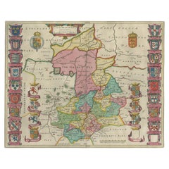
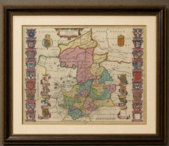
Antique Map of Cambridgeshire & Cambridge by Joan Blaeu, Hand-Colored, 1645

Antique Map of Cambridgeshire & Cambridge by Joan Blaeu, Hand-Colored, 1645

Located in Langweer, NL

TITLE: Antique Map of Cambridgeshire & Cambridge by Joan Blaeu, Hand-Colored, 1645 DESCRIPTION: A highly decorative 17th-century map of Cambridgeshire by the great Dutch cartographe...

Category

Antique Mid-17th Century Dutch Baroque Maps

Materials

Paper

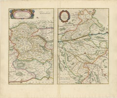
Antique Blaeu Double Map of Perche, Blois, Orléans and Tours, 1642

Antique Blaeu Double Map of Perche, Blois, Orléans and Tours, 1642

Located in Langweer, NL

The map is supplied unframed. Keywords: Willem Blaeu, Joan Blaeu, antique map of France, Perche map, La Perche Comté, Blaisois map, Blois map, Orléans map, Tours map, Loire Valley ...

Category

Antique Mid-17th Century Dutch Maps

Materials

Paper

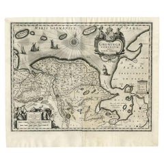
Antique Map of the Province of Groningen by Blaeu, 1635

Antique Map of the Province of Groningen by Blaeu, 1635

Located in Langweer, NL

German text on the rear. This map is one of two almost identical German editions (1634 and 1635) published by Blaeu.

Category

Antique 17th Century Maps

Materials

Paper

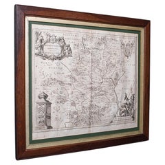
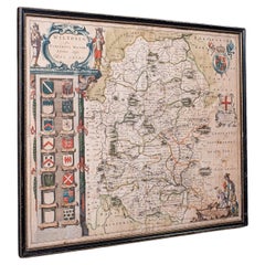
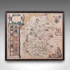
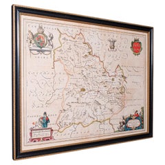
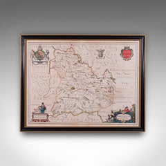
Antique Wiltshire County Map, Dutch, Framed Cartography, Latin, Blaeu, C.1650

Antique Wiltshire County Map, Dutch, Framed Cartography, Latin, Blaeu, C.1650

Located in Hele, Devon, GB

This is an antique county map of Wiltshire. A Dutch, framed atlas engraving of cartographic interest by Joan Blaeu (1596 - 1673), dating to the mid 17th century and later, circa 1650.

Category

Antique 1650s Dutch Jacobean Maps

Materials

Glass, Paper

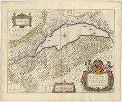
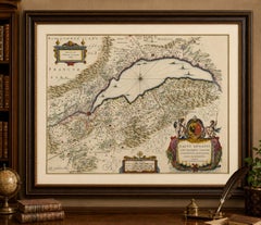
Lake Geneva Antique Blaeu Atlas Map of Geneva and Léman, 1642

Lake Geneva Antique Blaeu Atlas Map of Geneva and Léman, 1642

Located in Langweer, NL

Lake Geneva Antique Blaeu Atlas Map of Geneva and Léman, 1642 Description This beautiful original hand-colored map depicts Lake Geneva (Lac Léman) and the surrounding territories of...

Category

Antique Mid-17th Century Dutch Maps

Materials

Paper

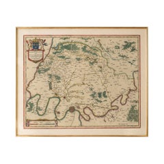
Antique Map Paris & Île-de-France – Blaeu Hand Colored c.1642

Antique Map Paris & Île-de-France – Blaeu Hand Colored c.1642

Located in Langweer, NL

Antique Map Paris & Île-de-France – Blaeu Hand Colored c.1642 Description: A highly desirable and visually refined 17th-century map centered on Paris and the Île-de-France region, e...

Category

Antique Mid-17th Century Dutch Maps

Materials

Paper

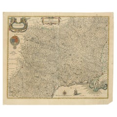
Map of Languedoc by Willem Blaeu, Antique French Copper Engraving 1635

Map of Languedoc by Willem Blaeu, Antique French Copper Engraving 1635

Located in Langweer, NL

Map of Languedoc by Willem Blaeu, Antique French Copper Engraving 1635 This fine antique map titled "Langvedoc" depicts the historical province of Languedoc in southern France and w...

Category

Antique 1630s Maps

Materials

Paper

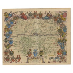
1663 Blaeu's Engraved Map of Frankfurt with Decorative Coats of Arms

1663 Blaeu's Engraved Map of Frankfurt with Decorative Coats of Arms

Located in Langweer, NL

This piece stands out as a testament to the Blaeu family's craftsmanship and the artistry of map-making in the 17th century.

Category

Antique 1660s Dutch Maps

Materials

Paper

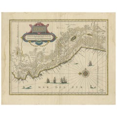
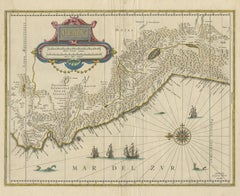
Antique Map of Peru in South America by Blaeu, circa 1645

Antique Map of Peru in South America by Blaeu, circa 1645

Located in Langweer, NL

Antique map titled 'Peru'. Original antique map of Peru.

Category

Antique Mid-17th Century Dutch Maps

Materials

Paper

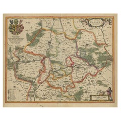
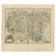
Antique Map of the Hesse Region of Germany by Blaeu, 1665

Antique Map of the Hesse Region of Germany by Blaeu, 1665

Located in Langweer, NL

Joan became the official cartographer of the Dutch East India Company. Around 1649 Joan Blaeu published a collection of Dutch city maps named Tooneel der Steeden (Views of Cities).

Category

Antique 17th Century Maps

Materials

Paper

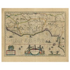
Antique Map of Guinea in West Africa by Blaeu, c.1638

Antique Map of Guinea in West Africa by Blaeu, c.1638

Located in Langweer, NL

Antique map titled 'Guinea'. Decorative map of West Africa, including numerous animals in the interior, sailing ships and several elegant cartouches.

Category

Antique 17th Century Maps

Materials

Paper

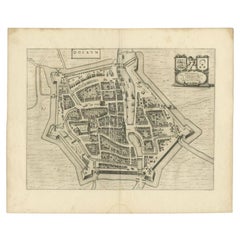
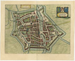
Antique Map of the City of Dokkum by Blaeu, c.1650

Antique Map of the City of Dokkum by Blaeu, c.1650

Located in Langweer, NL

Joan became the official cartographer of the Dutch East India Company. Around 1649 Joan Blaeu published a collection of Dutch city maps named Tooneel der Steeden (Views of Cities).

Category

Antique 17th Century Dutch Maps

Materials

Paper

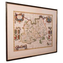
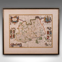
Antique Map of Surrey, English, Framed County Cartography, After Blaeu, C.1690

Antique Map of Surrey, English, Framed County Cartography, After Blaeu, C.1690

Located in Hele, Devon, GB

This is an antique map of Surrey. An English, framed cartography engraving by Willem Janszoon Blaeu, this centre fold edition dating to the William & Mary period, circa 1690.

Category

Antique 1690s British William and Mary Maps

Materials

Glass, Paper

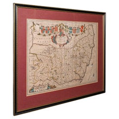
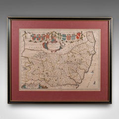
Antique Suffolk County Map, Dutch, Atlas Novus, Joan Blaeu, Cartography, C.1645

Antique Suffolk County Map, Dutch, Atlas Novus, Joan Blaeu, Cartography, C.1645

Located in Hele, Devon, GB

This is an antique county map of Suffolk. A Dutch, framed atlas engraving by Joan Blaeu, dating to the 17th century and later.

Category

Antique 1640s Dutch Charles II Maps

Materials

Glass, Paper

Circa 1659 Blaeu Family Map: Glogau and the Odra River Valley, Silesia

Circa 1659 Blaeu Family Map: Glogau and the Odra River Valley, Silesia

Located in Langweer, NL

Circa 1659 Blaeu Family Map: Glogau and the Odra River Valley, Silesia This hand-colored map from circa 1659 by the Blaeu Family, titled "Ducatus Silesiae Glogani Vera Delineatio," ...

Category

Antique 1650s Maps

Materials

Paper

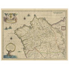
Antique Map of Gallaecia Regnum by W.J. Blaeu, Paper, Circa 1640

Antique Map of Gallaecia Regnum by W.J. Blaeu, Paper, Circa 1640

Located in Langweer, NL

He studied with the famous Danish astronomer Tycho Brahe, with whom he honed his instrument and globe making skills. Blaeu set up shop in Amsterdam, where he sold instruments and glo...

Category

Antique Mid-17th Century Dutch Maps

Materials

Paper

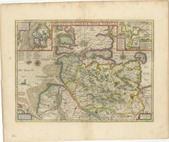
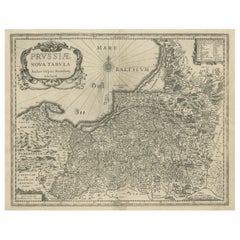
Antique Map of Prussia – Blaeu “Prussiae Nova Tabula”, Later Edition, c.1680

Antique Map of Prussia – Blaeu “Prussiae Nova Tabula”, Later Edition, c.1680

Located in Langweer, NL

Title Antique Map of Prussia – Blaeu “Prussiae Nova Tabula”, Later Edition, c.1680 Description Original antique engraved map titled “Prussiae Nova Tabula,” depicting the historic re...

Category

Antique 1680s Maps

Materials

Paper

Antique Map of Lower Silesia of The Famous Mapmaker Blaeu, c.1650

Antique Map of Lower Silesia of The Famous Mapmaker Blaeu, c.1650

Located in Langweer, NL

Joan became the official cartographer of the Dutch East India Company. Around 1649 Joan Blaeu published a collection of Dutch city maps named Tooneel der Steeden (Views of Cities).

Category

Antique 17th Century Maps

Materials

Paper

Antique Map of Leeuwarden, Capital of Friesland, the Netherlands, by Blaeu, 1649

Antique Map of Leeuwarden, Capital of Friesland, the Netherlands, by Blaeu, 1649

Located in Langweer, NL

Joan became the official cartographer of the Dutch East India Company. Around 1649 Joan Blaeu published a collection of Dutch city maps named Tooneel der Steeden (Views of Cities).

Category

Antique 17th Century Maps

Materials

Paper

Antique Map of the City of Dokkum, Friesland by Blaeu, c.1650

Antique Map of the City of Dokkum, Friesland by Blaeu, c.1650

Located in Langweer, NL

Joan became the official cartographer of the Dutch East India Company. Around 1649 Joan Blaeu published a collection of Dutch city maps named Tooneel der Steeden (Views of Cities).

Category

Antique 17th Century Maps

Materials

Paper

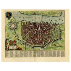
Beautiful Original Antique Map of Antwerp, Belgium by Mapmaker Blaeu, ca.1652

Beautiful Original Antique Map of Antwerp, Belgium by Mapmaker Blaeu, ca.1652

Located in Langweer, NL

Joan became the official cartographer of the Dutch East India Company. Around 1649 Joan Blaeu published a collection of Dutch city maps named Tooneel der Steeden (Views of Cities).

Category

Antique 1650s Dutch Maps

Materials

Paper

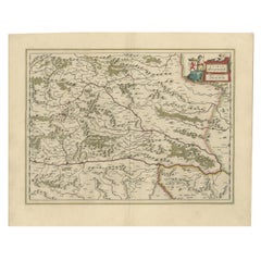
Map of Styria by William Blaeu, 1645: A Masterpiece of 17th-Century Cartography

Map of Styria by William Blaeu, 1645: A Masterpiece of 17th-Century Cartography

Located in Langweer, NL

This 1645 map, created by Willem Janszoon Blaeu, represents Styria (Steyrmark), a historical region in present-day Austria, located in the Alpine regions.

Category

Antique 1640s Dutch Maps

Materials

Paper

Original Antique Map of Trier and Luxembourg by Joan Blaeu, Amsterdam circa 1640

Original Antique Map of Trier and Luxembourg by Joan Blaeu, Amsterdam circa 1640

Located in Langweer, NL

Map of Trier and Luxembourg by Joan Blaeu, Amsterdam circa 1640 This beautifully engraved and hand-colored map titled Trevirensis Archiepiscopatus, et Lutzenburgi Ducatus depicts th...

Category

Antique Mid-17th Century Dutch Maps

Materials

Paper

Antique Map of Frisian Cities Sloten, Ylst, Workum and Hindelopen by Blaeu, 1652

Antique Map of Frisian Cities Sloten, Ylst, Workum and Hindelopen by Blaeu, 1652

Located in Langweer, NL

Joan became the official cartographer of the Dutch East India Company. Around 1649 Joan Blaeu published a collection of Dutch city maps named Tooneel der Steeden (Views of Cities).

Category

Antique 1650s Maps

Materials

Paper

Large Rhine River Map, Moselle and Meuse, by Willem Blaeu, Hand-coloured - 1640

Large Rhine River Map, Moselle and Meuse, by Willem Blaeu, Hand-coloured - 1640

Located in Langweer, NL

Rhine River & Tributaries Antique Map by Willem Blaeu, c.1640 This spectacular mid-seventeenth-century copper-engraved map, titled in Latin “Rhenus Fluviorum Europae celeberrimus, c...

Category

Antique Mid-17th Century Dutch Maps

Materials

Paper

Antique Map of the Siege of Breda, City in the Netherlands by Blaeu, 1649

Antique Map of the Siege of Breda, City in the Netherlands by Blaeu, 1649

Located in Langweer, NL

Joan became the official cartographer of the Dutch East India Company. Around 1649 Joan Blaeu published a collection of Dutch city maps named Tooneel der Steeden (Views of Cities).

Category

Antique 17th Century Maps

Materials

Paper

Original Map with Bird's-Eye View of Zutphen in the Netherlands by Blaeu, 1649

Original Map with Bird's-Eye View of Zutphen in the Netherlands by Blaeu, 1649

Located in Langweer, NL

Joan became the official cartographer of the Dutch East India Company. Around 1649 Joan Blaeu published a collection of Dutch city maps named Tooneel der Steeden (Views of Cities).

Category

Antique 1640s Maps

Materials

Paper

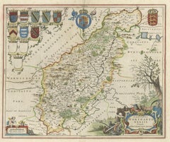
Map of Northumberland by Joan Blaeu

Map of Northumberland by Joan Blaeu

By Joan (Johannes) Blaeu

Located in London, GB

Johannes 'Joan' Blaeu (1596 - 1673) Comitatus Northumbria, Vernacular Northumberland (1662) Engraving with later hand-colouring 43 x 52 cm A decorative map of Northumberland by the ...

Category

1660s Landscape Prints

Materials

Engraving

Antique Plan of the Fortress of Greetsiel, Germany, by Blaeu, c.1650

Antique Plan of the Fortress of Greetsiel, Germany, by Blaeu, c.1650

Located in Langweer, NL

This print originates from 'Novum ac magnum theatrum urbium Belgicae' by J. Blaeu. Artists and Engravers: Joan Blaeu was a Dutch cartographer born in Alkmaar, the son of cartogra...

Category

Antique 17th Century Maps

Materials

Paper

Stunning Bird's-Eye View Plan of Hasselt by Blaeu in The Netherlands, 1649

Stunning Bird's-Eye View Plan of Hasselt by Blaeu in The Netherlands, 1649

Located in Langweer, NL

Joan became the official cartographer of the Dutch East India Company. Around 1649 Joan Blaeu published a collection of Dutch city maps named Tooneel der Steeden (Views of Cities).

Category

Antique 1640s Maps

Materials

Paper

Nice Hand-Colored Plan by  Blaeu of Bolsward in Friesland, the Netherlands, 1652

Nice Hand-Colored Plan by Blaeu of Bolsward in Friesland, the Netherlands, 1652

Located in Langweer, NL

Joan became the official cartographer of the Dutch East India Company. Around 1649 Joan Blaeu published a collection of Dutch city maps named Tooneel der Steeden (Views of Cities).

Category

Antique 1650s Maps

Materials

Paper

Beautiful Bird's-Eye View Plan of Enkhuizen in The Netherlands by Blaeu, 1649

Beautiful Bird's-Eye View Plan of Enkhuizen in The Netherlands by Blaeu, 1649

Located in Langweer, NL

Joan became the official cartographer of the Dutch East India Company. Around 1649 Joan Blaeu published a collection of Dutch city maps named Tooneel der Steeden (Views of Cities).

Category

Antique 1640s Maps

Materials

Paper

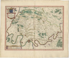
Mapping the Heart of France: Willem Blaeu's 17th Century Île-de-France, ca.1650

Mapping the Heart of France: Willem Blaeu's 17th Century Île-de-France, ca.1650

Located in Langweer, NL

It included Paris and its immediate vicinity, extending to include areas that were under the direct influence and control of the kings of France. It is a historic map from "Theatrum...

Category

Antique 1650s Maps

Materials

Paper

Great Antique Bird's-Eye View Plan of Brielle by Blaeu in The Netherlands, 1649

Great Antique Bird's-Eye View Plan of Brielle by Blaeu in The Netherlands, 1649

Located in Langweer, NL

Joan became the official cartographer of the Dutch East India Company. Around 1649 Joan Blaeu published a collection of Dutch city maps named Tooneel der Steeden (Views of Cities).

Category

Antique 1640s Dutch Maps

Materials

Paper

Antique Map of Buckinghamshire in England, 1743

Antique Map of Buckinghamshire in England, 1743

Located in Langweer, NL

Artists and Engravers: John Overton (1640-1713) and his son, Henry, produced a number of atlases and maps from 1665 to c.1755. They never possessed a complete set of county map plate...

Category

Antique 18th Century Maps

Materials

Paper

Moses Pitt's 17th-Century Map of Frankfurt, Circa 1690

Moses Pitt's 17th-Century Map of Frankfurt, Circa 1690

Located in Langweer, NL

Moses Pitt is best known for his ambitious, though financially troubled, *Atlas Major*, intended to rival Blaeu and Janssonius' works. This map, created in that period, reflects his ...

Category

Antique 1690s British Maps

Materials

Paper

1633 Map Entitled "Beauvaisis Comitatus Belova Cium, Ric.0002

1633 Map Entitled "Beauvaisis Comitatus Belova Cium, Ric.0002

Located in Norton, MA

This map was among the most important of that group and accounts for variants of this map being issued by competing Blaeu and Hondius firms.

Category

Antique 17th Century Dutch Maps

Materials

Paper

Antique Map of Asia Minor (Natolia) – Janssonius, circa 1650

Antique Map of Asia Minor (Natolia) – Janssonius, circa 1650

Located in Langweer, NL

Janssonius, a major Amsterdam-based map publisher and a contemporary of Blaeu, issued this map as part of his *Atlas Novus*.

Category

Antique Mid-17th Century Dutch Maps

Materials

Paper

Antique Map of the County of Devon by Overton, 1713

Antique Map of the County of Devon by Overton, 1713

Located in Langweer, NL

Artists and Engravers: John Overton (1640-1713) and his son, Henry, produced a number of atlases and maps from 1665 to c.1755. They never possessed a complete set of County map plate...

Category

Antique 18th Century Maps

Materials

Paper

  • 1
Get Updated with New Arrivals
Save "Blaeu Maps", and we’ll notify you when there are new listings in this category.

Blaeu Maps For Sale on 1stDibs

There is a range of blaeu maps for sale on 1stDibs. Each of these unique blaeu maps was constructed with extraordinary care, often using paper, metal and silver leaf. Blaeu maps have been made for many years, and versions that date back to the 18th Century alongside those produced as recently as the 20th Century.

Finding the Right Collectibles-curiosities for You

Antique and vintage collectibles and curiosities can bring whimsy and wonder to any interior. 

Decorating with old scientific instruments, historical memorabilia and vintage musical instruments, as well as other authentic collectibles and curiosities that can be found on 1stDibs, presents an opportunity to create a unique, natural history museum-like atmosphere in your home that can provoke conversation as often as it pays tribute to how far we’ve come in understanding our world. 

And bringing collectibles and curiosities into your space is actually on trend — Wunderkammern, or curiosity cabinets, were all the rage in Europe during the 1500s and continued to have adherents there and in the U.S. in the following centuries. Today, however, they’re experiencing a real surge in popularity and influencing how many interior designers are furnishing and decorating homes — combining contemporary with antique, scientific with tribal, earthly with extraterrestrial, Les Lalanne tables with Flemish tapestries.

The original Wunderkammern were entire rooms filled with objects demonstrating their owners’ worldly knowledge: A proper one included artificiala or preciosa (objets d’art); naturalia (such as skeletons, shells, minerals); exotica (taxidermy or dried plants); and scientifica (scientific instruments), frequently alongside religious relics and ancient artifacts.

Pay tribute to a history of rich and diverse musical traditions that have taken shape all over the world by decorating your home with a collection of antique and vintage musical instruments — with a little help from strong hanging wire or some wall hooks, vintage brass instruments such as a gong, French horn or trumpet can help elevate a home office or complement the efforts you’ve made to ensure a welcoming vibe in your home’s entryway. Bells or antique wind instruments can add provocative metallic contrasts to dark woods as tabletop decorative objects.  

Create an intriguing focal point with Georgian scientific instruments, such as stick barometers with mahogany cases or lacquered brass telescopes. These items stem from an era named for the monarchies of the four King Georges, who ruled England in succession starting in 1714 (plus King William’s reign, which lasted until 1837). Just as there was beautiful jewelry produced during the period that today is coveted by collectors, there is much to be found in the collectibles and curiosities realm too.

Wanderlust, nostalgia and a shared love of good design are contributing factors to certain trends in decorating — just as vintage trunks and luggage have reappeared as furniture or home accents in a bedroom or foyer, decorating with globes, maps or nautical objects is similarly rooted in the allure of travel and a penchant for the stylish finishing touch that collectibles bring to our homes.

Find a wide range of antique and vintage collectibles and curiosities on 1stDibs.
Read More