
Map Of London

to
13
91
10
44
31
25
22
17
14
12
11
9
8
7
6
6
6
6
4
4
4
4
3
3
2
2
2
2
2
1
1
1
1
1
1
1
1
1
10
3
3
2
2
Vintage Map of London – Phillips’ Tape Indicator Map of Central London, c.1930

Vintage Map of London – Phillips’ Tape Indicator Map of Central London, c.1930

Located in Langweer, NL

Phillips Tape Indicator Map of London c.1930 – Antique City Plan This large and detailed map of central London is titled “Phillips’ Tape Indicator Map of London.”

Category

Early 20th Century Scottish Maps

Materials

Paper

Antique Map of London by Tirion '1754'

Antique Map of London by Tirion '1754'

Located in Langweer, NL

This map of the area ten miles round the City of London was published in Amsterdam by Isaak Tirion.

Category

Antique Mid-18th Century Maps

Materials

Paper

Antique Map of London by Thomas Moule and William Schmollinger

Antique Map of London by Thomas Moule and William Schmollinger

Located in Rochester, NY

Decorative engraved map of London by William Schmollinger for Moule's English County maps.

Category

Antique Early 19th Century English Prints

Materials

Paper

Coronation Arrangements Leaflet Map of London 1937 Vintage Transport map poster

Coronation Arrangements Leaflet Map of London 1937 Vintage Transport map poster

Located in London, GB

Coronation Arrangements - Map of London 1937 45x60cm (unfolded) Lithograph Published for the Coronation of George VI, by London Transport, this shows all the key locations!

Category

1930s Modern More Prints

Materials

Lithograph

Regency Brass Inlaid Mahogany Map of London Printed Top Coffee Table, Circa 1930

Regency Brass Inlaid Mahogany Map of London Printed Top Coffee Table, Circa 1930

Located in Germantown, MD

A Regency style Brass Inlaid Mahogany Map of London. Brass inlays. Map insert protected with Glass.

Category

Early 20th Century American Edwardian Coffee and Cocktail Tables

Materials

Brass

Antique Map of London Showing the Area from Essex to Surrey, England, 1741

Antique Map of London Showing the Area from Essex to Surrey, England, 1741

Located in Langweer, NL

Very detailed map showing the area from Essex to Surrey and shows a lovely view of London with a high level of detail, stretching from Old London Bridge and Docklands to the farmland...

Category

Antique 18th Century Maps

Materials

Paper

Original Vintage Travel Poster Picture Map Of London Daily Telegraph Pictorial

Original Vintage Travel Poster Picture Map Of London Daily Telegraph Pictorial

Located in London, GB

Original vintage map poster - The Daily Telegraph Picture Map of London - featuring a colourful mid-century pictorial map of landmark buildings, museums and galleries, historic place...

Category

Vintage 1950s British Posters

Materials

Paper

Wonderground Map of London by MacDonald 'Max' Gill c. 1924 original poster

Wonderground Map of London by MacDonald 'Max' Gill c. 1924 original poster

By "Leslie MacDonald ""Max"" Gill"

Located in London, GB

Although he continued to practice as an architect, Frank Pick commissioned him to create seven pictorial maps for the Underground, the first being the famous 1913 ‘Wonderground Map o...

Category

1920s Modern Landscape Prints

Materials

Lithograph

Vintage 18th Century Street Map, London, Houses of Parliament, Westminster Abbey

Vintage 18th Century Street Map, London, Houses of Parliament, Westminster Abbey

Located in Hele, Devon, GB

This is a vintage 18th century street map of London. An English, framed reproduction showing the parish of St Margaret's Westminster, dating to the late 20th century, circa 1980.

Category

Vintage 1980s British Georgian Maps

Materials

Glass, Paper

Vintage 18th Century Street Map, London, St James's Westminster, Cartography

Vintage 18th Century Street Map, London, St James's Westminster, Cartography

Located in Hele, Devon, GB

This is a vintage 18th century street map of London. An English, framed reproduction showing the parish of St James's Westminster, dating to the late 20th century, circa 1980.

Category

Vintage 1980s British Georgian Maps

Materials

Glass, Paper

Vintage 18th Century Street Map, London, Covent Garden, The Strand, Cartography

Vintage 18th Century Street Map, London, Covent Garden, The Strand, Cartography

Located in Hele, Devon, GB

This is a vintage 18th century street map of London. An English, framed reproduction showing the parishes of St Clement's Danes and St Mary Savoy, dating to the late 20th century, ci...

Category

Vintage 1980s British Georgian Maps

Materials

Glass, Paper

Antique Folding London Map, English, Cartography, Historic, Georgian, Dated 1783

Antique Folding London Map, English, Cartography, Historic, Georgian, Dated 1783

Located in Hele, Devon, GB

This is an antique folding London map. An English, paper on linen cartographical study of the London metropolis and the surrounding area, published in the mid Georgian period, dated ...

Category

Antique Late 18th Century British Georgian Maps

Materials

Linen, Paper

Vintage 18th Century Street Map, London, St Martins In The Field, Cartography

Vintage 18th Century Street Map, London, St Martins In The Field, Cartography

Located in Hele, Devon, GB

This is a vintage 18th century street map of London. An English, framed reproduction showing the parish of St Martin's In the Fields, dating to the late 20th century, circa 1980.

Category

Vintage 1980s British Georgian Maps

Materials

Glass, Paper

Vintage 18th Century Street Map, London, Lincoln's Inn, The Strand, Cartography

Vintage 18th Century Street Map, London, Lincoln's Inn, The Strand, Cartography

Located in Hele, Devon, GB

This is a vintage 18th century street map of London. An English, framed reproduction showing the parishes of St Clement's Danes and St Mary Savoy, dating to the late 20th century, ci...

Category

Vintage 1980s English Georgian Maps

Materials

Glass, Paper

Vintage Framed 18th Century Street Map, London, West End, Soho, Leicester Square

Vintage Framed 18th Century Street Map, London, West End, Soho, Leicester Square

Located in Hele, Devon, GB

This is a vintage 18th century street map of London. An English, framed reproduction showing the parish of St Ann's, dating to the late 20th century, circa 1980.

Category

Vintage 1980s British Georgian Maps

Materials

Glass, Paper

Decorative London Railway Map, Victorian Transport Plan of London & Suburbs 1885

Decorative London Railway Map, Victorian Transport Plan of London & Suburbs 1885

Located in Langweer, NL

Decorative London Railway Map, Victorian Transport Plan of London & Suburbs, 1885 A fascinating and highly decorative Victorian railway map illustrating London and its rapidly expan...

Category

Antique Late 19th Century British Maps

Materials

Paper

Antique Map of the United Kingdom and Ireland, c.1873

Antique Map of the United Kingdom and Ireland, c.1873

Located in Langweer, NL

Antique map titled 'Groot Brittanje en Ierland'. Old map depicting the United Kingdom and Ireland, with inset maps of London and factory districts of the UK.

Category

Antique 19th Century Maps

Materials

Paper

Large Scale Map of the London Metropolis

Large Scale Map of the London Metropolis

Located in Dallas, TX

The product is a large scale map of the London Metropolis, specifically focusing on the city in intricate detail.

Category

Mid-20th Century English Maps

Materials

Paper

Antique Map of England with Inset Maps of the Region of Liverpool and London

Antique Map of England with Inset Maps of the Region of Liverpool and London

Located in Langweer, NL

Antique map titled 'England'. Original antique map of England, with two inset maps of the region of Liverpool and London.

Category

Antique Mid-19th Century Maps

Materials

Paper

1953 Coronation Map for London Transport

1953 Coronation Map for London Transport

Located in London, GB

Coronation Arrangements – Map of London (1953) Lithograph 45 x 60 cm (unfolded) Published by London Transport for the Coronation of Elizabeth II, this delightfully-coloured map illu...

Category

1950s Landscape Prints

Materials

Lithograph

Antique Map of the City of London by Balbi '1847'

Antique Map of the City of London by Balbi '1847'

Located in Langweer, NL

Antique map titled 'London'. Original antique map of the city of London.

Category

Antique Mid-19th Century Maps

Materials

Paper

1937 Coronation Map for London Transport

1937 Coronation Map for London Transport

Located in London, GB

Coronation Arrangements – Map of London (1937) Lithograph 45 x 60 cm (unfolded) Published by London Transport for the Coronation of George VI, this map illustrates the route the Kin...

Category

1950s Landscape Prints

Materials

Lithograph

Road Map, John Ogilby, No 54, London, Yarmouth, Britannia

Road Map, John Ogilby, No 54, London, Yarmouth, Britannia

By John Ogilby

Located in BUNGAY, SUFFOLK

Of the sixth volume, on London, only the general map appeared in print, and that after Ogilby's death.

Category

Antique 1670s English Baroque Maps

Materials

Paper

Isle of Man Map, Ordnance Survey Style, Bacon London, 1885

Isle of Man Map, Ordnance Survey Style, Bacon London, 1885

Located in Langweer, NL

Isle of Man Map, Ordnance Survey Style, Bacon London 1885 Description: This finely detailed Victorian map of the Isle of Man was published in London in 1885 as part of the New Large...

Category

Antique Late 19th Century British Maps

Materials

Paper

Isle of Wight Map, Ordnance Survey Style, Bacon London, 1885

Isle of Wight Map, Ordnance Survey Style, Bacon London, 1885

Located in Langweer, NL

Isle of Wight Map, Ordnance Survey Style, Bacon London 1885 Description This finely engraved large-scale map of the Isle of Wight was published in London in 1885 by George W.

Category

Antique Late 19th Century British Maps

Materials

Paper

Lakes of Killarney Map, County Kerry Ireland, Bacon London, 1885

Lakes of Killarney Map, County Kerry Ireland, Bacon London, 1885

Located in Langweer, NL

Lakes of Killarney Map, County Kerry Ireland, Bacon London 1885 Description: This finely engraved Victorian map of the Lakes of Killarney and the surrounding countryside in County K...

Category

Antique Late 19th Century British Maps

Materials

Paper

Road Map Britannia 1675/6 No 5 Road London to Barwick, London Stilton Grey Frame

Road Map Britannia 1675/6 No 5 Road London to Barwick, London Stilton Grey Frame

By John Ogilby

Located in BUNGAY, SUFFOLK

John Ogilby (British 1600-1676) cosmographer and geographick printer to Charles II. A road map from Britannia, 1675/6. No 5, The road from London to Barwick: London to Stilton In a g...

Category

Antique Late 17th Century British Charles II Maps

Materials

Paper

Original Antique Map of the Road from London to Bensington

Original Antique Map of the Road from London to Bensington

Located in Langweer, NL

Antique map titled 'The Road from London to St. Davids in com: Pembroke (..)'.

Category

Antique Late 17th Century Maps

Materials

Paper

The Land of Promise — Elegant Hand-Colored Biblical Map of Canaan, London 1827

The Land of Promise — Elegant Hand-Colored Biblical Map of Canaan, London 1827

Located in Langweer, NL

The Land of Promise — Elegant Hand-Colored Biblical Map of Canaan, London 1827 This finely engraved and beautifully hand-colored biblical map depicts Canaan, or the Land of Promise ...

Category

Antique Early 19th Century British Maps

Materials

Paper

London 1744 Published Watercolour Antique Map of East Africa by Eman Bowen

London 1744 Published Watercolour Antique Map of East Africa by Eman Bowen

Located in West Sussex, Pulborough

We are delighted to offer for sale this New and Accurate Map of Nubia & Abissinia, together with all the Kingdoms Tributary Thereto, and bordering upon them published in 1744 by Eman...

Category

Antique 1740s English George III Maps

Materials

Paper

Road Map No43 London to Kings Lynn, Royston to Downham, John Ogilby, Britannia

Road Map No43 London to Kings Lynn, Royston to Downham, John Ogilby, Britannia

By John Ogilby

Located in BUNGAY, SUFFOLK

Of the sixth volume, on London, only the general map appeared in print, and that after Ogilby's death.

Category

Antique Late 17th Century British Charles II Maps

Materials

Paper

1876 Map of the United States: Detailing the Railroads and Unsettled Territories

1876 Map of the United States: Detailing the Railroads and Unsettled Territories

Located in Langweer, NL

He is particularly noted for: - Stanford’s Library Map of London (1862): This map was groundbreaking for its detail and scale, providing one of the most accurate representations of ...

Category

Antique 1870s Maps

Materials

Paper

England and London Government Map with Allegorical Vignettes, ca. 1720

England and London Government Map with Allegorical Vignettes, ca. 1720

Located in Langweer, NL

Below it lies an attractively detailed map of the city of London, focused on the River Thames and its surrounding boroughs, rendered with precise street layouts and districts.

Category

Antique Early 18th Century French Maps

Materials

Paper

Road Map Britannia No 32 the Road from London to Barnstable John Ogilby Framed

Road Map Britannia No 32 the Road from London to Barnstable John Ogilby Framed

By John Ogilby

Located in BUNGAY, SUFFOLK

Of the sixth volume, on London, only the general map appeared in print, and that after Ogilby's death.

Category

Antique Late 17th Century English Charles II Maps

Materials

Paper

Road Map Britannia No 15 London to St Davids John Ogilby Brown Gilt Frame

Road Map Britannia No 15 London to St Davids John Ogilby Brown Gilt Frame

By John Ogilby

Located in BUNGAY, SUFFOLK

Of the sixth volume, on London, only the general map appeared in print, and that after Ogilby's death.

Category

Antique Late 17th Century British Charles II Maps

Materials

Paper

Original Antique Map of Liverpool and Environs, Victorian Mersey Atlas Map, 1885

Original Antique Map of Liverpool and Environs, Victorian Mersey Atlas Map, 1885

Located in Langweer, NL

It pairs particularly well with companion maps of Manchester, Glasgow, or London for a decorative gallery wall of historic British cities.

Category

Antique Late 19th Century British Maps

Materials

Paper

Antique Map of the Coromandel Peninsula, 1754

Antique Map of the Coromandel Peninsula, 1754

Located in Langweer, NL

Rare map of Coromandel printed for the London Magazine.

Category

Antique 18th Century Maps

Materials

Paper

Peloponnesus Classical Map — Travels of Anacharsis Greece, Wilkinson c1818

Peloponnesus Classical Map — Travels of Anacharsis Greece, Wilkinson c1818

Located in Langweer, NL

Peloponnesus Classical Map — Travels of Anacharsis Greece, Wilkinson c1818 A finely engraved and hand-colored classical map of the Peloponnesus, published in London by Robert Wilkin...

Category

Antique Early 19th Century British Maps

Materials

Paper

Antique Map of the Southern Hemipshere by Lowry '1852'

Antique Map of the Southern Hemipshere by Lowry '1852'

Located in Langweer, NL

Antique map titled 'Perspective Projection of The World on the horizon of London'.

Category

Antique Mid-19th Century Maps

Materials

Paper

Antique Map of the Northern Hemisphere by Lowry, '1852'

Antique Map of the Northern Hemisphere by Lowry, '1852'

Located in Langweer, NL

Antique map titled 'Perspective Projection of the World on the horizon of London'.

Category

Antique Mid-19th Century Maps

Materials

Paper

Large Decorative Colonial-Era Map of South India – Peninsula of India, 1800

Large Decorative Colonial-Era Map of South India – Peninsula of India, 1800

Located in Langweer, NL

Antique Map of South India – “A Map of the Peninsula of India,” London 1800 This large and detailed antique map titled *A Map of the Peninsula of India* was published in London in 1...

Category

Antique Early 19th Century English Maps

Materials

Linen, Paper

Antique Map of the Pacific Ocean by Anson, 1765

Antique Map of the Pacific Ocean by Anson, 1765

Located in Langweer, NL

Following his capture of the Nostra the treasures were paraded through the streets of London. The map shows the pacific islands and much of the Mexican and California coast.

Category

Antique 18th Century Maps

Materials

Paper

20thC Leather Cased Collection Of Bartholomew Maps Of Great Britain c.1920

20thC Leather Cased Collection Of Bartholomew Maps Of Great Britain c.1920

Located in Royal Tunbridge Wells, Kent

Antique 20th Century leather-cased collection of Bartholomew British road maps by Edward Stanford Ltd of London. One volume features a map of the entire British Isles, divided into n...

Category

20th Century British Other Maps

Materials

Leather, Paper

Antique Copper Engraving of Folding Plan of London, Published in 1804

Antique Copper Engraving of Folding Plan of London, Published in 1804

Located in Langweer, NL

This rare map comes originally from the publication: Modern London: Being the History and Present State of the British Metropolis.

Category

Antique Early 1800s Maps

Materials

Paper

Biblical Genealogy Timeline of the Ante-Diluvian Patriarchs — London 1823

Biblical Genealogy Timeline of the Ante-Diluvian Patriarchs — London 1823

Located in Langweer, NL

Executed in refined copperplate engraving typical of early nineteenth-century London atlas production, the chart demonstrates clarity of design and intellectual ambition.

Category

Antique Early 19th Century British Maps

Materials

Paper

Large Antique Lithography Map of Kent, English, Cartography, Robert Morden, 1700

Large Antique Lithography Map of Kent, English, Cartography, Robert Morden, 1700

Located in Hele, Devon, GB

Superb lithography of Kent and its county detail, perfect for display Displays a desirable aged patina and in very good order Fascinating Queen Anne period cartography, appealingly s...

Category

Antique Early 18th Century British Queen Anne Maps

Materials

Glass, Wood, Paper

Road Map John Ogilby No 75 Kings Lyn Harwich, Britannia Framed Wallhanging

Road Map John Ogilby No 75 Kings Lyn Harwich, Britannia Framed Wallhanging

By John Ogilby

Located in BUNGAY, SUFFOLK

Of the sixth volume, on London, only the general map appeared in print, and that after Ogilby's death.

Category

Antique 1670s European Baroque Maps

Materials

Paper

  • 1

Recent Sales

Greenwood Map of London

Greenwood Map of London

Located in London, GB

GREENWOOD'S MAP OF LONDON (1827-1856)

Category

Antique 19th Century English Maps

Materials

Paper

Illustrated Map of London from Exhibtion

Illustrated Map of London from Exhibtion

Unavailable

H 35.44 in W 42.92 in D 1.19 in

Illustrated Map of London from Exhibtion

Located in Alton, GB

Detailed illustrated map of London from the great exhibition of industry of all nations 1851.

Category

Antique 19th Century Maps

Materials

Paper

Hand-Colored Panoramic Map of London, 1736

Hand-Colored Panoramic Map of London, 1736

Unavailable

H 21.75 in W 67.25 in D 0.01 in

Hand-Colored Panoramic Map of London, 1736

By Homann Heirs

Located in New York, NY

Urbium Londini et West-Monasterii nec non Suburbii Southwark accurata Ichnographia by Homann Heirs. Nuremberg, 1736. Title in both Latin and German with elegant cartouche decorated w...

Category

Antique 1730s German Maps

Materials

Paper, Watercolor

Original Map of London by John Rocque, 1741-1745

Original Map of London by John Rocque, 1741-1745

Unavailable

H 76.5 in W 103 in D 3 in

Original Map of London by John Rocque, 1741-1745

By John Roque 1

Located in Bantam, CT

Wikipedia at: https://en.wikipedia.org/wiki/John_Rocque%27s_Map_of_London,_1746. Provenance: Osterley House via Virginia Cherill Her third husband was George Child-Villiers, 9th E...

Category

Antique 1740s English George III Wallpaper

Large 1812 Antique Map of London

Large 1812 Antique Map of London

Unavailable

H 21 in W 31 in D 1 in

Large 1812 Antique Map of London

By Langley & Belch

Located in La Jolla, CA

One of the most visually appealing maps of the London of the period. Both the West India Docks and East India Docks are illustrated, having been built in 1802 and 1806 respectively.

Category

Antique 1810s English Regency Prints

One of the First Maps of London

One of the First Maps of London

Unavailable

H 13 in W 19 in D 1 in

One of the First Maps of London

By Georg Braun and Frans Hogenberg

Located in La Jolla, CA

Fine example of this important early bird’s-eye view of London, which appeared in Volume 1 of Braun & Hogenberg's Civitates Orbis Terrarum. The view was based on a now-lost twenty...

Category

Antique 16th Century German Northern Renaissance Prints

Materials

Paper

Embroidered Map of London Wall Hanging (custom made)

Embroidered Map of London Wall Hanging (custom made)

By Ekta Kaul

Located in Shaftesbury, Dorset

Kaul prefers to work with natural materials such as silks, cottons and slub linen sourced from fair trade cooperatives in her homeland India. This, her London Map, is embroidered on ...

Category

2010s Mixed Media

Materials

Linen

Embroidered Map of London Wall Hanging 'Customizable with Details'

Embroidered Map of London Wall Hanging 'Customizable with Details'

By Ekta Kaul

Located in Blandford Forum, Dorset

Kaul prefers to work with natural materials such as silks, cottons and slub linen sourced from fair trade cooperatives in her homeland India. This, her London Map, is embroidered on ...

Category

2010s British Decorative Art

Materials

Linen

London (England)
London (England)

London (England)

Unavailable

H 31.5 in W 23.75 in

London (England)

Located in Florham Park, NJ

Late 19th Century map of London highlighting the city's marvels.

Category

Late 19th Century Academic Prints and Multiples

Materials

Lithograph

Pr. Map Chests by Gillows

Pr. Map Chests by Gillows

Unavailable

H 38 in W 51 in D 21.5 in

Pr. Map Chests by Gillows

By Gillows of Lancaster & London

Located in Toronto, ON

Pr. of matching map chests by the firm Gillows in satinwood and mahogany. Original green marble tops with silver plated bronze gallery. Each lock is stamped and the piece itself is s...

Category

20th Century English Commodes and Chests of Drawers

Materials

Marble

Washington D.C. Map, 1795

Washington D.C. Map, 1795

Unavailable

H 25 in W 30 in D 1.5 in

Washington D.C. Map, 1795

By John Russell

Located in Houston, TX

This is one of nine maps published in London as part of John Reid's "An American Atlas" and engraved by John Russell of London.

Category

Antique 1790s Great Britain (UK) Maps

Large Framed Eighteenth Century World Map

Large Framed Eighteenth Century World Map

Unavailable

H 36.5 in W 52 in

Large Framed Eighteenth Century World Map

By Herman Moll

Located in New York, NY

Herman Moll (1654-1732) A New and Correct Map of the World London, c. 1730 Engraving with hand-coloring Excellent condition Framed to full museum specifications (framed size - 3...

Category

Antique 18th Century and Earlier English Maps

Materials

Paper, Watercolor

Original Vintage Poster London Town Pictorial Map Southern Railway Underground

Original Vintage Poster London Town Pictorial Map Southern Railway Underground

By Kerry Lee

Located in London, GB

Original vintage Travel By Train map poster for London Town by the British artist, illustrator and poster designer Kerry Lee (1902-1988) featuring a detailed pictorial map of central...

Category

1930s More Prints

Materials

Paper

Original Vintage Travel By Train London Town Pictorial Map Poster Kerry Lee

Original Vintage Travel By Train London Town Pictorial Map Poster Kerry Lee

By Kerry Lee

Located in London, GB

Original vintage Travel By Train map poster for London Town by the British artist, illustrator and poster designer Kerry Lee (1902-1988) featuring a detailed pictorial map of central...

Category

1950s More Prints

Materials

Paper

18th Century Wall Map of North America

18th Century Wall Map of North America

Unavailable

H 38 in W 24 in

18th Century Wall Map of North America

By George Willdey

Located in New York, NY

George Willdey To His Sacred & Most Excellent Majesty George by the Grace of God King of Great Britain France & Ireland &c. This Map of North America. Published: London, 1720.

Category

Antique 18th Century and Earlier Prints

Large Scale Double-Hemisphere World Map; Wall Map

Large Scale Double-Hemisphere World Map; Wall Map

By Herman Moll

Located in New York, NY

Herman Moll A New and Correct Map of the World... Published, London c. 1709 Engraving with original hand-coloring.

Category

Antique 18th Century and Earlier British Prints

London (England)
London (England)

London (England)

Unavailable

H 24 in W 31.5 in

London (England)

Located in Florham Park, NJ

Highly detailed street map of late 19th Century London. Each street is named as are gardens, parks, bodies of water, and important buildings.

Category

19th Century Academic Prints and Multiples

Materials

Lithograph

Original Art Deco Travel Advertising Poster: AB Aerotransport Swedish Air-Lines

Original Art Deco Travel Advertising Poster: AB Aerotransport Swedish Air-Lines

By Ernst Mentze

Located in London, GB

Great image by Ernst Mentze showing an elegant lady wearing a fashionable dress and hat, holding a large red umbrella in one hand and three planes on leashes in the other, each plane...

Category

1920s Art Deco More Prints

Materials

Paper

Original Vintage Map of London, circa 1900

Original Vintage Map of London, circa 1900

Sold

H 17.75 in W 23.5 in D 0.07 in

Original Vintage Map of London, circa 1900

Located in St Annes, Lancashire

Great vintage map of London. John Bartholomew and Co for the Edinburgh Geographical Institute, circa 1900 Lithograph.

Category

Antique 1840s English Maps

Materials

Paper

Map of London
Map of London

Map of London

Sold

H 22 in W 31.5 in D 1 in

Map of London

Located in Douglas Manor, NY

5-1039 Lithograph Map of London dated1832 in a wood frame Printed by Peridon Ltd.

Category

Antique 19th Century Paintings

Large Original Antique Street Map of London, 1861

Large Original Antique Street Map of London, 1861

By Edward Weller

Located in St Annes, Lancashire

Wonderful street map of London showing the area between Kensington in the west and Limehouse in the east.

Category

Antique 1860s English Early Victorian Maps

Materials

Paper

Large Map of London
Large Map of London

Large Map of London

Sold

H 30.32 in W 77.56 in D 0.79 in

Large Map of London

Located in Gloucestershire, GB

Late Georgian/possibly early Victorian fine copy of the first large great map of London, Westminster and river Thames. The map was first produced in 1560 by Ralph Agas a famous map a...

Category

Antique 16th Century English Early Victorian Prints

Vintage Barrister's Map of London, English, Framed, Inner, Middle Temple, C.1970

Vintage Barrister's Map of London, English, Framed, Inner, Middle Temple, C.1970

Located in Hele, Devon, GB

Our Stock # 24730 This is a vintage barrister's map of London. An English, annotated Inner and Middle Temple lithograph framed behind glass, dating to the late 20th century, circa 1...

Category

Late 20th Century British Mid-Century Modern Maps

Materials

Glass, Wood, Paper

John Senex Map of London in 1720

John Senex Map of London in 1720

Sold

H 28.35 in W 31.11 in D 1.19 in

John Senex Map of London in 1720

By John Senex

Located in London, GB

Plan of the City's of London, Westminster and Borough of Southwark, original antique map, published in 1720 by John Senex and engraved by Samuel Parker, hand coloured, with mount and...

Category

Antique 1720s British George II Maps

John Rocque Map of London

John Rocque Map of London

Sold

H 81.89 in W 109.45 in D 0.4 in

John Rocque Map of London

By John Rocque

Located in London, GB

John Rocque was of French Huguenot stock from Monosque in Provence. The London he eventually settled in, was an expanding city which had grown unchecked and by the 1730s a new map wa...

Category

Vintage 1970s English Prints

Framed Map of London Park

Framed Map of London Park

Sold

H 34.25 in W 27 in D 1.25 in

Framed Map of London Park

Located in Old Town Orange, CA

Framed print of London, cream paper, with sketch drawings, on white matting, and framed in a modern black frame. Size: 27”W x 34-1/3”H x 1-1/4”D 1 of 2 pieces.

Category

21st Century and Contemporary Decorative Art

Materials

Paper

Huge John Rocque Map of London 1746, Republished By Harry Margary

Huge John Rocque Map of London 1746, Republished By Harry Margary

Located in London, GB

Late twentieth century Harry Margary republication of John Rocque's celebrated map of 1746, 'A plan of the cities of London and Westminster and borough of Southwark'.

Category

Late 20th Century British George II Maps

Materials

Paper

Original 1938 Southern Railways Travel Poster: Pictorial Map of London Town

Original 1938 Southern Railways Travel Poster: Pictorial Map of London Town

By Baynard Press, London, Kerry Lee

Located in London, GB

Original vintage lithograph travel poster depicting a pictorial map of central London with a decorative border.

Category

Vintage 1930s British Posters

Materials

Paper

Antique Map, The Environs of London, English, Framed City Plan, Victorian, 1850

Antique Map, The Environs of London, English, Framed City Plan, Victorian, 1850

Located in Hele, Devon, GB

This is an antique map, The Environs of London. An English, framed city map with hand coloured detail, dating to the early Victorian period, circa 1850.

Category

Antique 1850s British Victorian Maps

Materials

Glass, Paper

19th Century London Postal Map of Large Scale - Framed

19th Century London Postal Map of Large Scale - Framed

Located in Kinderhook, NY

Wonderfully graphic and acurately detailed last quarter 19th century postal map of London, United Kingdom, published by Kelly & Co.

Category

Antique 19th Century British Prints

Materials

Paper, Acrylic, Wood

London Panoramic Map from the Illustrated London News, circa 1861

London Panoramic Map from the Illustrated London News, circa 1861

Located in Colorado Springs, CO

This is an absolutely stunning large format landscape style map of the city of London. Printed in 1861 as a special edition for The Illustrated News of London this is an extremely ra...

Category

Antique 19th Century British Maps

Map of the British Isles with Insets of London and Dublin, Leiden 1876

Map of the British Isles with Insets of London and Dublin, Leiden 1876

Located in Langweer, NL

Title: Map of the British Isles with Insets of London and Dublin, Leiden 1876 This detailed 19th-century Dutch map, titled “Het Britsche Rijk,” was published in 1876 in the Nieuwe H...

Category

Antique 1870s Dutch Maps

Materials

Paper

Large Antique Wimbledon Map, SW London, English, Framed Cartography, Victorian

Large Antique Wimbledon Map, SW London, English, Framed Cartography, Victorian

Located in Hele, Devon, GB

This is an antique town map of Wimbledon, South West London. An English, framed atlas engraving of cartographic interest, dating to the late Victorian period and later, circa 1885.

Category

Antique Late 19th Century British Late Victorian Maps

Materials

Glass, Wood, Paper

LWSR Railway Map
LWSR Railway Map

LWSR Railway Map

Sold

H 29.93 in W 45.28 in D 1.19 in

LWSR Railway Map

Located in London, GB

A framed map of the London and South Western Railway, published 1904.

Category

Early 20th Century English Edwardian Maps

Original Vintage Poster London Bastion Of Liberty Illustrated Map WWII Churchill

Original Vintage Poster London Bastion Of Liberty Illustrated Map WWII Churchill

By Kerry Lee

Located in London, GB

Original vintage travel map poster for London The Bastion of Liberty by the British artist, illustrator and poster designer Kerry Lee (1902-1988) to encourage tourism after World War...

Category

Vintage 1940s British Posters

Materials

Paper

Original Vintage London Transport Travel Poster Heart Of Empire Pictorial Map

Original Vintage London Transport Travel Poster Heart Of Empire Pictorial Map

By "Leslie MacDonald ""Max"" Gill"

Located in London, GB

Original vintage London Underground travel poster of the iconic Wonderground Map of London by the notable British cartographer, graphic designer and artist Leslie MacDonald "Max" Gil...

Category

Vintage 1920s British Posters

Materials

Paper

Wonderful Rare 19th Century City of London Map

Wonderful Rare 19th Century City of London Map

Sold

H 17.33 in W 22.05 in D 1.97 in

Wonderful Rare 19th Century City of London Map

Located in Gloucestershire, GB

Wonderful and rare late 19th century reprint of City of London map originally published for Charles II in 1677. 20 maps in narrow black wooden frames (total 177cm/70" x 281cm/110...

Category

Antique 19th Century British Prints

Original Vintage London Underground Transport Railways Map By Harry Beck

Original Vintage London Underground Transport Railways Map By Harry Beck

By Harry Beck

Located in London, GB

Original vintage London Transport Railways map by Harry Beck (Henry Charles Beck; 1902-1974).

Category

Vintage 1950s British Posters

Materials

Paper

Philips’ New Map of Africa

Philips’ New Map of Africa, 1899

Sold

H 50.99 in W 47.64 in D 0.99 in

Philips’ New Map of Africa

Located in London, London

[PHILIP, George] Philips’ New Map of Africa London & Liverpool George Philip & Son [1899] Attractive large map of Africa by the firm founded by the Scottish cartographer George Ph...

Category

1890s Naturalistic More Art

Materials

Watercolor, Engraving

Large English Map of Europe, Circa 1920

Large English Map of Europe, Circa 1920

Located in Los Angeles, CA

A Large Framed Map of Europe from the London Geographical Institute.

Category

Early 20th Century English Prints

London Transport Underground.

London Transport Underground., 1979

Sold

H 42.33 in W 52.17 in D 0.99 in

London Transport Underground.

Located in London, London

[TUBE MAP]. GARBUTT, Paul E. (designer). London Transport Underground.

Category

1970s Figurative Prints

Materials

Color

Antique Oarsman's Map of the River Thames, English, Cartography, Published 1912

Antique Oarsman's Map of the River Thames, English, Cartography, Published 1912

Located in Hele, Devon, GB

This is an antique copy of The Oarsman's and Angler's Map of the River Thames - New Edition. An English, bound map book, published in English by Edward Stanford, London, this new edi...

Category

Early 20th Century British Other Books

Materials

Paper

Rare Engraved "Map of North America", Emanuel Bowen & John Gibson Published 1776

Rare Engraved "Map of North America", Emanuel Bowen & John Gibson Published 1776

By Emanuel Bowen

Located in Shippensburg, PA

The whole laid down according to the latest and Most authentick Improvements, By Eman Bowen Gegr: to His Majesty and John Gibson Engraver. (with) A Particular Map of Baffin and Hudso...

Category

Antique 18th Century British Neoclassical Prints

Materials

Glass, Wood, Paper

William IV Terrestrial Globe by Cruchley

William IV Terrestrial Globe by Cruchley

Sold

H 45 in W 26 in D 0.1 in

William IV Terrestrial Globe by Cruchley

Located in Lymington, Hampshire

Some of his most popular publicatons included travel maps and guides of London, the British Isles and Europe.

Category

Antique 1830s English Globes

Materials

Oak

Large Original Antique Map of London, 1861

Large Original Antique Map of London, 1861

Sold

H 37 in W 50.5 in D 0.2 in

Large Original Antique Map of London, 1861

Located in St Annes, Lancashire

Large unframed map of London. Titled "The Environs of London."

Category

Antique 1860s English Victorian Maps

Materials

Paper

Original John Dunn's Ordnance Map of London, 19th Century

Original John Dunn's Ordnance Map of London, 19th Century

Located in St Annes, Lancashire

Fabulous colorful map of London in a glazed vintage frame. Original color.

Category

Antique Late 19th Century English Victorian Maps

Materials

Paper

Hand-Colored Panoramic Map of London, 1736

Hand-Colored Panoramic Map of London, 1736, 1736

Sold

H 21.75 in W 67.25 in D 0.01 in

Hand-Colored Panoramic Map of London, 1736

Located in New York, NY

Urbium Londini et West-Monasterii nec non Suburbii Southwark accurata Ichnographia by Homann Heirs. Nuremberg, 1736. Title in both Latin and German with elegant cartouche decorated w...

Category

1730s More Art

Materials

Paper, Watercolor

Original Vintage Pictorial Travel Poster Children's Map Of London Fairytales Art

Original Vintage Pictorial Travel Poster Children's Map Of London Fairytales Art

Located in London, GB

Original vintage fold-out pictorial travel map poster - Children's Map of London - featuring the streets, parks, railways and the River Thames and images of the main places of intere...

Category

Vintage 1950s British Posters

Materials

Paper

A British engraving of a map of London in the year 1597

A British engraving of a map of London in the year 1597

Located in Petworth, West Sussex

Gulielmus Haiward and J Gascoyne A true and exact draught of the tower liberties survey’d in the year 1597 Engraving, published Society of Antiquaries, 1742 Image 40 x 53 cm. In a c...

Category

18th Century Old Masters Landscape Prints

Materials

Engraving

Rare Near & Middle East Map by G.W. Bacon & Co. LTD, London, circa 1880

Rare Near & Middle East Map by G.W. Bacon & Co. LTD, London, circa 1880

Located in San Francisco, CA

Rare Near & Middle East Map by G.W. Bacon & Co. LTD, London circa 1880 Though the map is in it's original folded condition (see final pic), this will look amazing once properly ma...

Category

Antique Late 19th Century English Maps

Materials

Paper

1843 London "Metropolis" Hand-Colored Pocket Map by John Arrowsmith

1843 London "Metropolis" Hand-Colored Pocket Map by John Arrowsmith

Located in Colorado Springs, CO

Issued as a folding map, for easy transport and use, the map is a wonderful snapshot of bustling London metropolis in the 1840s.

Category

Antique 1840s Maps

James Imray & Son of London Map of Cuba 1894, Monumental

James Imray & Son of London Map of Cuba 1894, Monumental

Located in Miami, FL

James Imray & Son of London Map of Cuba 1894, Monumental Offered for sale is a monumental map of the island of Cuba prepared by the famed English cartographers James Imray & Son dat...

Category

Antique Late 19th Century English Maps

Materials

Plexiglass, Wood, Paper

Get Updated with New Arrivals
Save "Map Of London", and we’ll notify you when there are new listings in this category.

Map Of London For Sale on 1stDibs

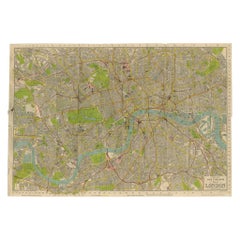
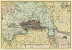
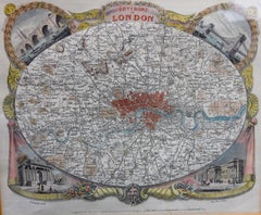
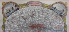
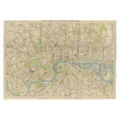
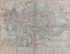
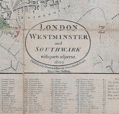
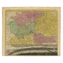
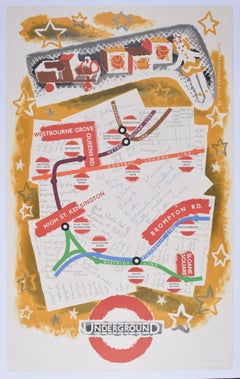
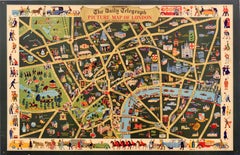
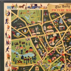
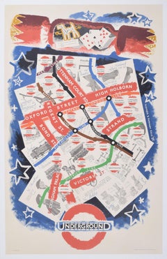
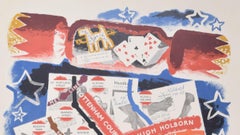
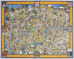
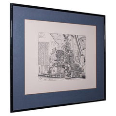
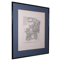
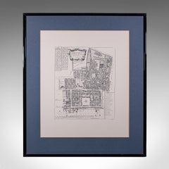
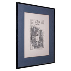
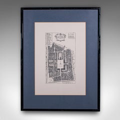
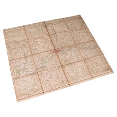
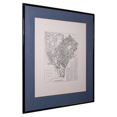
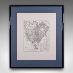
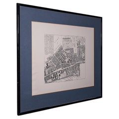
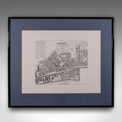
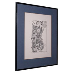
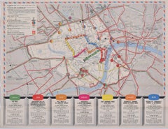
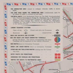
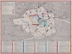
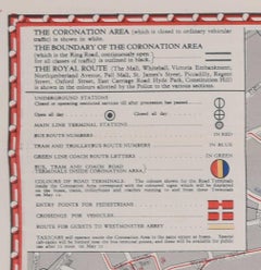
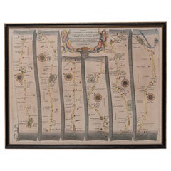
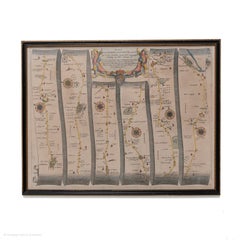
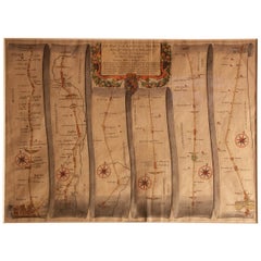
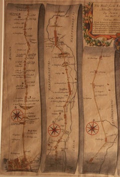
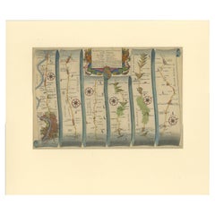
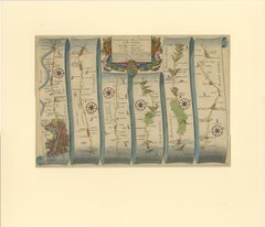
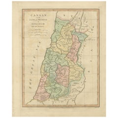
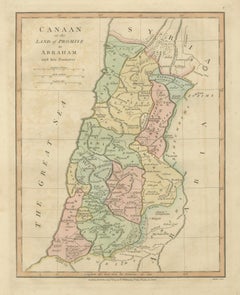
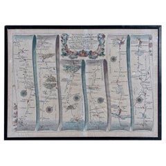
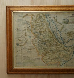
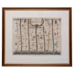
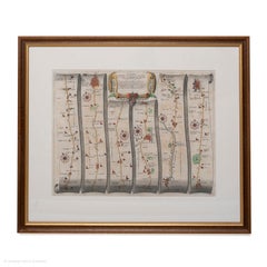
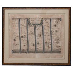
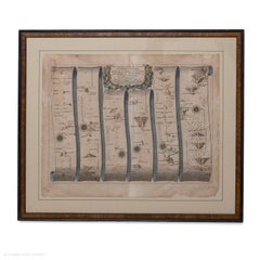
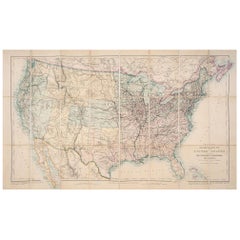
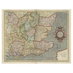
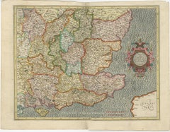
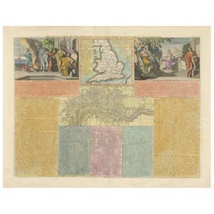
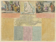
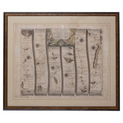
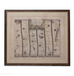
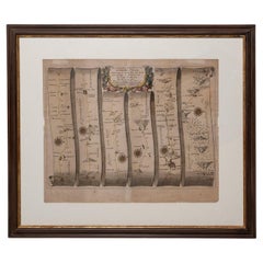
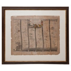
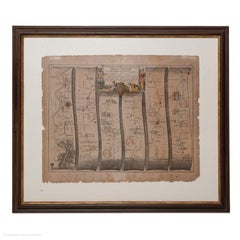
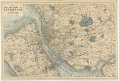
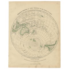
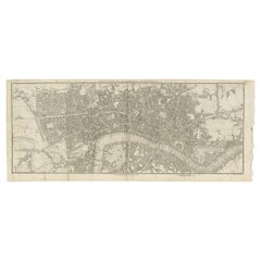
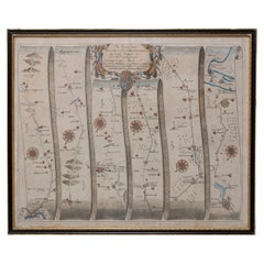
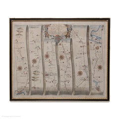
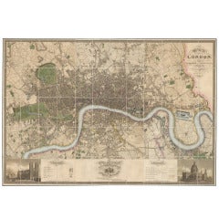
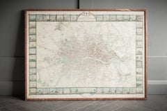
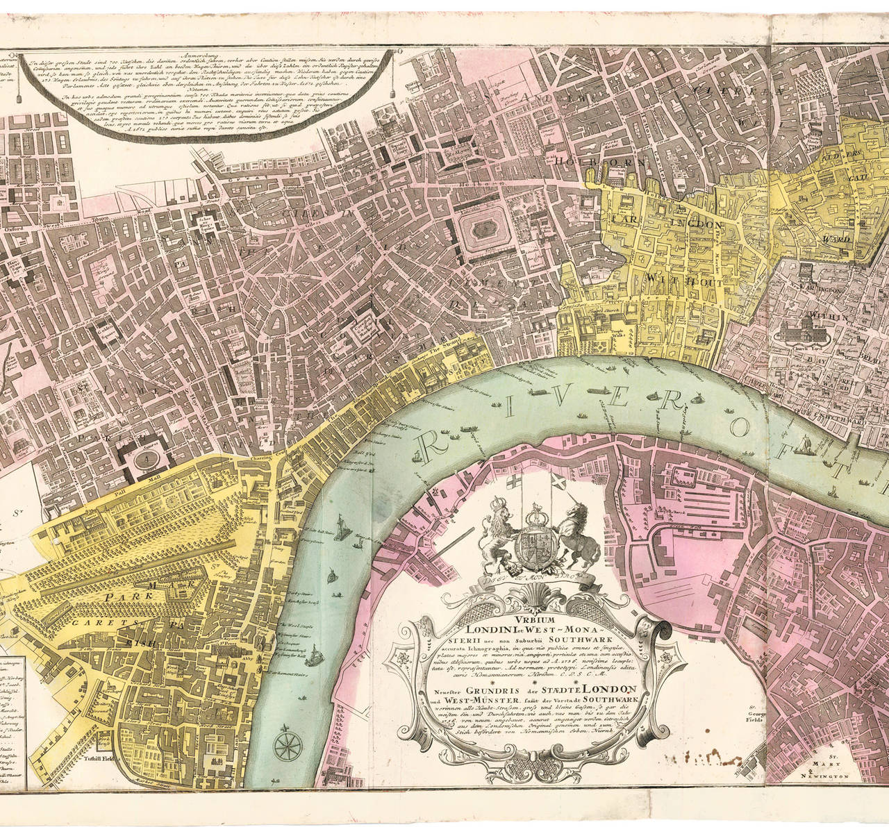
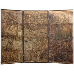
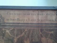
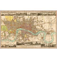
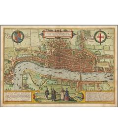
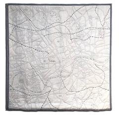
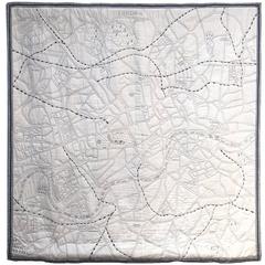
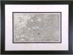
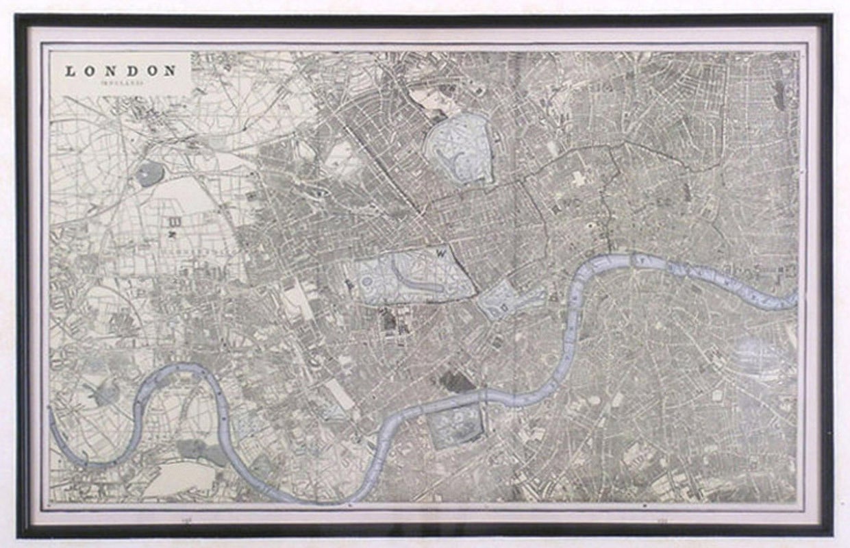
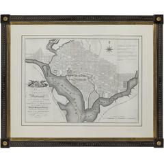
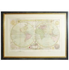
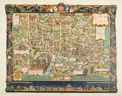
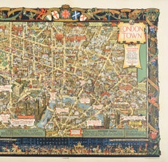
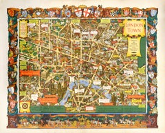
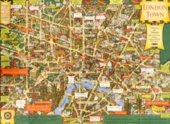
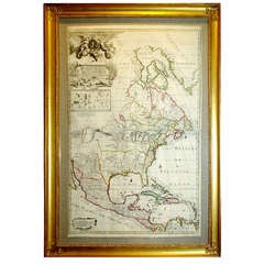
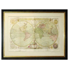
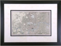
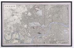
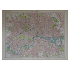
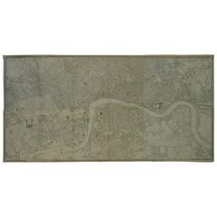
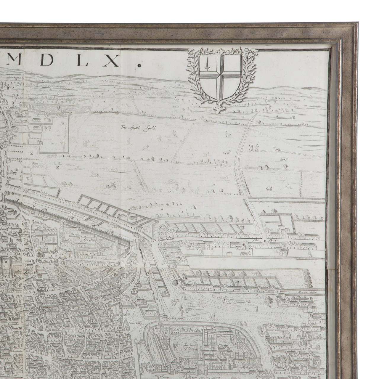
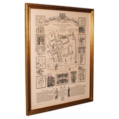
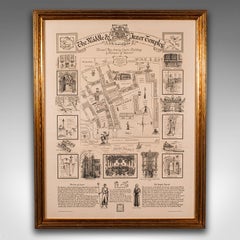
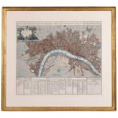
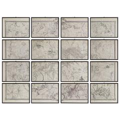
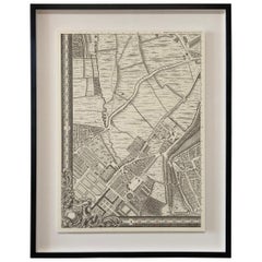
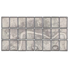
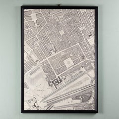
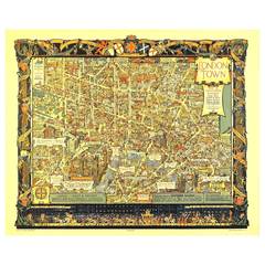
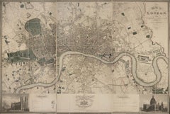
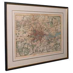
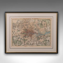
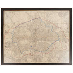
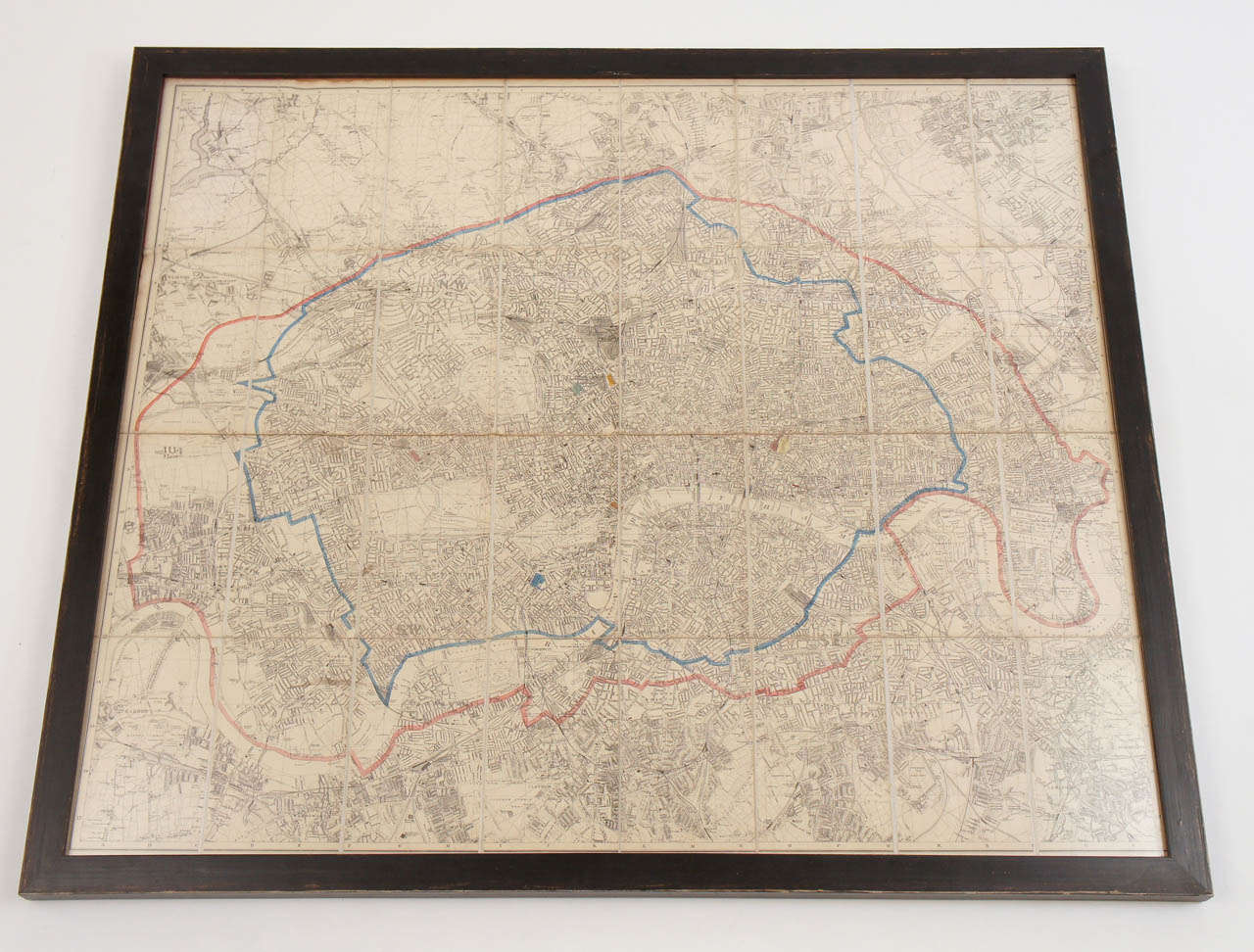
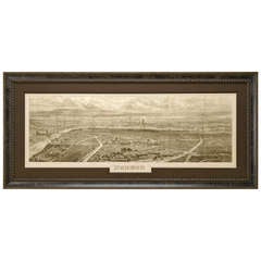
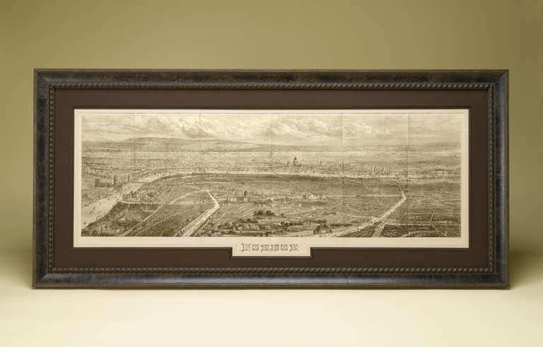
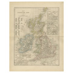
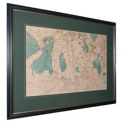
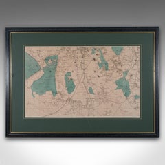
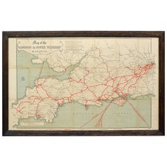
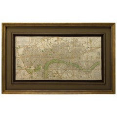
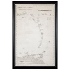
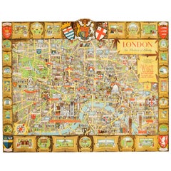
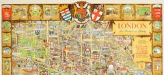
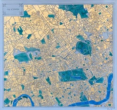
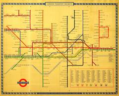
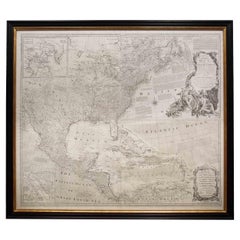
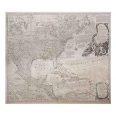
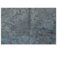
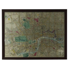
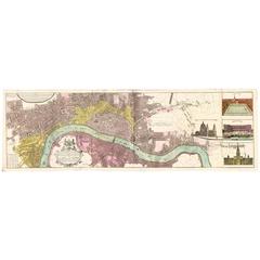
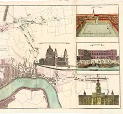
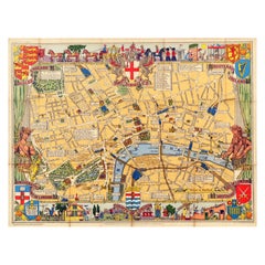
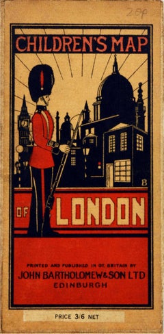
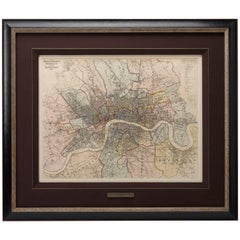
At 1stDibs, there are many versions of the ideal map of london for your home. Frequently made of paper, wood and glass, every map of london was constructed with great care. If you’re shopping for a map of london, we have 106 options in-stock, while there are 5 modern editions to choose from as well. Whether you’re looking for an older or newer map of london, there are earlier versions available from the 18th Century and newer variations made as recently as the 21st Century. A map of london, designed in the Victorian, Georgian or Baroque style, is generally a popular piece of furniture. You’ll likely find more than one map of london that is appealing in its simplicity, but
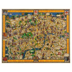
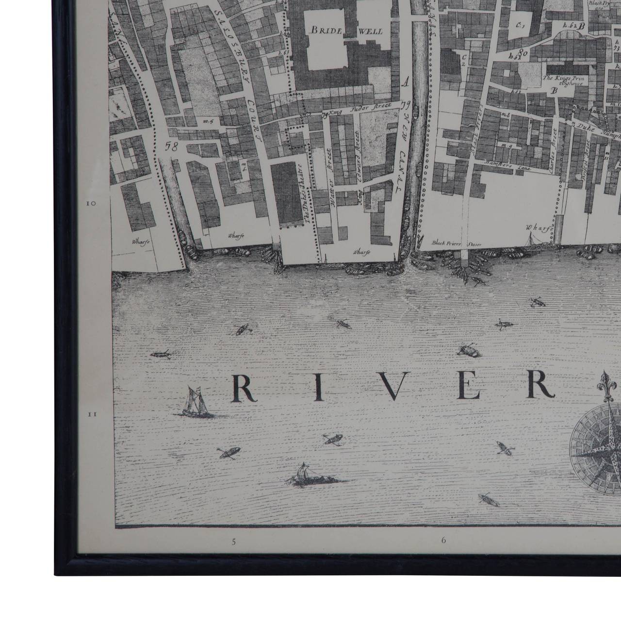
 John Ogilby, Kerry Lee and Ekta Kaul produced versions that are worth a look.

How Much is a Map Of London?

A map of london can differ in price owing to various characteristics — the average selling price 1stDibs is $1,398, while the lowest priced sells for $30 and the highest can go for as much as $1,042,875.