
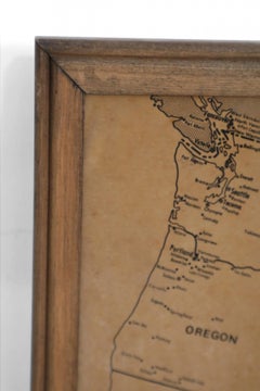
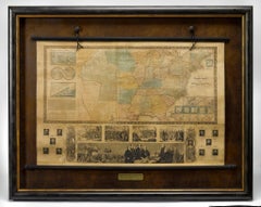
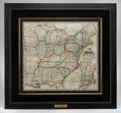
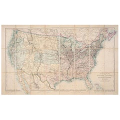
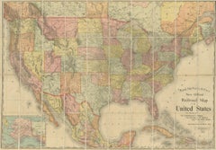
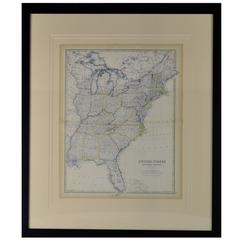
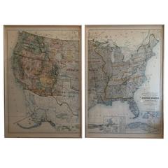
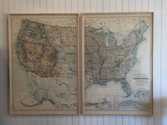
Vintage Framed United States Map
Located in Queens, NY
Vintage aged paper map of the United States mounted on particle board and framed in a simple wooden
Category
20th Century American Mid-Century Modern Maps
Materials
Wood, Paper
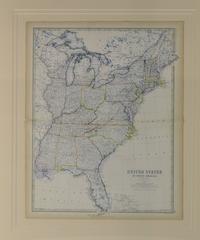
Vintage Framed United States Map
Located in Queens, NY
Vintage aged paper map of the United States mounted on particle board and framed in a simple wooden
Wood, Paper
$340
H 10.24 in W 16.15 in D 0.01 in
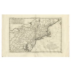
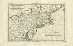
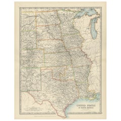
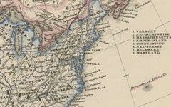
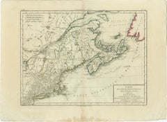
Antique Northeastern United States Map — New England & Mid-Atlantic, Bonne, 1780
Located in Langweer, NL
Antique Northeastern United States Map — New England & Mid-Atlantic, Bonne c.1780 This finely
Paper

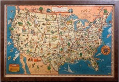
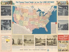
1939 "A Good-Natured Map of the United States" by Greyhound
Located in Colorado Springs, CO
Presented is an original 1939 map, titled “A Good-Natured Map of the United States Setting Forth
Paper

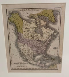
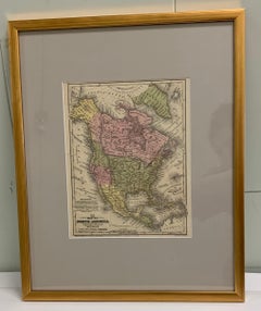
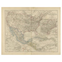
1830 Mexico and United States Framed Map
Located in Stamford, CT
Map of North America published circa 1830. Map shows United States into Canada. Mexico extending
Glass, Wood, Paper
$325Sale Price|20% Off
H 18.51 in W 14.49 in D 0.01 in
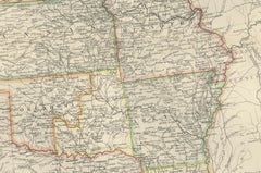
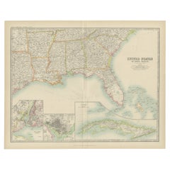
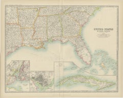
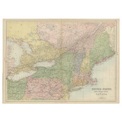
Map of United States Central Sheet 1903 – Railroads, States, and Topography
Located in Langweer, NL
Map of United States Central Sheet 1903 – Railroads, States, and Topography This is a finely
Paper
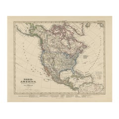
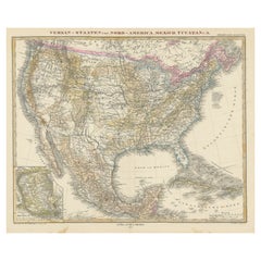
United States, Canada & Mexico – 1857 North America Map
Located in Langweer, NL
North America Map – United States, Canada, Mexico 1857 This impressive antique print shows “Nord
Paper
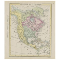
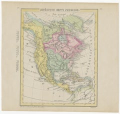
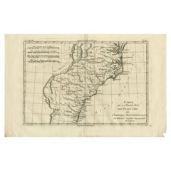
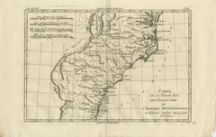
Small Map of the United States, circa 1870
Located in Langweer, NL
Antique map titled 'Amérique septe. Physique'. Small map of the United States. lithographed by C
Paper

Framed 1839 Hand Colored Map of the United States
Located in Stamford, CT
Framed hand colored map of the United States of America from 1839. Newly framed in a giltwood frame.
Giltwood, Paper, Glass

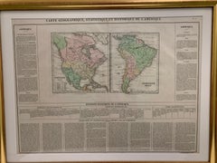
Framed 1820s Hand Colored Map of the United States
Located in Stamford, CT
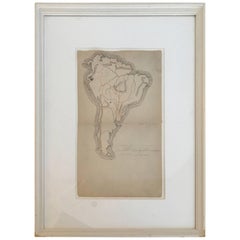
Framed 1820s hand colored map photos of North America and South America. As found framed in
Giltwood, Paper, Glass
$600
H 26.5 in W 22.25 in D 0.75 in
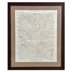
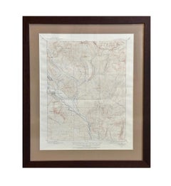
Vintage "Colorado, Crested Butte Sheet" USGS Topographical Map, 20th Century
By United States Geological Survey
Located in Colorado Springs, CO
United States Geological Survey. Highly detailed, the map captures the rugged topography of Gunnison
Paper

$550
H 14.18 in W 20.67 in D 0.01 in
United States Antique Map c.1888 – Railroads, Territories & State Stats
Located in Langweer, NL
Antique Map of the United States – Rand McNally, circa 1888 This antique map of the United States
Paper

$12,500
H 41.5 in W 52.5 in D 4 in
1845 "Ensign's Travellers' Guide and Map of the United States" Hand-Colored Map
Located in Colorado Springs, CO
This is an exquisite and dramatic steel-engraved wall map of the United States, published by T
Paper

$299
H 14.97 in W 11.03 in D 0 in
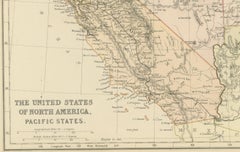
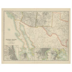
Antique Map of The United States of North America, Pacific States, 1882
Located in Langweer, NL
The map is from the same 1882 Blackie Atlas and focuses on the Pacific States of the United States
Paper

$248Sale Price|20% Off
H 15.75 in W 23.23 in D 0 in
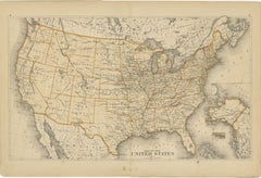
1874 Map of the United States with Territorial Boundaries
Located in Langweer, NL
Title: 1874 Map of the United States with Territorial Boundaries Description: This is an 1874 map
Paper

$766Sale Price|20% Off
H 16.54 in W 26.78 in D 0.02 in
Antique Map of the United States by Titus '1871'
Located in Langweer, NL
Antique map titled 'The United States of America'. Original antique map of the United States. This
Paper


$287Sale Price / set|20% Off
H 9.65 in W 12.21 in D 0.02 in
Antique Map of the United States by Lowry, '1852'
Located in Langweer, NL
Antique map titled 'United States'. Four individual sheets of the United States. This map
Paper

1866 Ensign & Bridgman's Rail Road Map of the United States
Located in Colorado Springs, CO
Presented is an 1866 issue of “Ensign & Bridgeman’s Rail Road Map of the United States, showing
Paper

$191Sale Price|20% Off
H 9.06 in W 11.23 in D 0.02 in
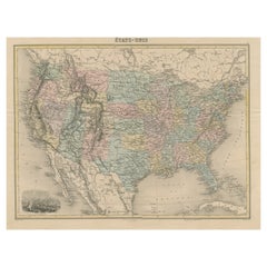
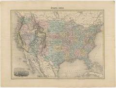
Antique Map of the United States by Balbi '1847'
Located in Langweer, NL
Antique map titled 'Etats-Unis'. Original antique map of the United States. This map originates
Paper
$153Sale Price|20% Off
H 8.15 in W 10.44 in D 0.02 in
Steel Engraved Map of the United States with Inset Map of Florida
Located in Langweer, NL
Antique map titled 'United States'. Steel engraved map of the United States. With small inset map
Paper

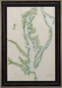
1856 U.S. Coast Survey Map of Chesapeake Bay and Delaware Bay
Located in Colorado Springs, CO
of the United States Coast Survey. The Office of the Coast Survey, founded in 1807 by President
Paper

Antique Map of The United States of North America, 1882
Located in Langweer, NL
This is a historical map titled "The United States of North America, Central Part" from the 1882
Paper

$15,500
H 54.25 in W 50 in D 3.25 in
1856 "Map of the United States" by Ensign, Bridgeman, and Fanning
Located in Colorado Springs, CO
Presented is a scarce American wall map of the United States and Mexico issued by Ensign, Bridgman
Paper

$516Sale Price|20% Off
H 14.65 in W 17.84 in D 0.02 in
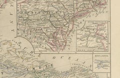
Antique Map of the Eastern United States with Inset Map of Texas
Located in Langweer, NL
. Inset map of the "southern principal part of Texas." Shows states, major cities, railroads, topography
Paper
$406
H 10.24 in W 16.15 in D 0.01 in
Antique Map Southern United States — Carolina & Georgia, Bonne c.1780
Located in Langweer, NL
Antique Map Southern United States — Carolina & Georgia, Bonne c.1780 This finely engraved
Paper

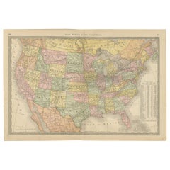
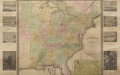
Large Original Antique Map of the United States of America. 1891
By Rand McNally & Co.
Located in St Annes, Lancashire
Fabulous map of The United States Original color By Rand, McNally & Co. Dated 1891 Unframed
Paper
$466
H 17.33 in W 21.66 in D 0.01 in
United States, Mexico & West Indies Map – Nieuwe Hand-Atlas, 1876
Located in Langweer, NL
United States, Mexico & West Indies Map – Nieuwe Hand-Atlas, 1876 This richly detailed 1876 map
Paper

$4,850
H 25.5 in W 35.5 in D 0.07 in
"The United States from the Latest Authorities" Antique Wall Map, 1835
Located in Colorado Springs, CO
This is a 1835 map of “The United States from the Latest Authorities” by Ezra Strong. A hand
Paper

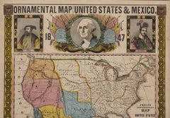
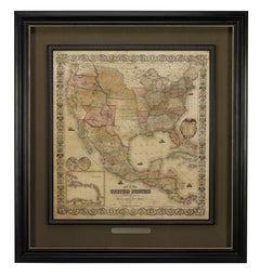
1847 Ornamental Map of the United States & Mexico by H. Phelps
Located in Colorado Springs, CO
propaganda map of the United States expressing U.S. dominance of the North American continent. The hand
Paper
$459Sale Price|20% Off
H 15.44 in W 20.4 in D 0.02 in
Antique Map of the United States with Vignette of Washington
Located in Langweer, NL
Antique map titled 'États-Unis'. A very attractive and detailed late 19th century map of the United
Paper
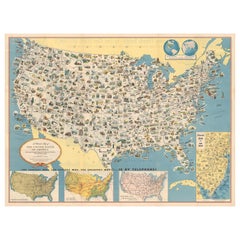
Old Decorative Pictorial Map of the United States, circa 1953
Located in Langweer, NL
Antique map titled 'A Pictorial Map of the United States of America Showing Principal Regional
Paper


Original Antique Map of United States, Grattan and Gilbert, 1843
Located in St Annes, Lancashire
Great map of United States Drawn and engraved by Archer Published by Grattan and Gilbert. 1843
Paper


$287Sale Price|40% Off
H 18.71 in W 24.02 in D 0.02 in
Antique Map of the Eastern United States by Levasseur '1875'
Located in Langweer, NL
map of the Eastern United States. This map originates from 'Atlas de Géographie Moderne Physique et
Paper
$133Sale Price|20% Off
H 9.06 in W 12.21 in D 0.02 in
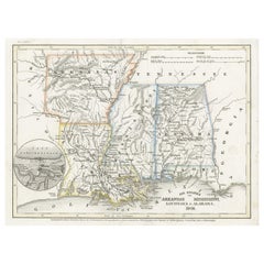
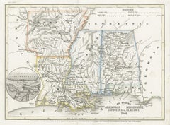
Antique Map of the Southern United States with Inset Map of New Orleans
Located in Langweer, NL
Antique map titled 'Die Staaten von Arkansas Mississippi, Louisiana & Alabama'. Detailed map of the
Paper


Large Vintage Maps of the United States, in 3 Sections, 1920
Located in St Annes, Lancashire
Great maps of the USA in 3 sections Unframed Original color By John Bartholomew and Co
Paper

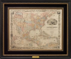
1859 "Map of the United States of America..." by J. H. Colton
By J.H. Colton
Located in Colorado Springs, CO
Presented is an 1859 “Map of the United States of America, the British Provinces, Mexico, the West
Paper

$406
H 18.51 in W 14.49 in D 0.01 in
Map of Western United States 1903 – Railroads, State Borders, and Terrain
Located in Langweer, NL
Map of Western United States 1903 – Railroads, State Borders, and Terrain This beautifully
Paper

$656
H 19.38 in W 24.41 in D 0.01 in
1874 Map of Western United States – Detailed Atlas by Keith Johnston
Located in Langweer, NL
1874 Map of Western United States by Keith Johnston – Detailed Atlas This is an original antique
Paper


$239Sale Price|20% Off
H 19.49 in W 24.41 in D 0.02 in
Antique Map of the United States ' North East ' by Johnston '1909'
Located in Langweer, NL
Antique map titled 'United States of North America'. Original antique map of United States of North
Paper


$239Sale Price|20% Off
H 19.49 in W 24.41 in D 0.02 in
Antique Map of the United States 'North West' by Johnston, '1909'
Located in Langweer, NL
Antique map titled 'United States of North America'. Original antique map of the United States of
Paper
$334Sale Price|20% Off
H 19.49 in W 24.41 in D 0.02 in
Antique Map of the United States ' South East ' by Johnston '1909'
Located in Langweer, NL
Antique map titled 'United States of North America'. Original antique map of United States of North
Paper


Antique Map of the United States of North America, c.1882
Located in Langweer, NL
Antique map titled 'United States of North America'. Old map of the United States of North America
Paper
$851Sale Price|20% Off
H 17.45 in W 27.45 in D 0.02 in
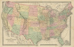
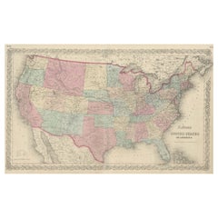
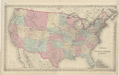
Antique Map of Colton's United States, Paper, Mid-19th Century, 1855
Located in Langweer, NL
Antique map titled 'Colton's United States of America'. Show railroads, canals, state capitals
Paper

$277Sale Price|20% Off
H 15.56 in W 21.46 in D 0.02 in
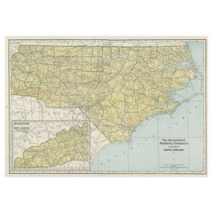
Colourful Old Detailed Map of Northern Carolina, United States of America
Located in Langweer, NL
Vintage map titled 'The Geographical Publishing Company's Premier Map of North Carolina'. Beautiful
Paper

$4,000
H 37 in W 49.5 in D 1 in
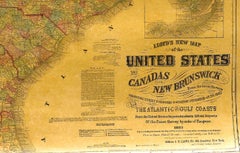
1863 "Lloyd's New Map of the United States, the Canadas, and New Brunswick"
Located in Colorado Springs, CO
Presented is “Lloyd's New Map of the United States, the Canadas and New Brunswick, From the latest
Linen, Wood, Paper


$566
H 14.69 in W 17.92 in D 0.02 in
Antique Map of the United States with inset map of Mexico City Area, c.1859
Located in Langweer, NL
the United States of America showing the Caribbean. With an inset map of the surrounding area of
Paper
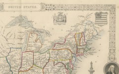
$335
H 10.95 in W 14.26 in D 0.01 in
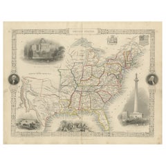
Ornate 1850s Map of the United States: Featuring Iconic Landmarks and Portrets
Located in Langweer, NL
Ornate 1850s Map of the United States: Featuring Iconic Landmarks and Historical Portraits This
Paper
$1,054
H 18.12 in W 29.93 in D 0.01 in
1876 Map of the United States: Detailing the Railroads and Unsettled Territories
Located in Langweer, NL
Stanford’s Smaller Railway Map of the United States, 1876 This original 1876 map, titled
Paper
$334Sale Price|20% Off
H 19.49 in W 24.41 in D 0.02 in
Antique Map of the United States of North America by Johnston '1909'
Located in Langweer, NL
Antique map titled 'United States of North America'. Original antique map of United States of North
Paper

$2,246Sale Price|25% Off
H 30.91 in W 43.9 in D 0.02 in
Antique Railroad Map of the United States by Rand, McNally & Co, 1900
Located in Langweer, NL
Antique map titled 'Rand, McNally & Co's New Official Railroad map of the United States with
Linen, Paper


$239Sale Price|20% Off
H 10.24 in W 14.18 in D 0.02 in
Antique Map of the United States of North America by Wyld '1845'
Located in Langweer, NL
Antique map titled 'Map of The United States of North America'. Original antique map of the United
Paper

$536Sale Price|20% Off
H 16.34 in W 22.25 in D 0.01 in
Antique Map of the Northeastern United States and Canada by Tardieu, 1802
Located in Langweer, NL
. States and Provinces Mentioned: The map covers various states in the northeastern United States and
Paper


$421Sale Price|20% Off
H 15.08 in W 18.75 in D 0.02 in
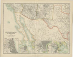
Antique Map of Part of the United States Including Lower California & Arizona
Located in Langweer, NL
Antique map of part of the United States of America including Lower California, Arizona and part of
Paper

$535Sale Price|20% Off
H 15.08 in W 18.71 in D 0.02 in
Antique Map with Hand Coloring of the United States and the Caribbean
Located in Langweer, NL
the United States of America showing the Caribbean. With an inset map of the surrounding area of
Paper


$784Sale Price|20% Off
H 14.38 in W 17.88 in D 0.02 in
Antique Map of the United States of America, also showing the Caribbean
Located in Langweer, NL
the United States of America showing the Caribbean. With an inset map of the surrounding area of
Paper


$239Sale Price|20% Off
H 17.52 in W 23.63 in D 0.02 in
Antique Map of The United States Southern Section by A & C. Black, 1870
Located in Langweer, NL
Antique map titled 'United States Southern Section'. Original antique map of Map of The United
Paper

$239Sale Price|20% Off
H 17.52 in W 23.63 in D 0.02 in
Antique Map of The United States and Canada by A & C. Black, 1870
Located in Langweer, NL
Antique map titled 'United States North Eastern Section and Canada'. Original antique map of Map of
Paper
$813
H 21.66 in W 31.11 in D 0.02 in
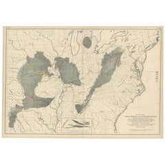
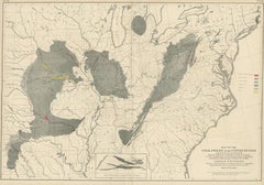
Antique Map of the Coal Fields of the United States by Walker '1874'
Located in Langweer, NL
Antique map titled 'Map of the coal fields of the United States, compiled from state reports and
Paper
Unavailable
H 42 in W 55 in D 2.5 in
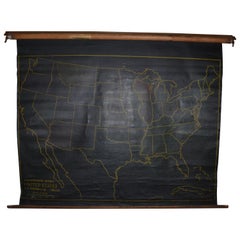
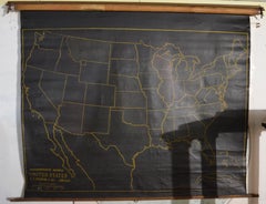
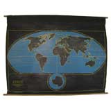
Map of United States, Early 1900s, with Chalkboard Canvas on Retractable Roller
Located in Madison, WI
Map of the United States, early 1900s. Unique classroom application with its durable black
Canvas, Wood
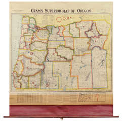
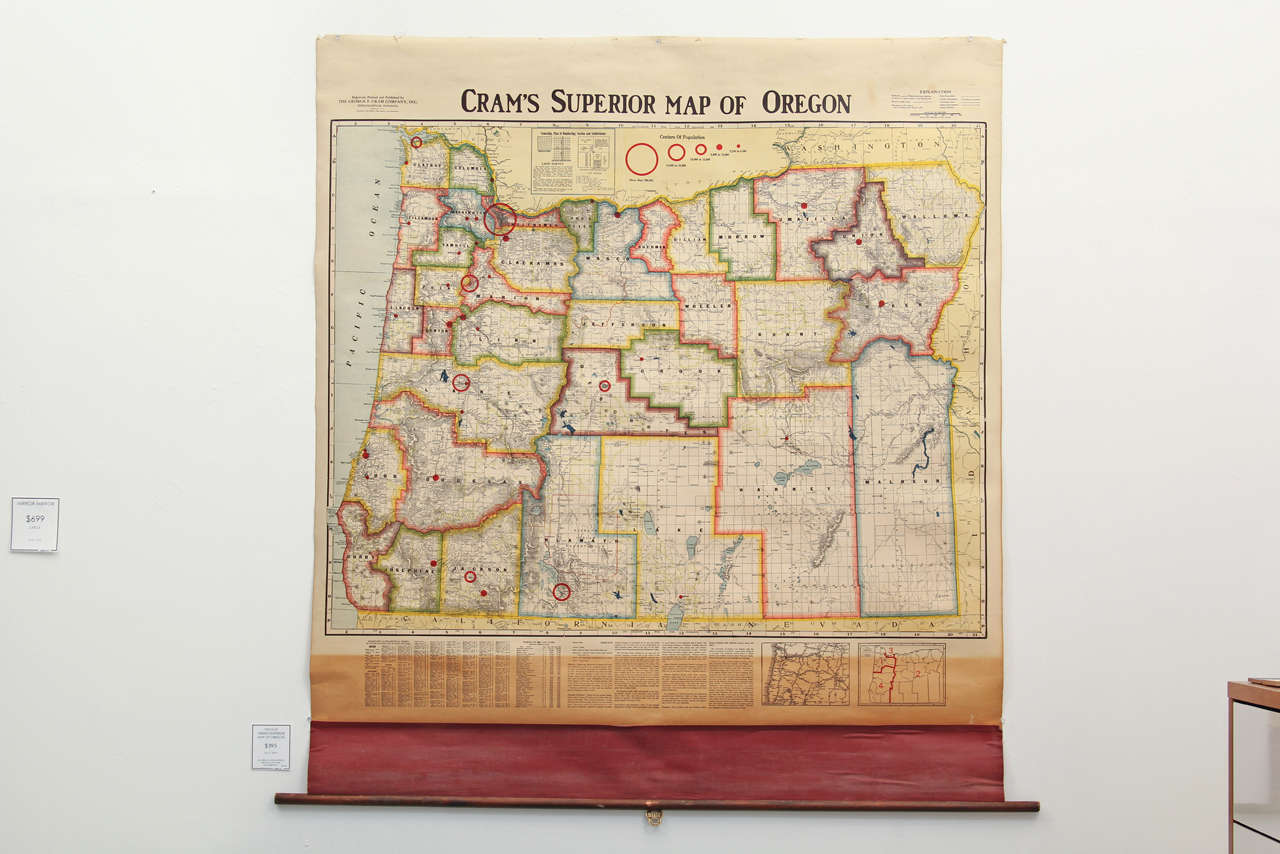
Crams Superior Map Of Oregon
By George F. Cram
Located in Seattle, WA
Vivid colors and bold graphics characterize this vintage circa 1940's school map of the State of
Linen
Map of the Original 13 Colonies
Located in Acworth, GA
Antique map showing the early formation of the new United States. Conservation framing with UV
Paper
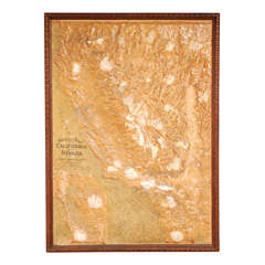
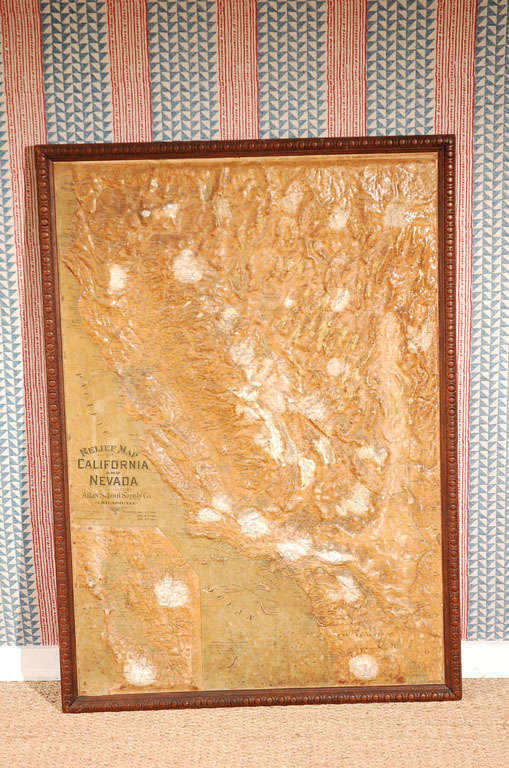
Relief Map of California and Nevada
Located in Los Angeles, CA
Lovely vintage relief map in the original frame. Great sepia colors
Paper, Wood
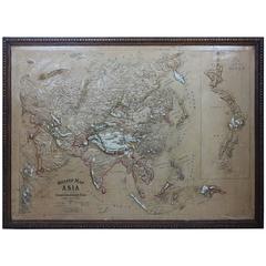
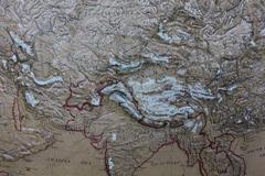
Large 1900s Relief Map of Asia
Located in Chicago, IL
Large 1900s relief map of Asia in original oak frame.
Oak, Paper
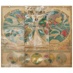
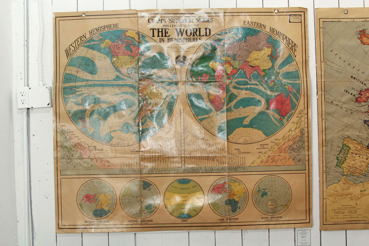
Political Map Of The World In Hemispheres
By George F. Cram
Located in Seattle, WA
Artistic as it is educational this stunning vintage Cram's Superior Series Map of the World will
Linen
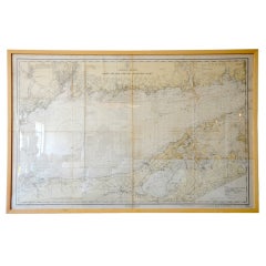
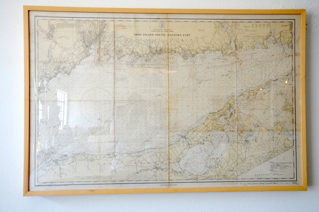
Framed Vintage Nautical Map of Long Island Sound
Located in Houston, TX
Great framed vintage nautical map of Long Island Sound, would look great in a Hamptons Home
Wood
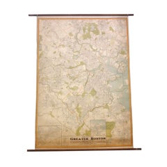

Oversize 1930's Street Map of Greater Boston
Located in Asheville, NC
A fantastic wall map of the greater Boston area in the late 1930's - Streets are detailed
Walnut, Canvas
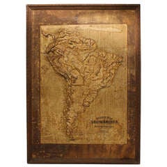
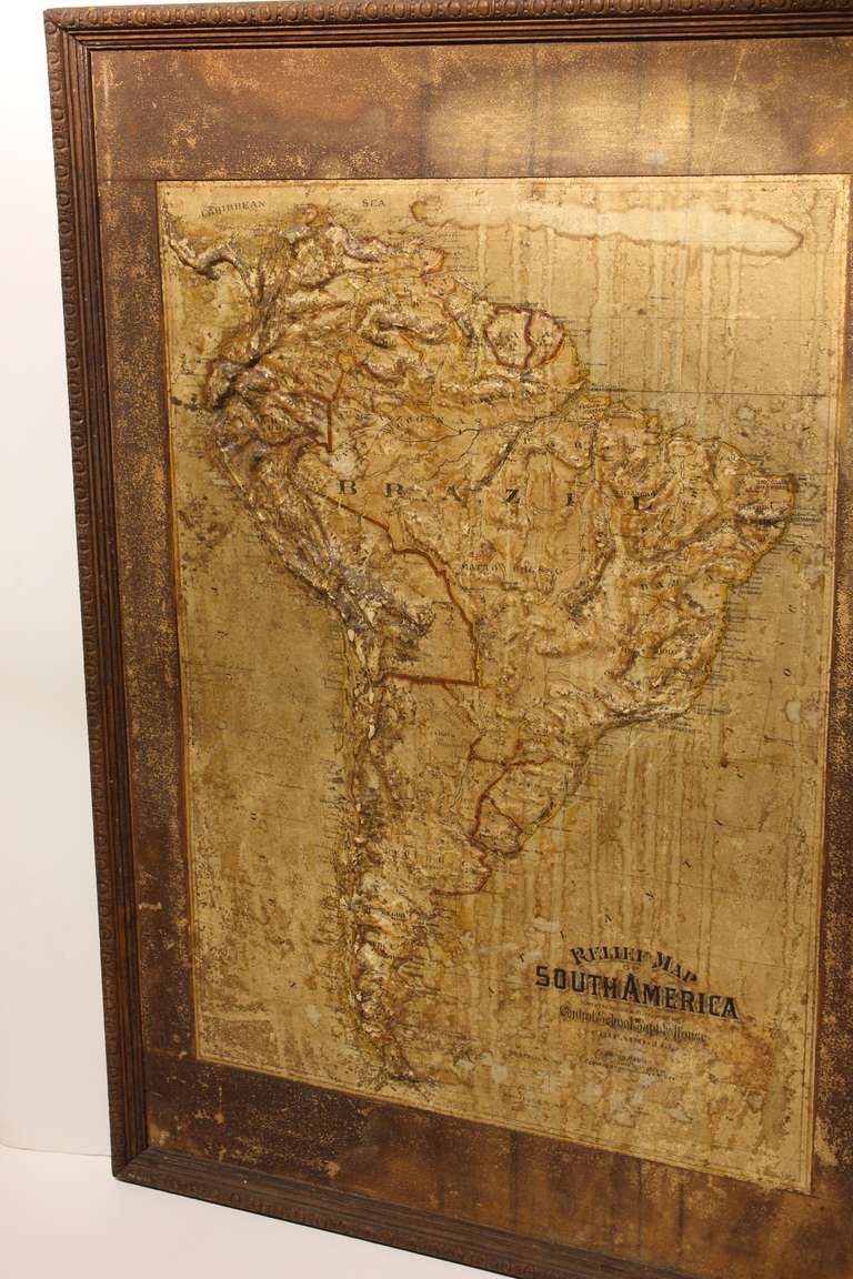
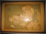
Large Late 1800's Raised Relief Map Of South America
Located in Chicago, IL
Large Late 1800's raised Relief Map of South America by Central School Supply House in Chicago
Paper, Wood
Unavailable
H 1 in W 18.5 in D 15 in
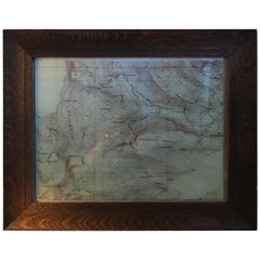
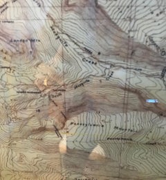
Topographical Map of the Pennsylvania Mountains in a Quarter Sawn Oak Frame
Located in Chicago, IL
19th century topographical map of the Pennsylvania Mountains. The map is framed in a beautiful
Oak, Paper
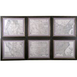
Set of 6 Maps the United States
By A. Steiler
Located in Florham Park, NJ
/> The United States of America is sectioned in six separately engraved plates. When laid side
Unavailable
H 64.5 in W 44.5 in D 2 in
Map of United States Territories and Insular Possesssions, circa 1953
Located in West Hollywood, CA
Map of United States Territories and Insular Possessions, circa 1953 reproduction. Department of
Paper
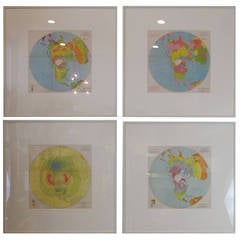
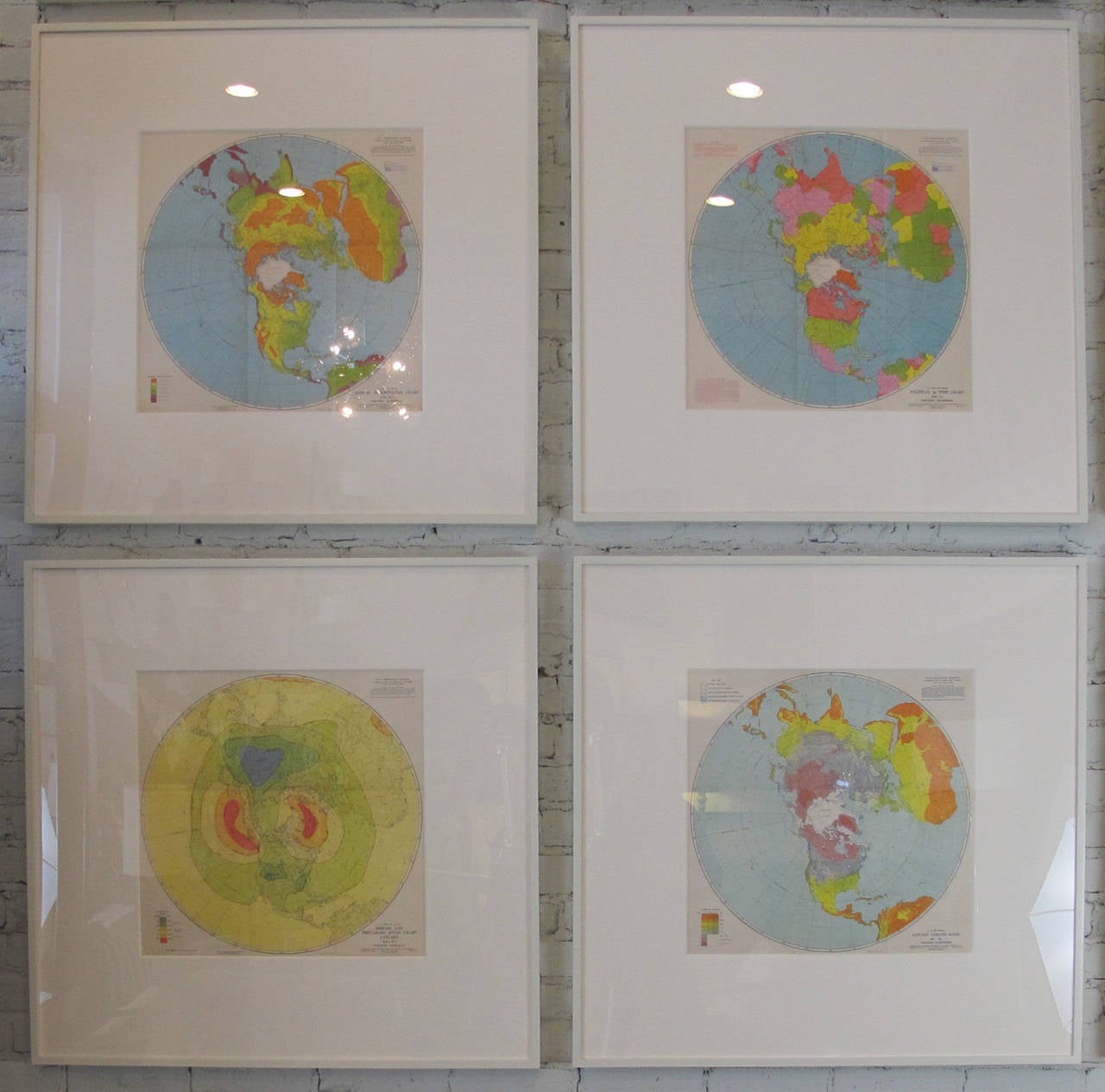
Air Force Aeronautic Charts
Located in New York, NY
Aeronautic maps published by the U.S. Air Force. Charts document annual precipitation, climatic
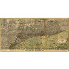
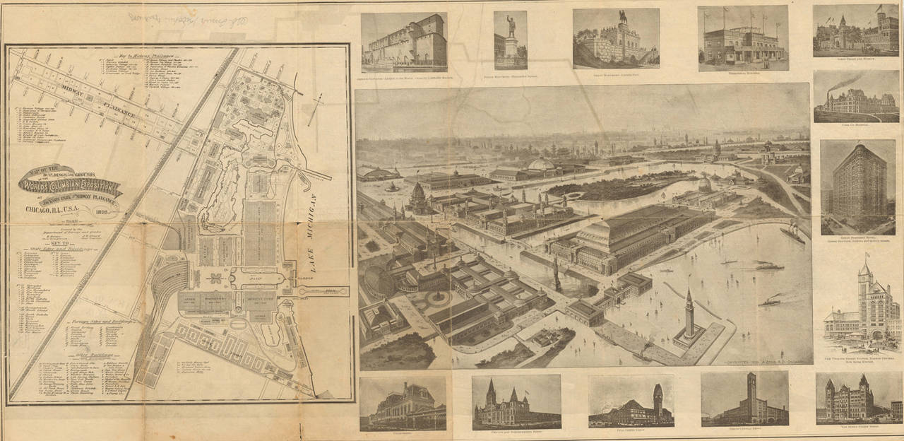
Bird's-Eye View of Chicago, 1893
By Peter Roy
Located in Houston, TX
An exceptional bird's-eye view of the Chicago area, this map is largely uncolored, though some
Unavailable
H 43.31 in W 64.18 in D 1.19 in
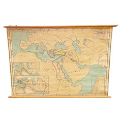
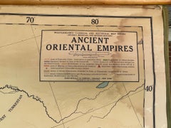
Antique Rand McNally & Company Schoolmap. Ancient Oriental Empires. Historical
By Rand McNally & Co.
Located in ROTTERDAM, ZH
This is a real unique map made by the famous Rand McNally Company. This rare schoolmap is probably
Fabric, Paper


Unavailable
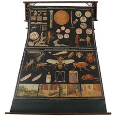
Vintage Geographical Terms Chart
By Denoyer-Geppert
Located in Alexandria, VA
Wonderful school chart made for teaching geographical terms such as plains and deserts. Published by Denoyer-Geppert Co. Chicago, ILL. U.S.A.
Fabric
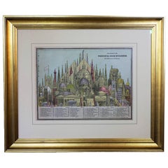
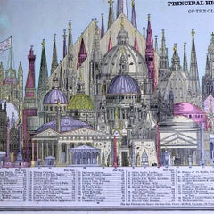
1887 Engraving of Old World Buildings Framed
By George F. Cram
Located in Pataskala, OH
line on cotton rag mat. Title/Content of map: 1887 Cram Comparison of Tall Buildings Globally
Paper

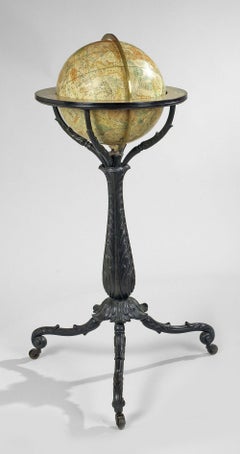
Pair of American Globes on Cast Iron Stands
Located in London, Middlesex
The Celestial circa 1833 and the terrestrial, circa 1840 Lorings/ Terrestrial Globe / containing all/ The Late Descoveries/ And/ Geographical Improvements / also the Tracks of /th...
Iron
Unavailable
H 36 in W 57 in D 1 in
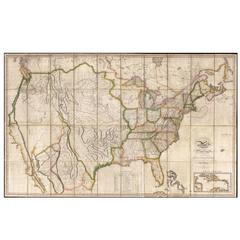
Map of the United States with the Contiguous British and Spanish Possessions
By John Melish
Located in La Jolla, CA
engraved wall map, dissected and laid on original linen. Melish's map is generally regarded as the
Paper
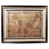
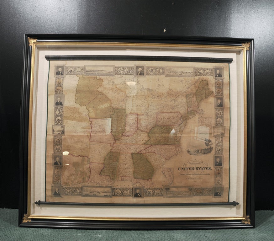
Embellished Map by S. Bishop Munson (Framed)
By Samuel Bishop Munson
Located in New York, NY
A New and Embellished Map of the United States Compiled from the Latest & Most Authentic Documents

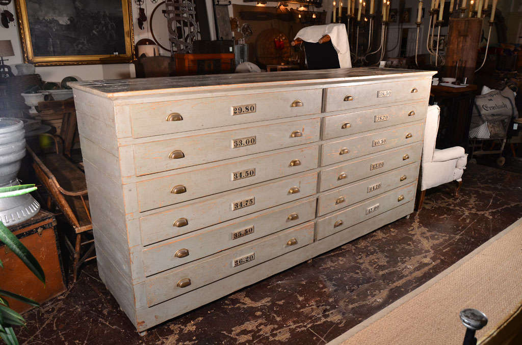
Map Case
Located in Dallas, TX
Large Gray Map Case with 12 numbered drawers and wood herringbone pattern on back.
Metal
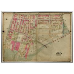
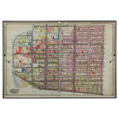
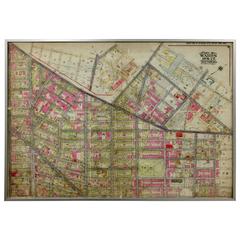
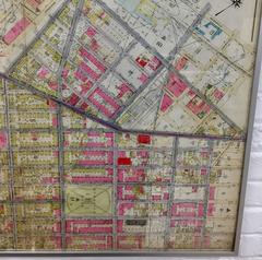
Rare 1916 Map of Fort Greene Brooklyn 'Brooklyn Map #4'
Located in Tarrytown, NY
Rare 1916 map of Fort Greene, Brooklyn. This rare map of Fort Greene is from the Atlas of the

Unavailable
H 27.5 in W 37.5 in D 1 in
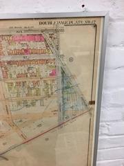
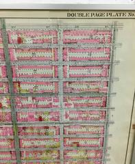
Rare 1916 Map of Prospect Park/Flatbush Avenue 'Brooklyn Map #6'
Located in Tarrytown, NY
Rare 1916 map of Prospect Park/Flatbush Avenue, Brooklyn. This rare map is from The Atlas of the
Unavailable
H 47.75 in W 33.25 in D 1.5 in
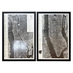
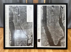
Pair of Monumental National Air Map Company Manhattan Aerial Photo Maps, 1955
Located in San Francisco, CA
A monumental and rare circa 1955 framed two-piece aerial photographic map of the borough of
Acrylic, Wood, Paper
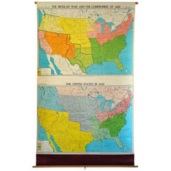
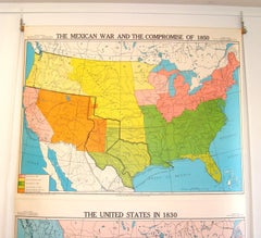
School Wall Map American History
By George F. Cram
Located in Lambertville, NJ
Superb pull-down wall map reflecting U.S. territorial changes between 1830 and 1850. Executed by
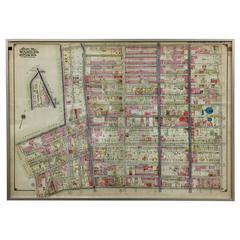
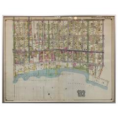
Rare 1916 Map of Brooklyn
Located in Tarrytown, NY
Rare map of Brooklyn, 1916. The map was originally backed on linen for preservation. The map is
Rare 1916 Map of Brooklyn
Located in Tarrytown, NY
Rare map of Brooklyn neighborhood from 1916. The map was originally backed on linen for

Cartocraft Slated World Wall Map
Located in Stamford, CT
Made in Chicago
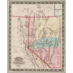
DeGroot's Map of Nevada Territory
By Henry DeGroot
Located in La Jolla, CA
The first printed map devoted to Nevada Territory, with the first printed guide book on Nevada
Paper
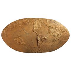
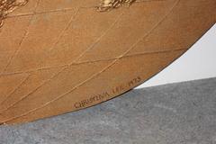
Handmade 3D World Map Sculpture
Located in Chicago, IL
Handmade 3D world map sculpture by Christina Lee. Measures: 8' long.
Plaster, Raw Linen, Wood
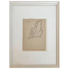
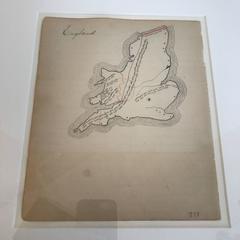
19th Century Schoolboy Map of England
Located in Boston, MA
19th century schoolboy Map of England. Custom framed.
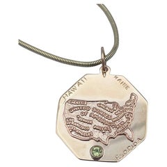
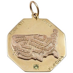
USA Map Florida Maine Hawaii Gold Charm
Located in New York, NY
Large octagonal charm. In the center is an applied figural map of the United States, embossed with
14k Gold

19th Century Schoolboy Map of South America
Located in Boston, MA
19th century Schoolboy map of South America. Custom framed.
Interesting Large Victorian Relief Map of Africa
Located in Stamford, CT
Good relief map with a great patina and original oak frame
Wood
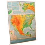
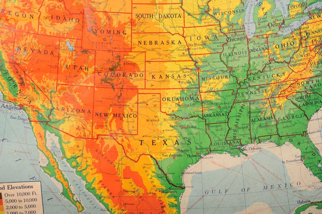
USA Teaching Aid Map on Wooden Rollers
Located in New York, NY
Teaching aid map of North America and territories. Colored Elevations.
Canvas
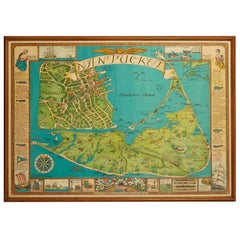
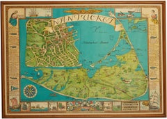
Vintage Nantucket Map with Original Wood Frame
Located in New York City, NY
Vintage map of Nantucket. Mid-20th century in original wood frame.
Wood, Paper
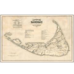
Original Antique 1869 Wall Map of Nantucket
Located in La Jolla, CA
Nice example of the wall map version of Reverend F.C. Ewer's Historical Map of Nantucket. The
Paper
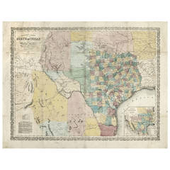
Richardson's New Map of the State of Texas
By Willard Richardson 1, Charles Desilver
Located in Houston, TX
map for the 1862 almanac states that 80 miles have been completed on that line. The present map has


Texas Map Turtle–Graptemys Versa by Henry Horenstein
By Henry Horenstein
Located in New York, NY
Texas map turtle–Graptemys versa by Henry Horenstein limited edition signed and numbered framed
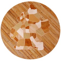
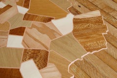
Reclaimed Wood Brooklyn Map Marquetry Wall Art
By Gregoire Abrial
Located in Brooklyn, NY
Round reclaimed wood wall art or sculpture of a Brooklyn map inlaid using marquetry technique. The
Epoxy Resin, Wood
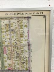
Rare 1916 of Bushwick Brooklyn, Brooklyn Map #5
Located in Tarrytown, NY
Rare 1916 map of Bushwick, Brooklyn. This rare map of Bushwick, Brooklyn is from The Atlas of the
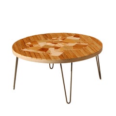

Reclaimed Wood Brooklyn Map Marquetry Coffee Table
By Gregoire Abrial
Located in Brooklyn, NY
Round reclaimed wood coffee table / cocktail table with Brooklyn map inlaid using marquetry
Steel
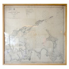
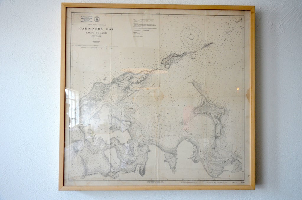
Framed Vintage Nautical Map of Gardiners Bay Long Island
Located in Houston, TX
Great framed vintage nautical map of Gardiners Bay Long Island, would look great in a Hamptons Home
Unavailable
H 50 in W 40.75 in D 27.75 in
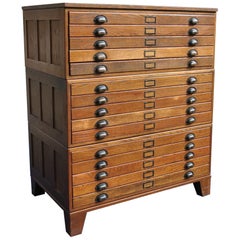
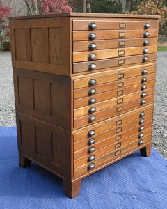
Hamilton Map Cabinet Flat File Industrial Cabinet Architects Cabinet
By Hamilton
Located in Newtown, CT
Hamilton map file cabinet in great condition from the 1920s. 15 drawers with base. It is 27.75
Wood
Unavailable
H 54.25 in W 64.5 in
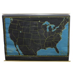
Vintage Pull Down Cartograph Slated Chalkboard Map by Denoyer & Geppert Co
Located in Chicago, IL
Vintage pull down cartograph slated chalkboard map of United States by Denoyer & Geppert Co.
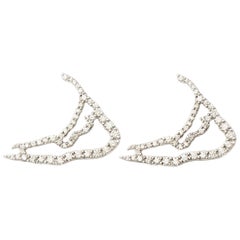
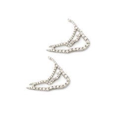
Susan Lister Locke Nantucket in Diamonds Map Earrings
By Susan Lister Locke
Located in Nantucket, MA
The shape of Nantucket Island is as iconic as the island itself. From the Diamond Island™ Collection, these 18 Karat Palladium White Gold earrings, set with diamonds, are striking an...
Diamond, 18k Gold, White Gold, Palladium
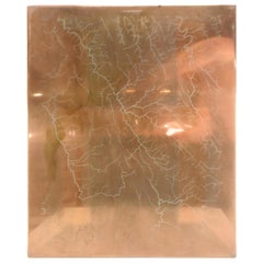
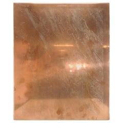
Copper Waterway Map Printing Plate of Winchester, VA
Located in Cookeville, TN
This is a unique antique copper printing plate for Winchester, Virginia. It is a waterway plate. The plate is labelled “Winchester 83” and is presented unframed.
Copper
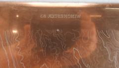
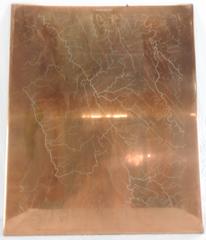
Copper Topographical Map Printing Plate of Winchester, VA
Located in Cookeville, TN
This is a unique antique copper printing plate for Winchester, Virginia. It is a topographical plate. The plate is labeled “Winchester 83” and is presented unframed.
Copper
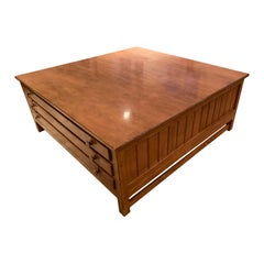
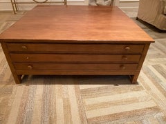
Vintage Map Drawer Coffee Table by Troy Wesnidge Inc
Located in Chicago, IL
Perfectly scaled for a large space, this coffee table is vintage map drawer style. Polished maple
Maple
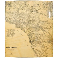
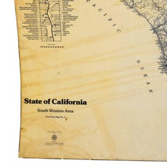
Map of California South Western Area by AAA Automotive Club
Located in Los Angeles, CA
Fiberglass map of California South Western area by AAA Automotive Club An oversized road map that
Lacquer, Paper
Unavailable
H 13 in W 52 in D 4 in
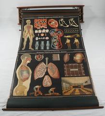
Denoyer Geppert Vintage Science Charts and Maps, Steampunk Industrial
By Denoyer-Geppert
Located in Canaan, CT
very collectable Denoyer Geppert vintage science charts. rack holds 6 charts, only 5 are in rack. charts are canvas with wear only to edges. colors are still vibrant, and drawings ar...
Canvas, Wood
Unavailable
H 18.25 in W 31 in D 1.5 in
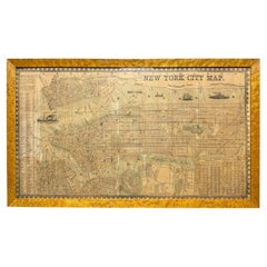
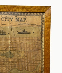
Antique 1857 New York City Map by Humphrey Phelps, Framed in Burlwood
Located in Black Rock, CT
A unique 1857 New York City map published by Humphrey Phelps, showing Manhattan, Brooklyn, Jersey
Burl, Paper

18kt Fairmined Ecological Yellow Gold Engraved World Map Love Locket
Located in New York, NY
The striking Love Locket was designed to keep your loved ones close. Handmade in our 18kt Fairmined Ecological gold, the Love Locket features a beautiful embossing of our Mother Eart...
Gold, 18k Gold, Yellow Gold
Unavailable
H 15.5 in W 12.5 in D 0.5 in
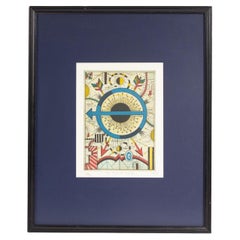
Tony Fitzpatrick Signed 2012 “The Map Of Mercy” Limited Edition Color Etching
Located in Indianapolis, IN
"The Map of Mercy," this abstract work depicts a blue and black circle bisected by an arrow
Paper
Unavailable
H 58 in W 56.5 in D 1 in
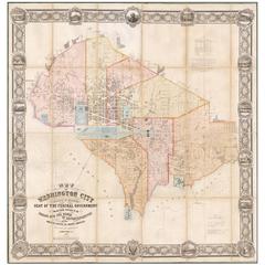
Map of Washington City District of Columbia Seat of the Federal Government
By Albert Boschke
Located in La Jolla, CA
Albert Boschke’s suppressed wall map of Washington City, District of Columbia. One of the most
Paper
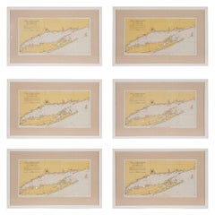
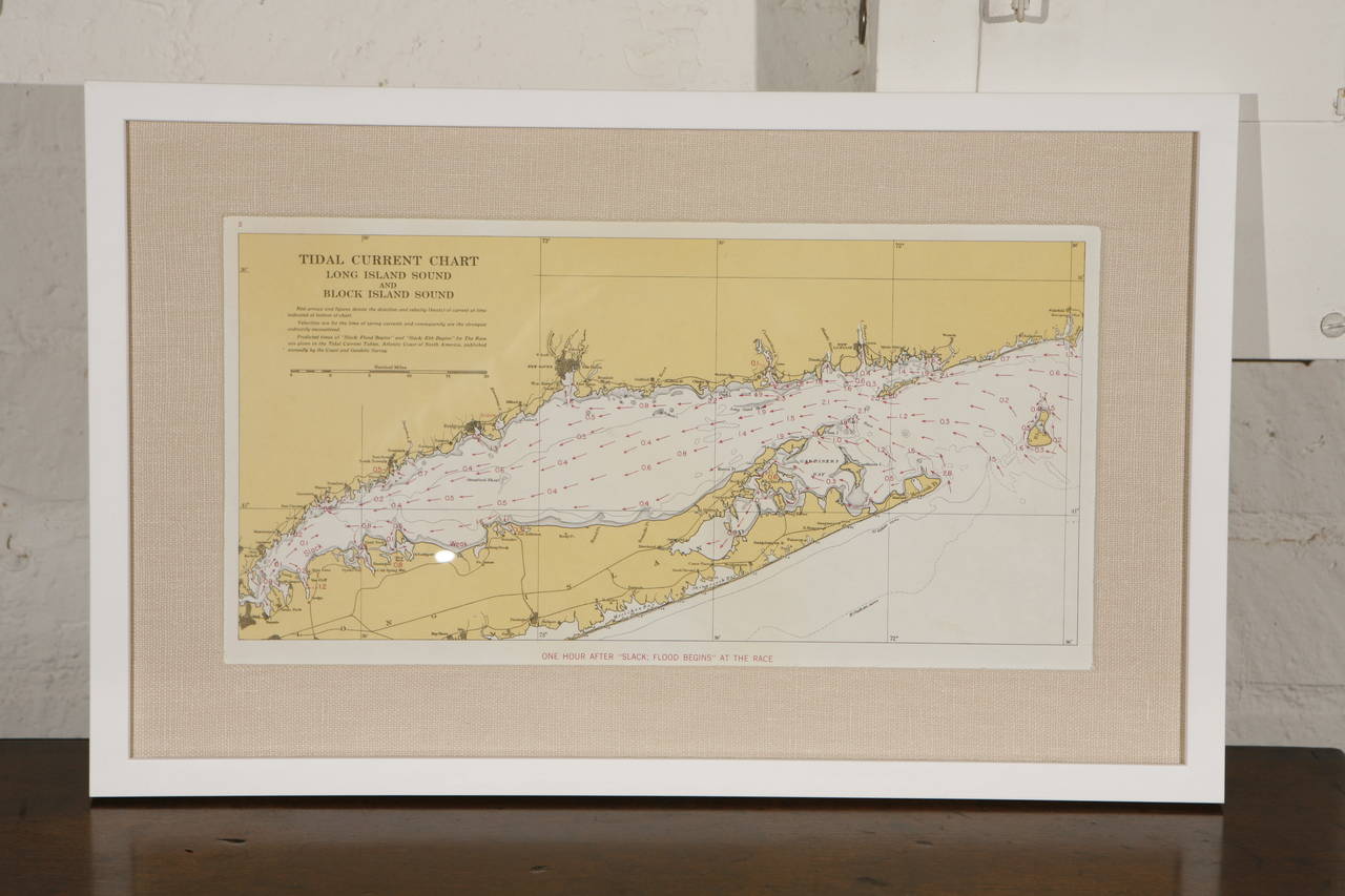
1960s Set of Six Long Island Tidal Current Charts or Maps
Located in Culver City, CA
historical interest. Each map charts the tidal current directions and speeds for different times of a race in
Linen, Paper, Plexiglass, Wood
Unavailable
H 35.04 in W 23.23 in
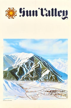
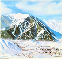
Original Vintage Winter Travel Poster Sun Valley Idaho Ski Resort Bald Mountain
Located in London, GB
Original vintage winter travel poster for Sun Valley in Idaho the United States featuring a ski map
Paper
Produced in 1843, the well-preserved volume is evidence of the author's exacting specifications.
New or old, the coverlets add old-time charm to any space.
Get into the games! These items celebrate the events, athletes, host countries and sporting spirit.
French trendsetter and serial collector Daniel Rozensztroch tells us about his obsession with objects related to seafaring men.
It's hard to resist the allure of a beautiful pool. So, go ahead and daydream about whiling away your summer in paradise.
The sought-after designer worked with the team at Hoffman Creative to produce a monograph that beautifully showcases some of Studio Shamshiri's most inspiring projects.
Italian writer and collector Umberto Pasti opens the doors to his remarkable cave of wonders in North Africa.
Hollywood A-listers, ex-pat aristocrats and art collectors and style setters of all stripes appreciate the allure of the coastal California hamlet — much on our minds after recent winter floods.