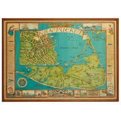
Vintage Nantucket Map with Original Wood Frame
View Similar Items


1 of 4
Vintage Nantucket Map with Original Wood Frame
About the Item
- Dimensions:Height: 25 in (63.5 cm)Width: 33 in (83.82 cm)Depth: 2 in (5.08 cm)
- Materials and Techniques:
- Place of Origin:
- Period:
- Date of Manufacture:1950
- Condition:Wear consistent with age and use.
- Seller Location:New York City, NY
- Reference Number:1stDibs: LU985116043832
You May Also Like
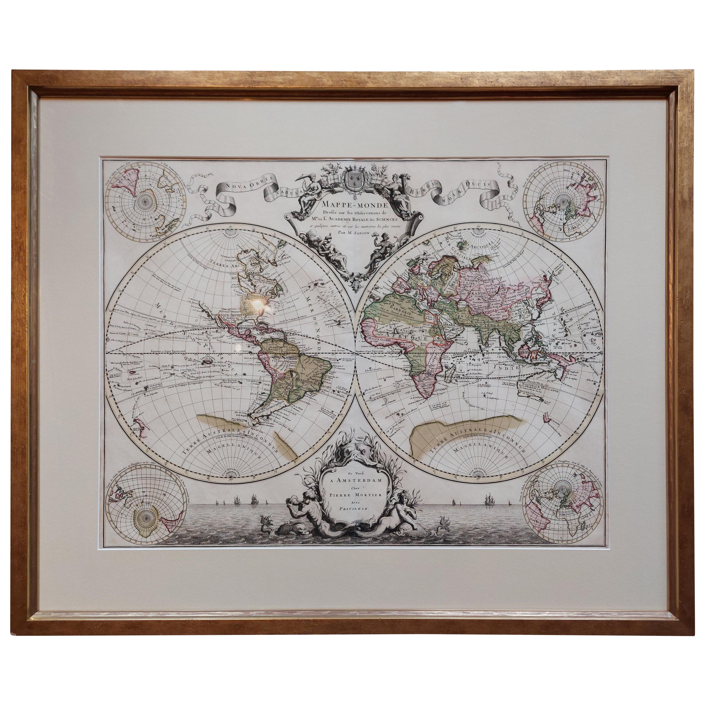
- Original Antique Hand-colored World Map with or without Frame, '1696'Located in Langweer, NLAntique world map titled 'Mappe-Monde dressee sur les Observations de Mrs. de l'Academie Royale des Sciences (..)'. Beautiful original antique world map...Category
Antique Late 17th Century Maps
MaterialsPaper
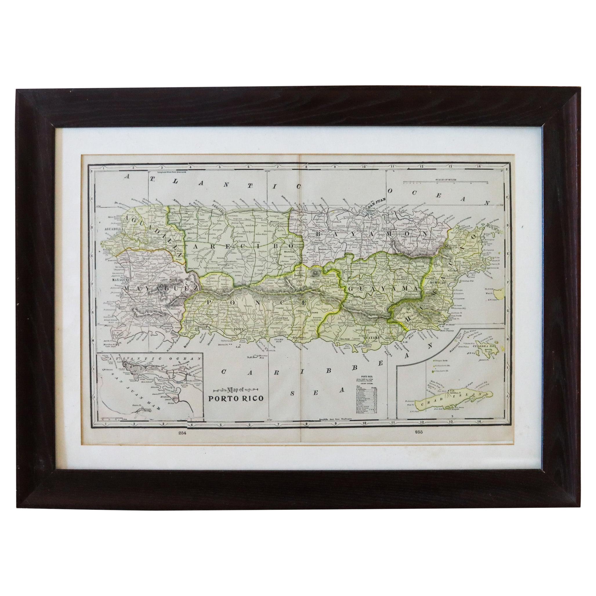
- Puerto Rico 1910 Original Antique Map Of The Island In A Period Wood FrameLocated in Miami, FLAn antique framed map of Puerto Rico. Very nice antique map of Puerto Rico printed in a folio of two pages. This map was printed in thin pa...Category
Antique Early 1900s Puerto Rican American Classical Prints
MaterialsGlass, Wood, Paper
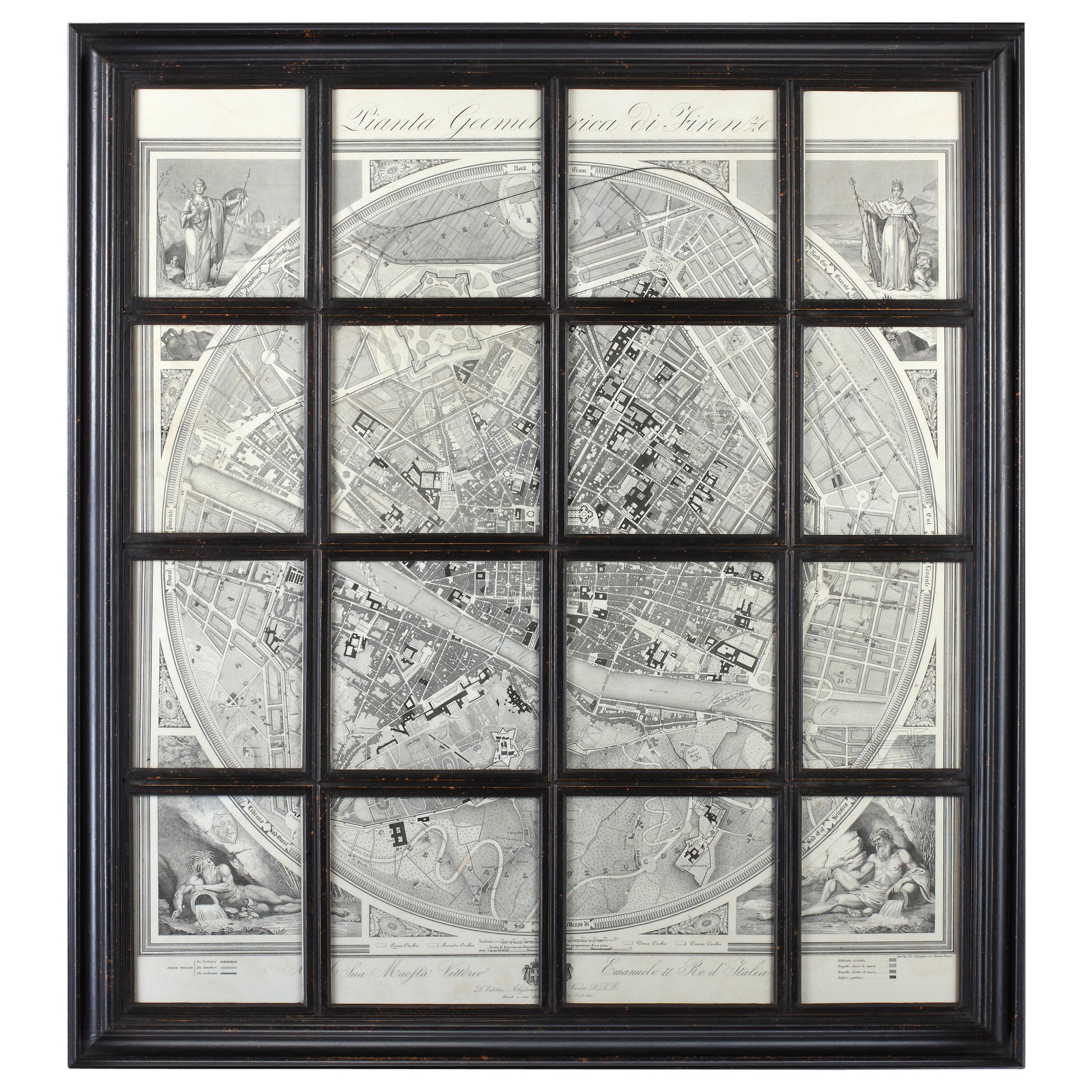
- Geometric Map of Florence with Black Lacquered Frame Old Map ReproductionLocated in Scandicci, FlorenceGEOMETRIC PLAN OF THE CITY OF FLORENCE WHICH IS TRUE AS 1:4.500, showing expansions and urban planning changes. The entire print, reproduced on paper, is framed with a "window" struc...Category
21st Century and Contemporary Italian Prints
MaterialsWood, Paper
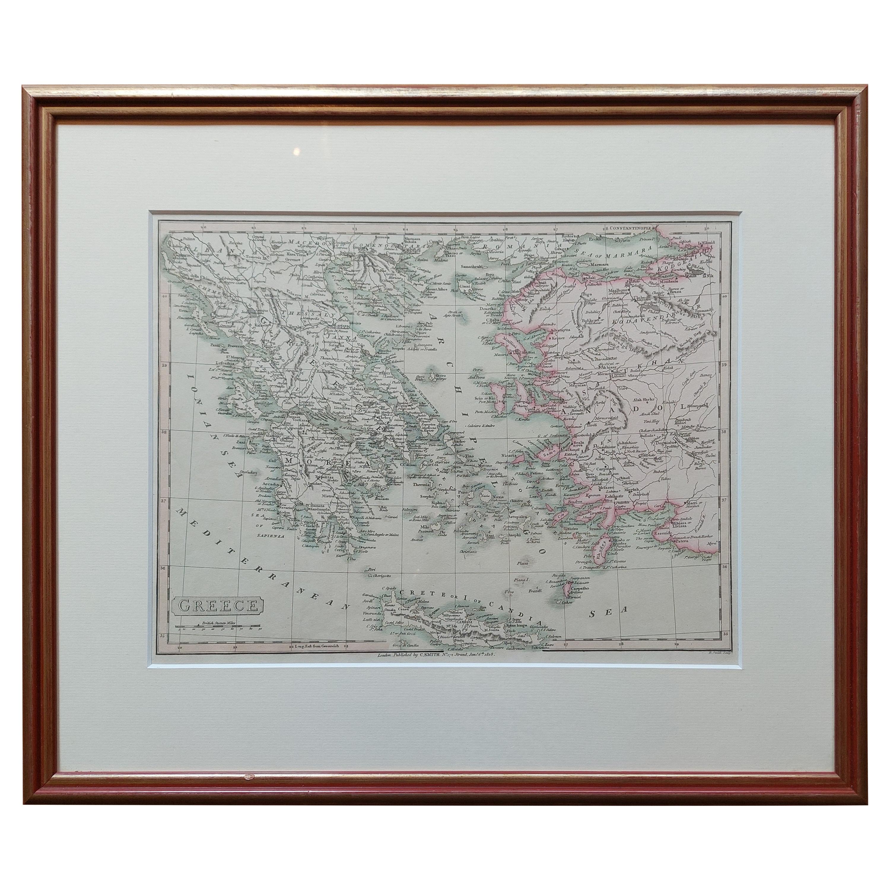
- Original Antique Map in Frame of Greece by Smith '1818'Located in Langweer, NLNicely framed map titled 'Greece'. Original antique map of Greece published by C. Smith, 1818. Frame included.Category
Antique Early 19th Century Maps
MaterialsPaper
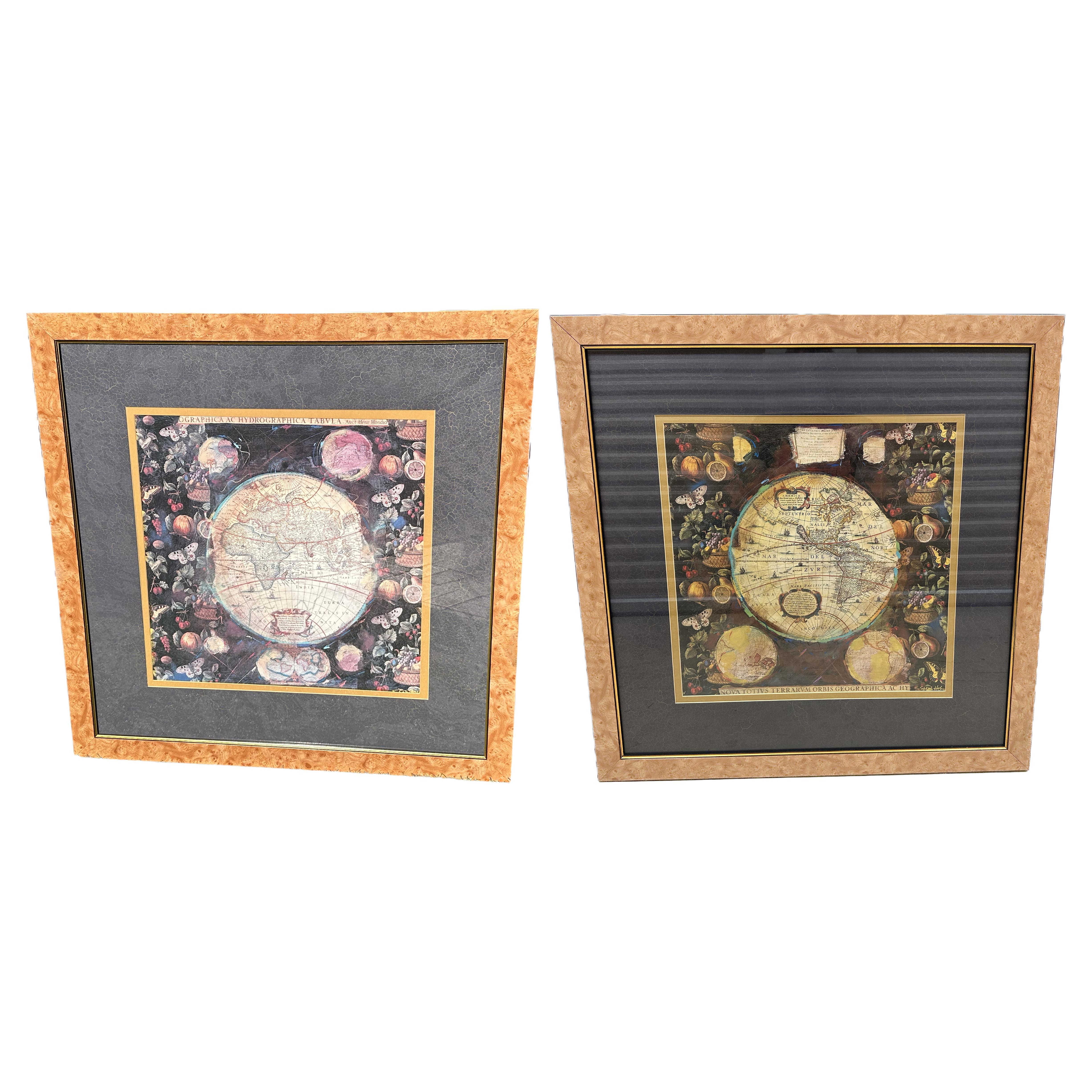
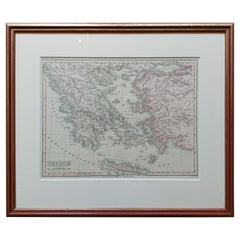 $306 Sale Price20% Off
 - Pair of Prints Depicting Antique World Maps Framed in Burl WoodLocated in Dallas, TXA pair of prints depicting antique world maps framed in burl wood. One picture contains a depiction of Africa, Europe, and Oceania. The other picture is of North and South America. T...Category
20th Century American Prints
MaterialsPaper
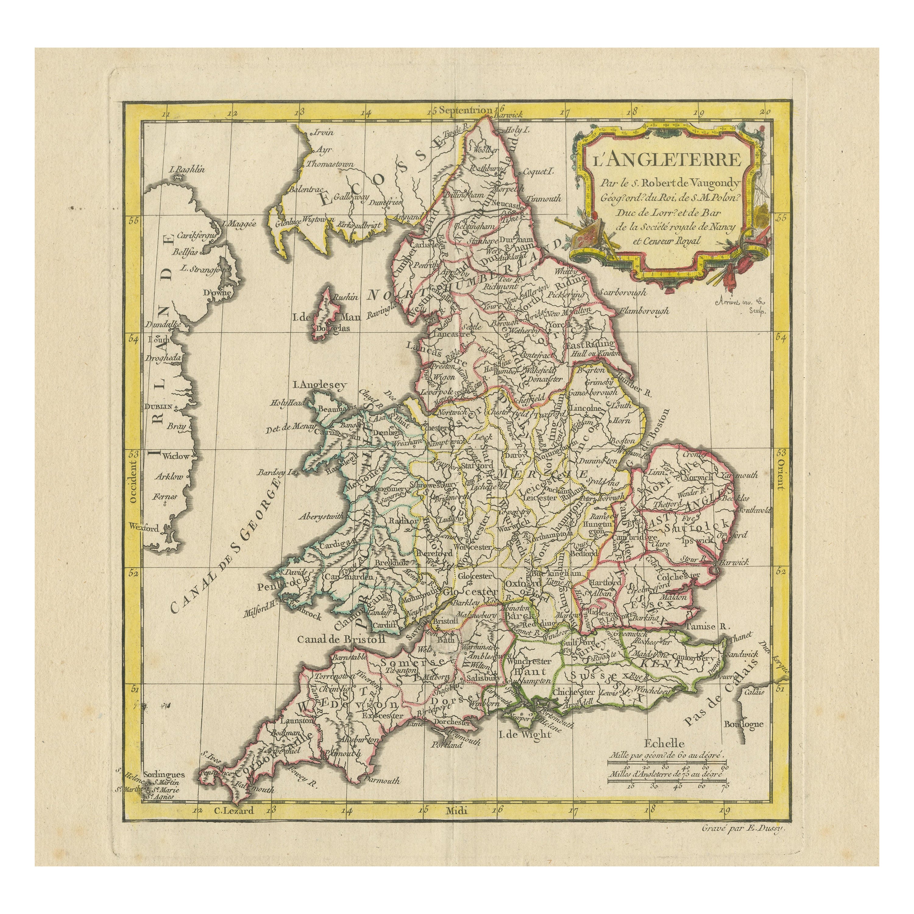
- Original Antique Map of England with Hand ColoringLocated in Langweer, NLAntique map titled 'Engand'. Original old map of England. Engraved by W. Milton. Published by John Mc. Gowan, circa 1829.Category
Antique Mid-19th Century Maps
MaterialsPaper


Recently Viewed
View AllMore Ways To Browse
Retro United States Map
Vintage Map Framed
Framed Vintage Maps
Pull Down School Chart
Used Wall Paneling
Chinois Antique
Antique Chinois
Japanese Wall Decor
Antique Egyptian Print
Egypt Print Antique
Antique Colored French Prints
Turkish Costumes
Wahlen Print
Bonnard 1860
Antique Horse Plates
Art Deco 1925 Poster
Train Decor
Military Engraving