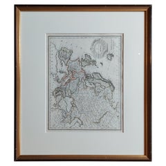
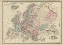
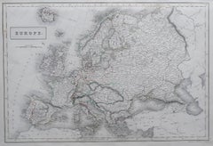
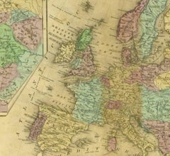
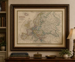
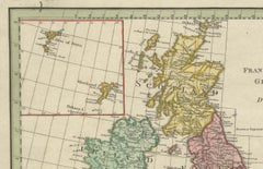
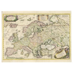
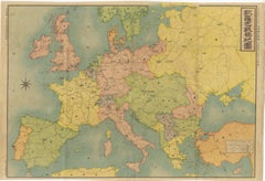
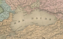
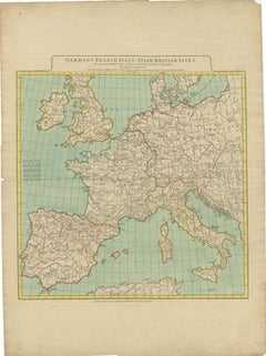
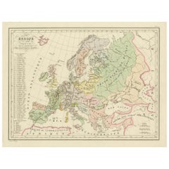
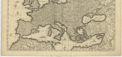
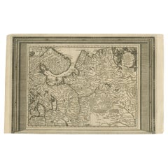
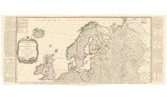
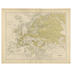
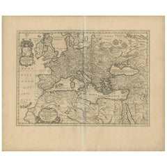
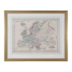
Antique Map of Europe by Lapie, '1809'
Located in Langweer, NL
Antique map titled 'Europe'. Original antique map of Europe by P.
Category
Antique Early 19th Century Maps
Materials
Paper
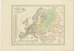
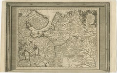
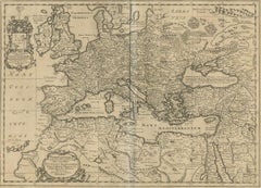
Antique Map of Europe by Lapie, '1809'
Located in Langweer, NL
Antique map titled 'Europe'. Original antique map of Europe by P.
Paper


$185Sale Price|20% Off
Antique Rain Map of Europe by Johnston '1850'
Located in Langweer, NL
Antique map titled 'Hyetographic or Rain Map of Europe'.
Paper

$139Sale Price|20% Off
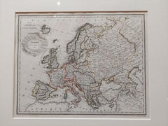
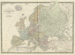
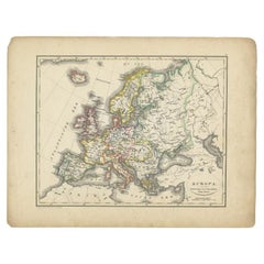
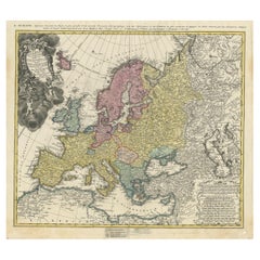
Antique Map of Europe by Balbi '1847'
Located in Langweer, NL
Antique map titled 'Europe'. Original antique map of Europe.
Paper

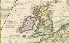
Original Antique Map of Europe, Arrowsmith, 1820
Located in St Annes, Lancashire
Great map of Europe Drawn under the direction of Arrowsmith.
Paper

$325Sale Price|20% Off
Antique Map of Europe by Johnson, '1872'
Located in Langweer, NL
Antique map titled 'Johnson's Europe'. Original map of Europe.
Paper

$348Sale Price|40% Off
Antique Map of Europe by Levasseur, '1875'
Located in Langweer, NL
Antique map titled 'Carte générale de l'Europe'. Large map of Europe.
Paper


$139Sale Price|20% Off
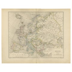
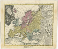
Antique Map of Europe by Lowry, 1852
Located in Langweer, NL
Antique map titled 'Europe'. Original map of Europe. This map originates from 'Lowry's Table Atlas constructed and engraved from the most recent authorities' by J.W.
Paper


$139Sale Price|20% Off
Antique Map of Europe by Wyld '1845'
Located in Langweer, NL
Antique map titled 'Europe'. Original antique map of Europe.
Paper
Antique Map of Europe by Levasseur 'c.1840'
Located in Langweer, NL
Antique map titled 'Europe'. Original antique map of Europe.
Paper


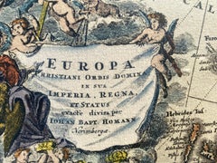
Antique Map of Europe by Hederichs, circa 1740
Located in Langweer, NL
Antique map titled 'Europa Christiani Orbis Domina'. Rare miniature map of Europe.
Paper


$146Sale Price|30% Off
Antique Map of Europe by R. Bonne, 1780
Located in Langweer, NL
A fine example of Rigobert Bonne and Guilleme Raynal’s 1780 map of Europe. Drawn by R. Bonne for G. Raynal’s Atlas de Toutes les Parties Connues du Globe Terrestre, Dressé pour l'His...
Paper


$232Sale Price|20% Off
Antique Map of Europe by W. G. Blackie, 1859
Located in Langweer, NL
Antique map titled 'Europe'. Original antique map of Europe.
Paper


$371Sale Price|20% Off
Antique Map of Europe by Keizer & de Lat, 1788
Located in Langweer, NL
Antique map titled 'Kaartje van Europa (..)'. Uncommon original antique map of Europe.
Paper
$2,033Sale Price|30% Off
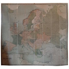
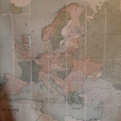
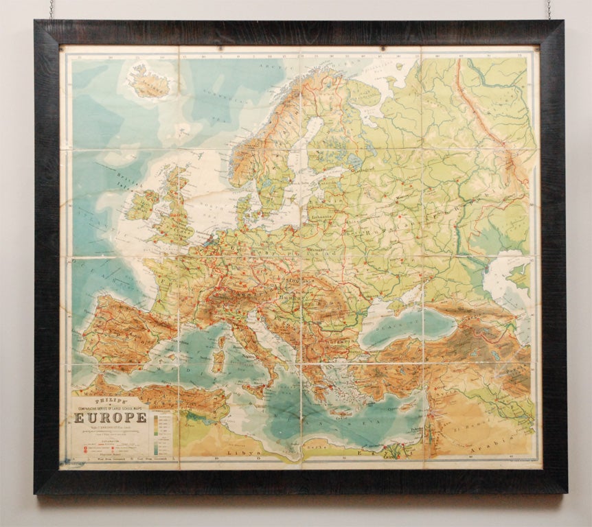
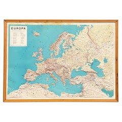
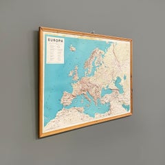
Large Wall Map of Europe by George Philip & Son, circa 1920
Located in Langweer, NL
Antique map titled 'Philips' New Commercial Map of Europe'.
Paper, Linen

Large Original Antique Map of Europe by Sidney Hall, 1847
Located in St Annes, Lancashire
Great map of Europe Drawn and engraved by Sidney Hall Steel engraving Original colour outline Published by A & C Black. 1847 Unframed Free shipping.
Paper

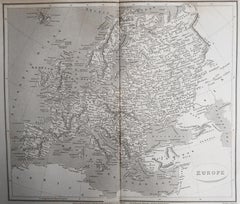
Map of Europe, 1844
Located in Houston, TX
Over 150 year old engraved map of Europe by Olney from 1844. Original hand color.
Ink, Watercolor, Handmade Paper


$984Sale Price|20% Off
Vintage Reproduction 17th Century Map of Europe, American, Cartography, Blaeuw
Located in Hele, Devon, GB
This is a vintage reproduction map of Europe. An American, paper stock cartography print in frame after the work by Blaeuw, dating to the late 20th century, circa 1970.
Glass, Wood, Paper

$427Sale Price|20% Off
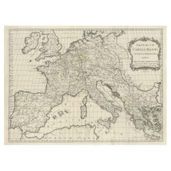
Antique Map of Europe by T. Kitchin, Charlemagne's Empire, Circa 1779
Located in Langweer, NL
Antique map titled 'Imperium Caroli Magni (..)'. Large antique map of Europe, showing the Empire of Charlemagne in the 8th Century.
Paper

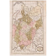
1849 Map of "Europaische Russland", 'Meyer Map of European Russia', Ric. R017
Located in Norton, MA
1849 Map of "Europaische Russland" ( Meyer Map of European Russia) Ric.r017 A lovely map of European Russia dating to 1849 by Joseph Meyer.
Paper


Antique Map of Europe by Pierre M. Lapie, Engraved, France, 1842
Located in Langweer, NL
Antique map titled 'Carte de l'Europe'. Map of Europe. This map originates from 'Atlas universel de géographie ancienne et moderne (..)' by Pierre M.
Paper

Nice Decorative Black and White Small Antique Map of Europe, 'circa 1834'
Located in Langweer, NL
Antique French map titled 'Europe par A.H. Dufour'. Uncommon map of Europe.
Paper
French Map of Europe by Cortambert – Russia, Scandinavia & Balkans, 1864
Located in Langweer, NL
French Map of Europe by Cortambert – Russia, Scandinavia & Balkans 1864 A large and finely detailed antique map of Europe published in Paris in 1864 under the direction of the Frenc...
Paper
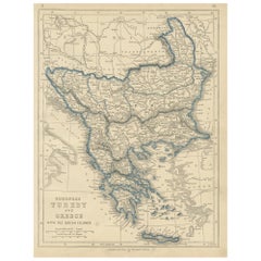
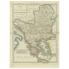
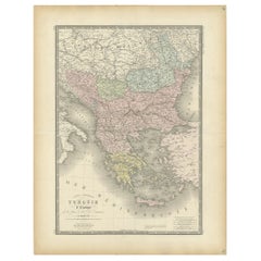
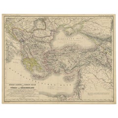
1852 Antique Map of European Turkey and Greece by J.W. Lowry
Located in Langweer, NL
Antique map titled 'European Turkey and Greece with the Ionian Islands'.
Paper
$845Sale Price|35% Off
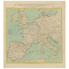
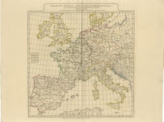
1788 Map of Europe - France, Italy, Spain, Germany, Great Britain & Ireland
Located in Langweer, NL
Title: "1788 Map of Europe - France, Italy, Spain, Germany, Great Britain & Ireland by D'Anville" Description: This detailed map of Europe, titled "First Part of the Map of Eu...
Paper
$176Sale Price|20% Off
Colorful Detailed Antique Map of Europe, Published in 1882
Located in Langweer, NL
"The Antique Map of Europe from 'The Comprehensive Atlas and Geography of the World,' published in 1882 by Blackie & Son, is a testament to meticulous cartography and scholarly preci...
Paper

Antique Map of European Russia by Tirion, c.1725
Located in Langweer, NL
Detailed map of European Russia. Artists and Engravers: Isaak Tirion, a Dutch publisher in Amsterdam, was born 1705.
Paper
$2,695Sale Price|20% Off
17th-Century Coronelli Map of Europe, Engraved Detail, Venice 1692
Located in Langweer, NL
Large 17th-Century Coronelli Map of Europe with Mythical Islands and Rich Detail This exceptional two-sheet map of Europe by Vincenzo Maria Coronelli, published in Venice in 1692,...
Paper
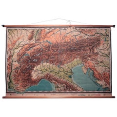

Vintage Swedish Topographic School Map of European Alps, Made in Sweden 1922
Located in Los Angeles, CA
Vintage Swedish Topographic School map of European Alps, Made in Sweden 1922 This vintage Swedish school map is so unique and a great example of why these are so collectible.
Linen, Wood, Paper
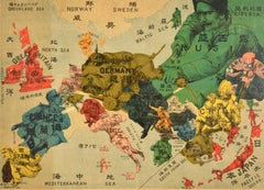
Antique Japanese Map of Europe, Russo-Japanese War, Meiji 1904
Located in Langweer, NL
Antique Japanese Map of Europe, Russo-Japanese War, Meiji 1904 This striking and historically charged Japanese map of Europe was issued in 1904 (Meiji 37) at the outbreak of the Rus...
Paper
Antique Double Map of Europe, Barbarian Invasions – Lapie, Paris, 1838
Located in Langweer, NL
Antique Double Map of Europe, Barbarian Invasions – Lapie, Paris, 1838 This striking double-sheet map of Europe was published in Paris in 1838 as part of the Atlas Universel de Géog...
Paper
Antique Map of Europe – Political Divisions by Andriveau-Goujon, Paris 1861
Located in Langweer, NL
Antique Map of Europe – Political Divisions by Andriveau-Goujon, Paris 1861 This beautifully engraved and hand-colored antique map of Europe was published in 1861 by the Parisian ca...
Paper

Antique Map of Europe from an Old Dutch School-Atlas, 1852
Located in Langweer, NL
Antique map titled 'Europa'. Map of Europe. This map originates from 'School-Atlas van alle deelen der Aarde' by Otto Petri.
Paper

Political Map of Europe – Nieuwe Hand-Atlas by Frijlink & van Otterloo, 1876
Located in Langweer, NL
Title: Political Map of Europe – Nieuwe Hand-Atlas by Frijlink & van Otterloo, 1876 Description: This 19th-century Dutch map titled “Europa” was published in 1876 in the Nieuwe Hand...
Paper
$1,374Sale Price|30% Off
Map of Europe Highlighting Ancient and Modern Geographical Divisions (1794)
Located in Langweer, NL
Map of Europe Highlighting Ancient and Modern Geographical Divisions (1794).
Paper
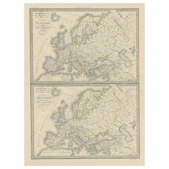

Two Antique Maps of Europe on One Sheet in Different Time Periods, 1842
Located in Langweer, NL
Antique map titled 'Carte de l'Europe'. Two maps of Europe.
Paper
Antique Map of European Russia, 1903, with Colorful Provincial Boundaries
Located in Langweer, NL
Title: Antique Map of European Russia, 1903, with Colorful Provincial Boundaries Description: This antique map, titled "European Russia," was engraved and published in 1903 by W. & ...
Paper
Antique Map of Europe in the 12th Century - Malte-Brun & Sarrazin, 1880
Located in Langweer, NL
Title: Antique Map of Europe in the 12th Century - Malte-Brun & Sarrazin, 1880 Description: This is an antique map titled "Europe en 1100," depicting Europe as it was around the 12...
Paper
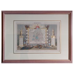
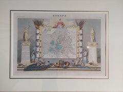
Map of Europe
Located in Roma, IT
Etching hand colored realized by Giovanni Maria Cassini in 1788. Table from "Nuovo Atlante Geografico Universale", published in Rome in 1788 at Calcografia Camerale. Very good cond...
Etching
Grand Map of Europe by Frederick de Wit, Circa 1690: A Baroque Era Masterpiece.
Located in Langweer, NL
This is an attractive historical map of Europe created by Frederick de Wit, published around 1690.
Paper
Antique Map of Europe with Elaborate Title Cartouche, c.1750
Located in Langweer, NL
Ordin des Mathematiques: Publiee par les Heritiers d'Homann L'An 1743'. This map depicts all of Europe including Iceland and parts of North Africa and Asia.
Paper
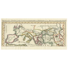
Phoenician Trade Routes – Antique Map of Europe and the Mediterranean, 1748
Located in Langweer, NL
Phoenician Trade Routes – Antique Map of Europe and the Mediterranean, 1748 This antique German map titled Vorstellung von Europa zur Erläuterung der Schifffahrt der Phönicier auf d...
Paper


Antique Map of Europe Stretching from Northern Africa to the Baltic Sea, 1719
Located in Langweer, NL
Original antique map of Europe stretching from northern Africa to the Baltic Sea.
Paper

Majestic Map of Europe by Andriveau-Goujon - Complete Continental View - ca.1849
Located in Langweer, NL
Majestic 19th Century Map of Europe by Andriveau-Goujon - Complete Continental View - Circa 1849 This magnificent and intricately detailed map of Europe, titled "Carte Physique et...
Paper

Antique Map of Europe in the Year 800 and 1500, Published in 1842
Located in Langweer, NL
Antique map titled 'Carte de l'Europe'. Two maps of Europe.
Paper

Antique Map of Europe, 1903, with Intricate Political Boundaries and Rich Detail
Located in Langweer, NL
Title: Antique Map of Europe, 1903, with Intricate Political Boundaries and Rich Detail Description: This antique map, titled "Europe," is a finely engraved and beautifully colored ...
Paper
$353Sale Price|20% Off
Antique Map of European Russia with Picture Frame Border
Located in Langweer, NL
Antique map titled 'La Moscovie Septentrionale (..)'. Decorative example of van der Aa's map of the northern part of European Russia.
Paper
Antique Map of Europe – Roman to Medieval Transition, d’Anville, c.1818
Located in Langweer, NL
Particularly effective when grouped with Roman and early medieval European maps. Technique: Engraving with original outline color Maker: Jean-Baptiste Bourguignon d’Anville (after),...
Paper

$1,700Sale Price|33% Off
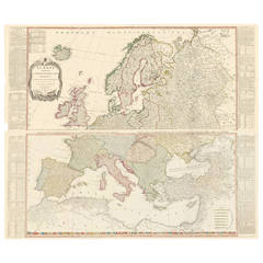
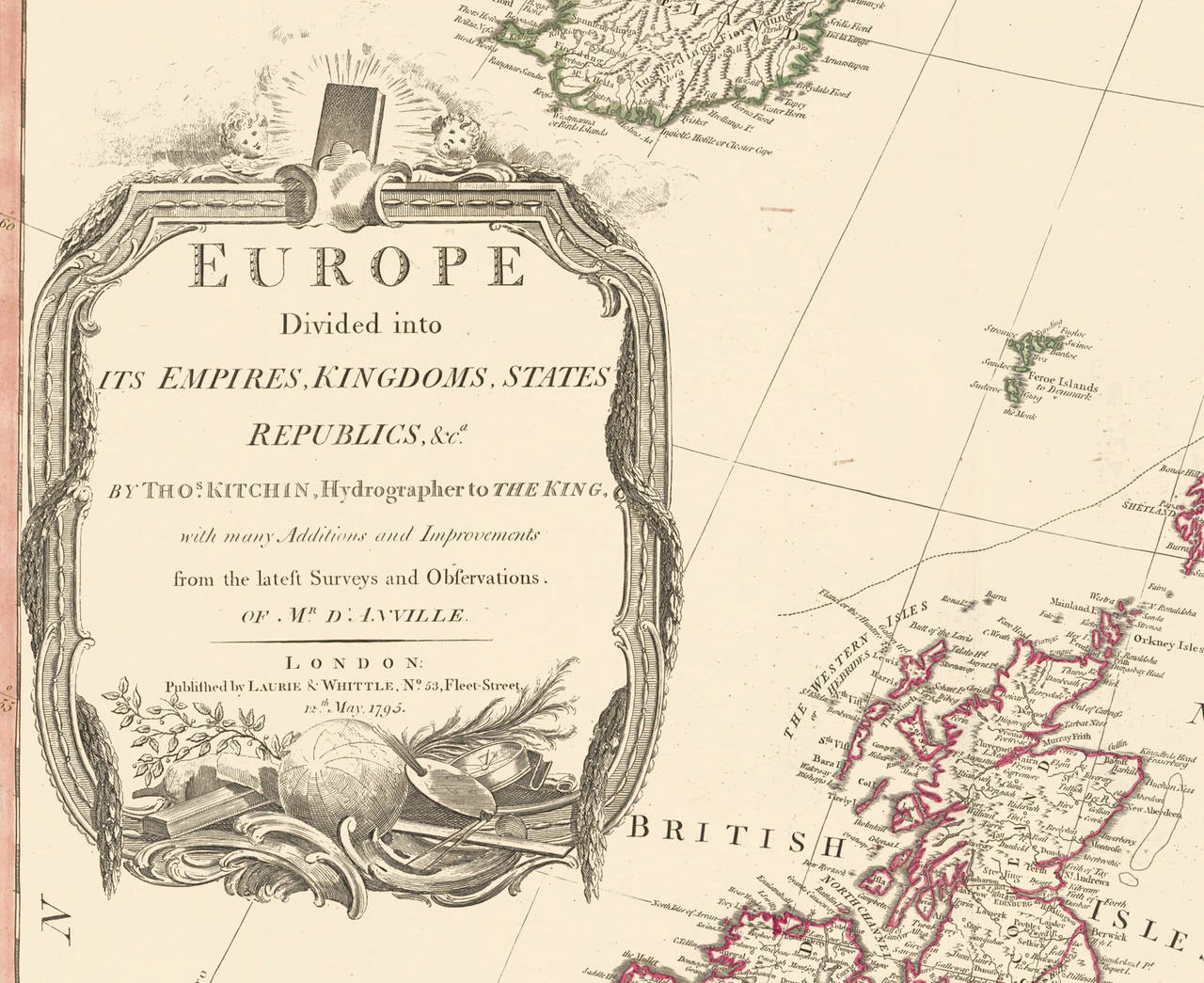
Two-Part Large Hand-Colored Map of Europe from 1798
By Thomas Kitchin
Located in New York, NY
Map of Europe printed on two separate sheets from A New Universal Atlas by Thomas Kitchin.
Paper

Vintage Map of Europe Italian Framed Print in Freijo Wood with Brass Rosettes
Located in Miami, FL
Vintage Map of Europe Italian Framed Print in Freijo Wood with Brass Rosettes Offered for sale is a vintage map of Europe beautifully framed under glass in Brazilian freijo wood ado...
Glass, Wood, Paper

$316Sale Price|20% Off
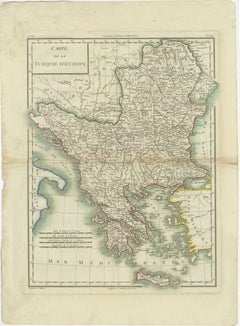
Antique Map of European Turkey and Greece, Copperplate Engraving, 1857
Located in Langweer, NL
European Turkey and Greece Map – Balkans and Ionian Islands 1857 This detailed antique print shows “Die Europäische Türkei, Griechenland und die Ionischen Inseln” meaning “European ...
Paper

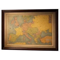
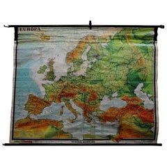
Vintage school wall map of Europe 1815-1871, Belgium 1950s
Located in Meulebeke, BE
Belgium / 1950 / school map Europe 1815-1871 / canvas, wood / Mid-century / vintage Vintage school map of Europe between 1815 and 1871, designed by C.J.P.
Canvas, Wood
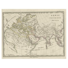
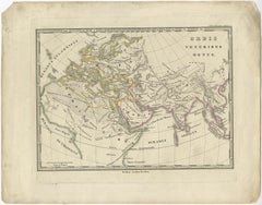
Antique Map of Europe and Part of Asia and Africa, 1848
Located in Langweer, NL
Antique map titled 'Orbis Veteribus Notus'. Old map of the European continent, also depicting a portion of Asia and Africa.
Paper
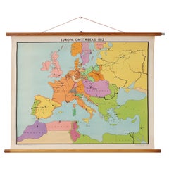
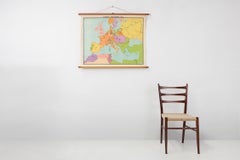
Vintage historical wall map of Europe around 1812, Belgium 1950s
Located in Meulebeke, BE
Belgium / 1950 / school map Europe 1812 / canvas, wood / Mid-century / vintage Beautiful vintage wall-mounted historical map of Europe around 1812, designed by Inst.
Canvas, Wood
Genuine Antique Map of European Turkey by Pierre Antoine Tardieu, 1802
Located in Langweer, NL
This is an original antique map titled "Carte de la Turquie d'Europe," which depicts the European territories of the Ottoman Empire.
Paper

Finely Engraved Antique Map of Europe with inset of America, c.1745
By Guillaume De L'Isle
Located in Langweer, NL
Finely engraved historical map with a profusion of details. It shows western Europe and the northern Mediterranean basin as far as Crete.
Paper
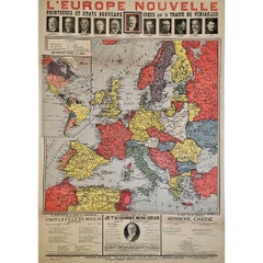
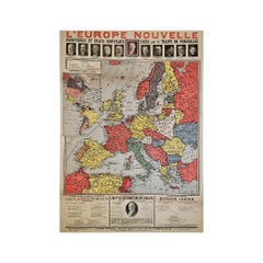
Original poster, titled “L’Europe Nouvelle” - political map of Europe
Located in PARIS, FR
This fascinating original poster, titled “L’Europe Nouvelle”, presents a vivid political map of Europe and the world as reshaped by the Treaty of Versailles, signed in 1919 at the co...
Linen, Paper, Lithograph

Physical Map of Europe – Nieuwe Hand-Atlas by Frijlink & van Otterloo, 1876
Located in Langweer, NL
The map uses fine lithographic lines with delicate hand-coloring to outline political boundaries—yellow for the Americas, pink for Asia, and blue for Europe.
Paper
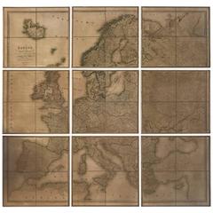
Nine-Piece Map of Europe
Located in New York, NY
Vintage map of Europe divided into nine separate frames which each have dimensions of D.75" x W. 20.75" x H. 20".
Paper
Two-Part Large Hand-Colored Map of Europe from 1798
By Thomas Kitchin
Located in New York, NY
Map of Europe printed on two separate sheets from A New Universal Atlas by Thomas Kitchin.
Paper
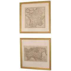
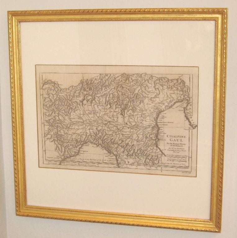
Pair of 18th Century French Maps of Europe
Located in Corona Del Mar, CA
A pair of a series of maps of Europe after the conquest of Caesar. Plotted by Sir D'Anville who was geographer to the King of France, Louis XV.
Rare 1710 Hand-Colored Map of Europe
By Frederick de Wit
Located in La Jolla, CA
The inset map on the left shows the continuation of the Mediterranean.
Paper

1806 Brightly and Kinnersley Map of Euro Russia
Located in Pataskala, OH
An interesting early 19th century map of European Russia, largely prior to the imperial expansions.


Unavailable
H 47.25 in W 31.5 in
Original Antique Poster French Infantry In Battle WWI Hindenburg Line Europe Map
Located in London, GB
Original antique World War One poster - French Infantry In Battle / L'Infanterie Francais Dans La Bataille - featuring an image of a French soldier in uniform wearing a winter coat a...
Paper

Unavailable
H 41.34 in W 29.93 in
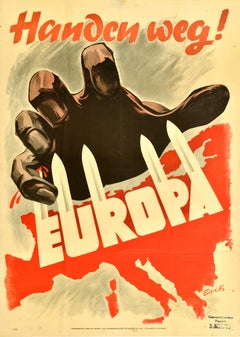
Original Vintage WWII Poster Handen Weg! Europa Hands Off Europe War Netherlands
Located in London, GB
Original vintage World War Two poster - Hands off Europe / Handen weg! Europa - featuring a dramatic illustration depicting a giant hand grasping at the map of Europe defending itsel...
Paper
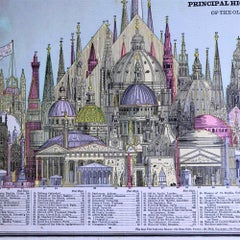
1887 Engraving of Old World Buildings Framed
By George F. Cram
Located in Pataskala, OH
The Washington Monument is the tallest one and many are places of worship and other significant buildings from around Europe are shown. This is perfect for an architects office, libr...
Paper
Unavailable
H 20.08 in W 28.35 in
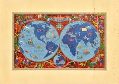
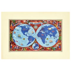
Original Vintage Travel Poster Air France Planisphere Illustrated Map Boucher
By Lucien Boucher
Located in London, GB
Colourful depiction of the world featuring planes, sailing ships and mythical sea creatures with the Air France route lines marked around the world, a decorative sun on the equator l...
Paper
Unavailable
H 39.38 in W 24.81 in
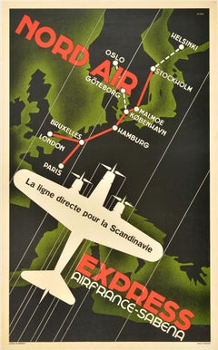
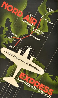
Original Vintage Travel Poster Nord Air Express Air France Sabena Art Deco
Located in London, GB
Original vintage travel advertising poster for Nord Air Express Air France Sabena featuring an Art Deco design showing a tri-engine propeller plane flying at speed over a map of Euro...
Paper

Unavailable
H 0.04 in W 9.85 in D 14.57 in
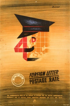
Original Vintage General Post Office Poster Foreign Letter Postage Rate GPO
Located in London, GB
Original vintage advertising poster for the GPO General Post Office - 4d Minimum Foreign Letter Postage Rate - featuring a stylised image of a postman wearing a hat with the 4 and D ...
Paper


Neil Young With Booker T. + The MG's Vintage 1993 Tour Tee Shirt
Located in Long Island City, NY
This is a promotional t-shirt for the 1993 World Tour of Neil Young + The MGs, with North American dates listed and a map of Europe of the back. Stated size L. Bust: 22.5" Botto...
Unavailable
H 22.05 in W 29.93 in
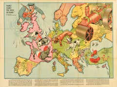
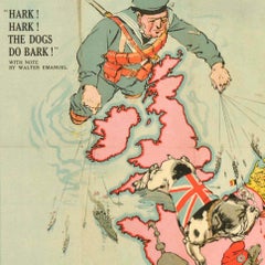
Original Antique World War One Poster Hark The Dogs Do Bark WWI Dogs Of War
Located in London, GB
With note by Walter Emanuel - featuring a serio-comic map of Europe at war with military soldier caricature portraits and some countries represented by dogs with Russia as a bear, a ...
Paper
Unavailable
H 33.67 in W 20.48 in
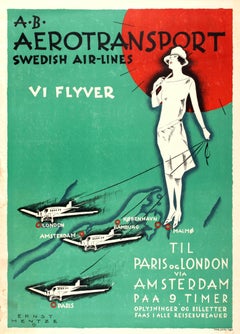
Original Art Deco Travel Advertising Poster: AB Aerotransport Swedish Air-Lines
By Ernst Mentze
Located in London, GB
Great image by Ernst Mentze showing an elegant lady wearing a fashionable dress and hat, holding a large red umbrella in one hand and three planes on leashes in the other, each plane...
Paper
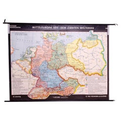
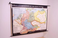
German Vintage school map of Central Europe, 1961
Located in Prague 8, CZ
Old Vintage school paper map of Central Europe. It was produced in 1961 in Germany.
Wood, Paper
Unavailable
H 22.25 in W 30.12 in
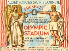
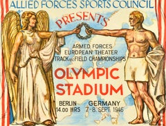
Original Vintage Military Poster Track And Field Allied Forces Sports Council
Located in London, GB
Original vintage military sport poster - Allied Forces Sports Council presents Armed Forces European Theater Track and Field Championships Olympic Stadium Berlin Germany - starting a...
Paper
![Carte generale des costes de l'Europe sur l'ocean [...].](https://a.1stdibscdn.com/archivesE/upload/a_5923/1508837429054/cb3798_master.jpg?width=240)
Unavailable
H 24.41 in W 36.03 in
Carte generale des costes de l'Europe sur l'ocean [...].
By Alexis Hubert Jaillot
Located in Zeeland, Noord-Brabant
Carte generale des costes de l'Europe sur l'ocean comprises depuis Dronthem en Norvege jusques au Detroit de Gibraltar.' - (General coastal map of Europe and the oceans from Dronthem...
Engraving
Unavailable
H 10.4 in W 14.06 in
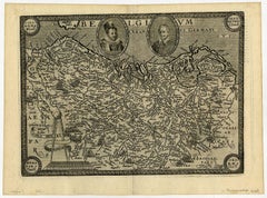
Belgium - A map of North-West Europe, centered on Belgium and the Netherlands.
By Johann Busschemacher
Located in Zeeland, Noord-Brabant
Etching/engraving on hand laid (verge) paper. A map of North-West Europe, centered on Belgium and the Netherlands.
Engraving, Etching
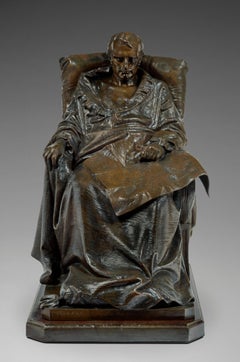

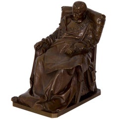
Last Days of Napoleon in St-Helena
Located in Paris, FR
Sitting on his chair, the fallen Emperor holds in his hands an open map of Europe on his knees, contemplating his past conquests and glory.
Bronze


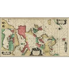
A Chart of the Sea Coast from England to the Streights.
Located in Zeeland, Noord-Brabant
A map of the European coast, with England on the left and the Straight of Gibraltar on the right edge.
Engraving
Unavailable
H 41.34 in W 29.53 in
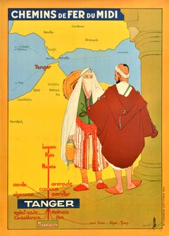
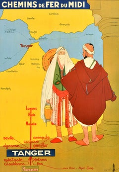
Original Vintage Train Travel Poster Tanger Morocco Chemins De Fer Du Midi
Located in London, GB
Original vintage train travel poster advertising the Chemins de Fer du Midi railway company to Tanger / Tangier in Morocco featuring a colourful illustration of a lady and man in tra...
Paper

Unavailable
H 23.63 in W 15.75 in
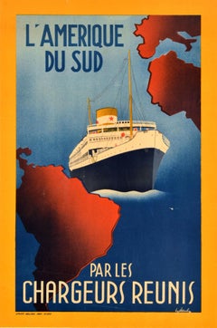
Original Vintage Travel Poster Amerique Du Sud Par Les Chargeurs Reunis Cruise
Located in London, GB
Original vintage cruise travel poster for South America by Chargeurs Reunis / L'Amerique Du Sud par les Chargeurs Reunis featuring a ship sailing on the Atlantic Ocean between map sh...
Paper

Unavailable
H 19.69 in W 12.21 in
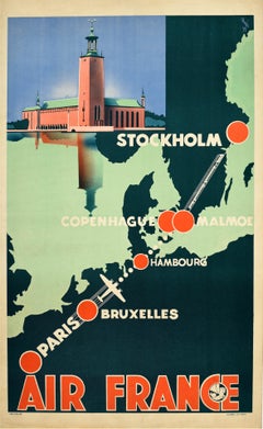
Original Vintage Travel Poster Air France Stockholm Paris Art Deco Scandinavia
Located in London, GB
Original vintage travel poster for Air France promoting their Scandinavia flight route from Paris to Stockholm by plane and train via Brussels Hamburg Copenhagen and Malmo - featurin...
Paper

1674 Map of Europe
Located in Milford, NH
Hand colored map of Europe dated 1674. Large proportion with custom framing.
Antique Map of Europe by J. Janssonius, circa 1650
Located in Langweer, NL
An uncommon map of Europe prepared by Nicolas Blankaart, extending to the Middle East and the northern tip of Africa, as it was during the time of the Roman Empire.
Paper

Sold
H 10.12 in W 12.84 in D 0.01 in
Relief Atlas Map of Europe by Hachette – Antique French Map c.1883
Located in Langweer, NL
Antique Map of Europe – Physical Relief Map by Hachette, circa 1883 Description: This antique map titled “Europe Physique” was published by Hachette in Paris around 1883 and origina...
Paper
Large English Map of Europe, Circa 1920
Located in Los Angeles, CA
A Large Framed Map of Europe from the London Geographical Institute.

Sold
H 13.59 in W 8.04 in D 0.01 in
1574 Sebastian Münster Woodcut Map of Europe: Early View of the Continent
Located in Langweer, NL
Title: Early Woodcut Map of Europe from Münster's Cosmographia, 1574 This is an original early woodcut map of Europe by the famed cartographer Sebastian Münster, printed in 1574 by ...
Paper

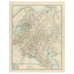
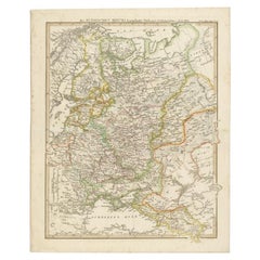
Antique Map of European Russia by A.K. Johnston, 1865
Located in Langweer, NL
Antique map titled 'European Russia'. This map originates from the ‘Royal Atlas of Modern Geography’ by Alexander Keith Johnston.
Paper

Antique Map of Europe Made by German Geographer, c.1870
Located in Langweer, NL
Antique map titled 'Europa'. Old map of the European continent.
Paper
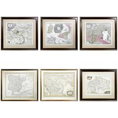

Six Framed Maps of Europe
Located in Essex, MA
One Mantua by Baumeister , Pamplona , Sicily by Matth. Seutter , Venice by Matth. Seuttero , Hungary by Guillaume De Lisle , Spain By De Lisle.

Giltwood Framed Matted Map / Europe
Located in Tarry Town, NY
Giltwood framed and matted library / study room map of Europe. Each map is in great condition. Frame is about 32" Long x 25.5" wide.
Giltwood, Paper
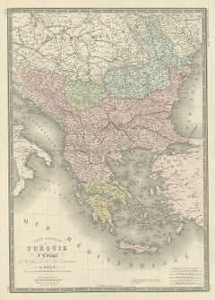
Antique Map of Turkey in Europe by Levasseur, '1875'
Located in Langweer, NL
Antique map titled 'Carte générale de la Turquie d'Europe'.
Paper


Antique Map of Russia in Europe by Johnston, 1882
Located in Langweer, NL
Antique map titled 'European Russia'. Old map of Russia in Europe.
Paper

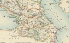
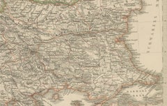
Antique Map of Southeast Europe by Kiepert, c.1870
Located in Langweer, NL
Old map of Southeast Europe. This map originates from 'H.
Paper
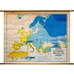
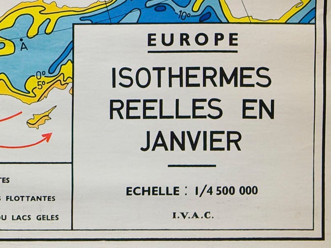
Vintage Belgian School Map of Isotherms across Europe in January
Located in Houston, TX
Map of winds and temperature in Europe in January.
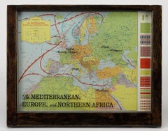
Hammond's Map of the Mediterranean, Europe, and Africa, circa 1941
Located in Colorado Springs, CO
This is an original WWII folding folio map of the Mediterranean, Europe, and Africa. The map was one of six foldout maps in a color lithographic folio titled "Battle Maps: Covering A...

German Antique Map of the Russian Empire in Europe, c.1825
Located in Langweer, NL
Original antique map of the Russian Empire in Europe. This map originates from 'Stielers Handatlas'.
Paper
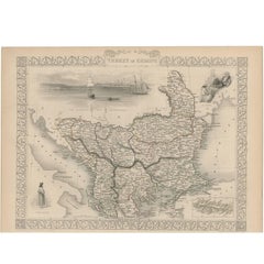

Antique Map of Turkey in Europe by J. Tallis, circa 1851
Located in Langweer, NL
A highly decorative and detailed mid-19th century map of 'Turkey in Europe' (The Balkans: northern Greece, Macedonia, Bulgaria, Albania, Serbia, Bosnia-Herzogovina, southern Romania)...
Paper


Charming Miniature Map of Asia Minor or Turkey in Europe, 1685
Located in Langweer, NL
Antique map titled 'Natolia quae olim Asia Minor.' Charming miniature map of Asia Minor or Turkey in Europe from the pocket atlas 'Introductionis in Universam Geographiam tam Veterem...
Paper
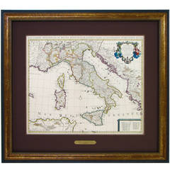
Hand-Colored Map of Southern Italy, circa 1720
Located in Colorado Springs, CO
This elegantly engraved, hand-colored map focuses on the Italian peninsula from Abruzzo down to the Northeastern section of Sicily. Political divisions, towns and cities, rivers and ...
1730 Dutch Map of the Italian Pennisula and Mediterranean
Located in Colorado Springs, CO
Exceptional 1730 Dutch map, entitled: L'Italie Dressee sur les Observations de Mrs. de l'Academie Royale des Sciences..., which shows all of Italy, to include Sicily, Sardinia and Co...


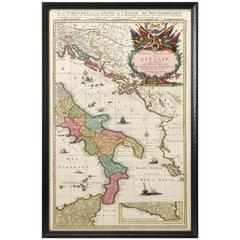
Antique Map of Southern Italy, Hand-Colored, circa 1720
Located in Colorado Springs, CO
Presented is an original map of the Eastern Part of Italy, circa 1720. The map displays the kingdoms of Naples and Sicily, showing the southern half of Italy and much of the Balkans....
Paper
Sold
H 12.09 in W 16.15 in D 0.04 in
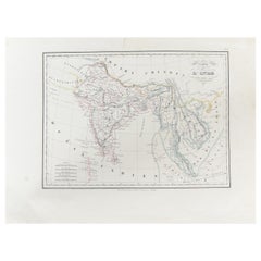
Antique Carte de L'Inde Myanmar, Malaysia Vietnam Map of Asia the Chinese Empire
Located in Amsterdam, Noord Holland
Additional information: Type: Map Country of Manufacturing: Europe Period: 18th century Qing (1661 - 1912) Condition: Overall Condition A (Good): Some trace of use.
Paper
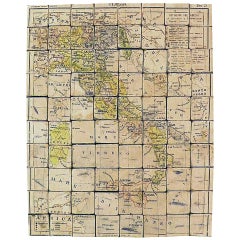

Puzzle Atlas with Maps, Italy, circa 1900
Located in Milan, IT
80 little wooden cubes covered with printed paper that depending on which side they form the maps of Italy, Europe, North America, South America, Asia and Africa.
Wood, Paper
Sold
H 28.94 in W 38.98 in D 0.79 in
Italian modern Topographic geographical map in wood frame of Europe, 1950s-1990s
Located in MIlano, IT
Italian modern Topographic geographical map in wood frame of Europe, 1950-1990s Three-dimensional geographical map of Europe on paper.
Wood, Paper

Sold
H 62.21 in W 80.32 in D 0.79 in
Fantastic School Map Physical View of Europe Wall Chart Poster Print Decoration
Located in Berghuelen, DE
An impressive wall chart depicting a map of Europe. Used as teaching material in German schools.
Canvas, Wood, Paper
Sold
H 35.04 in W 23.23 in D 0.04 in
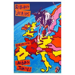
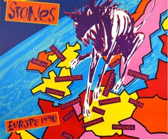
Original Vintage Music Concert Poster Rolling Stones Urban Jungle Europe Tour
Located in London, GB
Original vintage music concert poster for the English rock band The Rolling Stones Urban Jungle tour to promote their Steel Wheels album released in 1989 featuring a graffiti style i...
Paper
Sold
H 29.53 in W 21.66 in D 0.04 in
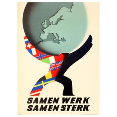
Original Vintage ERP Marshall Plan Poster - Europe Work Together Strong Together
Located in London, GB
Mettes depicting a shadow figure covered in European flags holding up a globe showing the map of Europe with chains linking the text together below.
Paper
Sold
H 18.51 in W 24.81 in D 0.04 in
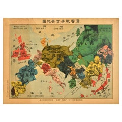
Original Antique World War One Humoros Wap Map Of The World WWI Japan Caricature
Located in London, GB
Original antique World War One satirical map of Europe and Asia portraying the outbreak of WWI featuring colourful caricatures and illustrations of the countries including Germany as...
Paper
Sold
H 20.08 in W 28.75 in D 0.04 in
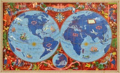
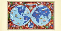
Original Vintage Air France Poster Illustrated Map World Travel Art Planisphere
By Lucien Boucher
Located in London, GB
Colourful depiction of the world featuring planes, sailing ships and mythical sea creatures with the Air France route lines marked around the world, a decorative sun on the equator l...
Paper


Construction & Garment Worker
By Robert Cronbach
Located in Long Island City, NY
While Adolf Hitler hosted a conference to redraw the map of Europe, trials of Soviet leaders began in the Soviet Union.
Bronze


Sold
H 14.57 in W 9.85 in D 0.04 in
Original Vintage General Post Office Poster Foreign Letter Postage Rate GPO
Located in London, GB
Original vintage advertising poster for the GPO General Post Office - 4d Minimum Foreign Letter Postage Rate - featuring a stylised image of a postman wearing a hat with the 4 and D ...
Paper
Sold
H 39.38 in W 24.41 in D 0.04 in
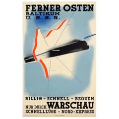
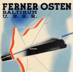
Original Vintage Poster Nord Express Far East Baltic USSR Warsaw Railway Train
Located in London, GB
Original vintage travel poster for Ferner Osten Baltikum USSR Billig Schnell Bequem nur durch Warschau Schnellzuge Nord-Express / Far East Baltic States USSR Cheap Fast Convenient th...
Paper

Sold
H 26.78 in W 18.9 in D 0.04 in
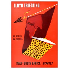
Original Vintage Cruise Travel Poster Lloyd Triestino Europa Italy South Africa
Located in London, GB
Europa Italy South Africa Express - featuring a dynamic design against a red background showing a map of Europe and Africa highlighting Italy and the eastern coastline of Africa hang...
Paper


Sold
H 7.25 in W 6.63 in D 5 in
Fine Bronze Sculpture of "Last Days of Napoleon" by Vincenzo Vela, Barbedienne
By F. Barbedienne Foundry, Vincenzo Vela 1
Located in Shippensburg, PA
His right hand rests languidly on an arm of the chair his left nervously clutched rests on a map of Europe of 1814 spread on his lap, that Europe whose boundary lines he had so often...
Bronze

Sold
H 7.5 in W 5 in D 6.88 in
French Bronze Sculpture "Last days of Napoleon" by Vincenzo Vela & F Barbedienne
By F. Barbedienne Foundry, Vincenzo Vela 1
Located in Shippensburg, PA
His right hand rests languidly on an arm of the chair his left nervously clutched rests on a map of Europe of 1814 spread on his lap, that Europe whose boundary lines he had so often...
Bronze


Original Antique Map of Ancient Greece, Achaia, Corinth, 1786
Located in St Annes, Lancashire
Great map of Ancient Greece. Showing the region of Thessaly, including Mount Olympus Drawn by J.D. Barbie Du Bocage Copper plate engraving by P.F Tardieu Original hand color...
Paper
It's hard to resist the allure of a beautiful pool. So, go ahead and daydream about whiling away your summer in paradise.
It’s never too early for good design. These interiors combine elevated furnishings and a youthful spirit, resulting in spaces that are at once elegant and whimsical.
Produced in 1843, the well-preserved volume is evidence of the author's exacting specifications.
New or old, the coverlets add old-time charm to any space.
Get into the games! These items celebrate the events, athletes, host countries and sporting spirit.
French trendsetter and serial collector Daniel Rozensztroch tells us about his obsession with objects related to seafaring men.
The sought-after designer worked with the team at Hoffman Creative to produce a monograph that beautifully showcases some of Studio Shamshiri's most inspiring projects.
Italian writer and collector Umberto Pasti opens the doors to his remarkable cave of wonders in North Africa.