Items Similar to Asprey & Co Bond Street c1930s Trade Catalogue

Want more images or videos?
Request additional images or videos from the seller
1 of 21
UnknownAsprey & Co Bond Street c1930s Trade Catalogue
About the Item
[195] pp.
New Bond Street
c1930s from Bond Street London
Vintage luxe carriage-trade catalogue
11 3/8" x 8 7/8"
- Dimensions:Height: 11.38 in (28.91 cm)Width: 8.88 in (22.56 cm)
- Medium:
- Period:
- Condition:
- Gallery Location:Bristol, CT
- Reference Number:
About the Seller
4.7
Vetted Seller
These experienced sellers undergo a comprehensive evaluation by our team of in-house experts.
Established in 2000
1stDibs seller since 2019
97 sales on 1stDibs
Typical response time: <1 hour
- ShippingRetrieving quote...Ships From: Bristol, CT
- Return PolicyThis item cannot be returned.
More From This SellerView All
- Distillerie De Liqueurs E. Eppe c1898 Advert SignageLocated in Bristol, CTOriginal liqueur advert signage in bright pink & sky blue colours w/ silver bottles & a stamp (LR) dated 1898 Art Sz: 11 3/4"H x 17 1/2"W Frame Sz: 15 1/4"H x 21"WCategory
19th Century More Art
MaterialsPaper
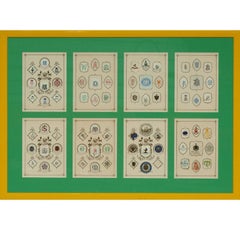
- Bespoke Stationary LetterheadsLocated in Bristol, CTRare (8) panel/ (9) per plate framed bespoke stationary letterhead c1930s crests together with (3) preparatory sheets mounted on verso all custom framed Image Sz: 14 1/4"H x 22 1/4"...Category
1930s More Art
MaterialsPaper
- Decoupage Floral Lily of The ValleyLocated in Bristol, CTPaper c1970s mosaic depicting a decoupage lily of the valley floral still life by BJ (signed LL) Bobby Mitchell of 345 East 57th St Sutton Pl NYC ...Category
1970s More Art
MaterialsPaper
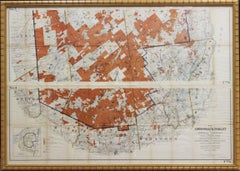
- 1911 No's 3 & 4 Map Of The Adirondack ForestLocated in Bristol, CTMap Sz: 38 1/2"H x 55 1/2"W Frame Sz: 40"H x 57"WCategory
1910s More Art
MaterialsPaper
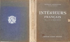
- Interiers Francais Presentes Par Jean Badovici, ArchitecteLocated in Bristol, CTEditions Albert Morance 1925 11" x 9 3/8" Lacking plate 8, 26, 30 & 36 Jean Badovici (6 January 1893 – 17 August 1956) was a French architect and ar...Category
Early 20th Century More Art
MaterialsPaper, Gouache
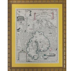
- Mount Desert Island Region of The Maine Coast 1941Located in Bristol, CTClassic and rare map of the Mt. Desert Island Region of the Maine Coast c1941 by Luther S. Phillips Map Sz: 19 1/2"H x 15 1/2"W Frame Sz: 25 1/4"H x ...Category
1940s More Art
MaterialsLithograph, Paper

You May Also Like
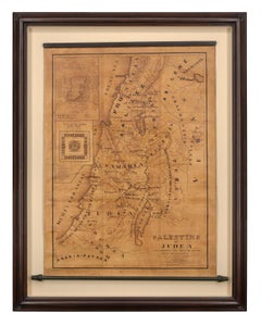
- Map of Palestine or Judea, Illustrating the History of the New TestamentBy Rev. Nathan B. RogersLocated in New York, NYPen and ink on paper, laid down on canvas, mounted to wooden scroll bars Signed and dated lower right: “Drawn by N. B. Rogers August. 1843” Inscribed with an ownership inscription on the verso: Rev. E. D. Daniels, Palmer, Mass. Provenance: Rev. Eugene Davidson Daniels, Palmer, Massachusetts, 1871 This extraordinary manuscript map is a rare survivor of the devotional and educational culture of New England in the first half of the nineteenth century. Although at first glance resembling a large-scale engraving or printed publication, this precisely rendered wall map was entirely drawn by hand, the product of meticulous research by a minister working in isolation in rural Maine. The map shows New Testament era cities, towns, tribal areas, and political borders as well as physical features such as rivers, lakes, mountains, and hills (indicated by half-tone cross-hatching). On to this geographically accurate rendering of the Holy Land, Rogers has located and inscribed significant locales mentioned in the Gospels and has annotated these places with relevant citations from the Bible. He further records these by plotting the travels of Jesus on what resemble a series of trails across the Holy Land. Each is distinguished by a different pattern of dots and dashes – correlated to an explanatory table at the lower right. From this we know that these lines document the “Flight into Egypt and return,” “Travels of Christ from Nazareth to Jerusalem and return,” “Travels from the commencement of his Ministry to the first Passover,” “Travels from the first and the second Passover,” “Travels from Jerusalem to Galilee after the 2nd Passover,” and “Travels from the third Passover to the Crucifixion.” An inset map of “Jerusalem...Category
19th Century More Art
MaterialsCanvas, Paper, Ink, Pen
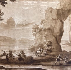
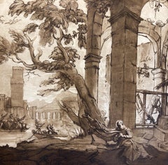
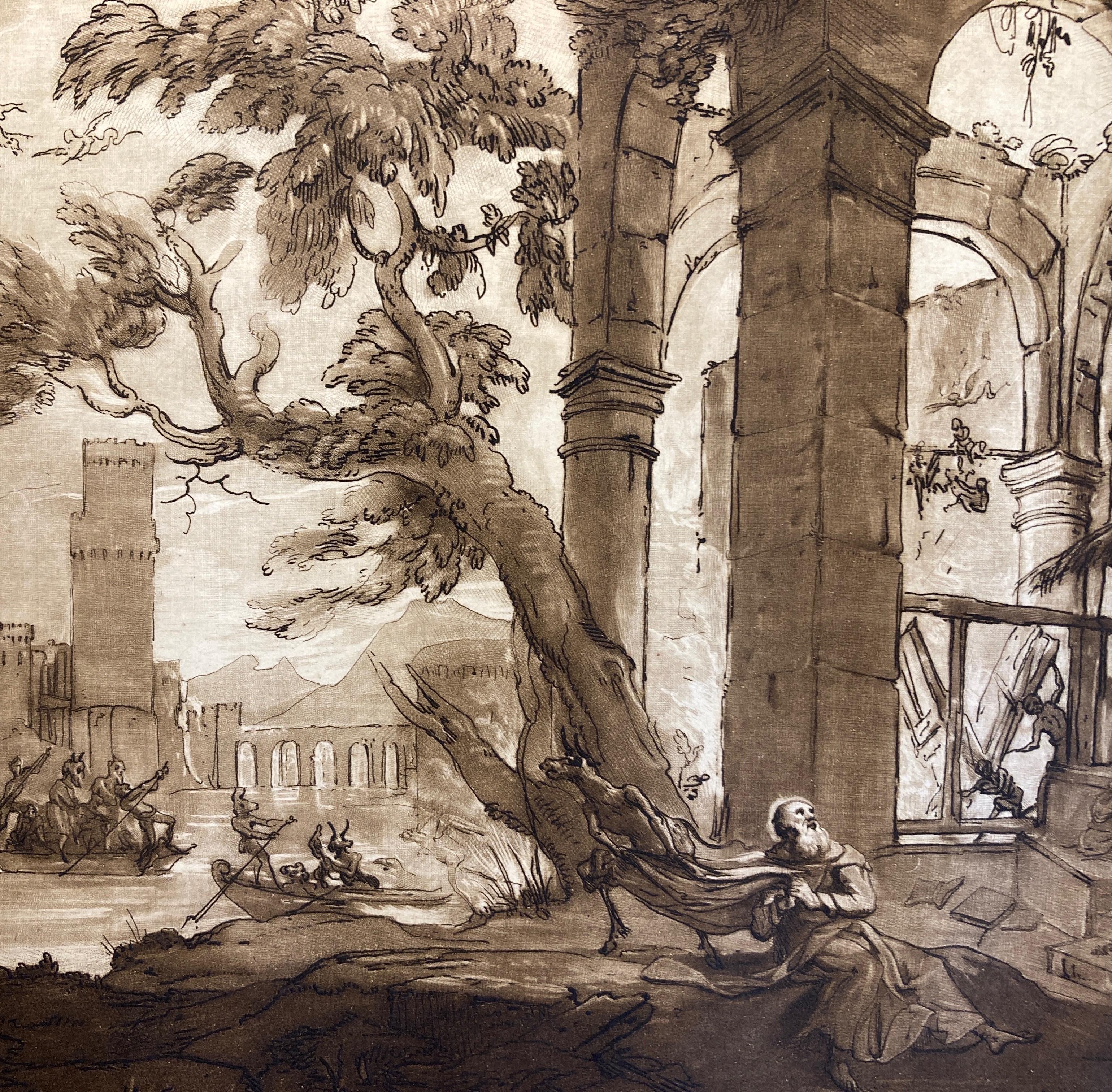
- Claude Lorrain Landscape with Hermes and the Muses, Aquatint by Richard EarlomBy (after) Claude Lorrain (Claude Gellée)Located in Greven, DEClaude Lorrain landscape with the God Hermes, Amor and the Muses. Richard Earlom aquatint c1817 by Lorrain, Claude le/Earlom, Richard Countryside with ...Category
19th Century Baroque Landscape Prints
MaterialsPaper
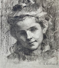
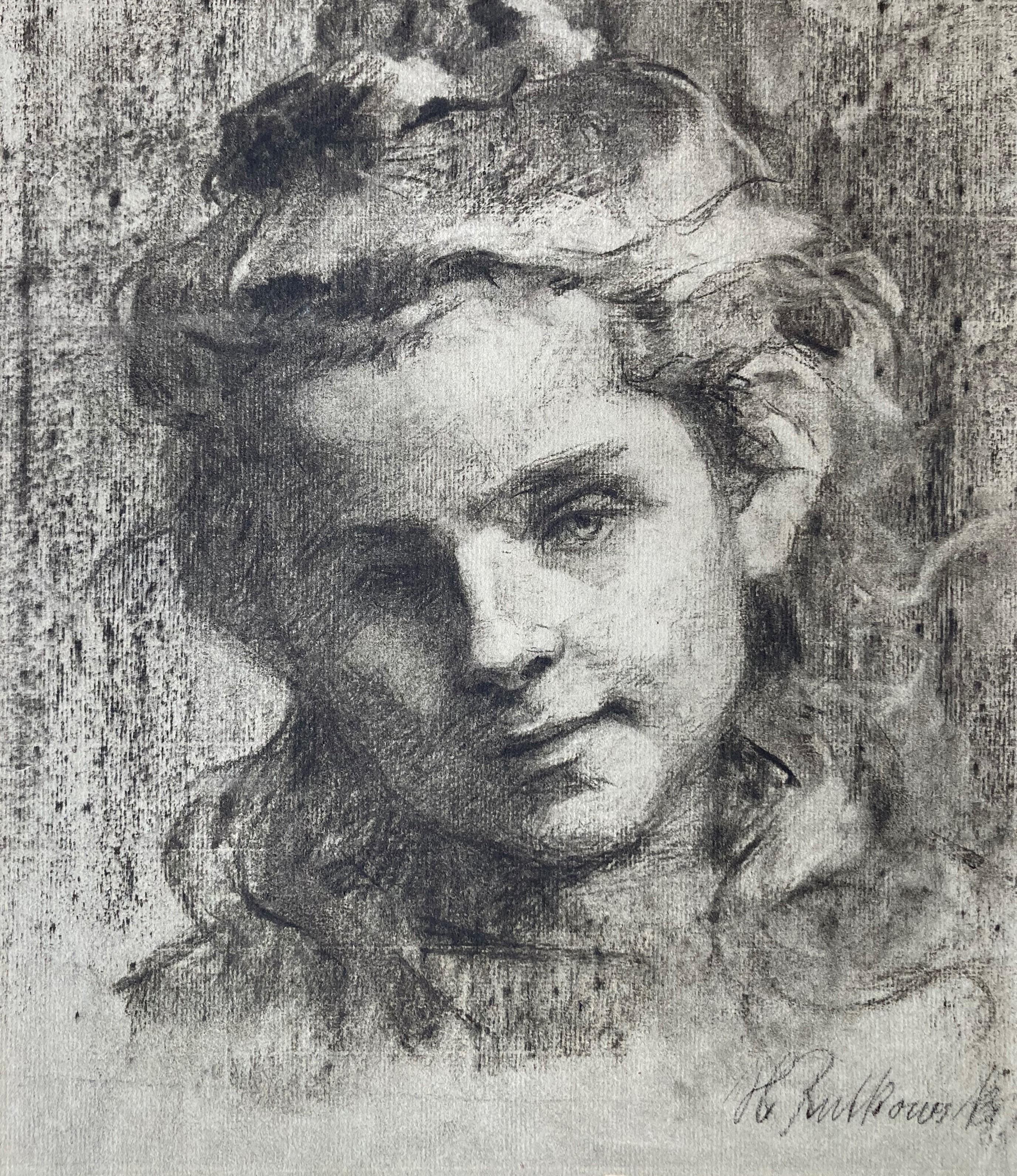
- German Female Artist, Study or Portrait of a Girl, Expressionism, RealismLocated in Greven, DEHelene Rutkowski is an artist who was born in 1862. The maker's first piece to be offered at auction was "Baumbestandene Allee im Herbst" at Quentin Auction House in 2021. She worked in the style of Realism and Expressionism and her works remind one of Käthe Kollwitz. This beautiful drawing...Category
20th Century Realist Portrait Drawings and Watercolors
MaterialsCharcoal, Handmade Paper
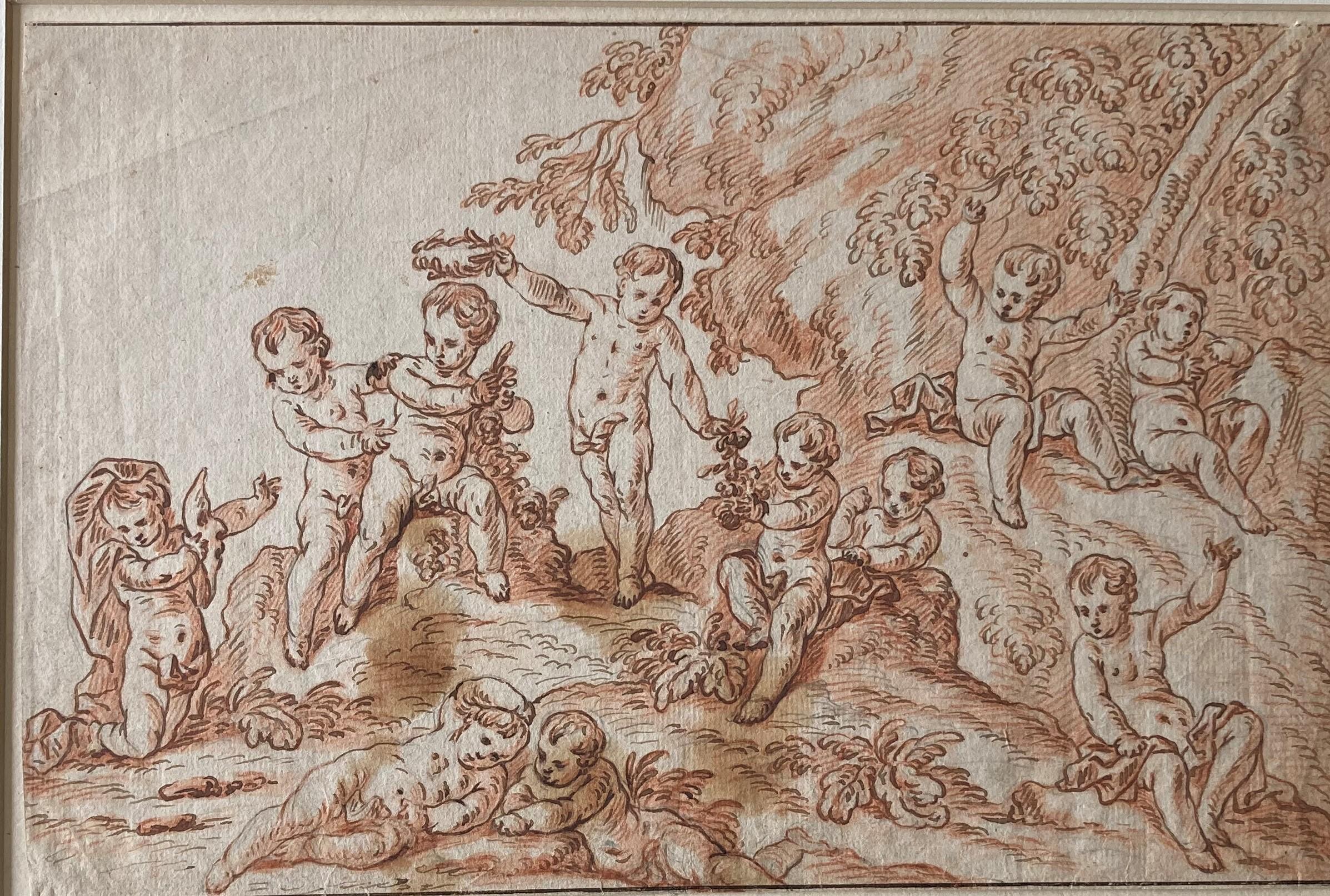
- Putti in a Landscape, Putti playing, flowers, Berchet, French Art, Old MasterBy Pierre BerchetLocated in Greven, DEPierre Berchet, Drawing of Putti playing in a landscape, Painter of decorative history subjects; trained under La Fosse; worked in France and during the 1690s...Category
17th Century Baroque Figurative Drawings and Watercolors
MaterialsHandmade Paper
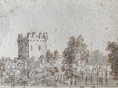
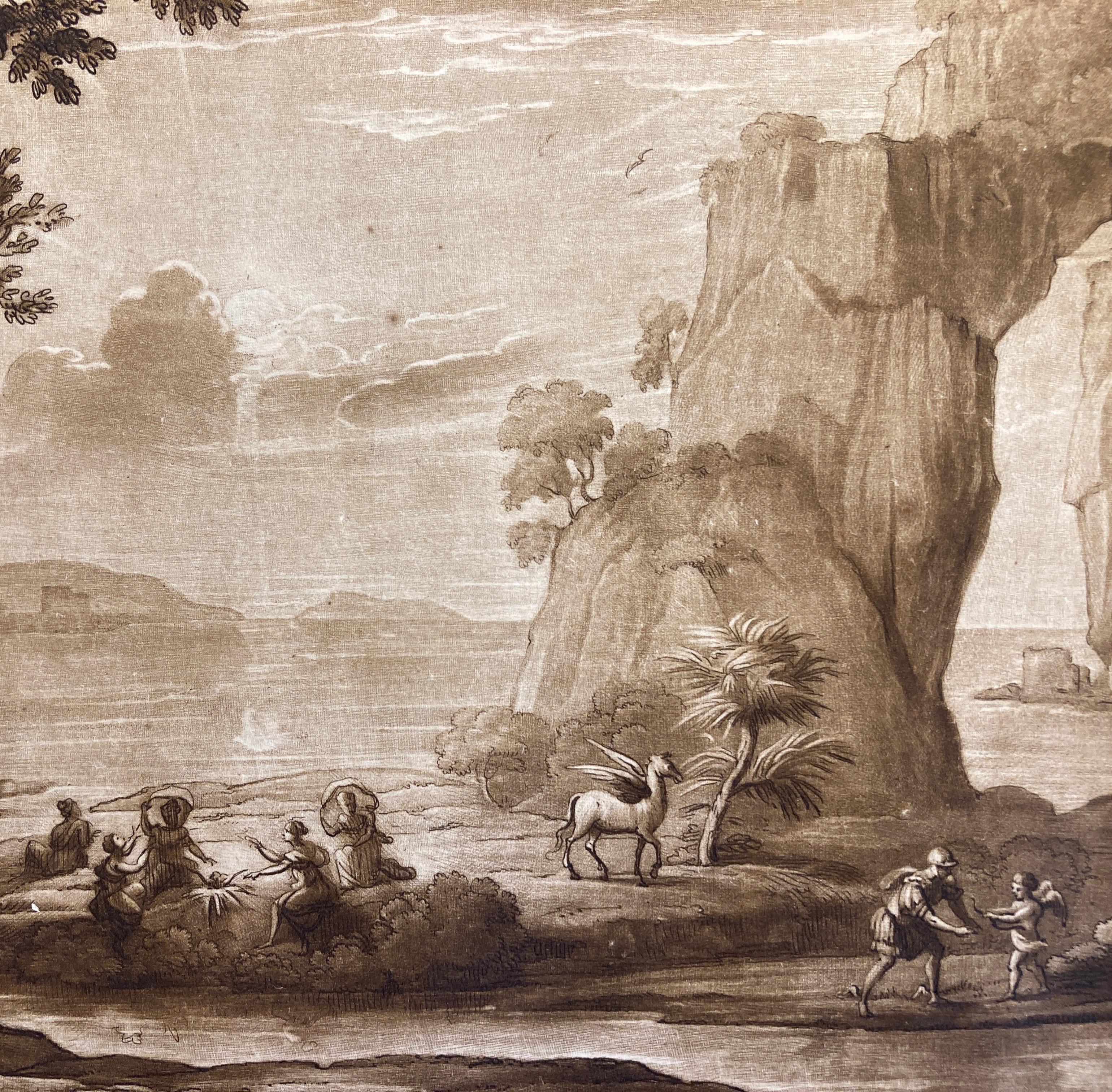
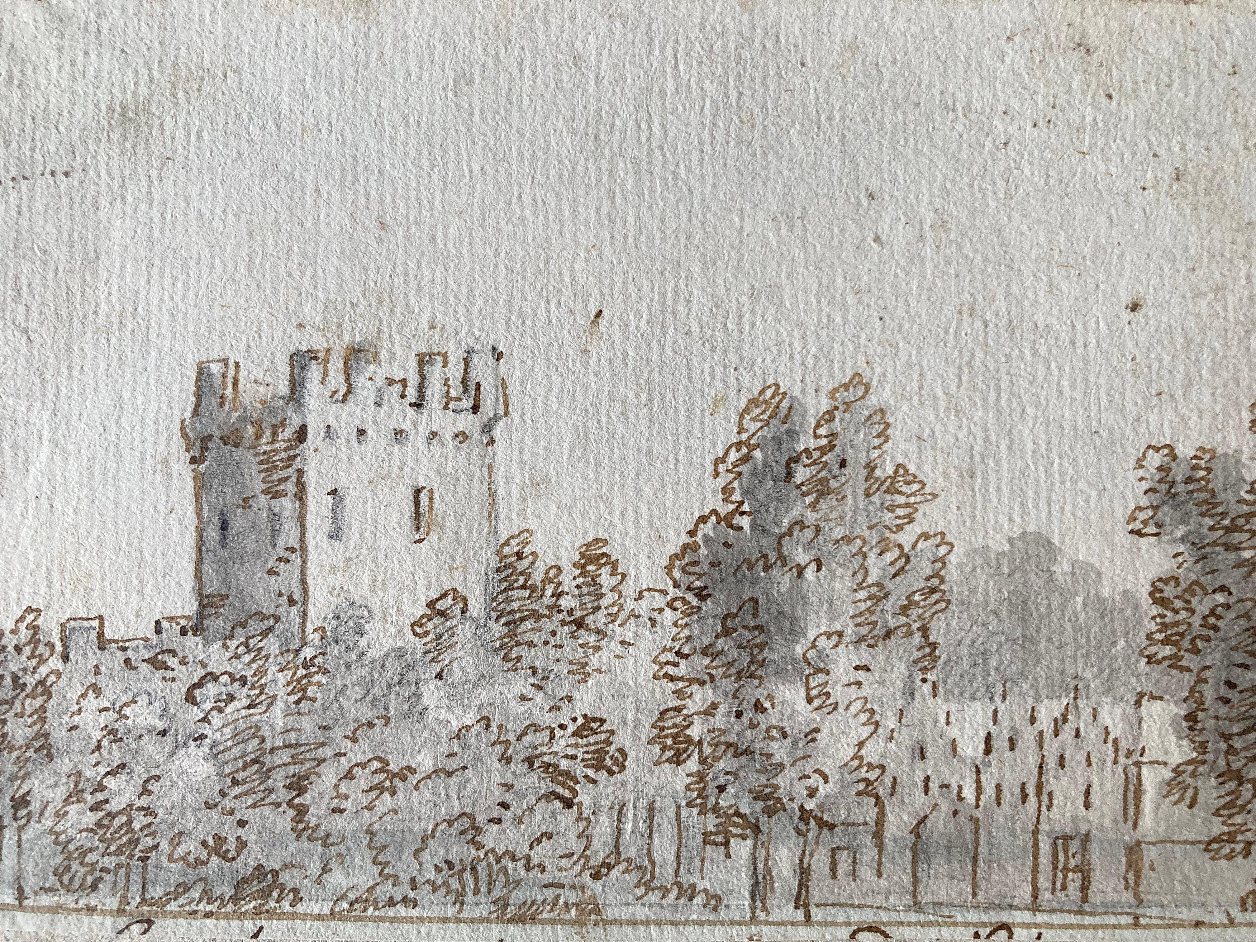
- View of Castle of Vianen, Batestein, Dutch Golden Age, Schouman, Old Master ArtBy Aert SchoumanLocated in Greven, DEThough he is most celebrated today for his extraordinary work as an artist of ornithological and zoological subject matters, Schouman was also a prolific documenter of landscape in his native Holland. The present drawing, which depicts a view of the Castel of Vianen, fits securely into a corpus of drawings Schouman produced on the same scale and in the same distinctive combination of media, examples of which are today housed in the collection of the Koninklijk Zeeuwsch Genootschap der Wetenschappen, Middelburg. Castle Batestein (also called Batenstein ) is a castle disappeared from the Netherlands . It was built on the banks of the Lek in the small town of Vianen, then in the province of South Holland (now in the province of Utrecht ). The castle was burned down in 1696 and then demolished. Remains only the Hofpoort (or castle gate...Category
18th Century Baroque Landscape Drawings and Watercolors
MaterialsHandmade Paper, Pen
- Claude Lorrain Landscape with temptation of Saint Anthony, Aquatint by EarlomBy (after) Claude Lorrain (Claude Gellée)Located in Greven, DEClaude Lorrain landscape with the temptation of Saint Anthony .Richard Earlom aquatint c1817 by Lorrain, Claude le/Earlom, Richard Country...Category
19th Century Baroque Landscape Prints
MaterialsPaper