Items Similar to Grand Quai - Lithograph - 19th Century


Want more images or videos?
Request additional images or videos from the seller
1 of 5
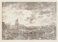
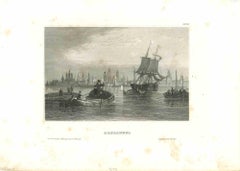
Antonio FontanesiGrand Quai - Lithograph - 19th Century19th Century
19th Century
About the Item
This splendid lithograph Grand Quai is part of the series of prints dedicated to views of the city of Geneva, engraved by the Italian artist Antonio Fontanesi.
The state of preservation of the artwork is excellent.
Image Dimensions: 15 x 22 cm
The signature is engraved on the plate the lower left. At the top of the paper, the inscription “Interieur de Geneve”, while at the bottom, below the image, the inscription “JMP Pilet & Cougnard Editeurs Geneve”.
Antonio Fontanesi (Reggio Emilia, 1818 - Turin, 1882) was an Italian painter, engraver, teacher, and soldier. He was one of the most important 19th-century Italian painters, though somewhat unknown. After fighting in the I Independence War, he moved to Geneva, where he met local painters that encouraged him to paint landscapes and to open to European artistic novelties. In Paris, he met Corot and Barbizon painters, whilst in London he was influenced by Turner’s and Constable’s works. He taught in Lucca, Turin, and then in Tokyo.
His artworks are very suggestive, rich in lyricism and in melancholic, Romantic and, according to some scholars, Pre-Symbolist atmospheres. Fontanesi observed and studied natural reality to reach a deeper and more universal motive and to find, reflected, human feelings: for this reason, he is considered one of the most emblematic Italian Romantic painters of the European Romantic movement.
He was also a fine draftsman and expert etcher: his etchings and lithographs, like in this case, are characterized by the same research on atmospheric values as in painting, with synthetic and essential light effects.
This is a beautiful artwork, an excellent engraving, depicting a Romantic view on a peculiar place in Geneva.
- Creator:Antonio Fontanesi (1818 - 1882, Italian)
- Creation Year:19th Century
- Dimensions:Height: 14.3 in (36.3 cm)Width: 20.2 in (51.3 cm)Depth: 0.04 in (1 mm)
- Medium:
- Movement & Style:
- Period:
- Framing:Framing Options Available
- Condition:Insurance may be requested by customers as additional service, contact us for more information.
- Gallery Location:Roma, IT
- Reference Number:
About the Seller
4.9
Platinum Seller
These expertly vetted sellers are 1stDibs' most experienced sellers and are rated highest by our customers.
1stDibs seller since 2017
6,749 sales on 1stDibs
Typical response time: 2 hours
- ShippingRetrieving quote...Ships From: Grasse, France
- Return PolicyA return for this item may be initiated within 14 days of delivery.
More From This SellerView All
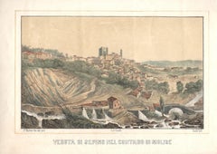
- View of Sepino - Original Lithograph by F- Cirelli - Mid 19th CenturyLocated in Roma, ITVeduta di Sepino is an original artwork realized in the XIX Century by Cirelli. Colored Lithograph on paper. On the lower left corner the writing "P. Mattei di dal vero" and, on ...Category
Mid-19th Century Old Masters Figurative Prints
MaterialsLithograph
- Landscape - Lithograph by Antonio Fontanesi - 1880By Antonio FontanesiLocated in Roma, ITThis splendid lithograph, realized in 1880s, is part of the series of prints dedicated to views of the Landscape, engraved by the Italian artist Antonio Fontanesi. The state of preservation of the artwork is very good. The signature is engraved on the plate the lower right. Antonio Fontanesi (Reggio Emilia, 1818 - Turin, 1882) was an Italian painter, engraver, teacher, and soldier. He was one of the most important 19th-century Italian painters, though somewhat unknown. After fighting in the I Independence War...Category
1880s Old Masters Landscape Prints
MaterialsLithograph
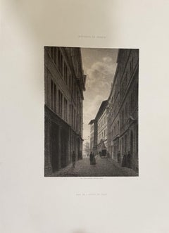
- De Rue de l'Hotel De Ville - Lithograph by Antonio Fontanesi - 19th CenturyBy Antonio FontanesiLocated in Roma, ITThis splendid lithograph De Rue de l'Hotel De Ville is part of the series of prints dedicated to views of the city of Geneva, engraved by the Italian artist Antonio Fontanesi. The s...Category
19th Century Old Masters Landscape Prints
MaterialsLithograph
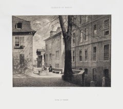
- Le Bout de la Treille - Lithograph - 19th CenturyBy Antonio FontanesiLocated in Roma, ITThis splendid lithograph Le bout de la Treille is part of the series of prints dedicated to views of the city of Geneva, engraved by the Italian artist Antonio Fontanesi. The state ...Category
19th Century Old Masters Landscape Prints
MaterialsLithograph
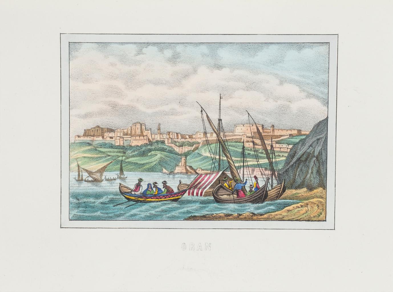
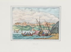
- View of Oran - Original Lithograph - 1846Located in Roma, ITView of Oran is an original Hand-colored lithograph on paper realized in 1846 by an Anonymous artist of the XIX century. Titled in Italian on the lower center "Oran". The state of...Category
1840s Old Masters Figurative Prints
MaterialsLithograph
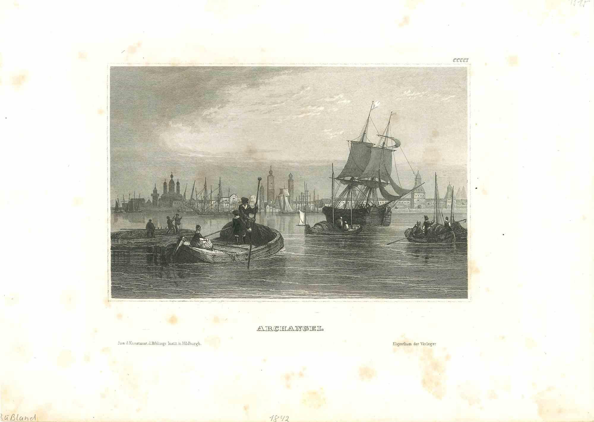
- Archangel - Original Lithograph - Early 19th CenturyLocated in Roma, ITArchangel is an original modern artwork realized in Germany in the first half of the 19th Century. Original B/W Lithograph on Ivory Paper. Inscripted on the lower margin in Capit...Category
Early 19th Century Old Masters Figurative Prints
MaterialsLithograph
You May Also Like
- Ruins of the Roman Baths of Belisarius: A 19th C. Etching by Luigi RossiniBy Luigi RossiniLocated in Alamo, CAThis early 19th century etching entitled "Veduta degl' Avanzi delle Torri di Belisario Dalla parte che guarda l' Interno della Città, vicino a Porta S. Giovanni, A. Mura Aureliane" (...Category
1820s Old Masters Landscape Prints
MaterialsEtching
- L'Isle de France: A Hand-colored 17th Century Map by De WitBy Frederick de WitLocated in Alamo, CAThis colorful and detailed 17th century hand-colored copperplate map by Frederick De Wit was published in Amsterdam between 1666 and 1760. The map depicts the Île-de-France, which is one of the ancient provinces of France. Paris is located in the center of the map, with Versailles to the southwest The map extends from Rouen in the west to Reims in the east. The area around Paris, the Véxin Français, was the original domain of the king of France. Other areas were ruled by French feudal lords. For example, the Véxin Normand area was the domain of the Duke of Normandy...Category
Early 18th Century Old Masters More Prints
MaterialsEngraving
- Map of the Russian Empire: An Original 18th Century Hand-colored Map by E. BowenLocated in Alamo, CAThis is an original 18th century hand-colored map entitled "A New & Accurate Map of The Whole Russian Empire, As Contain'd Both In Europe and Asia, Drawn from Authentic Journals, Sur...Category
Mid-18th Century Old Masters Landscape Prints
MaterialsEngraving
- View of Emden, Germany: A 16th Century Hand-colored Map by Braun & HogenbergBy Franz HogenbergLocated in Alamo, CAThis is a 16th century original hand-colored copperplate engraved map of a bird's-eye View of Embden, Germany entitled " Emuda, vulgo Embden vrbs Frisia orientalis primaria" by Georg Braun & Franz Hogenberg, in volume II of their famous city atlas "Civitates Orbis Terrarum", published in Cologne, Germany in 1575. This is a beautifully colored and detailed map of Emden, a seaport in northwestern Germany, along the Ems River and perhaps portions of over Dollart Bay, near the border with the Netherland. The map depicts a bird's-eye view of the city from the southwest, as well as a view of the harbor and an extensive system of canals. Numerous ships of various sizes, as well as two rowboats containing numerous occupants are seen in the main waterway in the foreground and additional boats line two canals in the center of the city. Two men and two women are shown on a hill in the foreground on the right, dressed in the 16th century style of nobility. Two ornate crests are included in each corner. A title strap-work cartouche is in the upper center with the title in Latin. The crest on the right including Engelke up de Muer (The Little Angel on the Wall) was granted by Emperor Maximilian I in 1495. This is an English translation of an excerpt of Braun's description of Embden: "In Emden, the capital of East Frisia, rich merchants live in very fine houses. The city has a broad and well-situated harbour, which in my opinion is unique in Holland. Frisia and the whole of the Netherlands, for the ships can anchor here right under the city walls. They have also extended the harbour as far as the New Town, so that up to 400 ships can now find shelter here when the sea is rough." The emphasis on the harbor and waterways within the city highlights the importance of Emden's place as a seaport at this time. Embden developed from a Dutch/Flemish trading settlement in the 7th-8th centuries into a city as late as late 14th century. In 1494 it was granted staple rights, and in 1536 the harbour was extended. In the mid-16th century Emden's port was thought to have the most ships in Europe. Its population then was about 5,000, rising to 15,000 by the end of the 16th century. The Ems River flowed directly under the city walls, but its course was changed in the 17th century by the construction of a canal. Emden has canals within its city limits, a typical feature of Dutch towns, which also enabled the extension of the harbor. In 1744 Emden was annexed by Prussia and is now part of Germany. It was captured by French forces in 1757 during the Seven Years' War, but recaptured by Anglo-German forces in 1758. During the Napoleonic French era, Emden and the surrounding lands of East Frisia were part of the short-lived Kingdom of Holland. References:Van der Krogt 4, 1230, State 2; Taschen, Braun and Hogenberg...Category
16th Century Old Masters Landscape Prints
MaterialsEngraving
- Ireland: A Framed 17th Century Hand-colored Map by Jan JannsonBy Johannes JanssoniusLocated in Alamo, CAThis is a 17th century hand-colored map entitled "Hibernia Regnum Vulgo Ireland" by Johannes Janssonius's (Jan Jansson), published in Amsterdam in 1640. This highly detailed map depicts the Emerald Isle with an extensive display of towns, roads, mountains, rivers, lakes and county borders, etc. It includes two decorative cartouches on the left. The title cartouche includes the Irish harp and the second, in the upper left, includes a lion wearing a crown on the left, a unicorn on the right and a coat-of-arms in the middle, which includes another Irish harp. A distance scale is seen in the lower right, augmented with two putti. The map is embellished with three sailing ships and a sea monster. Western portions of Scotland and England...Category
Mid-17th Century Old Masters Landscape Prints
MaterialsEngraving
- View of Meissen, Germany: A 16th Century Hand-colored Map by Braun & HogenbergBy Franz HogenbergLocated in Alamo, CAThis is a 16th century original hand-colored copperplate engraved map of View of View of Meissen, Germany entitled "Misena Hermun Duvorum Urbs" by Georg Braun & Franz Hogenberg, from their famous city atlas "Civitates Orbis Terrarum", published in Cologne, Germany in 1575. The map depicts a side view and bird's-eye view, looking across the Elbe River (labelled Albis Fluvius on the map; White River in Latin) from the northeast. In the foreground are three women in conversation on a hill above the city, along with a man and a woman in conversation by a road, all dressed in contemporary costumes of the upper class. A coat-of-arms is present in each upper corner. A great castle sits atop a hill in the background on the left. Meissen grew up around Albrechtsburg castle, built by Emperor Henry I around AD 929, and was granted a municipal charter at the end of the 12th century. From 1471 onwards, the castle complex was reconstructed as the residence of the Saxon electors on the northeast corner of the Domberg (Cathedral Hill). Meissen cathedral is a Gothic hall church begun c. 1270; in 1413 a bolt of lightning destroyed its west towers, which were replaced only in the 20th century. Meissen lies to the northwest of Dresden, Germany in Saxony. Meissen is famous for its Meissen porcelain and the Albrechtsburg castle The following is an English translation of an excerpt from Braun's description of the city: "This city is surrounded by very many rivers, to the east flows the Elbe, to the south the Triebisch, to the west are the mountains, to the north the Meisse, after which the city is said to be named. The city is well-situated in its surroundings, the navigable rivers, the mountains and the healthy air. Around the city there is a good land to grow grain, fertile vineyards on the hillsides and without doubt the mountains are not without ore, for one mile away, up the Elbe, is Scharfenberg, where silver and lead ore are mined.." References: Van der Krogt 4, 2684; Taschen, Braun and Hogenberg...Category
16th Century Old Masters Landscape Prints
MaterialsEngraving


Recently Viewed
View AllMore Ways To Browse
European 19th Century Art
Grand Light
Old Lithographs
19th Century Soldier
Italian 19th Century Engravings
Soldiers Lithograph
19th Century Italian Etching
Unknown Italian Landscape 19th Century
Lucca Antique
Barbizon Painting Corot
Universal Geneve Used
Universal Geneve
Lucca Painting
1919 Thomas Moran 1919
Cooper Overlay
1814 U S Map
Kaiko Moti On Sale
Stow Wengenroth On Sale