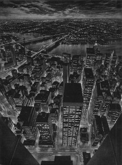
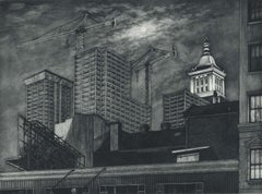
The World Below (view of lower Manhattan from observation deck of Twin Towers)
View Similar Items
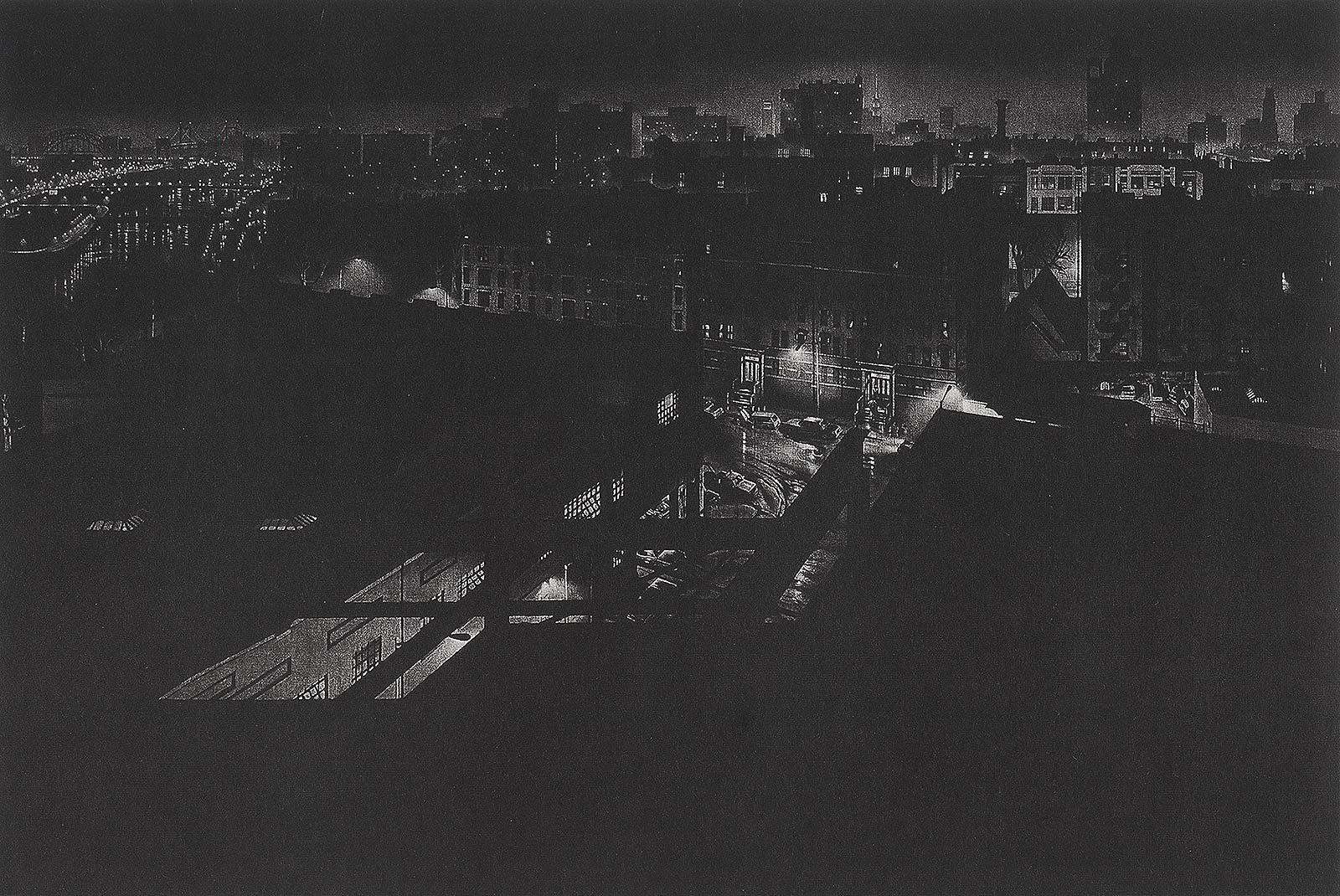


Art WergerThe World Below (view of lower Manhattan from observation deck of Twin Towers)1999
1999
About the Item
- Creator:Art Werger (1955, American)
- Creation Year:1999
- Dimensions:Height: 15.75 in (40.01 cm)Width: 11.75 in (29.85 cm)
- Medium:
- Movement & Style:
- Period:
- Condition:
- Gallery Location:New Orleans, LA
- Reference Number:1stDibs: LU84132564711

Art Werger
Art Werger was born in Ridgewood, New Jersey, in 1955. He received a bachelor of fine arts degree from the Rhode Island School of Design, in 1978 and a master of fine arts degree from the University of Wisconsin, in 1982. From 1982 to 2000, he was a professor of art at Wesleyan College, in Macon, Georgia. Since 2000, he has been the director of foundations and professor of printmaking at Ohio University, in Athens, Ohio. Werger’s impressive, intense prints invite audiences to assume new perspectives and consider the unfolding scene, as though they were casual bystanders. He encourages viewers to develop their interpretations of the action. Werger thrives on dealing with the technical complexities of print media. He most often uses mezzotint, a type of intaglio printmaking, where the artist works from dark to light. Werger carefully refines his images to reflect the precision of this process. His prints have received many awards and have been displayed in numerous international and national exhibitions. They are included in corporate and museum collections, such as the Corcoran Gallery of Art in Washington, D.C., Boston Public Library, Brooklyn Museum, Philadelphia Museum of Art and the Museum of Fine Arts in Boston.
- Lafitte's Blacksmith House (a bar named for a pirate on Bourbon St, New Orleans)By Frederick MershimerLocated in New Orleans, LALafitte's Blacksmith Shop is a New Orleans landmark at 941 Bourbon St. Like most New Orleans legends, history of Lafitte's Blacksmith Shop is a gumbo of tru...Category
Early 2000s Contemporary Landscape Prints
MaterialsMezzotint, Aquatint
- Mont et Mervale (Mountains and Wonder)By Christine RavauxLocated in New Orleans, LABorn in Charleroi, Belgium, Christine Ravaux is an artist who mirrors her surroundings in the mezzotints she creates. She has portrayed the black hills that dot the landscape of the ...Category
1990s Contemporary Landscape Prints
MaterialsMezzotint, Aquatint
 $300 Sale Price33% Off
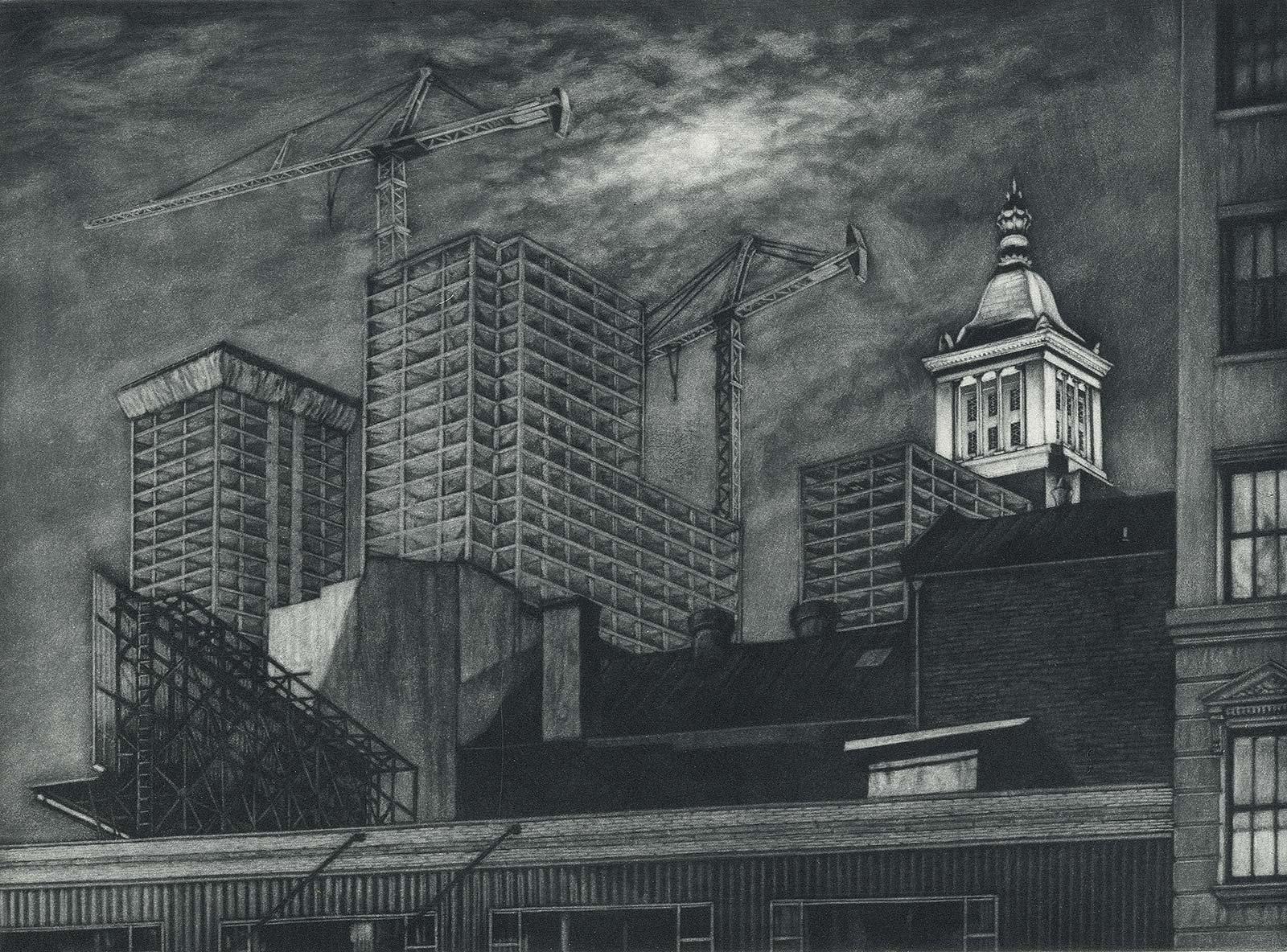
 - Cranes and Concrete (in the 80s, a boom saw buildings racing into the sky?By Frederick MershimerLocated in New Orleans, LA"Cranes and Concrete" is Frederick Mershimer's mezzotint of the construction scene on Broadway between 13th and 14th streets. Mershimer is no strang...Category
1980s Contemporary Landscape Prints
MaterialsMezzotint
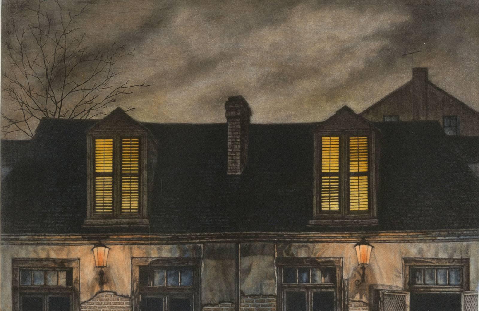
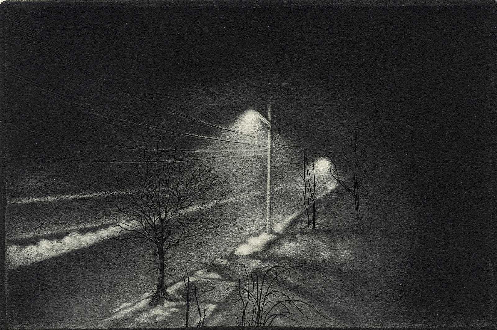
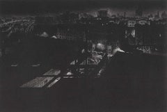
- Girders (rainy night view of artist's former studio in Washington HeightsBy Craig McPhersonLocated in New Orleans, LA"Griders" is Craig McPherson's rainy night scene showing the view from his former studio in Washington Heights in NYC. The image is the companion pi...Category
1980s Contemporary Landscape Prints
MaterialsMezzotint
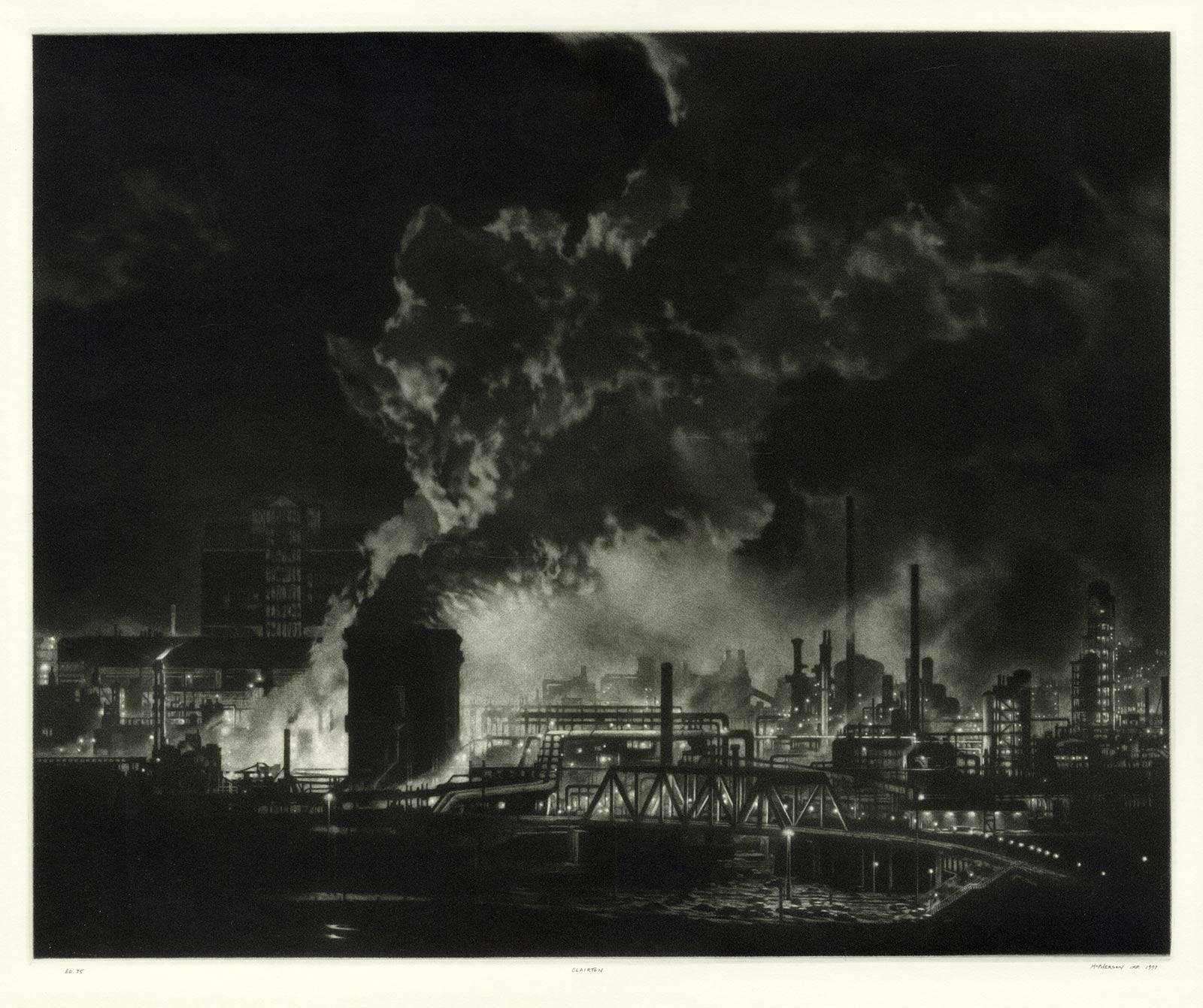
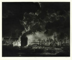
- Clairton (night view of US Steel Clairton coke plant, largest in America)By Craig McPhersonLocated in New Orleans, LAMcPherson's night view of the Clairton steelworks is printed on light green laid paper referenced as Hartley M1. It is signed, titled and dated in pencil. Marked ed 75 and "imp" in...Category
1990s American Modern Landscape Prints
MaterialsMezzotint
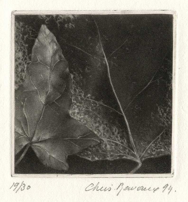
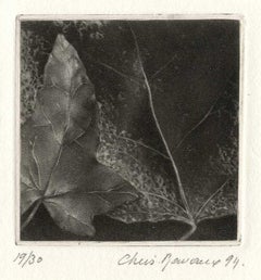
- LeavesBy Christine RavauxLocated in New Orleans, LAThis impression is #19 out of an edition 30 Born in 1961 in Charleroi, Belgium, Ravaux is an artist who mirrors her surroundings in the mezzotints she creates. She has portrayed see...Category
1990s American Modern Landscape Prints
MaterialsMezzotint
 $80 Sale Price20% Off
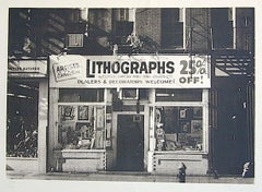
- LITHOGRAPHS Greenwich Village NYC, Signed Mezzotint, Art Gallery, PhotorealismBy John BaederLocated in Union City, NJLITHOGRAPHS Greenwich Village NYC by the American photorealist artist John Baeder is a limited edition mezzotint printed using hand printmaking techniques on archival, cream colored ...Category
1970s Photorealist Landscape Prints
MaterialsMezzotint
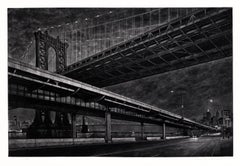
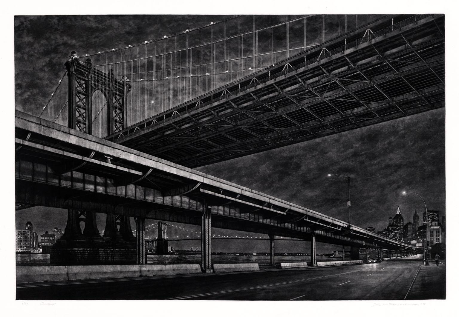
- CrossingsBy Frederick MershimerLocated in New York, NYCROSSINGS Contemporary artist Frederick Mershimer created the mezzotint engraving entitled "Crossings" in 1998. This impression is signed, titled, and dated in pencil. The printed ...Category
Late 20th Century American Realist Landscape Prints
MaterialsMezzotint
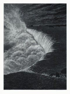
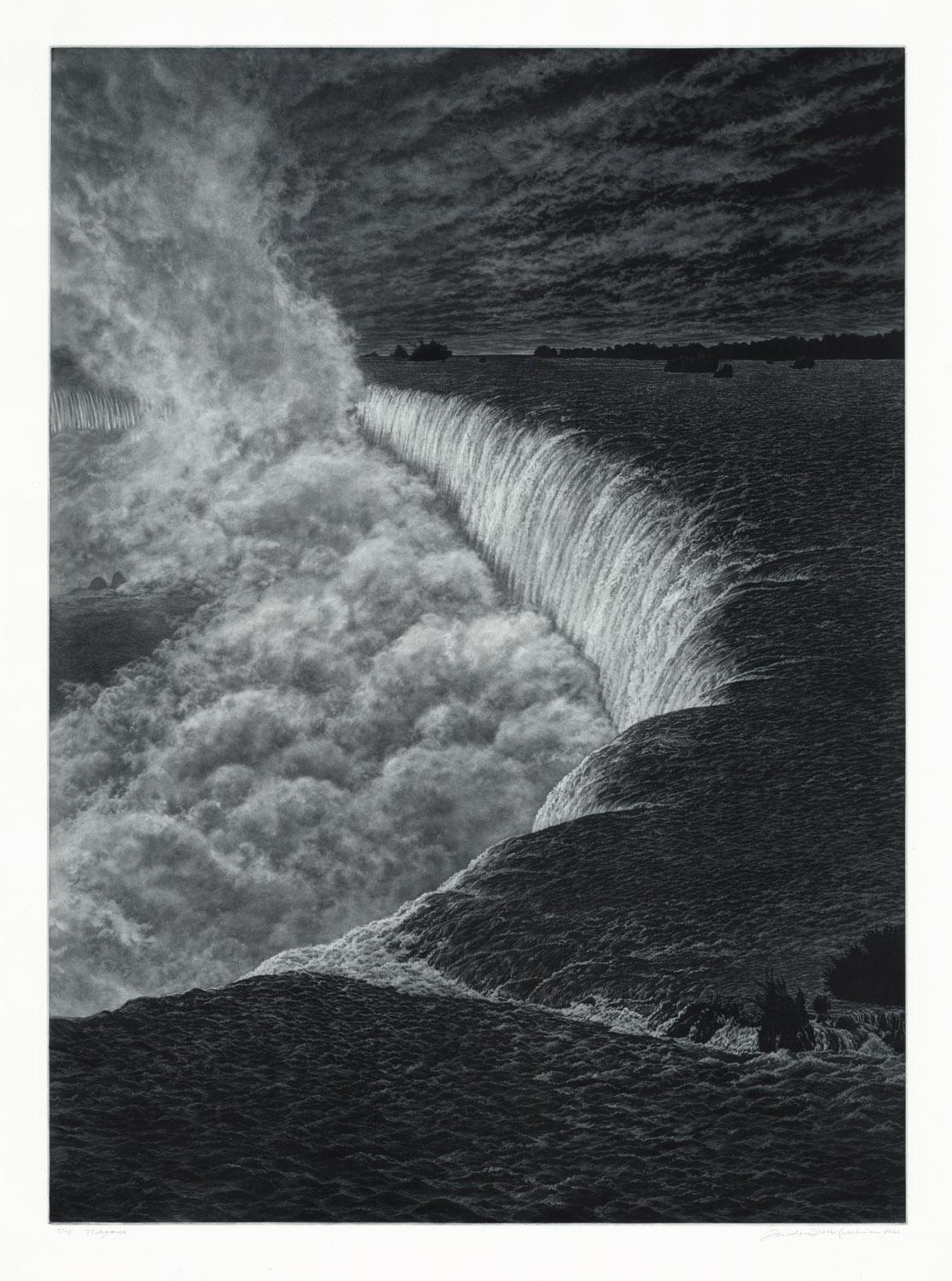
- NiagaraBy Frederick MershimerLocated in New York, NYNIAGARA Contemporary artist Frederick Mershimer created the mezzotint engraving entitled “Niagara” in 2021. This impression is signed, titled, dated, and inscribed “5/45”- the 5th ...Category
21st Century and Contemporary American Realist Landscape Prints
MaterialsMezzotint
- Cartusia Bruxellensis Monastery in Brussels: A 17th C. Hand-colored EngravingBy Lucas Vorsterman the YoungerLocated in Alamo, CAThis is a 17th century hand-colored copperplate engraving entitled "Cartusia Bruxellensis" by Lucas Vorsterman, the Younger, after a drawing by Jacob van Werden or Jacques van Weerden, published in 1659 in Antonius Sanderus' book 'Chorographia sacra Brabantiae sive celebrium aliquot in ea provincia ecclesiarum et coenobiorum descriptio . . . Brussel' (A sacred chorography of Brabant, or a description of several famous churches and convents in that province). It also appeared in other publications by Sanderus. In the 17th century, Brussels was within the Duchy of Brabant. This engraving depicts a bird's-eye view of the Scheut Carthusian Monastery in Brussels. Scheut is a district of Anderlecht, a municipality of Brussels, Belgium. The monastery housed monks, who took a vow of silence, in 20 rooms. There is a central courtyard with trees and shrubs. Monks are depicted strolling along its pathways. The cells for the friars are in the middle the cloister. There are people along the streets in the foreground and to the right of the large, imposing monastery. Some are on horseback, others are walking. In the lower right, what appears to be a dog pulls a small cart containing barrels, possibly of beer or wine. Districts and neighborhoods are labelled in the background, including Scheut, Anderlecht and Ransfort. A very ornate cartouche in the lower left contains Latin and the artist's attribution. Another decorative cartouche in the upper central area contains the title. This beautifully hand-colored and detailed engraving is printed on laid, chain-linked paper with wide, full margins. The sheet measures 17.25" high and 21.25" wide. It has Latin text on the verso. It has a central vertical fold, as issued, which is reinforced on the verso. Two small spots in the lower margin may actually represent drops of watercolor paint used to color the engraving. It is otherwise in very good condition. Antonius Sanderus (1586-1664) was a Flemish Catholic cleric and historian. He was born "Antoon Sanders", but Latinized his name like many writers and scholars of his time. He was the author of several books, including 'Chorographia Sacra Brabantiae', which was illustrated with this engraving. Lucas Vorsterman the Younger (1624-between 1666 & 1676) was a Flemish Baroque engraver and draughtsman. He produced engravings after the work of contemporary painters and for books by Antwerp publishers. Jacob van Werden or Jacques van Weerden (active 1643-1669), was a Flemish draughtsman, cartographer, military engineer and archer who was active in the Habsburg Netherlands. His drawings were used as designs for prints executed by various printmakers. He worked on maps, topographical views, historical scenes, portraits and book illustrations. He had a career as a military engineer and a member of the guard of the Spanish King. He advised on various military engineering projects and was an engineer of the Spanish army...Category
Mid-17th Century Old Masters Landscape Prints
MaterialsEngraving
- L'Isle de France: A Hand-colored 17th Century Map by De WitBy Frederick de WitLocated in Alamo, CAThis colorful and detailed 17th century hand-colored copperplate map by Frederick De Wit was published in Amsterdam between 1666 and 1760. The map depicts the Île-de-France, which is one of the ancient provinces of France. Paris is located in the center of the map, with Versailles to the southwest The map extends from Rouen in the west to Reims in the east. The area around Paris, the Véxin Français, was the original domain of the king of France. Other areas were ruled by French feudal lords. For example, the Véxin Normand area was the domain of the Duke of Normandy...Category
Early 18th Century Old Masters More Prints
MaterialsEngraving
- Map of the Russian Empire: An Original 18th Century Hand-colored Map by E. BowenLocated in Alamo, CAThis is an original 18th century hand-colored map entitled "A New & Accurate Map of The Whole Russian Empire, As Contain'd Both In Europe and Asia, Drawn from Authentic Journals, Sur...Category
Mid-18th Century Old Masters Landscape Prints
MaterialsEngraving