Items Similar to 'Mount Kenya, Kenya' — from the series 'Axis Mundi', Contemporary

Want more images or videos?
Request additional images or videos from the seller
1 of 8
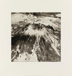
Beth Ganz'Mount Kenya, Kenya' — from the series 'Axis Mundi', Contemporary2020
2020
About the Item
Beth Ganz, 'Mount Kenya, Kenya', copperplate photogravure etching, edition 10, 2020. Signed, titled, and numbered 6/10 in pencil. A superb, richly-inked impression in warm black ink, on cream, wove, cotton rag paper; the full sheet in excellent condition. Archivally sleeved, unmatted.
Image size 10 1/2 x 10 1/2 inches; sheet size 16 x 15 1/2 inches.
From the artist's series of 64 photogravure etchings 'Axis Mundi'. Additional works from the series are available; please inquire.
Exhibited: 'Photography in Ink, A Look at Contemporary Copper-Plate Photogravure,' Curated by Leandro Villaro, Penumbra Exhibition Space Gallery, Nov 30, 2022 - March 15, 2023.
ABOUT THE IMAGE
Mount Kenya (Kikuyu: Kĩrĩnyaga, Kamba, Ki Nyaa) is an extinct stratovolcano in Kenya and the second-highest in Africa, after Kilimanjaro. The highest peaks of the mountain are Batian (5,199 meters or 17,057 feet), Nelion (5,188 m or 17,021 ft), and Point Lenana (4,985 m or 16,355 ft). Mount Kenya is located in the former Eastern and Central provinces of Kenya; its peak is now the intersection of Meru, Embu, Kirinyaga, Nyeri, and Tharaka Nithi counties, about 16.5 kilometers (10.3 miles) south of the equator, around 150 km (90 mi) north-northeast of the capital Nairobi. Mount Kenya is the source of the name of the Republic of Kenya.
Mount Kenya is a volcano created approximately 3 million years after the opening of the East African Rift. Before glaciation, it was 7,000 m (23,000 ft) high and covered by an ice cap for thousands of years, resulting in eroded slopes and numerous valleys radiating from the peak. There are currently 11 small glaciers, which are shrinking rapidly and may disappear by 2050.
Mount Kenya is the main water catchment area for two large rivers in Kenya; the Tana, the largest river in Kenya, and the Ewaso Nyiro North. The Mount Kenya ecosystem provides water directly to over 2 million people. The rivers on Mount Kenya have been named after the villages on the slopes of the mountain that they flow close to. The Thuchi River is the district boundary between Tharaka Nithi and Embu. Mount Kenya is a major water tower for the Tana River, which in 1988 supplied 80% of Kenya's electricity using a series of seven hydroelectric power stations and dams.
Mount Kenya is important to each of the four ethnic communities living around it, all of which formed in the area in the last several hundred years. The main ethnic groups are Kikuyu, Ameru, Embu, and Maasai, the first three closely related. All groups believe the mountain to be sacred and revere it as an important aspect of their cultures.
The Kikuyu living on the southern and western sides of the mountain are agriculturalists and make use of the highly fertile volcanic soil on the lower slopes. They believe that God, Ngai or Mwene Nyaga, lived on Mount Kenya when he came down from the sky and that the mountain is Ngai's throne on earth, 'God's Resting Place' or 'Where God Lives'. It is the place where Gĩkũyũ, the father of the tribe, used to meet with God. Thus according to the Kikuyu records, Gĩkũyũ is the first person on Earth to ascend the mountain. The snow caps of the mountain symbolically represent a crown on God's habitation. Kikuyu traditionally built their houses with doors facing the mountain. The Kikuyu name for Mt. Kenya is Kĩrĩnyaga which literally means ‘the one with the ostrich’. The ostrich has black or brownish–grey feathers with patches of white. The Kikuyu attributed an ostrich's likeness to an object that was dark-colored with white patches. Kĩrĩnyaga figuratively means ‘the one with white patches’, referring to the glaciers among the peaks of the mountain. Translated to the Kamba language, kĩrĩnyaga, is ki nyaa— the name that Ludwig Kraph, a German missionary and explorer, was given when he sighted the mountain from Kitui (in Kamba country). He recorded it as Kenya, and it became the name of not only the mountain but also the country.
The Embu people live southeast of Mount Kenya and believe the mountain is God's home (the Embu word for God is Ngai or Mwene Njeru). The mountain is sacred, and they build their houses with the doors facing toward it.
The Ameru occupy the east, north, and north-western slopes of the mountain. They are generally agricultural and also keep livestock and occupy what is some of the most fertile land in Kenya. The Meru god Murungu was from the skies. Their name for Mt. Kenya is Kirimara, which means 'mountain with white features'.
The Maasai are semi-nomadic people who use the land north of the mountain to graze their cattle. They believe their ancestors came down from the mountain at the beginning of time. The Maasai name for Mount Kenya is Ol Donyo Keri, which means 'mountain of stripes', referring to the dark areas observed from the surrounding plains. A Maasai prayer refers to Mount Kenya as follows, “God bless our children, let them be like the olive tree of Morintat, let them grow and expand, let them be like Ngong Hills like Mt. Kenya, like Mt. Kilimanjaro and multiply in number.”
Mount Kenya National Park, established in 1949, protects the region surrounding the mountain. Currently, the national park is within the forest reserve which encircles it. In April 1978, the area was designated a UNESCO Biosphere Reserve. The national park and the forest reserve, combined, became a UNESCO World Heritage Site in 1997. The park receives over 16,000 visitors per year.
ABOUT THE SERIES 'AXIS MUNDI'
"This body of work focuses on satellite images of sacred mountains around the world—places where heaven and earth are thought to meet. The phenomenon of revering mountains as holy sites is an archetype found in many cultures.
"This shared experience finds a visual echo in the ubiquity of images of the earth that are now available to any person with a computer and an Internet connection. What does the specificity of place mean when we can move across the surface of the earth in seconds and reduce everything to a series of pixels? To me, this process recalls abstract painting, which transforms the specific into gesture and form. Rather than treat digital technology as necessarily destructive to human meaning and experience, my work offers new ways of seeing that are reconcilable with the old. To this end, I combine 19th Century Photogravure technique with 21st-century surveillance captures.
"Axis Mundi consists of 64 copperplate photogravures. The work is laid out in a grid, an arbitrary conversion of the visual world into a flat space that happens both on the picture plane and in the data processing. The title refers to the belief in a 'world center,' often conceived of as a mountain: a place where communication between higher and lower realms is possible. This project is a search for such a center in a world of decentralization and fragmentation."
—Beth Ganz
ABOUT THE ARTIST
Beth Ganz is a contemporary American multidisciplinary visual artist, who lives and works in New York City. She graduated from Pratt Institute with a BFA (honors) in Painting, Sculpture, and Printmaking. The focus of her work is the intersection of landscape, digital technology, and abstraction. Ganz works in paint, brush, and ink drawing, both independently and alongside digital and analog printing techniques, including photogravure and intaglio printing.
Ganz’s work has been the subject of many solo exhibitions, including 'Atlas Project' at Cynthia-Reeves Gallery, 'Up Close and Far Away, Grids and Toiles: Beth Ganz at Wave Hill House,' Wave Hill, and 'Geothermal Topographies' at Reeves Contemporary. She has been shown in numerous group exhibitions, and her work is represented in many public and private collections, including the 9-11 Memorial Museum, the Library of Congress, the New York Historical Society, and the New York Public Library Prints Collection.
Ganz teaches workshops in photogravure and intaglio at Manhattan Graphics Center and has been a long-time grantee of the Elizabeth Foundation for the Arts.
AWARDS AND RESIDENCIES
2018 – Signal: Tri-State Juried Exhibition (2nd Place), Katonah Museum of Art, Katonah, New York (Juror: Lumi Tan)
2001-2014 – Studio Program, Elizabeth Foundation for the Arts, New York, NY
2005 – Johnson & Johnson Purchase Prize, 48th Annual National Print Exhibition, Hunterdon Museum of Art, Clinton, NJ
1999 – Prints USA Juror’s Award, Springfield Art Museum, Springfield, MO
1993 – 37th Annual National Print Exhibition (Honorable Mention), Hunterdon Art Center, Clinton, NJ
1992 – Small Impressions 1992 (Juror’s Award), Printmaking Council of New Jersey, NJ
BIBLIOGRAPHY: MAGAZINES, JOURNALS, NEWSPAPERS, AND ONLINE MEDIA
2018 – Mary Legrand, “A Signal of Invention,” Bedford Record, July 2018
2017 – Sara Mintz, “Profile of an Artist: Beth Ganz,” Journal of the Print World, Vol. 40, #4, October 2017
2017 – Cate McQuaid, “Critics’ Picks, The Ticket: Music, Theater, Dance, Art and more,” Boston Globe, May 2017 4, 2017
2017 – Beth Ganz, “New Prints: Beth Ganz and the Atlas Project Landscape,” Journal of the Print World, I Vol. 40, #3, July 2017
Collections: Duke Energy, Charlotte, NC; Evelyn Lauder Breast Center at SKMCC, New York, NY; Frost Bank, Houston, Texas; Hofstra Museum, Hofstra University; Johnson and Johnson Corporate Collection, NJ; Library of Congress, Washington, DC; New York Historical Society; New York Public Library Prints Collection; Norwegian Cruise Lines Corporation (Commission for the BLISS Cruise Ship); NYU Langone Health, New York, NY; Permanent Collection of the US Consulate, Cape Town, South Africa; Squib Corporation Collection, NJ; 9-11 Memorial Museum, New York, NY; Tommy Hilfiger Corporate Collection, New York, NY; United States Embassy Permanent Collection, Tbilisi, Georgia; Universal Studios, Los Angeles, CA; US Department of State, Art Bank Program, Washington, DC.
- Creator:
- Creation Year:2020
- Dimensions:Height: 10.5 in (26.67 cm)Width: 10.5 in (26.67 cm)
- Medium:
- Movement & Style:
- Period:
- Condition:
- Gallery Location:Myrtle Beach, SC
- Reference Number:
About the Seller
5.0
Recognized Seller
These prestigious sellers are industry leaders and represent the highest echelon for item quality and design.
Platinum Seller
These expertly vetted sellers are 1stDibs' most experienced sellers and are rated highest by our customers.
Established in 1995
1stDibs seller since 2016
254 sales on 1stDibs
Typical response time: 1 hour
Associations
International Fine Print Dealers Association
- ShippingRetrieving quote...Ships From: Myrtle Beach, SC
- Return PolicyA return for this item may be initiated within 7 days of delivery.
More From This SellerView All
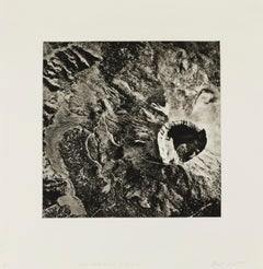
- 'Mount St. Elias, Yukon, Alaska' — from the series 'Axis Mundi', ContemporaryLocated in Myrtle Beach, SCBeth Ganz, 'Mount St. Elias, Yukon, Alaska', copperplate photogravure etching, edition 10, 2021. Signed, titled, and numbered 6/10 in pencil. A superb, richly-inked impression in warm black ink, on cream, wove, cotton rag paper; the full sheet in excellent condition. Archivally sleeved, unmatted. Image size 10 1/2 x 10 1/2 inches; sheet size 16 x 15 1/2 inches. From the artist's series of 64 photogravure etchings 'Axis Mundi'. Additional works from the series are available; please inquire. Exhibited: 'Photography in Ink, A Look at Contemporary Copper-Plate Photogravure,' Curated by Leandro Villaro, Penumbra Exhibition Space Gallery, Nov 30, 2022 - March 15, 2023. ABOUT THE IMAGE Mount Saint Elias, the second-highest mountain in Canada and the United States stands on the Yukon and Alaska border about 26 miles (42 km) southwest of Mount Logan, the highest mountain in Canada. The Canadian side of Mount Saint Elias forms part of Kluane National Park and Reserve, while the U.S. side is within Wrangell-St. Elias National Park and Preserve. Mount Saint Elias is notable for its immense vertical relief. Its summit rises 18,008 feet (5,489 m) vertically in just 10 miles (16 km) horizontal distance from the head of Taan Fjord, off of Icy Bay. The name of the mountain in Tlingit (indigenous peoples of the Pacific Northwest Coast of North America), Yasʼéitʼaa Shaa, means "mountain behind Icy Bay"; the Yakutat Tlingit occasionally call it Shaa Tlein "Big Mountain". It is one of the most important crests of the Kwaashkʼiḵwáan clan, who used it as a guide during their journey down the Copper River. Mount Fairweather, at the apex of the British Columbia and Alaska borders at the head of the Alaska Panhandle, is known as Tsalx̱aan; legend states that this mountain and Yasʼéitʼaa Shaa (Mt. St. Elias) originally stood next to each other, but had an argument and separated. Their children, the mountains between the two peaks, are called Tsalx̱aan Yátxʼi ("Children of Tsalxaan"). European explorers first sighted the mountain on July 16, 1741, with the arrival of the expedition commanded by Vitus Bering, a Danish explorer in service of Russia. While some historians contend that Bering named the mountain, others believe that eighteenth-century mapmakers named it after Cape Saint Elias when Bering left the peak unnamed. Mt. St. Elias was first climbed on July 31, 1897, by an Italian expedition led by famed explorer Prince Luigi Amedeo, Duke of the Abruzzi (who also reconnoitered the current standard route on K2 in 1909) and included noted mountain photographer Vittorio Sella. In 2007 Gerald Salmina directed an Austrian documentary film, Mount St. Elias, about a team of skiers/mountaineers determined to make "the planet's longest skiing descent" by ascending the mountain and then skiing nearly all 18,000 feet down to the Gulf of Alaska; the movie finished editing and underwent limited release in 2009. The climbers ended up summiting on the second attempt and skiing down to 13,000 ft (3,960 m). ABOUT THE SERIES 'AXIS MUNDI' "This body of work focuses on satellite images of sacred mountains around the world—places where heaven and earth are thought to meet. The phenomenon of revering mountains as holy sites is an archetype found in many cultures. "This shared experience finds a visual echo in the ubiquity of images of the earth that are now available to any person with a computer and an Internet connection. What does the specificity of place mean when we can move across the surface of the earth in seconds and reduce everything to a series of pixels? To me, this process recalls abstract painting, which transforms the specific into gesture and form. Rather than treat digital technology as necessarily destructive to human meaning and experience, my work offers new ways of seeing that are reconcilable with the old. To this end, I combine 19th Century Photogravure technique with 21st Century surveillance captures. "Axis Mundi consists of 64 copperplate photogravures. The work is laid out in a grid, which is an arbitrary conversion of the visual world into a flat space that happens both on the picture plane and in the data processing. The title refers to the belief in a 'world center,' often conceived of as a mountain: a place where communication between higher and lower realms is possible. This project is a search for such a center in a world of decentralization and fragmentation." —Beth Ganz ABOUT THE ARTIST Beth Ganz is a contemporary American multidisciplinary visual artist, who lives and works in New York City. She graduated from Pratt Institute with a BFA (honors) in Painting, Sculpture, and Printmaking. The focus of her work is the intersection of landscape, digital technology, and abstraction. Ganz works in paint, brush, and ink drawing, both independently and alongside digital and analog printing techniques, including photogravure and intaglio printing. Ganz’s work has been the subject of many solo exhibitions, including 'Atlas Project' at Cynthia-Reeves Gallery, 'Up Close and Far Away, Grids and Toiles: Beth Ganz at Wave Hill House,' Wave Hill, and 'Geothermal Topographies' at Reeves Contemporary. She has been shown in numerous group exhibitions, and her work is represented in many public and private collections, including the 9-11 Memorial Museum, the Library of Congress, the New York Historical Society, and the New York Public Library Prints...Category
21st Century and Contemporary Contemporary Landscape Prints
MaterialsPhotogravure, Etching
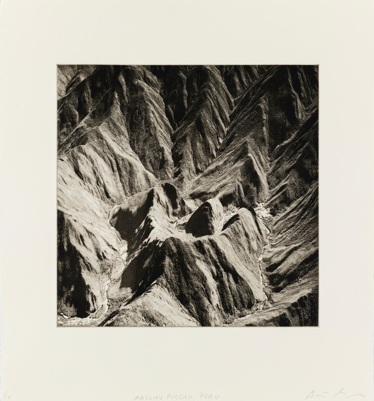
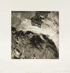
- 'Machu Picchu, Peru' — from the series 'Axis Mundi', ContemporaryLocated in Myrtle Beach, SCBeth Ganz, 'Machu Picchu, Peru', copperplate photogravure etching, edition 10, 2021. Signed, titled, and numbered 6/10 in pencil. A superb, richly-inked i...Category
21st Century and Contemporary Contemporary Landscape Prints
MaterialsPhotogravure, Etching
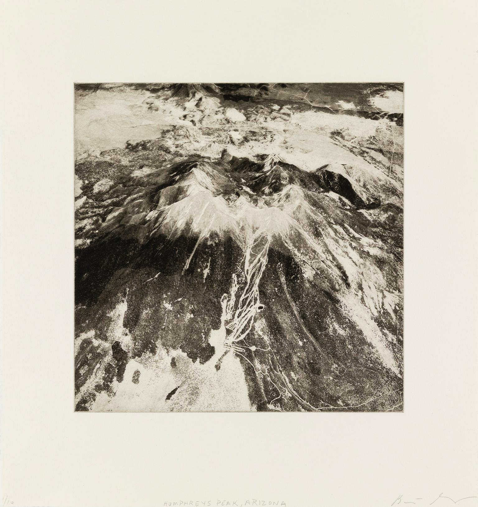
- 'Humphrey's Peak, Arizona' — from the series 'Axis Mundi', ContemporaryLocated in Myrtle Beach, SCBeth Ganz, 'Humphrey's Peak, Arizona', copperplate photogravure etching, edition 10, 2021. Signed, titled, and numbered 6/10 in pencil. A superb, richly-inked impression in warm black ink, on cream, wove, cotton rag paper; the full sheet in excellent condition. Archivally sleeved, unmatted. Image size 10 1/2 x 10 1/2 inches; sheet size 16 x 15 1/2 inches. From the artist's series of 64 photogravure etchings, 'Axis Mundi'. Additional works from the series are available; please inquire. Exhibited: 'Photography in Ink, A Look at Contemporary Copper-Plate Photogravure,' Curated by Leandro Villaro, Penumbra Exhibition Space Gallery, Nov 30, 2022 - March 15, 2023. ABOUT THE IMAGE Humphreys Peak (Hopi: Aaloosaktukwi, Navajo: Dookʼoʼoosłííd) is the highest natural point and the second most prominent peak after Mount Graham in the U.S. state of Arizona, with an elevation of 12,637 feet (3,852 m) and is located within the Kachina Peaks Wilderness in the Coconino National Forest, about 11 miles (17.7 km) north of Flagstaff, Arizona. Humphreys Peak is the highest of a group of dormant volcanic peaks known as the San Francisco Peaks. Humphreys Peak was named in about 1870 for General Andrew A. Humphreys, a U.S. Army officer who was a Union general during the American Civil War and who later became Chief of Engineers of the United States Army Corps of Engineers. The San Francisco Peaks are a sacred place for Hopi, Navajo, Havasupai, Zuni, Apache, and other Native American tribes. A place of sacred shrines and ancestral dwellings, The Peaks are associated with emergence, deities, ancestors, life-giving moisture, and spiritual ceremony and are still actively utilized today. Numerous medicinal herbs and other plants used in traditional ceremonies and to treat ailments are found at several levels of the Peaks. The plants are said to have place-specific energies—that is, they must come from these sacred sites to fulfill their proper function. To the Hopi, the Peaks are Nuvatukaovi, “The Place of Snow on the Very Top,” home for half the year to the ancestral kachina spirits who live among the clouds around the summit. When properly honored through song and ceremony, it is believed that the kachinas will bring gentle rains to thirsty crops. ABOUT THE SERIES 'AXIS MUNDI' "This body of work focuses on satellite images of sacred mountains around the world—places where heaven and earth are thought to meet. The phenomenon of revering mountains as holy sites is an archetype found in many cultures. "This shared experience finds a visual echo in the ubiquity of images of the earth that are now available to any person with a computer and an Internet connection. What does the specificity of place mean when we can move across the surface of the earth in seconds and reduce everything to a series of pixels? To me, this process recalls abstract painting, which transforms the specific into gesture and form. Rather than treat digital technology as necessarily destructive to human meaning and experience, my work offers new ways of seeing that are reconcilable with the old. To this end, I combine 19th Century Photogravure technique with 21st Century surveillance captures. "Axis Mundi consists of 64 copperplate photogravures. The work is laid out in a grid, which is an arbitrary conversion of the visual world into a flat space that happens both on the picture plane and in the data processing. The title refers to the belief in a 'world center,' often conceived of as a mountain: a place where communication between higher and lower realms is possible. This project is a search for such a center in a world of decentralization and fragmentation." —Beth Ganz ABOUT THE ARTIST Beth Ganz is a contemporary American multidisciplinary visual artist, who lives and works in New York City. She graduated from Pratt Institute with a BFA (honors) in Painting, Sculpture, and Printmaking. The focus of her work is the intersection of landscape, digital technology, and abstraction. Ganz works in paint, brush, and ink drawing, both independently and alongside digital and analog printing techniques, including photogravure and intaglio printing. Ganz’s work has been the subject of many solo exhibitions, including 'Atlas Project' at Cynthia-Reeves Gallery, 'Up Close and Far Away, Grids and Toiles: Beth Ganz at Wave Hill House,' Wave Hill, and 'Geothermal Topographies' at Reeves Contemporary. She has been shown in numerous group exhibitions, and her work is represented in many public and private collections, including the 9-11 Memorial Museum, the Library of Congress, the New York Historical Society, and the New York Public Library Prints Collection. Ganz teaches workshops in photogravure and intaglio at Manhattan Graphics Center and has been a long-time grantee of the Elizabeth Foundation for the Arts. AWARDS AND RESIDENCIES 2018 – Signal: Tri-State Juried Exhibition (2nd Place), Katonah Museum of Art, Katonah, New York (Juror: Lumi Tan) 2001-2014 – Studio Program, Elizabeth Foundation for the Arts, New York, NY 2005 – Johnson & Johnson Purchase Prize, 48th Annual National Print Exhibition, Hunterdon Museum of Art, Clinton, NJ 1999 – Prints USA Juror’s Award, Springfield Art Museum, Springfield, MO 1993 – 37th Annual National Print Exhibition (Honorable Mention), Hunterdon Art Center, Clinton, NJ 1992 – Small Impressions 1992 (Juror’s Award), Printmaking Council of New Jersey, NJ BIBLIOGRAPHY: MAGAZINES, JOURNALS, NEWSPAPERS, AND ONLINE MEDIA 2018 – Mary Legrand, “A Signal of Invention,” Bedford Record, July 2018 2017 – Sara Mintz, “Profile of an Artist: Beth Ganz,” Journal of the Print World, Vol. 40, #4, October 2017 2017 – Cate McQuaid, “Critics’ Picks, The Ticket: Music, Theater, Dance, Art and more,” Boston Globe, May 2017 4, 2017 2017 – Beth Ganz, “New Prints: Beth Ganz and the Atlas Project Landscape,” Journal of the Print World, I Vol. 40, #3, July 2017 Collections: Duke Energy, Charlotte, NC; Evelyn Lauder Breast Center at SKMCC, New York, NY; Frost Bank, Houston, Texas; Hofstra Museum, Hofstra University; Johnson and Johnson...Category
21st Century and Contemporary Contemporary Landscape Prints
MaterialsPhotogravure, Etching
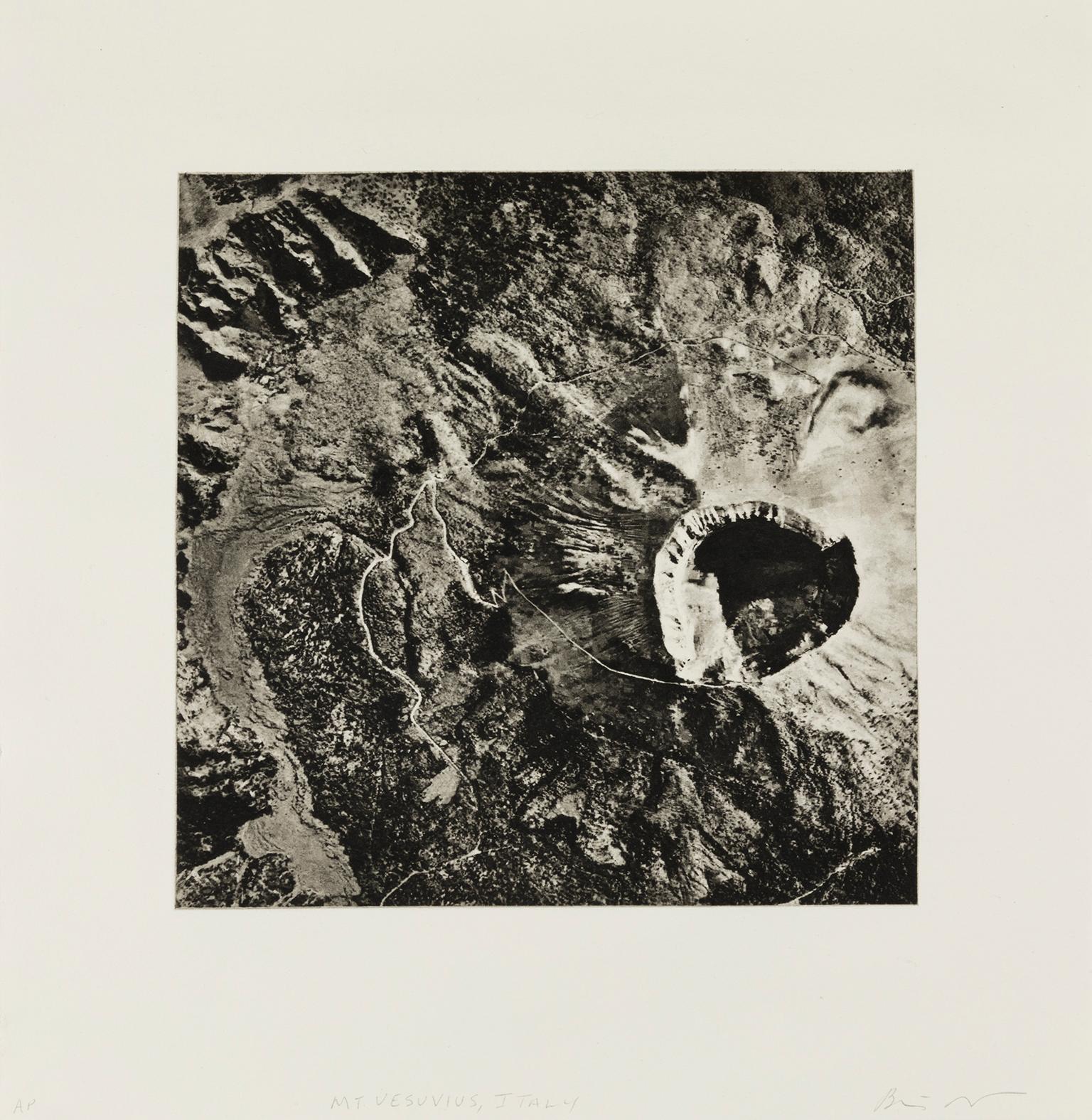
- 'Mount Vesuvius, Italy' — from the series 'Axis Mundi', ContemporaryLocated in Myrtle Beach, SCBeth Ganz, 'Mount Vesuvius, Italy', copperplate photogravure etching, edition 10, 2020. Signed, titled, and numbered 6/10 in pencil. A superb, richly-inked impression in warm black ink, on cream, wove, cotton rag paper; the full sheet in excellent condition. Archivally sleeved, unmatted. Image size 10 1/2 x 10 1/2 inches; sheet size 16 x 15 1/2 inches. From the artist's series of 64 photogravure etchings 'Axis Mundi'. Additional works from the series are available; please inquire. Exhibited: 'Photography in Ink, A Look at Contemporary Copper-Plate Photogravure,' Curated by Leandro Villaro, Penumbra Exhibition Space Gallery, Nov 30, 2022 - March 15, 2023. ABOUT THE IMAGE Mount Vesuvius (Italian: Vesuvio) is a somma-stratovolcano located on the Gulf of Naples in Campania, Italy, about 9 km (5.6 mi) east of Naples and a short distance from the shore. It is one of several volcanoes forming the Campanian volcanic arc. Vesuvius consists of a large cone partially encircled by the steep rim of a summit caldera, resulting from the collapse of an earlier, much higher structure. The eruption of Mount Vesuvius in AD 79, one of the most catastrophic eruptions of all time, destroyed the Roman cities of Pompeii, Herculaneum, Oplontis, Stabiae, and several other settlements. The eruption ejected a cloud of stones, ashes and volcanic gases to a height of 33 km (21 mi). More than 1,000 people are thought to have died in the eruption. Vesuvius has erupted about three dozen times since. It is the only volcano on Europe's mainland to have erupted in the last hundred years (1929 and 1944). It is regarded as one of the most dangerous volcanoes in the world—3,000,000 people live near enough to be affected by an eruption, with at least 600,000 in the danger zone, the most densely populated volcanic region in the world. Eruptions tend to be violent and explosive; these are known as Plinian eruptions. Vesuvius has a long historical and literary tradition. It was considered a divinity of the Genius type (a divine nature much like a guardian angel) at the time of the eruption of AD 79: it appears under the inscribed name Vesuvius as a serpent in the decorative frescos of many household shrines, surviving from Pompeii. The Romans regarded Mount Vesuvius as being devoted to Hercules. The historian Diodorus Siculus relates a tradition that Hercules, in the performance of his labors, passed through the country of nearby Cumae on his way to Sicily and found there a place called 'the Phlegraean Plain' ('plain of fire') 'from a hill which anciently vomited out fire ... now called Vesuvius.' It was inhabited by giant bandits, 'the sons of the Earth'. With the gods' assistance, he pacified the region and continued his journey. The area around Vesuvius was officially declared a national park on June 5, 1995. The summit of Vesuvius is open to visitors, and the park authorities maintain a small network of paths around the volcano. There is access by road to within 200 meters (660 ft) of the summit and a spiral walkway around the volcano from the road to the crater. ABOUT THE SERIES 'AXIS MUNDI' "This body of work focuses on satellite images of sacred mountains around the world—places where heaven and earth are thought to meet. The phenomenon of revering mountains as holy sites is an archetype found in many cultures. "This shared experience finds a visual echo in the ubiquity of images of the earth that are now available to any person with a computer and an Internet connection. What does the specificity of place mean when we can move across the surface of the earth in seconds and reduce everything to a series of pixels? To me, this process recalls abstract painting, which transforms the specific into gesture and form. Rather than treat digital technology as necessarily destructive to human meaning and experience, my work offers new ways of seeing that are reconcilable with the old. To this end, I combine 19th Century Photogravure technique with 21st Century surveillance captures. "Axis Mundi consists of 64 copperplate photogravures. The work is laid out in a grid, which is an arbitrary conversion of the visual world into a flat space that happens both on the picture plane and in the data processing. The title refers to the belief in a 'world center,' often conceived of as a mountain: a place where communication between higher and lower realms is possible. This project is a search for such a center in a world of decentralization and fragmentation." —Beth Ganz ABOUT THE ARTIST Beth Ganz is a contemporary American multidisciplinary visual artist, who lives and works in New York City. She graduated from Pratt Institute with a BFA (honors) in Painting, Sculpture, and Printmaking. The focus of her work is the intersection of landscape, digital technology, and abstraction. Ganz works in paint, brush, and ink drawing, both independently and alongside digital and analog printing techniques, including photogravure and intaglio printing. Ganz’s work has been the subject of many solo exhibitions, including 'Atlas Project' at Cynthia-Reeves Gallery, 'Up Close and Far Away, Grids and Toiles: Beth Ganz at Wave Hill House,' Wave Hill, and 'Geothermal Topographies' at Reeves Contemporary. She has been shown in numerous group exhibitions, and her work is represented in many public and private collections, including the 9-11 Memorial Museum, the Library of Congress, the New York Historical Society, and the New York Public Library Prints...Category
21st Century and Contemporary Contemporary Landscape Prints
MaterialsPhotogravure, Etching
- 'Craugh Phadrig, Ireland' — from the series 'Axis Mundi', ContemporaryLocated in Myrtle Beach, SCBeth Ganz, 'Craugh Phadrig, Ireland', copperplate photogravure etching, edition 10, 2020. Signed, titled, and numbered 6/10 in pencil. A superb, richly-inked impression in warm black ink, on cream, wove, cotton rag paper; the full sheet in excellent condition. Archivally sleeved, unmatted. Image size 10 1/2 x 10 1/2 inches; sheet size 16 x 15 1/2 inches. From the artist's series of 64 photogravure etchings, 'Axis Mundi'. Additional works from the series are available; please inquire. Exhibited: 'Photography in Ink, A Look at Contemporary Copper-Plate Photogravure,' Curated by Leandro Villaro, Penumbra Exhibition Space Gallery, Nov 30, 2022 - March 15, 2023. ABOUT THE IMAGE Cruach Phadraig in Irish, known as Croagh Patrick...Category
21st Century and Contemporary Contemporary Landscape Prints
MaterialsPhotogravure, Etching
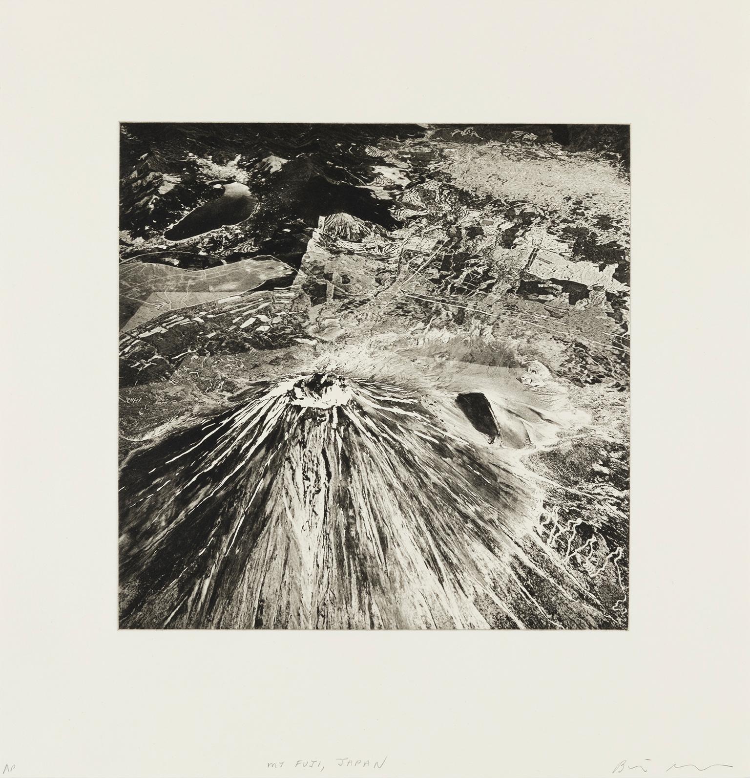
- 'Mount Haru, Japan' — from the series 'Axis Mundi', ContemporaryLocated in Myrtle Beach, SCBeth Ganz, 'Mount Haru, Japan', copperplate photogravure etching, edition 10, 2019. Signed, titled, and numbered 6/10 in pencil. A superb, richly-inked impression in warm black ink, on cream, wove, cotton rag paper; the full sheet in excellent condition. Archivally sleeved, unmatted. Image size 10 1/2 x 10 1/2 inches; sheet size 16 x 15 1/2 inches. From the artist's series of 64 photogravure etchings 'Axis Mundi'. Additional works from the series are available; please inquire. Exhibited: 'Photography in Ink, A Look at Contemporary Copper-Plate Photogravure,' Curated by Leandro Villaro, Penumbra Exhibition Space Gallery, Nov 30, 2022 - March 15, 2023. Mount Haku Mount Haku, commonly referred to as simply Hakusan is the most prominent natural feature of Ishikawa Prefecture, located on the island of Honshu. Its name means “white mountain,” and it is, in fact, covered with snow for more than half of the year. A dormant stratovolcano, it has been estimated to have first been active 300,000 to 400,000 years ago, with the most recent eruption occurring in 1659. The mountain's tallest peak, Gozenga-mine, gives the mountain its height of 2,702 m (8,865 ft). Along with Ken-ga-mine, which is 2,677 m (8,783 ft), and Ōnanji-mine, which is 2,648 m (8,688 ft), the three peaks are considered "Mount Haku's Three Peaks" (Hakusan San-mine). Mount Bessan and Mount Sannomine are sometimes included and called "Mount Haku's Five Peaks" (Hakusan go-mine). Mount Haku is considered to be one of Japan’s “Three Holy Mountains” (San-rei-zan), the other two being Mount Fuji and Tateyama. It has traditionally been revered by the people of the area as a source of water essential for farming and as a navigational landmark for fishermen and others at sea. Taichō, a mountain Shugendo monk, first climbed Mount Hakusan in 717. For hundreds of years, people have come to Haku for prayers (Hakusan Shinkō). A branch shrine of Shirayama Hime Shrine, which served as the supreme shrine for Kaga Province, is on the mountain. The Shirayama Hime Shrine is the main shrine (sō-Honshu) of approximately 2,000 Hakusan shrines (Hakusan jinja) in Japan. The area surrounding Mount Haku is one of the few in Japan that contains outcroppings from the Jurassic period of the Mesozoic era. Many of Japan's typical examples of dinosaur fossils were found in this area. One of the major rock outcrops is in the Kuwashima area and is known as the "Kuwashima Fossil Wall" (Kuwashima Kasekikabe). The mountain is well known for its many onsen (hot springs), and for its diverse variety of alpine plants are found, including the chocolate lily, which is Ishikawa's prefectural plant. Many alpine plants were first discovered along the older hiking trails leading to Hakusan Shrine, and have Hakusan in their names. These include Primula cuneifolia (Hakusan Kozakura), Anemone narcissiflora (Hakusan Ichige), Dactylorhiza (Hakusan Chidori), Geranium yesoemse (Hakusan Fuuro) and Rhododendron brachycarpum (Hakusan Shakunage). Mount Haku was designated as a national park in 1962 and was renamed Hakusan National Park. Because the central part of the mountain has much precipitous terrain, there are very few roads and, as a result, little human intrusion into the area. Also limiting human intrusion is the designation of the park as a Wildlife Protection Area, covering over 38,061 ha. The park stretches beyond the mountain's borders into Toyama Prefecture. In 1980 an area of 48,000 ha was designated a UNESCO Man and the Biosphere Reserve. ABOUT THE SERIES 'AXIS MUNDI' "This body of work focuses on satellite images of sacred mountains around the world—places where heaven and earth are thought to meet. The phenomenon of revering mountains as holy sites is an archetype found in many cultures. "This shared experience finds a visual echo in the ubiquity of images of the earth that are now available to any person with a computer and an Internet connection. What does the specificity of place mean when we can move across the surface of the earth in seconds and reduce everything to a series of pixels? To me, this process recalls abstract painting, which transforms the specific into gesture and form. Rather than treat digital technology as necessarily destructive to human meaning and experience, my work offers new ways of seeing that are reconcilable with the old. To this end, I combine 19th Century Photogravure technique with 21st Century surveillance captures. "Axis Mundi consists of 64 copperplate photogravures. The work is laid out in a grid, which is an arbitrary conversion of the visual world into a flat space that happens both on the picture plane and in the data processing. The title refers to the belief in a 'world center,' often conceived of as a mountain: a place where communication between higher and lower realms is possible. This project is a search for such a center in a world of decentralization and fragmentation." —Beth Ganz ABOUT THE ARTIST Beth Ganz is a contemporary American multidisciplinary visual artist, who lives and works in New York City. She graduated from Pratt Institute with a BFA (honors) in Painting, Sculpture, and Printmaking. The focus of her work is the intersection of landscape, digital technology, and abstraction. Ganz works in paint, brush, and ink drawing, both independently and alongside digital and analog printing techniques, including photogravure and intaglio printing. Ganz’s work has been the subject of many solo exhibitions, including 'Atlas Project' at Cynthia-Reeves Gallery, 'Up Close and Far Away, Grids and Toiles: Beth Ganz at Wave Hill House,' Wave Hill, and 'Geothermal Topographies' at Reeves Contemporary. She has been shown in numerous group exhibitions, and her work is represented in many public and private collections, including the 9-11 Memorial Museum, the Library of Congress, the New York Historical Society, and the New York Public Library Prints...Category
21st Century and Contemporary Contemporary Landscape Prints
MaterialsPhotogravure, Etching

You May Also Like
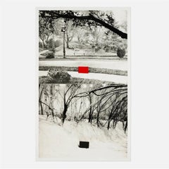
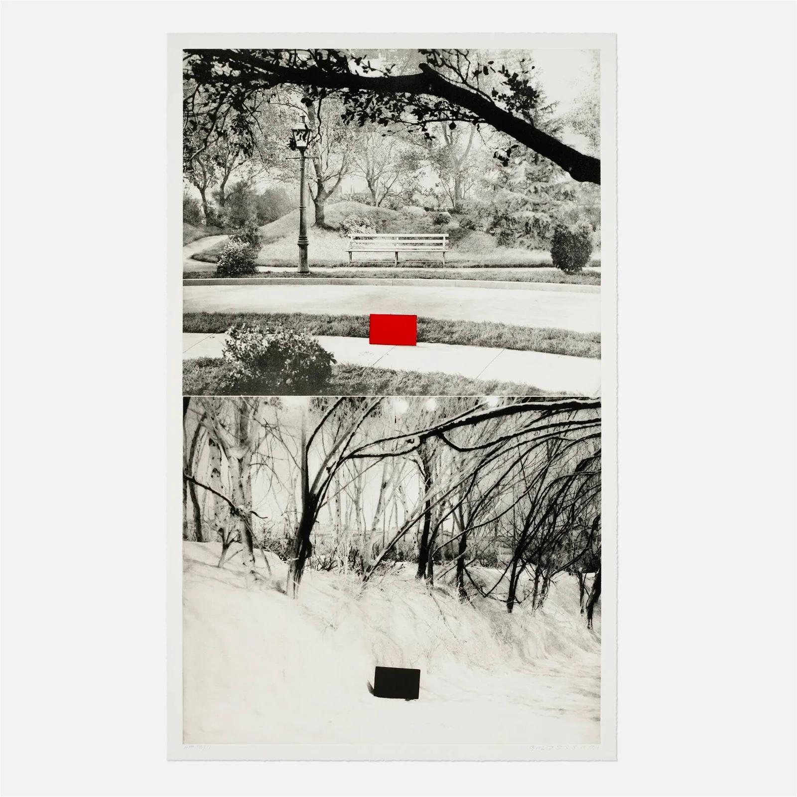
- Two Sets (One with Bench)By John BaldessariLocated in Miami, FLJohn Baldessari (June 17, 1931 - January 2, 2020, American) Two Sets (One with Bench) 1989-1990 Photogravure with aquatint 47 3/8 29 5/8 in. Artist's Proof (A.P) Pencil signed and nu...Category
1990s Contemporary Landscape Prints
MaterialsAquatint, Photogravure
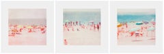
- The Wildwood EtchingsBy Isca Greenfield-SandersLocated in New York, NY2014, set of 3 photogravures with aquatint, 18 3/4 x 18 inches each, edition of 35. Signed and numbered by the artist.Category
21st Century and Contemporary Figurative Prints
MaterialsAquatint, Etching, Photogravure
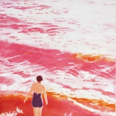
- WADING I (PINK)By Isca Greenfield-SandersLocated in Fairfield, CTDirect to plate photogravure and aquatint. Edition of 40.Category
2010s Landscape Prints
MaterialsPaper, Aquatint, Photogravure
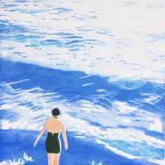
- WADING I (BLUE)By Isca Greenfield-SandersLocated in Fairfield, CTDirect to plate photogravure and aquatint. Edition of 40.Category
2010s Landscape Prints
MaterialsPaper, Aquatint, Photogravure
- Harney County, OregonBy Robert AdamsLocated in New York, NYRobert Adams Harney County, Oregon 2005 Set of four photogravures Each image: 19 7/8 x 15 5/8 inches; 51 x 40 cm Each frame: 29 x 25 inches; 74 x 64 cm Edition of 30 Each signed, ...Category
Early 2000s Contemporary Landscape Prints
MaterialsPhotogravure
- Presentation print for Royal Mail Christmas Stamp Series (Signed) British artistBy Andy GoldsworthyLocated in New York, NYAndy Goldsworthy Presentation print for Royal Mail Christmas Stamp Series, 2003 Color photogravure on handmade rag paper with deckled edges 15 × 20 1/4 inches hand signed lower right...Category
Early 2000s Contemporary Abstract Prints
MaterialsHandmade Paper, Photogravure, Mixed Media, Pencil