Items Similar to Very Large Marine Shipping Scene Impressive Statement Piece


Want more images or videos?
Request additional images or videos from the seller
1 of 13
Dutch/ FlemishVery Large Marine Shipping Scene Impressive Statement Piece
About the Item
Large Marine Scene
Dutch or Flemish, 20th century
color print on canvas, framed
framed: 27 x 34 inches
canvas: 20 x 27.5 inches
provenance: private collection, UK
condition: very good and sound condition
- Creator:Dutch/ Flemish
- Dimensions:Height: 27 in (68.58 cm)Width: 34 in (86.36 cm)
- Movement & Style:
- Period:
- Condition:
- Gallery Location:Cirencester, GB
- Reference Number:1stDibs: LU509313285362
About the Seller
5.0
Platinum Seller
These expertly vetted sellers are 1stDibs' most experienced sellers and are rated highest by our customers.
Established in 1989
1stDibs seller since 2016
3,450 sales on 1stDibs
Typical response time: 2 hours
- ShippingRetrieving quote...Ships From: Cirencester, United Kingdom
- Return PolicyA return for this item may be initiated within 3 days of delivery.
More From This SellerView All
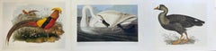
- Classic Bird Color Prints x 3 - Beautiful Set of 3 Classical BirdsLocated in Cirencester, GloucestershireSet of 3 Colored Bird Prints each unframed, 10.5 x 14.5 inches condition: very good A beautiful set of 3 colored prints of classical birds in landscape settings. As a set, they make wonderful interior design either presented on their own or as a gallery wall grouping.Category
20th Century Old Masters Animal Prints
MaterialsColor
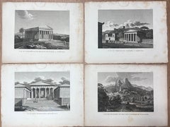
- Set of 4 Ancient Greek Monuments Pantheon Athens Antique French Engravings SetBy Antique FrenchLocated in Cirencester, GloucestershireSet of 4 Antique French Black & White Engravings Ancient Greek views and monument landmarks including the Pantheon, Athens. each paper : 9 x 12 inches...Category
19th Century Renaissance Landscape Prints
MaterialsEngraving
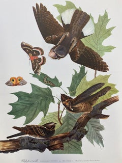
- Large Classical Bird Color Print after John James Audubon - Belted KingfisherBy After John James AudubonLocated in Cirencester, GloucestershireClassical Bird print, after John James Audubon, printed by Harry N. Abrams, Publishers, New York unframed, 17 x 14 inches color print on pap...Category
20th Century Victorian Animal Prints
MaterialsColor
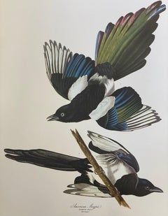
- Large Classical Bird Color Print after John James Audubon - American MagpieBy After John James AudubonLocated in Cirencester, GloucestershireClassical Bird print, after John James Audubon, printed by Harry N. Abrams, Publishers, New York unframed, 17 x 14 inches color print on paper condition: very good provenance: from...Category
20th Century Victorian Animal Prints
MaterialsColor
- Large Classical Bird Color Print after John James Audubon - Brown PelicanBy After John James AudubonLocated in Cirencester, GloucestershireClassical Bird print, after John James Audubon, printed by Harry N. Abrams, Publishers, New York unframed, 17 x 14 inches color print on pap...Category
20th Century Victorian Animal Prints
MaterialsColor
- Large Classical Bird Color Print after John James Audubon - Painted FinchBy After John James AudubonLocated in Cirencester, GloucestershireClassical Bird print, after John James Audubon, printed by Harry N. Abrams, Publishers, New York unframed, 17 x 14 inches color print on pap...Category
20th Century Victorian Animal Prints
MaterialsColor


You May Also Like
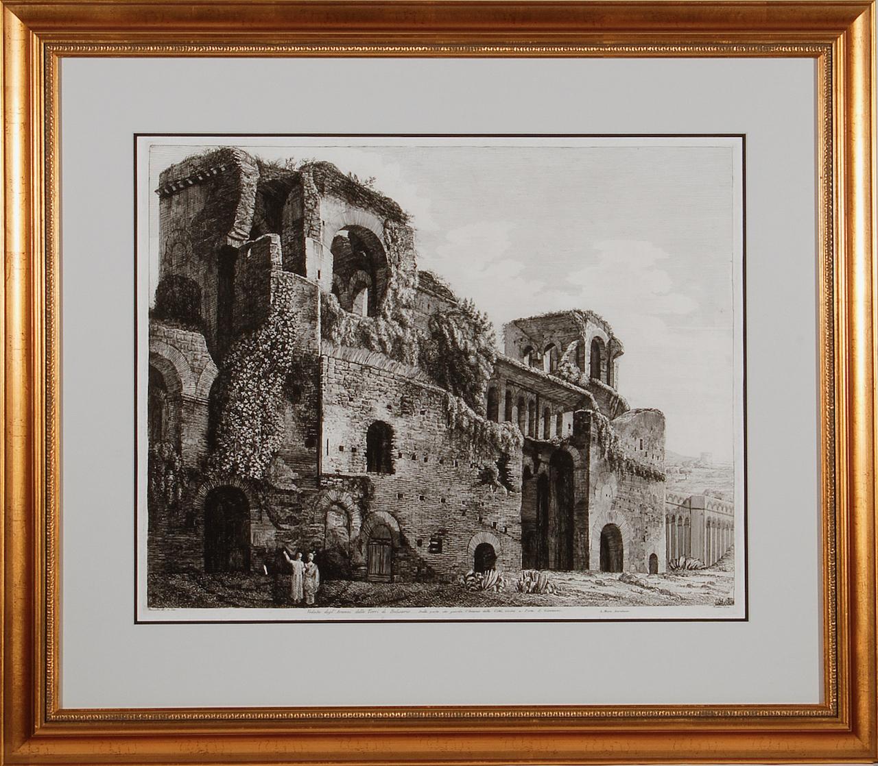
- Ruins of the Roman Baths of Belisarius: A 19th C. Etching by Luigi RossiniBy Luigi RossiniLocated in Alamo, CAThis early 19th century etching entitled "Veduta degl' Avanzi delle Torri di Belisario Dalla parte che guarda l' Interno della Città, vicino a Porta S. Giovanni, A. Mura Aureliane" (...Category
1820s Old Masters Landscape Prints
MaterialsEtching
- L'Isle de France: A Hand-colored 17th Century Map by De WitBy Frederick de WitLocated in Alamo, CAThis colorful and detailed 17th century hand-colored copperplate map by Frederick De Wit was published in Amsterdam between 1666 and 1760. The map depicts the Île-de-France, which is one of the ancient provinces of France. Paris is located in the center of the map, with Versailles to the southwest The map extends from Rouen in the west to Reims in the east. The area around Paris, the Véxin Français, was the original domain of the king of France. Other areas were ruled by French feudal lords. For example, the Véxin Normand area was the domain of the Duke of Normandy...Category
Early 18th Century Old Masters More Prints
MaterialsEngraving
- Map of the Russian Empire: An Original 18th Century Hand-colored Map by E. BowenLocated in Alamo, CAThis is an original 18th century hand-colored map entitled "A New & Accurate Map of The Whole Russian Empire, As Contain'd Both In Europe and Asia, Drawn from Authentic Journals, Sur...Category
Mid-18th Century Old Masters Landscape Prints
MaterialsEngraving
- View of Emden, Germany: A 16th Century Hand-colored Map by Braun & HogenbergBy Franz HogenbergLocated in Alamo, CAThis is a 16th century original hand-colored copperplate engraved map of a bird's-eye View of Embden, Germany entitled " Emuda, vulgo Embden vrbs Frisia orientalis primaria" by Georg Braun & Franz Hogenberg, in volume II of their famous city atlas "Civitates Orbis Terrarum", published in Cologne, Germany in 1575. This is a beautifully colored and detailed map of Emden, a seaport in northwestern Germany, along the Ems River and perhaps portions of over Dollart Bay, near the border with the Netherland. The map depicts a bird's-eye view of the city from the southwest, as well as a view of the harbor and an extensive system of canals. Numerous ships of various sizes, as well as two rowboats containing numerous occupants are seen in the main waterway in the foreground and additional boats line two canals in the center of the city. Two men and two women are shown on a hill in the foreground on the right, dressed in the 16th century style of nobility. Two ornate crests are included in each corner. A title strap-work cartouche is in the upper center with the title in Latin. The crest on the right including Engelke up de Muer (The Little Angel on the Wall) was granted by Emperor Maximilian I in 1495. This is an English translation of an excerpt of Braun's description of Embden: "In Emden, the capital of East Frisia, rich merchants live in very fine houses. The city has a broad and well-situated harbour, which in my opinion is unique in Holland. Frisia and the whole of the Netherlands, for the ships can anchor here right under the city walls. They have also extended the harbour as far as the New Town, so that up to 400 ships can now find shelter here when the sea is rough." The emphasis on the harbor and waterways within the city highlights the importance of Emden's place as a seaport at this time. Embden developed from a Dutch/Flemish trading settlement in the 7th-8th centuries into a city as late as late 14th century. In 1494 it was granted staple rights, and in 1536 the harbour was extended. In the mid-16th century Emden's port was thought to have the most ships in Europe. Its population then was about 5,000, rising to 15,000 by the end of the 16th century. The Ems River flowed directly under the city walls, but its course was changed in the 17th century by the construction of a canal. Emden has canals within its city limits, a typical feature of Dutch towns, which also enabled the extension of the harbor. In 1744 Emden was annexed by Prussia and is now part of Germany. It was captured by French forces in 1757 during the Seven Years' War, but recaptured by Anglo-German forces in 1758. During the Napoleonic French era, Emden and the surrounding lands of East Frisia were part of the short-lived Kingdom of Holland. References:Van der Krogt 4, 1230, State 2; Taschen, Braun and Hogenberg...Category
16th Century Old Masters Landscape Prints
MaterialsEngraving
- Ireland: A Framed 17th Century Hand-colored Map by Jan JannsonBy Johannes JanssoniusLocated in Alamo, CAThis is a 17th century hand-colored map entitled "Hibernia Regnum Vulgo Ireland" by Johannes Janssonius's (Jan Jansson), published in Amsterdam in 1640. This highly detailed map depicts the Emerald Isle with an extensive display of towns, roads, mountains, rivers, lakes and county borders, etc. It includes two decorative cartouches on the left. The title cartouche includes the Irish harp and the second, in the upper left, includes a lion wearing a crown on the left, a unicorn on the right and a coat-of-arms in the middle, which includes another Irish harp. A distance scale is seen in the lower right, augmented with two putti. The map is embellished with three sailing ships and a sea monster. Western portions of Scotland and England...Category
Mid-17th Century Old Masters Landscape Prints
MaterialsEngraving
- View of Meissen, Germany: A 16th Century Hand-colored Map by Braun & HogenbergBy Franz HogenbergLocated in Alamo, CAThis is a 16th century original hand-colored copperplate engraved map of View of View of Meissen, Germany entitled "Misena Hermun Duvorum Urbs" by Georg Braun & Franz Hogenberg, from their famous city atlas "Civitates Orbis Terrarum", published in Cologne, Germany in 1575. The map depicts a side view and bird's-eye view, looking across the Elbe River (labelled Albis Fluvius on the map; White River in Latin) from the northeast. In the foreground are three women in conversation on a hill above the city, along with a man and a woman in conversation by a road, all dressed in contemporary costumes of the upper class. A coat-of-arms is present in each upper corner. A great castle sits atop a hill in the background on the left. Meissen grew up around Albrechtsburg castle, built by Emperor Henry I around AD 929, and was granted a municipal charter at the end of the 12th century. From 1471 onwards, the castle complex was reconstructed as the residence of the Saxon electors on the northeast corner of the Domberg (Cathedral Hill). Meissen cathedral is a Gothic hall church begun c. 1270; in 1413 a bolt of lightning destroyed its west towers, which were replaced only in the 20th century. Meissen lies to the northwest of Dresden, Germany in Saxony. Meissen is famous for its Meissen porcelain and the Albrechtsburg castle The following is an English translation of an excerpt from Braun's description of the city: "This city is surrounded by very many rivers, to the east flows the Elbe, to the south the Triebisch, to the west are the mountains, to the north the Meisse, after which the city is said to be named. The city is well-situated in its surroundings, the navigable rivers, the mountains and the healthy air. Around the city there is a good land to grow grain, fertile vineyards on the hillsides and without doubt the mountains are not without ore, for one mile away, up the Elbe, is Scharfenberg, where silver and lead ore are mined.." References: Van der Krogt 4, 2684; Taschen, Braun and Hogenberg...Category
16th Century Old Masters Landscape Prints
MaterialsEngraving