
Antique Maps Of Britain

to
78
122
37
78
67
57
31
25
19
14
14
13
13
13
9
7
5
5
4
4
4
4
3
3
3
3
3
3
3
2
2
2
2
2
2
2
1
1
1
1
1
1
1
1
3
3
3
2
2
Sort By
Antique Map of Britain in Roman Times
Located in Langweer, NL
Antique map titled 'Britannia Romana collected from Ptolemy (..)'. Map of Britain in Roman times
Category

Early 19th Century Antique Maps Of Britain

Materials

Paper

Antique Map of Britain in Roman Times
$460 Sale Price
20% Off
H 17.6 in W 11.07 in D 0.02 in
Antique Map of British North America by Lowry, '1852'
Located in Langweer, NL
Antique map titled 'British North America'. Original map of British North America. This map
Category

Mid-19th Century Antique Maps Of Britain

Materials

Paper

Antique Map of British North America by Lowry, '1852'
$94 Sale Price
20% Off
H 9.65 in W 12.21 in D 0.02 in
Large Original Vintage Map of British Island Possessions, circa 1920
Located in St Annes, Lancashire
Great map of British Island Possessions Original color. Good condition Published by Alexander
Category

1920s English Antique Maps Of Britain

Materials

Paper

Antique Map of British America by Tallis 'c.1850'
Located in Langweer, NL
Antique map titled 'British America'. Decorative map of British America, with vignettes showing
Category

Mid-19th Century Antique Maps Of Britain

Materials

Paper

Antique Map of British America by Tallis 'c.1850'
$440 Sale Price
25% Off
H 10.44 in W 13.78 in D 0.02 in
Antique Map of British North America by W. G. Blackie, 1859
Located in Langweer, NL
Antique map titled 'British North America'. Original antique map of British North America. This map
Category

Mid-19th Century Antique Maps Of Britain

Materials

Paper

Antique Map of British North America by W. G. Blackie, 1859
$235 Sale Price
20% Off
H 14.57 in W 21.26 in D 0.02 in
Detailed Antique Map of Britain, Wales and the Coast of Ireland
Located in Langweer, NL
Antique map titled 'Carta d'Inghilterra e del Principato di Galles'. Detailed map of Britain, Wales
Category

Mid-19th Century Antique Maps Of Britain

Materials

Paper

Detailed Antique Map of Britain, Wales and the Coast of Ireland
$244 Sale Price
20% Off
H 11.15 in W 18.04 in D 0.02 in
19th-Century Decorative Map of British America with Arctic and Pacific Vignettes
Located in Langweer, NL
19th-Century Decorative Map of British America with Arctic and Pacific Vignettes This 19th
Category

1850s Antique Maps Of Britain

Materials

Paper

A Tallis Map of British Guiana with Colonial Vignettes and Other Landmarks, 1851
Located in Langweer, NL
This Tallis map of British Guiana (now known as Guyana) is a richly decorated document, much like
Category

1850s Antique Maps Of Britain

Materials

Paper

Antique Map of British India with Insets of Kabul and Nepal
Located in Langweer, NL
Antique map titled 'British India, northern part'. Large format map of the northern area of the
Category

Early 19th Century Antique Maps Of Britain

Materials

Paper

Antique Map of British India with Insets of Kabul and Nepal
$545 Sale Price
20% Off
H 21.38 in W 25.12 in D 0.02 in
Antique Map of British North America, The Dominion of of Canada, 1882
Located in Langweer, NL
This map is titled "British North America, Dominion of Canada," from the 1882 Blackie Atlas. It
Category

1880s Antique Maps Of Britain

Materials

Paper

Antique Map of British North America, The Dominion of of Canada, 1882
$235 Sale Price
20% Off
H 14.97 in W 22.45 in D 0 in
Old Map of British Mediterranean Territories with Images of Historic Sites, 1851
Located in Langweer, NL
John Tallis & Company was a British map-making firm that gained widespread acclaim in the 19th
Category

1850s Antique Maps Of Britain

Materials

Paper

Antique Map of British Guayana with Insets of Georgetown, Devil's Rock Etc, 1851
Located in Langweer, NL
Antique map titled ‘British Guayana’. Includes decorative vignettes titled Georgetown, Christmas
Category

19th Century Antique Maps Of Britain

Materials

Paper

Antique Map of the British Isles with Walls, Settlements and Other Features
Located in Langweer, NL
Antique map titled 'Insulae Britannicae'. Interesting map of Britain, Scotland, and Ireland. It
Category

Late 18th Century Antique Maps Of Britain

Materials

Paper

Antique Map of the British Isles with Walls, Settlements and Other Features
$206 Sale Price
20% Off
H 7.88 in W 9.26 in D 0.02 in
Antique Map of the British Isles According to the Geography of the Roman Empire
Located in Langweer, NL
Antique map titled 'Insulae Britannicae'. Interesting map of Britain, Scotland, and Ireland. It
Category

Late 18th Century Antique Maps Of Britain

Materials

Paper

Hampshire County, Britain/England: A Map from Camden's" Britannia" in 1607
By John Norden
Located in Alamo, CA
An early hand-colored map of Britain's Hampshire county, published in the 1607 edition of William
Category

Early 17th Century English Antique Maps Of Britain

Materials

Paper

British Possessions on the North West Coast of South America, 1860
Located in Langweer, NL
British possessions on the northwest coast of South America during that time. It features a detailed map
Category

1860s Antique Maps Of Britain

Materials

Paper

British Possessions on the North West Coast of South America, 1860
$319 Sale Price
20% Off
H 18.51 in W 12.41 in D 0 in
Steel Engraved Map of Ancient Britain
Located in Langweer, NL
Antique map titled 'Angleterre Ancienne'. Original old map of Ancient Britain. Source unknown, to
Category

Late 19th Century Antique Maps Of Britain

Materials

Paper

Steel Engraved Map of Ancient Britain
$112 Sale Price
20% Off
H 10.24 in W 8.31 in D 0.02 in
British Island Group Map 1695 – Morden’s Smaller Islands of the British Ocean
Located in Langweer, NL
British Island Group Map 1695 – Morden’s Smaller Islands of the British Ocean This rare and
Category

Late 17th Century English Antique Maps Of Britain

Materials

Paper

Rare Small Antique Map of Great Britain and Ireland
Located in Langweer, NL
Antique map titled 'La Grande Bretagne et Irlande'. Small antique map of Great Britain and Ireland
Category

Mid-18th Century Antique Maps Of Britain

Materials

Paper

Rare Small Antique Map of Great Britain and Ireland
$216 Sale Price
20% Off
H 6.58 in W 7.21 in D 0.02 in
Antique Map of the British Isles with Outline Coloring
Located in Langweer, NL
Antique map titled 'Iles Britanniques'. Attractive map of the British Isles. Details England
Category

Mid-19th Century Antique Maps Of Britain

Materials

Paper

Antique Map of the British Isles with Outline Coloring
$103 Sale Price
20% Off
H 13.39 in W 10.12 in D 0.02 in
Antique Map of the British Isles by Johnston '1909'
Located in Langweer, NL
Antique map titled 'The British Isles'. Original antique map of the British Isles. With inset maps
Category

Early 20th Century Antique Maps Of Britain

Materials

Paper

Antique Map of the British Isles by Johnston '1909'
$235 Sale Price
20% Off
H 24.41 in W 19.49 in D 0.02 in
Map of the British Isles with Historical Kings, 1719
Located in Langweer, NL
This antique map, titled "Les Royaumes d'Angleterre d'Escosse et d'Irlande," offers a detailed view
Category

Early 18th Century Antique Maps Of Britain

Materials

Paper

Map of the British Isles with Historical Kings, 1719
$413 Sale Price
20% Off
H 7.64 in W 9.93 in D 0.02 in
Antique Map of the British Isles by Balbi '1847'
Located in Langweer, NL
Antique map titled 'Iles Britanniques'. Original antique map of the British Isles. This map
Category

Mid-19th Century Antique Maps Of Britain

Materials

Paper

Antique Map of the British Isles by Balbi '1847'
$141 Sale Price
20% Off
H 9.06 in W 11.23 in D 0.02 in
Antique Map of the British Isles by Delamarche, 1806
Located in Langweer, NL
Antique map titled 'Les Isles Britanniques.' Decorative map of the British Isles by Robert de
Category

19th Century Antique Maps Of Britain

Materials

Paper

Antique Map of the British Isles by Delamarche, 1806
$141 Sale Price
20% Off
H 11.3 in W 14.65 in D 0 in
1806 John Cary Map of Hindoostan – Detailed British Cartography of India
Located in Langweer, NL
Title: 1806 John Cary Map of Hindoostan – Detailed British Cartography of India This highly
Category

Early 1800s Antique Maps Of Britain

Materials

Paper

1806 John Cary Map of Hindoostan – Detailed British Cartography of India
$507 Sale Price
20% Off
H 21.26 in W 24.41 in D 0 in
Antique Map of Gloucestershire in Britain by Camden, 1637
Located in Langweer, NL
Antique map titled 'Glocestriae comitatus olim sedes Dobunorum'. Map of Gloucestershire, England
Category

17th Century Antique Maps Of Britain

Materials

Paper

Antique Map of Gloucestershire in Britain by Camden, 1637
$338 Sale Price
20% Off
H 12.8 in W 16.15 in D 0 in
Antique Map of Northern India 'British Indies', C.1880
Located in Langweer, NL
Plate 56 : 'Britsch-Indie, Noord.' (British Indies, North). This lithographed map originates from
Category

19th Century Antique Maps Of Britain

Materials

Paper

Antique Map of Northern India 'British Indies', C.1880
$61 Sale Price
20% Off
H 9.45 in W 7.49 in D 0 in
Antique Map of the British Isles by Lotter, 1764
Located in Langweer, NL
Antique map titled 'Le Grand Bretagne ou les Royaumes d'Angleterre et d'Ecosse'. Old engraved map
Category

18th Century Antique Maps Of Britain

Materials

Paper

Antique Map of the British Isles by Lotter, 1764
$315 Sale Price
20% Off
H 21.26 in W 25.2 in D 0 in
Antique Map of the British Isles with Contemporary Hand Coloring
Located in Langweer, NL
Antique map titled 'Les Isles Britanniques'. Original antique map of the British Isles, with
Category

Late 18th Century Antique Maps Of Britain

Materials

Paper

Antique Map of the British Isles with Contemporary Hand Coloring
$263 Sale Price
20% Off
H 12.52 in W 9.73 in D 0.02 in
Interesting Small Map of the British Isles with Hand Coloring
Located in Langweer, NL
Antique map titled 'Insularum Britannicarum Tabula'. Interesting small map of the British Isles by
Category

Early 18th Century Antique Maps Of Britain

Materials

Paper

Interesting Small Map of the British Isles with Hand Coloring
$357 Sale Price
20% Off
H 7.49 in W 4.34 in D 0.02 in
Attractive Small Map of the British Isles with Decorative Cartouche
Located in Langweer, NL
'. Attractive small map of the British Isles with decorative cartouche. Published circa 1705.
Category

Early 18th Century Antique Maps Of Britain

Materials

Paper

Attractive Small Map of the British Isles with Decorative Cartouche
$244 Sale Price
20% Off
H 6.38 in W 7.6 in D 0.02 in
Original Antique Map of the British Isles Surrounded by Text
Located in Langweer, NL
Antique map titled 'Des Isles Britanniques'. Original antique map of the British isles. This map is
Category

Late 18th Century Antique Maps Of Britain

Materials

Paper

Original Antique Map of the British Isles Surrounded by Text
$347 Sale Price
20% Off
H 16.54 in W 23.71 in D 0.02 in
Rare Old Map of the British Solomon Islands Protectorate, 1925
Located in Langweer, NL
Antique map titled 'British Solomon Islands Protectorate'. Old map of the British Solomon
Category

1920s Antique Maps Of Britain

Materials

Paper

Rare Old Map of the British Solomon Islands Protectorate, 1925
$253 Sale Price
20% Off
H 12.8 in W 17.13 in D 0 in
Antique Map of the British Isles by Covens & Mortier, 1730
By Covens & Mortier
Located in Langweer, NL
Covens and Mortier's attractive double-page engraved map of the British Isles, based on the 1702 De
Category

Mid-18th Century Antique Maps Of Britain

Materials

Paper

Antique Map of the British Isles by Covens & Mortier, 1730
$611 Sale Price
20% Off
H 20.87 in W 25.79 in D 0.02 in
Antique Map of France by British Mapmaker Wells, c.1710
Located in Langweer, NL
Antique map titled 'A New Map of France (..)'. Original antique map of France. It covers all of
Category

18th Century Antique Maps Of Britain

Materials

Paper

Antique Map of France by British Mapmaker Wells, c.1710
$338 Sale Price
20% Off
H 18.12 in W 21.26 in D 0 in
Antique Map of the British Isles by H. Chatelain, 1719
By Henri-Abraham Chatelain
Located in Langweer, NL
Beautiful hand colored large format map of the British Isles, with large insets of the Eastern and
Category

Early 18th Century Antique Maps Of Britain

Materials

Paper

Antique Map of the British Isles by H. Chatelain, 1719
$705 Sale Price
20% Off
H 20.08 in W 25.2 in D 0.02 in
Antique Map of the Palaeontology of the British Isles by Johnston '1850'
Located in Langweer, NL
Antique map titled 'Palaeontological Map of the British Islands'. Original antique map showing the
Category

Mid-19th Century Antique Maps Of Britain

Materials

Paper

Antique Map of the Palaeontology of the British Isles by Johnston '1850'
$423 Sale Price
20% Off
H 21.07 in W 14.18 in D 0.02 in
Antique Map of the British Isles and Part of the Coast of France
Located in Langweer, NL
Antique map titled 'Carte Particuliere l'Angleterre (..)'. Original antique map of the British
Category

Mid-19th Century Antique Maps Of Britain

Materials

Paper

Antique Map of the British Isles and Part of the Coast of France
$216 Sale Price
20% Off
H 21.38 in W 16.3 in D 0.02 in
1808 C. Smith Map of Hindoostan – British India with Intricate Details
Located in Langweer, NL
Title: 1808 C. Smith Map of Hindoostan – British India with Intricate Details This map, titled
Category

Early 1800s Antique Maps Of Britain

Materials

Paper

1808 C. Smith Map of Hindoostan – British India with Intricate Details
$366 Sale Price
20% Off
H 15.56 in W 12.21 in D 0 in
1788 Map of Europe - France, Italy, Spain, Germany, Great Britain & Ireland
Located in Langweer, NL
Title: "1788 Map of Europe - France, Italy, Spain, Germany, Great Britain & Ireland by D'Anville
Category

1780s Antique Maps Of Britain

Materials

Paper

1788 Map of Europe - France, Italy, Spain, Germany, Great Britain & Ireland
$1,053 Sale Price
20% Off
H 31.5 in W 21.07 in D 0.01 in
Antique Map of the British Islands by J. Thomson, 1817
Located in Langweer, NL
Group of 5 maps of the Channel Islands, Scilly, Jersey, the Isle of Mann and the Isle of Wight
Category

Early 19th Century Antique Maps Of Britain

Materials

Paper

Antique Map of the British Islands by J. Thomson, 1817
$197 Sale Price
20% Off
H 21.07 in W 27.76 in D 0.02 in
Sebastian Münster's 16th Century Map of the British Isles, ca.1590
Located in Langweer, NL
/browned, lower right corner a bit thumbed). Sebastian Münster's 16th Century Map of the British Isles
Category

16th Century Antique Maps Of Britain

Materials

Paper

Sebastian Münster's 16th Century Map of the British Isles, ca.1590
$601 Sale Price
20% Off
H 13 in W 16.07 in D 0 in
Uncommon, Large Map of the British Islands to Petshora Bay, 1891
Located in Langweer, NL
Antique map titled 'British Islands to Petshora Bay - White Sea'. Uncommon, large map of the
Category

1890s Antique Maps Of Britain

Materials

Paper

Uncommon, Large Map of the British Islands to Petshora Bay, 1891
$1,090 Sale Price
20% Off
H 42.13 in W 27.56 in D 0 in
Interesting Map of Great Britain and Northern Europe with various Illustrations
Located in Langweer, NL
Antique map titled 'Itinera Varia Auctoris'. Very interesting map of Great Britain and Northern
Category

Mid-18th Century Antique Maps Of Britain

Materials

Paper

Antique Map of the British Isles, Insets of the Shetland Islands and Hebrides
Located in Langweer, NL
Antique map titled 'Great Britain and Ireland with ye Judges Circuits'. A scarce map of the British
Category

Late 18th Century Antique Maps Of Britain

Materials

Paper

Antique Map of the British Isles, Insets of the Shetland Islands and Hebrides
$620 Sale Price
20% Off
H 16.82 in W 19.45 in D 0.02 in
Antique Map of the Ancient British Isles by Janssonius 'circa 1640'
Located in Langweer, NL
Antique map titled 'Insularum Britannicarum Acurata Delineatio'. Original antique map of the
Category

Mid-17th Century Antique Maps Of Britain

Materials

Paper

Antique Map of the Ancient British Isles by Janssonius 'circa 1640'
$893 Sale Price
20% Off
H 19.89 in W 23.23 in D 0.02 in
Antique Map of the South Part of Great Britain by Tirion, c.1750
By Isaak Tirion
Located in Langweer, NL
Koningryk Engeland (..).' Attractive map showing the south part of Great Britain; the Kingdom of England
Category

18th Century Antique Maps Of Britain

Materials

Paper

Antique Map of the South Part of Great Britain by Tirion, c.1750
$423 Sale Price
20% Off
H 15.95 in W 16.54 in D 0 in
Beneath the Surface: James Wyld's 1844 Geological Map of the British Isles
Located in Langweer, NL
This superb original geological map of the United Kingdom of Great Britain and Ireland by James
Category

1840s Antique Maps Of Britain

Materials

Paper

Beneath the Surface: James Wyld's 1844 Geological Map of the British Isles
$846 Sale Price
20% Off
H 27.17 in W 16.93 in D 0 in
Antique Map of the British Possessions in North America by Wyld '1845'
Located in Langweer, NL
Antique map titled 'Map of The British Possessions in North America'. Original antique map of the
Category

Mid-19th Century Antique Maps Of Britain

Materials

Paper

Antique Map of the British Possessions in North America by Wyld '1845'
$188 Sale Price
20% Off
H 10.24 in W 14.18 in D 0.02 in
Large Antique Map of the British Isles, with inset of the Orkneys and Shetlands
Located in Langweer, NL
Antique map titled 'A Map of Great Britain and Ireland (..)'. Large antique map of the British
Category

Late 18th Century Antique Maps Of Britain

Materials

Paper

Large Antique Map of the British Isles, with inset of the Orkneys and Shetlands
$601 Sale Price
20% Off
H 18.43 in W 24.93 in D 0.02 in
Antique Map 'Colored Cartouches' of the British Isles by Covens & Mortier ‘1761’
By Covens & Mortier
Located in Langweer, NL
Covens and Mortier's attractive double-page engraved map of the British Isles, based on the 1702 De
Category

Late 18th Century Antique Maps Of Britain

Materials

Paper

England, Scotland & Ireland: A Hand Colored Map of Great Britain by Tirion
By Isaak Tirion
Located in Alamo, CA
This is a hand-colored double page copperplate map of Great Britain entitled "Nieuwe Kaart van de
Category

Mid-18th Century Dutch Antique Maps Of Britain

Materials

Paper

Old Map of Indonesian Islands Borneo, Celebes, New Guinea & New Britain, 1792
Located in Langweer, NL
Antique map titled 'Partie de la Nouvelle Grande Carte des Indes Orientales, contenant les Isles de
Category

1790s Antique Maps Of Britain

Materials

Paper

Old Map of Indonesian Islands Borneo, Celebes, New Guinea & New Britain, 1792
$1,363 Sale Price
20% Off
H 21.78 in W 25.99 in D 0 in
Antique Map of the British Isles and Part of Europe by Chatelain, c.1720
Located in Langweer, NL
Antique map titled 'Carte pour l'Intelligence de l'Histoire d'Angleterre (..)'. Decorative map
Category

18th Century Antique Maps Of Britain

Materials

Paper

Colorful Detailed Antique Map of The British Islands and `The North Sea, 1882
Located in Langweer, NL
Discover 'The British Islands and The North Sea' Map with Insets of Orkney, Shetland, and Channel
Category

1880s Antique Maps Of Britain

Materials

Paper

Rare Hand-colored Map of the British Isles by Gerard Valk, Published circa 1700
Located in Langweer, NL
Map of the British Isles by Gerard Valk circa 1700 – Hand-Colored Engraving This elegant
Category

Early 1700s Dutch Antique Maps Of Britain

Materials

Paper

Antique Map of New Guinea and New Britain by P. Carteret, circa 1773
Located in Langweer, NL
Antique Map: A Chart of Captain Carteret's Discoveries at New Britain (1769) This rare and
Category

Late 18th Century Antique Maps Of Britain

Materials

Paper

Antique Map of New Guinea and New Britain by P. Carteret, circa 1773
$517 Sale Price
20% Off
H 10.63 in W 28.55 in D 0.02 in
Antique Map of Great Britain and Ireland by Brion de la Tour, 1766
Located in Langweer, NL
Antique map titled 'Les Isles Britanniques (..).' Attractive map of Great Britain surrounded by
Category

18th Century Antique Maps Of Britain

Materials

Paper

Antique Map of Great Britain and Ireland by Brion de la Tour, 1766
$517 Sale Price
20% Off
H 11.54 in W 14.97 in D 0 in
  • 1
Get Updated with New Arrivals
Save "Antique Maps Of Britain", and we’ll notify you when there are new listings in this category.

Antique Maps Of Britain For Sale on 1stDibs

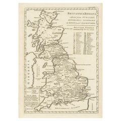
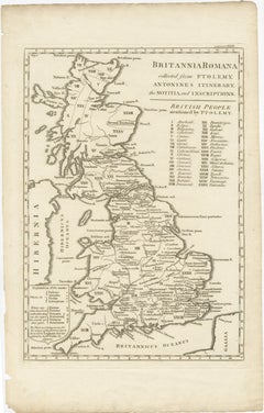
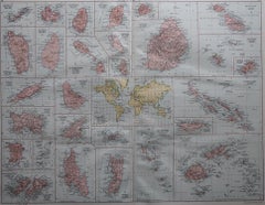
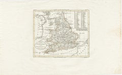
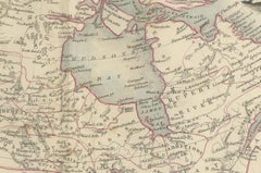
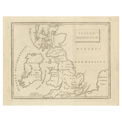
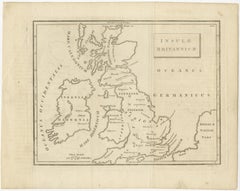
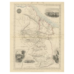
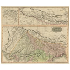
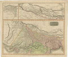
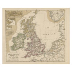
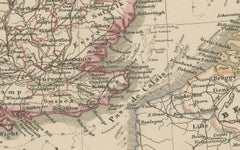
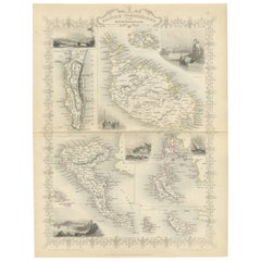
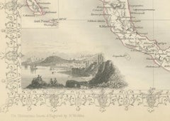
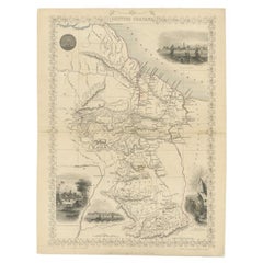
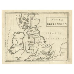
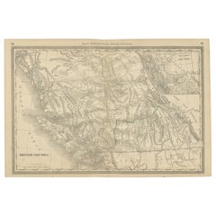
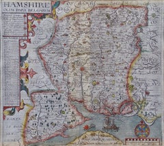
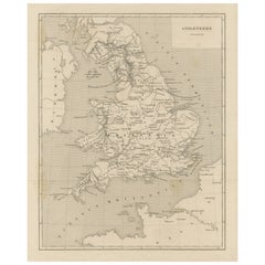
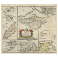
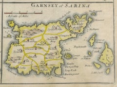
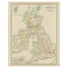
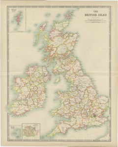
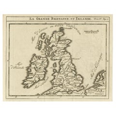
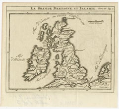
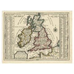
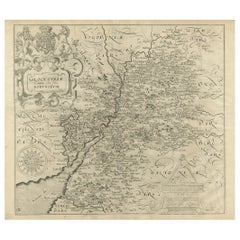
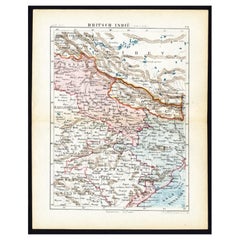
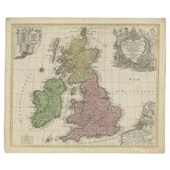
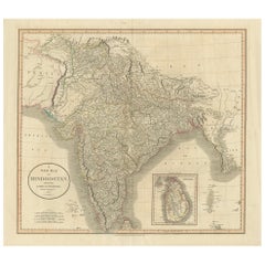
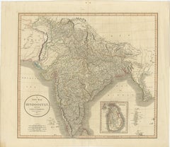
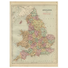
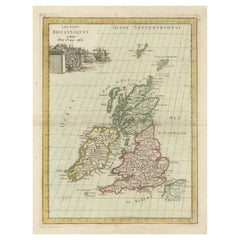
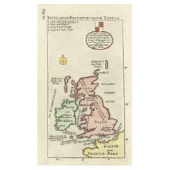
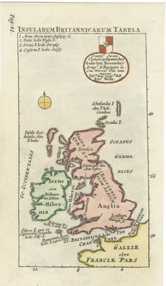
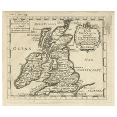
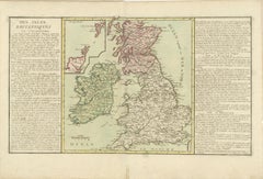
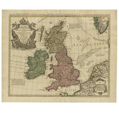
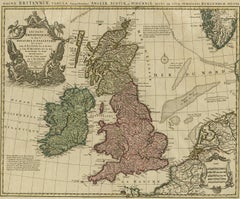
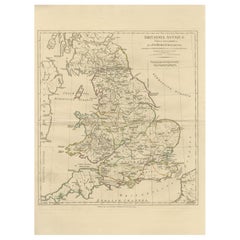
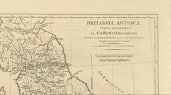
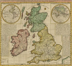
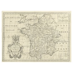
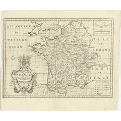
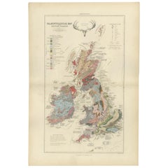
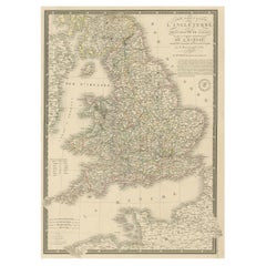
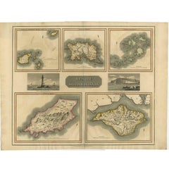
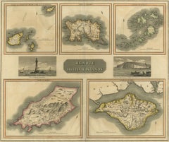
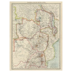
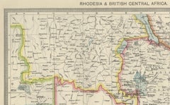
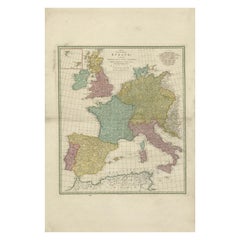
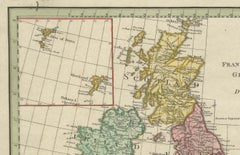
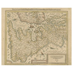
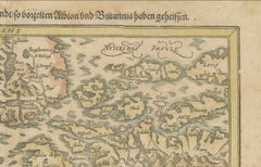
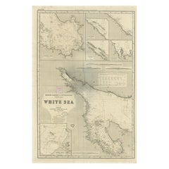
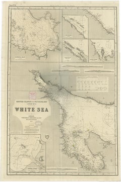
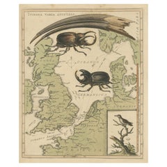
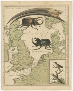
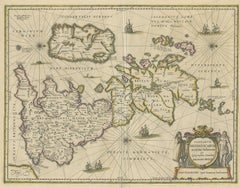
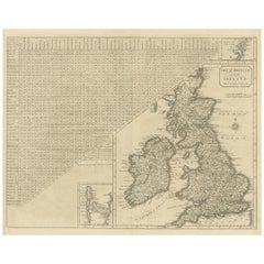
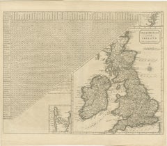
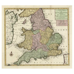
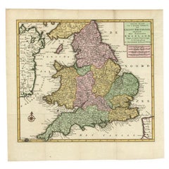
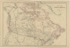
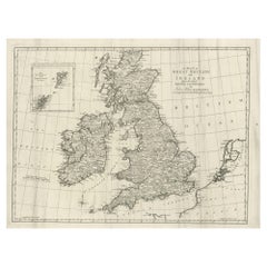
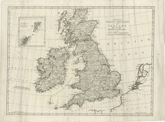
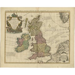
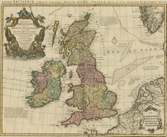
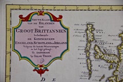
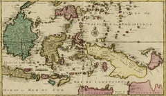
At 1stDibs, there are many versions of the ideal antique maps of britain for your home. An antique maps of britain — often made from paper, wood and brass — can elevate any home. You’ve searched high and low for the perfect antique maps of britain — we have versions that date back to the 18th Century alongside those produced as recently as the 20th Century are available. When you’re browsing for the right antique maps of britain, those designed in styles are of considerable interest. Many designers have produced at least one well-made antique maps of britain over the years, but those crafted by Covens & Mortier, Isaak Tirion and Henri-Abraham Chatelain are often thought to be among the most beautiful.

How Much is a Antique Maps Of Britain?

An antique maps of britain can differ in price owing to various characteristics — the average selling price 1stDibs is $500, while the lowest priced sells for $72 and the highest can go for as much as $75,000.