Antique Maps Virginia

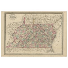
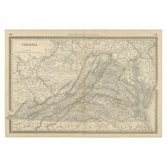
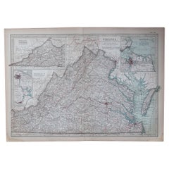
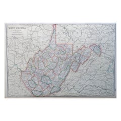
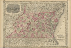
Antique Map of Virginia, Delaware, Maryland & West Virginia by Johnson, 1872
Located in Langweer, NL
Antique map titled 'Johnson's Viriginia (..). Original map of Virginia, Delaware, Maryland and West
Category

Late 19th Century Antique Maps Virginia

Materials

Paper

Antique Map of Virginia, Delaware, Maryland & West Virginia by Johnson, 1872
$240 Sale Price
20% Off
H 18.12 in W 26.38 in D 0.02 in
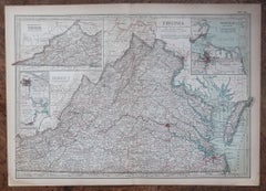
Antique Map of Virginia, with Inset Map of the South Western Continuation
Located in Langweer, NL
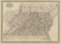
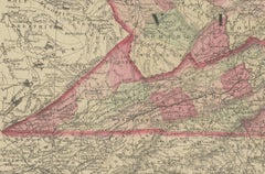
Antique map titled 'Virginia'. Original antique map of Virginia, United States. With inset map of
Category

Late 19th Century Antique Maps Virginia

Materials

Paper

Antique Map of Virginia, with Inset Map of the South Western Continuation
$279 Sale Price
20% Off
H 8.27 in W 10.63 in D 0.02 in
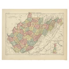
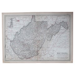
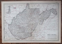
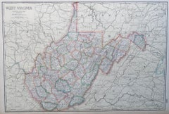
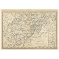
Antique Map of Virginia, with Inset Map of the Northern Part, 1888
Located in Langweer, NL
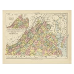
Antique map titled 'West Virginia'. Original antique map of Virginia, United States. With inset map
Category

Late 19th Century British Antique Maps Virginia

Materials

Paper

Antique Map of Virginia, with Inset Map of the Northern Part, 1888
$279 Sale Price
20% Off
H 8.27 in W 10.63 in D 0.02 in
Antique Virginia Map c.1888 – Railroads, Towns & The Old Dominion
Located in Langweer, NL
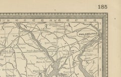
Antique Map of Virginia – Rand McNally, circa 1888 This antique map of Virginia was published by
Category

Late 19th Century American Antique Maps Virginia

Materials

Paper

Original Antique Map of the American State of Virginia, 1903
Located in St Annes, Lancashire
Antique map of Virginia Published By A & C Black. 1903 Original colour Good condition Unframed
Category

Early 1900s English Antique Maps Virginia

Materials

Paper

Original Antique Map of the American State of Virginia, 1903
Located in St Annes, Lancashire
Antique map of West Virginia Published By A & C Black. 1903 Original colour Good condition
Category

Early 1900s English Antique Maps Virginia

Materials

Paper

Large Original Antique Map of West Virginia, USA, C.1900
Located in St Annes, Lancashire
Fabulous map of West Virginia Original color Engraved and printed by the George F. Cram Company
Category

1890s American Antique Maps Virginia

Materials

Paper

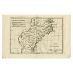
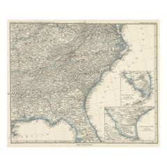
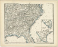
Antique Map of Tennessee, Kentucky, Virginia, Alabama, Georgia and Surroundings
Located in Langweer, NL
, Tennessee, Kentucky, Virginia and part of Florida. With inset maps of the southern part of Florida and the
Category

Mid-19th Century Antique Maps Virginia

Materials

Paper

Antique Map of Tennessee, Kentucky, Virginia, Alabama, Georgia and Surroundings
$649 Sale Price
25% Off
H 15.16 in W 18.71 in D 0.02 in
West Virginia Antique Railroad Map c.1888 – Mountain State Counties & Towns
Located in Langweer, NL
Antique Map of West Virginia – Rand McNally, circa 1888 This antique map of West Virginia was
Category

Late 19th Century American Antique Maps Virginia

Materials

Paper

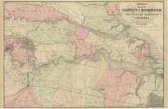
1862 Johnson's Map of the Vicinity of Richmond & Peninsular Campaign, Virginia
Located in Langweer, NL
Title: 1862 Johnson's Map of the Vicinity of Richmond & Peninsular Campaign, Virginia Description
Category

1860s American Antique Maps Virginia

Materials

Paper

1864 Johnson's Map of Virginia, Delaware, and Maryland with Fort Monroe Inset
Located in Langweer, NL
Title: 1864 Johnson's Map of Virginia, Delaware, and Maryland with Fort Monroe Inset Description
Category

1860s Antique Maps Virginia

Materials

Paper

Antique Map of Virginia & the Chesapeake Bay by Jacques-Nicolas Bellin, c. 1750
By Jacques-Nicolas Bellin
Located in Philadelphia, PA
celui des Comtés." Which translates as: "Map of Virginia, Chesapeake Bay, and Neighboring Countries
Category

18th Century French Baroque Antique Maps Virginia

Materials

Paper

1837 Mitchell's "Tourist's Pocket Map of the State of Virginia" by J.H. Young
Located in Colorado Springs, CO
This is J. H. Young's pocket map of the Virginia, which shows county development current to 1835
Category

1830s American Antique Maps Virginia

Materials

Paper

Antique Maritime Chart of East Coast Virginia to Nova Scotia
Located in Norwell, MA
1920 nautical chart of the East Coast of the United States from Virginia to Maine, New Brunswick
Category

1920s North American Antique Maps Virginia

Materials

Paper

Engraving of Idols of Secotam Village in Virginia 'or now North Carolina', 1721
Located in Langweer, NL
image 'Le Dieu des Vents, autre Idole des Virginiens'. The God of Wind. Both idols are key to Virginian
Category

1720s Antique Maps Virginia

Materials

Paper

1870 "Johnson's North Carolina and South Carolina" Published by A. J. Johnson
Located in Colorado Springs, CO
are the neighboring states of Georgia, Tennessee, Kentucky, and Virginia. The map is beautifully
Category

1870s American Victorian Antique Maps Virginia

Materials

Paper

Virginia. USA. Century Atlas state antique vintage map
Located in Melbourne, Victoria
'The Century Atlas. Virginia' Original antique map, 1903. Central fold as issued. Map name and
Category

Early 20th Century Victorian Antique Maps Virginia

Materials

Lithograph

West Virginia. USA. Century Atlas state antique vintage map
Located in Melbourne, Victoria
'The Century Atlas. West Virginia' Original antique map, 1903. Central fold as issued. Map name
Category

Early 20th Century Victorian Antique Maps Virginia

Materials

Lithograph

Bermuda: An Early 17th Century Hand-colored Map by Henricus Hondius
By Henricus Hondius
Located in Alamo, CA
. The Bermudas were granted to the Virginia Company, which is referenced on the map. The distance to the
Category

Early 17th Century Old Masters Antique Maps Virginia

Materials

Engraving

Recent Sales

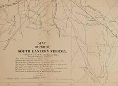
Rare Civil War Map of Part of South Eastern Virginia
Located in New York, NY
Rare Civil War Map published in 1862 by H. Lindenkohl & Chs. G. Krebs, shows fortifications used
Category

19th Century Realist Antique Maps Virginia

Materials

Lithograph

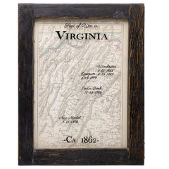
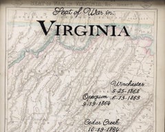
Antique Civil War Map of Virginia, "Seat of War in Virginia Sheet 2" 1862
Located in Colorado Springs, CO
This informative map of the Seat of War in Virginia, &c., sheet 2 covers the area in northern
Category

1860s British Antique Maps Virginia

Materials

Paper

Antique Civil War Map of Virginia, "Seat of War in Virginia Sheet 3" 1862
Located in Colorado Springs, CO
This informative map of the Seat of War in Virginia, sheet 3 spans the area from Petersburg and
Category

1860s British Antique Maps Virginia

Materials

Paper

1818 Carey Atlas Correct Hand-Colored Map of Virginia
Located in Colorado Springs, CO
VIRGINIA" Published by M. Carey & Sons, Philadelphia. This original, historic Map of Virginia is found
Category

1810s North American Antique Maps Virginia

Northeastern Virginia and Vicinity of Washington Civil War Map
Located in Colorado Springs, CO
This is an attractive and highly detailed Civil War map of Northern Virginia, which shows the
Category

1890s American Antique Maps Virginia

Rare 17th Century American Map of Virginia and Florida by Jan Janssonius
By Jan Johansson
Located in Wiscasset, ME
dedicated to Italy. 1646 a fourth volume came out with "English County Maps", a year after a similar issue
Category

18th Century and Earlier Dutch Rococo Antique Maps Virginia

Antique Map of Virginia, Showing the Location of Civil War Battle Fields, 1902
Located in Colorado Springs, CO
Presented is an original map from 1902 showing the locations of battlefields across Virginia and
Category

Early 1900s American Antique Maps Virginia

Materials

Paper

1862 Pocket Map of Eastern Virginia Representing the Seat of the Civil War
Located in Colorado Springs, CO
This is an 1862 map of Eastern Virginia, compiled by Walter L. Nicholson for the U.S. Coast Survey
Category

1860s Antique Maps Virginia

Defenses of Washington. Extract of Military Map of N.E. Virginia, Circa 1891
Located in Colorado Springs, CO
This historical and interesting map details the various defenses poised to defend Washington from
Category

1890s Antique Maps Virginia

"Historical Civil War Map" Antique U.S. Pocket Map by Asher and Co., 1862
Located in Colorado Springs, CO
shows all the events of the war, up until August 9th, 1862, in Culpepper, Virginia. This map shows the
Category

1860s American Antique Maps Virginia

Materials

Paper

Survey for Military Defenses Map of Northeastern Va and Vicinity of Washington
Located in Colorado Springs, CO
"Surveys for military defenses. Map of Northeastern Virginia and Vicinity of Washington. Corrected
Category

1890s American Antique Maps Virginia

Civil War Panorama of the Seat of War by John Bachmann, Antique Print circa 1864
Located in Colorado Springs, CO
theaters of War" (Stephenson & McKee Virginia in Maps p.239). This view, taken from the apparent vantage
Category

1860s American Antique Maps Virginia

Materials

Paper

County Map of Virginia and West Virginia /// American Cartography Geography Art
Located in Saint Augustine, FL
Artist: Samuel Augustus Mitchell (American, 1790-1868) Title: "County Map of Virginia and West
Category

1860s Academic Antique Maps Virginia

Materials

Watercolor, Engraving

Original Antique Map of Virginia, circa 1890
Located in St Annes, Lancashire
Great map of Virginia Original color. Published, circa 1890 Repairs to minor edge tears
Category

1890s English Other Antique Maps Virginia

Materials

Paper

Original Antique Map of Virginia, circa 1890
H 16.5 in W 11.75 in D 0.07 in
Large Original Antique Map of Virginia, USA, 1894
By Rand McNally & Co.
Located in St Annes, Lancashire
Fabulous map of Virginia Original color By Rand, McNally & Co. Published, 1894 Unframed
Category

1890s American Antique Maps Virginia

Materials

Paper

Original Antique Map of West Virginia, circa 1890
Located in St Annes, Lancashire
Great map of West Virginia Original color. Published, circa 1890 Repairs to a couple of
Category

1890s English Other Antique Maps Virginia

Materials

Paper

1829 Map of Virginia and Maryland by Anthony Finley
Located in Colorado Springs, CO
Maryland and Virginia from 1829. Originally drawn by D.H. Vance and engraved by J.H. Young, this map was
Category

1820s American Antique Maps Virginia

Materials

Paper

Large Original Antique Map of West Virginia, USA, 1894
By Rand McNally & Co.
Located in St Annes, Lancashire
Fabulous map of West Virginia Original color By Rand, McNally & Co. Published, 1894 Unframed
Category

1890s American Antique Maps Virginia

Materials

Paper

Large Original Antique Map of Virginia, USA, circa 1900
Located in St Annes, Lancashire
Fabulous map of Virginia Original color Engraved and printed by the George F. Cram Company
Category

1890s American Antique Maps Virginia

Materials

Paper

Original Antique Map of The American State of Virginia, 1889
Located in St Annes, Lancashire
Great map of Virginia Drawn and Engraved by W. & A.K. Johnston Published By A & C Black
Category

1880s Scottish Victorian Antique Maps Virginia

Materials

Paper

Original Antique Map of The American State of West Virginia, 1889
Located in St Annes, Lancashire
Great map of West Virginia Drawn and Engraved by W. & A.K. Johnston Published By A & C Black
Category

1880s Scottish Victorian Antique Maps Virginia

Materials

Paper

17th Century 1630 Nova Anglia Colored Map Engraving Belgium Virginia Jan Jansson
By J. Jansson
Located in Dayton, OH
17th century 1630 Nova Anglia colored map engraving Belgium Virginia Jan Jansson Nova Anglia by
Category

17th Century American Colonial Antique Maps Virginia

Materials

Paper

Antique Map of South Carolina, North Carolina, and Virginia by Tardieu, 1802
Located in Langweer, NL
) - **Features**: The map includes detailed representations of South Carolina, North Carolina, and Virginia
Category

Early 1800s Antique Maps Virginia

Materials

Paper

Old French Map with Details of New England, Lake Erie, Virginia, Maryland, 1780
Located in Langweer, NL
England. Detailed map of the region bounded by New England, Lake Erie, the Allegehenies, Virginia and
Category

1780s Antique Maps Virginia

Materials

Paper

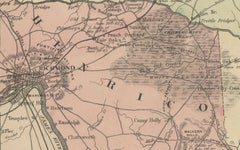
Antique Map of the vicinity of Richmond by Johnson, 1872
Located in Langweer, NL
Richmond and Peninsular Campaign in Virginia. This map originates from 'Johnson's New Illustrated Family
Category

Late 19th Century Antique Maps Virginia

Materials

Paper

Florida and Virginia: A 17th Century Hand-colored Map by Hondius after Mercator
By Gerard Mercator
Located in Alamo, CA
This hand-colored early 17th century copper-plate map entitled "Virginia et Florida" was originally
Category

Early 17th Century Antique Maps Virginia

Materials

Engraving

Florida and Virginia: A 17th Century Hand-colored Map by Hondius after Mercator
By Gerard Mercator
Located in Alamo, CA
This hand-colored early 17th century copper-plate map entitled "Virginia et Florida" was originally
Category

Early 17th Century Dutch Antique Maps Virginia

Materials

Paper

Virginie (Virginia)
By Alain Manesson Mallet
Located in New York, NY
Original engraving map of Virginia published by French cartographer Alain Mallet, who compiled and
Category

17th Century Realist Antique Maps Virginia

Materials

Engraving

1749 French Map of New England, New York, New Jersey, Pennsylvania and Virginia
Located in New York, NY
Original hand-colored map of the British Colonies in North America, a decade prior to the French
Category

1740s Realist Antique Maps Virginia

Materials

Engraving

People Also Browsed

Great Antique Bird's-Eye View Plan of Brielle by Blaeu in The Netherlands, 1649
Located in Langweer, NL
Antique print, titled: 'Briela.' Bird's-eye view plan of Brielle in The Netherlands. With key to locations and coats of arms. Text in Dutch on verso. This plan originates from th...
Category

1640s Antique Maps Virginia

Materials

Paper

Large Antique Map of the State of Texas, 1861
Located in Langweer, NL
Antique map titled 'Johnson's New Map of the State of Texas' Large map of Texas, shows railroads, wagon roads, the U.S. Mail Route, rivers, ports, large towns, and villages of the mi...
Category

Mid-19th Century American Antique Maps Virginia

Materials

Paper

Large Antique Map of the State of Texas, 1861
$471 Sale Price
20% Off
H 18.04 in W 26.58 in D 0.02 in
Pablo Picasso, "Tête de Femme", original linoleum cut, hand signed
By Pablo Picasso
Located in Chatsworth, CA
This piece is an original linoleum cut in color by Pablo Picasso, 1962. It is hand signed and numbered 40/50 from the edition of 50; there were also 35 artist's proofs. This piece is...
Category

1960s Modern Antique Maps Virginia

Materials

Linocut

19th Century Hudson River School Bucolic Landscape
By John Frederick Kensett
Located in Soquel, CA
Beautiful example of the Hudson River School romantic bucolic New York autumn landscape with cows foraging. Illegible artist signature on stretcher bar (See enhanced images). Conditi...
Category

1870s Hudson River School Antique Maps Virginia

Materials

Linen, Oil

Rare Antique Map of the Americas with Island California by Danckerts, c.1680
Located in Langweer, NL
Rare Antique Map of the Americas with Island California by Justus Danckerts, ca. 1696 This exceptional antique map titled Novissima et Accuratissima Totius Americae Descriptio per I...
Category

Late 17th Century Dutch Antique Maps Virginia

Materials

Paper

Rare Antique Map of the Americas with Island California by Danckerts, c.1680
$3,369 Sale Price
20% Off
H 20.48 in W 24.22 in D 0.02 in
Late 18th Century Spanish Refectory Table or Farm Table with Four Drawers
Located in Miami, FL
Unique piece 18th century Spanish refectory table. Beautiful console. Impressive farm table with four drawers Geometrical carved in front and and sides with iron hardware in drawers ...
Category

Late 18th Century Spanish Baroque Antique Maps Virginia

Materials

Walnut

8'x10'10" Scarlet Red Vintage Persian Heriz Hand Knotted 100% Wool Oriental Rug
Located in Carlstadt, NJ
Scarlet Red, Vintage Persian Heriz with Large Medallion Design, 100% Wool, Rustic Look, Even Wear, Cropped Thin, Good Condition, Sides and Ends Professionally Secured, Oriental Rug P...
Category

1960s Persian Heriz Serapi Antique Maps Virginia

Materials

Wool

6'6"x9' Crimson Red Vintage Persian Shiraz Worn Down Hand Knotted All Wool Rug
Located in Carlstadt, NJ
Crimson Red, Vintage Persian Shiraz with All Over Design, Worn and Distressed, Sheared Low, Zero Pile, Sides and Ends Professionally Secured, Hand Knotted, 100% Wool, Oriental Rug Pr...
Category

1960s Persian Bohemian Antique Maps Virginia

Materials

Wool

Biosca Dining Table in Stained Pine
By BIOSCA
Located in Waalwijk, NL
Biosca, dining table, stained pine, iron, Spain, 1960s Outstanding Spanish dining table that is executed by Biosca in an architectural way. The two bases feature a geometrical carve...
Category

1960s Spanish Mid-Century Modern Antique Maps Virginia

Materials

Iron

Biosca Dining Table in Stained Pine
$11,000
H 28.75 in W 74.81 in D 31.11 in
Unique Antique 19th Century Spanish Renaissance Bargueño in Solid Chestnut Wood
Located in Casteren, NL
On offer here is an exceptional Spanish Renaissance bargueño, crafted in the mid 19th century, from solid chestnut wood. This masterpiece, with its warm brown color, exudes timeless ...
Category

Mid-19th Century Spanish Renaissance Antique Maps Virginia

Materials

Brass

Unique Antique 19th Century Spanish Renaissance Bargueño in Solid Chestnut Wood
$11,552 Sale Price
20% Off
H 53.55 in W 44.89 in D 16.54 in
Original Limited Edition Print by Frederick S. Coburn, Narrative of Arthur G.Pym
By Goya
Located in St Annes, Lancashire
Sensational image by Frederick Simpson Coburn In the style of one of my favourite artists, Goya Photogravure Limited edition of 300. This is No. 84 From The Complete Works of Edg...
Category

Early 1900s American Romantic Antique Maps Virginia

Materials

Paper

Period 17th Century Walnut Spanish Large Armchair
Located in Hudson, NY
This Spanish walnut chair with a large wide seat was made circa 1680-1700. Made from well carved but simply done walnut the chair is centered on a fabric covered back with carved vol...
Category

Late 17th Century Spanish Renaissance Antique Maps Virginia

Materials

Walnut

Antique mid 18th Century Large Spanish Pinewood Carved Arm chair or Fauteuil
Located in Casteren, NL
Presenting a magnificent antique Spanish chair, crafted from solid pine wood around 1750. This chair is a substantial piece, reflecting the high status of its original owner and indi...
Category

Mid-18th Century Spanish Moorish Antique Maps Virginia

Materials

Pine, Rush

Abstract Blue and White Fish Patterns, Mediterranean, Expressionist Seascape
Located in Barcelona, ES
This series by Enric Servera explores the relationship of humans to salt and seawater. The intention of these works is to submerge us into the sea, a salty treasure that surrounds us...
Category

2010s Abstract Antique Maps Virginia

Materials

Paper, Mixed Media, Acrylic, Watercolor

Model Canoe by Native North American Indians, C.1930
Located in Incline Village, NV
Displayed on a custom made metal stand designed especially for this boat, this is a typical model dugout canoe carved by the Nootka or Makah Indian tribe of the Pacific Northwest Coa...
Category

1930s Canadian Native American Antique Maps Virginia

Materials

Wood

Model Canoe by Native North American Indians, C.1930
$1,565
H 4.75 in W 24.5 in D 5.75 in
Large Early Baroque Frame, “Regina Coeli” Italy, late 16th / early 17th Century
Located in Greding, DE
A large gilded Baroque frame made of carved wood with stucco applications, partially polychrome-painted. Inner dimensions: 116 x 78 cm The tall, rectangular frame is crowned by a lar...
Category

Early 17th Century Italian Baroque Antique Maps Virginia

Materials

Wood, Giltwood

Get Updated with New Arrivals
Save "Antique Maps Virginia", and we’ll notify you when there are new listings in this category.

Read More

Patchwork Quilts Are the Latest Nostalgic Design Trend

New or old, the coverlets add old-time charm to any space.

Medal-Worthy Memorabilia from Epic Past Olympic Games

Get into the games! These items celebrate the events, athletes, host countries and sporting spirit.

Ahoy! You’ve Never Seen a Collection of Sailor Art and Kitsch Quite Like This

French trendsetter and serial collector Daniel Rozensztroch tells us about his obsession with objects related to seafaring men.

39 Incredible Swimming Pools

It's hard to resist the allure of a beautiful pool. So, go ahead and daydream about whiling away your summer in paradise.

Pamela Shamshiri Shares the Secrets behind Her First-Ever Book and Its Effortlessly Cool Interiors

The sought-after designer worked with the team at Hoffman Creative to produce a monograph that beautifully showcases some of Studio Shamshiri's most inspiring projects.

Moroccan Artworks and Objects Take Center Stage in an Extraordinary Villa in Tangier

Italian writer and collector Umberto Pasti opens the doors to his remarkable cave of wonders in North Africa.

Montecito Has Drawn Royalty and Celebrities, and These Homes Are Proof of Its Allure

Hollywood A-listers, ex-pat aristocrats and art collectors and style setters of all stripes appreciate the allure of the coastal California hamlet — much on our minds after recent winter floods.

Whaam! Blam! Pow! — a New Book on Pop Art Packs a Punch

Publishing house Assouline and writer Julie Belcove have teamed up to trace the history of the genre, from Roy Lichtenstein, Andy Warhol and Yayoi Kusama to Mickalene Thomas and Jeff Koons.