British Empire Map
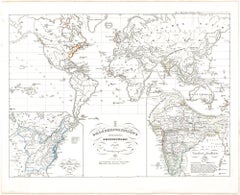
Old British Empire Map - Ancient Map by Karl Spruner - 1760 ca.
By Karl Spruner von Merz
Located in Roma, IT
Old British Empire Map is an artwork realized around 1760 by Karl Spruner.
Original hand-colored
Category
1760s Modern Figurative Prints
Materials
Etching
$331
H 14.38 in W 17.72 in D 0.08 in
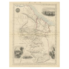
A Tallis Map of British Guiana with Colonial Vignettes and Other Landmarks, 1851
Located in Langweer, NL
economic and cultural importance of British Guiana to the British Empire. Maps with such detailed vignettes
Category
Antique 1850s Maps
Materials
Paper
$274 Sale Price
20% Off
H 14.26 in W 10.71 in D 0 in
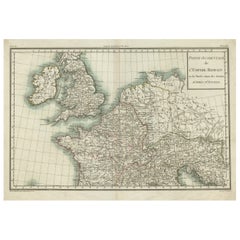
Western Roman Empire Map: British Isles & Gaul - 1802 Tardieu Atlas
Located in Langweer, NL
Antique Map Description and title: "Partie Occidentale de l'Empire Romain ou du Monde connu des
Category
Antique Early 1800s Maps
Materials
Paper
$416 Sale Price
20% Off
H 16.19 in W 23.04 in D 0.01 in
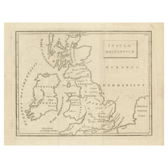
Antique Map of the British Isles According to the Geography of the Roman Empire
Located in Langweer, NL
Antique map titled 'Insulae Britannicae'. Interesting map of Britain, Scotland, and Ireland. It
Category
Antique Late 18th Century Maps
Materials
Paper
$170 Sale Price
20% Off
H 8.08 in W 10.24 in D 0.02 in
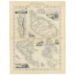
Old Map of British Mediterranean Territories with Images of Historic Sites, 1851
Located in Langweer, NL
this map were crucial naval bases and points of control that allowed the British Empire to exert
Category
Antique 1850s British Maps
Materials
Paper
$341 Sale Price
20% Off
H 14.26 in W 10.71 in D 0.01 in
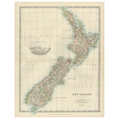
Antique Map of New Zealand, 1903, Featuring the North and South Islands and Alps
Located in Langweer, NL
importance of New Zealand within the British Empire at the time. This map is a fascinating window into the
Category
Early 20th Century Maps
Materials
Paper
$378
H 18.51 in W 14.49 in D 0.01 in
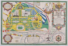
British Empire Exhibition 1924 Wembley map by Stanley Kennedy North
Located in London, GB
."
Stanley Kennedy North (1887 - 1942)
British Empire Exhibition Map (1924)
Lithograph
51 x 75 cm
This
Category
1920s Landscape Prints
Materials
Lithograph
$478
H 20.08 in W 29.53 in
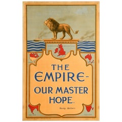
Original Antique Poster British Empire Our Master Hope Britain Stanley Baldwin
Located in London, GB
design depicting a lion standing on a podium above illustrations of British Empire territories including
Category
Vintage 1920s British Posters
Materials
Paper
$2,594
H 35.04 in W 22.45 in D 0.04 in
Recent Sales
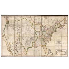
Map of the United States with the Contiguous British and Spanish Possessions
By John Melish
Located in La Jolla, CA
engraved wall map, dissected and laid on original linen.
Melish's map is generally regarded as the
Category
Antique 1810s American American Empire Prints
Materials
Paper
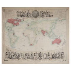
Large Original Antique Decorative Map of The World, Fullarton, C.1870
Located in St Annes, Lancashire
Great map of British Empire Throughout the World
Wonderful figurative borders
From the
Category
Antique 1870s Scottish Maps
Materials
Paper
Superb, Large Map of British India, Chinese Empire, Indochina, Malaysia, 1860
Located in Langweer, NL
. A superb, large-scale map of British India, the Chinese Empire, Indochina, the Malay Peninsula, and
Category
Antique 1860s Maps
Materials
Paper
H 22.8 in W 31.07 in D 0 in
Antique Map of India and Burma at The Time of the British Empire, 1834
Located in Langweer, NL
at the time of the British Empire. Scale bars and legenda below map. Artists and Engravers: Published
Category
Antique 19th Century Maps
Materials
Paper
Ornate Cartography of Colonial Grandeur: The West India Islands around 1851
Located in Langweer, NL
British Empire. His work was often used as the textual accompaniment to the maps produced by John Tallis
Category
Antique 1850s Maps
Materials
Paper
H 10.71 in W 14.26 in D 0 in
People Also Browsed
Rocky Outcropping and Bathers at the Swimming Hole - Landscape
By Tyler Micoleau
Located in Soquel, CA
Highly textured landscape, with thick impasto illustrating a glorious scene of figures swimming in calm waters near large rocks and swaying trees, by Tyler Micoleau (American, 1911-2...
Category
1960s American Impressionist Landscape Paintings
Materials
Masonite, Oil
$1,850
H 14.75 in W 18.75 in D 1 in
Naval Battle Engagement at Sea Large Busy Battle Scene Many Ships, Signed Oil
Located in Cirencester, Gloucestershire
English School, early 20th century
signed
oil painting on canvas, unframed
canvas: 17 x 24 inches
provenance: private collection, Eng;and
condition: good and sound condition, minor ...
Category
Early 20th Century Old Masters Landscape Paintings
Materials
Oil, Canvas
$1,529 Sale Price
20% Off
H 17 in W 24 in
Samuraï Maeda Armor
Located in Paris, FR
Armor Samuraï Maeda, ceremonial armor
with handcrafted helmet and protects.
Made with original japanese fabrics only use for
samuraï armor confection, with solid brass and
metal deta...
Category
Vintage 1930s Japanese Arms, Armor and Weapons
Materials
Fabric, Glass
Sky & Surf - Abstracted Watercolor Landscape with Birds
By Les Anderson
Located in Soquel, CA
Expressive watercolor landscape of an abstracted crashing surf swirling into a dreamy sky, punctuated by silhouetted birds in flight by Les (Leslie Luverne) Anderson (American, 1928-...
Category
1980s American Impressionist Abstract Drawings and Watercolors
Materials
Paper, Watercolor
$340 Sale Price
20% Off
H 15 in W 23 in D 0.03 in
Edo Period Samurai Suit Of Armor
Located in New Orleans, LA
This exquisite Tetsusabiji Uchidashi Gomai Dou Gusoku (Five-Plate Russet Iron Embossed Cuirass Armor), crafted in the 18th century, exemplifies the pinnacle of Edo-period samurai arm...
Category
Antique 18th Century Asian Edo Arms, Armor and Weapons
Materials
Copper, Iron
Les Banderilles (IV), from A Los Toros Avec Picasso
By Pablo Picasso
Located in Washington, DC
Artist: Pablo Picasso
Title: Les Banderilles (IV)
Portfolio: A Los Toros Avec Picasso
Medium: Transfer lithograph
Date: 1961
Edition: Unnumbered
Frame Size: 17 1/4" x 19 3/4"
Sheet S...
Category
1960s Abstract Animal Prints
Materials
Lithograph
Steinway & Sons Concert Grand Piano
Located in SAINT-OUEN-SUR-SEINE, FR
This extraordinary concert grand piano with 88 keys was made by the prestigious firm Steinway & Sons around 1894. The case's decoration was entrusted to the company Cuel & Cie and mo...
Category
Antique Late 19th Century French Louis XV Musical Instruments
Materials
Wood, Giltwood
California Eucalyptus, Oak and Pond Landscape
By Jesse Don Rasberry
Located in Soquel, CA
Beautiful landscape painting of a California pond with Eucalyptus and Oak trees by Jesse Don Rasberry (American, 20th Century). Presented in a rustic wooden frame. Signed on verso. ...
Category
Early 2000s Impressionist Landscape Paintings
Materials
Canvas, Oil
$700 Sale Price
20% Off
H 12 in W 14 in D 0.75 in
A Grand Tour wooden maquette, depicting the Cathedral of Milan, Italy circa 1880
Located in Milan, IT
Rare and unusual Wunderkammer architectural model in miniature, entirely handmade, in balsa wood, depicting the Cathedral of Milan. Original patina. Italy second half of the 19th cen...
Category
Antique Late 19th Century Italian Architectural Models
Materials
Wood
$10,658
H 39 in W 51 in D 30.75 in
Signed Charger and Vase - Eduardo Vega
Located in Dallas, TX
The Brendan Bass Estate Collection pays homage to the beauty of vintage and antique
pieces, each artfully concealing endless stories collected through the generations in which they ...
Category
Mid-20th Century Mid-Century Modern Vases
Materials
Ceramic
Italian Marble Bust Vanitas / Memento Mori 19th Century Carved Sculpture Italy
Located in Ijzendijke, NL
Masterfully carved Italian Vanitas bust in solid marble from late 19th century.
White Carrara marble skull combined with a red Rosso Imperiale marble Roman toga (robe).
The roman...
Category
Antique Late 19th Century Italian Renaissance Revival Busts
Materials
Marble, Carrara Marble
$13,613
H 23.63 in W 14.97 in D 7.88 in
Waterloo Battlefield with 3 Monuments - Butte du Lion, Antique Oil Painting
Located in Cirencester, Gloucestershire
The Battlefield of Waterloo
English School, 19th century
original oil painting on canvas, framed
canvas: 12 x 15.5 inches
framed: 17.5 x 20.5 inches
condition: overall very good and ...
Category
Early 19th Century Old Masters Landscape Paintings
Materials
Canvas, Oil
$4,807 Sale Price
20% Off
H 17.5 in W 21 in D 2 in
Gilded Louis XIV Style Mirror
Located in Los Angeles, CA
An elaborately hand carved and gilded Louis XIV style frame with original slightly mottled mercury mirror.
Category
Antique Early 1800s French Baroque Wall Mirrors
Materials
Wood
Large Woven Painted Basketry Wall Mask Blackwater Rivers, Papua New Guinea
Located in Point Richmond, CA
Large woven painted basketry wall mask created in Blackwater Rivers area, Papua New Guinea. With open expressive mouth and mask fringed with feathers, striking mask that easily hang...
Category
Mid-20th Century Papua New Guinean Tribal Tribal Art
Materials
Organic Material
$1,715 Sale Price
30% Off
H 24 in W 15 in D 9.5 in
Illuminated Manuscript Painting by the German School
By German School
Located in New Orleans, LA
Extraordinary in its beauty and rarity, this early 16th-century German painting of an illuminated manuscript showcases a masterful trompe l’oeil effect. Unequivocally among the fines...
Category
16th Century Renaissance Still-life Paintings
Materials
Oil, Panel
German SchoolIlluminated Manuscript Painting by the German School, Painted in the early 16th century
$648,500
H 25 in W 27.63 in D 2.25 in
Untitled - Screen Print After Jackson Pollock - 1964
By Jackson Pollock
Located in Roma, IT
Screenprint, from the posthumous edition of 50 printed in 1964 (first edition of 25 printed in 1951)
With the blindstamp of the estate: “Estate of J. Pollock 1964” and “Strathmore us...
Category
1960s Abstract Abstract Prints
Materials
Paper, Screen
$48,557
H 23.04 in W 29.14 in D 0.04 in
Get Updated with New Arrivals
Save "British Empire Map", and we’ll notify you when there are new listings in this category.
British Empire Map For Sale on 1stDibs
With a vast inventory of beautiful furniture at 1stDibs, we’ve got just the British empire map you’re looking for. Each British empire map for sale was constructed with extraordinary care, often using paper, wood and animal skin. If you’re shopping for a British empire map, we have 52 options in-stock, while there are 1 modern editions to choose from as well. Your living room may not be complete without a British empire map — find older editions for sale from the 18th Century and newer versions made as recently as the 21st Century. When you’re browsing for the right British empire map, those designed in Baroque, Art Deco and folk art styles are of considerable interest. Kerry Lee, Leslie MacDonald Gill and Alison Castle each produced at least one beautiful British empire map that is worth considering.
How Much is a British Empire Map?
Prices for a British empire map start at $120 and top out at $240,857 with the average selling for $2,090.
More Ways To Browse
Antique Atlases
Mediterranean Antique
19th Century British Colonial Furniture
British Colonial Antique Furniture
Illustrated Map
Ancient Maps
Antique Atlas Furniture
Antique Maltese
Map Of Britain
Antique Maps Of North America
Antique Maps Of Britain
King George V
Scotland Map
Antique Maps Scotland
Alps Furniture
Spanish Empire
Steam Ship
Maps Of Australia
