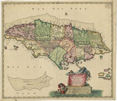
Map Of Jamaica

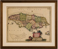
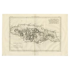
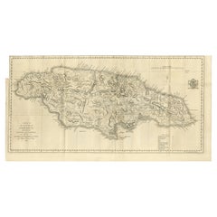
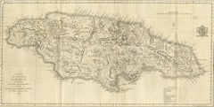
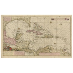
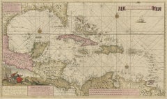
Antique Hand-Colored Map of Jamaica, circa 1680

Antique Hand-Colored Map of Jamaica, circa 1680

Located in Langweer, NL

Please study the photographs carefully as they form an important part of the condition description. Keywords: Antique Jamaica Map, Jamaica Map, Caribbean Map, Antique Caribbean Map,...

Category

Antique 1720s Dutch Baroque Maps

Materials

Paper

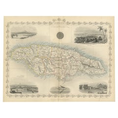
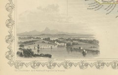
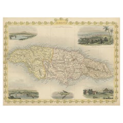
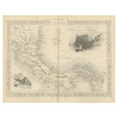
An Ornate and Historical Tallis Map of Jamaica with Decorative Vignettes, 1851

An Ornate and Historical Tallis Map of Jamaica with Decorative Vignettes, 1851

Located in Langweer, NL

This original antique map of Jamaica is part of the renowned series created by the Tallis Company, known for their detailed and decorative maps of the 19th century.

Category

Antique 1850s English Maps

Materials

Paper

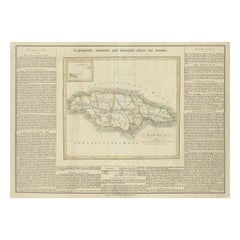
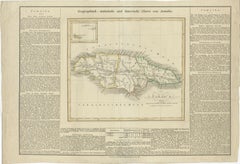
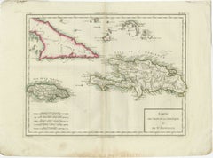
Antique Map of Jamaica and Hispaniola (Saint-Domingue and Santo Domingo), 1802

Antique Map of Jamaica and Hispaniola (Saint-Domingue and Santo Domingo), 1802

Located in Langweer, NL

Key Geographic Features and Areas: 1. **Jamaica**: - The map shows Jamaica with detailed markings of its parishes, key towns, and geographical features such as rivers and mountai...

Category

Antique Early 1800s Maps

Materials

Paper

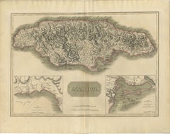
Jamaica Map by John Thomson, Kingston & Port Royal Harbors, c.1817

Jamaica Map by John Thomson, Kingston & Port Royal Harbors, c.1817

Located in Langweer, NL

Jamaica Map by John Thomson, Kingston & Port Royal Harbors, c.1817 A finely engraved and historically important early 19th-century map of Jamaica by the celebrated Scottish cartogra...

Category

Antique Early 19th Century British Maps

Materials

Paper

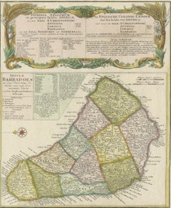
Rare French Colonial America Map, Jamaica Barbados Carolina, c.1719

Rare French Colonial America Map, Jamaica Barbados Carolina, c.1719

Located in Langweer, NL

Rare French Colonial America Map, Jamaica Barbados Carolina, c.1719 Description: This remarkable and highly detailed early eighteenth-century French map presents a fascinating overv...

Category

Antique Early 19th Century French Maps

Materials

Paper

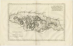
Jamaica – Original Antique Island Map by Rigobert Bonne, c.1780

Jamaica – Original Antique Island Map by Rigobert Bonne, c.1780

Located in Langweer, NL

Jamaica – Enlightenment Island Map by Rigobert Bonne, c.1780 This finely engraved late-18th-century map depicts the island of Jamaica, titled Carte de l’Isle de la Jamaïque, engrave...

Category

Antique Late 18th Century French Maps

Materials

Paper

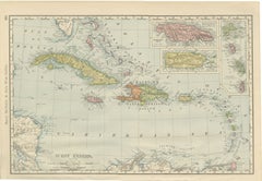
Antique Map of the West Indies, with Cuba, Jamaica and Puerto Rico, 1899

Antique Map of the West Indies, with Cuba, Jamaica and Puerto Rico, 1899

By Rand McNally & Co.

Located in Langweer, NL

This is an original antique map, not a modern reproduction. This item is sold unframed.

Category

Antique Late 19th Century American Late Victorian Maps

Materials

Paper

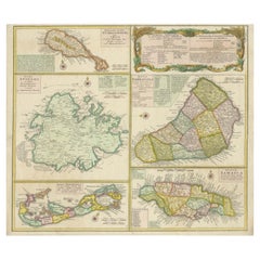
Original Old Map of St Kitts, Antigua, Bermuda, Barbados, and Jamaica, ca.1745

Original Old Map of St Kitts, Antigua, Bermuda, Barbados, and Jamaica, ca.1745

Located in Langweer, NL

Shows the islands of Saint Christopher or Saint Kitts, Antigua, Bermuda, Barbados, and Jamaica. Artists and Engravers: Following the long period of Dutch domination, the Homann fami...

Category

Antique 1740s Maps

Materials

Paper

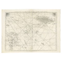
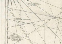
Navigational Chart of Jamaica, Cape Gracias a Dios, and the Mosquito Coast, 1775

Navigational Chart of Jamaica, Cape Gracias a Dios, and the Mosquito Coast, 1775

Located in Langweer, NL

Here's a detailed description: Key Features of the Map: 1. **Geographical Coverage**: - The map highlights the Island of Jamaica and Cape Gracias a Dios, including the surroundi...

Category

Antique 1770s Maps

Materials

Paper

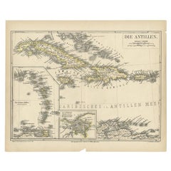
Antique Map of the Antilles by Meyer, 1878

Antique Map of the Antilles by Meyer, 1878

Located in Langweer, NL

Antique map titled 'Die Antillen'. Old map of the Antilles, it shows Jamaica, Puerto Rico, the Bahamas and Cuba.

Category

Antique 19th Century Maps

Materials

Paper

Recent Sales

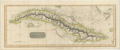
Antique Map of Cuba by John Thomson, Havana Caribbean Island Map, 1816

Antique Map of Cuba by John Thomson, Havana Caribbean Island Map, 1816

Located in Langweer, NL

Jamaica Map by John Thomson, Kingston & Port Royal Harbors, c.1817 A finely engraved and historically important early 19th-century map of Jamaica by the celebrated Scottish cartogra...

Category

Antique Early 19th Century British Maps

Materials

Paper

1794 Map of Jamaica by Bryan Edwards – Parishes, Plantations, Settlements

1794 Map of Jamaica by Bryan Edwards – Parishes, Plantations, Settlements

Located in Langweer, NL

1794 Bryan Edwards Map of Jamaica – Parishes, Plantations, Settlements This is an important antique map titled “A Map of the Island of Jamaica, Divided into Counties and Parishes,” ...

Category

Antique Late 18th Century English Maps

Materials

Paper

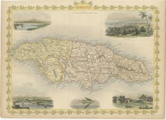
Antique Map of Jamaica with Decorative Vignettes

Antique Map of Jamaica with Decorative Vignettes

Sold

H 10.48 in W 14.45 in D 0.02 in

Antique Map of Jamaica with Decorative Vignettes

Located in Langweer, NL

Antique map titled 'Jamaica'. Includes decorative vignettes of Kingston, Port Antonio, Port Royal Harbour and Sugar Mill.

Category

Antique Mid-19th Century Maps

Materials

Paper

Highly Detailed Antique Map of Jamaica in the Caribbean, c.1780

Highly Detailed Antique Map of Jamaica in the Caribbean, c.1780

Located in Langweer, NL

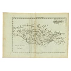
Antique map titled 'Carte de l'Isle de la Jamaique.' Highly detailed map of Jamaica, showing towns, rivers, some topographical features, political boundaries and important ports.

Category

Antique 18th Century Maps

Materials

Paper

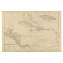
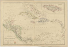
Antique Map of the West Indies by A & C, Black, 1870

Antique Map of the West Indies by A & C, Black, 1870

Located in Langweer, NL

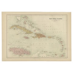
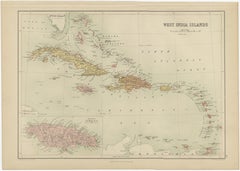
Antique map titled 'West India Islands'. Original antique map of the West Indies, Caribbean, with an inset map of Jamaica.

Category

Antique Late 19th Century Maps

Materials

Paper

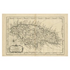
Antique Map of the Island of Jamaica by Bellin, '1758'

Antique Map of the Island of Jamaica by Bellin, '1758'

Located in Langweer, NL

Antique map titled 'Carte de l'Isle de la Jamaique'. Original antique map of the island of Jamaica, showing and naming regional divisions and places along the coast.

Category

Antique Mid-18th Century Maps

Materials

Paper

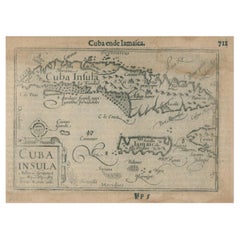
1609 Antique Map of Cuba and Jamaica by Cornelis Claesz, Rare Caribbean Map

1609 Antique Map of Cuba and Jamaica by Cornelis Claesz, Rare Caribbean Map

Located in Langweer, NL

This 1609 copper-engraved map titled "Cuba ende Iamaica" depicts Cuba, Jamaica, and surrounding areas with remarkable detail.

Category

Antique Early 1600s Maps

Materials

Paper

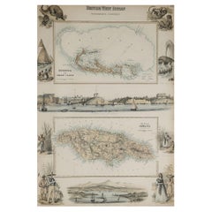
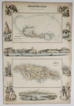
Original Antique Decorative Map of Bermuda & Jamaica, Fullarton, C.1870

Original Antique Decorative Map of Bermuda & Jamaica, Fullarton, C.1870

Located in St Annes, Lancashire

Great map of Bermuda and Jamaica Wonderful figural border From the celebrated Royal Illustrated Atlas Lithograph.

Category

Antique 1870s Scottish Maps

Materials

Paper

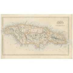
Antique Map of the Island of Jamaica by G.H. Swanston, 1860

Antique Map of the Island of Jamaica by G.H. Swanston, 1860

Located in Langweer, NL

This map was published in London, for his Royal Illustrated Atlas. Parishes, mountains, rivers, roads, and railroads (in red) clearly shown. Accurate and very comprehensive location ...

Category

Antique Mid-19th Century Maps

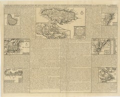
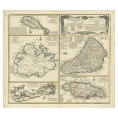
Stunning Map of Caribbean Islands, Incl Jamaica, Bermuda, Barbados and St. Kitts

Stunning Map of Caribbean Islands, Incl Jamaica, Bermuda, Barbados and St. Kitts

By Homann Heirs

Located in Langweer, NL

Large sheet with five maps describing the islands of St. Kitts, Antigua, Bermuda, Barbados and Jamaica.

Category

Antique Mid-18th Century Maps

Materials

Paper

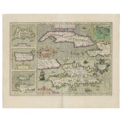
Antique Map of Cuba, Haïti, Jamaica, Puerto Rico and St Margareta, Havanna, 1630

Antique Map of Cuba, Haïti, Jamaica, Puerto Rico and St Margareta, Havanna, 1630

Located in Langweer, NL

Title: "Cuba Insula" - "Hispaniola Insula". 2 old colors copper engraved maps of Cuba and Haïti (one below the other on 1 sheet), with 3 small additional maps (Jamaica, St.

Category

Antique 1630s Maps

Materials

Paper

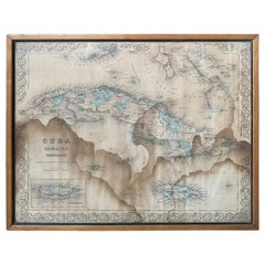
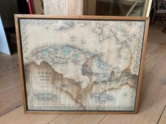
J.H. Colton & Co. Hand Colored Engraved Map of Cuba, Jamaica, & Puerto Rico

J.H. Colton & Co. Hand Colored Engraved Map of Cuba, Jamaica, & Puerto Rico

By J.H. Colton

Located in Atlanta, GA

19th century circa 1850s hand colored engraved map of Cuba, Jamaica, and Puerto Rico, Published by J.H.

Category

Antique 19th Century American Maps

Materials

Paper

You May Also Like

Engraving of a Map of Florida, the Gulf Coast, Caribbean & Central America, 1728

Engraving of a Map of Florida, the Gulf Coast, Caribbean & Central America, 1728

$12,040Sale Price|30% Off

H 24.61 in W 40.56 in D 0.02 in

Engraving of a Map of Florida, the Gulf Coast, Caribbean & Central America, 1728

Located in Langweer, NL

This exceptional antique map, titled "Nouvelle Carte Marine de Toute les Cotes de l´Amerique" and alternatively known as "Nieuwe groote en seer Curieuse Paskaart van Geheel-WestIndie...

Category

Antique Mid-18th Century Dutch Maps

Materials

Paper

Crossroads of Empires: A John Tallis Map of the Isthmus of Panama, 1851

Crossroads of Empires: A John Tallis Map of the Isthmus of Panama, 1851

$266Sale Price|20% Off

H 10.71 in W 14.26 in D 0 in

Crossroads of Empires: A John Tallis Map of the Isthmus of Panama, 1851

Located in Langweer, NL

The Tallis map of the Isthmus of Panama is a beautifully detailed work, characteristic of the maps produced by John Tallis & Company, which was one of the last cartographic firms to ...

Category

Antique 1850s Maps

Materials

Paper

Antique Map of Guadelupe in the Caribbean, 1759

Antique Map of Guadelupe in the Caribbean, 1759

$516

H 10.63 in W 13.59 in D 0.02 in

Antique Map of Guadelupe in the Caribbean, 1759

By Jacques-Nicolas Bellin

Located in Langweer, NL

Antique map titled 'Carte De L'Isle De La Guadeloupe'. Detailed map of Guadalupe, Mari-Galante and the Isles de Saintes. Produced by Nichlas Bellin for Prevost d'Exiles influential t...

Category

Antique Mid-18th Century French Maps

Materials

Paper

Original Engraving of the West Indies, Gulf of Mexico, Antilles, Caribbean, 1780

Original Engraving of the West Indies, Gulf of Mexico, Antilles, Caribbean, 1780

Located in Langweer, NL

Rigobert Bonne and G. Raynal's 1780 map of the West Indies, Gulf of Mexico, Antilles, and the Caribbean stands as a remarkable cartographic piece, offering a detailed and expansive v...

Category

Antique Late 18th Century French Maps

Materials

Paper

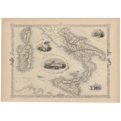
Antique Map of Southern Italy by J. Tallis, circa 1851

Antique Map of Southern Italy by J. Tallis, circa 1851

$236Sale Price|25% Off

H 10.52 in W 14.57 in D 0.02 in

Antique Map of Southern Italy by J. Tallis, circa 1851

Located in Langweer, NL

Decorative and detailed mid-19th century map of Southern Italy which was drawn and engraved by John Rapkin (vignettes by A. H. Wray and J. Rogers) and published in John Tallis & Co.'...

Category

Antique Mid-19th Century British Maps

Materials

Paper

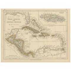
Antique Map of the West Indies and Central America by Lowry '1852'

Antique Map of the West Indies and Central America by Lowry '1852'

$91Sale Price|20% Off

H 9.65 in W 12.21 in D 0.02 in

Antique Map of the West Indies and Central America by Lowry '1852'

Located in Langweer, NL

Antique map titled 'West Indies and Central America'. Original map of the West Indies and Central America. This map originates from 'Lowry's Table Atlas constructed and engraved from...

Category

Antique Mid-19th Century Maps

Materials

Paper

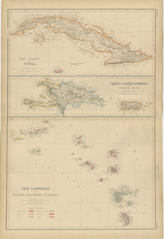
Cuba, Hayti, Santo Domingo and Leeward Islands, Antique Caribbean Map, 1859

Cuba, Hayti, Santo Domingo and Leeward Islands, Antique Caribbean Map, 1859

Located in Langweer, NL

Title: Cuba, Hayti, Santo Domingo and Leeward Islands, Antique Caribbean Map, 1859 Description: This original antique map depicts the island of Cuba together with Hayti (Hispaniola)...

Category

Antique Mid-19th Century British Maps

Materials

Paper

Saint-Domingue (French Section): 18th Century Map from France Militaire Series

Saint-Domingue (French Section): 18th Century Map from France Militaire Series

Located in Langweer, NL

This map is titled "St. Domingue (Partie Française)" and is part of the France Militaire series. It focuses on the French portion of Saint-Domingue, which corresponds to modern-day H...

Category

Antique 1790s Maps

Materials

Paper

Antique Map of Cuba, Hispaniola, Puerto Rico and the Leeward Islands, 1860

Antique Map of Cuba, Hispaniola, Puerto Rico and the Leeward Islands, 1860

Located in Langweer, NL

Antique Map of Cuba, Hispaniola, Puerto Rico and the Leeward Islands, 1860 This attractive and highly detailed map of the Caribbean was published by W. G. Blackie of Scotland around...

Category

Antique Mid-19th Century British Maps

Materials

Paper

Antique Map of the Antilles in the Caribbean, '1875'

Antique Map of the Antilles in the Caribbean, '1875'

$315Sale Price|44% Off

H 18.71 in W 24.02 in D 0.02 in

Antique Map of the Antilles in the Caribbean, '1875'

Located in Langweer, NL

Antique map titled 'Carte des Iles Antilles'. Large map of the Antilles. This map originates from 'Atlas de Géographie Moderne Physique et Politique' by A. Levasseur. Published, 1875.

Category

Antique Late 19th Century French Maps

Materials

Paper

Vintage Map of the Greater Antilles and Lesser Antilles

Vintage Map of the Greater Antilles and Lesser Antilles

$128Sale Price|20% Off

H 17.6 in W 22.64 in D 0.02 in

Vintage Map of the Greater Antilles and Lesser Antilles

Located in Langweer, NL

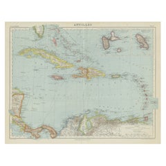
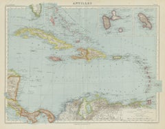
Vintage map titled 'Antilles'. Original map of the Antilles. Shows the Cayman Islands, Cuba, Hispaniola (subdivided into the nations of the Dominican Republic and Haiti), Jamaica, an...

Category

20th Century Maps

Materials

Paper

New Granada, New Andalusia & Guiana – Antique Map by Rigobert Bonne, c.1780

New Granada, New Andalusia & Guiana – Antique Map by Rigobert Bonne, c.1780

Located in Langweer, NL

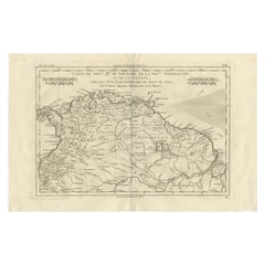
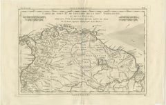
New Granada, New Andalusia & Guiana – Enlightenment Map by Rigobert Bonne, c.1780 This finely engraved late-18th-century map depicts northern South America, titled Carte du Nou...

Category

Antique Late 18th Century French Maps

Materials

Paper

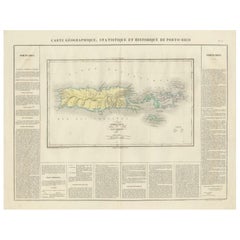
1825 Buchon Map of Puerto Rico & Virgin Islands with Detailed Colonial History

1825 Buchon Map of Puerto Rico & Virgin Islands with Detailed Colonial History

Located in Langweer, NL

This map of Puerto Rico and the Virgin Islands, published by Jean Alexandre Buchon in 1825, offers a unique look at the Caribbean during a time of European colonial dominance. Buch...

Category

Antique 1820s Maps

Materials

Paper

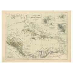
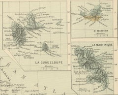
Antique Map of the Antilles and Central America – 1872

Antique Map of the Antilles and Central America – 1872

Located in Langweer, NL

Title: Antique Map of the Antilles and Central America – 1872 Description: This finely detailed antique map, titled Antilles et Amérique Centrale, was published in 1872 under t...

Category

Antique 1870s Maps

Materials

Paper

1880 Map of the Caribbean and Central America by Adolf Stieler

1880 Map of the Caribbean and Central America by Adolf Stieler

$266Sale Price|20% Off

H 14.97 in W 18.51 in D 0 in

1880 Map of the Caribbean and Central America by Adolf Stieler

Located in Langweer, NL

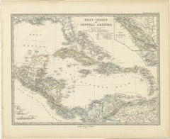
This is a detailed map titled "West-Indien und Central-Amerika," created by Adolf Stieler and published in Gotha in 1880. The map covers the Caribbean islands and the Central America...

Category

Antique 1880s Maps

Materials

Paper

Saint Domingue Map 1793 – Colonial Haiti and Dominican Republic Plan

Saint Domingue Map 1793 – Colonial Haiti and Dominican Republic Plan

Located in Langweer, NL

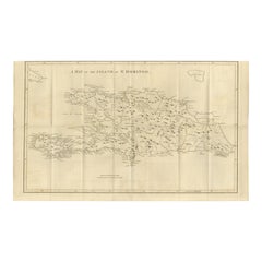
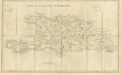
1793 Map of Saint Domingue (Haiti and DR) – Colonial Island Plan This antique map is titled “A Map of the Island of St. Domingo” and dates from circa 1793. It depicts the entire isl...

Category

Antique Late 18th Century English Maps

Materials

Paper

People Also Browsed

Alma Upholstered Accent Chair in Faux Mohair Velvet

Alma Upholstered Accent Chair in Faux Mohair Velvet

By Bloom Home Inc

Located in Old Town Orange, CA

Introducing the Alma Accent Chair – a timeless piece crafted for comfort and style. Upholstered in a faux mohair style velvet, the color is our french havane, a warm honey, caramel t...

Category

21st Century and Contemporary Chairs

Materials

Metal

A Spanish Wrought Iron Archive Chest, 18th Century

A Spanish Wrought Iron Archive Chest, 18th Century

$3,500

H 10.24 in W 24.41 in D 11.82 in

A Spanish Wrought Iron Archive Chest, 18th Century

Located in ARMADALE, VIC

A Spanish Wrought Iron Archive Chest, 18th Century Provenance: Private Australian Collection. Dimensions: Height: 26cm. Width: 62cm. Depth: 30cm.

Category

Antique 18th Century Spanish Blanket Chests

Materials

Wrought Iron

Classic Chandelier, 5 Arms Green Murano Glass Simplicissimus by Multiforme

Classic Chandelier, 5 Arms Green Murano Glass Simplicissimus by Multiforme

By Multiforme

Located in Venezia, Veneto

Classic chandelier, 5 arms green Murano glass Simplicissimus by Multiforme This collection in Murano glass is characterized by superb simplicity. It is the result of a research which...

Category

2010s Italian Other Chandeliers and Pendants

Materials

Blown Glass

Italian Mid-Century Vanity Console by Cesare Lacca  with Mirror in Burl Walnut

Italian Mid-Century Vanity Console by Cesare Lacca with Mirror in Burl Walnut

By Cesare Lacca

Located in Vigonza, Padua

Code: FH27 Measures cm: H 178 x W 136 x D 40. Elegant and highly distinctive Italian vanity or dressing table dating from the early 1950s, bearing the label of La Permanente Mobili ...

Category

Vintage 1950s Italian Mid-Century Modern Pier Mirrors and Console Mirrors

Materials

Mirror, Walnut

Italian Murano Glass Chandelier, Floral & Multicolored — Giovanni Dalla Fina

Italian Murano Glass Chandelier, Floral & Multicolored — Giovanni Dalla Fina

By Giovanni Dalla Fina Gallery

Located in Villaverla, IT

Italian Murano glass monumental multi-tier chandelier crafted during the nineteen sixties showcases theatrical, festive Venetian Baroque revival lighting design by Giovanni Dalla Fin...

Category

Vintage 1960s Italian Baroque Chandeliers and Pendants

Materials

Glass, Art Glass, Blown Glass, Murano Glass

Hand-Painted Decorative Iron Tray - Giraffe

Hand-Painted Decorative Iron Tray - Giraffe

$154 / item

H 1.19 in W 11.82 in D 16.93 in

Hand-Painted Decorative Iron Tray - Giraffe

By Bertrando Di Renzo

Located in ROCCAVIVARA CB, IT

Bring vibrant charm to your decor with our hand-painted iron tray, featuring a giraffe design on a teal blue background. Perfect for adding a playful yet sophisticated touch to coffe...

Category

21st Century and Contemporary Indian Modern Tableware

Materials

Iron

Framed Tibetan Thankga of Amitabha

Framed Tibetan Thankga of Amitabha

$6,000

H 42 in W 31 in D 1 in

Framed Tibetan Thankga of Amitabha

Located in Atlanta, GA

An antique Tibetan Thankga depicting Amitabha and surrounding deities, circa late 19th century. The center Amitabha is in a meditation form holding a black beggar's bowl. In the Maha...

Category

Antique Late 19th Century Tibetan Tibetan Paintings and Screens

Materials

Cotton, Silk, Wood, Paint

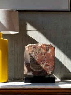
Egyptian Stone Relief of Man and Wife

Egyptian Stone Relief of Man and Wife

$255,000Sale Price|33% Off

H 11.03 in W 10.44 in D 1.58 in

Egyptian Stone Relief of Man and Wife

Located in London, GB

This painted limestone relief is an exquisite example of New Kingdom relief carving from the apogee of Egyptian artistic production. Carved in raised relief - a labour-intensive tech...

Category

Antique 15th Century and Earlier Egyptian Egyptian Busts

Materials

Limestone

Art Deco style bookends reading ladies Moyen Age signed Max Le Verrier.

Art Deco style bookends reading ladies Moyen Age signed Max Le Verrier.

By Max Le Verrier

Located in Antwerp, BE

Art Deco style bookends reading ladies Moyen Age signed Max Le Verrier. With the Max Le Verrier foundry seal. Design 1930. Posthumous, contemporary cast. Reading medieval ladies. ...

Category

2010s French Art Deco Bookends

Materials

Belgian Black Marble, Metal

Satin Murano 26" Flush Mount Glass & Brass Chandelier, Barovier & Toso, Italy

Satin Murano 26" Flush Mount Glass & Brass Chandelier, Barovier & Toso, Italy

By Barovier&Toso

Located in Niederdorfelden, Hessen

Extremely elegant Murano flush mount ceiling light with 18 etched Satin hand blown Murano glass petals and one bowl on a frosted golden brass frame. . Heavy duty. Has 15 sockets. In ...

Category

Vintage 1960s Italian Hollywood Regency Flush Mount

Materials

Brass

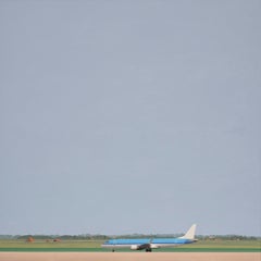
Airplane in landscape - landscape painting

Airplane in landscape - landscape painting

By Jeroen Allart

Located in New York, NY

This beautiful painting by Jeroen Allart is part of his minimalist landscape and animal painting he did in his home country the Netherlands. 'A farm stands before you on the horizon....

Category

2010s Contemporary Landscape Paintings

Materials

Canvas, Oil

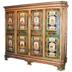
19th Century Venetian Armoire

19th Century Venetian Armoire

$13,500

H 83.5 in W 98 in D 30 in

19th Century Venetian Armoire

Located in New Orleans, LA

Beautiful Italian armoire made up of exceptional carved and painted panels.

Category

Antique 19th Century French Wardrobes and Armoires

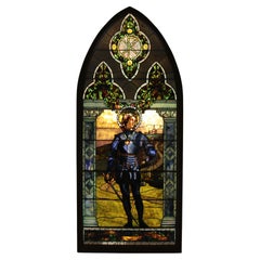
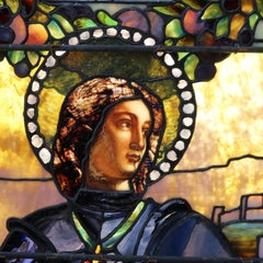
104" Historic Tiffany Window "Crusader", a Warrior Knight, after Mantegna c1890

104" Historic Tiffany Window "Crusader", a Warrior Knight, after Mantegna c1890

By Tiffany Studios

Located in Big Flats, NY

Magnificent historic Tiffany Studios framed window, "Crusader", a Warrior Knight, after the 1460 work by Italian Renaissance painter Andrea Mantegna (1431-1506). Incorporating a harm...

Category

Antique Late 19th Century American Arts and Crafts Windows

Materials

Stained Glass

Art Deco Sideboard by De Coene Frères, Belgium, Bronze Relief, 1940

Art Deco Sideboard by De Coene Frères, Belgium, Bronze Relief, 1940

By De Coene Frères

Located in Antwerp, BE

Art Deco sideboard from the Voltaire Serie designed by the Coene Freres in Kortrijk, Belgium with four hinged cabinet doors, with bronze relief leave plaques and includes the origina...

Category

Vintage 1940s Belgian Art Deco Sideboards

Materials

Wood

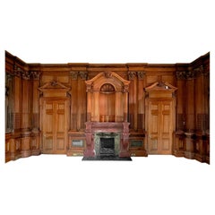
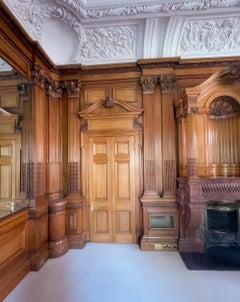
George Trollope & Sons fireplace & room, Paris Exhibition 1878 Gold Medal Winner

George Trollope & Sons fireplace & room, Paris Exhibition 1878 Gold Medal Winner

Located in London, GB

George Trollope and Sons. Exhibited at the Paris Universal Exhibition in 1878 winning a Gold Medal for Excellence. The set forms the four sides of a complete panelled room that was ...

Category

Antique 1870s Panelling

Materials

Marble

Early 20th Century Rustic French Side Table in Wood

Early 20th Century Rustic French Side Table in Wood

$1,486Sale Price|20% Off

H 20.08 in W 27.56 in D 19.69 in

Early 20th Century Rustic French Side Table in Wood

Located in Barcelona, ES

Rustic French Side Table in Solid Wood. By unknown manufacturer from France, circa 1930. In original condition, with minor wear consistent with age and use, preserving a beautiful p...

Category

Vintage 1930s French Mid-Century Modern Center Tables

Materials

Wood

Get Updated with New Arrivals
Save "Map Of Jamaica", and we’ll notify you when there are new listings in this category.

Map Of Jamaica For Sale on 1stDibs

Find many varieties of an authentic map of jamaica available at 1stDibs. A map of jamaica — often made from paper — can elevate any home. You’ve searched high and low for the perfect map of jamaica — we have versions that date back to the 18th Century alongside those produced as recently as the 20th Century are available. A map of jamaica is a generally popular piece of furniture, but those created in Art Deco styles are sought with frequency. You’ll likely find more than one map of jamaica that is appealing in its simplicity, but Ottomar Anton, Jacques-Nicolas Bellin and Homann Heirs produced versions that are worth a look.

Finding the Right Collectibles-curiosities for You

Antique and vintage collectibles and curiosities can bring whimsy and wonder to any interior. 

Decorating with old scientific instruments, historical memorabilia and vintage musical instruments, as well as other authentic collectibles and curiosities that can be found on 1stDibs, presents an opportunity to create a unique, natural history museum-like atmosphere in your home that can provoke conversation as often as it pays tribute to how far we’ve come in understanding our world. 

And bringing collectibles and curiosities into your space is actually on trend — Wunderkammern, or curiosity cabinets, were all the rage in Europe during the 1500s and continued to have adherents there and in the U.S. in the following centuries. Today, however, they’re experiencing a real surge in popularity and influencing how many interior designers are furnishing and decorating homes — combining contemporary with antique, scientific with tribal, earthly with extraterrestrial, Les Lalanne tables with Flemish tapestries.

The original Wunderkammern were entire rooms filled with objects demonstrating their owners’ worldly knowledge: A proper one included artificiala or preciosa (objets d’art); naturalia (such as skeletons, shells, minerals); exotica (taxidermy or dried plants); and scientifica (scientific instruments), frequently alongside religious relics and ancient artifacts.

Pay tribute to a history of rich and diverse musical traditions that have taken shape all over the world by decorating your home with a collection of antique and vintage musical instruments — with a little help from strong hanging wire or some wall hooks, vintage brass instruments such as a gong, French horn or trumpet can help elevate a home office or complement the efforts you’ve made to ensure a welcoming vibe in your home’s entryway. Bells or antique wind instruments can add provocative metallic contrasts to dark woods as tabletop decorative objects.  

Create an intriguing focal point with Georgian scientific instruments, such as stick barometers with mahogany cases or lacquered brass telescopes. These items stem from an era named for the monarchies of the four King Georges, who ruled England in succession starting in 1714 (plus King William’s reign, which lasted until 1837). Just as there was beautiful jewelry produced during the period that today is coveted by collectors, there is much to be found in the collectibles and curiosities realm too.

Wanderlust, nostalgia and a shared love of good design are contributing factors to certain trends in decorating — just as vintage trunks and luggage have reappeared as furniture or home accents in a bedroom or foyer, decorating with globes, maps or nautical objects is similarly rooted in the allure of travel and a penchant for the stylish finishing touch that collectibles bring to our homes.

Find a wide range of antique and vintage collectibles and curiosities on 1stDibs.
Read More