Map Of Austria

to
16
45
9
27
24
14
12
11
7
6
5
5
4
3
2
2
2
2
2
2
2
2
2
1
1
1
1
1
1
1
1
1
1
1
3
1
1
1
Sort By
Antique Map of Austria by Clouet '1787'
Located in Langweer, NL
Antique map titled 'Le Cercle d'Autriche'. Antique map of Austria. Originates from 'Geographie
Category

Antique Late 18th Century Maps

Materials

Paper

Antique Map of Austria by Clouet '1787'
H 17.33 in W 23.43 in D 0.02 in
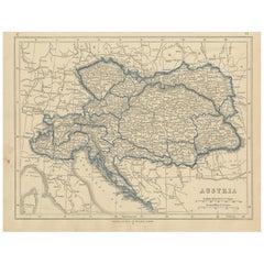
Antique Map of Austria by Lowry, 1852
Located in Langweer, NL
Antique map titled 'Austria'. Original map of Austria. This map originates from 'Lowry's Table
Category

Antique Mid-19th Century Maps

Materials

Paper

Antique Map of Austria by Lowry, 1852
H 9.65 in W 12.21 in D 0.02 in
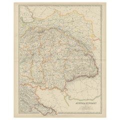
Antique Map of Austria- Hungary by Johnston, '1909'
Located in Langweer, NL
Antique map titled 'Austria- Hungary'. Original antique map of Austria- Hungary. This map
Category

Early 20th Century Maps

Materials

Paper

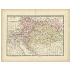
Antique Map of Austria-Hungary by Levasseur, '1875'
Located in Langweer, NL
Antique map titled 'Carte générale de la Monarchie Austro-Hongroise (..)'. Large map of Austria
Category

Antique Late 19th Century Maps

Materials

Paper

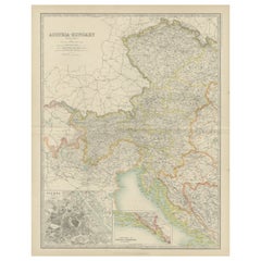
Antique Map of Austria- Hungary by Johnston '1909'
Located in Langweer, NL
Antique map titled 'Austria- Hungary'. Original antique map of Austria- Hungary. With inset maps of
Category

Early 20th Century Maps

Materials

Paper

Antique Map of Austria by F. de Wit, 1690
Located in Langweer, NL
detailed map of Austria by F. de Wit.
Category

Antique Late 17th Century Maps

Materials

Paper

Antique Map of Austria by F. de Wit, 1690
H 20.79 in W 25.04 in D 0.02 in
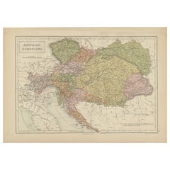
Antique Map of Austrian Dominions by A & C. Black, 1870
Located in Langweer, NL
Antique map titled 'Austrian Dominions'. Original antique map of Austrian Dominions. This map
Category

Antique Late 19th Century Maps

Materials

Paper

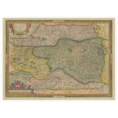
Antique Map of Austria by Ortelius, c.1612
Located in Langweer, NL
Antique map titled 'Austriae Descrip. per Wolfgangum Lazium' Original antique map of Austria
Category

Antique 17th Century Maps

Materials

Paper

Antique Map of Austria by Ortelius, c.1612
H 18.71 in W 22.84 in D 0 in
Antique Map of Austria, Centered Around the Danube from Passau to Vienna, C.1690
Located in Langweer, NL
Antique map of Austria titled 'Circuli Austriaci pars septentrionalis in quia archiducatus Austriae
Category

Antique 1690s Maps

Materials

Paper

Hand Colored 18th Century Homann Map of Austria Including Vienna and the Danube
By Johann Baptist Homann
Located in Alamo, CA
"Archiducatus Austriae inferioris" is a hand colored map of Austria created by Johann Baptist
Category

Antique Early 18th Century German Maps

Materials

Paper

Old Decorative Map of Austria, Centered on the Danube River and Vienna, Ca.1720
Located in Langweer, NL
Antique map titled 'Archiducatus Austriae inferioris (..).' Decorative map of Austria, centered on
Category

Antique 1720s Maps

Materials

Paper

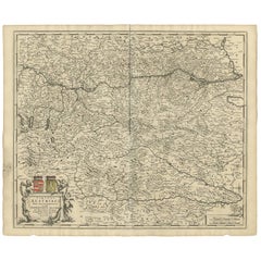
Antique Map of Austria by N. Visscher, circa 1690
Located in Langweer, NL
Antique map titled 'Austriae Archiducatus pars superior in omnes ejusdem'. Spectacular large map of
Category

Antique Late 17th Century Maps

Materials

Paper

Original Antique Map of Austria from an Old Dutch School Atlas, 1852
Located in Langweer, NL
Antique map titled 'Het Keizerrijk Oostenrijk'. Map of the Austrian Empire. This map originates
Category

Antique 1850s Maps

Materials

Paper

Hand Colored 18th Century Homann Map of Austria Including Vienna & the Danube
By Johann Baptist Homann
Located in Alamo, CA
"Archiducatus Austriae inferioris" is a hand colored map of Austria created by Johann Baptist
Category

Early 18th Century Old Masters Landscape Prints

Materials

Engraving

Austria by Wolfgang Lazius – A Magnificent 16th-Century Map from Ortelius
Located in Langweer, NL
Title: Avstriae Descrip – Wolfgang Lazius’ Map of Austria, 16th Century Description: This
Category

Antique 16th Century Maps

Materials

Paper

1634 Mercator/Jansson Map: Eastern Austria with Vienna, Hand-Colored
Located in Langweer, NL
1634 Mercator/Jansson Map: Eastern Austria with Vienna, Hand-Colored This hand-colored map from
Category

Antique 1630s Maps

Materials

Paper

Original Antique Map of The Austrian Empire, 1882
Located in Langweer, NL
Step into the past with an original Antique Map of The Austrian Empire from the esteemed
Category

Antique 1880s Maps

Materials

Paper

Old German Map of the Austrian Empire, ca.1870
Located in Langweer, NL
Antique map titled 'Kaiserthum Österreich'. Old map of the Austrian Empire. This map originates
Category

Antique 1870s Maps

Materials

Paper

Antique Map of the Austrian Empire by Petri, 1852
Located in Langweer, NL
Antique map titled 'Het Keizerrijk Oostenrijk'. Map of the Austrian Empire. This map originates
Category

Antique 19th Century Maps

Materials

Paper

Antique Map of the Austrian Empire by Migeon, 1880
Located in Langweer, NL
Antique map titled 'Empire d'Autriche'. Old map of the Austrian Empire. With decorative vignette
Category

Antique 19th Century Maps

Materials

Paper

Antique Map of Bavaria in Southern Germany and Austria, 1806
Located in Langweer, NL
Antique map titled 'Cercles de Baviere et d'Autriche.' This map shows Bavaria in southern Germany
Category

Antique 19th Century Maps

Materials

Paper

Antique Map of the Austrian Empire by Petri, c.1873
Located in Langweer, NL
Antique map titled 'Het Keizerrijk Oostenrijk'. Old map depicting the Austrian Empire. This map
Category

Antique 19th Century Maps

Materials

Paper

Antique Map of Germany with the Empire of Austria by Wyld '1845'
Located in Langweer, NL
Antique map titled 'The Confederated States of Germany with the Empire of Austria, and The Kingdoms
Category

Antique Mid-19th Century Maps

Materials

Paper

Original 18th-Century Map of Southern Austria, Carinthia, Carniola, and Styria
Located in Langweer, NL
title: 18th-Century Map of Southern Austria, Carinthia, Carniola, and Styria by Robert de Vaugondy
Category

Antique 1750s Maps

Materials

Paper

Antique Map of the Austrian Empire by W. G. Blackie, 1859
Located in Langweer, NL
Antique map titled 'The Austrian Empire'. Original antique map of the Austrian Empire with inset
Category

Antique Mid-19th Century Maps

Materials

Paper

Antique Map of the Region of Bavaria and Austria by Tirion, c.1740
Located in Langweer, NL
Antique map titled 'Carte des environs de Batavia - Kaart van de Buitenstreken van Batavia'. Map of
Category

Antique 18th Century Maps

Materials

Paper

1720 Johann Baptist Homann Map of the Austrian Circle and Surrounding Regions
Located in Langweer, NL
"1720 Johann Baptist Homann Map of the Austrian Circle and Surrounding Regions" Description of the
Category

Antique 1720s Maps

Materials

Paper

An Original Antique Mid-17th Century Blaeu Map of Styria in Southeastern Austria
Located in Langweer, NL
This is an antique map of Styria (referred to as “Stiria” or “Steyrmarck”), published by the
Category

Antique 1640s Maps

Materials

Paper

Woodcut Map of the Rhine River Region Covering the Palatinate, Austria and Elsa
Located in Langweer, NL
Early Woodcut Map of the Rhine River Region Covering the Palatinate, Austria, and Elsass, ca. 1628
Category

Antique 1620s Maps

Materials

Paper

Spectacular Large Map of Upper and Lower Austria between Passau and Wien, c.1700
Located in Langweer, NL
map of Upper and Lower Austria between Passau and Wien with figurative cartouche and armorial vignette
Category

Antique Early 1700s Maps

Materials

Paper

Vienna, Austria: A Large 17th Century Hand-Colored Map by Sanson and Jaillot
By Nicolas Sanson
Located in Alamo, CA
This large 17th century hand-colored map of Vienna, Austria and the surrounding countryside and
Category

Antique 1690s French Maps

Materials

Paper

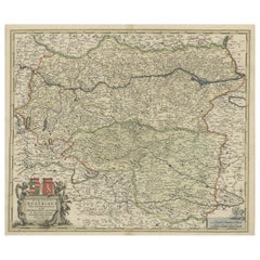
Antique Map of Styria by Mercator 'circa 1650'
Located in Langweer, NL
Antique map titled 'Stiria'. Original antique map of Styria, Austria. Published by G. Mercator
Category

Antique Mid-17th Century Maps

Materials

Paper

Antique Map of Styria by Mercator 'circa 1650'
H 16.15 in W 20.87 in D 0.02 in
Antique Map of the Region of Salzburg by Ortelius 'circa 1606'
Located in Langweer, NL
Antique map titled 'Salisburgensis Iurisdictionis'. Original antique map of the region of Salzburg
Category

Antique Early 17th Century Maps

Materials

Paper

Fine French Antique 1856 Hand Watercolour Map of Dept Des Hautes Pyrenees
Located in West Sussex, Pulborough
We are delighted to offer for sale this stunning 1856 hand watercolour map of the Austrian Alps
Category

Antique 1850s French Early Victorian Maps

Materials

Paper

Fine Antique 1856 Hand Watercolour Map of Dept Des Hautes Alpes by Levasseur's
Located in West Sussex, Pulborough
We are delighted to offer for sale this stunning 1856 hand watercolour map of the Austrian Alps
Category

Antique 1850s French Early Victorian Maps

Materials

Paper

Beautiful Colour French Antique 1856 Hand Watercolour Map of Dept Des La Corse
Located in West Sussex, Pulborough
We are delighted to offer for sale this stunning 1856 hand watercolour map of the Austrian Alps
Category

Antique 1850s French Early Victorian Maps

Materials

Paper

Large Panoramic View of Eisenerz, an Old Mining Town in Styria, Austria, c.1650
Located in Langweer, NL
Steyer'. Large panoramic view of Eisenerz, an old mining town in the Austrian state of Styria
Category

Antique 1650s Maps

Materials

Paper

Von Reilly Map of the Russian Empire, 1796
Located in Savannah, GA
A map of the Russian Empire in Europe by Von Reilly. Published in Vienna, 1796. 32 inches wide by
Category

Antique 1790s Austrian Prints

Materials

Glass, Wood, Paper

Vienna, Austria: A Large 17th Century Hand-colored Map by Sanson and Jaillot
By Nicholas Sanson d'Abbeville
Located in Alamo, CA
This large 17th century hand-colored map of Vienna, Austria and the surrounding countryside and
Category

1690s Landscape Prints

Materials

Engraving

Johannes Bleau C 1654 Engraved Map of Levinia Vice Comitatus Province of Lennox
By Johannes Bleau
Located in Los Angeles, CA
" Overall Dimensions: TITLE: Circa 1654 Map of Levinia Vice Comitatus the Province of Lennox IMAGE SIZE
Category

Antique Mid-17th Century Austrian Prints

Materials

Paper

Antique Map of Austria and Hungary by Ortelius, c.1590
Located in Langweer, NL
map of Austria and Hungary, following the Danube from Lintz to Bratislava and extending north to the
Category

Antique 16th Century Maps

Materials

Paper

Colourful Old Map of the Austrian Empire, with an Inset Map of Vienna, 1846
Located in Langweer, NL
Antique map titled 'Austrian Empire'. Old map of the Austrian Empire, with an inset map of
Category

Antique 1840s Maps

Materials

Paper

Antique Map of the Austrian Empire by A.K. Johnston, 1865
Located in Langweer, NL
Antique map titled 'Austrian Empire (Eastern Sheet)'. Depicting Hungary, Servia, Transylvania and
Category

Antique Mid-19th Century Maps

Materials

Paper

Antique Map of the Austrian Empire ‘West’ by A.K. Johnston, 1865
Located in Langweer, NL
Antique map titled 'Austrian Empire (Western Sheet)'. Depicting Dalmatia, Istria, Croatia, Bohemia
Category

Antique Mid-19th Century Maps

Materials

Paper

Rare Print of Archduke Charles of Austria Showing California as an Island, 1704
Located in Langweer, NL
Allegorical portrait of the Archduke Charles of Austria (calling himself the Spanish king Charles
Category

Antique Early 1700s Maps

Materials

Paper

Imperial Map Desk of the Habsburg Empire
Located in New Orleans, LA
This monumental, one-of-a-kind map desk hails from the Imperial Palace of the Habsburg Emperor
Category

Antique 19th Century Austrian Other Desks

Materials

Wood, Satinwood, Walnut

Antique Map of Austria, Turkey and Greece by Johnson, 1872
Located in Langweer, NL
Antique map titled 'Johnson's Austria, Turkey in Europe and Greece'. Original map of Austria
Category

Antique Late 19th Century Maps

Materials

Paper

Antique Map of Austria by J. Tallis, circa 1851
Located in Langweer, NL
A highly decorative and finely engraved mid-19th century map of Austria (including Bohemia) that
Category

Antique Mid-19th Century Maps

Antique Map of Austria 'Tirol' with Parts of Italy by J. Janssonius, 1649
Located in Langweer, NL
Antique map titled 'Comitatus Tirolensis'. Relief shown pictorially, decorative cartouche, figures
Category

Antique Mid-17th Century Maps

Materials

Paper

19th Century Map Imperial Court of Austria Habsburgs
Located in London, GB
Austria, with their various chancelleries, circa 1820. The map is very detailed and shows the various
Category

Antique 1820s Spanish Maps

Hand Colored 18th C. Homann Map of Bavaria & Portions of Austria and Switzerland
By Johann Baptist Homann
Located in Alamo, CA
This hand colored map of Bavaria in Southern Germany and portions of Austria and Switzerland
Category

Antique Early 18th Century German Maps

Materials

Paper

Antique Map of the City of Vienna by Balbi '1847'
Located in Langweer, NL
Antique map titled 'Vienne'. Original antique map of the city of Vienna, Austria. This map
Category

Antique Mid-19th Century Maps

Materials

Paper

Early 19th Century Map of Ottoman Europe and Surrounding Regions, 1821
Located in Langweer, NL
north, the map depicts parts of the **Austrian Empire** and **Transylvania**, highlighting the
Category

Antique 1820s Maps

Materials

Paper

World Map Night Stand Commode
Located in Boca Raton, FL
Custom Made funky cool world map nightstand.
Category

21st Century and Contemporary Austrian Mid-Century Modern Commodes and C...

Get Updated with New Arrivals
Save "Map Of Austria", and we’ll notify you when there are new listings in this category.

Map Of Austria For Sale on 1stDibs

Find many varieties of an authentic map of Austria available at 1stDibs. Frequently made of paper, hardwood and satinwood, every map of Austria was constructed with great care. You’ve searched high and low for the perfect map of Austria — we have versions that date back to the 18th Century alongside those produced as recently as the 19th Century are available. Each map of Austria bearing hallmarks is very popular. Many designers have produced at least one well-made map of Austria over the years, but those crafted by Johann Baptist Homann are often thought to be among the most beautiful.

How Much is a Map Of Austria?

The average selling price for a map of Austria at 1stDibs is $494, while they’re typically $124 on the low end and $348,500 for the highest priced.