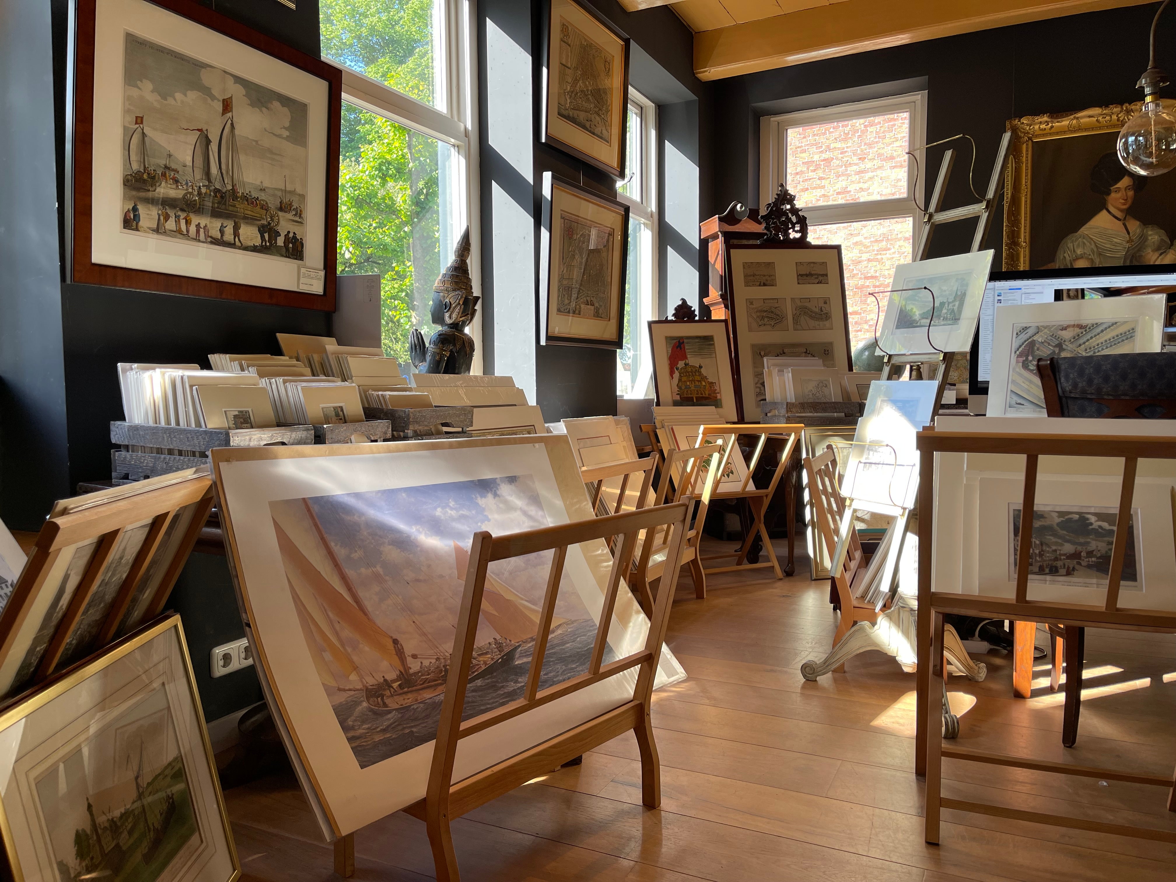
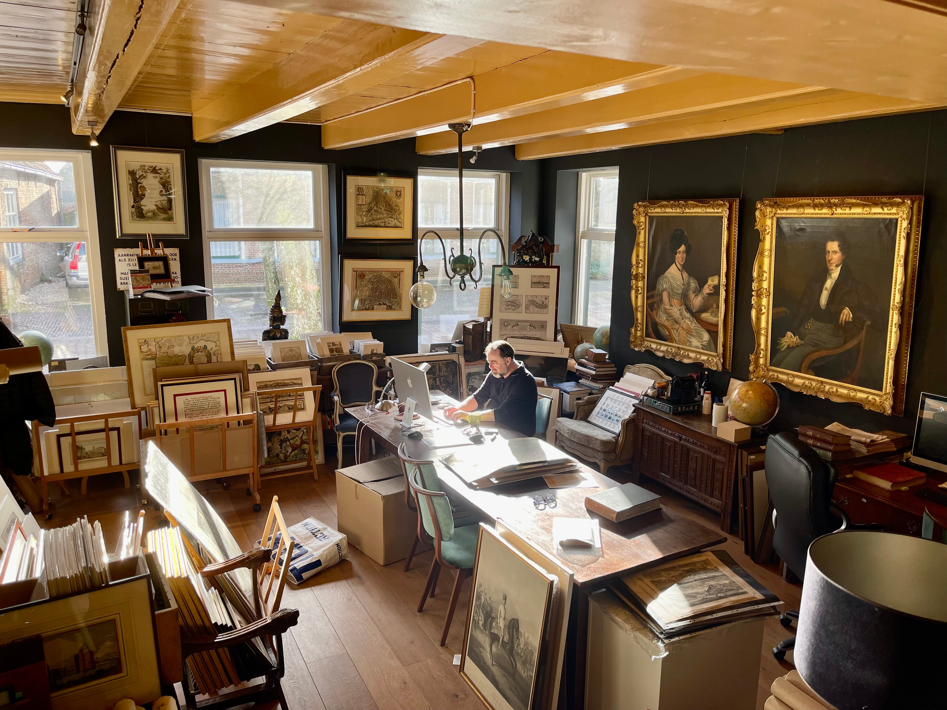
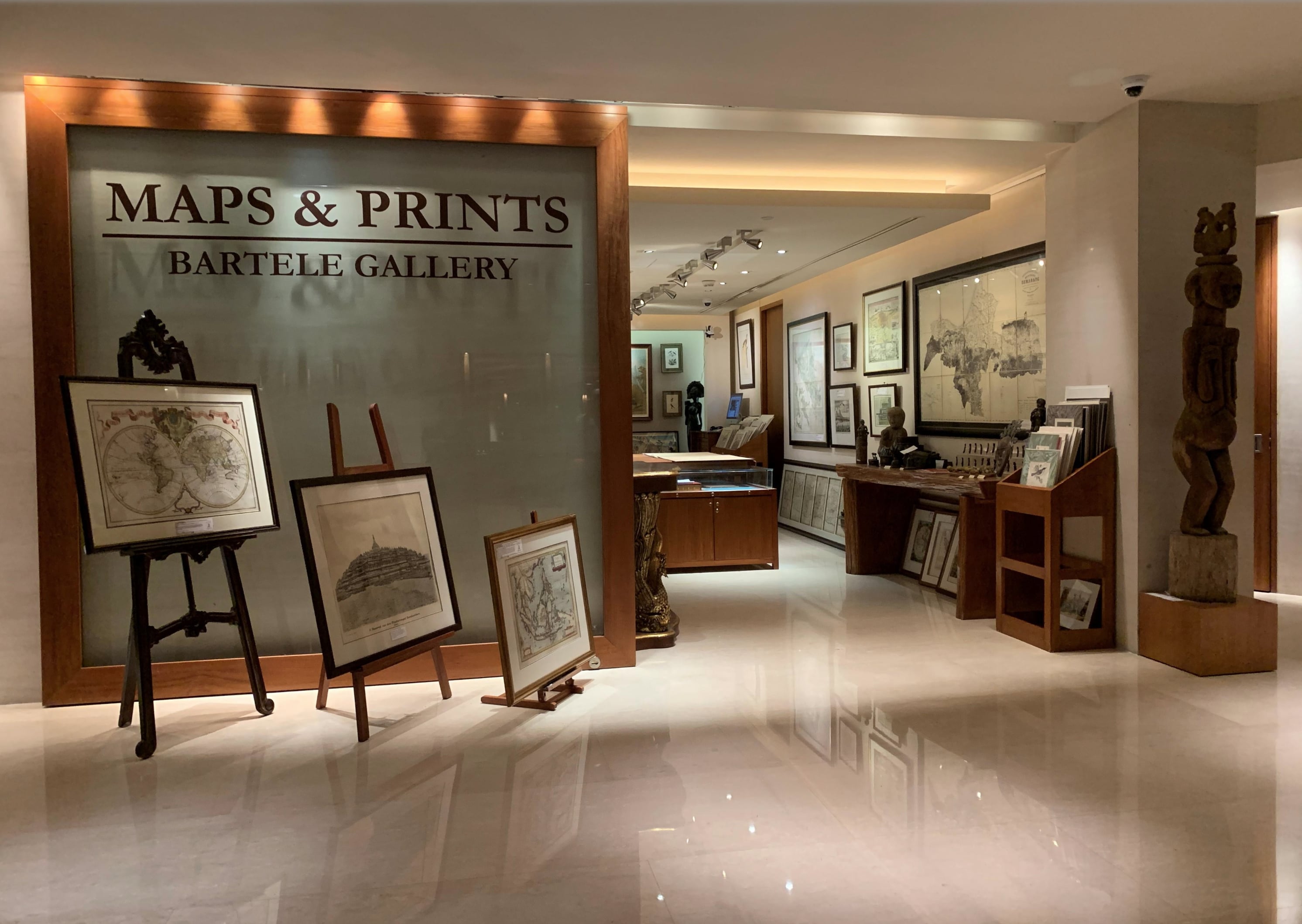
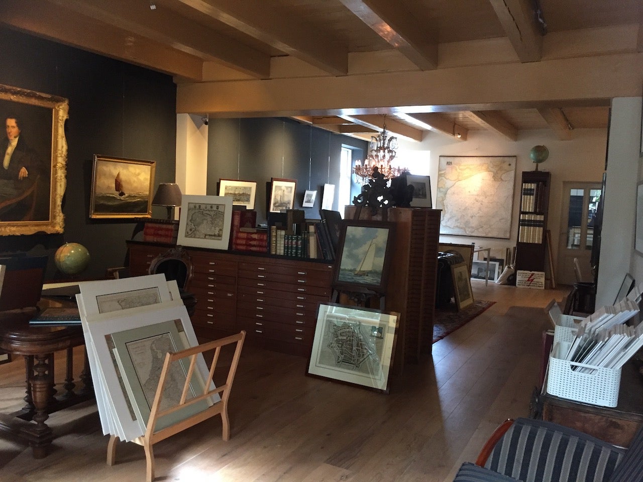
About Bartele Gallery
Bartele Gallery offers a wide range of antique maps, prints and rare books. Our extensive collection of antique maps covers every part of the world. Whilst cartography holds a special place in our collection, we also offer thousands of antique prints covering fields of interest as diverse as architecture, natural history, religion, ethnology and many more. Bartele Gallery is managed by Bartele Santema, in 2009 he founded the first gallery in Indonesia. This gallery is located in the Mandarin Oriental Hotel Jakarta and supported by curator Dr. David Parry, who wrote 'The ...Read More
Featured Pieces
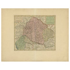
Antique Map of Hungary Incl Surroundings like Croatia, Bosnia, Servia, 1730
Located in Langweer, NL
Antique map titled 'Nieuwe Kaart van t Koninkryk Hongaryen en Zevenbergen na de laatste ontdekkingen'.
This map depicts Hungary including surroundings like Croatia, Bosnia, Servia,...
Category
Antique 18th Century Maps
Materials
Paper
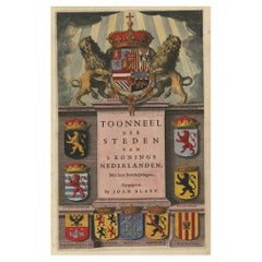
Antique Frontispiece by Blaeu, c.1650
Located in Langweer, NL
Antique print titled 'Toonneel der Steden (..)'. This plate originates from the famous town atlas of the Netherlands 'Toonneel der Steden' published by Joan Blaeu c. 1650.
Artists a...
Category
Antique 17th Century Prints
Materials
Paper
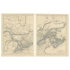
Antique Map of Canada, New Brunswick and Nova Scotia by Lowry, 1852
Located in Langweer, NL
Antique map titled 'Canada, New Brunswick & Nova Scotia'. Two individual sheets of Canada, New Brunswick and Nova Scotia. This map originates from 'Lowry...
Category
Antique Mid-19th Century Maps
Materials
Paper
Antique Map of the North Pole by V.M. Coronelli, circa 1692
By Vincenzo Coronelli
Located in Langweer, NL
Globe gore by Vincenzo Maria Coronelli shows the North Pole with the coasts of Canada, Greenland, Scandinavia and Siberia, and is decorated with pictorial scenes of bear, seal and wh...
Category
Antique Late 17th Century Maps
Materials
Paper

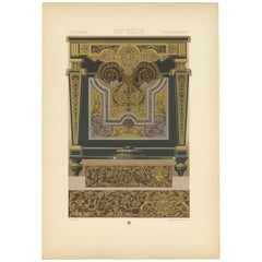
Pl. 110 Antique Print of 17th Century Console Table by Racinet, circa 1890
Located in Langweer, NL
Antique print titled '17th Century - XVIIc Siècle - XVIILes Jahrhundert'. Chromolithograph of console table by Charles - Andre Boulle with metallic inlay ...
Category
Antique Late 19th Century Prints
Materials
Paper
Antique Map of the Eastern United States by Levasseur '1875'
Located in Langweer, NL
Antique map titled 'Carte de la Region orientale des États-Unis et de la dominion du Canada'. Large map of the Eastern United States. This map originates from 'Atlas de Géographie Mo...
Category
Antique Late 19th Century Maps
Materials
Paper

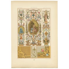
Pl. 104 Antique Print of 17th Century Interior Decor by Racinet, circa 1890
Located in Langweer, NL
Antique print titled '17th Century - XVIIc Siècle - XVIILes Jahrhundert'. Chromolithograph of interior decor (Painting, tapestry, woodwork), France orna...
Category
Antique Late 19th Century Prints
Materials
Paper
Antique Map Showing the Religions Around the World by Johnston '1854'
Located in Langweer, NL
Antique map titled 'Moral & Statistical Chart showing the Geographical Distribution of Man According to Religious Belief'. Rare large-size thematic map on the distribution of religio...
Category
Antique Mid-19th Century Maps
Materials
Paper

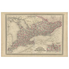
Antique Map of Ontario with an Inset Map of the Niagara River by Johnson, 1872
Located in Langweer, NL
Antique map titled 'Johnson's Ontario, of the dominion of Canada (..)'. Original map of Ontario, Canada, with an inset map of the Niagara River and vicinity. This map originates from...
Category
Antique Late 19th Century Maps
Materials
Paper
Antique Railroad Map of the United States by Rand, McNally & Co, 1900
Located in Langweer, NL
Antique map titled 'Rand, McNally & Co's New Official Railroad map of the United States with portions of The Dominion of Canada, The Republic of Mexico and the West Indies'. Large railroad map of the United States, sectionalised and laid on linen. Map shows state boundaries for the United States, Mexico, the West Indies, and lower portion of Canada; major cities and towns, military posts, Native American reservations, and railroads; Oklahoma and "Indian Territory." Inset: "Map of Alaska...
Category
20th Century Maps
Materials
Linen, Paper

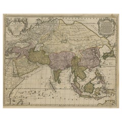
Large Antique Map of Asia including All of Southeast Asia, c.1792
Located in Langweer, NL
Antique map titled 'L' Asie Divisee en ses Empires, Royaumes, et Etats'. Attractive, large map of Asia including all of Southeast Asia. The cartography is archaic for the period with...
Category
Antique 18th Century Maps
Materials
Paper
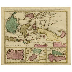
Old Map of Indonesian Islands Borneo, Celebes, New Guinea & New Britain, 1792
Located in Langweer, NL
Antique map titled 'Partie de la Nouvelle Grande Carte des Indes Orientales, contenant les Isles de Borneo, Iava, Celebes, Mindanao (..)'.
Detailed map of the Indonesian islands Bo...
Category
Antique 1790s Maps
Materials
Paper
More About Bartele Gallery

Featured Creators