R. S. Johnson Fine Art More Prints
to
3
3
3
Overall Height
to
Overall Width
to
3
1
1
1
2
1
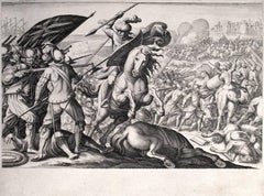
Défaite de la cavalerie Turque (1st State)
By Jacques Callot
Located in Chicago, IL
Defeat of the Turkish Cavalry (1st State)
From: The Life of Ferdinando de'Medici
Engraving
224 x 300 mm.; 8 7/8 x 11 7/8 inches
Reference:
Lieure No. 154
Meaume No. 541
Ru...
Category
17th Century Baroque More Prints
Materials
Engraving
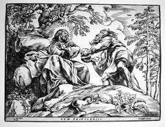
The Temptation of Christ by the Devil (2nd State)
By Christoffel Jegher
Located in Chicago, IL
Woodcut after Peter Paul Rubens (Siegen 1577-1640 Antwerp)
Reference:
Le Blanc 6
Hollstein 6 II/III
Notes:
1. A very fine impression of the 2nd state (of three) of this majo...
Category
17th Century Baroque More Prints
Materials
Woodcut
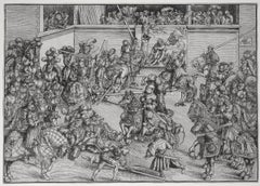
The Second Tournament with the Tapestry of Samson and the Lion
By Lucas Cranach the Elder
Located in Chicago, IL
Watermark:
Bull's Head with Serpent and Cross (Briquet 1575, dated 1492 by Briquet)
Provenance:
Martin Folkes (Lugt 1034)
Reverend G. L. Blake (Lugt 1172)
Reference:
Bartsc...
Category
18th Century and Earlier Northern Renaissance More Prints
Materials
Woodcut
Related Items
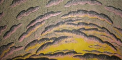
Dusk
By Louisa Chase
Located in New York, NY
Louisa Chase was born in Panama City, Panama. Seven years later, her family moved to Lancaster, Pennsylvania. She studied painting and sculpture at Syracuse University and at the Yal...
Category
Late 20th Century American Modern More Prints
Materials
Woodcut
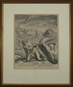
Johannes Sadeler I (Flemish 1550-1600) – Engraving 1582 - Jonah and the Whale II
By Johannes Sadeler I
Located in Meinisberg, CH
Johannes Sadeler I
(Flemish, ∗ 1550 in Brussels, Belgium – † 1600 Venice, Italy)
Jonah Spat Up by the Whale (Sheet II)
Engraved by Sadeler after an image created by Theodor Bernard...
Category
16th Century Renaissance Figurative Prints
Materials
Laid Paper, Engraving
Free Shipping
H 15.56 in W 13.19 in D 0.6 in
Primula Cortusoides - Siberian Primrose. Henry Andrews botanical engraving print
By Henry C Andrews
Located in Melbourne, Victoria
'Primula Cortusoides - Siberian Primrose'
Native of Siberia.
Original copper-line engraving with original hand-colouring from Henry Andrews' 'The Botanist's Repository', 1797-1812...
Category
Early 19th Century Naturalistic Still-life Prints
Materials
Engraving
St. Michael's Mount, Cornwall: A Framed 19th C. Engraving After Myles Foster
By Myles Birket Foster
Located in Alamo, CA
This beautiful 19th century framed hand-colored engraving is entitled "St. Michael's Mount, Cornwall" by J. Saddler after an original painting by the British artist Myles Birket Fost...
Category
Mid-19th Century Romantic Landscape Prints
Materials
Engraving
H 14.38 in W 17.88 in D 1.5 in
The Fighting Temeraire: A Framed 19th C. Engraving After J. M. W. Turner
By J.M.W. Turner
Located in Alamo, CA
This beautiful 19th century framed engraving "The Fighting Temeraire" by James Tibbetts Willmore is based on an original painting by the renowned British artist J.M.W. Turner. It was published by James S. Virtue & Co. in London between 1859-1875. It depicts the once mighty British warship the HMS Temeraire being towed away down the river Thames by a much smaller steamboat to a ship-breaking yard to be broken up for scrap. The Temeraire was first launched in 1798 and represented the pinnacle of British ship-building. 180-feet long, constructed of English oak and armed with 98 guns, she was one of the largest warships of the period. The Temeraire became a symbol of British pride and military power that endured throughout the 19th century. The man-of-war served during the French Revolutionary and Napoleonic Wars and was among the last serving ships to have been at the Battle of Trafalgar in 1805. It became one of the many older ships put out of service in the 1830s and 1840s. The once mighty and feared ship symbolizes a once magnificent, but now obsolete, technology. Turner seems to lament her inglorious final journey, being towed by a less magnificent, but modern steam powered tugboat.
The Turner painting was created in 1838 and is now held in the National Gallery in London. Willmore's engraving, created in 1859, captures the dramatic scene with great detail and skill. The image has become an iconic representation of the decline of Britain's naval power and the transition from sail to steam in the 19th century. The sunset in the background is symbolic of the sun going down on British naval power and tradition. The painting conveys profound and diverse themes that are central to the human experience: those of mortality and change, technology and progress, heroism and brutality. The painting demonstrates Turner’s skill as an artist. His ability to produce scenes of great beauty that are dramatic, but are also symbolic, stimulating both thoughtful analysis, as well as emotion. Turner's painting was voted by the British public in a 2005 BBC radio sponsored survey to be the British people's favorite painting of all time. In 2020 it was included on a new British banknote...
Category
Mid-19th Century Romantic Landscape Prints
Materials
Engraving
H 18 in W 20.5 in D 1 in
Draught of a Galley /// Old Masters Ship Boat Seascape Construction Diagram Art
By William Henry Toms
Located in Saint Augustine, FL
Artist: William Henry Toms (English, c.1700-1765)
Title: "Draught of a Galley" (Plate 13, Vol. III, page 131)
Portfolio: La Spectacle de la Nature
Year: 1737
Medium: Original Hand-Colored Engraving on laid paper
Limited edition: Unknown
Printer: Unknown, London, UK
Publisher: Humphreys, London, UK
Framing: Recently framed in a Regency style gold moulding with rag matting from Holland and museum glass. The frame is an antique frame we've reused, originally built by Knoedler Gallery, New York, NY
Framed size: 10.25" x 10.25"
Sheet size (irregular margins): 6.63" x 8.25"
Image size: 4.75" x 6.75"
Condition: In excellent condition with strong colors and good margins
Rare
Notes:
Comes from the 1737 volume edition of Noël-Antoine Pluche's "La Spectacle de la Nature", translated from the original French by Humphreys as "Nature Displayed". With two soft vertical folds within paper as issued. Various dealer reference numbers and an old price pencil inscribed in margins and on verso.
Biography:
William Henry Toms (c. 1700–1765) was an English engraver. He worked on portraits, book-plates, landscapes and prints of buildings. Among his works were the plates for Robert West's "Perspective Views of All the Ancient Churches in London" (1736–1739). In 1741, he worked with Thomas Badeslade on "Chorographia Britanniae or a New Set of Maps of all the Counties in England and Wales". The maps were republished on 29 September 1742, with additional place names. Among Toms's apprentices was the engraver and publisher John Boydell. W. H. Toms lived in Masham Street, London, and was the father of the painter Peter Toms. Toms died in 1765.
Noël-Antoine Pluche (1688-1761) , known as the abbé Pluche, was a French priest...
Category
1730s Baroque More Prints
Materials
Watercolor, Laid Paper, Engraving, Intaglio
A View of Scarborough, England: A Framed 19th C. Engraving After J. M. W. Turner
By J.M.W. Turner
Located in Alamo, CA
This beautiful 19th century framed engraving "Scarborough" by W. Chapman is based on an original painting by the renowned British artist J.M.W. Turner. It was published in London by ...
Category
Mid-19th Century Romantic Landscape Prints
Materials
Engraving
H 18.25 in W 20.88 in D 1 in
View of Emden, Germany: A 16th Century Hand-colored Map by Braun & Hogenberg
By Franz Hogenberg
Located in Alamo, CA
This is a 16th century original hand-colored copperplate engraved map of a bird's-eye View of Embden, Germany entitled " Emuda, vulgo Embden vrbs Frisia orientalis primaria" by Georg Braun & Franz Hogenberg, in volume II of their famous city atlas "Civitates Orbis Terrarum", published in Cologne, Germany in 1575.
This is a beautifully colored and detailed map of Emden, a seaport in northwestern Germany, along the Ems River and perhaps portions of over Dollart Bay, near the border with the Netherland. The map depicts a bird's-eye view of the city from the southwest, as well as a view of the harbor and an extensive system of canals. Numerous ships of various sizes, as well as two rowboats containing numerous occupants are seen in the main waterway in the foreground and additional boats line two canals in the center of the city. Two men and two women are shown on a hill in the foreground on the right, dressed in the 16th century style of nobility. Two ornate crests are included in each corner. A title strap-work cartouche is in the upper center with the title in Latin. The crest on the right including Engelke up de Muer (The Little Angel on the Wall) was granted by Emperor Maximilian I in 1495.
This is an English translation of an excerpt of Braun's description of Embden: "In Emden, the capital of East Frisia, rich merchants live in very fine houses. The city has a broad and well-situated harbour, which in my opinion is unique in Holland. Frisia and the whole of the Netherlands, for the ships can anchor here right under the city walls. They have also extended the harbour as far as the New Town, so that up to 400 ships can now find shelter here when the sea is rough."
The emphasis on the harbor and waterways within the city highlights the importance of Emden's place as a seaport at this time. Embden developed from a Dutch/Flemish trading settlement in the 7th-8th centuries into a city as late as late 14th century. In 1494 it was granted staple rights, and in 1536 the harbour was extended. In the mid-16th century Emden's port was thought to have the most ships in Europe. Its population then was about 5,000, rising to 15,000 by the end of the 16th century. The Ems River flowed directly under the city walls, but its course was changed in the 17th century by the construction of a canal. Emden has canals within its city limits, a typical feature of Dutch towns, which also enabled the extension of the harbor. In 1744 Emden was annexed by Prussia and is now part of Germany. It was captured by French forces in 1757 during the Seven Years' War, but recaptured by Anglo-German forces in 1758. During the Napoleonic French era, Emden and the surrounding lands of East Frisia were part of the short-lived Kingdom of Holland.
References:Van der Krogt 4, 1230, State 2; Taschen, Braun and Hogenberg...
Category
16th Century Old Masters Landscape Prints
Materials
Engraving
Echium Glaucophyllum, Henry Andrews antique botanical flower engraving print
By Henry C Andrews
Located in Melbourne, Victoria
'Echium Glaucophyllum - Sea-green-leaved Viper's Bugloss'
Native of Cape of Good Hope, South Africa.
Original copper-line engraving with original hand-colouring from Henry Andrews...
Category
Early 19th Century Naturalistic Still-life Prints
Materials
Engraving
Ireland: A Framed 17th Century Hand-colored Map by Jan Jannson
By Johannes Janssonius
Located in Alamo, CA
This is a 17th century hand-colored map entitled "Hibernia Regnum Vulgo Ireland" by Johannes Janssonius's (Jan Jansson), published in Amsterdam in 1640. This highly detailed map depicts the Emerald Isle with an extensive display of towns, roads, mountains, rivers, lakes and county borders, etc. It includes two decorative cartouches on the left. The title cartouche includes the Irish harp and the second, in the upper left, includes a lion wearing a crown on the left, a unicorn on the right and a coat-of-arms in the middle, which includes another Irish harp. A distance scale is seen in the lower right, augmented with two putti. The map is embellished with three sailing ships and a sea monster. Western portions of Scotland and England...
Category
Mid-17th Century Old Masters Landscape Prints
Materials
Engraving
H 17.88 in W 22 in D 0.75 in
Tournai (Tournay), Belgium: A 16th Century Hand-colored Map by Braun & Hogenberg
By Franz Hogenberg
Located in Alamo, CA
This is a 16th century original hand-colored copperplate engraved map of Tournai, Belgium, entitled "Tornacum" by Georg Braun & Franz Hogenberg, in volume IV of their famous city atlas "Civitates Orbis Terrarum", published in Cologne or Augsberg, Germany in 1575. The map provides a bird's-eye view of the walled city of Tournai, the second oldest city in Belgium. It lies approximately one hour by car southwest of Brussels or from Ghent. The names of thirty of its streets, prominent buildings, churches and squares are listed in a key within a strap-work cartouche in the lower left. These locations are numbered in the key corresponding to their locations on the map.
This colorful map of Tournai (Tornacum or Tournay as it was called in the 16th century) includes the title in Latin in a cartouche in the upper center. Three crests are present across the upper map. A man and two woman are standing on a hill in the foreground in the lower right dressed in the style of 16th century upper class residents of the town.
This is an English translation of an excerpt of Braun's description of Tornai: “Tornacum or Turnacum is a city in Gallia Belgica, situated on the Schelde in the territory of the Nervii, called Tournai by its French inhabitants, but Dorneck by the Germans. Tournai has always been a large and powerful city, with an abundance of goods and commercial activities and wonderfully resourceful craftsmen, who invent new articles every day, and although some of these go out of use they constantly conceive of other new things, both useful and delightful, so that they have at all times something that provides work and a means of livelihood for the poor."
ReferencesVan der Krogt 4, 4435, State 1; Taschen, Braun and Hogenberg...
Category
16th Century Old Masters Landscape Prints
Materials
Engraving
Yellow Pontic Azalea. Henry Andrews antique botanical flower engraving print
By Henry C Andrews
Located in Melbourne, Victoria
'Azalea Pontica - Yellow Pontic Azalea'
Native of the coat of the Black Sea.
Original copper-line engraving with original hand-colouring from Henry Andrews' 'The Botanist's Reposi...
Category
Early 19th Century Naturalistic Still-life Prints
Materials
Engraving
