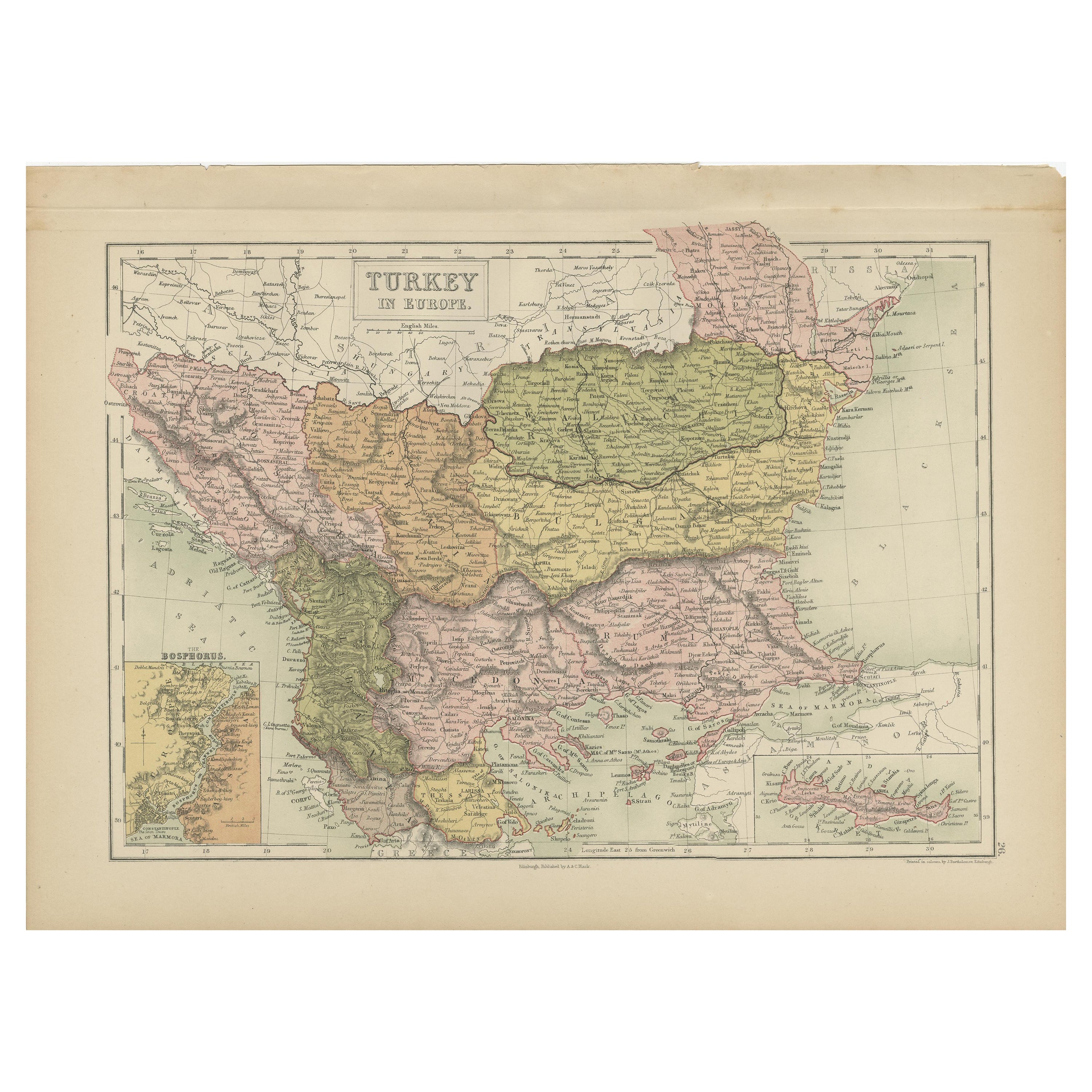
Border Sheep Show, Possibly Border Leicester Sheep in Scotland, ca.1870
View Similar Items

Want more images or videos?
Request additional images or videos from the seller
1 of 5
Border Sheep Show, Possibly Border Leicester Sheep in Scotland, ca.1870
About the Item
- Dimensions:Height: 13.86 in (35.2 cm)Width: 20.79 in (52.8 cm)Depth: 0 in (0.02 mm)
- Materials and Techniques:
- Period:
- Date of Manufacture:circa 1870
- Condition:Repaired: Condition: Good, given age. Original middle fold, as issued. A long diagonal tear, crossing almost the entire image. Backed on the rear with tape. A small nick in the right margin. General age-related toning. Wear consistent with age and use.
- Seller Location:Langweer, NL
- Reference Number:Seller: PCT-56663 1stDibs: LU3054326838802
About the Seller
5.0
Platinum Seller
These expertly vetted sellers are 1stDibs' most experienced sellers and are rated highest by our customers.
Established in 2009
1stDibs seller since 2017
1,933 sales on 1stDibs
More From This SellerView All
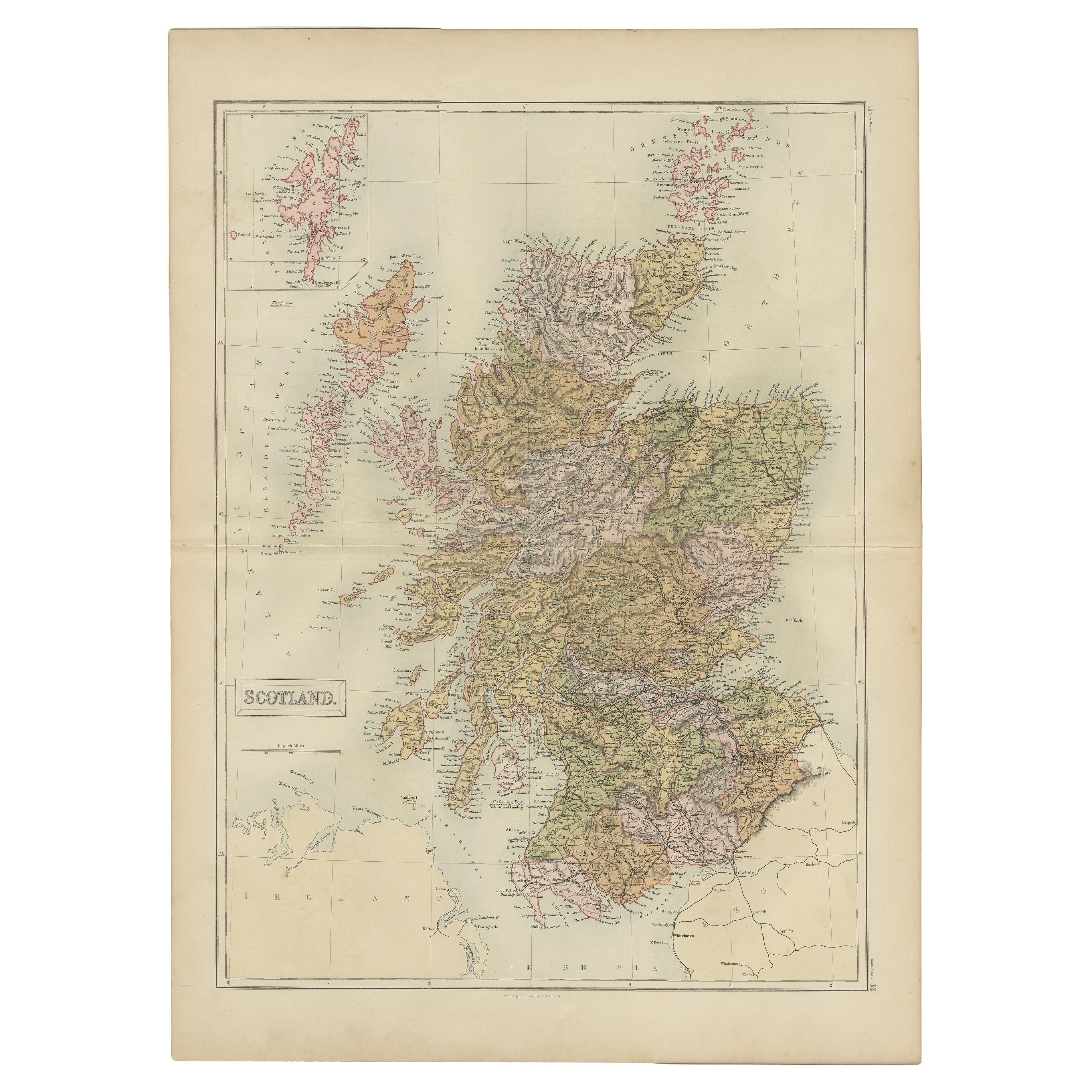
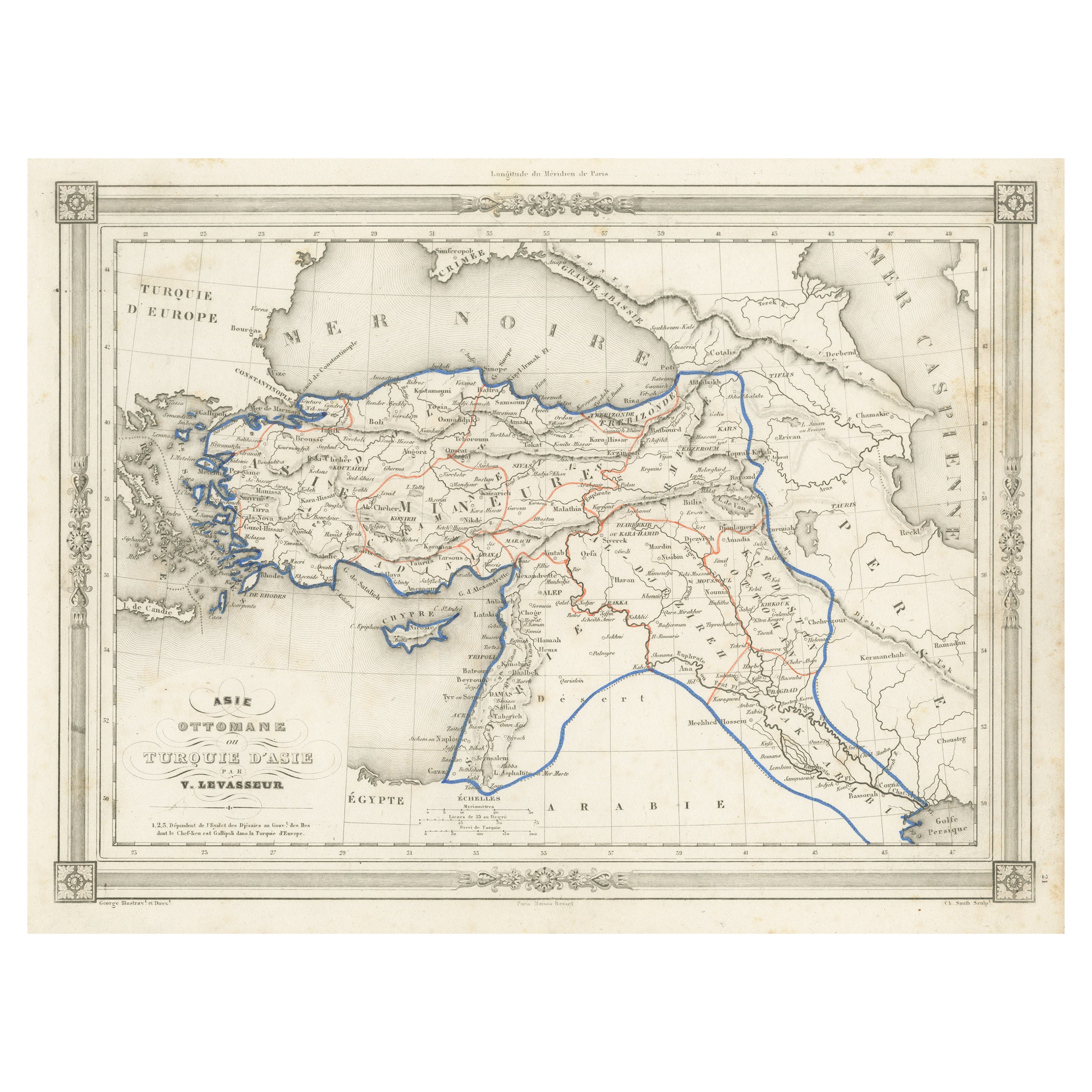
- Antique Map of Scotland by A & C. Black, 1870Located in Langweer, NLAntique map titled 'Scotland'. Original antique map of Scotland with inset map of Shetland island. This map originates from ‘Black's General Atlas of The World’. Published by A & C. ...Category
Antique Late 19th Century Maps
MaterialsPaper
 $211 Sale Price29% Off
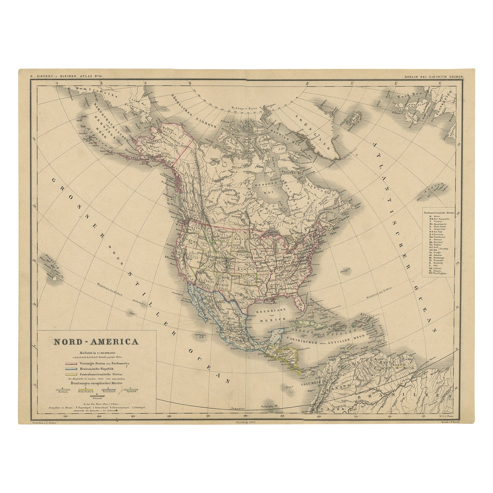
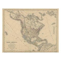
 - Old Original Antique German Map of North America, ca.1870Located in Langweer, NLAntique map titled 'Nord-America'. Old map of North America. This map originates from 'H. Kiepert's Kleiner Atlas der Neueren Geographie für Schule und Haus'. Artists and Engrave...Category
Antique 1870s Maps
MaterialsPaper
- Antique Sea Chart of the Shetland Islands, Scotland, ca.1745Located in Langweer, NLAntique map of Scotland titled 'Nieuwe Paskaard van Hitland met de daar omleggende eylanden na de nieuwe aftekening gemaakt by den Lofwaarden en onvermoeyden Hit en Zeeman Ian Bruyst...Category
Antique 1740s Maps
MaterialsPaper
 $1,098 Sale Price20% Off
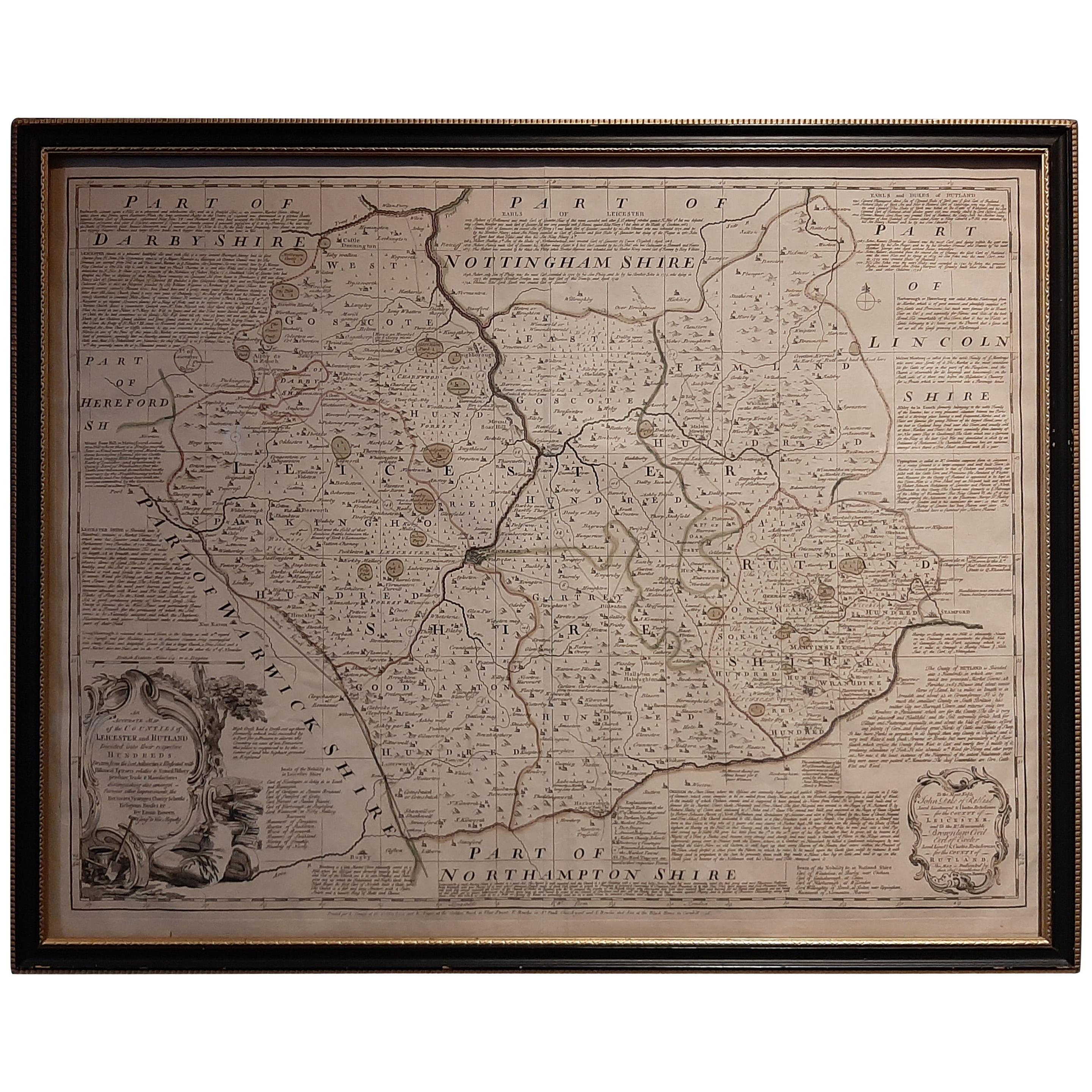
 - Antique Map of Leicester and Rutland by Tinney & Sayer, 'circa 1756'Located in Langweer, NLAntique map titled 'An Accurate Map of the Counties of Leicester and Rutland (..)'. Large map of Leicester and Rutland with dedications to the Most Noble John Duke of Rutland, and to...Category
Antique Mid-18th Century Maps
MaterialsPaper
 $702 Sale Price20% Off
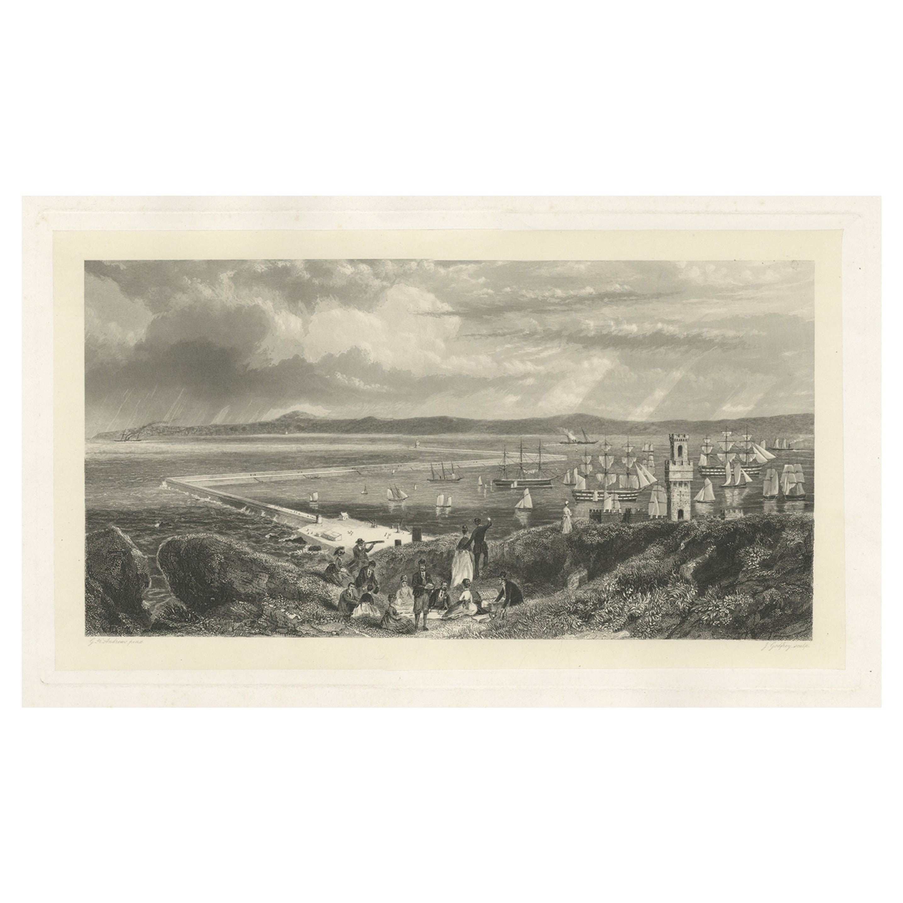
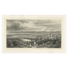
 - Old Decorative Maritime Print of Ships in an Harbour, Possibly England, C.1860Located in Langweer, NLUntitled antique maritime print. Antique print depicting an unidentified port/harbour. In the background various vessels. Source unknown, to be...Category
Antique 19th Century Prints
MaterialsPaper
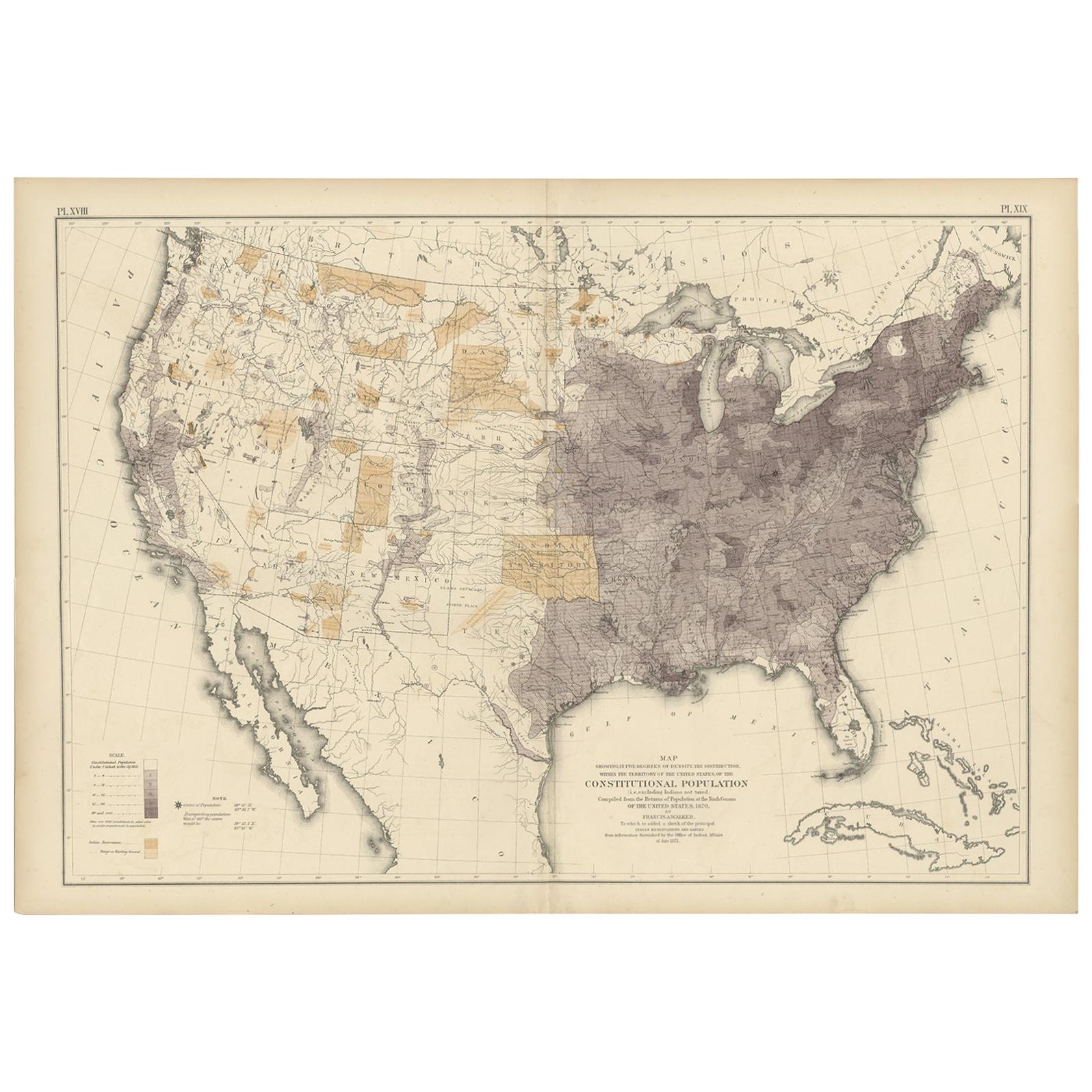
- Antique Chart of the US Population in 1870, published in 1874Located in Langweer, NLAntique chart titled 'Map showing, in five degrees of density, the distribution, within the territory of the United States, of the constitutional population, i.e., excluding Indians ...Category
Antique Late 19th Century Maps
MaterialsPaper
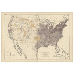 $790 Sale Price20% Off
You May Also Like
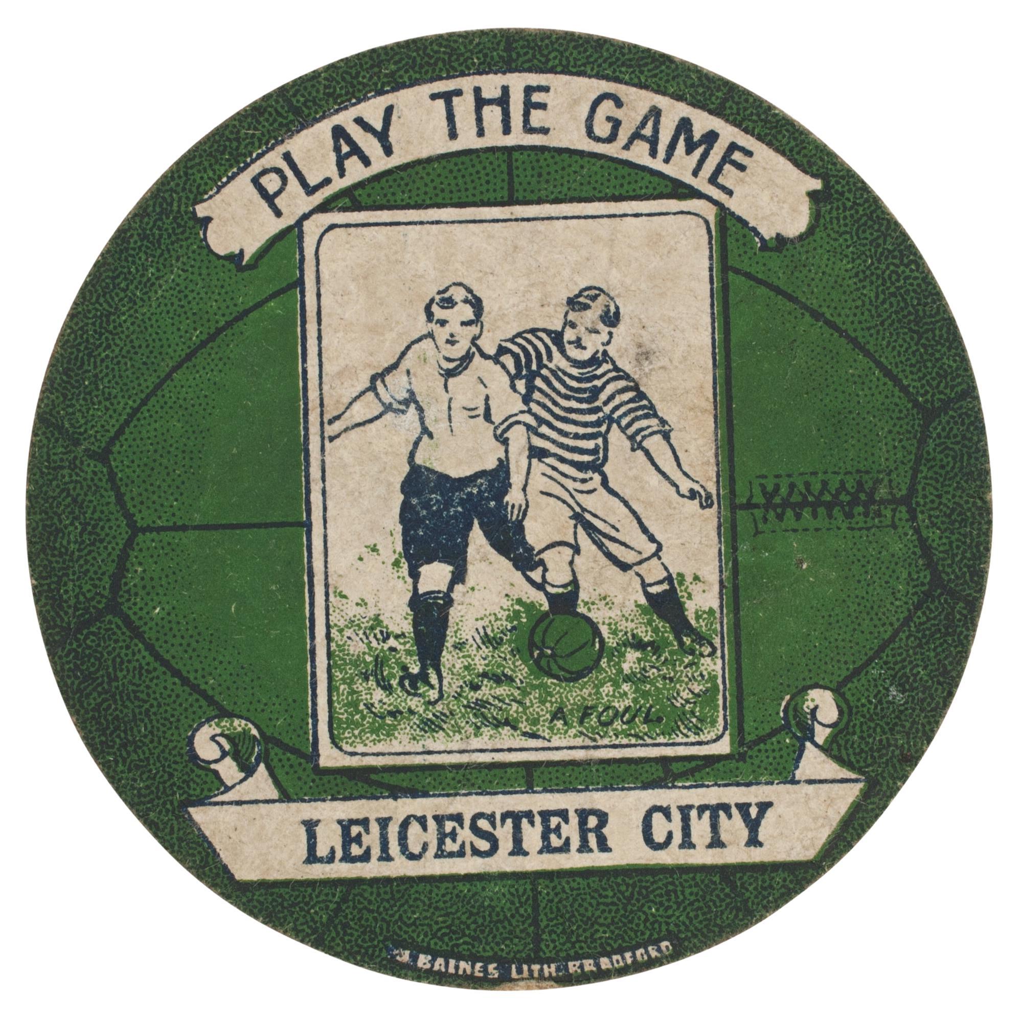
- Baines Football Trade Card, Leicester City Play the GameLocated in Oxfordshire, GBBaines football trade card, Leicester City play the game. A rare circular football trade card in the shape of a leather football ball. Made by the toy shop owner from Bradford, John Baines. Baines went on to produce not only football cards...Category
Vintage 1910s British Sporting Art Sports Equipment and Memorabilia
MaterialsPaper
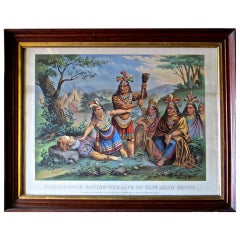
- Pocahontas and John Smith, Chromo-Lithograph, Dated 1870, RareLocated in Incline Village, NV"Pocahontas Saving The Life of Captain John Smith" is a chromo-lithograph made by the "New Eng. Chromo Lith. Co. Boston" (printed on the lower left border). It is dated 1870...Category
Antique 19th Century American Victorian Prints
MaterialsWood, Walnut, Paper
- Northern Scotland: A 16th Century Hand-colored Map by MercatorBy Gerard MercatorLocated in Alamo, CAA framed hand-colored 16th century map of Northern Scotland by Gerard Mercator entitled "Scotiae pars Septentrionalis", published in Amsterdam in 1636. It is a highly detailed map of the northern part of Scotland, with the northwest Highlands and the cities Inverness and Aberdeen, as well as the Orkney Islands and the Hebrides. There is a decorative title cartouche in the upper left corner. The map is presented in an antiqued brown wood...Category
Antique 16th Century Dutch Maps
MaterialsPaper
- Northern Scotland: A 17th Century Hand-colored Map by MercatorBy Gerard MercatorLocated in Alamo, CAThis is a framed hand-colored 17th century map of Northern Scotland by Gerard Mercator entitled "Scotiae pars Septentrionalis", published in Amsterdam in 1636. It is a highly detailed map of the northern part of Scotland, with the northwest Highlands and the cities Inverness and Aberdeen, as well as the Orkney Islands and the Hebrides. There is a decorative title cartouche in the upper left corner. The map is presented in an antiqued brown wood...Category
Antique 1630s Dutch Maps
MaterialsPaper
- “A Football Match, Scotland v. England” Antique Engraving, Proof Edition of 100By Overend and SmytheLocated in Colorado Springs, COThis is the 1889 William H. Overend (1851-1898) and Lionel Smythe (1839-1918) first edition, photogravure of the Calcutta Cup – a Rugby match between Scotland and England, that has been played over 100 times, the first match...Category
Antique 19th Century English Prints
MaterialsPaper
- England, Scotland & Ireland: A Hand Colored Map of Great Britain by TirionBy Isaak TirionLocated in Alamo, CAThis is a hand-colored double page copperplate map of Great Britain entitled "Nieuwe Kaart van de Eilanden van Groot Brittannien Behelzende de Kon...Category
Antique Mid-18th Century Dutch Maps
MaterialsPaper