Items Similar to 1731 Original German Engraving Print Chart of European Distances by T. Mayer

Want more images or videos?
Request additional images or videos from the seller
1 of 19
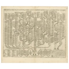
1731 Original German Engraving Print Chart of European Distances by T. Mayer
About the Item
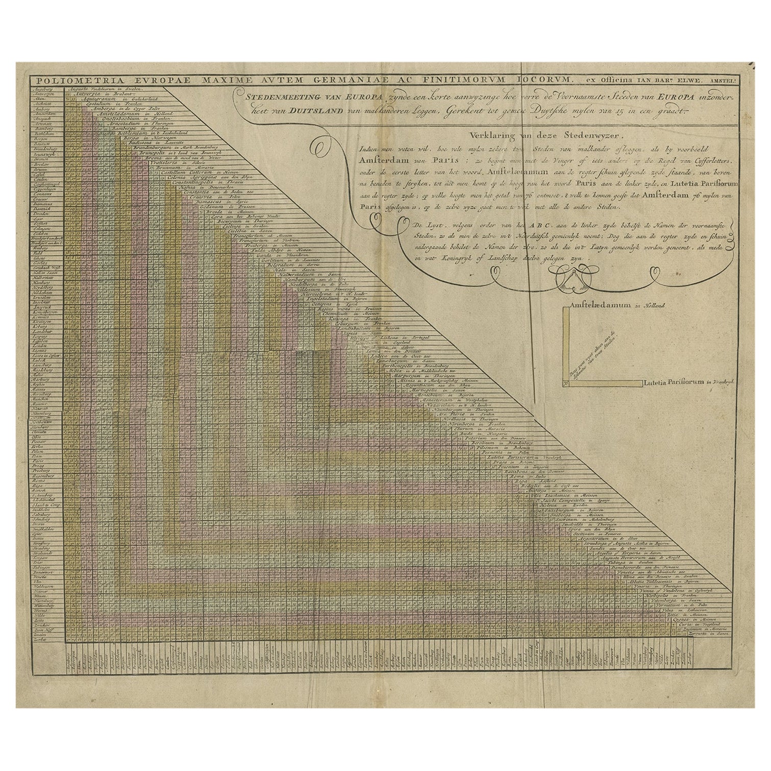
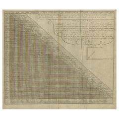
Tabula Poliometrica Germaniae ac Praecipuorum quorundam locorum Europae Nuremberg, 1731.
Author: T. Mayer; publisher: Homman.
Chart printed by engraving on copper plate, coeval coloring, valuable cartouche on the right with the following writing: Neu vermehrter curioser Meilen Zeiger der vornehmsten Stadte in Europa besonders in Teutschland wie vielgemeine Teutsche Meilen sulche vuneinander entlegen. Zum Exempel. Unus gradus Acquatoris continct at the bottom right.
Good condition, small paper cut at the top.
Measures: With frame 68 x 59.5 cm.
Shipping is insured by Lloyd's London.
- Dimensions:Height: 23.43 in (59.5 cm)Width: 26.78 in (68 cm)Depth: 0.79 in (2 cm)
- Materials and Techniques:
- Place of Origin:
- Period:1730-1739
- Date of Manufacture:1731
- Condition:
- Seller Location:Milan, IT
- Reference Number:1stDibs: LU1020220886202
About the Seller
4.9
Vetted Seller
These experienced sellers undergo a comprehensive evaluation by our team of in-house experts.
Established in 1999
1stDibs seller since 2014
370 sales on 1stDibs
Typical response time: <1 hour
- ShippingRetrieving quote...Ships From: Milan, Italy
- Return PolicyA return for this item may be initiated within 3 days of delivery.
More From This SellerView All
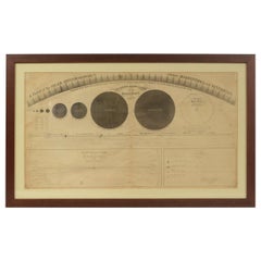
- 1855 Astronomical Plate of Distance of the Planets by FJ Huntington New YorkLocated in Milan, ITPlate of the distance of the planets “Entered according to Act of Congress in the year 1855 by F.J. Huntington in the Clerk's Office of the District Court of the United States for th...Category
Antique 1850s American Scientific Instruments
MaterialsGlass, Wood, Paper
- Old Nautical Print by Engraving on Copper Plate from the Panckoucke EncyclopédieLocated in Milan, ITPrint by engraving on copper plate from the Panckoucke Encyclopédie méthodique, end of the 18th century, volume Marine Planches (more than 1,500 figures dealing with all subjects on the marina: planes, construction, carpentry, tree trunks, armaments of maneuvers, ropes, sails, artillery, ship maneuvers and combat tactics). This is the plate n. 149, page. 166 fig. 1209-1212; with frame cm 57.8 x 31.8. The prospect of the side of a ship is depicted. The Print has the "Benard direxit...Category
Antique 1790s French Nautical Objects
MaterialsPaper
- Engraving Copper Print from Panckoucke Encyclopédie Nautical Subject 1782-1832Located in Milan, ITPrint by engraving on copper plate from the Panckoucke Encyclopédie méthodique, end of the 18th century, volume Marine Planches (more than 1,500 figures dealing with all subjects on ...Category
Antique 1790s French Nautical Objects
MaterialsPaper
- Engraving Print from the Panckoucke Encyclopédie Nautical Subject 1782-1832Located in Milan, ITPrint by engraving on copper plate from the Panckoucke Encyclopédie méthodique, end of the 18th century,volume Marine Planches (more than 1,500 figures dealing with all subjects on the marina: planes, construction, carpentry, tree trunks, armaments of maneuvers, ropes, sails, artillery, ship maneuvers and combat tactics). This is the plate no. n. 24, pag. 69 fig. 341 ; with frame cm 38.3 x 31.5. Ship ropes are depicted. The Print has the "Benard direxit...Category
Antique 1790s French Nautical Objects
MaterialsPaper
- Engraving Print from the Panckoucke Encyclopédie Nautical Subject 1782-1832Located in Milan, ITPrint by engraving on copper plate from the Panckoucke Encyclopédie méthodique, end of the 18th century, volume Marine Planches (more than 1,500 figures dealing with all subjects on ...Category
Antique 1790s French Nautical Objects
MaterialsPaper
- Engraving Print from the Panckoucke Encyclopédie Nautical Subject, 1782-1832Located in Milan, ITPrint by engraving on copper plate from the Panckoucke Encyclopédie méthodique, end of the 18th century, volume Marine Planches (more than 1,500 figures dealing with all subjects on the marina: planes, construction, carpentry, tree trunks, armaments of maneuvers, ropes, sails, artillery, ship maneuvers and combat tactics). This is the plate no. n. 26, pag. 70 fig. 350-353; with frame cm 38.3 x 31.5. Ship ropes are depicted. The Print has the "Benard direxit...Category
Antique 1790s French Nautical Objects
MaterialsPaper

You May Also Like
- Antique Chart of Travelling Distances between European Cities, Ca.1792Located in Langweer, NLAntique print Europe titled 'Poliometria Europae Maxime Autem Germaniae ac Finitimorum Locorum'. This unusual chart depicts the traveling distances between various European cities. ...Category
Antique 18th Century Maps
MaterialsPaper
- Framed 1731 Color Engraving, Map of Rotterdam by Matthaus Seutter, "Roterodami"Located in Bridgeport, CT"Roterodami". Seutter (1678-1757) was an important German 18th century map maker. Bird's eye view of the city above with full details, neoclassi...Category
Antique 18th Century European Renaissance Maps
MaterialsGlass, Wood, Paper
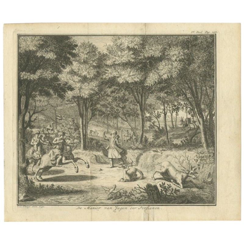
- Interesting Original Antique Print of the Hunting Methods of Persians, 1731Located in Langweer, NLAntique print titled 'De Manier van Jagen der Persianen'. This print shows the hunting methods of Persians. This print originates from 'Hedendaagsche historie of Tegenwoordige staat ...Category
Antique 18th Century Prints
MaterialsPaper
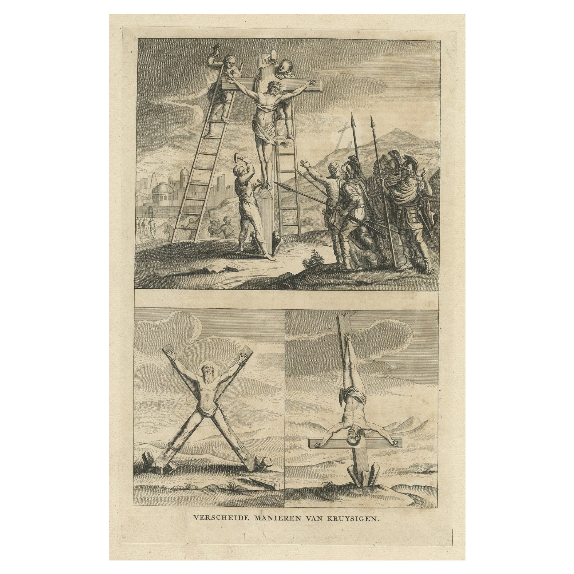
- Religious Antique Engraving of the Various Ways of Crucifixion, 1731Located in Langweer, NLDescription: Three religious images on one sheet titled 'Verscheide Manieren van Kruysigen'. Various methods of crucifixion. This print depicts religious punishments and originates...Category
Antique 1730s Religious Items
MaterialsPaper
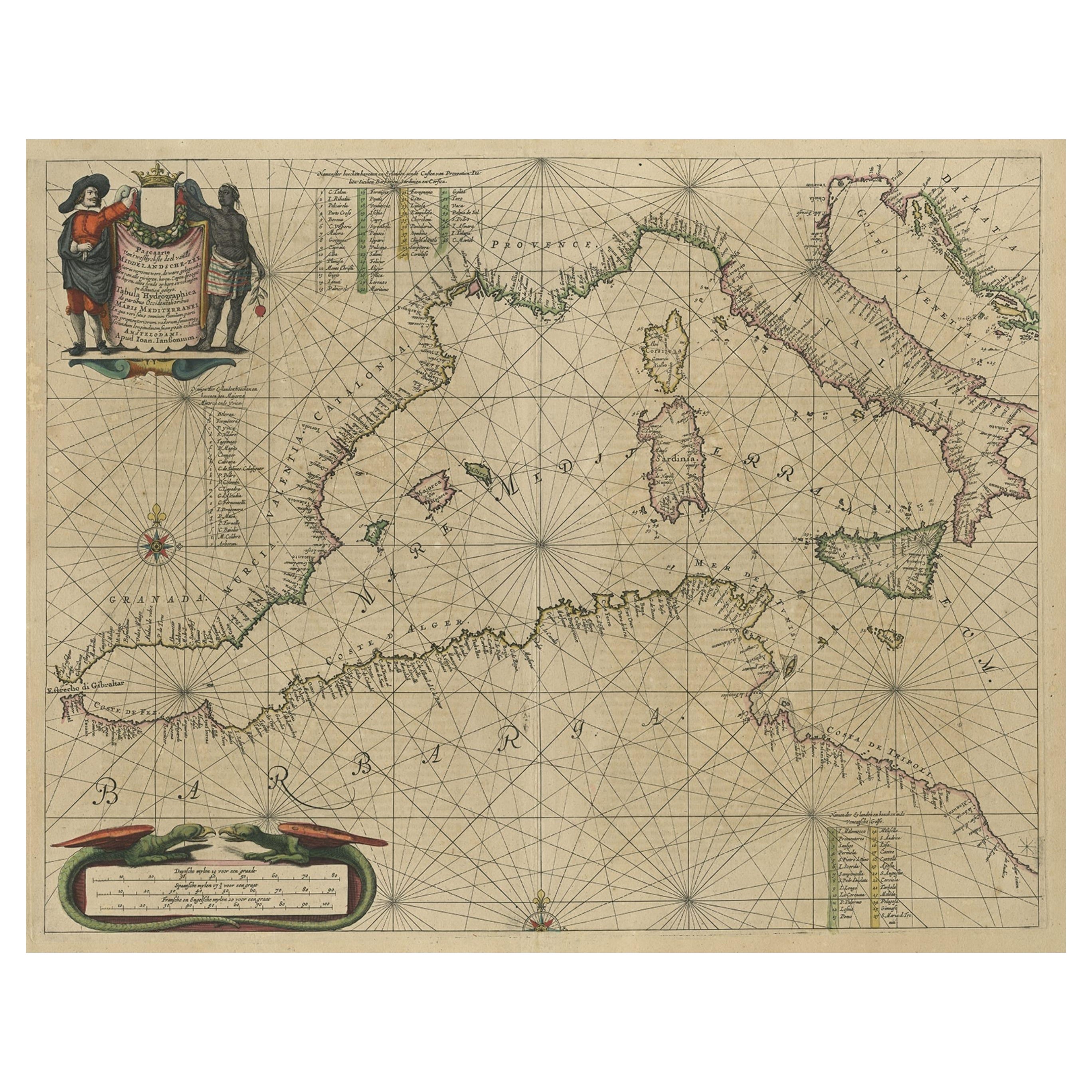
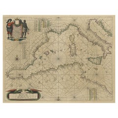
- Original Antique Engraving of a Sea Chart of the Western Mediterranean, ca.1650Located in Langweer, NLAntique map titled 'Pascaerte van 't westlyckste deel vande Middelandsche-Zee (..)'. Sea chart of the Western Mediterranean. The map extends from the Straits of Gibralter to Italy ...Category
Antique 1650s Maps
MaterialsPaper
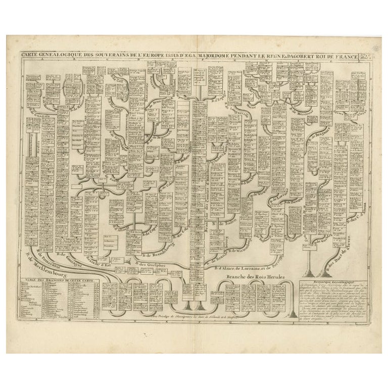
- Antique Genealogy Chart of the Leaders of Europe by Chatelain, 1732Located in Langweer, NLAntique print titled 'Carte Genealogique des Souverains de l'Europe (..)'. Chart of the royal line of the great Frankish major, Aega. As early as the 14th century the Hapsburgs attem...Category
Antique 18th Century Prints
MaterialsPaper


Recently Viewed
View AllMore Ways To Browse
May 68
German Chart
Copper Engraving Germany
Framed Chart
Writing Instruments
Zum Zum
Antique Writing Instruments
Antique Ac
Scientific Chart
Balance Scales Antique
Antique Balance Scales
Antique Balance Scale
Antique Balance Scales Scales
Antique Balance Scale Scales
Antique Balancing Scales
Antique Balancing Scale
Antique Brass Telescope
Antique Brass Telescopes