Items Similar to Jean Baptiste Van Lerberghe Theodolite - Circa 1700 to 1720


Video Loading
Want more images or videos?
Request additional images or videos from the seller
1 of 12
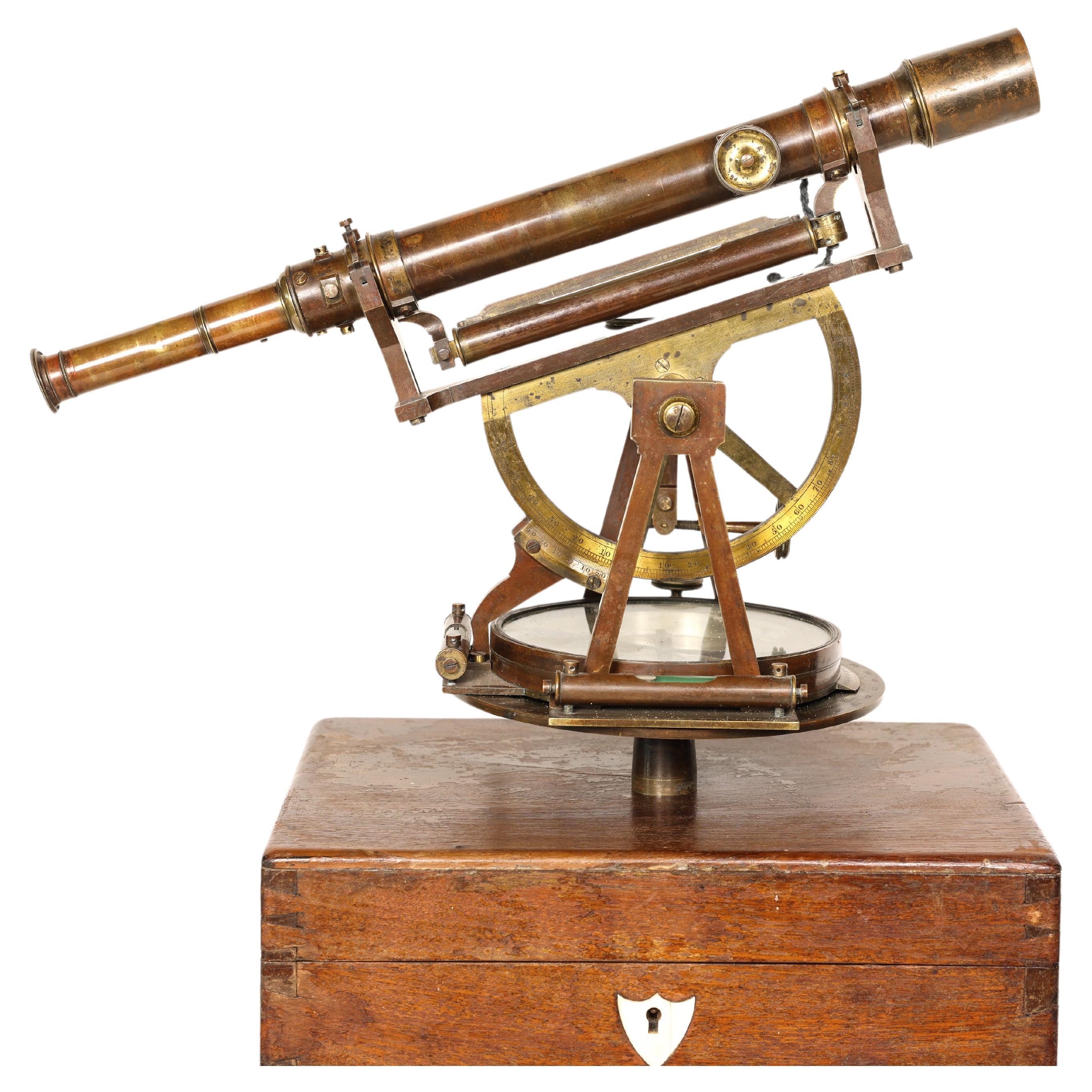
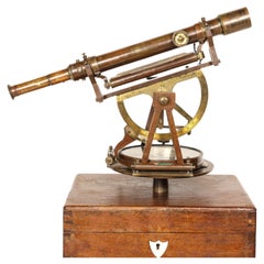
Jean Baptiste Van Lerberghe Theodolite - Circa 1700 to 1720
About the Item
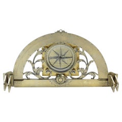
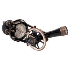
This is a fascinating and unique Theodolite that is engraved as a Semicircle - only 180 degrees.
The Theodolite was made by Jean Baptiste Van Lerberghe of Bollezelle, France. Bollezelle is about 11 miles south of Dunkirk and 20 miles west of Belgium border.
I found a Jean Baptiste Van Lerberghe who might fit the profile. Born in 1683 and passed away in 1750. He was born, married and died around Bollezeelle (he actually passed away in Bollzeelle). This Jean Baptiste could have made the Theodolite anytime between say 1698 and 1750. The Theodolite looks both crude and early to my eye. Key early features include the small full brass disc, the small sight vanes with very narrow slits, and the very small orientation compass (looks to be engraved to 180 degrees in 20 degree increments). My best guess is that this Van Lerberghe made this Theodolite between 1700 to 1720.
I don't have any info about what this Jean Baptiste Van Lerberghe did for living. I suspect he might have been a surveyor and made this Theodolite for his own personal use. I've seen another very early and crude surveying instrument, and that instrument was made and used by a surveyor.
I note that Jean Baptiste Van Lerberghe had a son born in Bollezelle in 1723 - Jean Baptiste Van Lerberghe Jr. In theory Junior could've made the Theodolite as well after his father passed away in 1750. I think the Theodolite is earlier than that. This also puts Jean Baptiste Van Lerberghe Senior in Bollezeele in the early 1720s.
Keywords: Surveyor, Surveying, Theodolite, Transit, Circumferentor, Semicircle, Level, Graphometer, Graphometre, Teodolite, Arpenteur
- Dimensions:Height: 8 in (20.32 cm)Width: 6 in (15.24 cm)Depth: 6 in (15.24 cm)
- Materials and Techniques:
- Place of Origin:
- Period:
- Date of Manufacture:Circa 1710
- Condition:Wear consistent with age and use. Missing one of the screws holding down the compass cover. The stand is not included.
- Seller Location:Placerville, CA
- Reference Number:1stDibs: LU9222236297562
About the Seller
No Reviews Yet
Vetted Seller
These experienced sellers undergo a comprehensive evaluation by our team of in-house experts.
Established in 1995
1stDibs seller since 2023
- ShippingRetrieving quote...Ships From: Placerville, CA
- Return PolicyA return for this item may be initiated within 14 days of delivery.
More From This SellerView All
- Wonderful Benjamin Pike & Sons (New York) Circa 1850 TheodoliteLocated in Placerville, CAThis is a Wonderful Pike & Sons Theodolite (166 Broadway) complete with Box & Tripod. American made 19th century Theodolites are VERY common. Finding one in great shape with its or...Category
Antique Mid-19th Century American Scientific Instruments
MaterialsBrass
- Langlois Graphometer - Circa 1730Located in Placerville, CAThis is a BEAUTIFUL Graphometer made by the premier instrument maker in France, Claude Langlois, after Bion and Butterfield had stopped making instruments. As discussed on my Graphometer - Semicircle webpage, the French produced a good number of Graphometers from 1600 to about 1850. And a fair number of these Graphometers are still around. If you want to add a really nice Graphometer to your collection, this Langlois merits serious consideration for these reasons: 1. While not as well-known internationally as Bion and Butterfield, Langlois was The Man in France after Bion and Butterfield had passed away. 2. The President of Harvard College...Category
Antique Early 18th Century French Scientific Instruments
MaterialsBrass
You May Also Like
- Antique Map of Peru by van der Aa, 'circa 1720'Located in Langweer, NLAntique map titled 'Le Perou, Grand Pays de l Amerique Meridionale (..)'. Decorative map of Peru including portions of Ecuador and northern Chile and Boliv...Category
Antique Early 18th Century Maps
MaterialsPaper
- Cooke Troughton & Simms TheodoliteLocated in Hamilton, OntarioCooke Troughton & Simms Theodolite in fitted mahogany case.Category
Early 20th Century English Scientific Instruments
MaterialsBrass
- Portrait Miniature Jean-Baptiste Couvelet, French, 1772-1830Located in Firenze, ITSHIPPING POLICY: No additional costs will be added to this order. Shipping costs will be totally covered by the seller (customs duties included). A girl, head and shoulders, her da...Category
Antique Late 18th Century French Louis XVI Models and Miniatures
MaterialsOak
- Antique Map of the Holy Land by Van Luchtenburg, c.1720Located in Langweer, NLAntique map titled 'Heylige Land verdeeld in de Twaalf Stammen Israels (..).' Highly detailed map of the Holy Land divided into 12 tribes of Israel...Category
Antique 18th Century Maps
MaterialsPaper
- Antique Map of the Bay of Batavia by Van der Aa, c.1720Located in Langweer, NLAntique map titled 'La Rade de Batavia'. A small early 18th century black and white map of the Bay of Batavia (Jakarta), Indonesia. Published by P....Category
Antique 18th Century Maps
MaterialsPaper
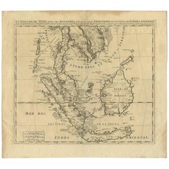
- Antique Map of Southeast Asia by H. Chatelain, circa 1720By Henri-Abraham ChatelainLocated in Langweer, NLAntique map titled 'Le Royaume de Siam aves les Royaumes qui luy sont Tributaires et les Isles de Sumatra Andemaon'. Influential map of Southeast Asia, including modern day Thailand, southern Vietnam, Cambodia, Malaysia, Singapore, Borneo, Sumatra and Java. Chatelain incorporated information provided by the French Jesuits and charts the route of the French Embassy to and from Siam in 1685-1686 through the Straits of Banca and the Gulf of Siam. With good detail of the Andaman Islands, the Gulf of Thailand (Golfe de Siam) and coastal Vietnam. In the Kingdom of Siam, this map shows the fortress of Bangkok, the ancient Siamese capital of Ayutthaya, royal palace, and the Dutch trading colony. In Cambodia, it details the village of Ponompingn (Phnom Penh...Category
Antique Early 18th Century Maps
MaterialsPaper


Recently Viewed
View AllMore Ways To Browse
Surveyors Theodolite
Theodolite Antique
Vintage Mortise Gauge
Iso Reporter
Kirby Vacuum Cleaner Vintage
Kirby Vintage Vacuums
Kodak Medalist Vintage Cameras
Kodak Medalist
Showbiz Pizza Animatronics
Transit Tripod
Ww Compass
Anatomical Eye Model
Scottish Barometer
Anatomical Heart Model
Antique Theatre Binoculars
Culinary Scale
Antique Pocket Barometers
Antique Penny Scale Scales