19th Century More Furniture and Collectibles
7
to
5
7
7
7
7
7
1
1
7
5
106
29
27
20
Period: 19th Century
Creator: Heinrich Kiepert
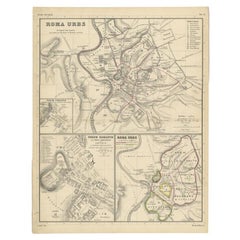
Detailed Original Antique Map of the Region of Rome in Italy, c.1870
Located in Langweer, NL
Antique map titled 'Roma Urbs'. Old map of Italy, it shows three inset maps of the region of Rome. This map originates from 'Atlas Antiquus, twaalf k...
Category
Antique 19th Century More Furniture and Collectibles
Materials
Paper
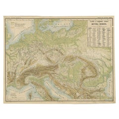
Nice Colourful Antique Map of the Rivers and Mountains of Europe c.1870
Located in Langweer, NL
Antique map titled 'Fluss und Gebirgs Karte von Mittel-Europa'. Old map of the European continent depicting the European mountains and rivers. This map originates from 'H. Kiepert's ...
Category
Antique 19th Century More Furniture and Collectibles
Materials
Paper
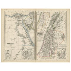
Antique Map of Egypt and Palestina by H. Kiepert 'circa 1870'
Located in Langweer, NL
Antique map titled 'Aegyptus, Phoenice et Palestina'. With inset maps of Tyrus, Alexandria and Hierosolyma. This map originates from 'Atlas Antiquus. Zwölf Karten zur Alten Geschicht...
Category
Antique 19th Century More Furniture and Collectibles
Materials
Paper
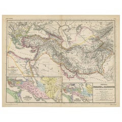
Antique Map of Part of the Roman Empire by H. Kiepert, circa 1870
Located in Langweer, NL
Antique map titled 'Imperia Persarum et Macedonum'. Depicts part of the Roman Empire, from Greece to Eastern India. This map originates from 'Atlas Antiqus. Zwölf Karten zur Alten Ge...
Category
Antique 19th Century More Furniture and Collectibles
Materials
Paper
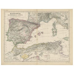
Antique Map of Spain, Mauritia and Africa by H. Kiepert, circa 1870
Located in Langweer, NL
Antique map titled 'Hispania, Mauretania et Africa'. This map originates from 'Atlas Antiquus. Zwölf Karten zur Alten Geschichte' by H. Kiepert. Published in Berlin, circa 1870.
Category
Antique 19th Century More Furniture and Collectibles
Materials
Paper
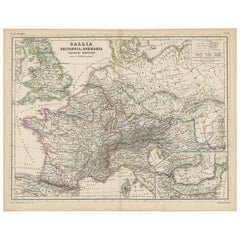
Antique Map of Western Europe by H. Kiepert, circa 1870
Located in Langweer, NL
Antique map titled 'Gallia, Britannia, Germania'. This map depicts a large part of Western Europe including countries like Germany, France, Great Britain, The Netherlands and more. T...
Category
Antique 19th Century More Furniture and Collectibles
Materials
Paper
Antique Map of Italy and Greece by H. Kiepert, circa 1870
Located in Langweer, NL
Antique map titled 'Italiae pars media'. This map originates from 'Atlas Antiquus. Zwölf Karten zur Alten Geschichte' by H. Kiepert. Published in Berlin, circa 187.
Category
Antique 19th Century More Furniture and Collectibles
Materials
Paper
Related Items
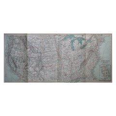
Original Antique Map of The United States of America, circa 1890
Located in St Annes, Lancashire
Great map of the USA
By The Stanford's Geographical Establishment
Original colour
Unframed.
Category
English Victorian Antique 19th Century More Furniture and Collectibles
Materials
Paper
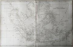
Original Antique Map of South East Asia, Arrowsmith, 1820
Located in St Annes, Lancashire
Great map of South East Asia
Drawn under the direction of Arrowsmith
Copper-plate engraving
Published by Longman, Hurst, Rees, Orme and Brown, 1820
Unframed.
Category
English Antique 19th Century More Furniture and Collectibles
Materials
Paper
17th Century Hand-Colored Map of West Africa by Mercator/Hondius
Located in Alamo, CA
A 17th century hand-colored map entitled "Guineae Nova Descriptio" by Gerard Mercator and Jodocus Hondius, published in their 'Atlas Minor' in Amsterdam in 1635. It is focused on the...
Category
Dutch Antique 19th Century More Furniture and Collectibles
Materials
Paper
Original Antique Map of Hungary, Arrowsmith, 1820
Located in St Annes, Lancashire
Great map of Hungary
Drawn under the direction of Arrowsmith.
Copper-plate engraving.
Published by Longman, Hurst, Rees, Orme and Brown, 1820
Unframed.
Category
English Antique 19th Century More Furniture and Collectibles
Materials
Paper
Original Antique Map of India. C.1780
Located in St Annes, Lancashire
Great map of India
Copper-plate engraving
Published C.1780
Three small worm holes to right side of map and one bottom left corner
Unframed.
Category
English Georgian Antique 19th Century More Furniture and Collectibles
Materials
Paper
Original Antique Map of Italy. C.1780
Located in St Annes, Lancashire
Great map of Italy
Copper-plate engraving
Published C.1780
Unframed.
Category
English Georgian Antique 19th Century More Furniture and Collectibles
Materials
Paper
Original Antique Map of Asia. C.1780
Located in St Annes, Lancashire
Great map of Asia
Copper-plate engraving
Published C.1780
Two small worm holes to right side of map
Unframed.
Category
English Georgian Antique 19th Century More Furniture and Collectibles
Materials
Paper
Original Antique Map of The World by Thomas Clerk, 1817
Located in St Annes, Lancashire
Great map of The Eastern and Western Hemispheres
On 2 sheets
Copper-plate engraving
Drawn and engraved by Thomas Clerk, Edinburgh.
Published by Mackenzie And Dent, 1817
...
Category
English Antique 19th Century More Furniture and Collectibles
Materials
Paper
Original Antique Map of Spain and Portugal, circa 1790
Located in St Annes, Lancashire
Super map of Spain and Portugal
Copper plate engraving by A. Bell
Published, circa 1790.
Unframed.
Category
English Other Antique 19th Century More Furniture and Collectibles
Materials
Paper
Antique 18th Century Map of the Province of Pensilvania 'Pennsylvania State'
Located in Philadelphia, PA
A fine antique of the colony of Pennsylvania.
Noted at the top of the sheet as a 'Map of the province of Pensilvania'.
This undated and anonymous map is thought to be from the Gentleman's Magazine, London, circa 1775, although the general appearance could date it to the 1760's.
The southern boundary reflects the Mason-Dixon survey (1768), the western boundary is placed just west of Pittsburgh, and the northern boundary is not marked.
The map has a number of reference points that likely refer to companion text and appear to be connected to boundaries. The western and southern boundaries are marked Q, R, S, for example. A diagonal line runs from the Susquehanna R to the Lake Erie P. A broken line marked by many letters A, B, N, O, etc., appears in the east.
There are no latitude or longitude markings, blank verso.
Framed in a shaped contemporary gilt wooden frame and matted under a cream colored matte.
Bearing an old Graham Arader Gallery...
Category
British American Colonial Antique 19th Century More Furniture and Collectibles
Materials
Paper
H 10.25 in W 13.25 in D 0.5 in
Original Antique Decorative Map of Iceland & Faroe, Fullarton, C.1870
Located in St Annes, Lancashire
Great map of Iceland and The Faroe Islands
Wonderful figural border
From the celebrated Royal Illustrated Atlas
Lithograph. Original color.
Published by Fullarton, Edinb...
Category
Scottish Antique 19th Century More Furniture and Collectibles
Materials
Paper
No Reserve
H 18.5 in W 12.5 in D 0.07 in
Original Antique Map of Cyprus. Circa 1880
Located in St Annes, Lancashire
Great map of Cyprus
Drawn and Engraved by R.Walker
Published W.Mackenzie, London
Original colour
Unframed.
Category
English Antique 19th Century More Furniture and Collectibles
Materials
Paper
Recently Viewed
View AllMore Ways To Browse
Pair Of High Nightstands
Mahogany Night Stand With Drawer
Large Night Table
Midcentury Teak Nightstand
Mid Century Teak Nightstands
Teak Nightstands Mid Century
Metal Headboard
Bed Luxury
Vintage Art Deco Bed
Glass Nightstands And Brass
Mid Century Modern Wood Headboard
King Brass Bed Frame
Midcentury Modern Walnut Headboard
Mid Century Modern Walnut Headboard
Mid Century Modern King Headboard
Midcentury Modern King Headboard
King Mid Century Modern Headboards
Dark Night Stands
