Items Similar to Early European Map from Italy, circa 1960

Want more images or videos?
Request additional images or videos from the seller
Early European Map from Italy, circa 1960
About the Item
Early European map from Italy, circa 1960. Paper backed on canvas. Made in Milan, Italy.
- Dimensions:Height: 40 in (101.6 cm)Width: 56 in (142.24 cm)Depth: 1 in (2.54 cm)
- Period:
- Date of Manufacture:1960s
- Condition:Wear consistent with age and use.
- Seller Location:Nashville, TN
- Reference Number:1stDibs: LU175029244993
About the Seller
4.9
Platinum Seller
These expertly vetted sellers are 1stDibs' most experienced sellers and are rated highest by our customers.
Established in 2006
1stDibs seller since 2015
257 sales on 1stDibs
Typical response time: 1 hour
- ShippingRetrieving quote...Ships From: Nashville, TN
- Return PolicyA return for this item may be initiated within 7 days of delivery.
More From This SellerView All
- Early Two Door Cabinet from Italy, circa 1800Located in Nashville, TNEarly Two Door Cabinet From Italy, circa 1800. Solid pine construction with fantastic original paint and hardware.Category
Antique Early 1800s European Cabinets
MaterialsPine
- Early Oak Dining Table From Italy, Circa 1850Located in Nashville, TNEarly Oak Dining Table From Italy, Circa 1850. Solid light oak construction with nice wear and use.Category
Antique 1850s Dining Room Tables
MaterialsOak
- Early Oak Console Table From Italy, Circa 1800Located in Nashville, TNEarly Oak Console Table From Italy, Circa 1800. Solid oak construction with fantastic original patina and wear.Category
Antique Early 1800s European Console Tables
MaterialsOak
- Early Oak Dining Table From Italy, Circa 1850Located in Nashville, TNEarly Oak Dining Table From Italy, Circa 1850. Solid oak construction with great patina and wear.Category
Antique 1850s European Dining Room Tables
MaterialsOak
- Early Walnut Side Table From Italy, Circa 1800Located in Nashville, TNEarly Walnut Side Table From Italy, Circa 1800. Solid walnut construction with nice original patina and wear.Category
Antique Early 1800s European End Tables
MaterialsWalnut
- Early Walnut Dining Table From Italy, Circa 1780Located in Nashville, TNEarly Walnut Dining Table From Italy, Circa 1780. Solid walnut construction with fantastic original iron hardware. Great patina and use.Category
Antique 1780s European Dining Room Tables
MaterialsWalnut

You May Also Like
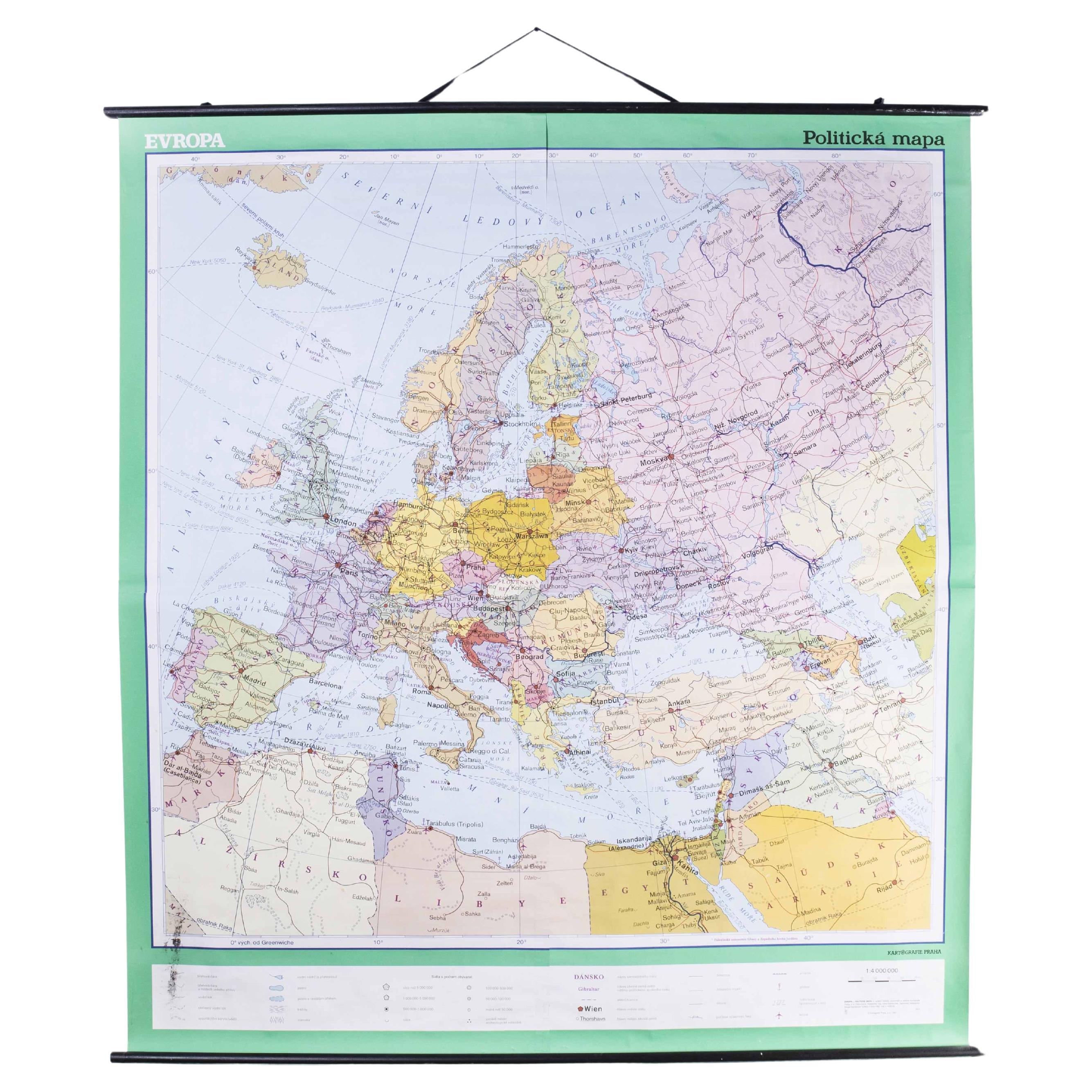
- Late 20th Century Educational Geographic Map - European CountriesLocated in Hook, HampshireLate 20th Century Educational Geographic Map – European Countries Late 20th Century Educational Geographic Map – European Countries. Good quality roll up s...Category
Late 20th Century Czech Posters
MaterialsCotton
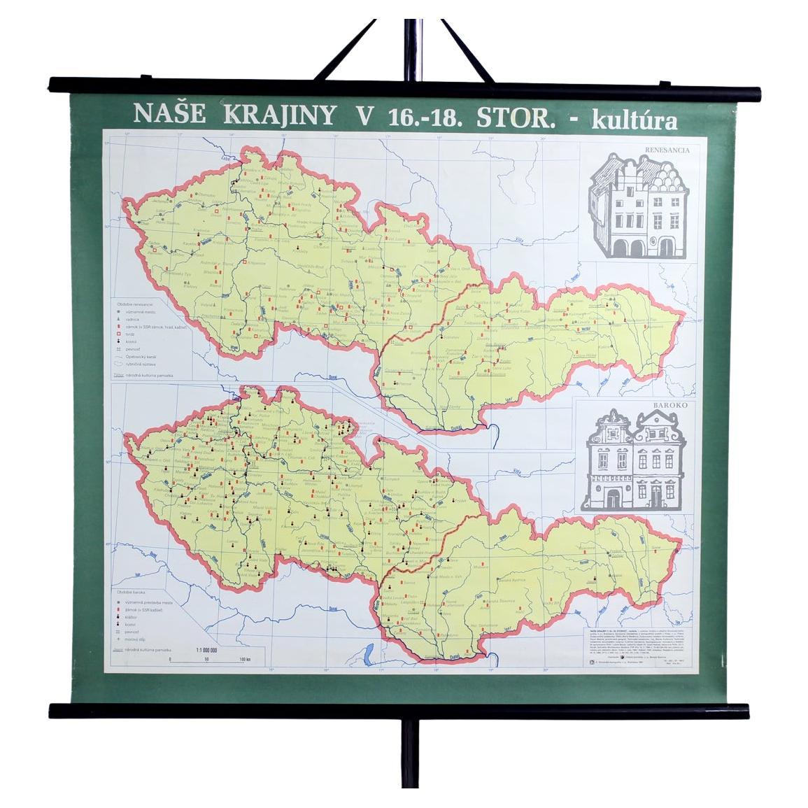
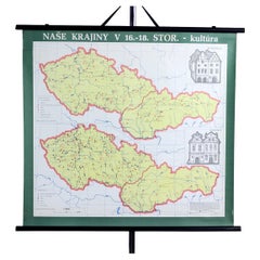
- Vintage School Map of Czechoslovakia, 1960sLocated in Zohor, SKThis is a great vintage school map produced in Czechoslovakia by Skolske pomucky n.p., which was a national factory for producing the school items i...Category
Vintage 1960s Slovak Mid-Century Modern Posters
MaterialsPaper
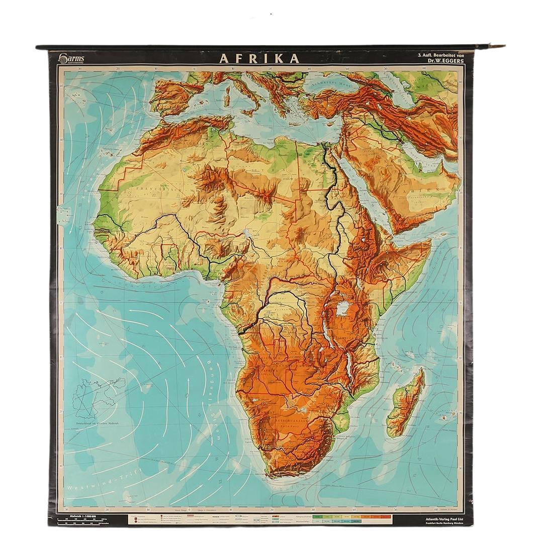
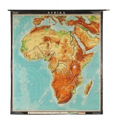
- Large Africa School Map, circa 1950Located in Meulebeke, BEGeographical vintage school wall card Africa. The school poster is in a good vintage condition with types of old -age signs that you can see from the produc...Category
Vintage 1950s German Mid-Century Modern Posters
MaterialsCanvas, Wood, Paper
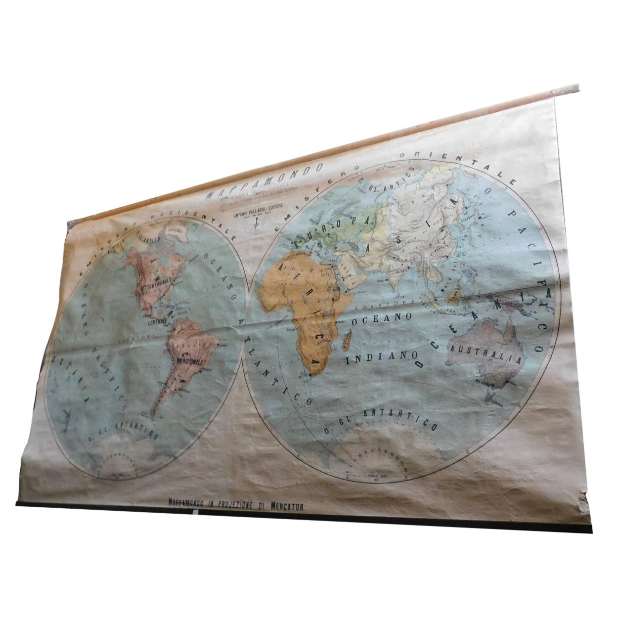
- Vintage Geographical Map of the World Map, Vallardi Milan, Early 20th CenturyLocated in Cuneo, Italy (CN)Vintage geographical map or planisphere, published by Vallardi publisher for the municipality of Milan, printed at the beginning of the 20th century,...Category
20th Century Italian Prints
MaterialsPaper
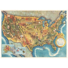
- American Election Map and 1960 Presidential Fact Sheet, Published 1960Located in Langweer, NLTitle: “The 50 United States of America” Subject: United States, Presidential Elections Date: 1960 (dated) Color: Printed Color Size: 24.9 x 17.9 inches (63.2 x 45.5 cm) This colorful map of the United States was drawn by Lorin Thompson and published by the General Foods Corporation. The map has an unusual coloring style with symbols of American history including past presidents, Native Americans, important buildings (White House, Statue of Liberty, Alamo), agriculture, industry, and more. Includes inset maps of Hawaii and Alaska with small American flags...Category
Vintage 1960s Posters
MaterialsPaper
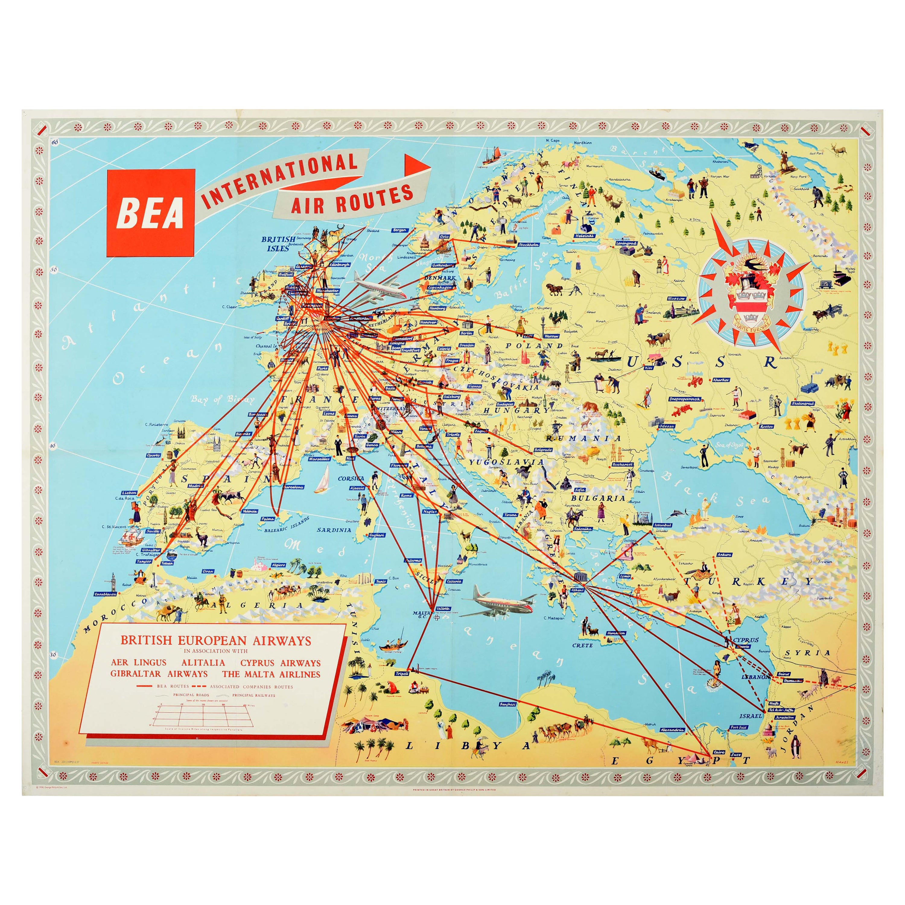
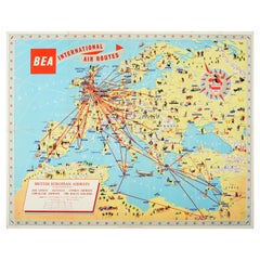
- Original Vintage Poster BEA British European Airways International Air Route MapLocated in London, GBOriginal vintage travel advertising poster for BEA British European Airways International Air Routes featuring an illustrated map showing the ...Category
Vintage 1950s British Posters
MaterialsPaper


Recently Viewed
View AllMore Ways To Browse
Alphonse Levy
Egyptian Film Poster
Vintage Cuban Film Posters
Star Wars Uk Quads
Vintage Food And Wine Posters
Retro Taxi Driver Poster
Moto Vintage Posters
Terminator Vintage Poster
Bullitt Movie Poster
Casablanca Film Poster
Wooden Sledge
Anna Karina
Davos Poster
Hungarian Movie Poster
24 Heures Du Mans Vintage
Henri Le Roy
Romania Poster
Vintage Godzilla Poster