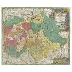
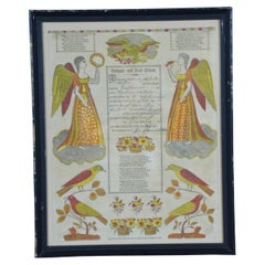
Antique 1822 German Johann Ritter & Co Taufscheine Birth Certificate Lithograph
View Similar Items


Want more images or videos?
Request additional images or videos from the seller
1 of 12
Antique 1822 German Johann Ritter & Co Taufscheine Birth Certificate Lithograph
About the Item
- Dimensions:Height: 16.5 in (41.91 cm)Width: 19.5 in (49.53 cm)Depth: 1 in (2.54 cm)
- Style:Folk Art (In the Style Of)
- Materials and Techniques:
- Period:
- Date of Manufacture:1821-1822
- Condition:Wear consistent with age and use. Good antique condition, wear and distressing commensurate with age, foxing to paper, wear and distressing to canvas, see pictures.
- Seller Location:Dayton, OH
- Reference Number:Seller: 283631stDibs: LU5343222247722

About the Seller
4.9
Platinum Seller
These expertly vetted sellers are 1stDibs' most experienced sellers and are rated highest by our customers.
Established in 2010
1stDibs seller since 2020
1,119 sales on 1stDibs
More From This SellerView All
- 1830 Antique German Pennsylvania Dutch Birth & Baptismal Lithograph CertificateLocated in Dayton, OHAntique German / “Pennsylvania Dutch” Birth and Baptismal Certificate lithograph with color block printing in red and yellow, printed in 1830 and signed in 1831. Measures: 14” x 1...Category
Antique 1830s Folk Art Prints
MaterialsPaper
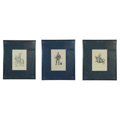
- 3 Antique German Hefner Alteneck Medieval Knights Armour Lithograph Prints 24"Located in Dayton, OHSet of three 19th century medieval chromolithograph prints from Hefner-Alteneck's "Costumes, Artworks and Appliances from the Middle Ages to the 17th Century." Illustrations by Dr. J...Category
Antique 19th Century Medieval Prints
MaterialsPaper
- Antique 1901 National Publishing Company's Road Map of New Jersey GeologicalLocated in Dayton, OHThe National Publishing Company's road map of New Jersey, showing all county and township divisions, cities villages and post-offices, railroads, ste...Category
Antique Early 1900s Victorian Prints
MaterialsPaper
- Antique 1630 Colored Belgium Map Flandria Gallica Flanders Henricus HondiusLocated in Dayton, OH"Antique hand colored map of Flanders, Belgium, circa 1630, engraved by Henricus Hondius. “Henricus Hondius II (1597 – 16 August 1651) was a Dutch eng...Category
Antique Early 17th Century Renaissance Maps
MaterialsPaper
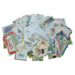
- 138 Vintage & Antique Post Cards Holiday Greeting Valentine Trade Comic AdLocated in Dayton, OHLot of 138 vintage and antique postcards for a variety of holiday greetings and travel locations, plus a handful of Lion Coffee print advertisements.Category
20th Century Prints
MaterialsPaper
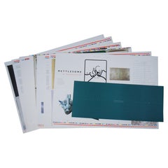
- Meddlesome & Mettlesome Exhibition Catalog Press Sheet Lot Contemporary ArtworkLocated in Dayton, OHLot of unbound press sheet pages and portfolio covers for the 1993 exhibition catalog of “Mettlesome & Meddlesome: Selections from the Collection of Ro...Category
1990s Modern Prints
MaterialsPaper


You May Also Like
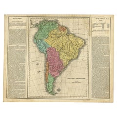
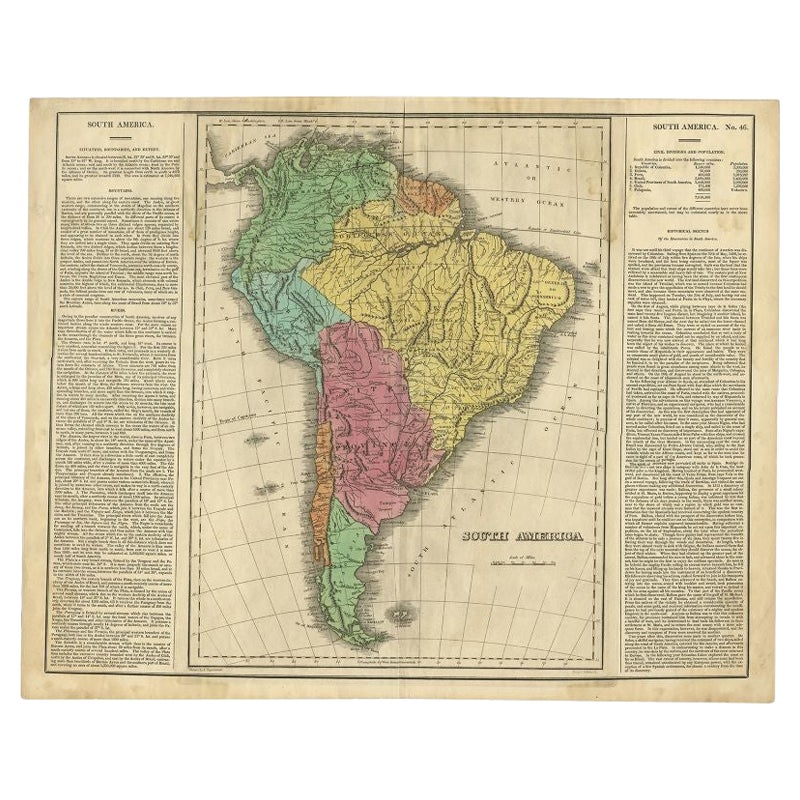
- Interesting Original Antique Map of South America, 1822Located in Langweer, NLAntique map titled 'South America'. Map of South America with attractive topography, surrounded on three sides by text on the history, geography, and economy of the continent. Sh...Category
Antique 19th Century Maps
MaterialsPaper
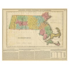
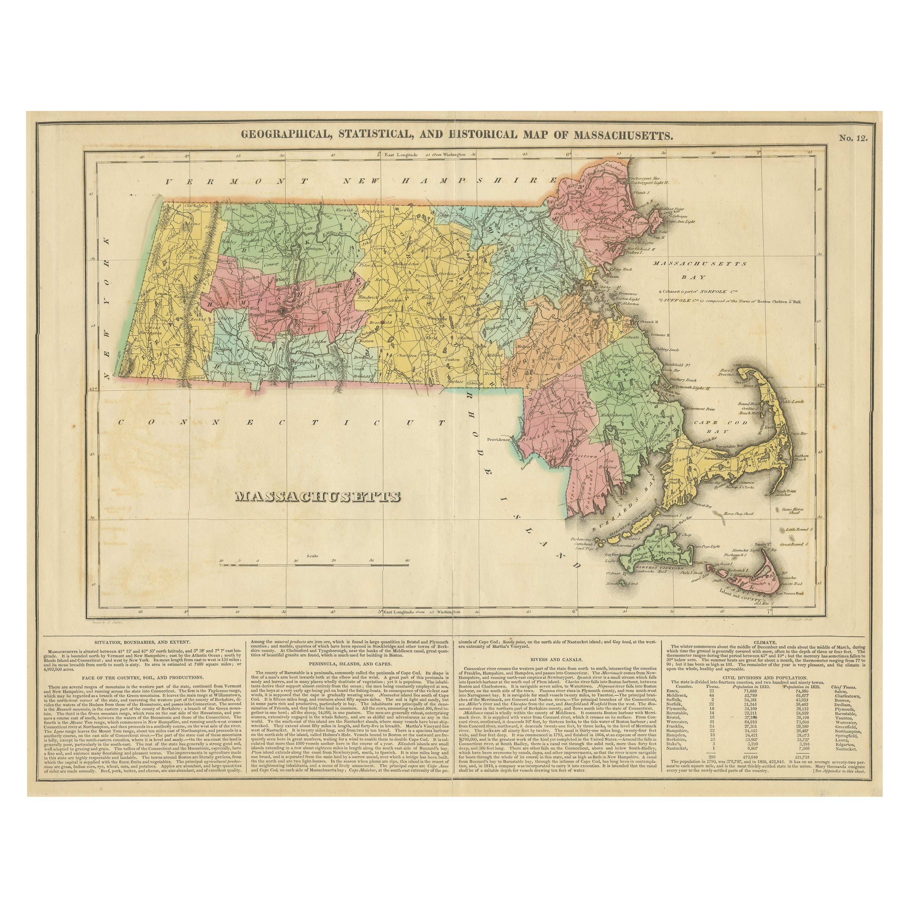
- Antique Geographical, Historical and Statistical Map of Massachusetts, 1822Located in Langweer, NLThis attractive map of Massachusetts presents a finely detailed overview of the state in the first quarter of the 19th century. Transportation ...Category
Antique 1820s Maps
MaterialsPaper
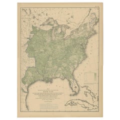
- Pl. 40 Antique Chart of the US Birth Rate, 1874Located in Langweer, NLAntique chart titled 'Map showing, in five degrees of density, the birth rate prevailing in the territory of the United States east of the 100th Meridian, so far as the same is indic...Category
Antique Late 19th Century Maps
MaterialsPaper
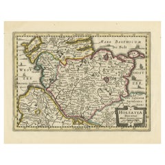
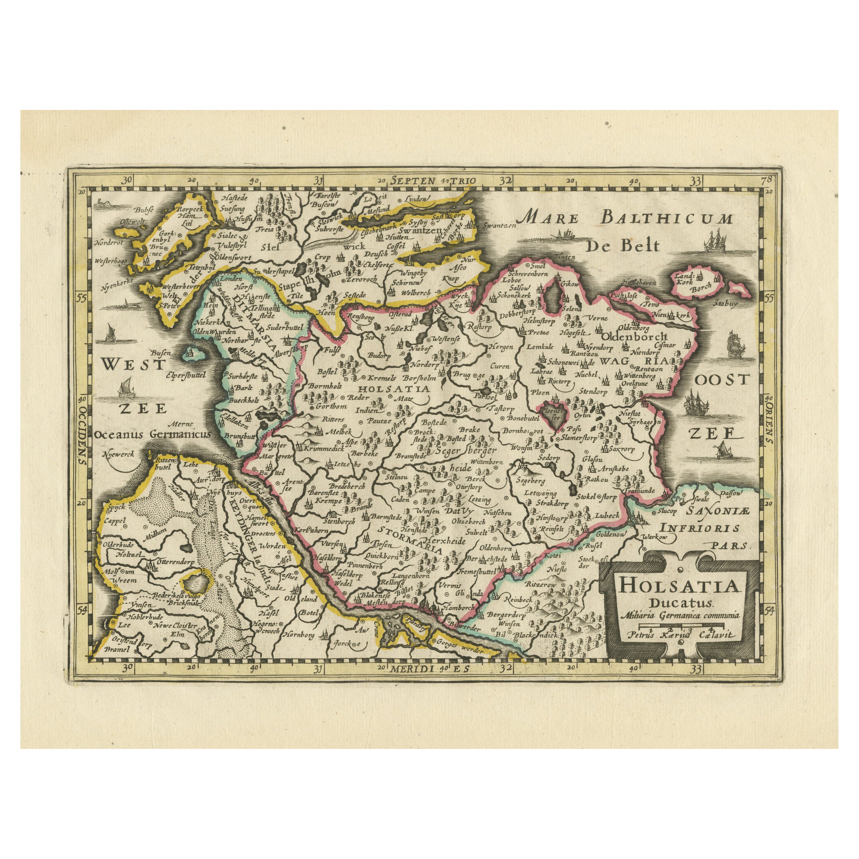
- Antique Map of Holstein, GermanyLocated in Langweer, NLAntique map titled 'Holsatia Ducatus'. Original old map of Holstein, Germany. By Petrus Kaerius, published circa 1650. Pieter van den Keere (Latin: Petrus Kaerius 1571 – circa 1646) ...Category
Antique Mid-17th Century Maps
MaterialsPaper
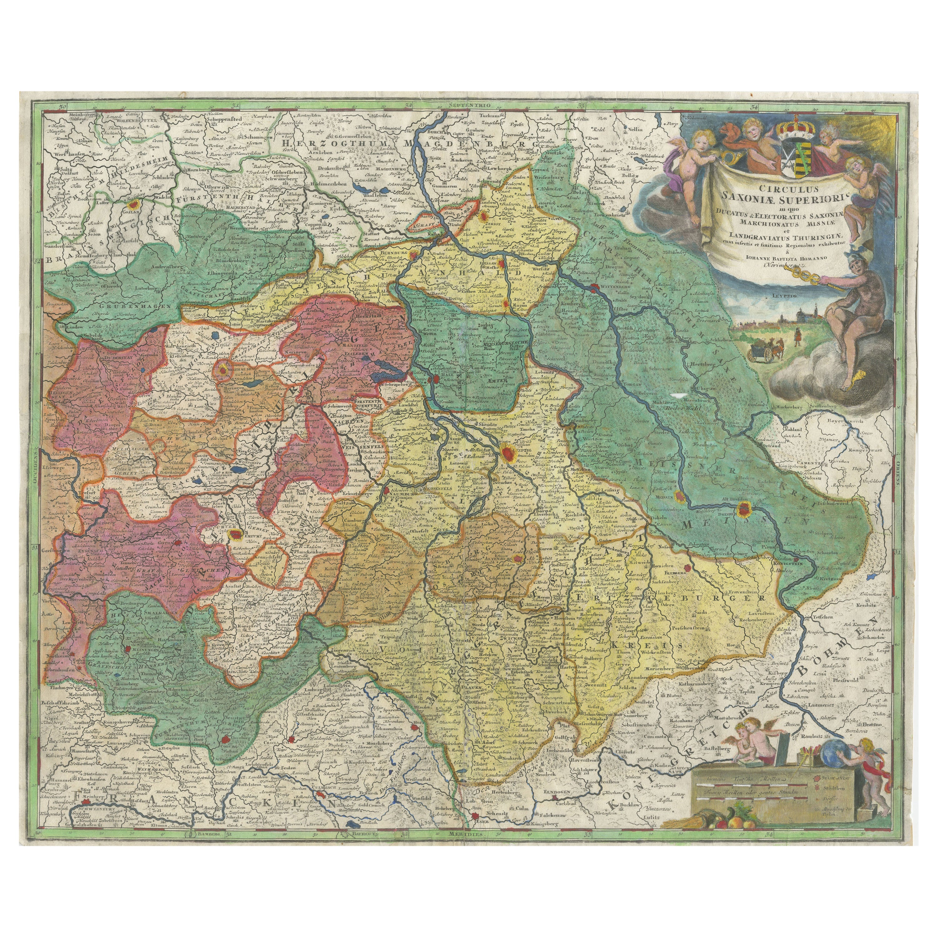
- Antique Map of Saxony, GermanyLocated in Langweer, NLOriginal antique map titled 'Circulus Saxoniae Superioris'. Original antique map of Saxony, Germany. The cities of Leipzig, Freiburg and many others are highlighted in gold. This map originates from 'Atlas Novus Terrarum Orbis...Category
Antique Early 18th Century Maps
MaterialsPaper
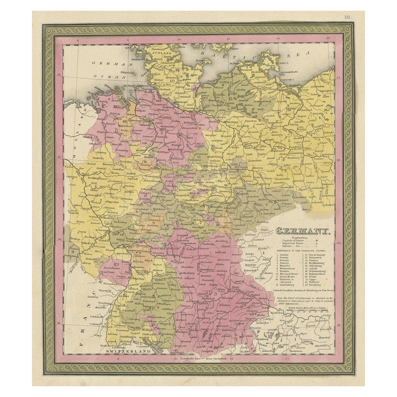
- Decorative Antique Map of Germany, 1846Located in Langweer, NLAntique map titled 'Germany'. Old map of Germany. This map originates from 'A New Universal Atlas Containing Maps of the various Empires, Kingdoms, ...Category
Antique 1840s Maps
MaterialsPaper