Items Similar to Antique Print of the Cape of Good Hope in South Africa, 1726
Want more images or videos?
Request additional images or videos from the seller
1 of 6
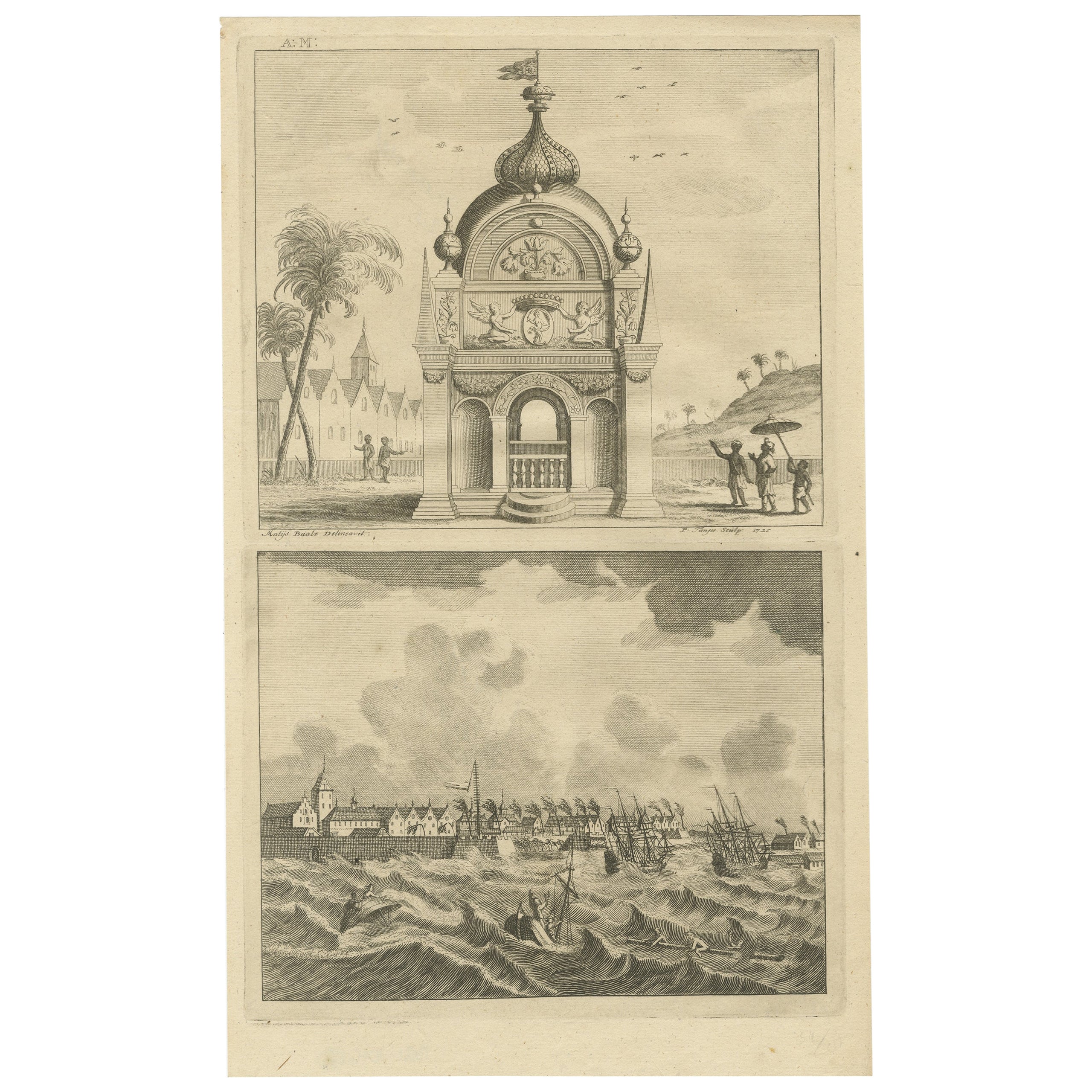
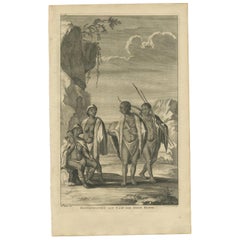
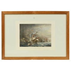
Antique Print of the Cape of Good Hope in South Africa, 1726
About the Item
Antique print Africa depicting the Cape of Good Hope. With Dutch legend. This print originates from 'Oud en Nieuw Oost-Indiën' by F. Valentijn.
Artists and Engravers: François Valentijn (1666-1727), a missionary, worked at Amboina from 1684 to 1694 and 1705 to 1713 and travelled extensively in the VOC's lands.
Condition: Very good, general age-related toning. Please study image carefully.
Date: 1726
Overall size: 38 x 34 cm.
Image size: 35.5 x 27 cm.
Antique prints have long been appreciated for both their aesthetic and investment value. They were the product of engraved, etched or lithographed plates. These plates were handmade out of wood or metal, which required an incredible level of skill, patience and craftsmanship. Whether you have a house with Victorian furniture or more contemporary decor an old engraving can enhance your living space. We offer a wide range of authentic antique prints for any budget.
- Dimensions:Height: 14.97 in (38 cm)Width: 13.39 in (34 cm)Depth: 0 in (0.01 mm)
- Materials and Techniques:
- Period:
- Date of Manufacture:1726
- Condition:Condition: Very good, general age-related toning. Please study image carefully.
- Seller Location:Langweer, NL
- Reference Number:
About the Seller
5.0
Platinum Seller
These expertly vetted sellers are 1stDibs' most experienced sellers and are rated highest by our customers.
Established in 2009
1stDibs seller since 2017
1,922 sales on 1stDibs
Typical response time: <1 hour
- ShippingRetrieving quote...Ships From: Langweer, Netherlands
- Return PolicyA return for this item may be initiated within 14 days of delivery.
More From This SellerView All
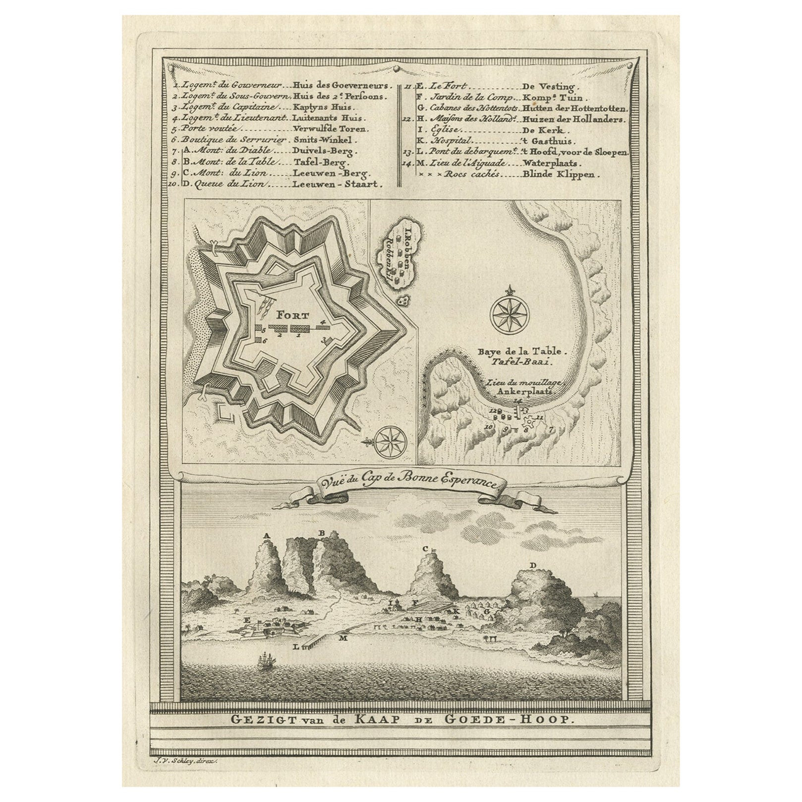
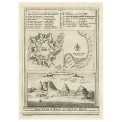
- Old Print with a View of the Cape of Good Hope and Table Bay, South Africa, 1750Located in Langweer, NLAntique print titled 'Gezigt van de Kaap de Goede-Hoop'. Old print with a view of the Cape of Good Hope and Table Bay. Engraved by J. van Schley for a Du...Category
Antique 1750s Maps
MaterialsPaper
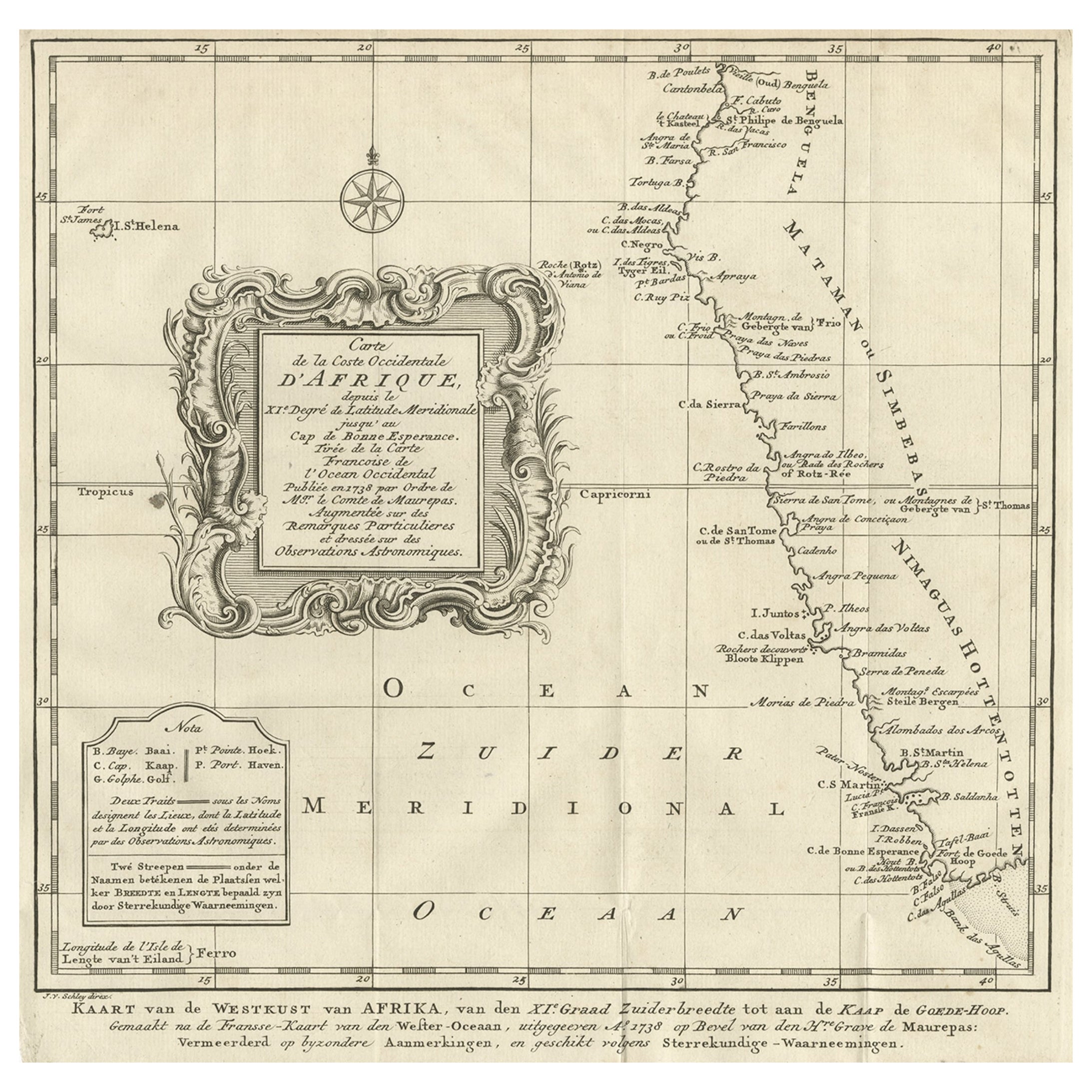
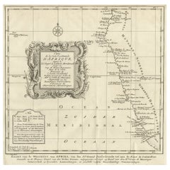
- Dutch Antique Map of the West Coast of Africa, to the Cape of Good Hope, 1747Located in Langweer, NLAntique map of the Coast of Africa titled 'Kaart van de West Kust van Afrika (..)'. Map of the west coast of Africa, from 11 degrees south latitude to the Cape of Good Hope. This...Category
Antique 1740s Maps
MaterialsPaper
- Antique Print of the Khoikhoi of Cape of Good Hope by Valentijn, 1726By F. ValentijnLocated in Langweer, NLAntique print titled 'Hottentotten aan Caap der Goede Hoope'. Print depicting the Khoikhoi of Cape of Good Hope, Africa. Including two text pages. This print originates from 'Oud en ...Category
Antique Early 18th Century Dutch Prints
MaterialsPaper
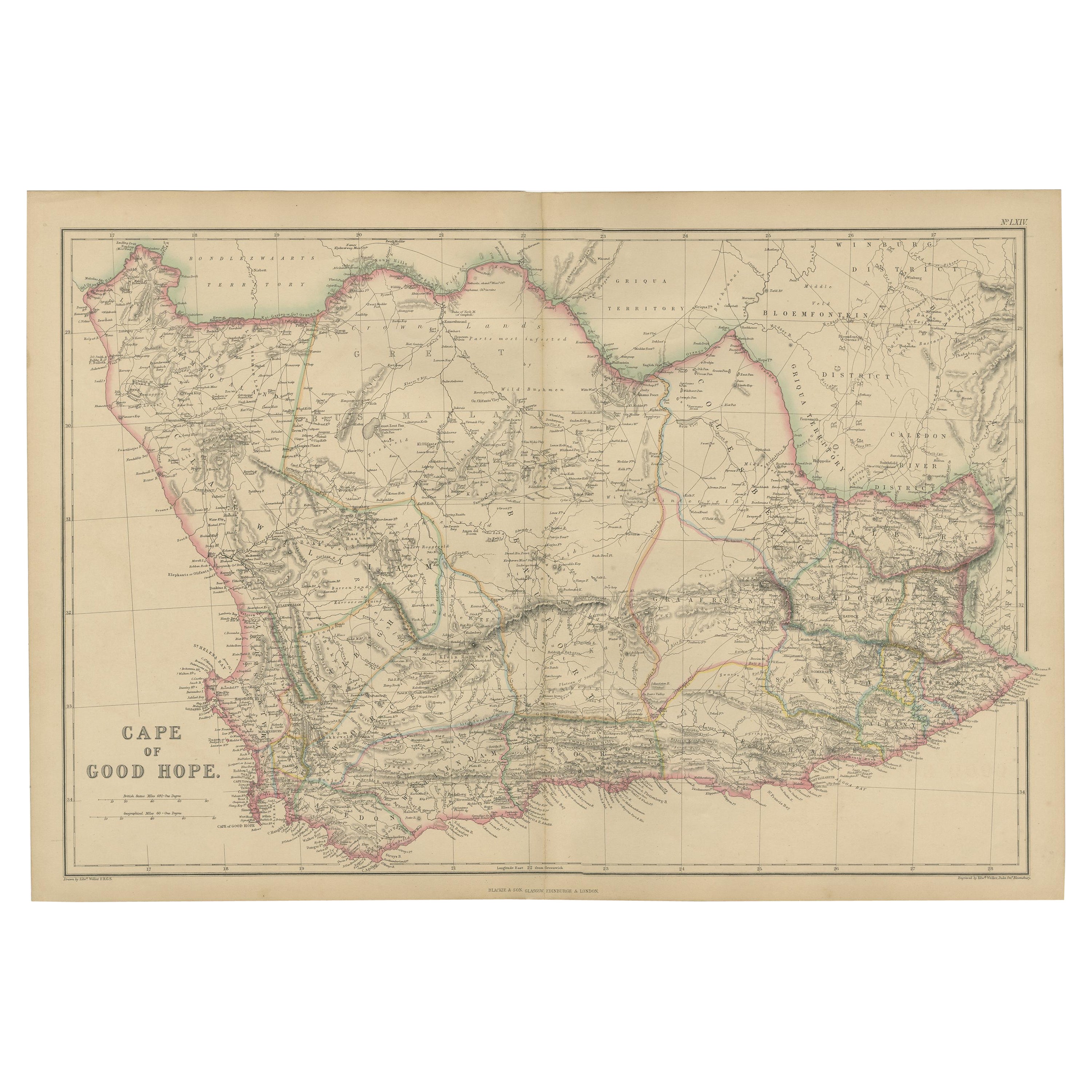
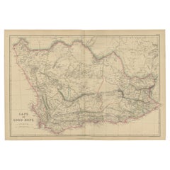
- Antique Map of the Cape of Good Hope by W. G. Blackie, 1859Located in Langweer, NLAntique map titled 'Cape of Good Hope'. Original antique map of the Cape of Good Hope. This map originates from ‘The Imperial Atlas of Modern Geography’. Published by W. G. Blackie, ...Category
Antique Mid-19th Century Maps
MaterialsPaper
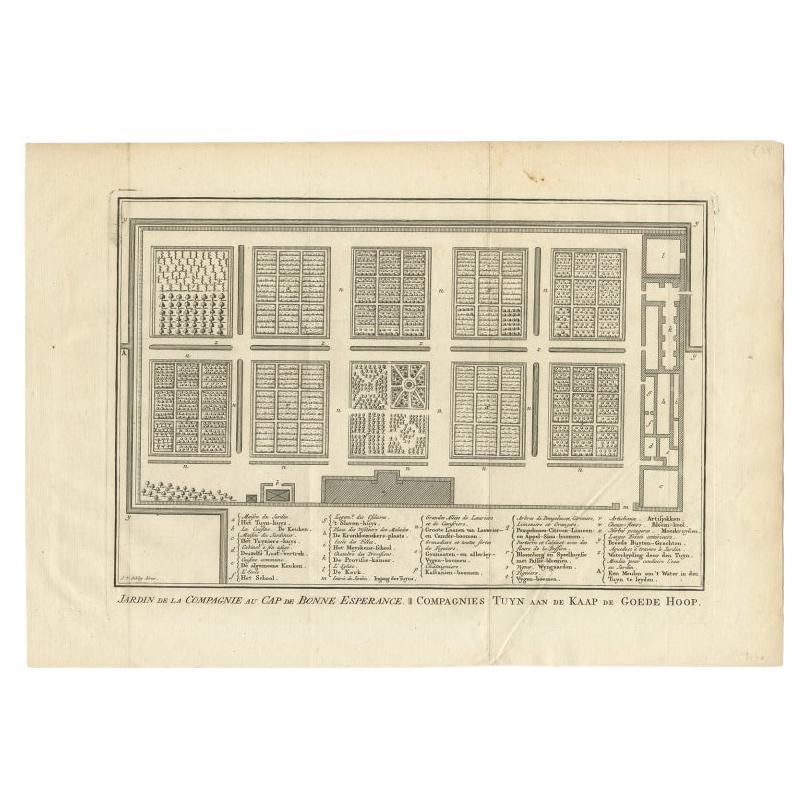
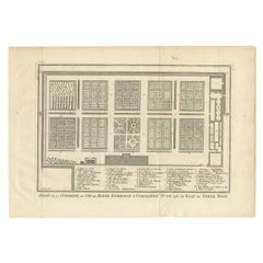
- Antique Print of the Gardens at Cape of Good Hope by Van Schley, 1756Located in Langweer, NLAntique print titled 'Jardin de la Compagnie au Cap de Bonne Esperance, Compagnies Tuyn aan de Kaap de Goede Hoop'. This print depicts the Gardens at Cape of Good Hope (VOC). This pr...Category
Antique 18th Century Prints
MaterialsPaper
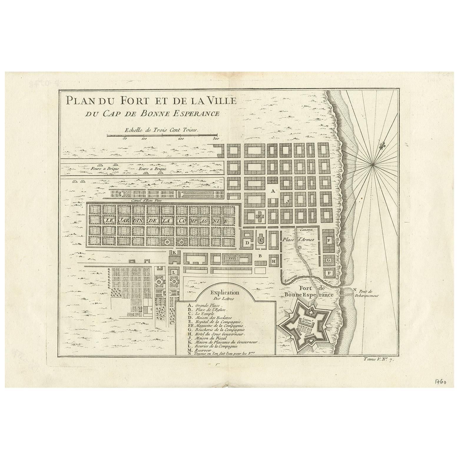
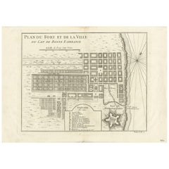
- Antique Map of the Cape of Good Hope by J.N. Bellin, 1748Located in Langweer, NLEarly plan of the Cape of Good Hope, includng a town plan and illustrations of the fortificatons. This map originates from Tome V of Abbe Prevost's Histoire generale du voyages.Category
Antique Mid-18th Century Maps
MaterialsPaper
You May Also Like
- Voyage to the Cape of Good Hope, First Edition, c1785Located in valatie, NYVoyage to the Cape of Good Hope, towards the Antarctic polar circle, and round the world, but chiefly into the country of the Caffres, from the year ...Category
Antique 18th Century Irish Books
MaterialsLeather, Paper
- Original Antique Map of South America. C.1780Located in St Annes, LancashireGreat map of South America Copper-plate engraving Published C.1780 Two small worm holes to left side of map Unframed.Category
Antique Early 1800s English Georgian Maps
MaterialsPaper
- Vintage Lithographic Print of Battle of Cape Lèzard, Early 1900s, Oakwood FrameLocated in Milan, ITLithographic print of the battle of Cape Lèzard on 21st October 1707, taken from the book Historical Gallery of Versailles. Skelton is the engraver. Original print by Victor Gilbert Théodore Gudin...Category
Early 20th Century French Nautical Objects
MaterialsPaper
- Original Antique Map of South America, circa 1830Located in St Annes, LancashireGreat map of South America Copper plate engraving Published by Butterworth, Livesey & Co., circa 1830 Unframed.Category
Antique Early 1800s English Other Maps
MaterialsPaper
- Antique 1798 James Colnett A Voyage to the South Atlantic & Round Cape Hope BookLocated in Hamilton, OntarioThis antique book titled "A Voyage to the South Atlantic and Round Cape Horn into the Pacific Ocean", and authored by W. Bennett, on the work of James Colnet...Category
Antique Late 18th Century English Georgian Books
MaterialsLeather, Paper
- Original Antique Map of South East Asia, Arrowsmith, 1820Located in St Annes, LancashireGreat map of South East Asia Drawn under the direction of Arrowsmith Copper-plate engraving Published by Longman, Hurst, Rees, Orme and Brown, 1820 Unframed.Category
Antique 1820s English Maps
MaterialsPaper


Recently Viewed
View AllMore Ways To Browse
Victorian African
Cape Dutch
Antique Cape House
Antique Victorian Cape
Cape Of Good Hope
Oud Wood
Cape Dutch Furniture
Cape Dutch Antique Furniture
South African Cape Antiques
Swedish Gustavian Chest Of Drawers
Dark Brown Ring
Pair Of Italian Commodes
Tall French Doors
Knot Chain
Pair Chest Of Drawers Italian
Pair Of Rosewood Cabinets
Pair Of Chest Of Drawers Italian
Mid Century Wall Sculpture Black