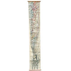
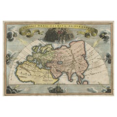
History of World Music, Switzerland, 1914
View Similar Items


1 of 10
History of World Music, Switzerland, 1914
About the Item
- Dimensions:Height: 136 in (345.44 cm)Width: 24 in (60.96 cm)Depth: 1 in (2.54 cm)
- Style:Art Nouveau (Of the Period)
- Materials and Techniques:
- Place of Origin:
- Period:1910-1919
- Date of Manufacture:1914
- Condition:Wear consistent with age and use. Some light restoration to top portion the folds could probably be removed by an expert paper restorer but will return if the scroll is kept roll over time. For high definition photos please inquire.
- Seller Location:Brooklyn, NY
- Reference Number:1stDibs: LU104062592112
You May Also Like
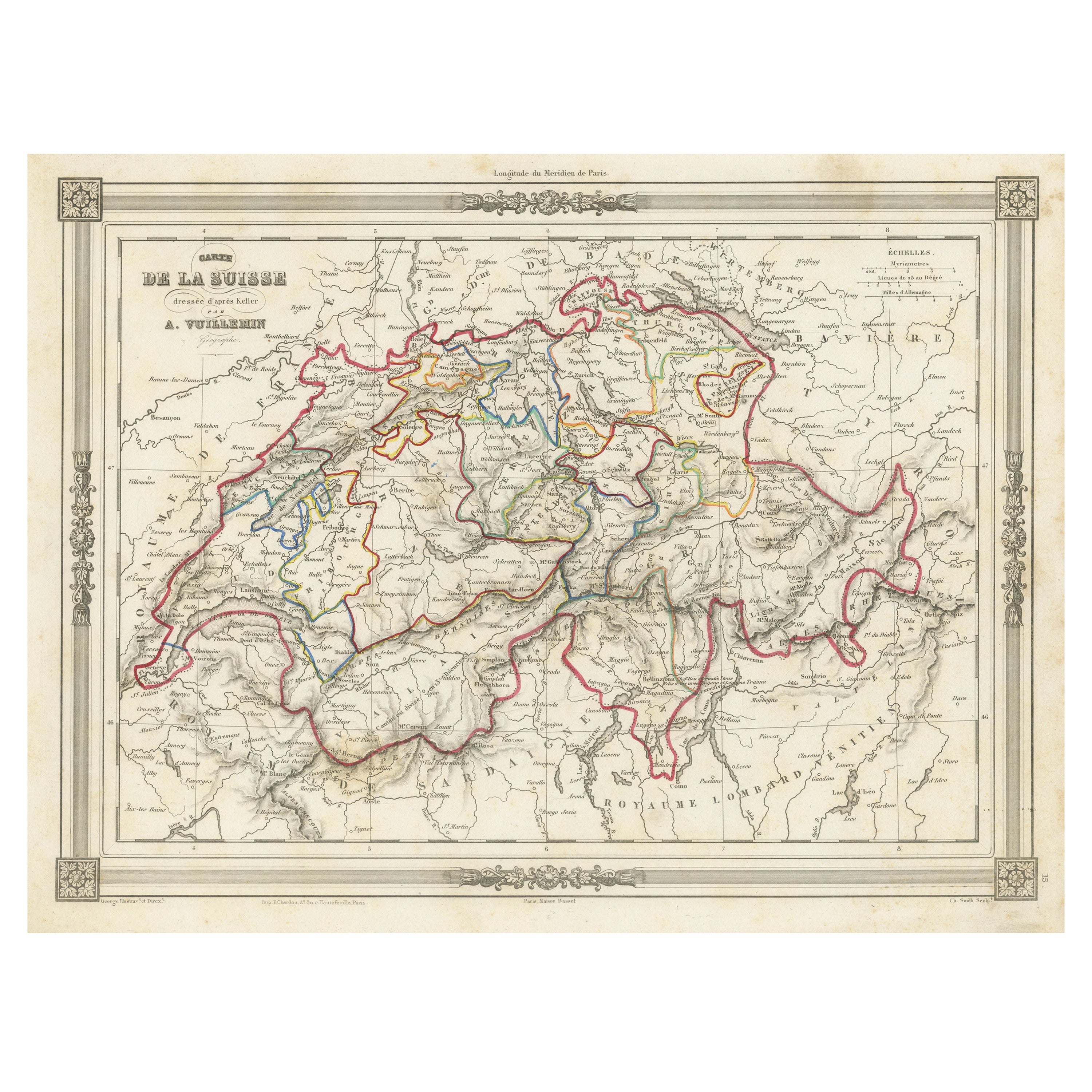
- 1859 Antique Swiss Panorama: Blackie's Detailed Map of SwitzerlandLocated in Langweer, NLThe "Antique Map of Switzerland" is a distinguished piece from 'The Imperial Atlas of Modern Geography', published in 1859 by the renowned cartographer W. G. Blackie. This map presen...Category
Antique Mid-19th Century Maps
MaterialsPaper
 $192 Sale Price30% Off
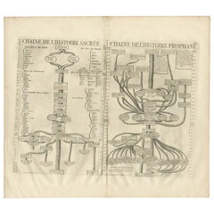
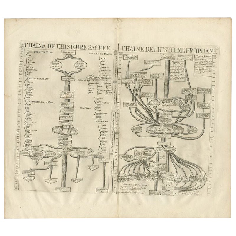
 - Antique Print of a Timeline of the Biblical History, 1732Located in Langweer, NLAntique print titled 'Chaine de l'Histoire Sacrée (..)'. Old print with two timelines, one of the Biblical history and another of the worldly governments. This print orginates from '...Category
Antique 18th Century Prints
MaterialsPaper
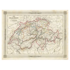
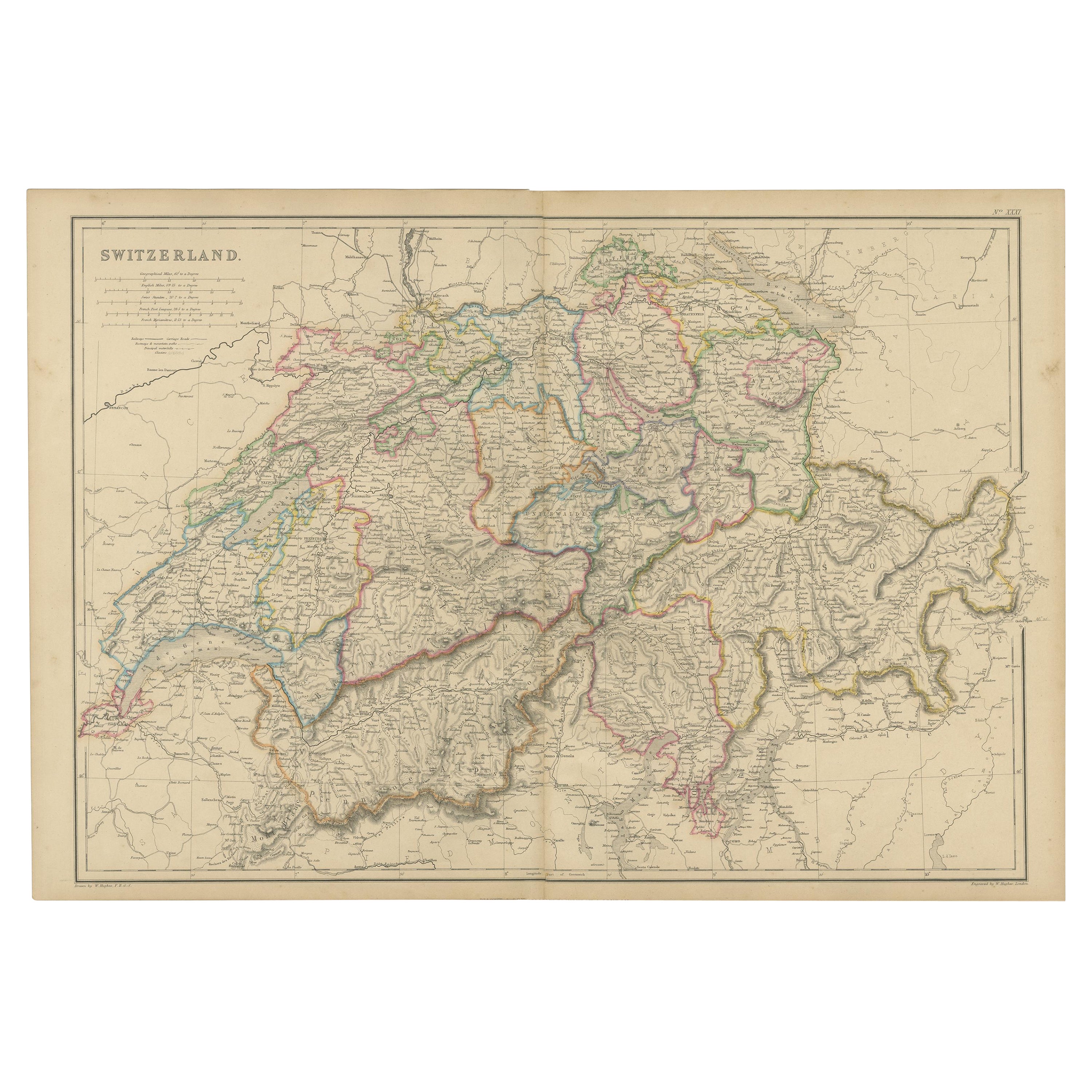
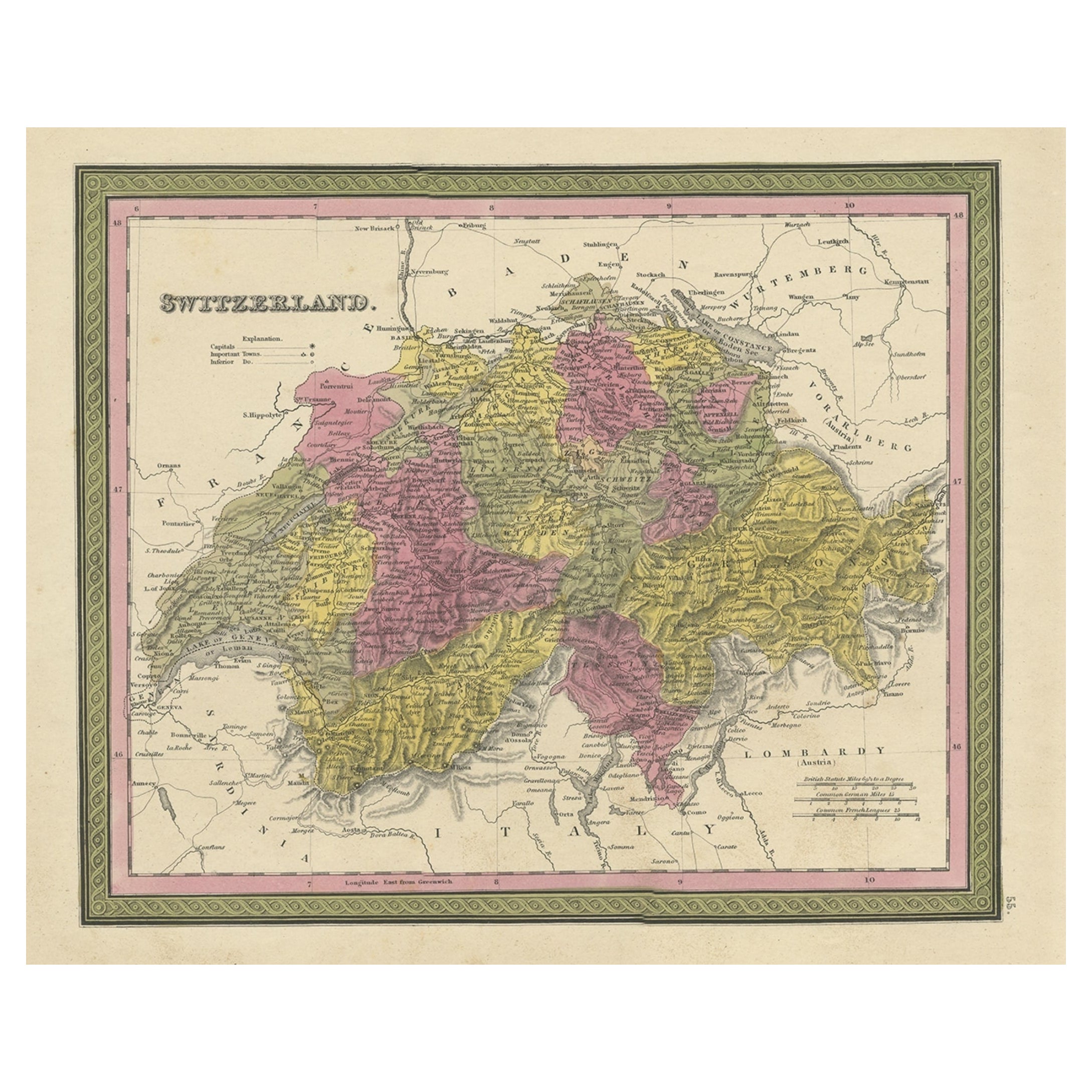
- Swiss Splendor: Antique Map of Switzerland and Its Cantons, 1852Located in Langweer, NLThe antique map titled 'Carte de la Suisse' is an attractive map of Switzerland. Here are the key details and features of the map: 1. **Geographic Coverage**: - The map provides comprehensive coverage of Switzerland, depicting the entire country. - It showcases the division of Switzerland by Cantons, including regions from Vaud to Grisons. - Additionally, the map includes parts of adjacent countries, such as France, Germany, and Italy, providing context for Switzerland's geographical location. 2. **Cartographic Details**: - The map offers detailed cartographic information, including the delineation of geographic features, rivers, mountains, and the names of Cantons and towns. - It presents a clear and informative representation of Switzerland's topography. 3. **Origin**: - This map originates from Maison Basset's 1852 edition of 'Atlas Illustre Destine a l'enseignement de la Geographie elementaire,' indicating its use for educational purposes, particularly in the teaching of geography. 4. **Educational Significance**: - As part of an educational atlas, the map likely played a role in instructing students about the geography of Switzerland and its political subdivisions. - It may have been employed as a visual aid to enhance students' understanding of Switzerland's Cantonal divisions. 5. **Aesthetic Appeal**: - The map is described as attractive, suggesting that it possesses not only educational value but also visual appeal. - Maps of this era often featured decorative elements that added to their aesthetic charm. 6. **Historical and Geopolitical Significance**: - Switzerland's unique position in Europe, as a country surrounded...Category
Antique Mid-19th Century Maps
MaterialsPaper
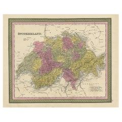
- Colourful Antique Map of Switzerland, 1846Located in Langweer, NLAntique map titled 'Switzerland'. Old map of Switzerland. This map originates from 'A New Universal Atlas Containing Maps of the various Empires...Category
Antique 1840s Maps
MaterialsPaper
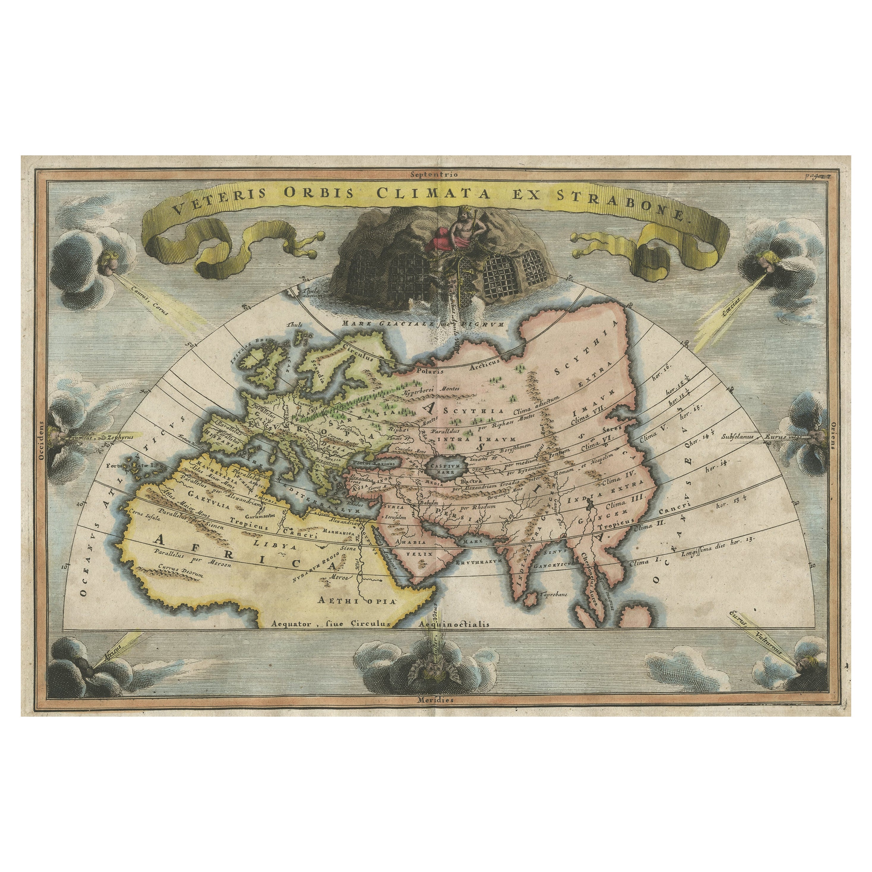
- Decorative Ancient World Map with Large Parts of the World Still Unknown, c 1731Located in Langweer, NLInteresting ancient map of the world, based upon Strabo. The Southern tip of Africa is undiscovered. No sign of Japan, the Korean Peninsula or Australia and Oceana. Excellent NE Pass...Category
Antique 1730s Maps
MaterialsPaper
 $395 Sale Price20% Off
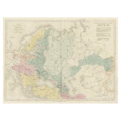
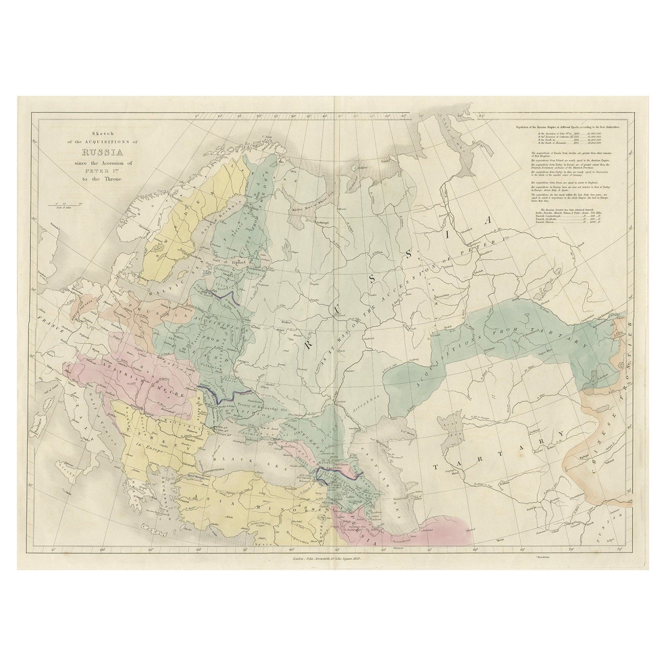
 - Historical Antique Map of Russia, Examining the History of Russia, 1838Located in Langweer, NLAntique map titled 'Sketch of the acquisitions of Russia since the Accession of Peter 1st to the Throne'. Historical map of Russia, examining the history o...Category
Antique 1830s Maps
MaterialsPaper