Items Similar to Interior with Native Timorese and an European in Kupang, Indonesia, 1825

Want more images or videos?
Request additional images or videos from the seller
1 of 5
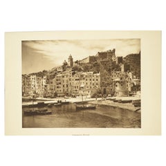
Interior with Native Timorese and an European in Kupang, Indonesia, 1825
About the Item
Antique print, titled: 'Coupang: Ile Timor. Interieur d'une Maison Timorienne.' - ('Coupang, Timor Island. Interior of a Timor house').
View of the interior of a house, with native family and a European visitor. Source: 'Voyage autour du monde sur les corvettes Uranie et la Physicienne pendant les années 1817, 1818, 1819 et 1820', Paris: 1825. This series of exquisitely engraved prints constitutes a unique documentation of exotic unknown lands and their inhabitants, made during the voyage of the Uranie (in honour of the muse of astronomy and geography). The expedition was led by Louis de Freycinet at the behest of the newly restored French king Louis XVIII and to restore prestige for the French nation.
Artists and Engravers: Made by 'Lerouge & Forget' after 'J. Alphonse Pellion'. Marie Joseph Alphonse Pellion (known as Odet-Pellion, 1796-1868) was a French vice-admiral. Author: Louis Claude de Saulces de Freycinet (1779-1841) was a French navigator who circumnavigated the earth.
Condition: Very good, given age. Some small imperfections (small stains) in the margins and a few in the top edge of the image. Margin edges a little uneven. General age-related toning and/or occasional minor defects from handling. Please study scan carefully.
- Dimensions:Height: 13.19 in (33.5 cm)Width: 19.69 in (50 cm)Depth: 0 in (0.02 mm)
- Materials and Techniques:
- Period:
- Date of Manufacture:1825
- Condition:Wear consistent with age and use.
- Seller Location:Langweer, NL
- Reference Number:
About the Seller
5.0
Platinum Seller
These expertly vetted sellers are 1stDibs' most experienced sellers and are rated highest by our customers.
Established in 2009
1stDibs seller since 2017
1,928 sales on 1stDibs
Typical response time: <1 hour
- ShippingRetrieving quote...Ships From: Langweer, Netherlands
- Return PolicyA return for this item may be initiated within 14 days of delivery.
More From This SellerView All
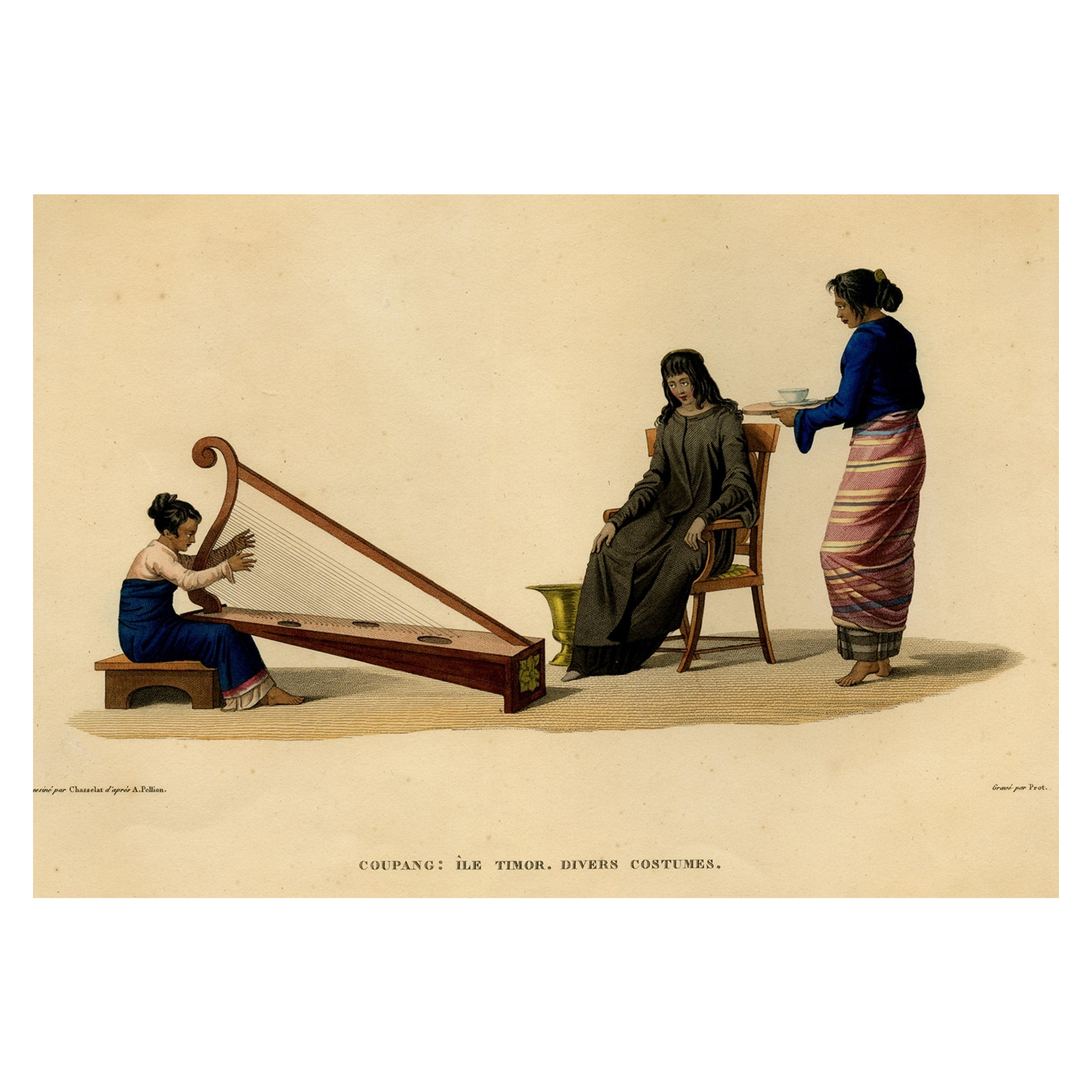
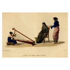
- Print of Timorese Ladies Playing Harp & Drinking Tea in Kupang, Indonesia, 1825Located in Langweer, NLAntique print, titled: 'Coupang: Ile Timor. Divers Costumes.' - ('Coupang, Timor Island. Various costumes'). Three figures in the native dress of the Indonesian island Timor. A y...Category
Antique 1820s Prints
MaterialsPaper
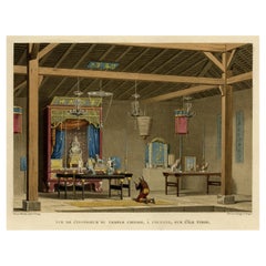
- Old View of the Interior of the Chinese Temple of Coupang or Kupang, Timor, 1825Located in Langweer, NLAntique print, titled: 'Vue du l'Interieur du Temple Chinois, a Coupang, Sur l'Ile Timor.' - ('View of the interior of the Chinese Temple of Coupang, Timor Island'). Source: 'Voyage ...Category
Antique 1820s Religious Items
MaterialsPaper
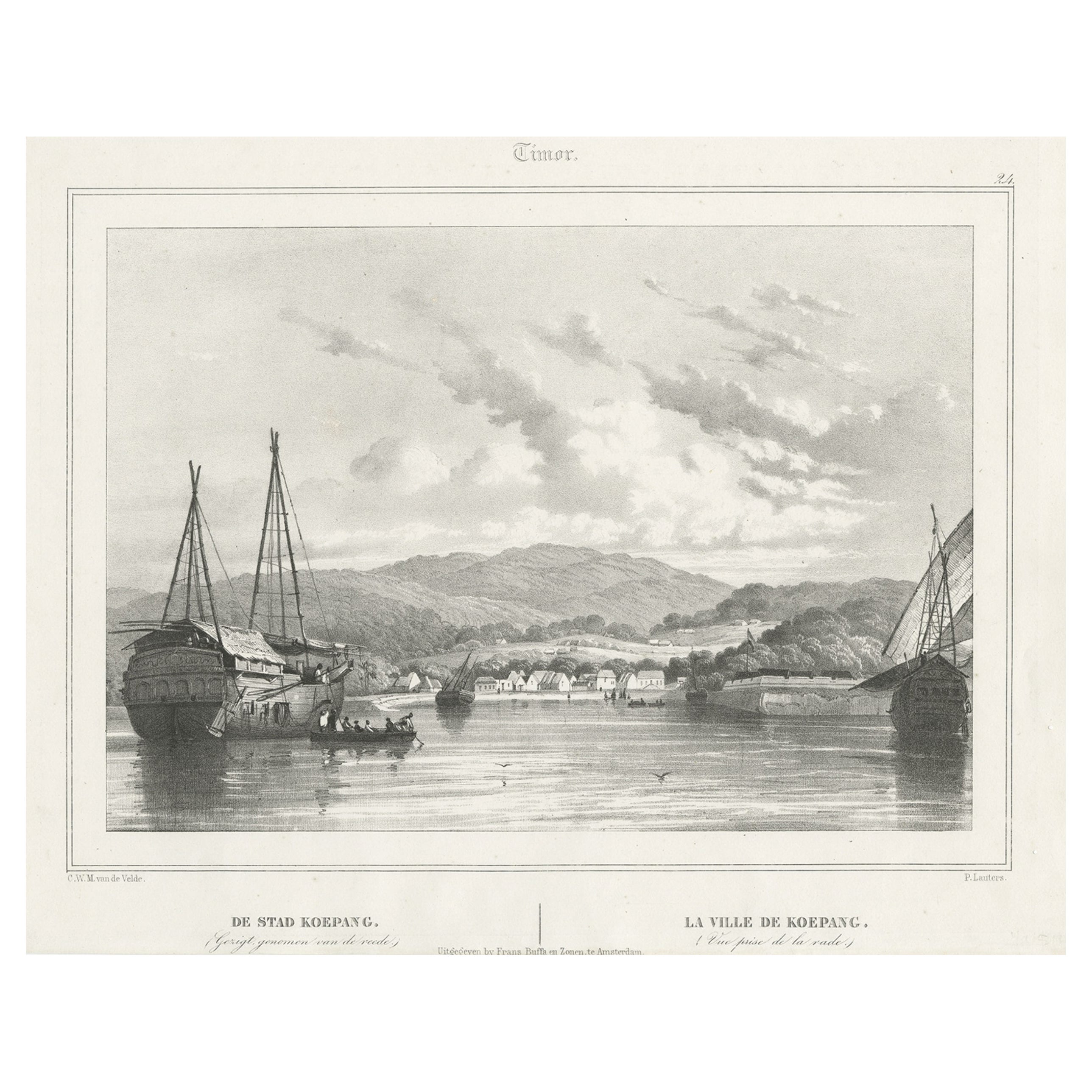
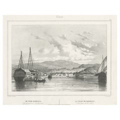
- Antique Print of Kupang or Koepang in the East Indies, Now West-Timor, IndonesiaLocated in Langweer, NLAntique print Timor titled 'De Stad Koepang, La Ville de Koepang'. View of the town of Koepang / Concordia / Kupang on the Island of Timor, Indonesia. Originates from 'Gezigten uit Neerlands Indie, naar de natuur geteekend en beschreven.', by C.W.M. van de Velde, published in Amsterdam, Frans Buffa en Zonen (1844-1845). Artists and Engravers: Charles William Meredith van de Velde (1818-1898) was a Dutch...Category
Antique 19th Century Prints
MaterialsPaper
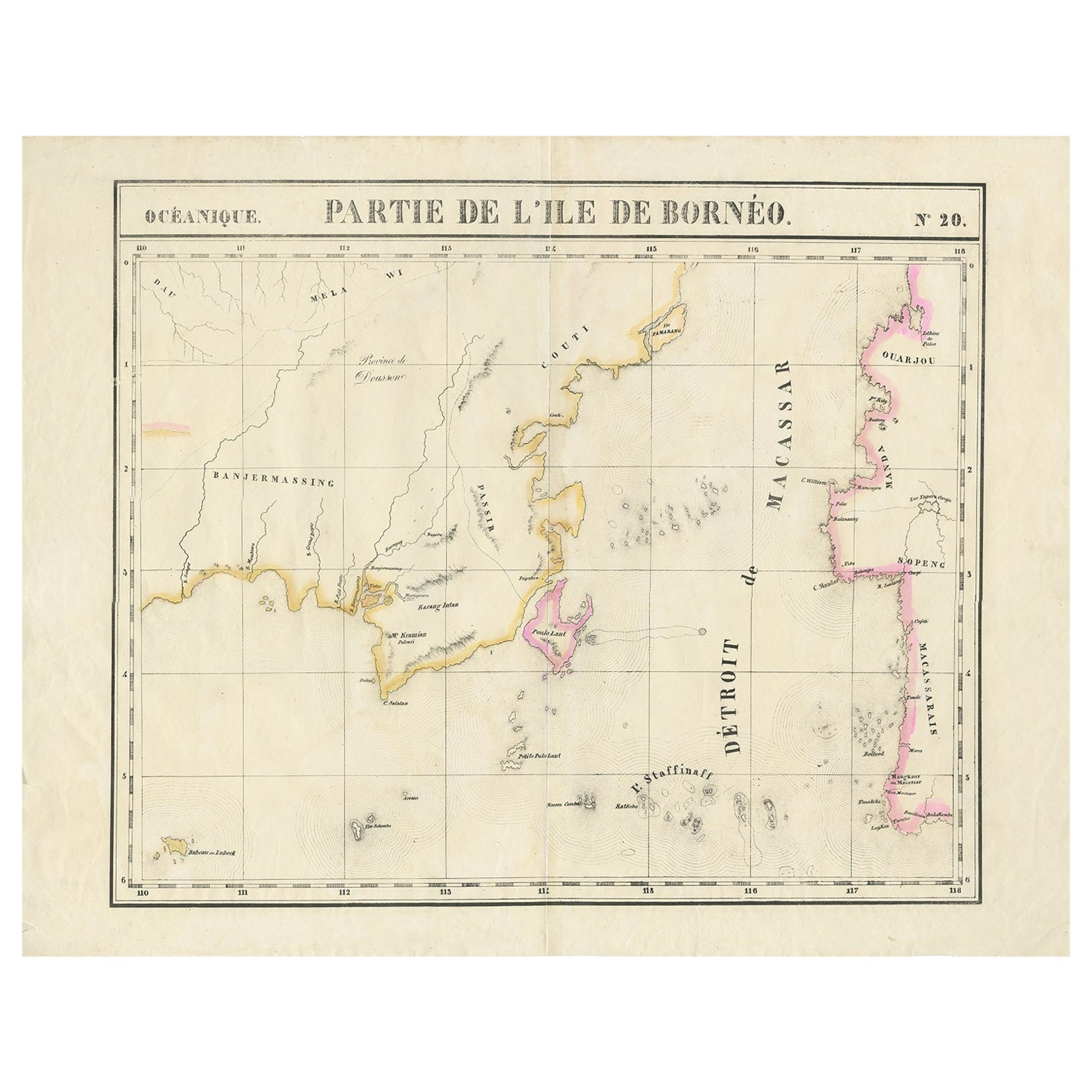
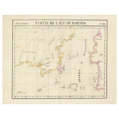
- Detailed Antique Map of a Portion of Borneo and Sulawesi in Indonesia, c.1825Located in Langweer, NLAntique map titled 'Partie de l'Ile de Bornéo'. Map of a portion of Borneo, primarily the Southern part of the Island, the Strait of Macassar and the Staffinaff Islands. Originates f...Category
Antique 19th Century Maps
MaterialsPaper
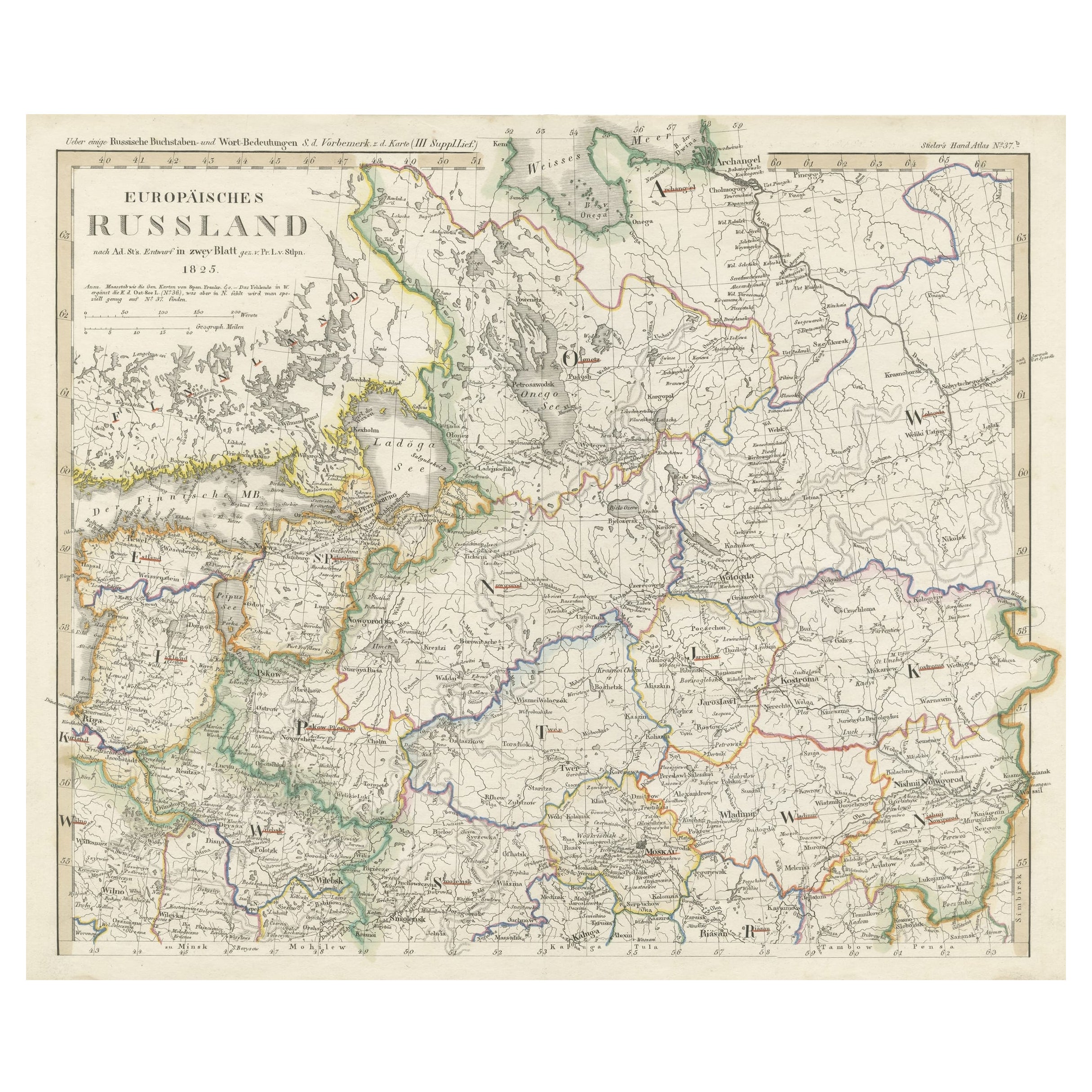
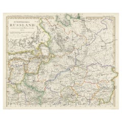
- Antique Map of Russia in Europe on Two Sheets from an Old German Atlas, Ca.1825Located in Langweer, NLDescription: Antique map titled 'Europäisches Russland'. Two individuel sheets, joined together they depict Russia in Europe. These maps originate from 'Stielers Handatlas'. Publis...Category
Antique 1820s Maps
MaterialsPaper
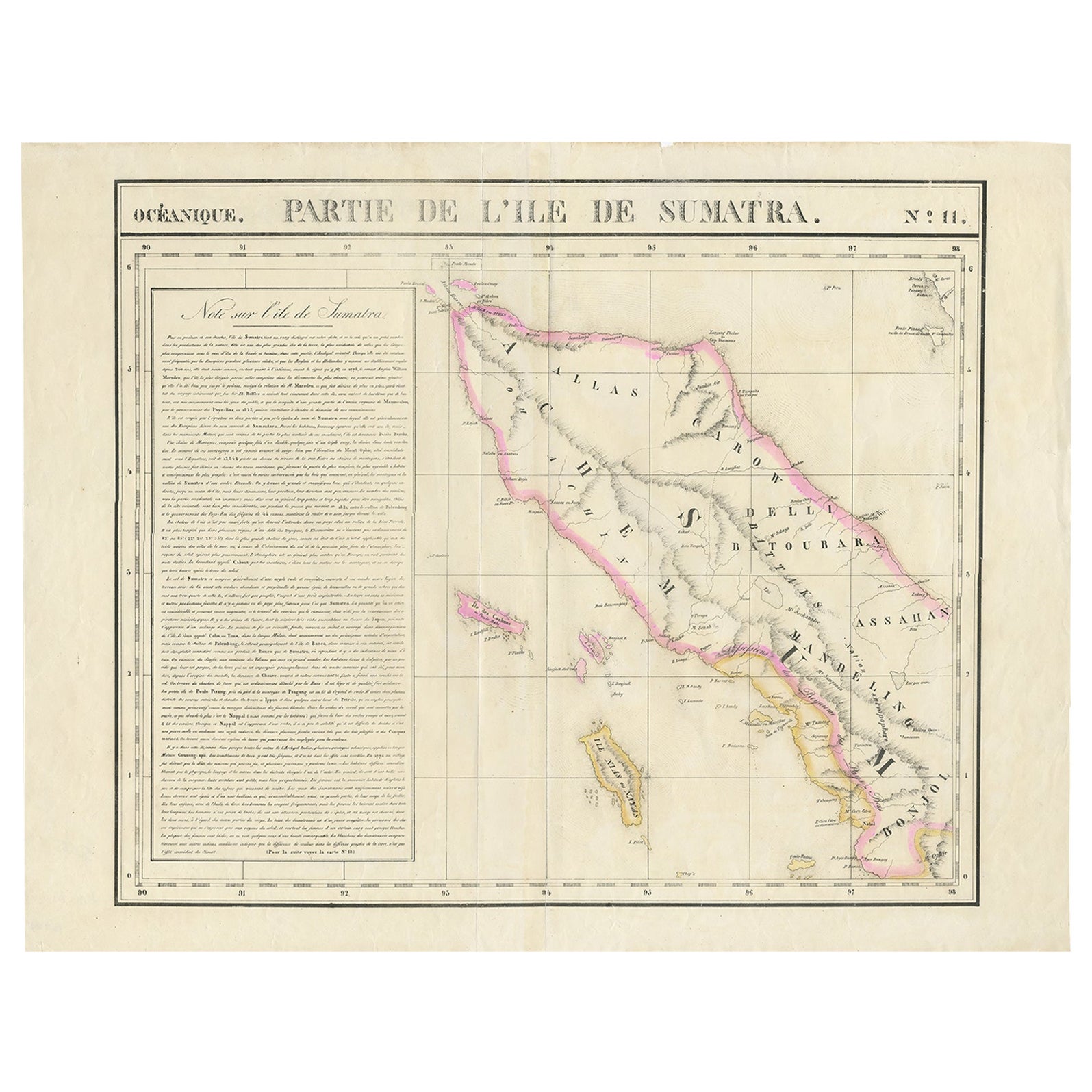
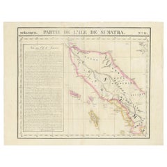
- Detailed Antique Map of Northern Sumatra, Indonesia, circa 1825Located in Langweer, NLAntique map titled 'Partie de l'Ile de Sumatra'. Chart showing the northern part of Sumatra. Originates from 'Atlas Universel' by P.M. Vandermaelen. Artists and Engravers: Philip...Category
Antique 19th Century Maps
MaterialsPaper
You May Also Like
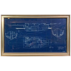
- John Alden Blueprint No. 583 of an Auxiliary Cruising YawlLocated in Norwell, MAExceptional and stunning original yacht blueprint from John G Alden of Boston. The legend panel reads “Auxiliary Cruising Yawl” cabin plan. March 21, 1934. C.A. Alberg John G. Alden ...Category
Vintage 1930s Nautical Objects
MaterialsPaper
- Scandinavia & Portions of Eastern Europe: 18th Century Hand-Colored Homann MapBy Johann Baptist HomannLocated in Alamo, CAAn early 18th century hand-colored copper-plate map entitled "Regni Sueciae in omnes suas Subjacentes Provincias accurate divisi Tabula Generalis" by Johann Baptist Homann (1663-1724...Category
Antique Early 18th Century German Maps
MaterialsPaper
- Southern & Eastern Europe: A Large 17th C. Hand-colored Map by Sanson & JaillotBy Nicolas SansonLocated in Alamo, CAThis large hand-colored map entitled "Estats de L'Empire des Turqs en Europe, ou sont les Beglerbeglicz our Gouvernements" was originally created by Nicholas Sanson d'Abbeville and t...Category
Antique 1690s French Maps
MaterialsPaper
- Double Front and Back Lithograph Depicting Portovenere and Pisa in Italy, 1930sLocated in Milan, ITDouble front and back lithograph depicting Portovenere and Piazza dei Miracoli in Pisa, dating back to the thirties. Very good condition. Cm 21.5 x 27.5.Category
Vintage 1930s Italian Nautical Objects
MaterialsPaper
- City View of Nuremberg, Germany: An 18th Century Hand-Colored Map by M. SeutterBy Matthew SeutterLocated in Alamo, CAAn 18th century hand-colored city view of Nuremburg, Germany entitled "Geometrischer Grundris der des Heiligen Römischen Reichs Freyen Stadt Nürnberg" by Matthaus Seutter from his "A...Category
Antique Mid-18th Century German Maps
MaterialsPaper
- West Africa Entitled "Guinea Propria": An 18th Century Hand Colored Homann MapBy Johann Baptist HomannLocated in Alamo, CAThis is a scarce richly hand colored copper plate engraved map of Africa entitled "Guinea Propria, nec non Nigritiae vel Terrae Nigrorum Maxima Pars" by Johann Baptist Homann (1664-1...Category
Antique Mid-18th Century German Maps
MaterialsPaper


Recently Viewed
View AllMore Ways To Browse
Louis Xviii
Louis Claude Artist
Muse Pendants
Decoration Interieur
Pendant Xviii
Large Wall Tapestries
Stripe Suit
Large Wall Tapestry
Types Of Antique Cabinets
Head Heads Wall Mounted
Set Of Brackets
Rope Motif
Vintage Steel Cabinet Cabinet
Steel Kitchen Cabinets Vintage
Jere Brass Wall Sculpture
Display Cabinets And Tables
Interiors With Chinese Antiques
Mid Century Brass Wall Sculpture