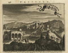
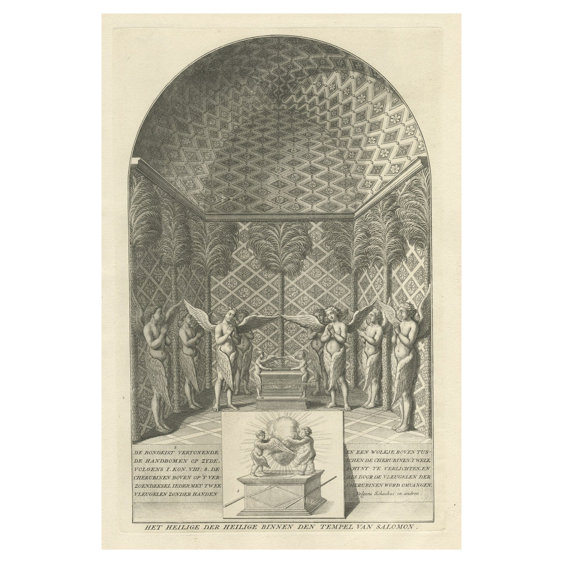
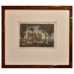
View of the 'Castle of the Good Robber' in the Holy Land, c.1680
View Similar Items
Want more images or videos?
Request additional images or videos from the seller
1 of 5
View of the 'Castle of the Good Robber' in the Holy Land, c.1680
About the Item
- Dimensions:Height: 4.81 in (12.2 cm)Width: 3.12 in (7.9 cm)Depth: 0 in (0.01 mm)
- Materials and Techniques:
- Period:
- Date of Manufacture:circa 1680
- Condition:Condition: Good, given age. Some staining top edge, not affecting image. General age-related toning and/or occasional minor defects from handling. Please study scan carefully.
- Seller Location:Langweer, NL
- Reference Number:Seller: PCT-627611stDibs: LU3054327110852
About the Seller
5.0
Platinum Seller
These expertly vetted sellers are 1stDibs' most experienced sellers and are rated highest by our customers.
Established in 2009
1stDibs seller since 2017
1,948 sales on 1stDibs
More From This SellerView All
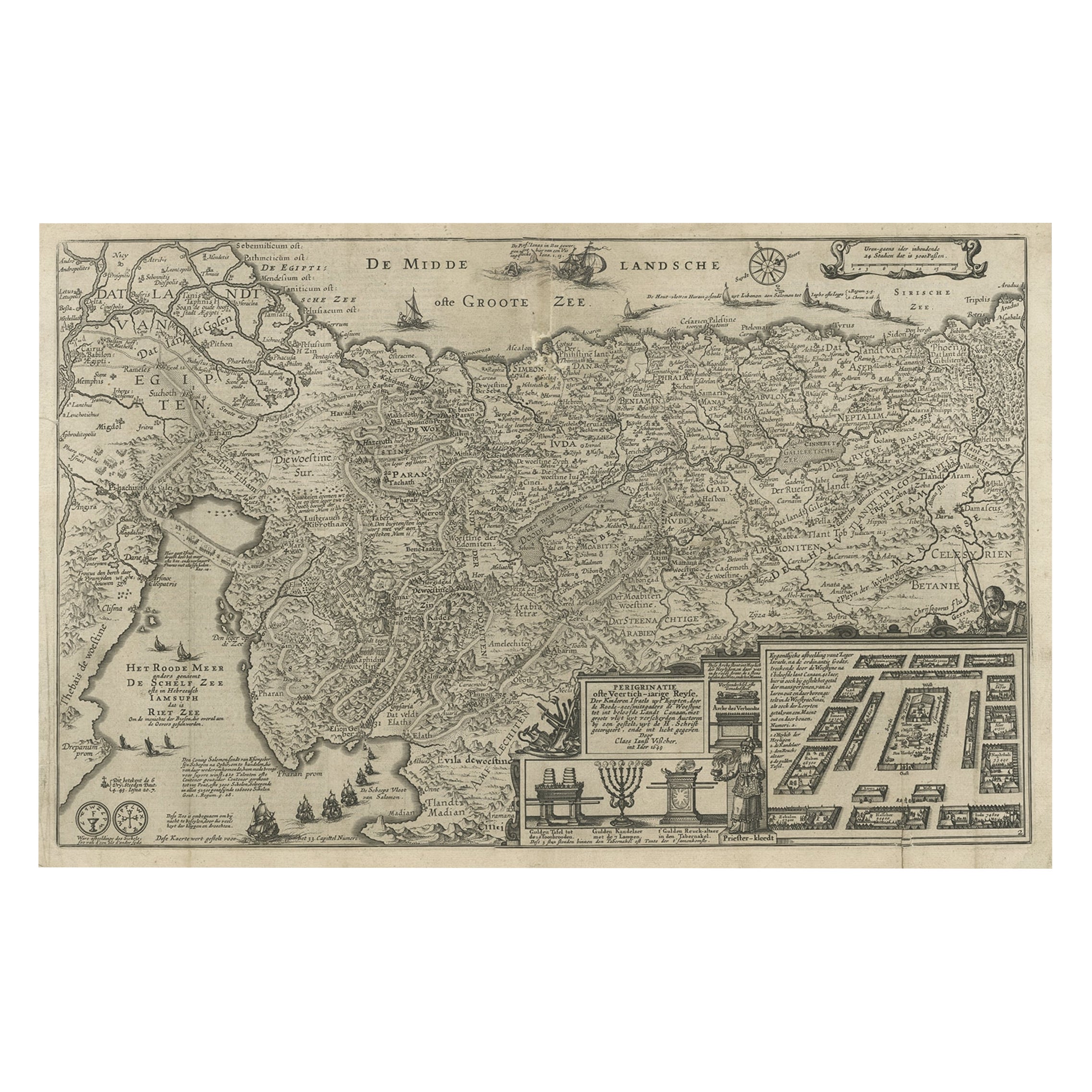
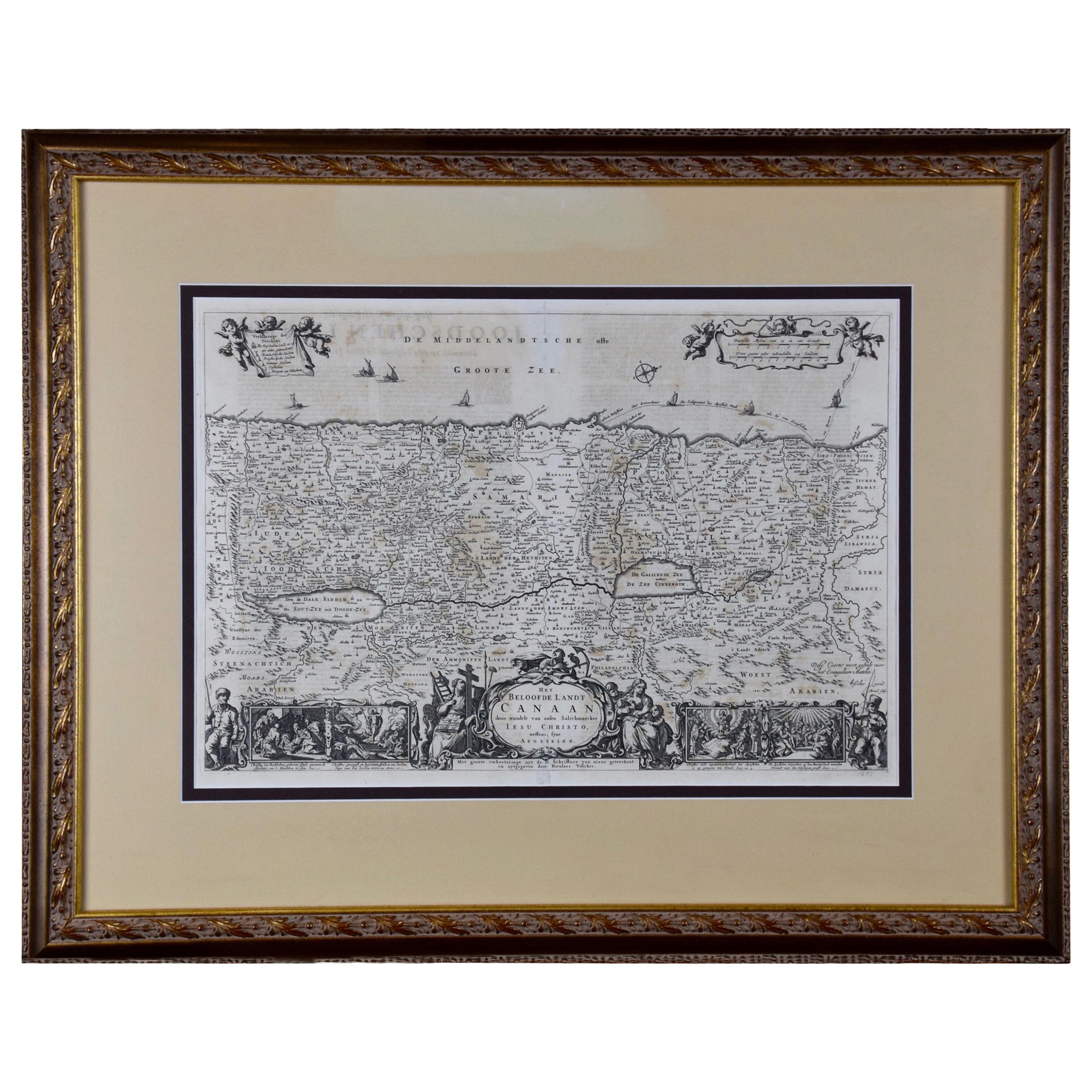
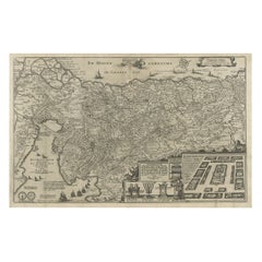
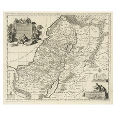
- Beautiful Rare Antique Map of the Holy Land, 1648Located in Langweer, NLAntique map Holy Land titled 'Perigrinatie ofte Veertich-Iarige Reyse, der kinderen Israels uyt Egipten, door de Roode-Zee; mitsgaders de Woestyne tot int Beloofde Landt Canaan, : met groote vlyt uyt verscheryden auctoren by een gestelt, uyt de H. Schrift gecorigeert, ende int licht gegeven'. Beautiful and rare antique map of the Holy Land...Category
Antique 1640s Maps
MaterialsPaper
 $738 Sale Price20% Off
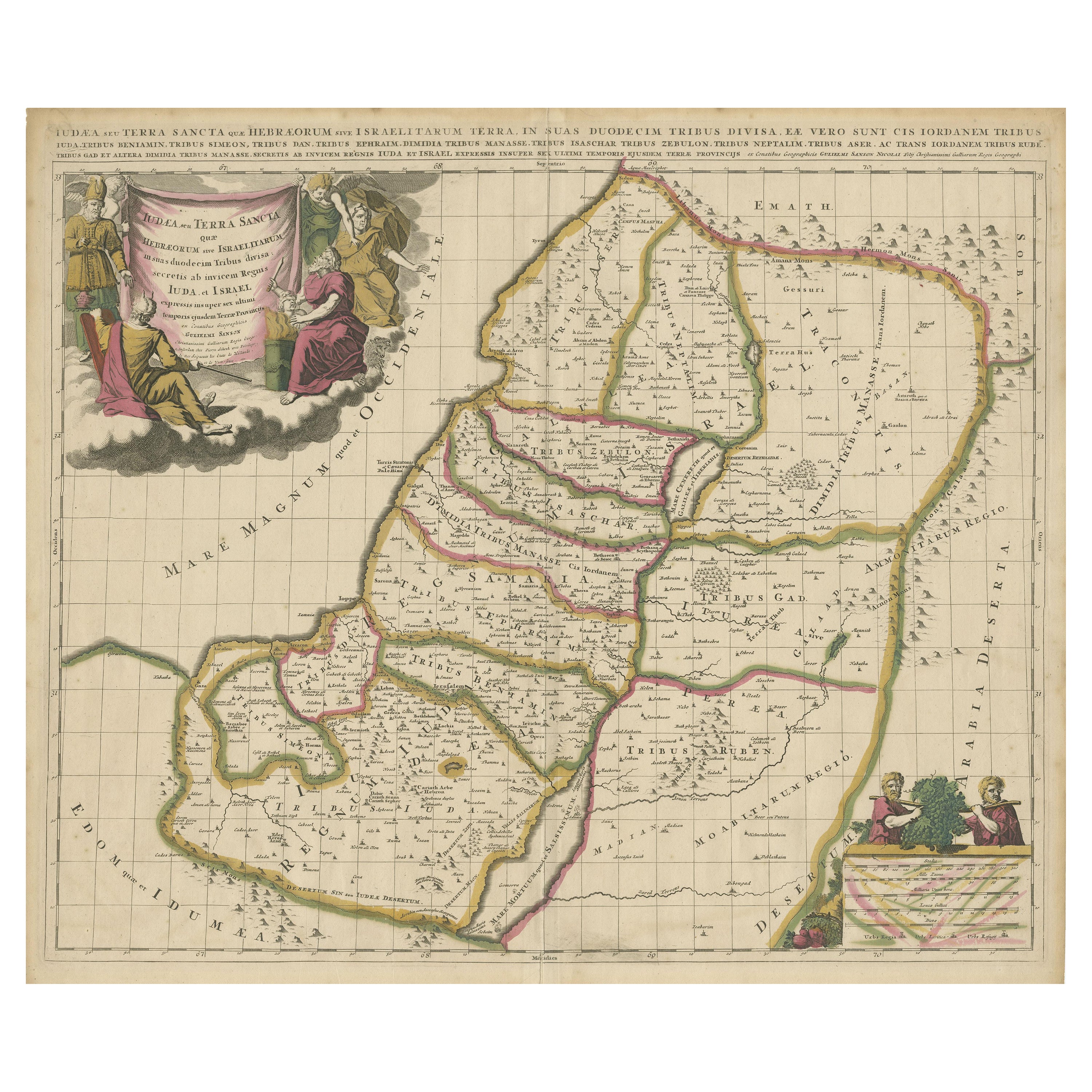
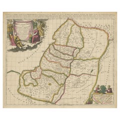
 - Antique Map of the Holy Land, Showing the Location of the Various TribesLocated in Langweer, NLAntique map titled 'Judaea seu Terra Sancta quae Hebraeorum sive Israelitarum (..)'. Map of The Holy Land, showing the location of the various tribes, in two kingdoms, Judah and Isra...Category
Antique Early 18th Century Maps
MaterialsPaper
 $1,054 Sale Price20% OffFree Shipping
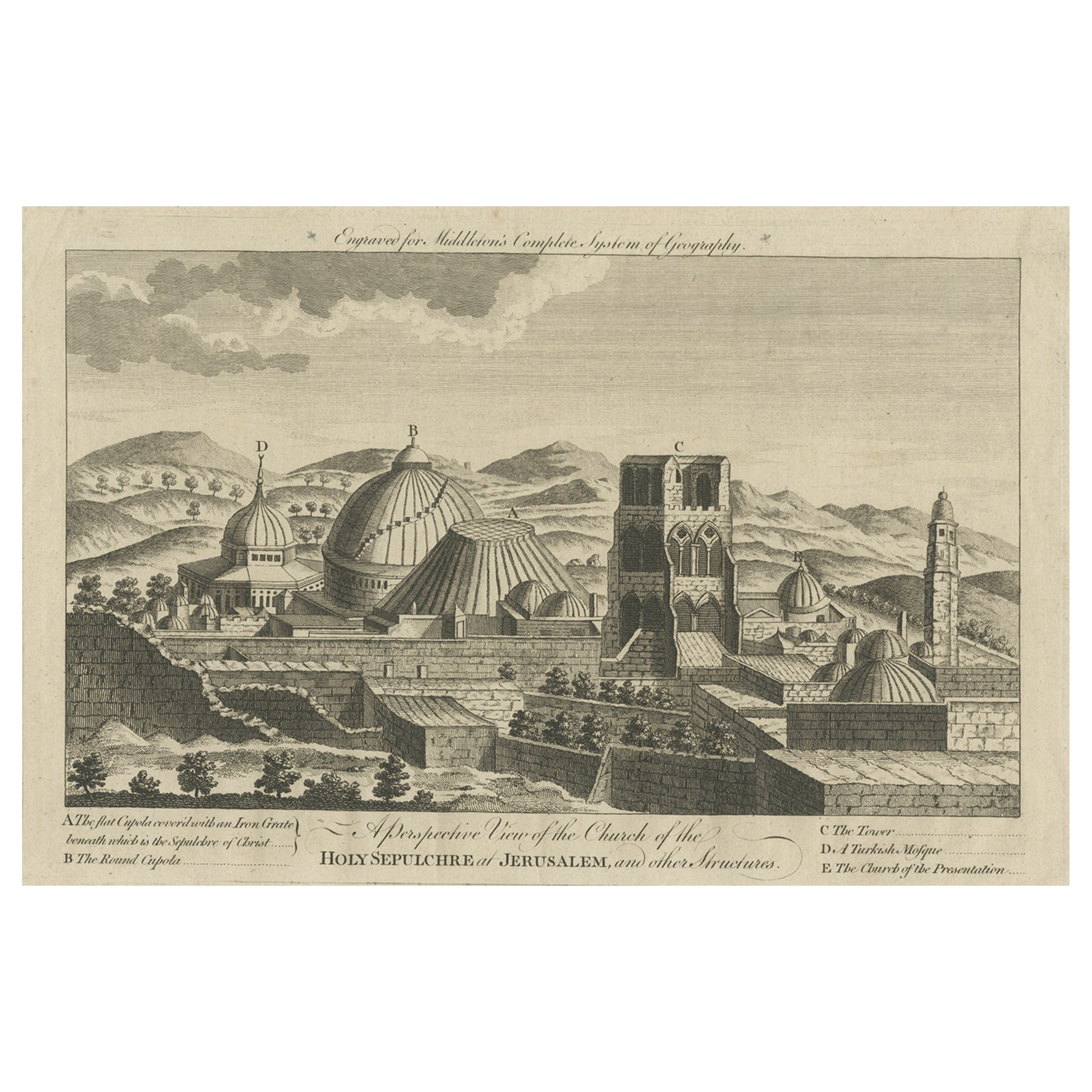
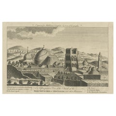
 - Antique View of the Holy Sepulchre Church in Jerusalem, Ca.1778Located in Langweer, NLDescription: Antique print titled 'A perspective View of the Church of the Holy Sepulchre at Jerusalem and other Structures'. A view of the Holy Sep...Category
Antique 1770s Prints
MaterialsPaper
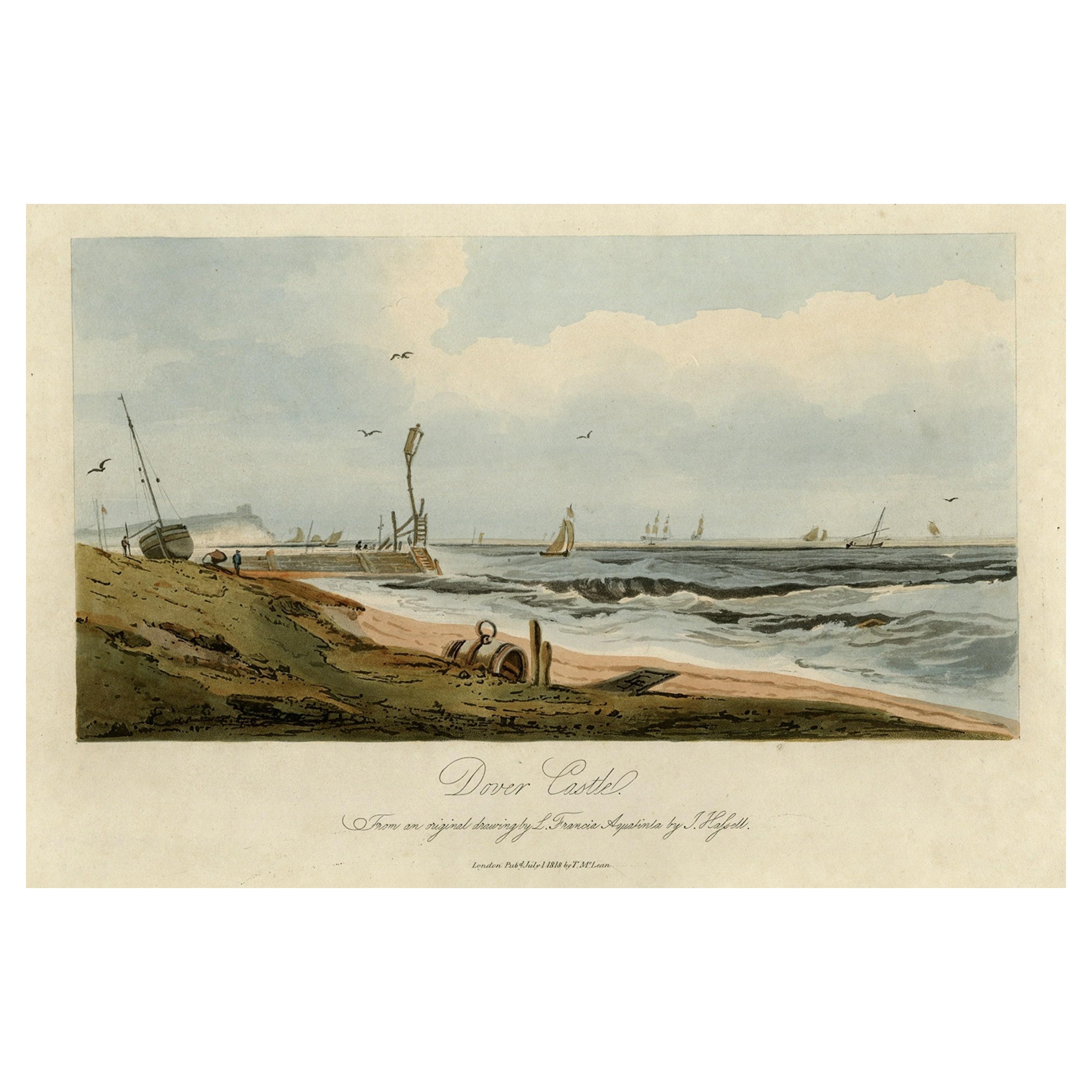
- View of Dover Castle Atop the Cliffs in the Background, England, 1818Located in Langweer, NLAntique print, titled: 'Dover Castle.' A view of the beach and sea with Dover Castle atop the cliffs in the background. Published by T. McLean in 1818. Artists and Engravers: ...Category
Antique 1810s Maps
MaterialsPaper
 $290 Sale Price20% Off
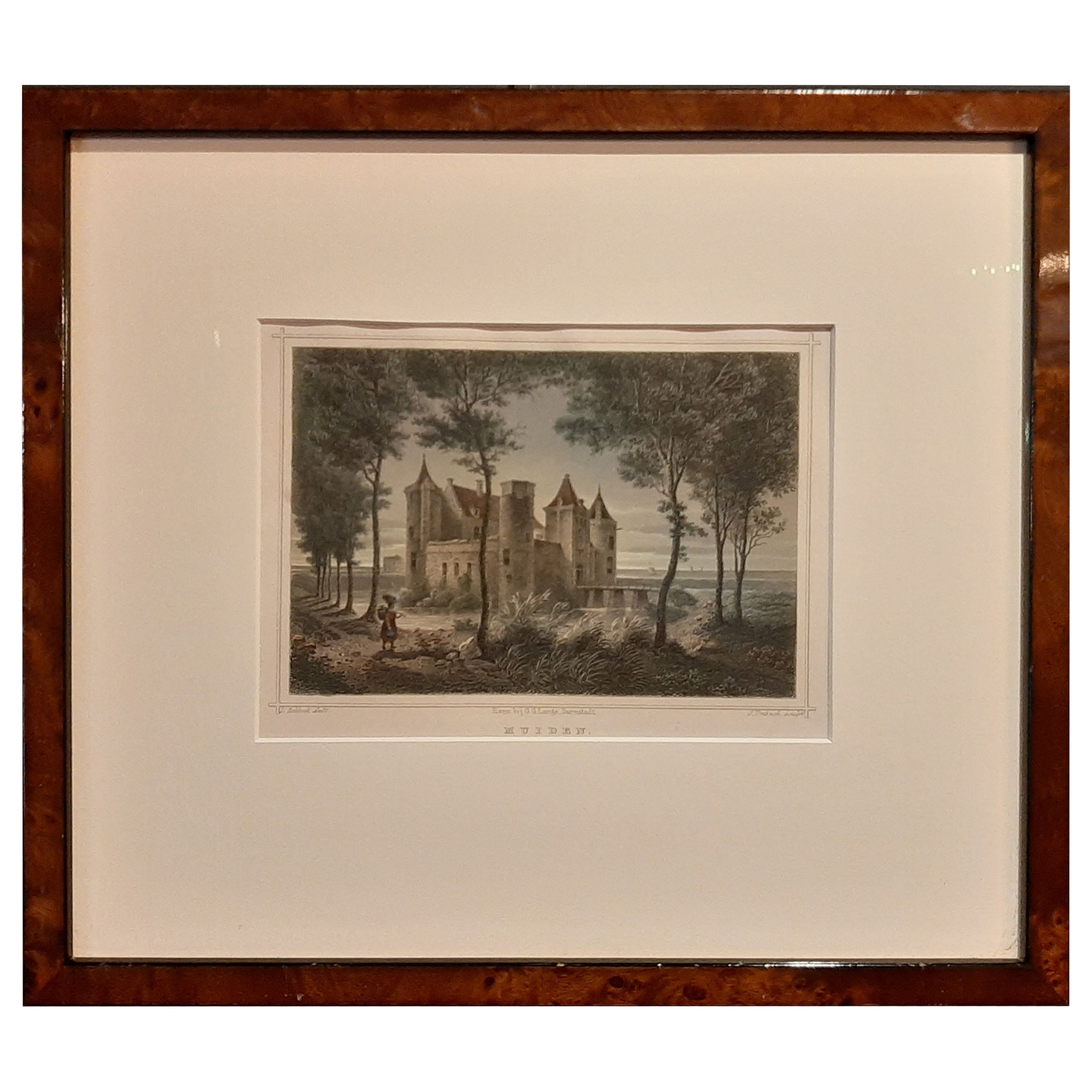
 - Nicely Framed View of Muiden Castle, the Netherlands, 1858Located in Langweer, NLAntique print titled 'Muiden'. View of Muiden Castle, the Netherlands. This print originates from 'Het koningrijk der Nederlanden voorgesteld in eene reeks van 136 naar de natuur get...Category
Antique 1850s Prints
MaterialsPaper
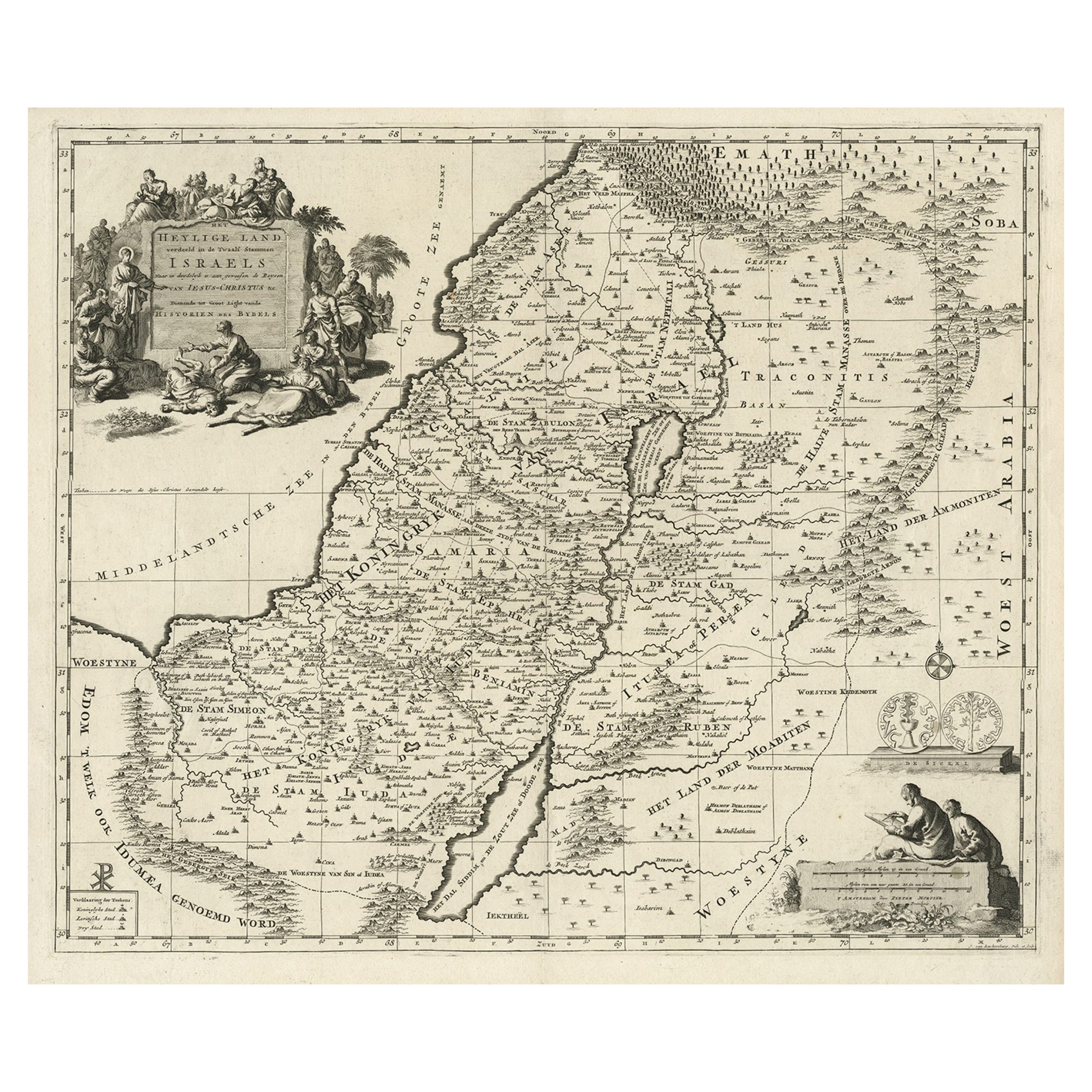
- Highly Detailed Antique Map of the Holy Land Showing 12 Tribes of Israel, c.1720Located in Langweer, NLAntique map titled 'Heylige Land verdeeld in de Twaalf Stammen Israels (..).' Highly detailed map of the Holy Land divided into 12 tribes of Israel...Category
Antique 1720s Maps
MaterialsPaper
You May Also Like
- The Holy Land at the Time of Jesus: A 17th Century Dutch Map by VisscherBy Nicolaes Visscher IILocated in Alamo, CAThis detailed Dutch map entitled "Het Beloofe de Landt Canaan door wandelt van onsen Salichmaecker Iesu Christo, nessens syne Apostelen" by Nicolaes Visscher was published in Amsterd...Category
Antique Mid-17th Century Dutch Maps
MaterialsPaper
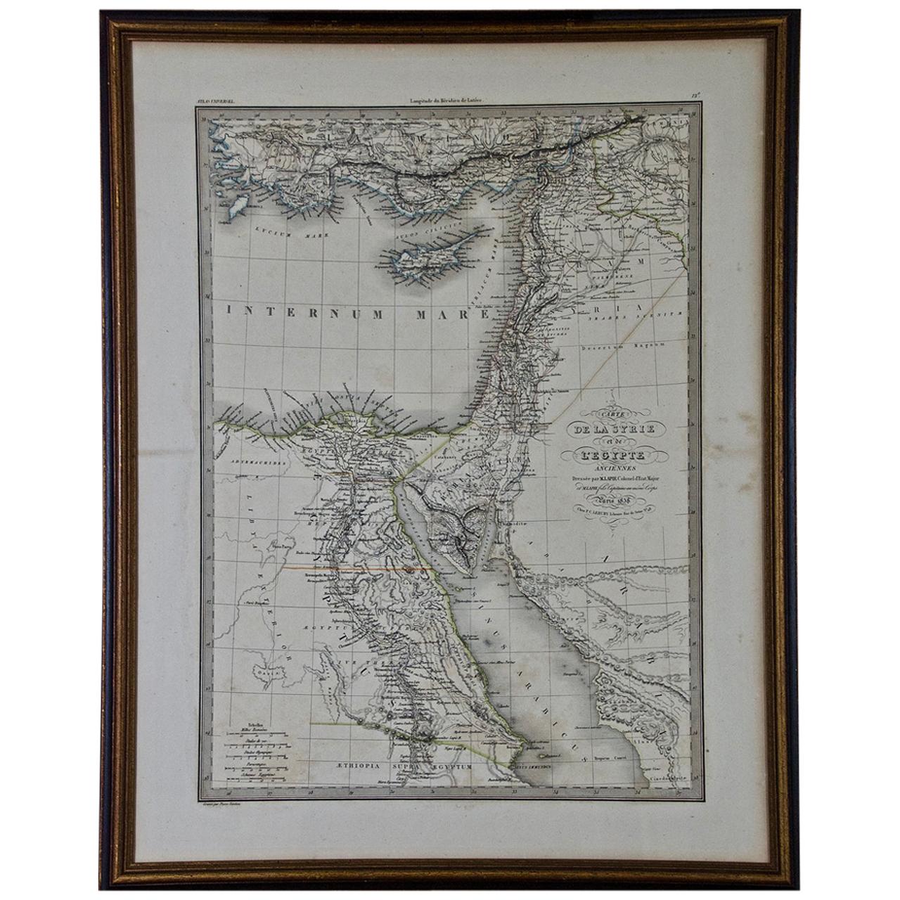
- Map of the Holy Land "Carte de la Syrie et de l'Egypte" by Pierre M. LapieBy Pierre M. LapieLocated in Alamo, CAAn early 19th century map of ancient Syria and Egypt entitled "Carte de la Syrie et de l'Egypte anciennes/dressée par M. Lapie, Colonel d'Etat Major, et...Category
Antique Early 19th Century French Maps
MaterialsPaper
- Vintage "View of the Center of Paris Taken from the Air" Lithograph MapLocated in San Diego, CAA very stylish "View of the Center of Paris Taken from the Air" lithograph map published by the Paris Ministry of Tourism, circa early 1950s. The piece measures 27" x 43" and shows...Category
20th Century French Mid-Century Modern Prints
MaterialsPaper
 $680 Sale Price20% Off
 - Flowers from The Holy Land souvenir bookLocated in East Geelong, VICContained within the olive wood covers of this Flowers from The Holy Land souvenir book are 11 thick cardboard pages, 10 of which have pressed flowers arranged on them. The flowers a...Category
Antique 1890s Israeli Books
MaterialsPaper
- N.E. View of the United States Capitol, Washington, DC Antique Proof Print 1858Located in Colorado Springs, COThis engraved print shows a view of the United States Capitol Building, in Washington, D.C. The print depicts the neoclassical building from the northeast orientation, with a bustling street scene in front. The steel engraving is a proof printing, drawn and engraved by Henry Sartain and published in 1858. Plans began in May 1854 to build a new cast-iron dome for the United States Capitol. The then-architect of the Capitol Thomas Walter and his team were sold on the aesthetics of a new dome, as well as the utility of a fire-proof one. A year later, on March 3, 1855, President Franklin Pierce...Category
Antique 1850s American Prints
MaterialsPaper
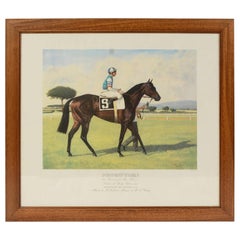
- Lithograph Depicting the Horse Winner of the Italian Derby in 1989Located in Milan, ITLithograph on paper made in the 1990s by the Salomone typography in Rome from a painting depicting Prorutori winner of the 1989 Italian Derby, ridden by M.L. Roberts. With frame 66.5...Category
1990s Italian Sports Equipment and Memorabilia
MaterialsWood, Paper


Recently Viewed
View AllMore Ways To Browse
Antique Keys Decor
Antique Key Decor
Castle Dutch
Castle Engraving
Authentic Antique Keys
Victorian African
Castle Key
Castle Keys
Antique Tapestry Framed
Framed Antique Tapestry
Pair Of Chest Nightstand
Tapestry Border
Wall Hook Hand
Large Antique Wood Doors
Louis Xvi Wood Commode
Vintage Suit Pink
Black Silk Rug
Lacquered Door Handle