Items Similar to Ancient Map of the Gulf of Naples - Drawing by Vincenzo Bizzarri -2016

Want more images or videos?
Request additional images or videos from the seller
1 of 2
Vincenzo BizzarriAncient Map of the Gulf of Naples - Drawing by Vincenzo Bizzarri -20162016
2016
$356.70
£265.66
€300
CA$500.30
A$548.69
CHF 282.98
MX$6,554.58
NOK 3,589.08
SEK 3,366.97
DKK 2,286.04
About the Item
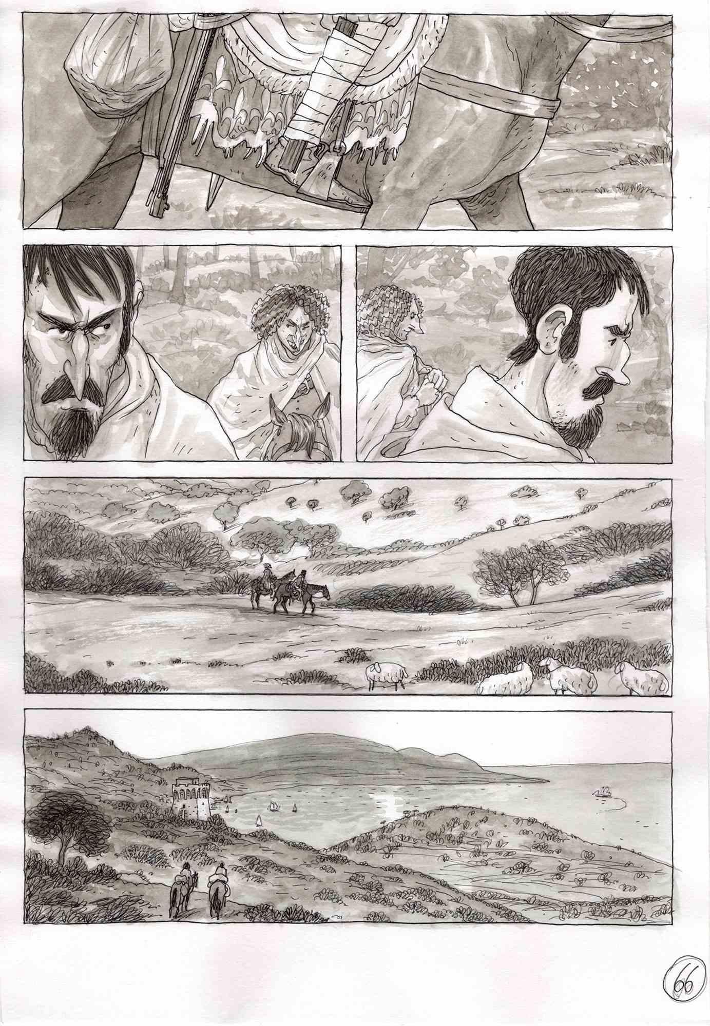
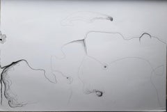
This work entitled "Ancient map of the Gulf of Naples" was made by Vincenzo Bizzarri in 2016 with ink and watercolor on rough paper 150gr (30x19cm). It is part of a series of illustrations commissioned by the superintendency of Pompeii. The condition of the work is good, it may have small imperfections (folds) and creases on the edges. The author's signature is on the front of the sheet.
Vincenzo Bizzarri
Born in 1987. In 2016 he published “Benvenuto Cellini” (Kleiner Flug) and “Il Paese dei tre santi” (Sarbacane). Republished also in Italy and Germany, the latter received the “Selection Polar” nomination at the Angouleme festival in 2018. In 2017 he published "Il Gran Ghetto" (Hazard Edizioni) and distributed together with the Gazzetta del Mezzogiorno. In 2019 he published with “1789 - La naissance d'un
monde ”and“ 1789 - La mort d'un monde ”, two albums on the French revolution and in 2021 the biographical graphic novel "Jean Gabin" (Glénat). Currently he continues to collaborate with various Italian and French publishing houses.
- Creator:Vincenzo Bizzarri
- Creation Year:2016
- Dimensions:Height: 7.56 in (19.2 cm)Width: 12.13 in (30.8 cm)Depth: 0.04 in (1 mm)
- Medium:
- Movement & Style:
- Period:
- Framing:Framing Options Available
- Condition:Insurance may be requested by customers as additional service, contact us for more information.
- Gallery Location:Roma, IT
- Reference Number:Seller: T-1300101stDibs: LU65039810712
About the Seller
4.9
Platinum Seller
Premium sellers with a 4.7+ rating and 24-hour response times
1stDibs seller since 2017
7,758 sales on 1stDibs
Typical response time: 2 hours
- ShippingRetrieving quote...Shipping from: Roma, Italy
- Return Policy
Authenticity Guarantee
In the unlikely event there’s an issue with an item’s authenticity, contact us within 1 year for a full refund. DetailsMoney-Back Guarantee
If your item is not as described, is damaged in transit, or does not arrive, contact us within 7 days for a full refund. Details24-Hour Cancellation
You have a 24-hour grace period in which to reconsider your purchase, with no questions asked.Vetted Professional Sellers
Our world-class sellers must adhere to strict standards for service and quality, maintaining the integrity of our listings.Price-Match Guarantee
If you find that a seller listed the same item for a lower price elsewhere, we’ll match it.Trusted Global Delivery
Our best-in-class carrier network provides specialized shipping options worldwide, including custom delivery.More From This Seller
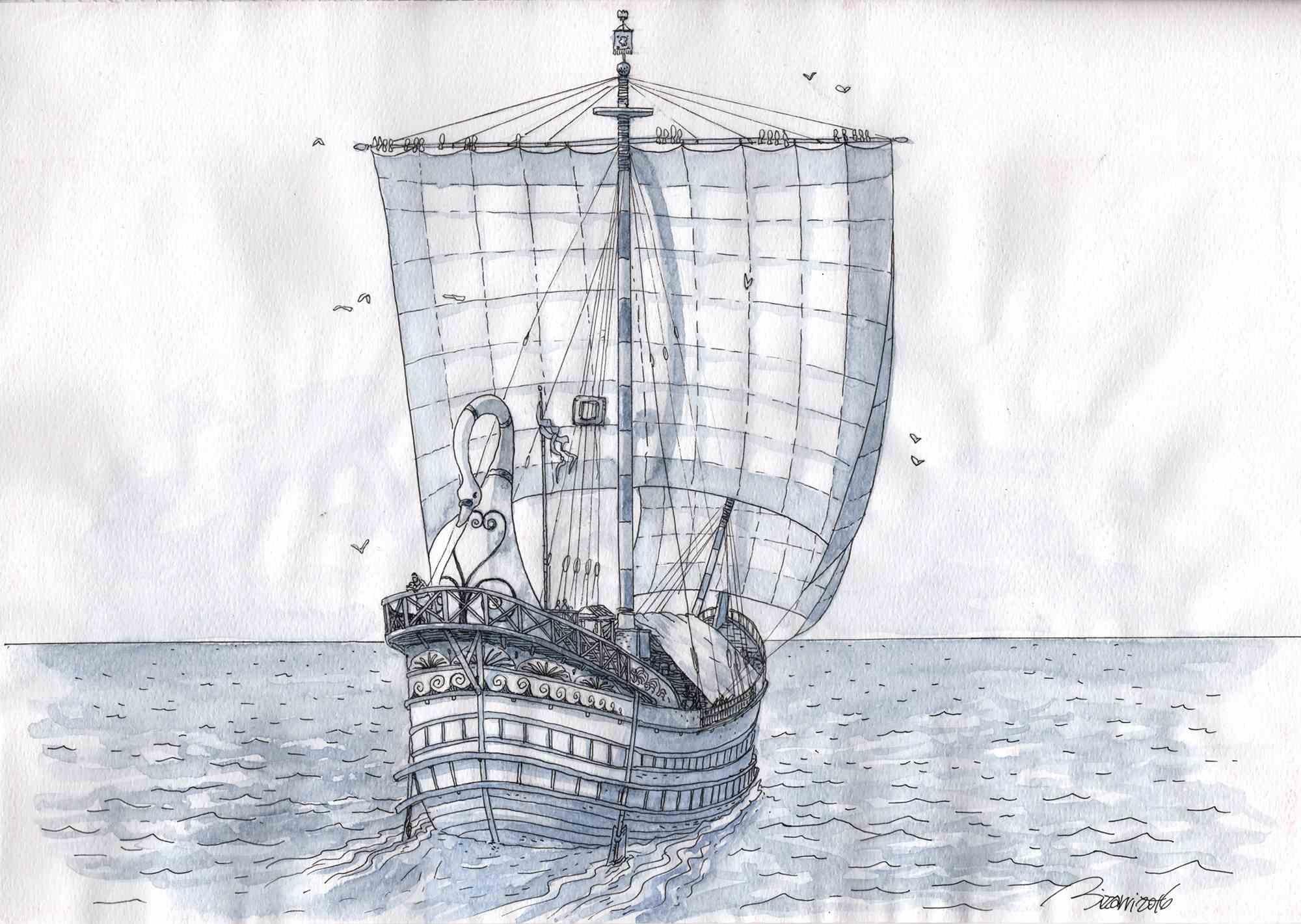
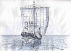
View AllRoman Merchant Ship - Drawing by Vincenzo Bizzarri -2016
Located in Roma, IT
This work entitled "Roman merchant ship" was made by Vincenzo Bizzarri in 2016 with ink and watercolor on rough paper 150gr (23,3x33 cm). It is part of a...
Category
Early 2000s Contemporary Drawings and Watercolor Paintings
Materials
Watercolor, Ink
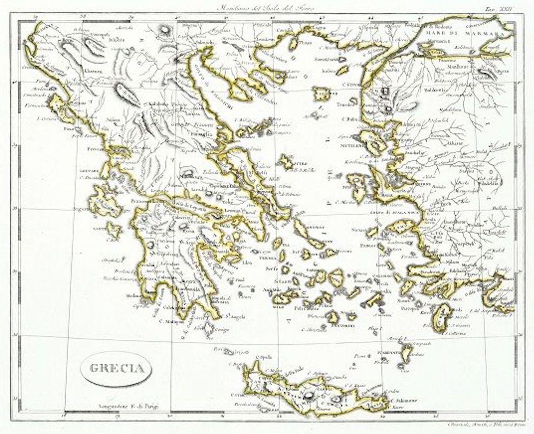
Map of Greece - Etching on Paper 19th Century
Located in Roma, IT
Image dimensions: 22.2 x 27.8 cm.
Grecia is an interesting hand-colored etching on paper, realized by an anonymous artist in the first half of the XIX century.
With the inscriptions in Italian, this original print describes the geography of Greece with the great charisma of the antique maps.
In very good conditions, except for a usual yellowing of the paper at the edges and minor defects and signs of the time, and some light yellow strips...
Category
19th Century Modern Figurative Prints
Materials
Etching

Arrival in the Kingdom of Naples - Illustration by Vincenzo Bizzarri -2015
Located in Roma, IT
This work entitled "Arrival in the Kingdom of Naples" is a board of the graphic novel published in 2016 by Kleiner Flug in Italy "Benvenuto Cellini". The...
Category
Early 2000s Contemporary Drawings and Watercolor Paintings
Materials
Ink, Permanent Marker
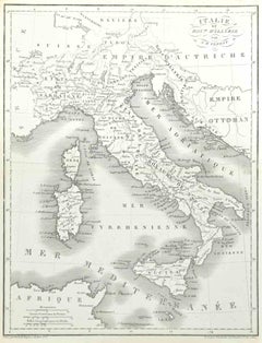
Map of Italy - Etching by Pierre François Tardieu - 1837
Located in Roma, IT
Map of Italy is an Etching realized in 1837.
Good conditions.
The artwork is realized in a well-balanced composition. the artwork and belongs to the suite suite "AtlasBatt" realize...
Category
1830s Modern Figurative Prints
Materials
Lithograph
Map of Greece - Original Etching by Antonio Zatta - 18th Century
Located in Roma, IT
This Map of Greece is an etching realized by Antonio Zatta, Cartographer, publisher and typographer.
The state of preservation of the artwork is good except for the worn paper and t...
Category
1780s Figurative Prints
Materials
Etching

Antique Map - Mar Di Athiopia - Etching by Johannes Janssonius - 1650s
By Johannes Janssonius
Located in Roma, IT
Antique Map - Mar Di Athiopia is an antique map realized in 1650 by Johannes Janssonius (1588-1664).
The Map is Hand-colored etching, with coeval watercolorang.
Good conditions wit...
Category
1650s Modern Figurative Prints
Materials
Etching

You May Also Like
Chroessi Schnell - "Surreal Maps" - surrealist abstract forms of a dream
Located in Winterswijk, NL
Chroessi Schnell - "Surreal Maps".
Surrealism, abstract forms, dream universe.
They are Alienations of the maps of "Münsterland" where my mother was born and grew up as a farmers d...
Category
21st Century and Contemporary Surrealist Drawings and Watercolor Paintings
Materials
Paper
Italian Contemporary Art by Fred Borghesi - Map of the Mind
Located in Paris, IDF
Watercolor and Ink on paper,
Fred Borghesi is an Italian artist born in 1987 who lives and works in London, UK. He is above all a multidisciplinary artist, constantly switching betw...
Category
2010s Abstract Drawings and Watercolors
Materials
Ink, Watercolor, Paper
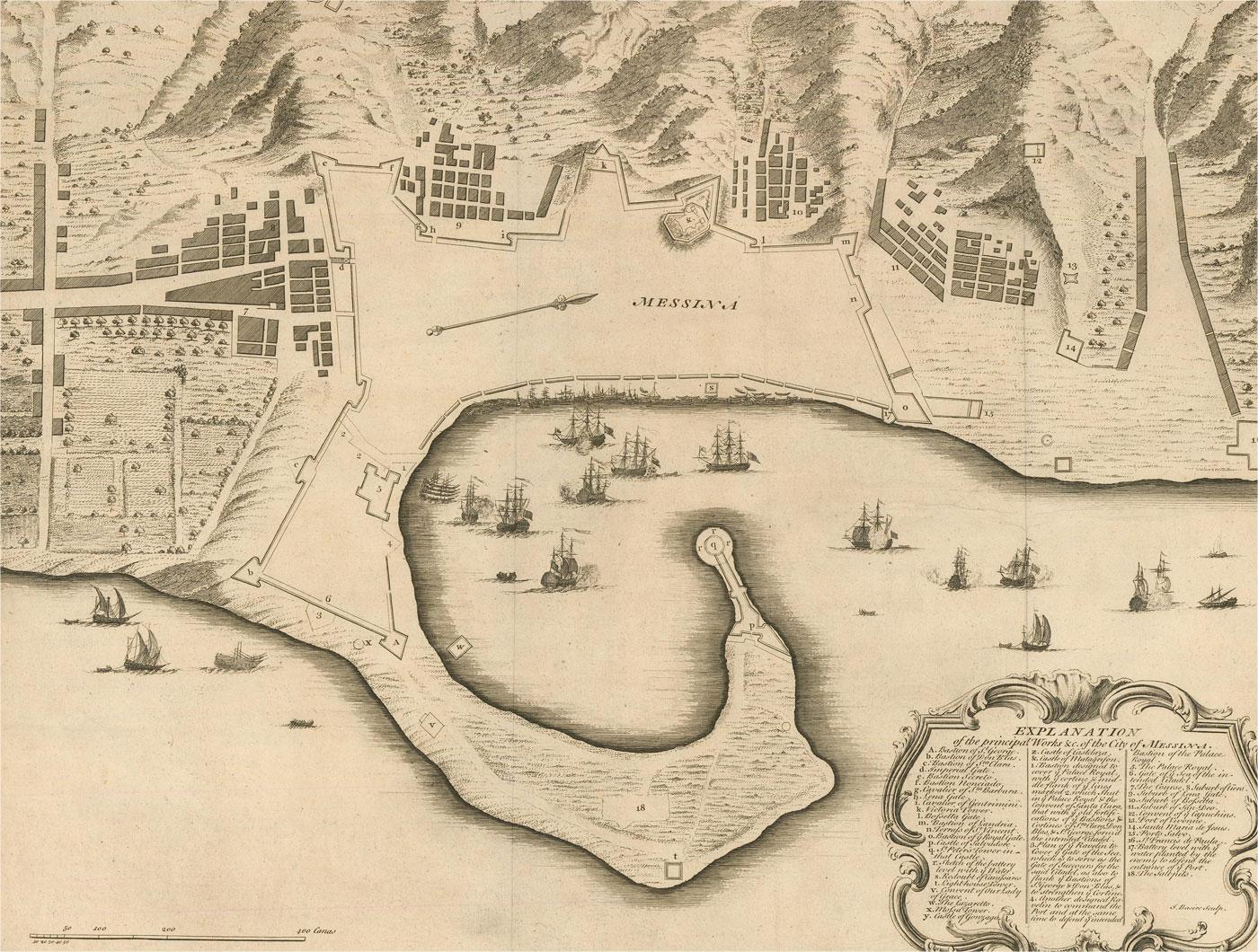
18th Century Map Engraving - Plan of the Works of the City of Messina, Sicily
Located in Corsham, GB
A map of Messina, a harbour city in northeast Sicily. Inscribed with the title in plate to the lower edge, 'Plan of the Works of the City of Messina, one of the strongest and most co...
Category
18th Century More Prints
Materials
Engraving

$285 Sale Price
20% Off
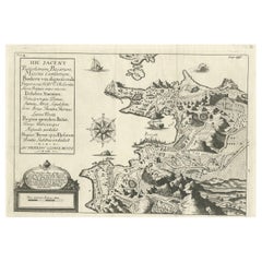
Old Original Map of Pozzuoli Near Naples in the Campania Region, Italy, ca.1740
Located in Langweer, NL
Antique map titled 'Hic Jacent Puteolorum Bajarum (..)'. Old map of the region of Pozzuoli showing the topographic and architectural features of interest. Pozzuoli is a city and comu...
Category
Antique 1740s Maps
Materials
Paper
$332 Sale Price
20% Off
Mediterranean and Adriatic Seas: Original 18th Century Hand-colored Map by Bowen
Located in Alamo, CA
This is an original 18th century hand-colored map entitled "An Accurate Chart of The Mediterranean and Adriatic Sea's; with the Archipelago & Part of the Black Sea. Exhibiting all th...
Category
Mid-18th Century Old Masters Landscape Prints
Materials
Engraving

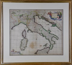
17th Century Dutch Map of Italy, Sicily, Sardinia, Corsica and Dalmatian Coast
By Theodorus Danckerts
Located in Alamo, CA
This hand colored 17th century Dutch map entitled "Novissima et Accuratissima totius Italiae Corsicae et Sardiniae Descriptio" by Theodore Danckerts depicts the Italian Peninsula in ...
Category
1690s Prints and Multiples
Materials
Engraving
More Ways To Browse
Ancient Maps
Painting Of Naples
Landscape Drawings Flowers
Vintage Building Drawings
Beach Scene Watercolor
Watercolor Iris
Watercolor Village Scene
Watercolors Of Venice
Drawing Of A House
Watercolor Flowers Vase
Profile Woman Painting
Watercolor Ocean
Marine Watercolours
Large Landscape Drawing
Paris Fashion Drawing
Watercolor Paintings Of Gardens
Marie Amelie Chautard Carreau
Octopus Print