
Want more images or videos?
Request additional images or videos from the seller
1 of 5
John SenexGreat Britain 1710 [-1728].
1710 [-1728].
$2,903.23
£2,150
€2,505.09
CA$4,074.99
A$4,444.59
CHF 2,336.92
MX$53,337.05
NOK 29,506.22
SEK 27,521.25
DKK 18,709.34
About the Item
Great Britain
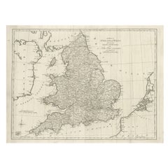
SENEX, John.
A New Map of Great Britain Corrected from the Observations communicated to the Royal Society at London. By John Senex F.R.S. To the Right Hono[ra]ble William Connelly ESQ. One of the Commissioners of His Maj[es]ties Revenue, Speakerof the Hono[a]ble House of Commons, and one of His Maj[es]ties most Hono[ra]ble Privy Council for Ye Kingdom of Ireland. This Map is dedicated by John Senex.
John Senex F.R.S. 1710 [-1728].
John Senex (1678-1740) was one of the foremost mapmakers in England in the early eighteenth century. He was also a surveyor, globemaker, and geographer. As a young man, he was apprenticed to Robert Clavell, a bookseller. He worked with several mapmakers over the course of his career, including Jeremiah Seller and Charles Price. In 1728, Senex was elected as a Fellow of the Royal Society, a rarity for mapmakers. The Fellowship reflects his career-long association as engraver to the Society and publisher of maps by Edmund Halley, among other luminaries. He is best known for his English Atlas (1714), which remained in print until the 1760s. After his death in 1740 his widow, Mary, carried on the business until 1755. Thereafter, his stock was acquired by William Herbert and Robert Sayer (maps) and James Ferguson (globes).
Double-page engraved map on 2 sheets joined, with full contemporary hand-colouring, size: 942 mm x 647 mm, sheet size: 970 x 680 mm.
Stain on upper left, minor creasing to the folds and some light soiling.
- Creator:
- Creation Year:1710 [-1728].
- Dimensions:Height: 38 in (96.52 cm)Width: 26.75 in (67.95 cm)
- Medium:
- Movement & Style:
- Period:1710-1719
- Condition:
- Gallery Location:London, GB
- Reference Number:Seller: 1084571stDibs: LU1419212313672
About the Seller
5.0
Vetted Professional Seller
Every seller passes strict standards for authenticity and reliability
Established in 1979
1stDibs seller since 2020
19 sales on 1stDibs
Typical response time: 5 hours
- ShippingRetrieving quote...Shipping from: London, United Kingdom
- Return Policy
More From This Seller
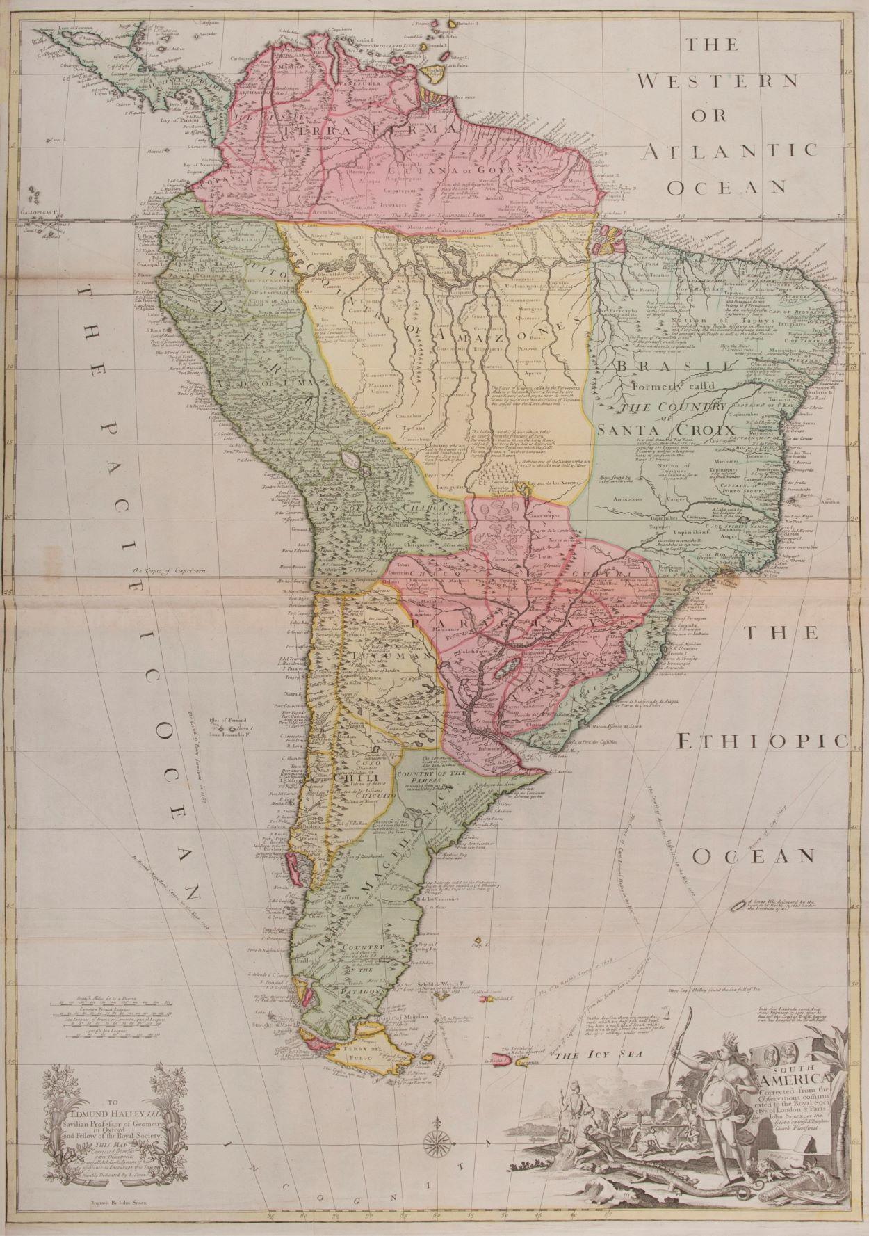
View AllSouth America
By John Senex
Located in London, GB
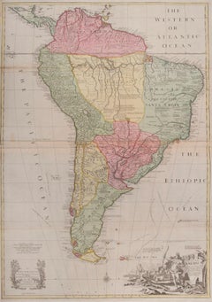
South America
SENEX, John.
South America Corrected from the Observations Communicated to the Royal Society’s of London & Paris. By John Senex. To Edmund Halley. LLD. Savilian Professor of Geometry in Oxford and Fellow of the Royal Society. This Map corrected from His own Discoveries In gratefull Acknowledgement of his Ready assistance to Encourage this Designe is Humbly Dedicated.
John Senex, at the Globe against St Dunstans Church, Fleetstreet, London 1710 [-1728].
John Senex (1678-1740) was one of the foremost mapmakers in England in the early eighteenth century. He was also a surveyor, globemaker, and geographer. As a young man, he was apprenticed to Robert Clavell, a bookseller. He worked with several mapmakers over the course of his career, including Jeremiah Seller and Charles...
Category
1710s Naturalistic More Art
Materials
Watercolor, Engraving
$4,051
Railway Map of India.
Located in London, GB
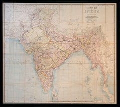
THUILLIER, Colonel Henry Ravenshaw.
Railway Map of India. Railways Brought up to October 1895. Scale 1 Inch = 48 miles or 1:3,041,280.
[Calcutta], Published under the direction of Colonel H. Thuillier, R.E., Surveyor General of India, October 1890.
A comprehensive railway map of British India, including the subcontinent and Burma, also displaying the main road networks, navigable canals, steamship routes, and telegraph connections across the peninsular. This publication by the Survey of India Office includes a useful ‘References’ key giving information on the differing gauges in use across the region, and a colour code highlighting the lands under direct British administration in pink, ‘Tributary States’ in yellow and ‘Independent & Foreign Possessions’ in Green. A notice records the price for colour as ‘Five Rupees’, as against ‘Four Rupees’ without.
Prepared under the direction of Colonel Henry Ravenshaw Thuillier, who as his father before him, served as Surveyor General of India from 1887 to 1895. Here Baluchistan is shown as an enclave of the British Raj. This strategically important territory lies in modern-day Pakistan, and is situated around the natural fort town of Quetta located high in the Chiltan mountains. It came under direct British rule in 1876, securing the vital Bolan Pass though which British troops under the command of General Michael Biddulph passed during the Second Anglo-Afghan War...
Category
1890s Other Art Style More Art
Materials
Lithograph
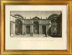
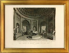
FEOLI. Vedute del Museo Pio-Clementino
By Vincenzo Feoli
Located in London, GB
Magnificent large plate illustrating the Vatican Museum at the end of the eighteenth century by Vincenzo Feoli (1750 - 1831) after Miccinelli and Costa.
The Pio-Clementino museum, n...
Category
1790s Naturalistic Interior Prints
Materials
Engraving, Handmade Paper
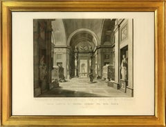
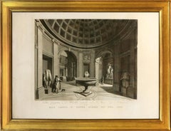
FEOLI. Vedute del Museo Pio-Clementino
By Vincenzo Feoli
Located in London, GB
Magnificent large plate illustrating the Vatican Museum at the end of the eighteenth century by Vincenzo Feoli (1750 - 1831) after Micenelli and Costa.
The Pio-Clementino museum, na...
Category
1790s Naturalistic Interior Prints
Materials
Engraving, Handmade Paper
FEOLI. Vedute del Museo Pio-Clementino
By Vincenzo Feoli
Located in London, GB
Magnificent large plate illustrating the Vatican Museum at the end of the eighteenth century by Vincenzo Feoli (1750 - 1831) after Miccinelli and Costa.
The Pio-Clementino museum, n...
Category
1790s Naturalistic Interior Prints
Materials
Color, Engraving
You May Also Like
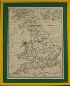
"Britannia"
Located in Bristol, CT
Drawn and engraved by Edw. Weller for Dr William Smith's 'Ancient Atlas' plate No. 10
Map Sz: 22 1/2"H x 17 3/8"W
Frame Sz: 27 1/8"H x 22"W
Category
1870s Prints and Multiples
Materials
Paper
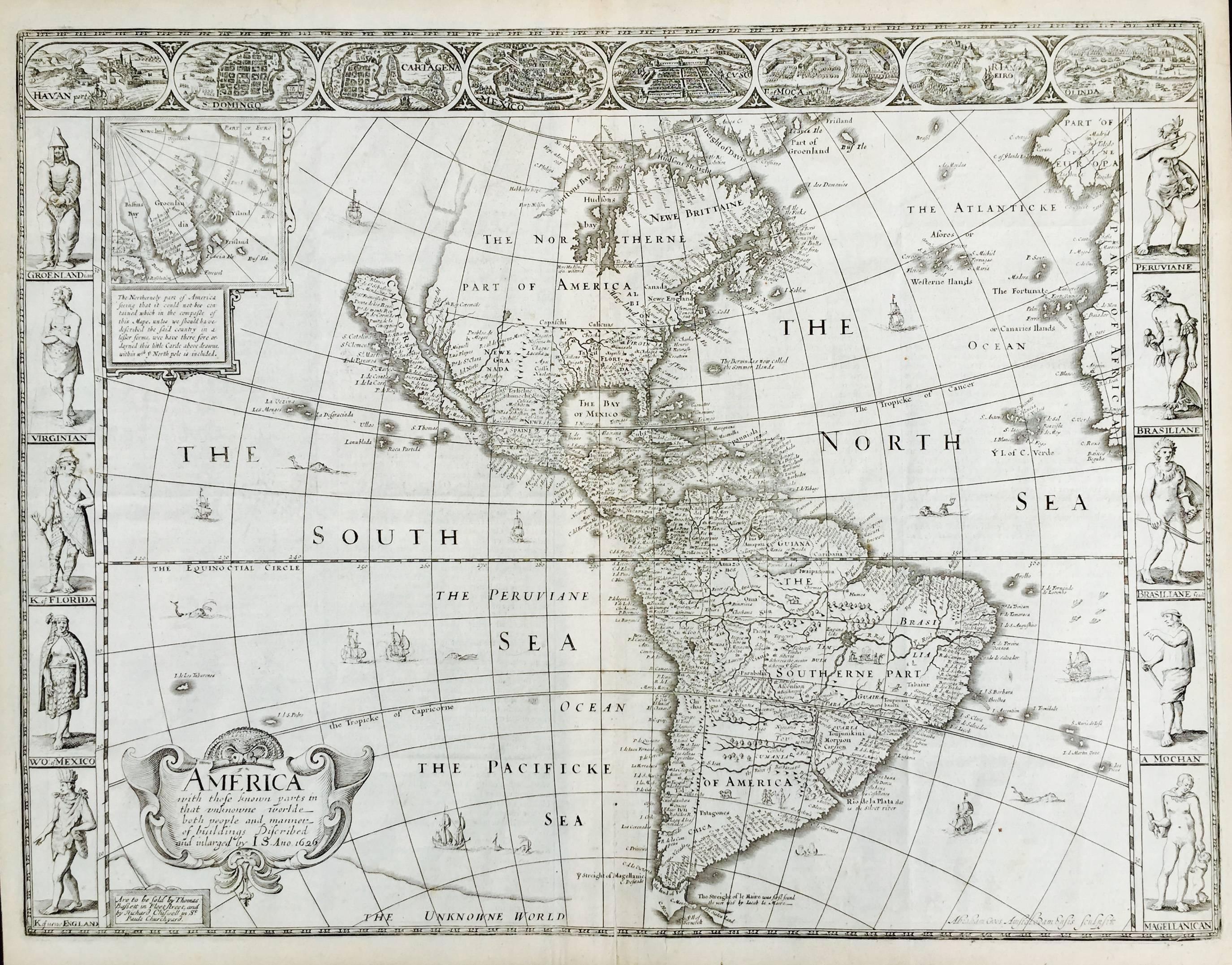
AMERICA
By John Speed
Located in Santa Monica, CA
IMPORTANT AMERICAN MAP - ONE OF THE FIRST TO SHOW CALIFORNIA as an ISLAND
JOHN SPEED (1552-1629)
AMERICA - With Those Known Parts In That Unknown Worlde (sic),
1626-(76)
(Burden 217 iv/iv) Engraving, uncolored. Engraved by Abraham Goos and
published by Thomas Basset and Richard Chiswell - 4th state of 4 in 1676
15 1/8 x 20 1/2” From “A Prospect of the Most Famous Parts of the
World”. Generally good condition. A repaired split in lower centerfold. This
is the most common version of this important map...
Category
1620s Old Masters Landscape Prints
Materials
Engraving

$4,080 Sale Price
52% Off
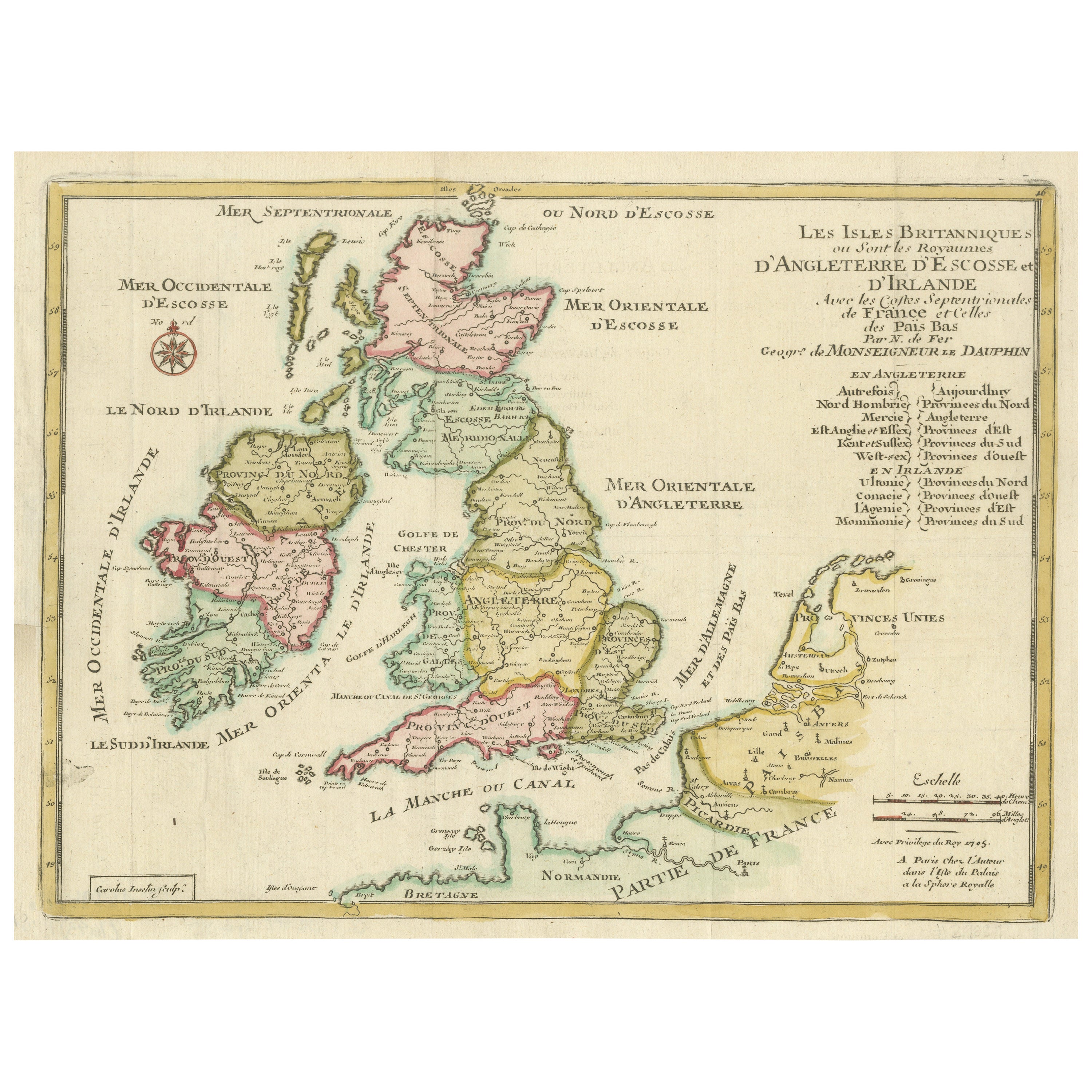
Original Antique Map of England, Ireland, Scotland and Wales
Located in Langweer, NL
Antique map titled 'Les Isles Britanniques, ou sont les Royaumes d Angleterre (..)'. Detailed map of England, Ireland, Scotland and Wales, with French coast and part of the Netherlan...
Category
Antique Early 18th Century Maps
Materials
Paper

$274 Sale Price
20% Off
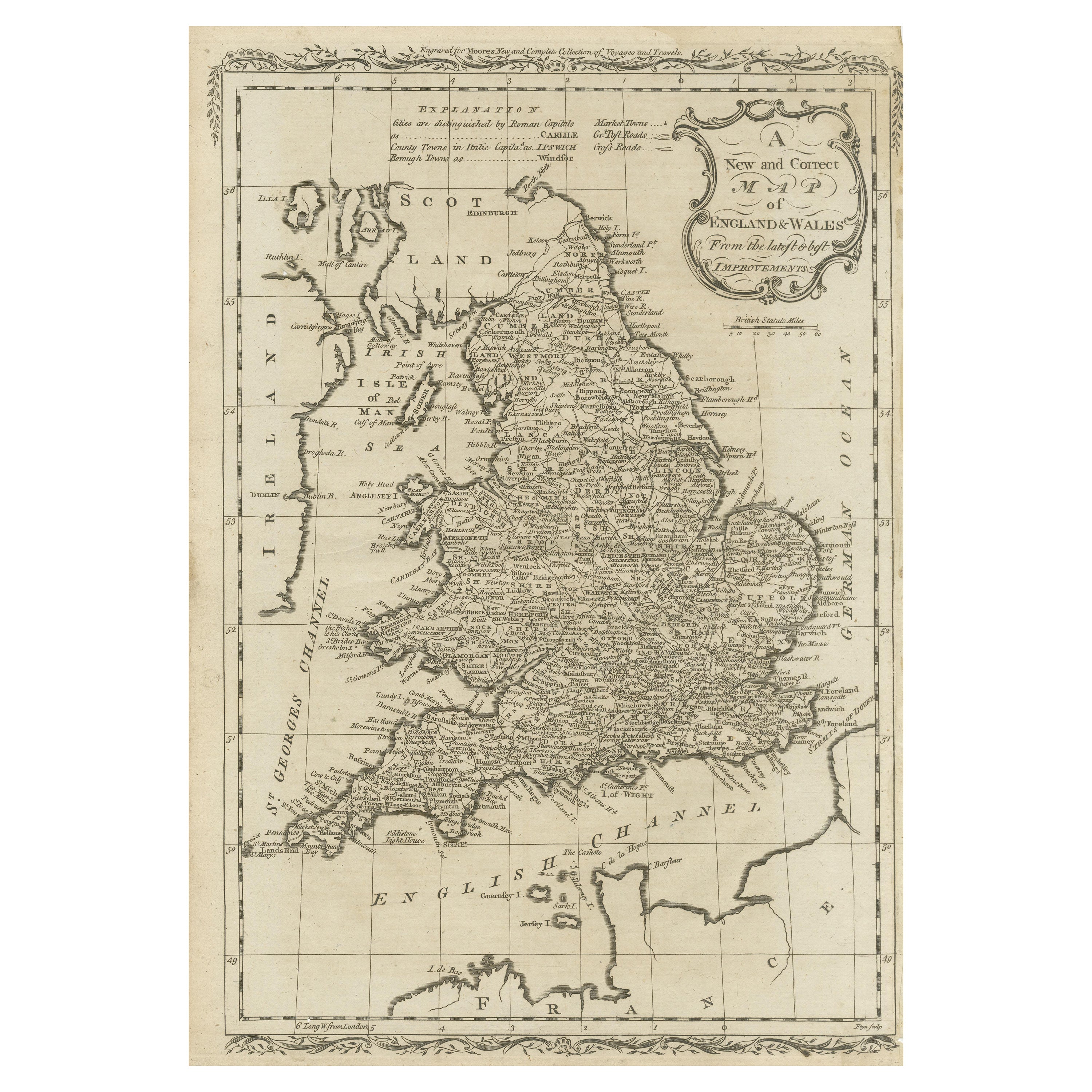
Original Antique Map of England and Wales
Located in Langweer, NL
Antique map titled 'A New and Correct Map of England and Wales from the Latest and Best Improvements'. Original antique map of England and Wales. Printed by Alex Hogg, London for George Henry Millar's 'New, Complete and Universal System...
Category
Antique Late 18th Century Maps
Materials
Paper

$226 Sale Price
20% Off
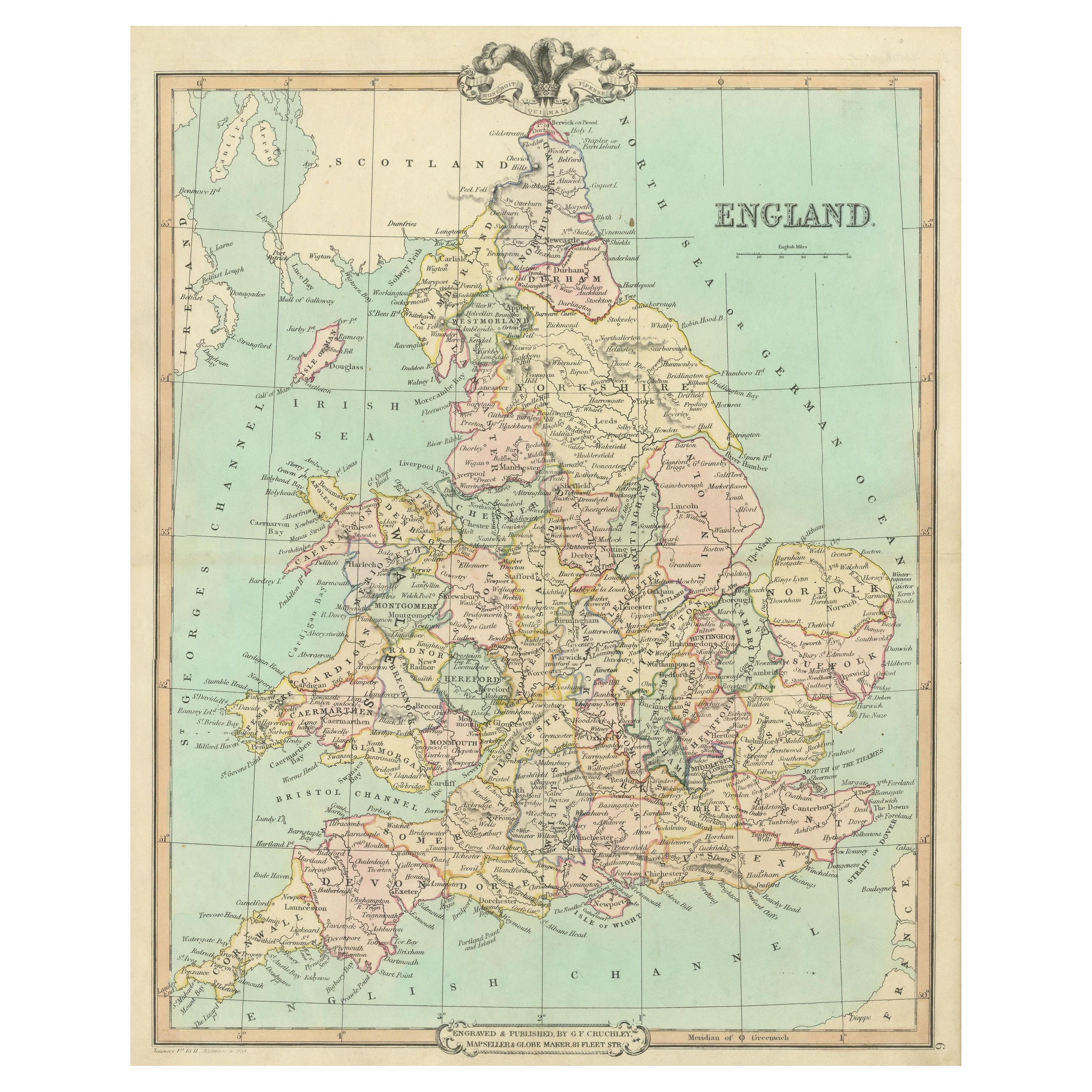
Antique Map of England and Wales, Also Including the Isle of Man
Located in Langweer, NL
Antique map titled 'England'. Original antique map of England and Wales from Northumberland to Cornwall from the St. George Channel east as far as the Strait of Dover. The Isle of Ma...
Category
Antique Mid-19th Century Maps
Materials
Paper

$368 Sale Price
20% Off
Large Antique Map England and Wales, with Part of the Coastlines
Located in Langweer, NL
Antique map titled 'A Map of England and Wales (..)'. Large antique map of England and Wales, with part of the continental and Irish coasts. Published J. Blair, circa 1779.
Category
Antique Late 18th Century Maps
Materials
Paper
$548 Sale Price
20% Off