Items Similar to Antique Manuscript Map - Forest of Andely
Want more images or videos?
Request additional images or videos from the seller
1 of 5
UnknownAntique Manuscript Map - Forest of AndelyCirca 1890
Circa 1890
$500
£387.79
€439.55
CA$715.59
A$781.93
CHF 405.38
MX$9,341.21
NOK 5,158.66
SEK 4,829.73
DKK 3,282.21
About the Item
Charming hand drawn ink and watercolor map of the Forest of Andely, in the Normandy area, France, circa 1890.
Original artwork on paper displayed on a white mat with a gold border. Archival plastic sleeve and Certificate of Authenticity included. Artwork, 20"L x 14.25"H; mat, 24"L x 18"H.
Enjoy a single shipping fee on combined purchases you make from MAPSandART
- Creation Year:Circa 1890
- Dimensions:Height: 24 in (60.96 cm)Width: 0.1 in (2.54 mm)Depth: 18 in (45.72 cm)
- Medium:
- Period:
- Condition:age toning, folds.
- Gallery Location:Houston, TX
- Reference Number:Seller: 10818D1stDibs: LU10421188003
About the Seller
5.0
Platinum Seller
Premium sellers with a 4.7+ rating and 24-hour response times
Established in 2001
1stDibs seller since 2015
1,071 sales on 1stDibs
Typical response time: 1 hour
- ShippingRetrieving quote...Shipping from: Houston, TX
- Return Policy
More From This Seller
View AllAncient World Map
Located in Houston, TX
Over 150 year old engraved map of the world as it was known during the antiquities by cartographer Delamarche from 1838. Original hand color. Shows African, European and Asian cont...
Category
1830s More Prints
Materials
Ink, Watercolor, Handmade Paper
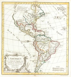
Map of Americas
Located in Houston, TX
Over 200 year old engraved map of Americas by Robert de Vaugondy from 1783. Original hand color. Shows North, Central and South Americas. Note the po...
Category
1780s More Prints
Materials
Ink, Watercolor, Handmade Paper
Map of Europe, 1844
Located in Houston, TX
Over 150 year old engraved map of Europe by Olney from 1844. Original hand color. Shows Northern Europe, Prussia and Germany.
Original antique map o...
Category
1840s More Prints
Materials
Ink, Watercolor, Handmade Paper

Map of Denmark, 1724
Located in Houston, TX
Extraordinary copper engraved map of Denmark by cartographer Christoph Weigel from 1724. Shows counties, rivers and towns. Ornate title cartouche. Original hand-color. Over 250 years old.
Original antique map displayed...
Category
17th Century Other Art Style More Prints
Materials
Paper, Ink, Watercolor

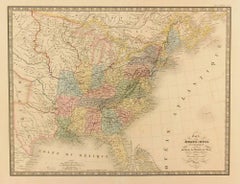
United States, 1844
Located in Houston, TX
Over 150 year old map of early United States of America with Western Districts from 1844. Original hand color. Districts shown include Hurons, Sioux, Mandans, Osages, and Ozark. Note independent Republic of Texas...
Category
1840s More Prints
Materials
Ink, Watercolor, Handmade Paper
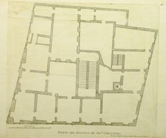
Antique Italian Engraving - Crescenzi Palace
By Giovanni Giacomo de Rossi
Located in Houston, TX
Antique copper engraving of the floor plan to Crescenzi Palace in Rome, Italy by Italian Giovanni Giacomo de' Rossi, 1650.
Original artwork on paper displayed on a white mat with a...
Category
15th Century and Earlier Interior Prints
Materials
Paper, Ink
$250 Sale Price
50% Off
You May Also Like
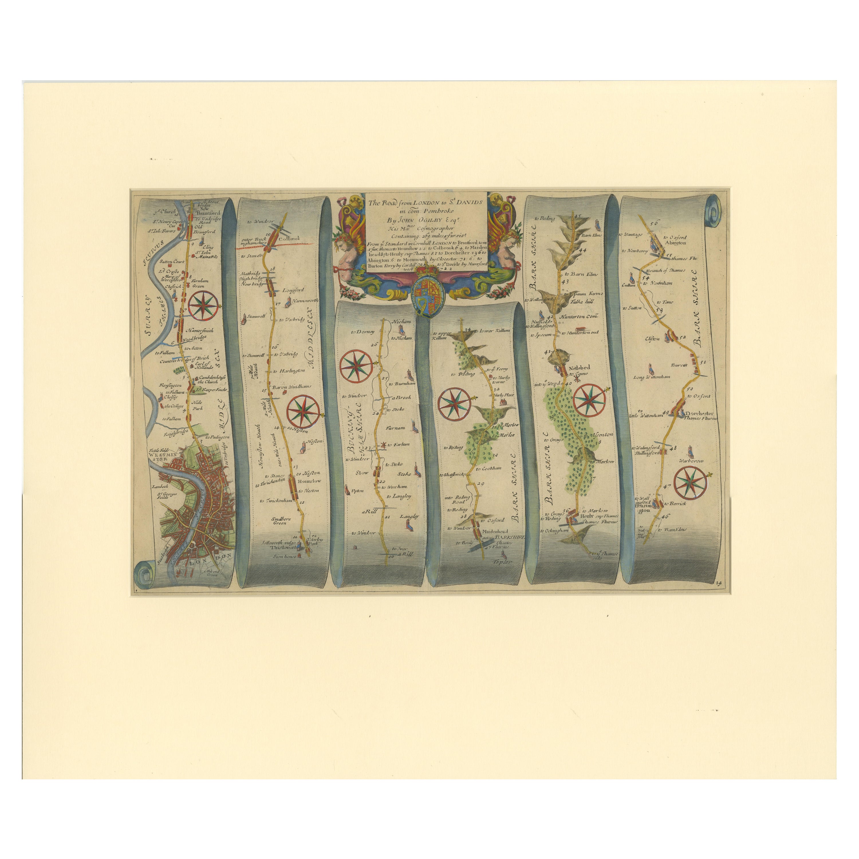
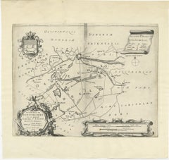
Original Antique Map of the Road from London to Bensington
Located in Langweer, NL
Antique map titled 'The Road from London to St. Davids in com: Pembroke (..)'. A strip map of the road from London to Bensington. The map is ornamented with numerous compass roses, a...
Category
Antique Late 17th Century Maps
Materials
Paper
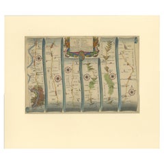
$511 Sale Price
20% Off
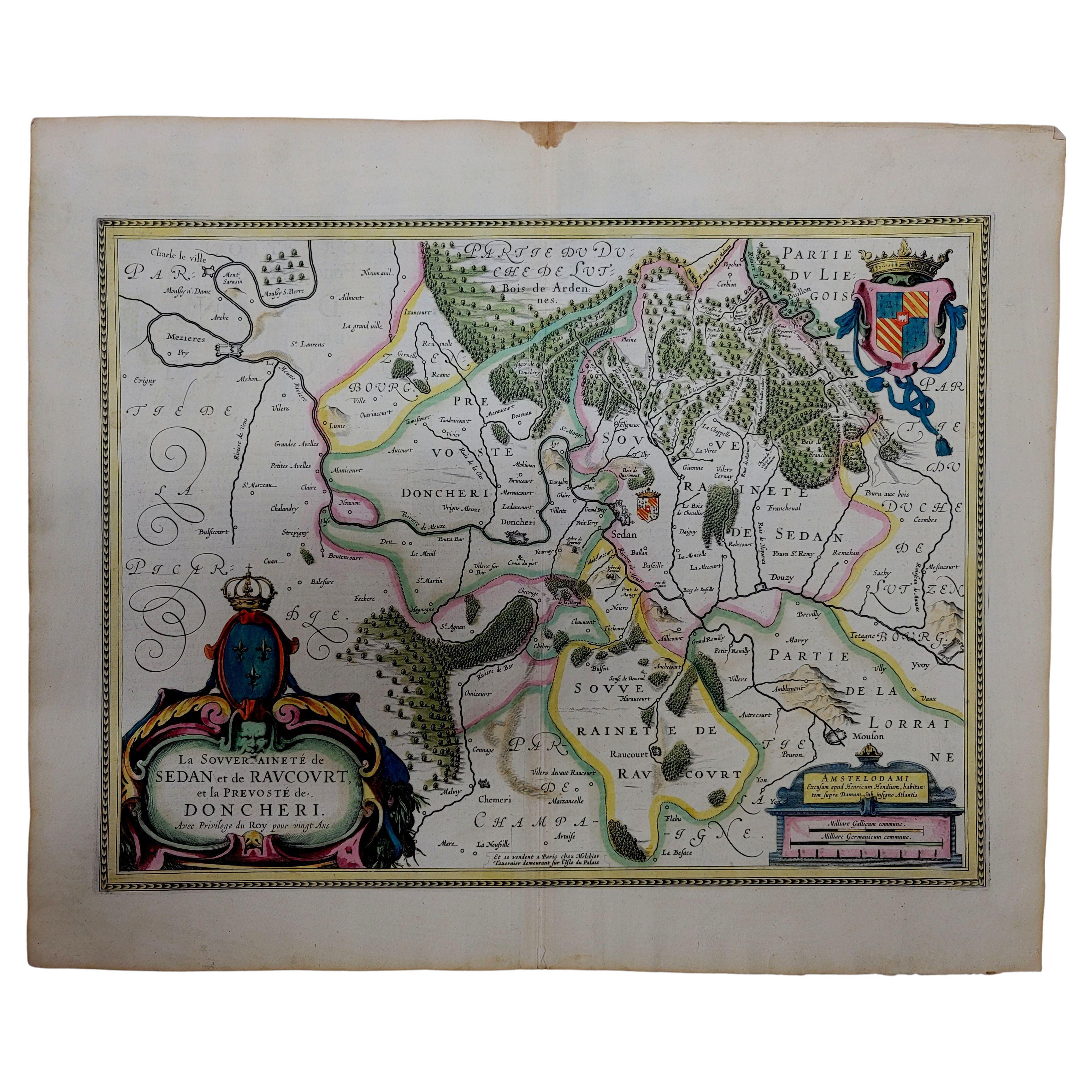
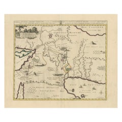
1633 Map "La Souverainete De Sedan Et De Raucourt, Et La Prevoste Ric0011
Located in Norton, MA
1653 map entitled
"La Souverainete de Sedan et de Raucourt, et la Prevoste de Doncheri,"
Ric0011
Description:
Lovely map centered on Sedan and Doncheri and the Meuze River fr...
Category
Antique 17th Century Dutch Maps
Materials
Paper

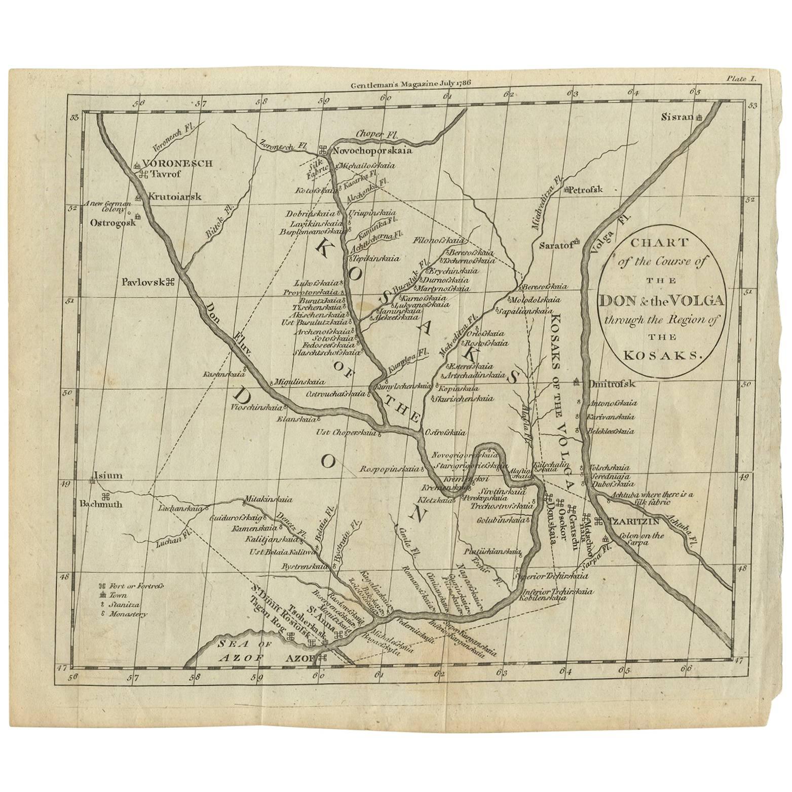
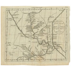
Antique Map of the course of the Don & Voga rivers
Located in Langweer, NL
Antique map titled 'Chart of the Course of The Don & the Volga through the Region of The Kosaks'. SW Russia & Ukraine: interesting map showing the course of th...
Category
Antique Late 18th Century Maps
Materials
Paper
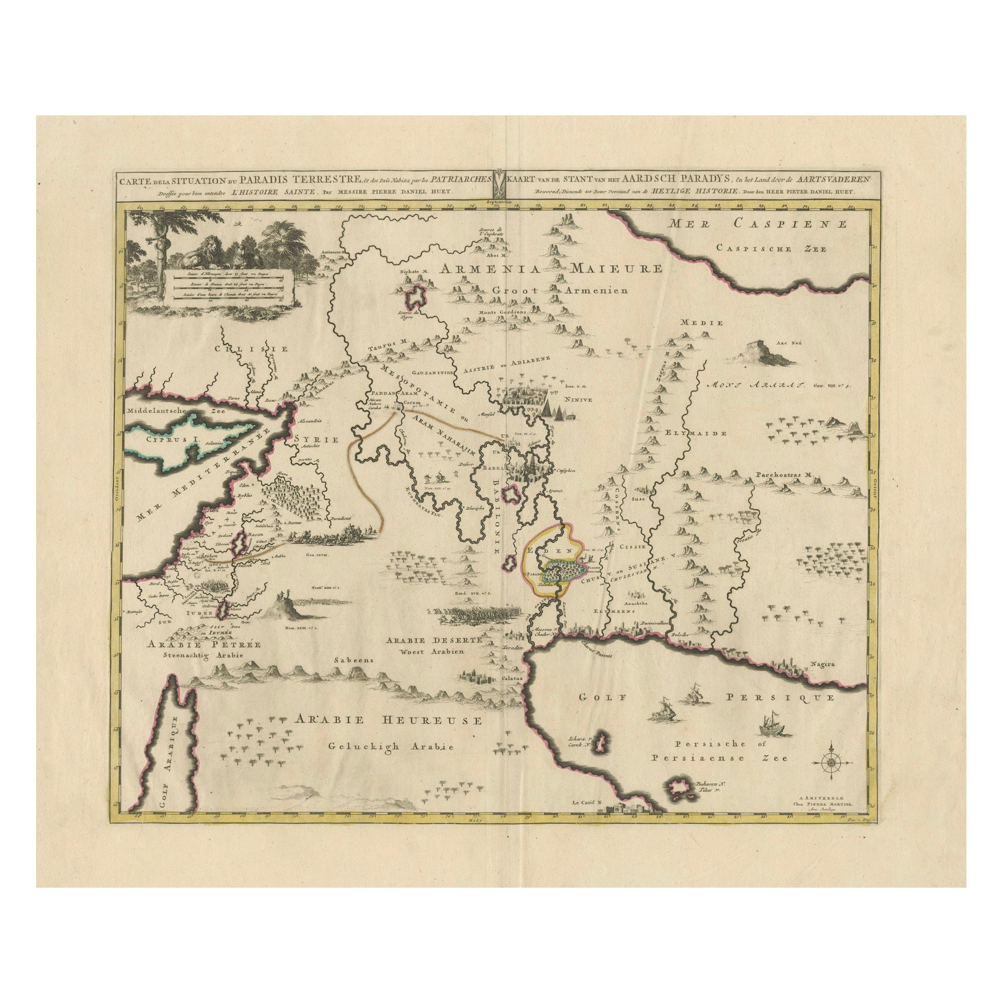
Antique Map of the Location of the Garden of Eden and Travels of the Patriarchs
Located in Langweer, NL
Title: Map of the Location of the Garden of Eden and Travels of the Patriarchs
Cartographer/Publisher:
Pieter Mortier (1661–1711), published by Covens & Mortier (Amsterdam, 1725)...
Category
Antique 1720s Maps
Materials
Paper
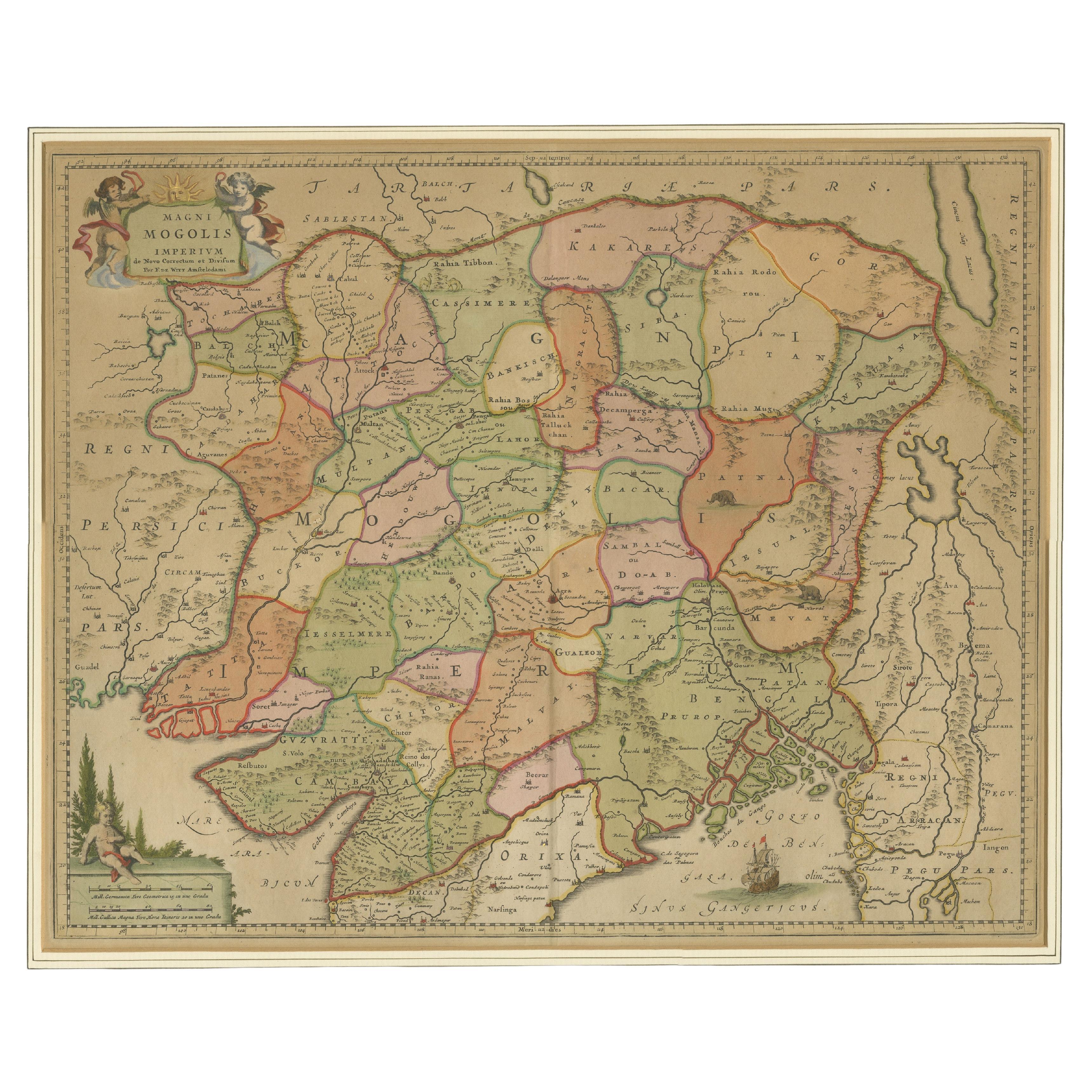
Antique Map of the Empire of the Great Mogul
Located in Langweer, NL
Antique map titled 'Magni Mogolis Imperium'. This map depicts the Empire of the Great Mogul in northern India including the region from Iran to Burma. The Indus and Ganges Rivers are...
Category
Antique Late 17th Century Maps
Materials
Paper
$908 Sale Price
20% Off
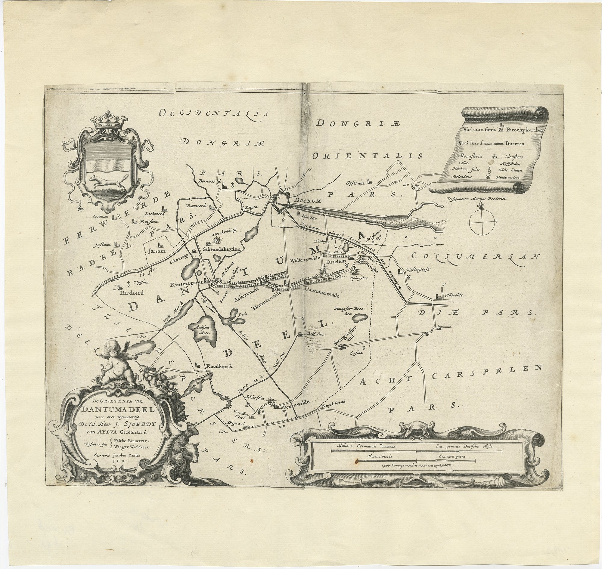
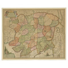
Antique Map of the Region of Dantumadeel by Schotanus, 1664
Located in Langweer, NL
Antique map titled 'De Grietenye van Dantumadeel (..)'. Map of the Grietenij of Dantumadeel, Friesland, The Netherlands. Originates from "Beschrijvinge ende nieuwe caerten van de Hee...
Category
Antique 17th Century Maps
Materials
Paper
More Ways To Browse
Antique Manuscript
Hand Drawn Map
Andy Warhol John Lennon
Andy Warhol Skateboard
Beat Bop
Harley Quinn
Looney Tunes Background
Peter Samuels
Plaster Impronte
Superman The Animated Series Original Production Cel Supergirl
Bartolomeo Paoletti
Disney Background
Looney Bird
Original Comic Strip Art
Peanuts Art
Vintage Cat Hat
Alberto Montano
Andy Warhol Banana