Items Similar to Original poster made in the 1950's of the Greater Portland Maine


Want more images or videos?
Request additional images or videos from the seller
1 of 8
E. O. NielsenOriginal poster made in the 1950's of the Greater Portland MaineCirca 1950
Circa 1950
$1,198.75
£890.50
€1,000
CA$1,664.60
A$1,816.47
CHF 952.77
MX$22,061.61
NOK 11,900.60
SEK 11,246.66
DKK 7,612.90
About the Item
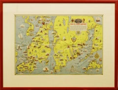
Original cartographic poster made in the 1950's that shows us all the monuments and different places of historical importance in the city of Portland.
Portland, also known as Portland, Maine (to avoid confusion with Portland, Oregon) is a city in the northeastern United States, the most populous in the state of Maine.
Portland is a historic city, with a very unusual old harbor and attracts more than 3 million tourists per year.
United States - Map - Tourism
Key to Points of Interest
- Creator:E. O. Nielsen
- Creation Year:Circa 1950
- Dimensions:Height: 21.26 in (54 cm)Width: 16.93 in (43 cm)
- Medium:
- Period:
- Condition:Good condition, light traces of folds, on linen.
- Gallery Location:PARIS, FR
- Reference Number:1stDibs: LU1792211498182
About the Seller
5.0
Gold Seller
Premium sellers maintaining a 4.3+ rating and 24-hour response times
Established in 2021
1stDibs seller since 2022
175 sales on 1stDibs
Typical response time: 2 hours
- ShippingRetrieving quote...Shipping from: PARIS, France
- Return Policy
Authenticity Guarantee
In the unlikely event there’s an issue with an item’s authenticity, contact us within 1 year for a full refund. DetailsMoney-Back Guarantee
If your item is not as described, is damaged in transit, or does not arrive, contact us within 7 days for a full refund. Details24-Hour Cancellation
You have a 24-hour grace period in which to reconsider your purchase, with no questions asked.Vetted Professional Sellers
Our world-class sellers must adhere to strict standards for service and quality, maintaining the integrity of our listings.Price-Match Guarantee
If you find that a seller listed the same item for a lower price elsewhere, we’ll match it.Trusted Global Delivery
Our best-in-class carrier network provides specialized shipping options worldwide, including custom delivery.More From This Seller
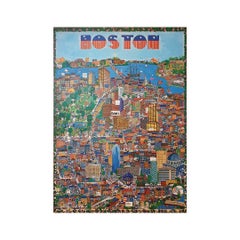
View All1972 original travel poster about the city of Boston Massachusetts - New England
Located in PARIS, FR
Nice tourist poster about the city of Boston. Boston is the capital and largest city of the state of Massachusetts and the New England region in the nor...
Category
1970s Prints and Multiples
Materials
Paper, Lithograph
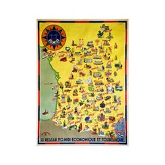
Circa 1935 map illustrated by André Giroux of the P.O Midi railroad network.
Located in PARIS, FR
Very beautiful map illustrated by André Giroux of the P.O Midi railroad network.
The railway company from Paris to Orleans and the Midi (PO Midi) is the n...
Category
1930s Prints and Multiples
Materials
Paper, Lithograph, Linen
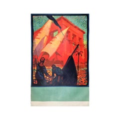
1932 Original poster by Odin Rosenvinge for the Franconia - Cunard Line
By Odin Rosenvinge
Located in PARIS, FR
Beautiful poster by Odin Rosenvinge a British artist born in 1880 for the Cunard Line.
Announcing a specific departure date, January 23, this atmospheric r...
Category
1930s Prints and Multiples
Materials
Paper, Linen, Lithograph
Circa 1970 travel poster USA - Chicago - Miami - Boston - New York - San Fran
Located in PARIS, FR
This vibrant circa 1970 travel poster, issued by the U.S. Department of Commerce, is a bold, joyful celebration of the United States' most iconic cities—filtered through the colorful...
Category
1970s Prints and Multiples
Materials
Linen, Paper, Lithograph

Circa 1950 original illustrated map for "Carte France autour de Bordeaux"
Located in PARIS, FR
The circa 1950 original illustrated map for "Carte France autour de Bordeaux" is an excellent representation of mid-20th century cartography, focusing on the area surrounding Bordeau...
Category
1950s Prints and Multiples
Materials
Paper, Linen
Circa 1930 Original poster - Boston - Harford Paris
Located in PARIS, FR
Designed in the golden age of spectacle and live entertainment, this poster likely promoted a vaudeville act, sideshow attraction, or variety performance that blurred the line betwee...
Category
1930s Prints and Multiples
Materials
Paper, Lithograph

You May Also Like
Original Antique Map of the American State of Massachusetts, 1903
Located in St Annes, Lancashire
Antique map of Vermont and New Hampshire
Published By A & C Black. 1903
Original colour
Good condition
Unframed.
Free shipping
Category
Antique Early 1900s English Maps
Materials
Paper

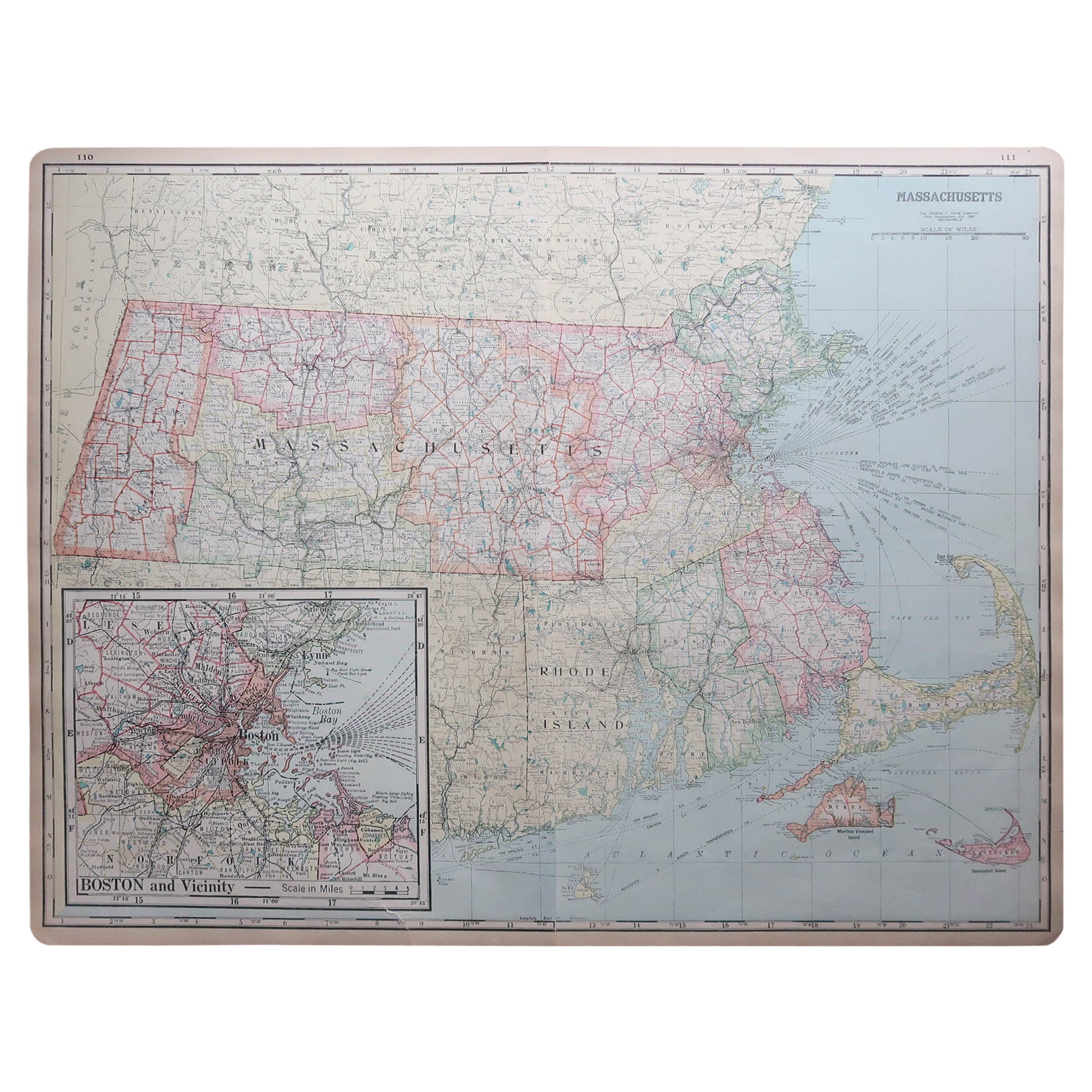
Large Original Antique Map of Massachusetts, USA, circa 1900
Located in St Annes, Lancashire
Fabulous map of Massachusetts
In 2 sheets. They can be joined but I have not done it
Original color
Engraved and printed by the George F. Cram ...
Category
Antique 1890s American Maps
Materials
Paper

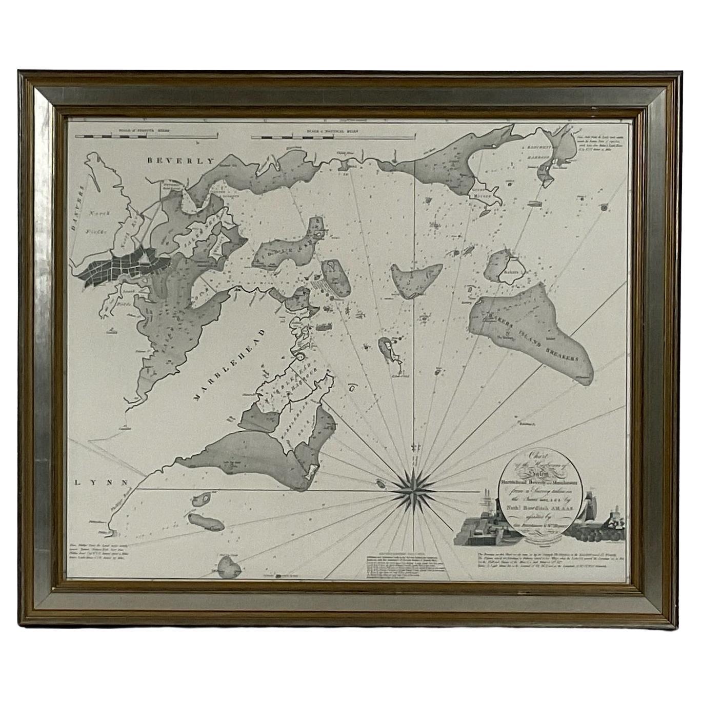
Chart of Boston's North Shore
Located in Norwell, MA
Rarely found restrike of an 1804 chart by Nathanael Bowditch of the Harbors of Salem, Marblehead, Beverly, and Manchester.
Showing the Islands of Great Misery, Satan, Cuney, Winter,...
Category
Vintage 1980s North American Maps
Materials
Paper

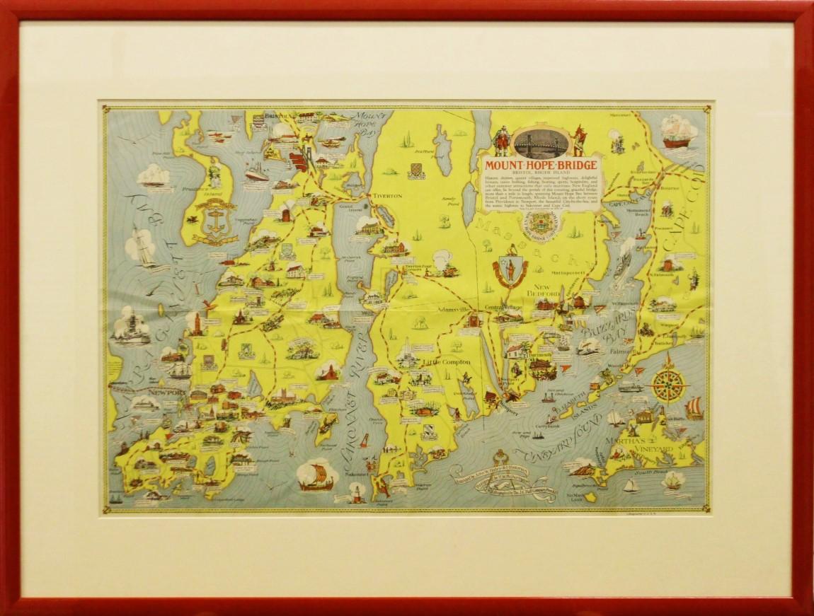
"Rhode Island Map, 1933"
Located in Bristol, CT
Classic c1933 colour (12 fold) red framed map of Rhode Island designed by H.W. Hetherington from Narragansett Bay to Buzzard's Bay
Map Sz: 17 3/8"...
Category
1930s Prints and Multiples
Materials
Lithograph
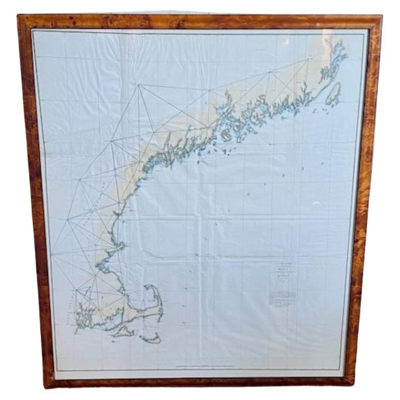
19th Century Chart of New England Coast, 1847
By U.S. Government
Located in Nantucket, MA
19th Century Chart of New England Coast: the U.S. Coast Survey Sketch A - Section 1, a triangulation chart showing the progress of the survey and details along the New England coas...
Category
Antique 1840s American Other Maps
Materials
Paper

The State of Rhode Island Map - Caleb Harris & Harding Harris, 1818
Located in Savannah, GA
Mathew Carey
(American/Philadelphia, 1760-1839)
The State of Rhode Island compiled from the surveys and observations of Caleb Harris by Harding Harris. Engraving with hand-coloring...
Category
Antique 1810s American Other Prints
Materials
Glass, Wood, Paper
More Ways To Browse
Suggestive Art
Taurus Art
The Little Prince
Tom Phillips
Vintage Brillo Pad
Vintage Egg Prints
World War Planes
Ww1 Posters
1970s Alexander Calder Lithograph Signed
After Modigliani
Alexander Calder Stabile
Anders Osterlin
Bruno Bischofberger
Chagall Yellow
Childrens Clothes
Courbet Paintings
De Gloire
Deco Pochoir Prints