Items Similar to The Atlantic Ocean - Original Etching by A. Stieler - 1857
Want more images or videos?
Request additional images or videos from the seller
1 of 5
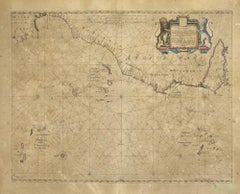
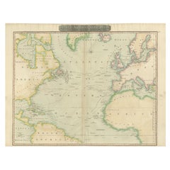
Adolf StielerThe Atlantic Ocean - Original Etching by A. Stieler - 18571857
1857
$286.85
£214.51
€240
CA$395.48
A$434.05
CHF 228.10
MX$5,165.10
NOK 2,915.79
SEK 2,664.45
DKK 1,828.90
About the Item
The Atlantic Ocean is an original colored print realized in 1857.
Hand-colored engraving made in Gotha (Germany) by Adolf Stieler.
Good conditions except for some light yellowing the margin.
Original title "Der Atlantische Ocean".
Stieler’s Hand-Atlas n. 41 printed on higher right corner.
This map corresponds to the number 41 of Stieler’s Hand-Atlas of the fifth edition (1866-1868) of 84 maps. After the death of Adolf Stieler, the work was known as the “Hand-Atlas uber alle Theile der Erde und uber das Weltgebäude” (Practical Atlas of all parts of the world and the universe), and was the leader Atlas German world in the last three decades of the nineteenth century and early twentieth. Published by the workshop Justus Perthes of Gotha (established since 1785) went through ten editions from 1816 to 1944.
Adolf Stieler (1775-1836) was a German cartographer who worked most of his life in the Geographic Institute Justus Perthes in Gotha. His atlas always been highly recognized for their excellence. Your Hand-Atlas was the leading German global atlas until mid-twentieth century
- Creator:Adolf Stieler (1775 - 1836)
- Creation Year:1857
- Dimensions:Height: 14.3 in (36.3 cm)Width: 17.33 in (44 cm)Depth: 0.08 in (2 mm)
- Medium:
- Period:
- Framing:Framing Options Available
- Condition:Insurance may be requested by customers as additional service, contact us for more information.
- Gallery Location:Roma, IT
- Reference Number:Seller: M-1032451stDibs: LU65035007701
About the Seller
4.9
Platinum Seller
Premium sellers with a 4.7+ rating and 24-hour response times
1stDibs seller since 2017
7,861 sales on 1stDibs
Typical response time: 1 hour
- ShippingRetrieving quote...Shipping from: Monaco, Monaco
- Return Policy
More From This Seller
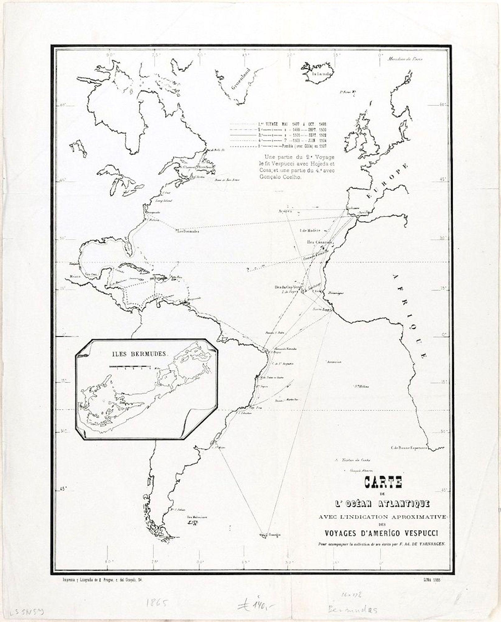
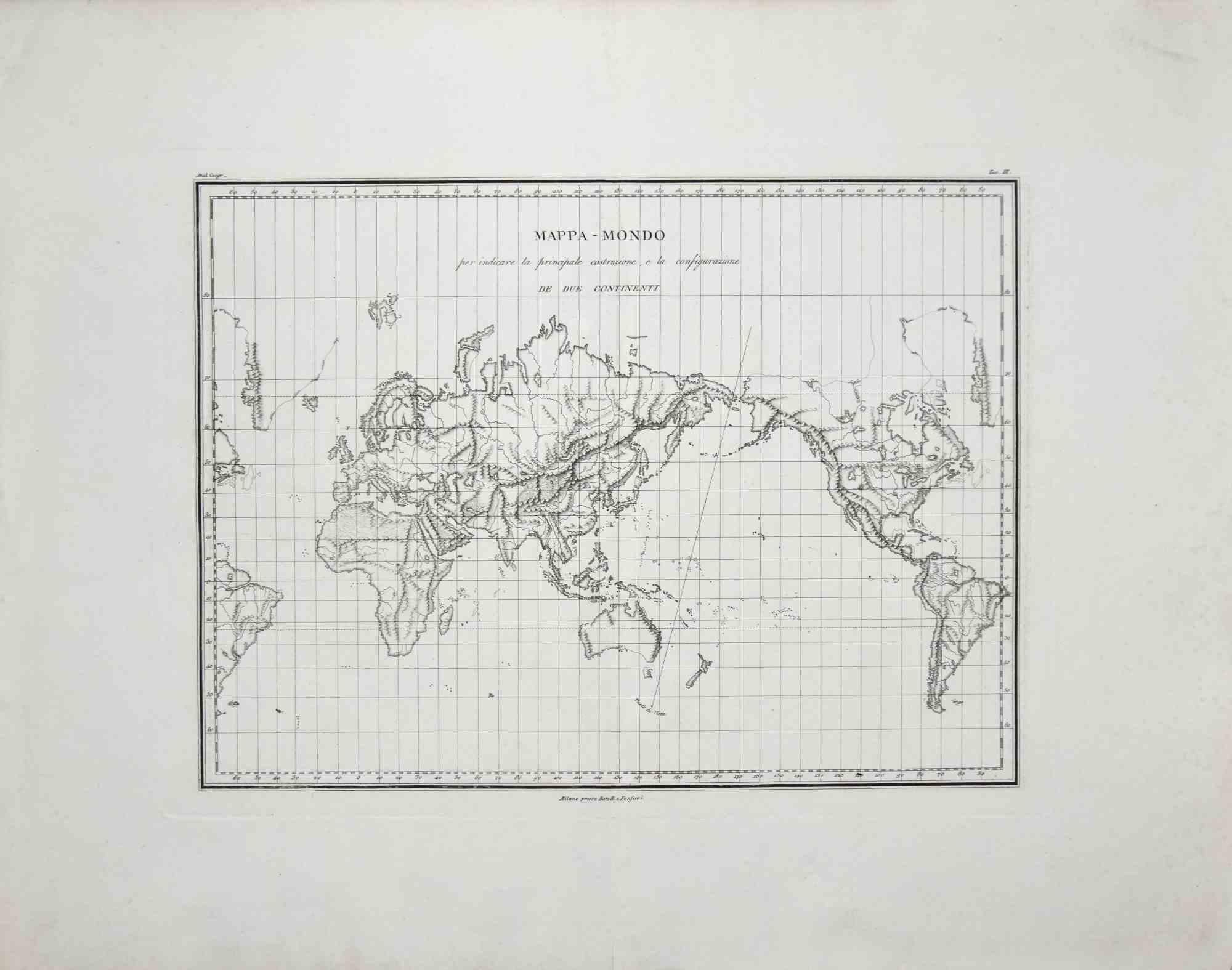
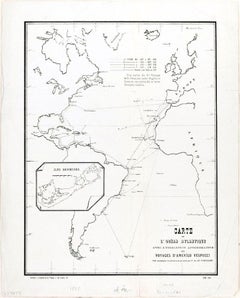
View AllCarte de l'Ocean Atlantique - by F. A. de Varnhagen - 1865
Located in Roma, IT
Bermuda Islands is an original black and white print realized in 1865.
Good conditions except for some light folds along the margin.
Original title "Carte de l'Océan Atlantique ave...
Category
1860s Figurative Prints
Materials
Etching
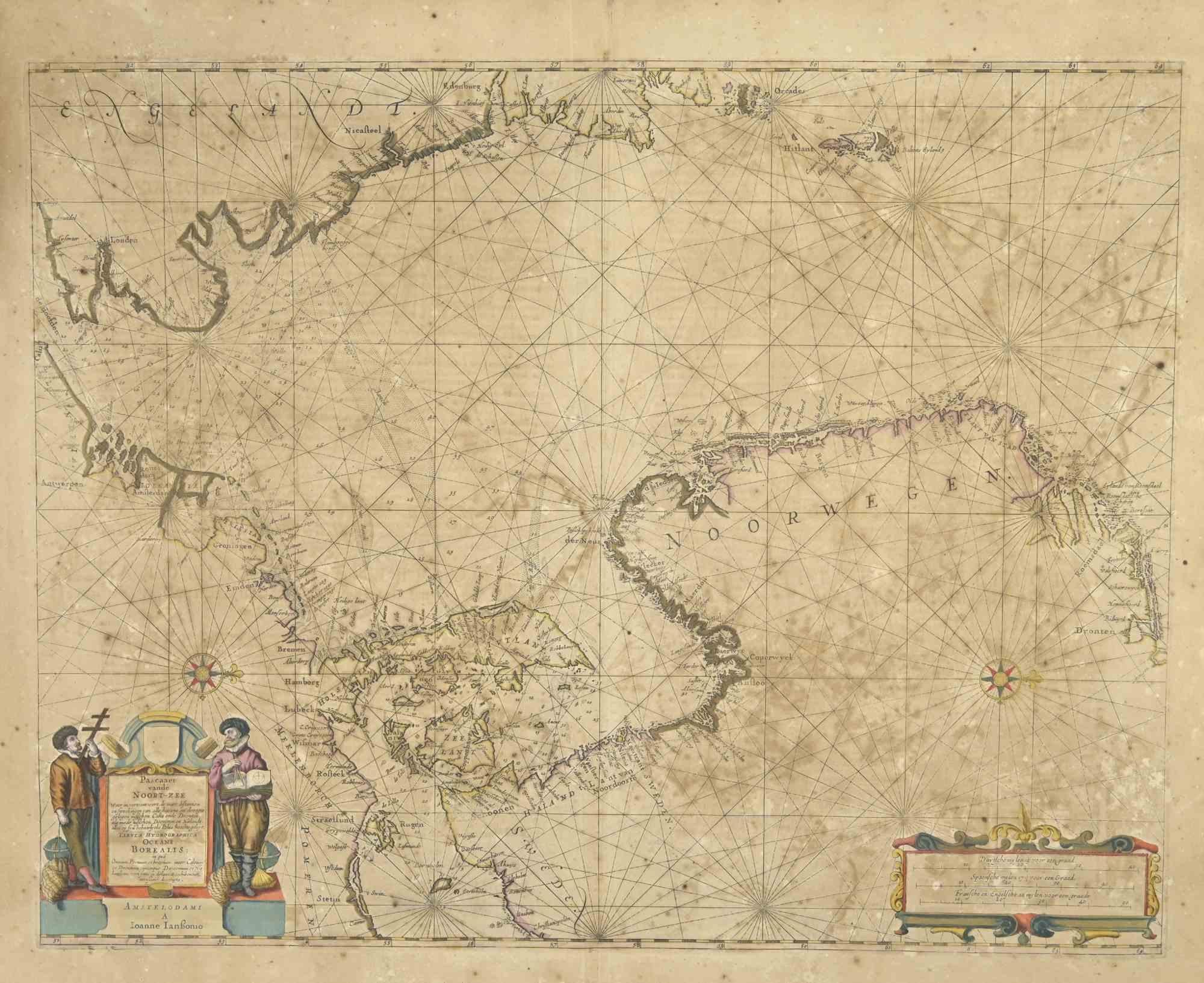
Oceani Borealis - Etching by Johannes Janssonius - 1660s
By Johannes Janssonius
Located in Roma, IT
Oceani Borealis is an ancient map realized in 1650 by Johannes Janssonius (1588-1664).
Good conditions.
From Atlantis majoris quinta pars, Orbem maritimum [Novus Atlas, volume V: c...
Category
1660s Modern Figurative Prints
Materials
Etching
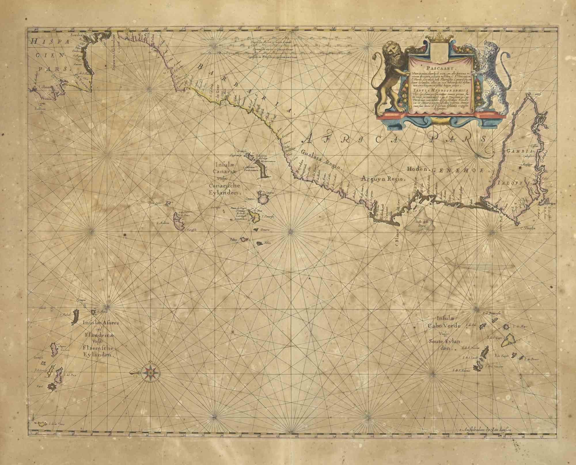
Mare Atlanticum - Etching by Johannes Janssonius - 1650s
By Johannes Janssonius
Located in Roma, IT
Mare Atlanticum is an ancient map realized in 1650 by Johannes Janssonius (1588-1664).
Good conditions.
From Atlantis majoris quinta pars, Orbem maritimum [Novus Atlas, volume V: c...
Category
1650s Modern Figurative Prints
Materials
Etching
Map of the World - Original Etching - 1820
Located in Roma, IT
Map of the World is an Original Etching realized by an unknown artist of 19th century in 1820.
Very good condition on two sheets of white paper joine...
Category
1820s Modern Figurative Prints
Materials
Etching

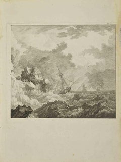
The Ocean - Etching by Pierre Quentin Chedel - 1755
By Pierre Quentin Chedel
Located in Roma, IT
The Ocean is an etching realized by Pierre Quentin Chedel in 1755.
Good conditions.
The artwork is depicted through confident strokes.
The etching was realized for the anatomy stu...
Category
1750s Modern Figurative Prints
Materials
Etching
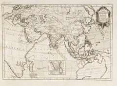
Carte Pour Servir a l'Histoire Philosophique.. - Etching by Rigobert Bonne- 1780
Located in Roma, IT
Etching on paper.
From Guillaume-Thomas Raynal, Histoire philosophique et politique des établissemens et du commerce des Européens dans les deux Indes, Geneva 1780.
This interestin...
Category
1780s Modern Figurative Prints
Materials
Etching
You May Also Like
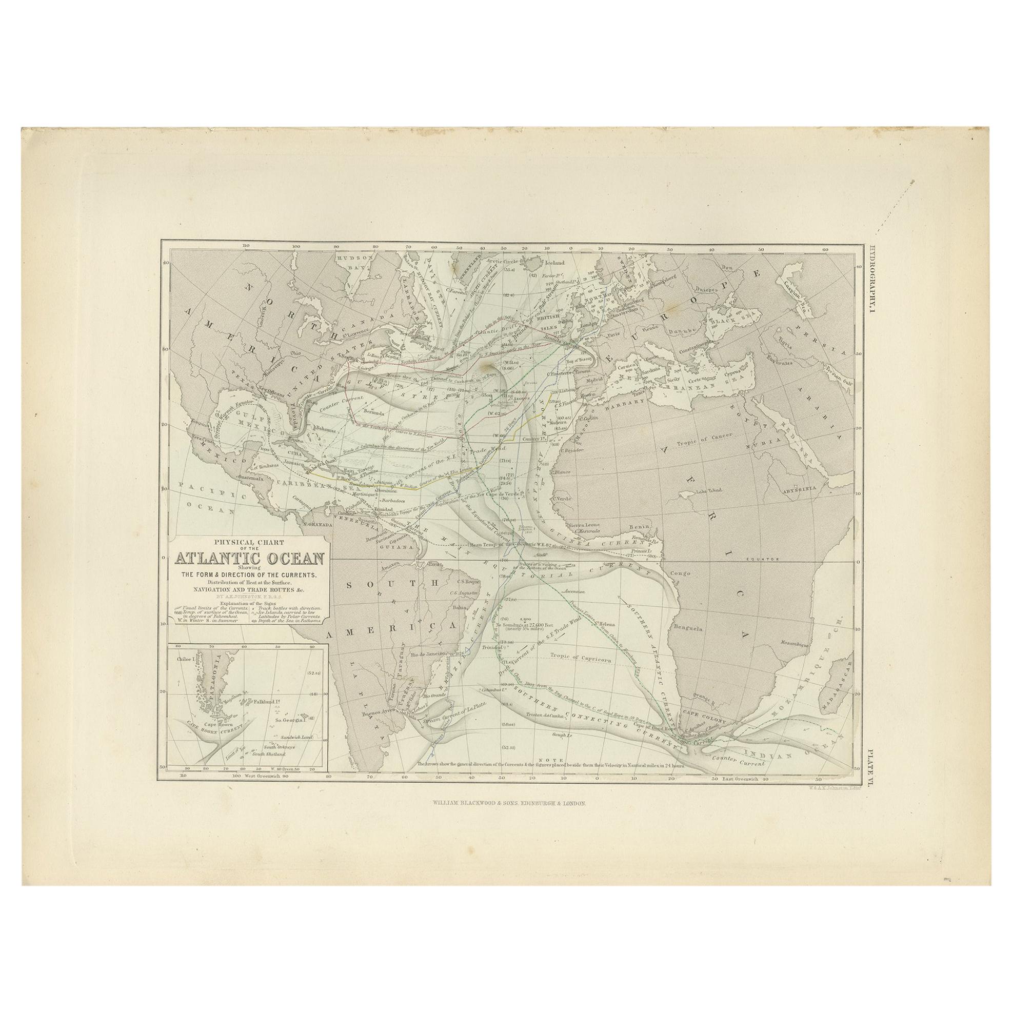
Antique Physical Chart of the Atlantic Ocean by Johnston '1850'
Located in Langweer, NL
Antique map titled 'Physical Chart of the Atlantic Ocean showing the form and direction of the currents'. Original antique chart of the Atlantic Ocean. This map originates from 'The ...
Category
Antique Mid-19th Century Maps
Materials
Paper

$191 Sale Price
20% Off
Antique Map of the Pacific Ocean by Rienzi, 1836
Located in Langweer, NL
Antique map titled 'Mélanésie'. Map of the Pacific ocean around Australia, including Java, Timor, the Solomon Islands and New Zealand. This print or...
Category
Antique 19th Century Maps
Materials
Paper

Antique Print of the Sea of Azov and the Crimean peninsula by Veith, circa 1855
Located in Langweer, NL
Antique lithograph titled 'Das Asow'sche und das Schwarze Meer mit Umgebung'. Rare view on the Sea of Azov, the Crimean peninsula and surroundings. In the foreground, military units ...
Category
Antique Mid-19th Century Prints
Materials
Paper
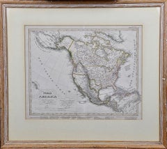
North America: A Framed Hand-colored 19th Century German Map by Adolph Stieler
By Adolf Stieler
Located in Alamo, CA
This framed early 19th century map of North America entitled "Nord-Amerika" is plate No. LIV (No. 46) from Adolph Stieler's Hand-Atlas, published in Gotha, Germany by Justus Perthes ...
Category
1830s Landscape Prints
Materials
Engraving
Interesting Map of the Atlantic Showing Nelson's and Trade Routes, 1817
By John Thomson
Located in Langweer, NL
Antique map titled 'Chart of the North Atlantic Ocean with Tracks of the Shipping to West Indies, North America, &cc'. Large map of the Atlantic, showing the tracks of the ships trad...
Category
Antique 19th Century Maps
Materials
Paper
$525 Sale Price
20% Off
Free Shipping
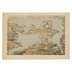
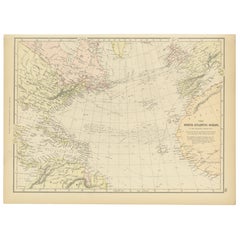
1882 Map of the North Atlantic Ocean Showing Cable Tracks and Trade Winds
Located in Langweer, NL
This 1882 map of the North Atlantic Ocean, published by Blackie and Son as part of the 'Comprehensive Atlas and Geography of the World,' provides an intricate depiction of one of the...
Category
Antique 1880s Maps
Materials
Paper
More Ways To Browse
Hockney Los Angeles Olympics
Hogarth Election
House Of Raquel Vega
Inuit Doll
Iona Rozeal Brown
Iris Woodblock Print
Irving Amen On Sale
Israel Museum Poster
Itzchak Tarkay Afternoon Tea
Itzchak Tarkay Serigraph
Ivory Cigarette Holder
J Alphege Brewer
J Didier
Jack Chandler
James A Pritchard
Jane Rogers
Japanese Warrior Woodblock Print
Japanese Woodblock Print Kuniyoshi