Items Similar to Griffin's 1955 Northern Ireland original map - Tourism - Geography

Want more images or videos?
Request additional images or videos from the seller
1 of 8
GriffinGriffin's 1955 Northern Ireland original map - Tourism - Geography1955
1955
$1,903.34
£1,410.04
€1,600
CA$2,617.93
A$2,911.89
CHF 1,527.57
MX$35,531.67
NOK 19,172.98
SEK 18,068.20
DKK 12,182.19
About the Item
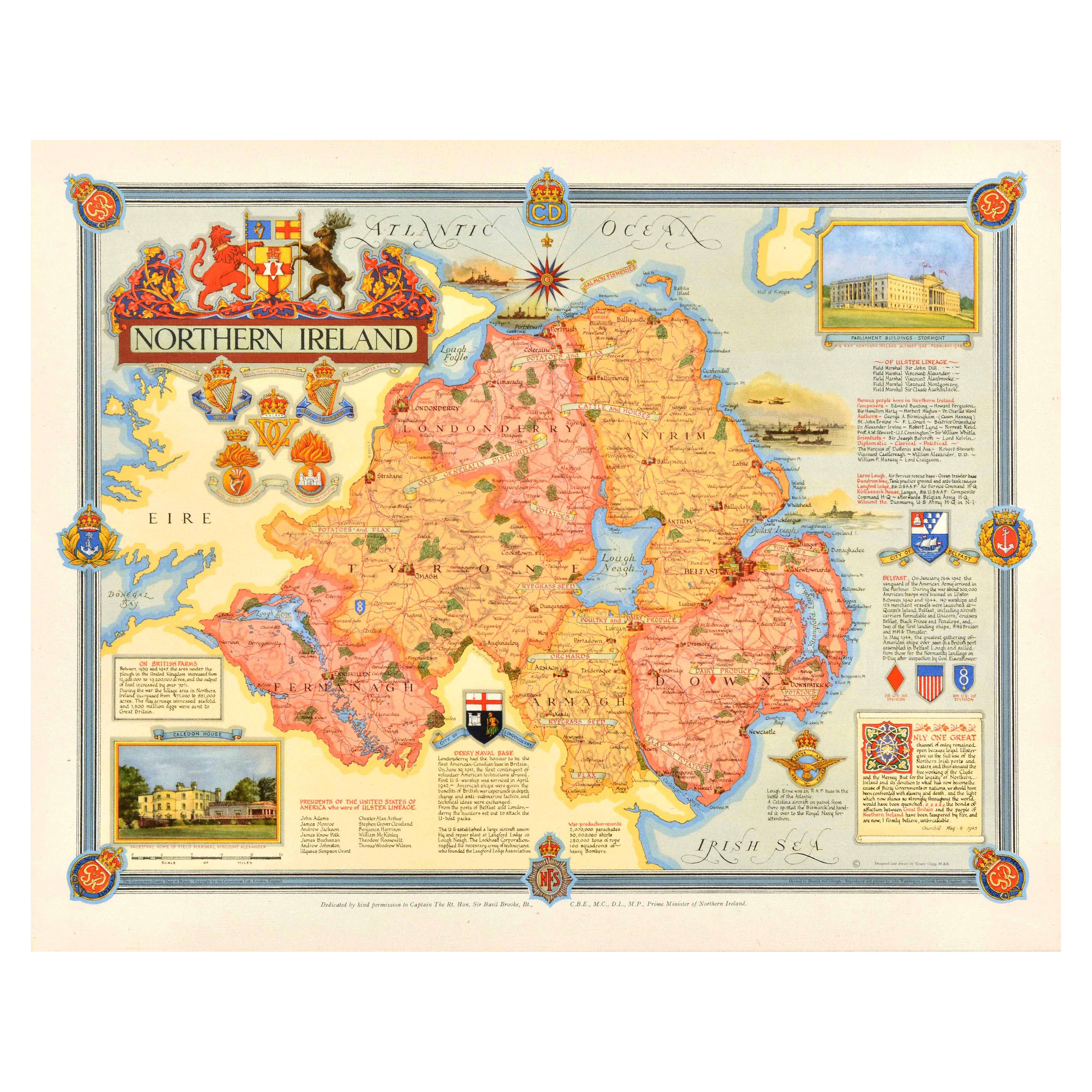
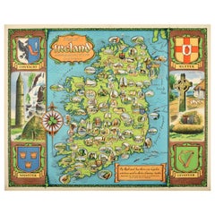
Griffin's 1955 Northern Ireland map stands out as a captivating representation of the region's geography and features. Printed by James Upton Limited in Birmingham, this map is not just a navigational aid; it's a historical artifact that invites us to explore the landscapes, cities, and details of Northern Ireland as they were in the mid-20th century.
The meticulous craftsmanship of this map reflects the dedication of the cartographers at Griffin, a renowned mapmaking company. The choice of Birmingham as the printing location adds a layer of historical significance, as Birmingham has been a hub for various industries, including printing, since the Industrial Revolution.
The map itself unfolds to reveal a wealth of information about Northern Ireland, capturing its topography, cities, rivers, and roadways. The use of vibrant colors and intricate details makes it not only a practical tool for navigation but also a visual delight for those interested in the artistry of mapmaking.
One of the notable features of Griffin's map is its depiction of historical and cultural landmarks. From ancient castles to bustling urban centers, the map offers a snapshot of Northern Ireland's rich heritage. The inclusion of symbols and annotations provides insights into the significance of various sites, making it a valuable resource for history enthusiasts.
Map - Geography - Tourism - Ireland
James Upton Limited Birmingham
- Creator:Griffin
- Creation Year:1955
- Dimensions:Height: 37.8 in (96 cm)Width: 24.02 in (61 cm)
- Medium:
- Period:
- Condition:Good condition, light restorations, on linen.
- Gallery Location:PARIS, FR
- Reference Number:1stDibs: LU1792213778642
About the Seller
5.0
Platinum Seller
Premium sellers with a 4.7+ rating and 24-hour response times
Established in 2021
1stDibs seller since 2022
171 sales on 1stDibs
Typical response time: 1 hour
- ShippingRetrieving quote...Shipping from: PARIS, France
- Return Policy
Authenticity Guarantee
In the unlikely event there’s an issue with an item’s authenticity, contact us within 1 year for a full refund. DetailsMoney-Back Guarantee
If your item is not as described, is damaged in transit, or does not arrive, contact us within 7 days for a full refund. Details24-Hour Cancellation
You have a 24-hour grace period in which to reconsider your purchase, with no questions asked.Vetted Professional Sellers
Our world-class sellers must adhere to strict standards for service and quality, maintaining the integrity of our listings.Price-Match Guarantee
If you find that a seller listed the same item for a lower price elsewhere, we’ll match it.Trusted Global Delivery
Our best-in-class carrier network provides specialized shipping options worldwide, including custom delivery.More From This Seller
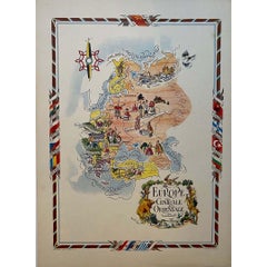
View AllJacques Liozu's 1951 illustrated map of Central and Eastern Europe
By Jacques Liozu
Located in PARIS, FR
Jacques Liozu's 1951 illustrated map of Central and Eastern Europe is a cartographic work of great beauty and precision. Jacques Liozu, the famous French artist-cartographer, created...
Category
1950s Prints and Multiples
Materials
Lithograph, Paper
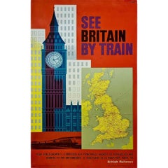
Circa 1960 original poster by Lander - See Britain by train - London
Located in PARIS, FR
The circa 1960 original poster by Lander, titled "See Britain by train British Railways - Londres," encapsulates the spirit of exploration and adventure that defined post-war Britain...
Category
1960s Prints and Multiples
Materials
Linen, Lithograph, Paper
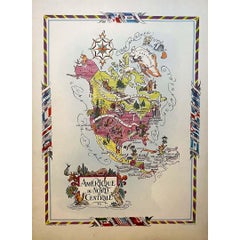
Jacques Liozu's 1951 illustrated map of North and Central America
By Jacques Liozu
Located in PARIS, FR
Jacques Liozu's 1951 illustrated map of North and Central America is an exceptional work of cartography that combines geographical precision with artistic aesthetics. Jacques Liozu, ...
Category
1950s Prints and Multiples
Materials
Lithograph, Paper
Jacques Liozu's 1951 illustrated map of South America
By Jacques Liozu
Located in PARIS, FR
Jacques Liozu's 1951 illustrated map of South America is an exceptional work of cartography that skilfully blends art and geography. French artist and cartographer Jacques Liozu crea...
Category
1950s Prints and Multiples
Materials
Lithograph, Paper

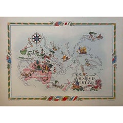
Jacques Liozu's 1951 illustrated map of Australia and Oceania
By Jacques Liozu
Located in PARIS, FR
Jacques Liozu's 1951 illustrated map of Australia and Oceania is a remarkable cartographic work that combines art and geography to offer an enchanting representation of this part of ...
Category
1950s Prints and Multiples
Materials
Lithograph, Paper
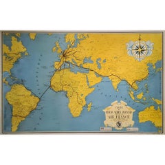
1938 original map titled "Carte du réseau aérien français" Air France
Located in PARIS, FR
The 1938 original map titled "Carte du réseau aérien français" by A. Collinet offers a captivating snapshot of Air France's global aviation network durin...
Category
1930s Prints and Multiples
Materials
Linen, Paper, Lithograph
You May Also Like
Original Vintage Post-World War Two Map Poster Northern Ireland UK WWII Clegg
Located in London, GB
Original vintage post-World War Two map poster of Northern Ireland featuring a colourful design by Ernest Costain Clegg (1876-1954) of the counties of Fermanagh, Tyrone, Londonderry,...
Category
Vintage 1940s British Posters
Materials
Paper

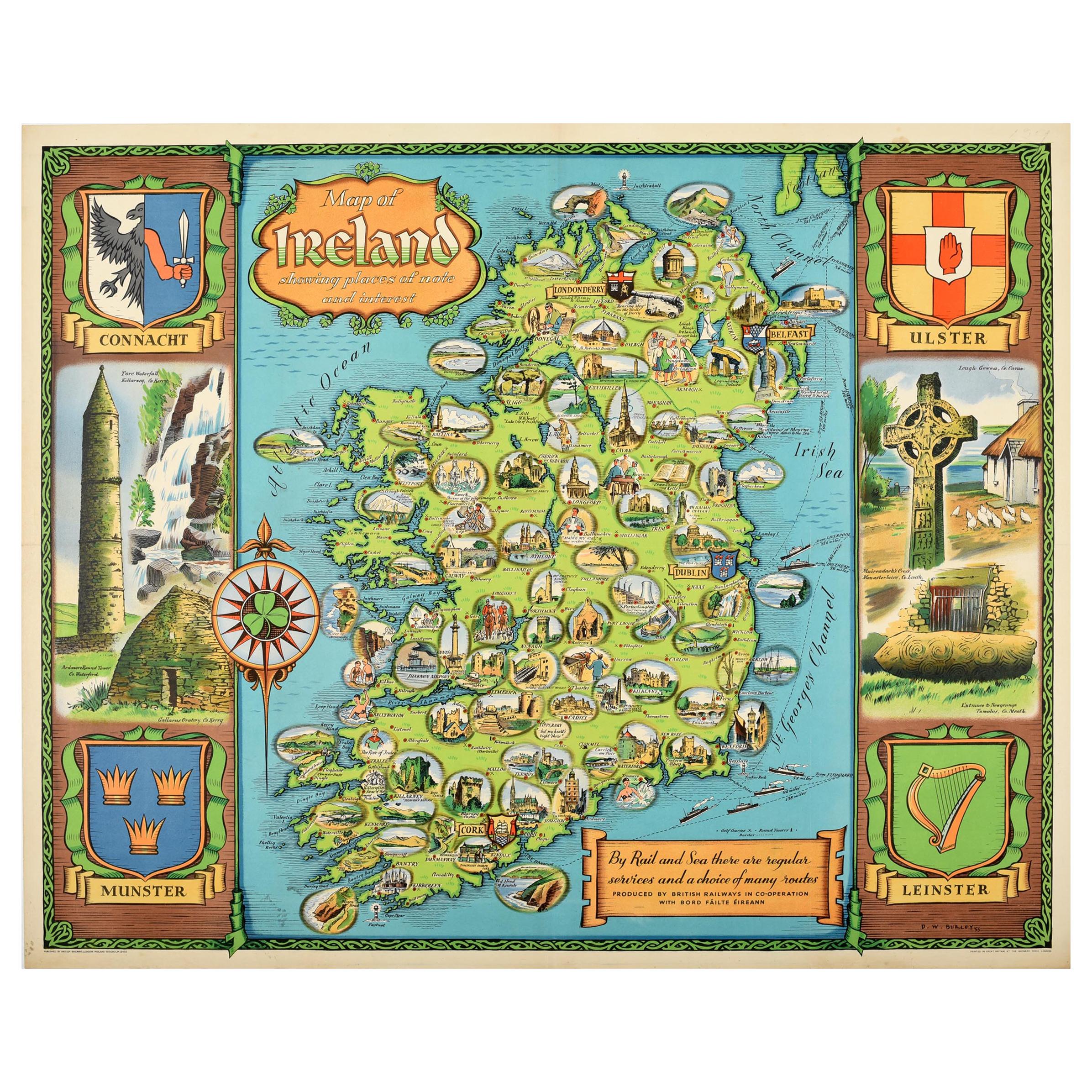
Original Vintage Travel Poster Map of Ireland Showing Places of Note & Interest
Located in London, GB
Original vintage poster - Map of Ireland showing places of note and interest. Colorful illustrated map of Ireland by David William Burley (1901-1990) including images of historic arc...
Category
Vintage 1950s British Posters
Materials
Paper
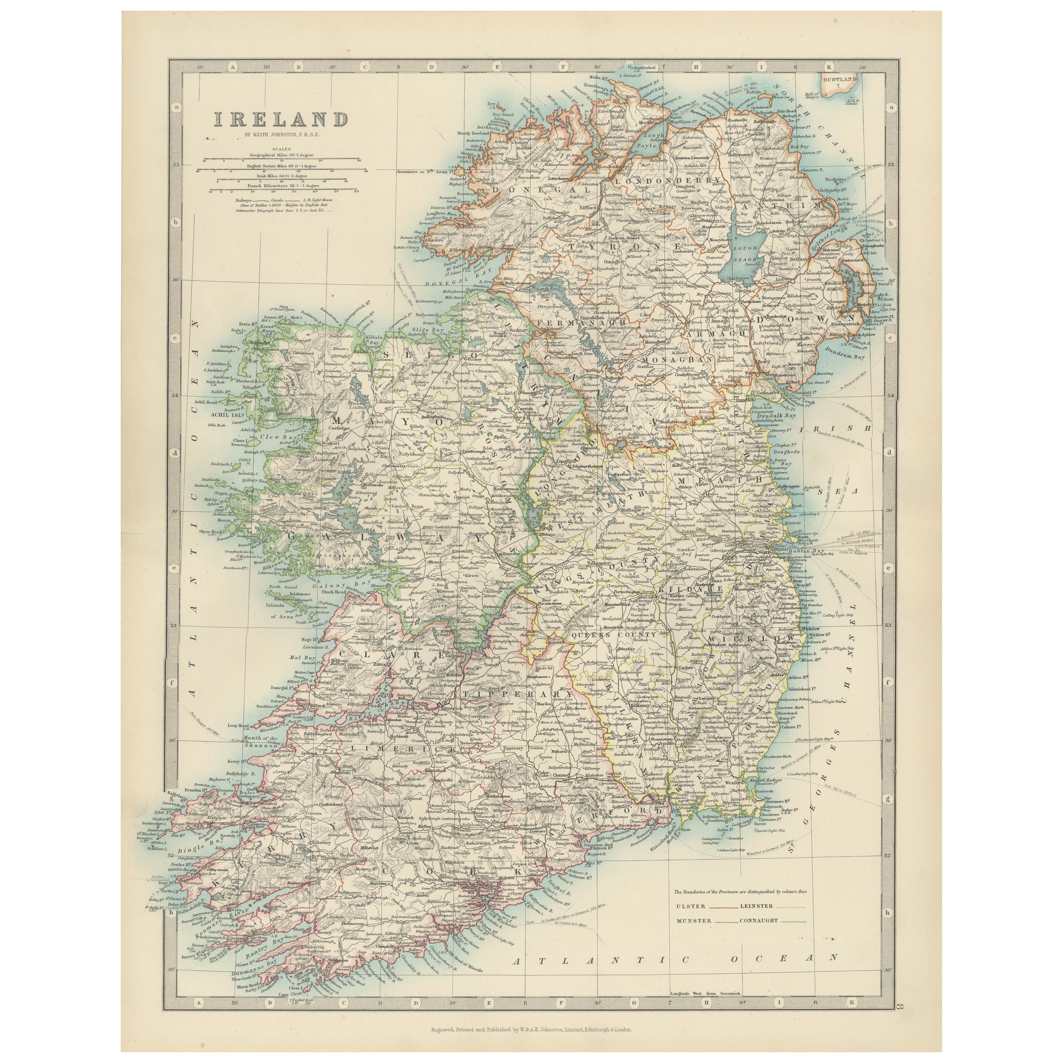
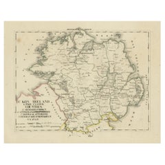
Antique Map of Ireland, 1903, with Intricate County Boundaries & Coastal Details
Located in Langweer, NL
Title: Antique Map of Ireland, 1903, with Intricate County Boundaries and Coastal Detail
Description:
This antique map of Ireland, engraved and published in 1903 by the esteemed W. ...
Category
Early 20th Century Maps
Materials
Paper

Large Original Antique Map of Ireland. C.1900
Located in St Annes, Lancashire
Fabulous map of Ireland
Original color.
Engraved and printed by the George F. Cram Company, Indianapolis.
Published, C.1900.
Unframed.
Free shipping.
Category
Antique 1890s American Maps
Materials
Paper

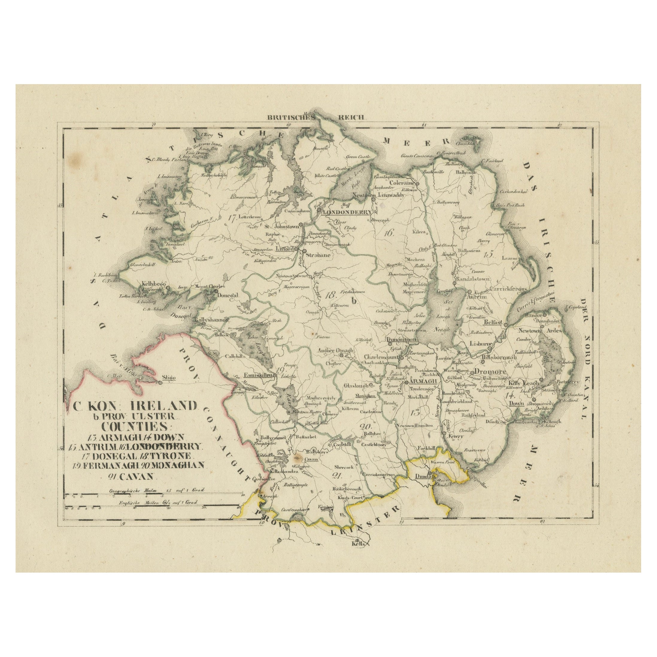
Antique 1830 Map of Ulster, Ireland with Armagh, Down, Antrim, Donegal, Tyrone
Located in Langweer, NL
Title: Antique 1830 Map of Ulster, Ireland with Armagh, Down, Antrim, Donegal, and Tyrone
Description: This 1830 German-language map, titled Britisches Reich – C. Kon: Ireland, ...
Category
Antique 1830s Maps
Materials
Paper
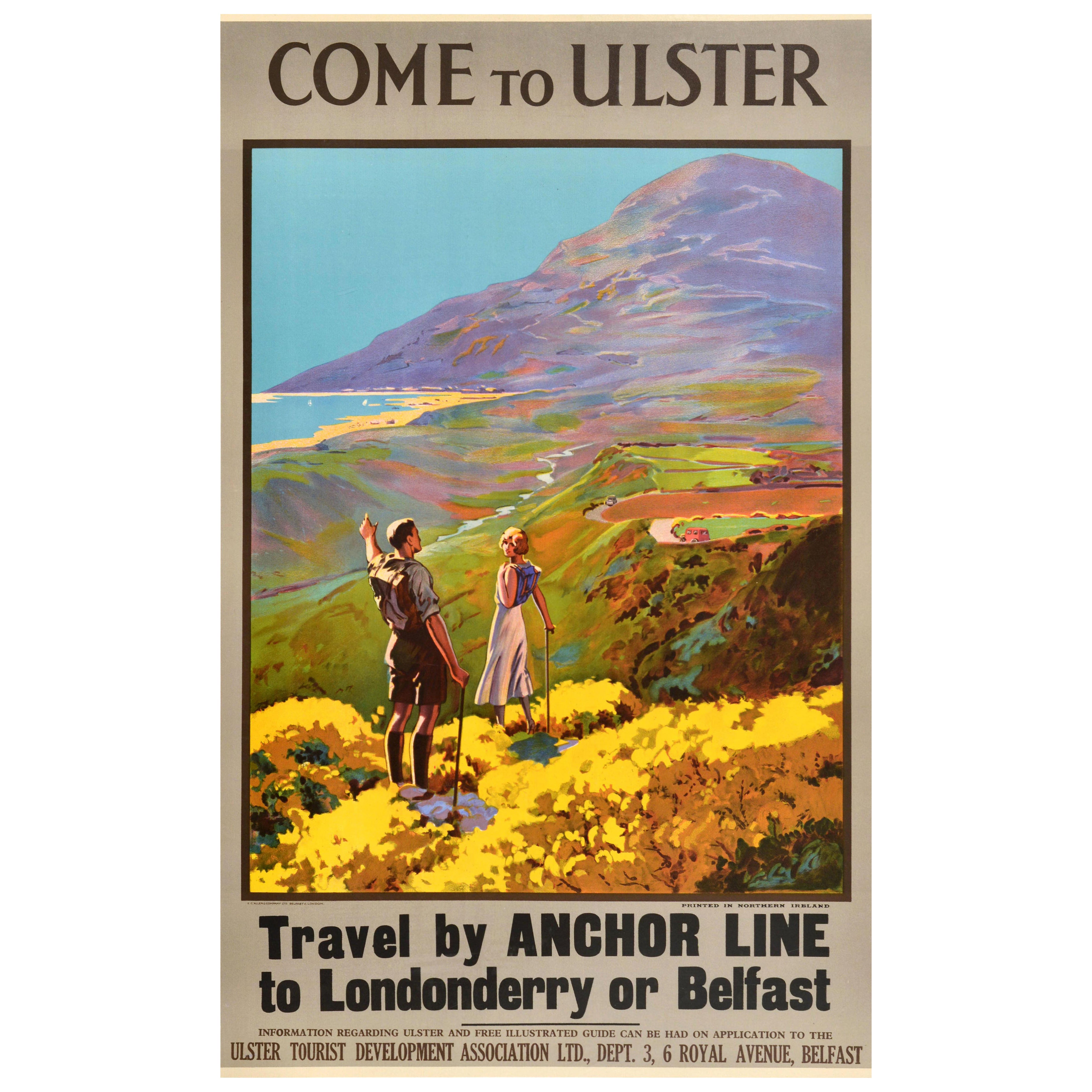
Original Vintage Travel Poster Come To Ulster Anchor Line Northern Ireland
Located in London, GB
Original vintage travel poster - Come to Ulster - featuring a scenic view of a young man and lady hiking through the countryside in northern Ireland with backpacks and walking sticks...
Category
Vintage 1930s British Posters
Materials
Paper

More Ways To Browse
Map Stand
Castle Ireland
Map Of Ireland
Cartographer Tool
History Of Portugal And Spain
Kaws Print Limited
Max Ernst Etching
Miro Verve
Original American Airlines Travel Poster
Portrait Of Jean Cocteau
Prints Fireworks
The Music Lesson
Womans Breast
70s Nude
Breast Plate
Etching Medieval
Hand Coloured Lithograph
Israeli Artist Jewlery