Items Similar to Jacques Liozu's 1951 illustrated map of Asia

Want more images or videos?
Request additional images or videos from the seller
1 of 8
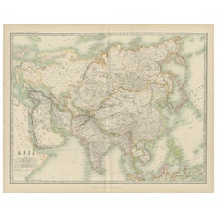
Jacques LiozuJacques Liozu's 1951 illustrated map of Asia1951
1951
$891.99
£667.86
€750
CA$1,247.53
A$1,359.70
CHF 708.07
MX$16,405.74
NOK 8,900.71
SEK 8,355.69
DKK 5,713.58
About the Item
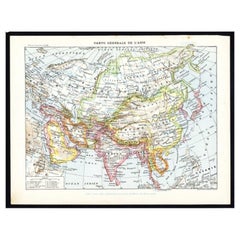
Jacques Liozu's 1951 illustrated map of Asia is an exceptional work of cartography that combines art and geography to offer a captivating vision of this vast continent. Jacques Liozu, the famous French artist-cartographer, created this map to highlight the geographical and cultural diversity of Asia.
The map's illustration is a true testament to Liozu's artistic talent. Using rich colors and detailed patterns, he has meticulously depicted Asia's majestic mountains, vast plains, mighty rivers and arid deserts. Every detail is realized with impressive precision, testifying to his dedication to his art.
Beyond its practical purpose of providing geographical information, this map is a true work of art, inviting the viewer to explore the complexity and richness of Asia. It captures the essence of the cultural diversity of this immense continent, highlighting the breathtaking landscapes and millennia-old civilizations found there.
In 1951, this map was an invaluable tool for researchers, students and geography enthusiasts wishing to learn more about Asia and its countless wonders.
Today, Jacques Liozu's illustrated map of Asia has become a sought-after collector's item for cartography enthusiasts and art lovers alike. It is a testament to art's ability to transcend mere informational function and capture the public's imagination. This map continues to fascinate and inspire, reminding us of the importance of art in our understanding and appreciation of the world around us.
Asia - Map
Odé Paris
- Creator:Jacques Liozu (1910 - 1974, French)
- Creation Year:1951
- Dimensions:Height: 16.15 in (41 cm)Width: 22.05 in (56 cm)
- Medium:
- Period:
- Condition:Very good condition.
- Gallery Location:PARIS, FR
- Reference Number:1stDibs: LU1792212725482
About the Seller
5.0
Gold Seller
Premium sellers maintaining a 4.3+ rating and 24-hour response times
Established in 2021
1stDibs seller since 2022
186 sales on 1stDibs
Typical response time: 1 hour
- ShippingRetrieving quote...Shipping from: PARIS, France
- Return Policy
Authenticity Guarantee
In the unlikely event there’s an issue with an item’s authenticity, contact us within 1 year for a full refund. DetailsMoney-Back Guarantee
If your item is not as described, is damaged in transit, or does not arrive, contact us within 7 days for a full refund. Details24-Hour Cancellation
You have a 24-hour grace period in which to reconsider your purchase, with no questions asked.Vetted Professional Sellers
Our world-class sellers must adhere to strict standards for service and quality, maintaining the integrity of our listings.Price-Match Guarantee
If you find that a seller listed the same item for a lower price elsewhere, we’ll match it.Trusted Global Delivery
Our best-in-class carrier network provides specialized shipping options worldwide, including custom delivery.More From This Seller
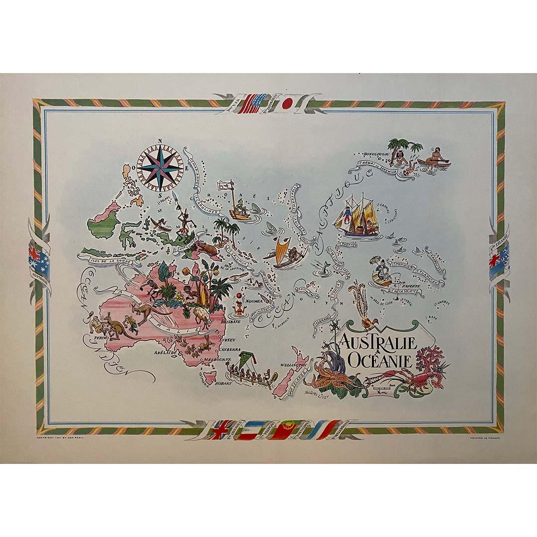
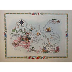
View AllJacques Liozu's 1951 illustrated map of Australia and Oceania
By Jacques Liozu
Located in PARIS, FR
Jacques Liozu's 1951 illustrated map of Australia and Oceania is a remarkable cartographic work that combines art and geography to offer an enchanting representation of this part of ...
Category
1950s Prints and Multiples
Materials
Lithograph, Paper
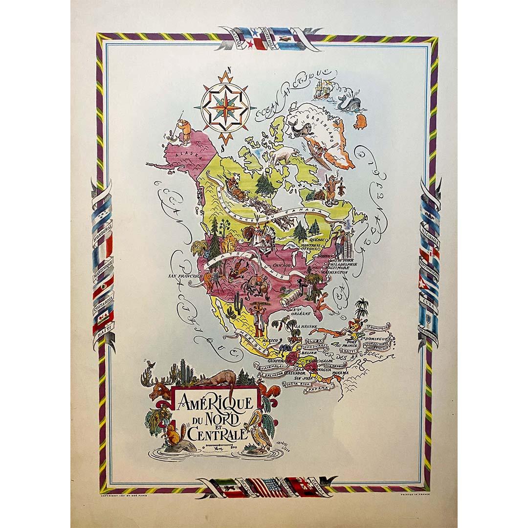
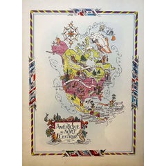
Jacques Liozu's 1951 illustrated map of North and Central America
By Jacques Liozu
Located in PARIS, FR
Jacques Liozu's 1951 illustrated map of North and Central America is an exceptional work of cartography that combines geographical precision with artistic aesthetics. Jacques Liozu, ...
Category
1950s Prints and Multiples
Materials
Lithograph, Paper
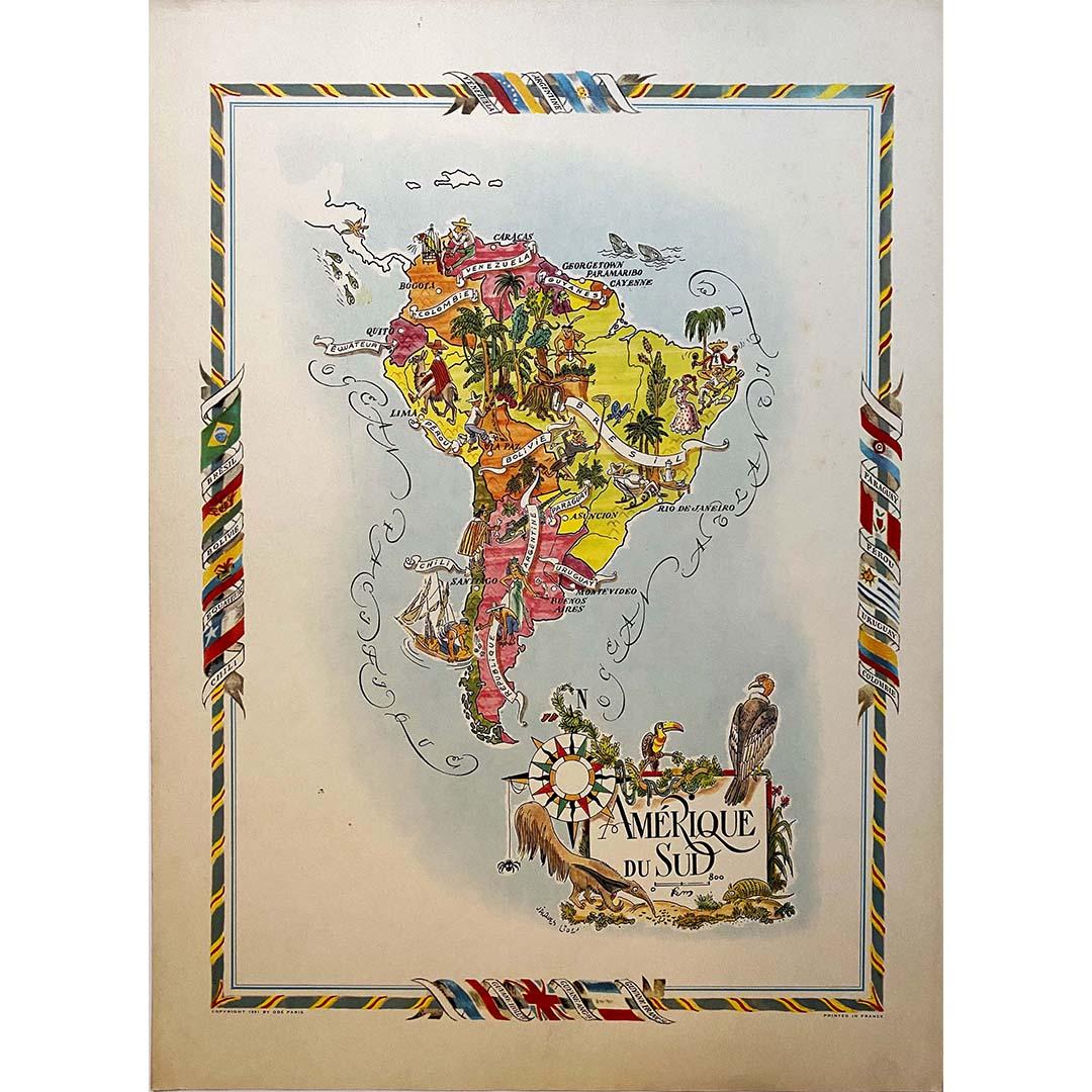
Jacques Liozu's 1951 illustrated map of South America
By Jacques Liozu
Located in PARIS, FR
Jacques Liozu's 1951 illustrated map of South America is an exceptional work of cartography that skilfully blends art and geography. French artist and cartographer Jacques Liozu crea...
Category
1950s Prints and Multiples
Materials
Lithograph, Paper

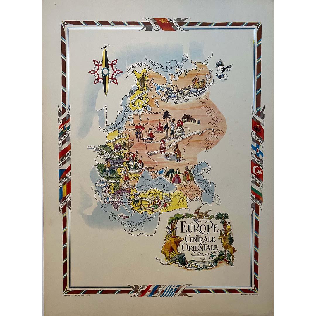
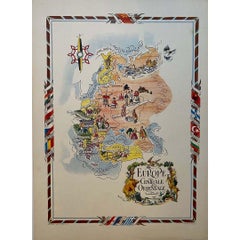
Jacques Liozu's 1951 illustrated map of Central and Eastern Europe
By Jacques Liozu
Located in PARIS, FR
Jacques Liozu's 1951 illustrated map of Central and Eastern Europe is a cartographic work of great beauty and precision. Jacques Liozu, the famous French artist-cartographer, created...
Category
1950s Prints and Multiples
Materials
Lithograph, Paper
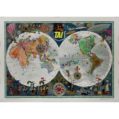
Circa 1950 original poster by Luc-Marie Bayle for TAI - World map
By Lue Marie Bayle
Located in PARIS, FR
This circa 1950 original poster, created by Luc-Marie Bayle, celebrates the global reach of TAI (Transports Aériens Intercontinentaux), one of France’s pioneering airline companies. ...
Category
1950s Prints and Multiples
Materials
Paper, Lithograph
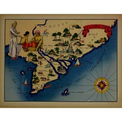
1943 original illustrated map of Cochinchine by Dylbert
Located in PARIS, FR
The 1943 original illustrated map of Cochinchine by Dylbert is a striking example of cartographic artistry from a period steeped in global conflict and colonial influence. Created du...
Category
1940s Prints and Multiples
Materials
Lithograph, Paper, Linen
You May Also Like
Antique Map of Asia by Johnston '1909'
Located in Langweer, NL
Antique map titled 'Asia'. Depicting China, Japan, Indonesia, India, Arabia and more. This map originates from the ‘Royal Atlas of Modern Geography’. Published by W. & A.K. Johnston,...
Category
Early 20th Century Maps
Materials
Paper
$237 Sale Price
20% Off
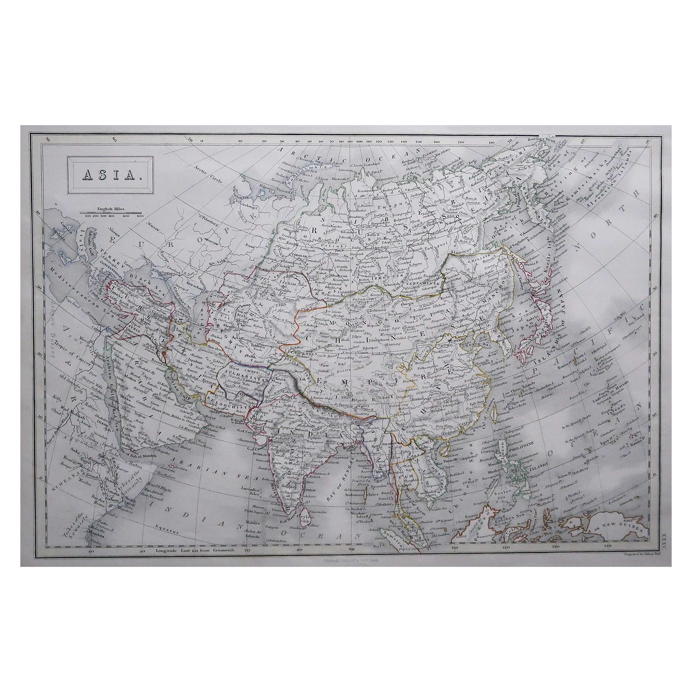
Large Original Antique Map of Asia by Sidney Hall, 1847
Located in St Annes, Lancashire
Great map of Asia
Drawn and engraved by Sidney Hall
Steel engraving
Original colour outline
Published by A & C Black. 1847
Unframed
Free shipping
Category
Antique 1840s Scottish Maps
Materials
Paper

Antique Map of Asia with Additional Country Information, c. 1749
Located in Langweer, NL
Antique map titled 'L'Asie divisée en ses principaux Empires et Royaumes'. Detailed map of Asia, with a large table on the right side, providing information about the various major c...
Category
Antique 18th Century Maps
Materials
Paper
$1,712 Sale Price
20% Off
Antique Map of Asia by Larousse, 1897
Located in Langweer, NL
Front: 'Carte Generale de l'Asie.' (General map of Asia). Rear: 'Asie.' (Asia, scenes of Asia, nature, plants and animals, people, costume).' This rare early lithographic print origi...
Category
Antique 19th Century Maps
Materials
Paper
$71 Sale Price
20% Off
Antique Map of Asia by K. Johnston, circa 1879
Located in Langweer, NL
No. 28 of Keith Johnston's General Atlas. Published by William Blackwood & Sons Edinburgh & London, circa 1879.
Category
Antique Late 19th Century Maps
Materials
Paper

Antique Map of Asia by Young, c.1860
Located in Langweer, NL
Antique map titled 'Asia'. Steel engraved map of Asia by Francis Young.
Artists and Engravers: Engraved by Lewis Becker. Published by S.O. Beeton.
We sell original antique maps to...
Category
Antique 19th Century Maps
Materials
Paper

$128 Sale Price
20% Off
More Ways To Browse
Illustrated Map
Vintage French Map
Vintage Illustrated Maps
Retro Sci Fi Art
Robert Sayer
Rufino Tamayo Lithograph
Supreme Skateboard
The Dinner Party
The Gates Central Park
Vintage Apple Computer
Vintage Art Deco Artwork
Vintage Constellation Print
Vintage Gravestones
Vintage Heron Prints
Vintage Vinyl Record Covers
William A Cooper
Agam Lithographs
Albert Robida