Items Similar to Jacques Liozu's 1951 illustrated map of North and Central America
Want more images or videos?
Request additional images or videos from the seller
1 of 8
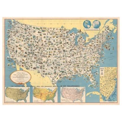
Jacques LiozuJacques Liozu's 1951 illustrated map of North and Central America1951
1951
$888.59
£673.03
€750
CA$1,238.67
A$1,348.24
CHF 710.19
MX$16,411.56
NOK 8,893.20
SEK 8,349.12
DKK 5,713.06
About the Item
Jacques Liozu's 1951 illustrated map of North and Central America is an exceptional work of cartography that combines geographical precision with artistic aesthetics. Jacques Liozu, a renowned French artist-cartographer, created this map to depict in elegant detail the vast expanses and diverse cultures of these two regions of the American continent.
The illustration of the map is a true work of art. Every detail is carefully studied to reflect geographical reality while conveying a sense of wonder and adventure.
Beyond its informative function, this map is a true invitation to travel. It captures the essence of the cultural and geographical diversity of these regions, awakening the viewer's curiosity and inspiring the desire to explore these fascinating lands.
Today, Jacques Liozu's illustrated map of North and Central America has become a prized collector's item for cartography enthusiasts and art lovers alike. It is a testament to Liozu's artistic talent and his ability to transform a geographical map into a striking and inspiring work of art. This map continues to amaze and captivate, reminding us of the importance of art in our understanding and appreciation of the world around us.
North America - Map - Central America
Odé Paris
- Creator:Jacques Liozu (1910 - 1974, French)
- Creation Year:1951
- Dimensions:Height: 22.05 in (56 cm)Width: 16.15 in (41 cm)
- Medium:
- Period:
- Condition:Very good condition.
- Gallery Location:PARIS, FR
- Reference Number:1stDibs: LU1792212726062
About the Seller
5.0
Gold Seller
Premium sellers maintaining a 4.3+ rating and 24-hour response times
Established in 2021
1stDibs seller since 2022
187 sales on 1stDibs
Typical response time: 3 hours
- ShippingRetrieving quote...Shipping from: PARIS, France
- Return Policy
Authenticity Guarantee
In the unlikely event there’s an issue with an item’s authenticity, contact us within 1 year for a full refund. DetailsMoney-Back Guarantee
If your item is not as described, is damaged in transit, or does not arrive, contact us within 7 days for a full refund. Details24-Hour Cancellation
You have a 24-hour grace period in which to reconsider your purchase, with no questions asked.Vetted Professional Sellers
Our world-class sellers must adhere to strict standards for service and quality, maintaining the integrity of our listings.Price-Match Guarantee
If you find that a seller listed the same item for a lower price elsewhere, we’ll match it.Trusted Global Delivery
Our best-in-class carrier network provides specialized shipping options worldwide, including custom delivery.More From This Seller
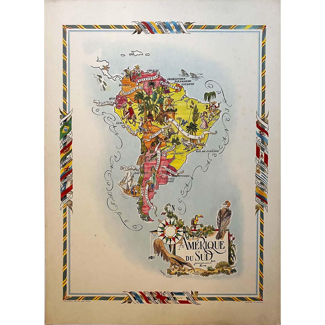
View AllJacques Liozu's 1951 illustrated map of South America
By Jacques Liozu
Located in PARIS, FR
Jacques Liozu's 1951 illustrated map of South America is an exceptional work of cartography that skilfully blends art and geography. French artist and cartographer Jacques Liozu crea...
Category
1950s Prints and Multiples
Materials
Lithograph, Paper

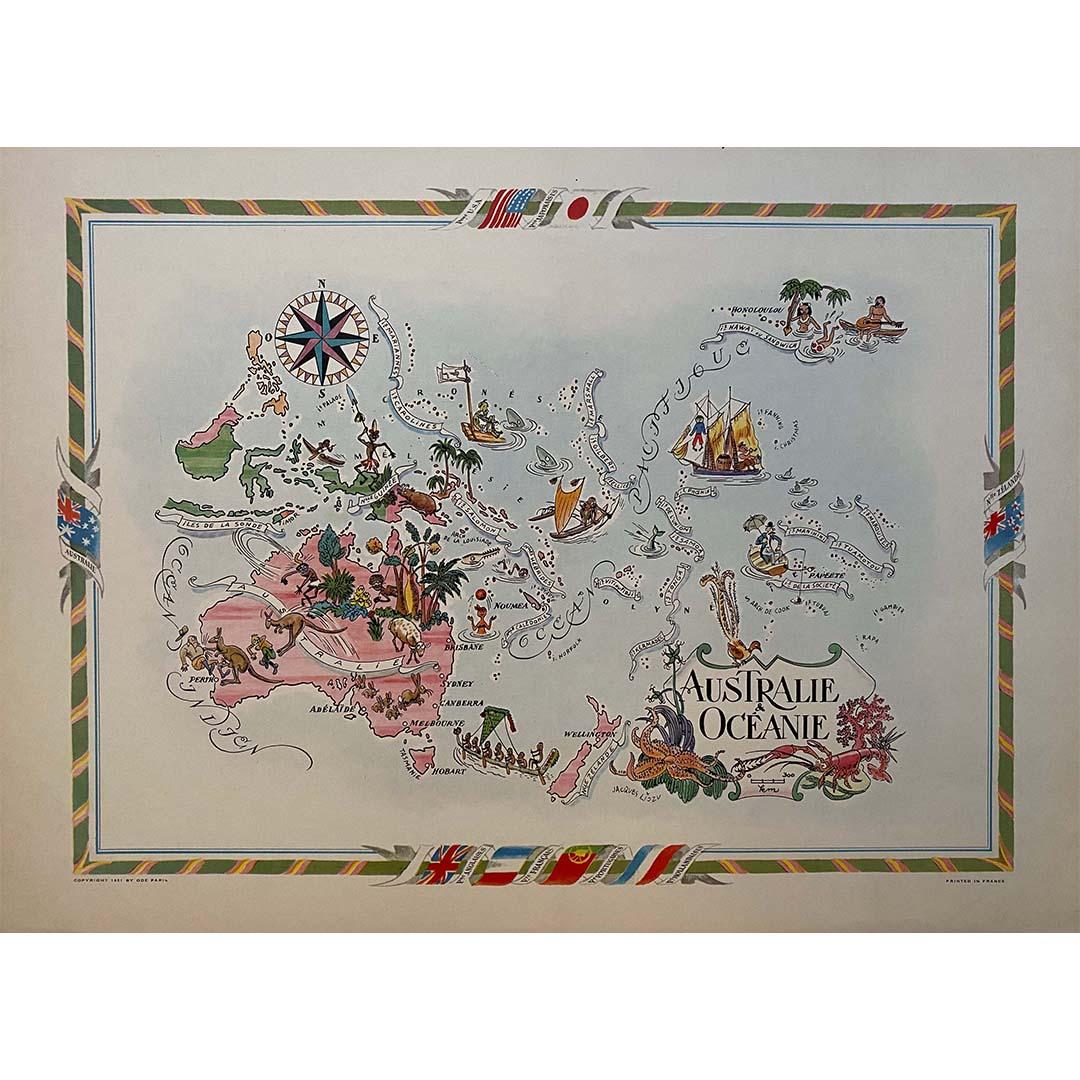
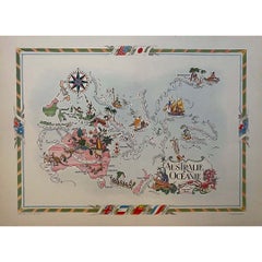
Jacques Liozu's 1951 illustrated map of Australia and Oceania
By Jacques Liozu
Located in PARIS, FR
Jacques Liozu's 1951 illustrated map of Australia and Oceania is a remarkable cartographic work that combines art and geography to offer an enchanting representation of this part of ...
Category
1950s Prints and Multiples
Materials
Lithograph, Paper
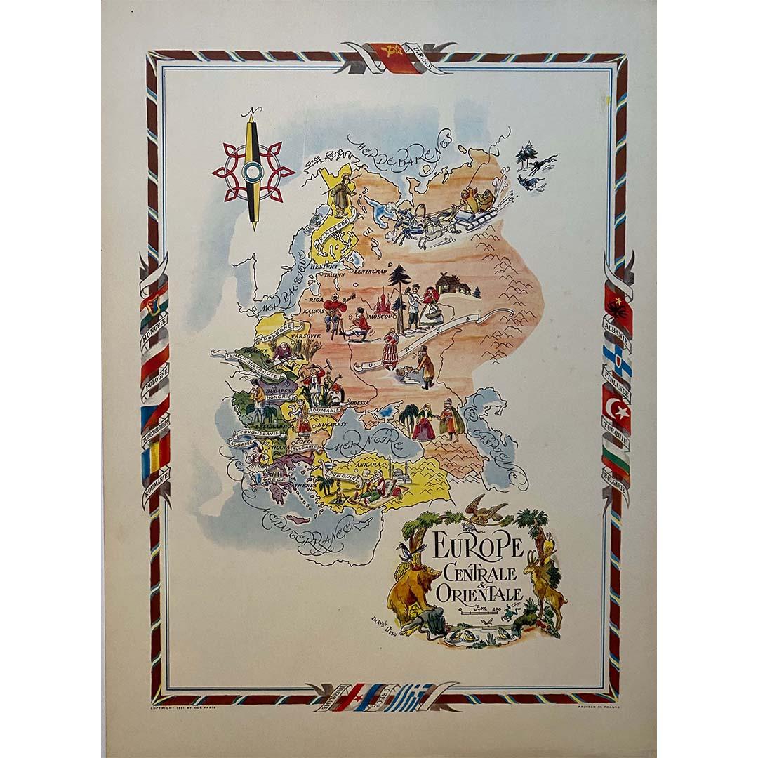
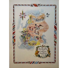
Jacques Liozu's 1951 illustrated map of Central and Eastern Europe
By Jacques Liozu
Located in PARIS, FR
Jacques Liozu's 1951 illustrated map of Central and Eastern Europe is a cartographic work of great beauty and precision. Jacques Liozu, the famous French artist-cartographer, created...
Category
1950s Prints and Multiples
Materials
Lithograph, Paper
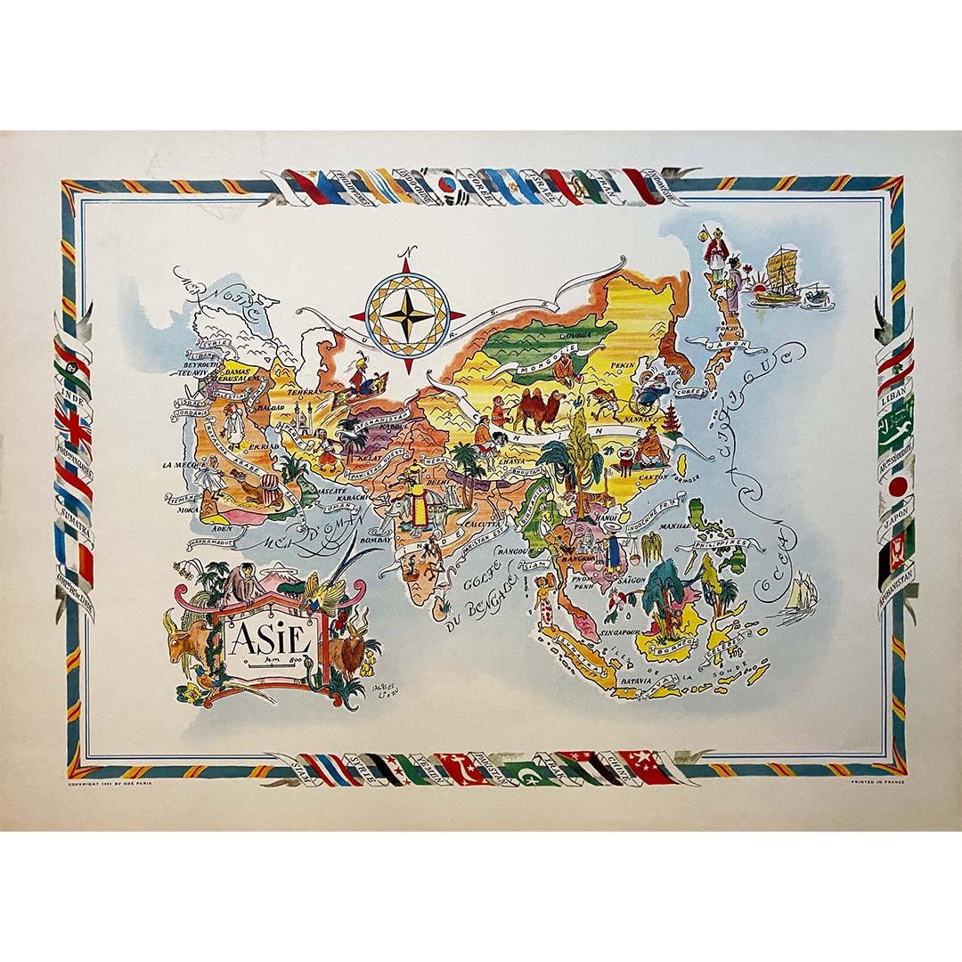
Jacques Liozu's 1951 illustrated map of Asia
By Jacques Liozu
Located in PARIS, FR
Jacques Liozu's 1951 illustrated map of Asia is an exceptional work of cartography that combines art and geography to offer a captivating vision of this vast continent. Jacques Liozu...
Category
1950s Prints and Multiples
Materials
Lithograph, Paper

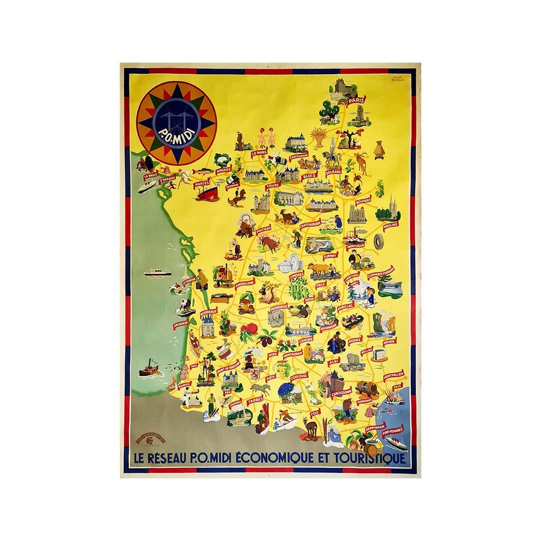
Circa 1935 map illustrated by André Giroux of the P.O Midi railroad network.
Located in PARIS, FR
Very beautiful map illustrated by André Giroux of the P.O Midi railroad network.
The railway company from Paris to Orleans and the Midi (PO Midi) is the n...
Category
1930s Prints and Multiples
Materials
Paper, Lithograph, Linen

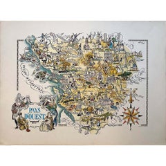
Jacques Liozu's 1951 illustrated map of the region of Pays d'Ouest
By Jacques Liozu
Located in PARIS, FR
Jacques Liozu's 1951 illustrated map of the Pays d'Ouest is a remarkable cartographic work that skilfully combines art and geography. Jacques Liozu, the famous French artist-cartogra...
Category
1950s Prints and Multiples
Materials
Lithograph, Paper
You May Also Like
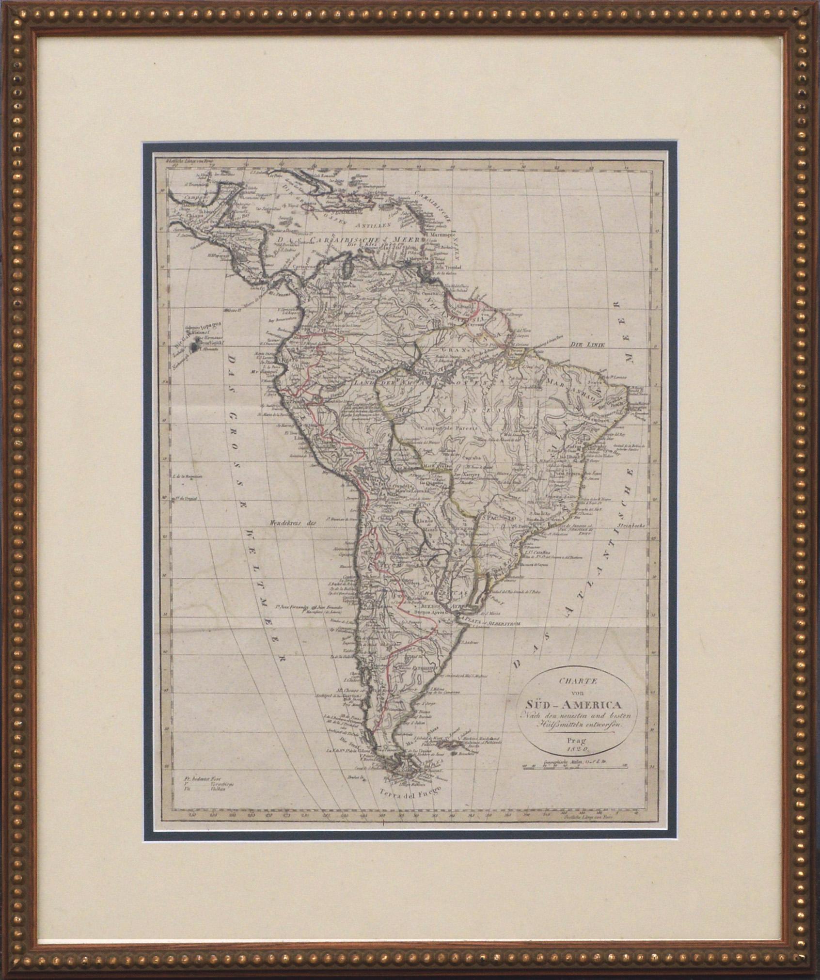
Charte von Sud-America (Map of South America) - Etching with Hand-Drawn Outlines
Located in Soquel, CA
Map of south America, engraved by Franz Pluth (Czech, 1800-1871), from the book "Neueste Länder - und Völkerkunde, ein geographisches Lesebuch für alle Stände" by Linder, F. L. (Prag...
Category
1820s Other Art Style More Prints
Materials
Paper, Printer's Ink, Etching

New Revised North America Map with Mythical Figures and Animals
Located in Houston, TX
Copperplate engraving hand colored map of Northern America. The figures of the mythical figure along the right side and the animals were added in later after the original printing. T...
Category
Early 1700s Naturalistic Landscape Prints
Materials
Engraving
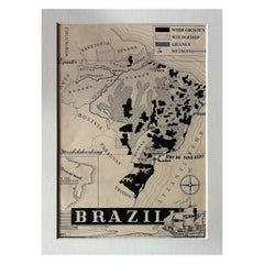
Original 1947 Map of Brazil by Charles Burki – Dutch Colonial Graphic Design
Located in Langweer, NL
Original 1947 Map of Brazil by Charles Burki – Dutch Colonial Graphic Design
This original 1947 pen-and-ink map of Brazil by Charles Burki (1909–1994) exemplifies the artist’s preci...
Category
Vintage 1940s Dutch Drawings
Materials
Paper
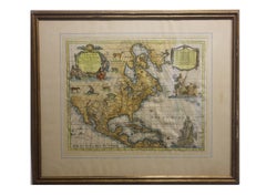
Antique Map with Hand Coloring of North America and the West Indies
Located in Langweer, NL
Original antique map titled 'Nord-America'. Old map of North America and the West Indies.
This map originates from Stielers Handatlas, published circa 1879. Stielers Handatlas (a...
Category
Antique Late 19th Century Maps
Materials
Paper
$550 Sale Price
25% Off
Free Shipping
Old Decorative Pictorial Map of the United States, circa 1953
Located in Langweer, NL
Antique map titled 'A Pictorial Map of the United States of America Showing Principal Regional Resources, Products, and Natural Features'.
This information-packed map was create by the General Drafting Company for the New Jersey Bell Telephone Company. The main map features over 700 drawings in full color including points of interest, natural resources, and agricultural products. At bottom are inset maps showing railroad lines, air routes, telephone lines, as well as a pictorial map of New Jersey...
Category
20th Century Maps
Materials
Paper
$710 Sale Price
20% Off
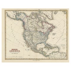
Large Original Vintage Map of North America, circa 1920
Located in St Annes, Lancashire
Great map of North America
Original color. Good condition
Published by Alexander Gross
Unframed.
Category
Vintage 1920s English Edwardian Maps
Materials
Paper

More Ways To Browse
Illustrated Map
Vintage French Map
Vintage Illustrated Maps
Retro Sci Fi Art
Robert Sayer
Rufino Tamayo Lithograph
Supreme Skateboard
The Dinner Party
The Gates Central Park
Vintage Apple Computer
Vintage Art Deco Artwork
Vintage Constellation Print
Vintage Gravestones
Vintage Heron Prints
Vintage Vinyl Record Covers
William A Cooper
Agam Lithographs
Albert Robida