Items Similar to Map of Ancient Greece - Original Etching by Antonio Zatta - 1785


Want more images or videos?
Request additional images or videos from the seller
1 of 5
Antonio ZattaMap of Ancient Greece - Original Etching by Antonio Zatta - 17851785
1785
$771.81
£583.31
€650
CA$1,078.15
A$1,172.92
CHF 618.93
MX$14,106.38
NOK 7,807.59
SEK 7,266.20
DKK 4,951.53
About the Item
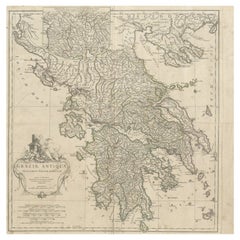
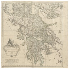
This Map of ancient Greek is an etching realized by Antonio Zatta in Venice in 1785.
The state of preservation of the artwork is good expect for the worn paper.
Mounted on a cardboard passpartout 70x50 cm.
On the lower left margin of the map the title "Grecia Antiqua" followed by Antonio Zatta, Venezia 1785.
- Creator:Antonio Zatta (1757 - 1797)
- Creation Year:1785
- Dimensions:Height: 16.54 in (42 cm)Width: 12.8 in (32.5 cm)Depth: 0.04 in (1 mm)
- Medium:
- Period:1770-1779
- Framing:Framing Options Available
- Condition:Insurance may be requested by customers as additional service, contact us for more information.
- Gallery Location:Roma, IT
- Reference Number:Seller: M-1139561stDibs: LU65037437342
About the Seller
4.9
Platinum Seller
Premium sellers with a 4.7+ rating and 24-hour response times
1stDibs seller since 2017
7,836 sales on 1stDibs
Typical response time: 1 hour
- ShippingRetrieving quote...Shipping from: Roma, Italy
- Return Policy
More From This Seller
View AllMap of Greece - Original Etching by Antonio Zatta - 18th Century
Located in Roma, IT
This Map of Greece is an etching realized by Antonio Zatta, Cartographer, publisher and typographer.
The state of preservation of the artwork is good except for the worn paper and t...
Category
1780s Figurative Prints
Materials
Etching

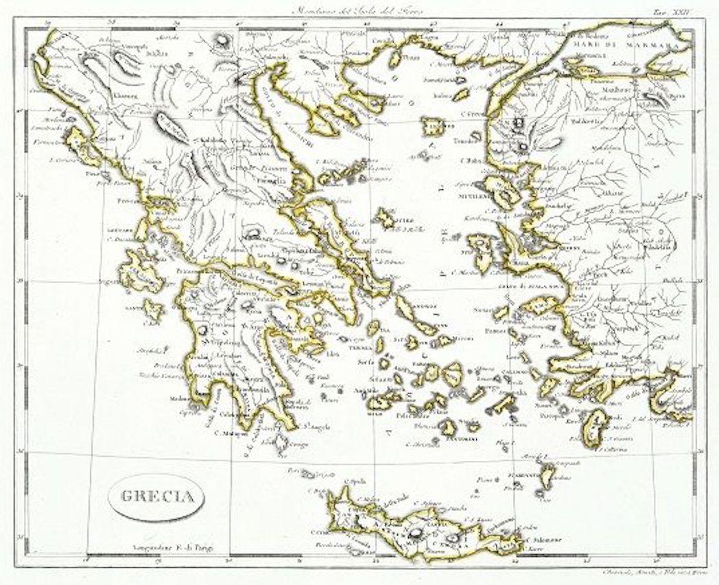
Map of Greece - Etching on Paper 19th Century
Located in Roma, IT
Image dimensions: 22.2 x 27.8 cm.
Grecia is an interesting hand-colored etching on paper, realized by an anonymous artist in the first half of the XIX century.
With the inscriptions in Italian, this original print describes the geography of Greece with the great charisma of the antique maps.
In very good conditions, except for a usual yellowing of the paper at the edges and minor defects and signs of the time, and some light yellow strips...
Category
19th Century Modern Figurative Prints
Materials
Etching

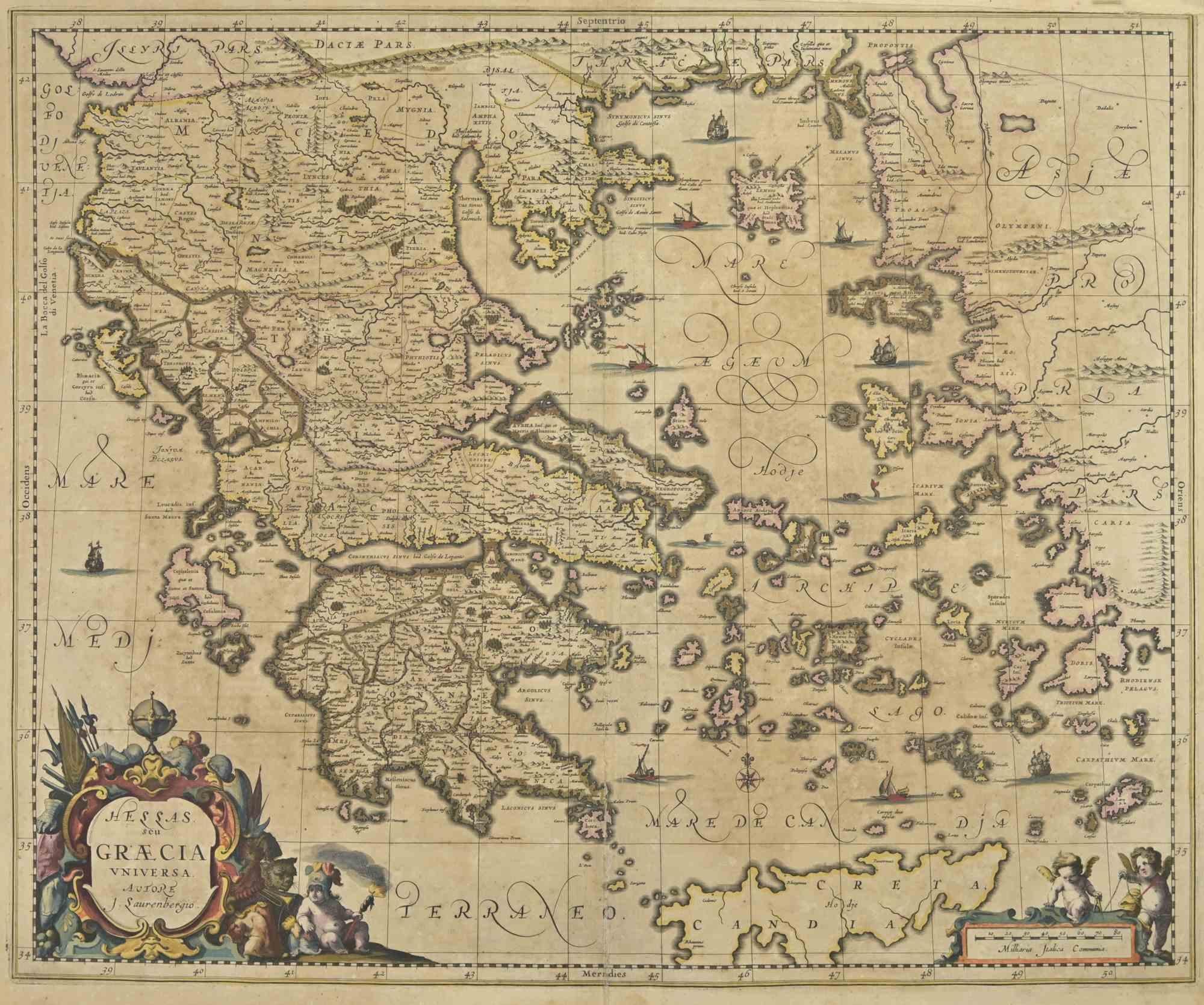
Antique Map - Map of Greece - Etching by Johannes Janssonius - 1650s
By Johannes Janssonius
Located in Roma, IT
Antique Map of Greece - Graecia Vniversa is an antique map realized in 1650 by Johannes Janssonius (1588-1664).
The Map is Hand-colored etching, with coeval watercoloring.
Good co...
Category
1650s Modern Figurative Prints
Materials
Etching

Map of Ancient Greece of Macedonia and... - Lithograph by Auguste Wahlen - 1844
Located in Roma, IT
Map of Ancient Greece of Macedonia and Thrace is a lithograph made by Auguste Wahlen in 1844.
Hand colored.
Good condition.
Bottom left is the original title "Carta della Grecia A...
Category
1840s Modern Figurative Prints
Materials
Lithograph

Map of Nubia and Abissinia - Original Etching by Antonio Zatta - 1784
Located in Roma, IT
This Map of Nubia and Abissinia is an etching realized by Antonio Zatta in Venice in 1784.
The state of preservation of the artwork is good expect for the worn paper with some littl...
Category
1770s Landscape Prints
Materials
Etching

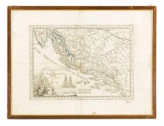
Dalmatia with the Adjacent Islands - Etching by Giovanni Cassini - 1792
Located in Roma, IT
Dalmatia with the Adjacent Islands - Plate 42 is an original old master artwork realized by Giovanni Cassini in 1792
Handcolored etching.
Includes frame
Category
Late 18th Century Old Masters Figurative Prints
Materials
Etching
You May Also Like
Antique Map of Greece by Allard (c.1698)
Located in Langweer, NL
Antique map titled 'Hellas seu Graecia Universa' Detailed map of Greece, with Crete, the Aegean Islands, and part of Turkey. With two cartouches, compass rose and scale. Carolus Alla...
Category
Antique Late 17th Century Maps
Materials
Paper

$930 Sale Price
20% Off
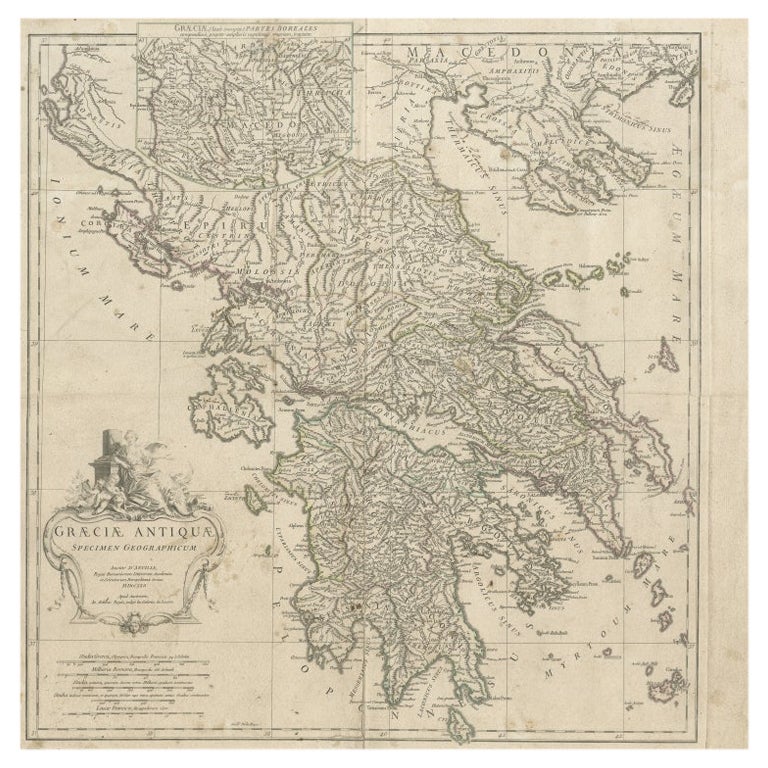
Large Scale Map of Greece with Inset Map of Macedonia, c.1786
Located in Langweer, NL
Antique map titled 'Graeciae Antiquae'. Large scale map of Greece, extends south to the island of Cythera. Inset map shows details of Macedonia. Publis...
Category
Antique 18th Century Maps
Materials
Paper
Antique Map of Greece by Keizer & de Lat, 1788
Located in Langweer, NL
Antique map titled 't Zuider Deel van Turks Europe genaamt Griekenland (..)'. Uncommon original antique map of Greece. This map originates from 'Nieuwe Natuur- Geschied- en Handelkun...
Category
Antique Late 18th Century Maps
Materials
Paper

$332 Sale Price
20% Off
Large Scale Map of Greece, Extending to Cythera with Inset of Macedonia, ca.1786
Located in Langweer, NL
Antique map titled 'Graeciae Antiquae'.
Large scale map of Greece, extends south to the island of Cythera. Inset map shows details of Macedonia. Pu...
Category
Antique 1780s Maps
Materials
Paper
$588 Sale Price
20% Off
Original Antique Map in Frame of Greece by Smith '1818'
Located in Langweer, NL
Nicely framed map titled 'Greece'. Original antique map of Greece published by C. Smith, 1818. Frame included.
Category
Antique Early 19th Century Maps
Materials
Paper
Antique Map of Greece by Lapie, 1842
Located in Langweer, NL
Antique map titled 'Carte de la Grèce Ancienne'. Map of Greece. This map originates from 'Atlas universel de géographie ancienne et moderne (..)' by Pier...
Category
Antique Mid-19th Century Maps
Materials
Paper

More Ways To Browse
Ancient Greece
Ancient Greek Art
Map Greece
Antique Maps Of Greece
Map Of Ancient Greece
Marcel Gimond
Outsider Art Cat
Pablo Picasso Pichet
Pepsi Cola Vintage
Queen Mary Ship
Raoul Dufy Watercolour
San Leandro
Sculpture Abstract Body
Sculpture Clay Birds
Sergii Shaulis
Southwest Sculpture
Steven Tyler
Stirling Moss