Items Similar to Early 18th Century Globe Terrestre Engraving

Want more images or videos?
Request additional images or videos from the seller
1 of 7
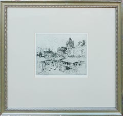
Francois HalmaEarly 18th Century Globe Terrestre Engraving1705
1705
$460
$57520% Off
£351.82
£439.7720% Off
€402.62
€503.2820% Off
CA$654.71
CA$818.3820% Off
A$708.86
A$886.0720% Off
CHF 376.87
CHF 471.0820% Off
MX$8,549.29
MX$10,686.6220% Off
NOK 4,739.30
NOK 5,924.1320% Off
SEK 4,418.38
SEK 5,522.9820% Off
DKK 3,007.08
DKK 3,758.8520% Off
About the Item
Wonderfully detailed steel engraving of the earth, locations labeled in French: Afrique, Grande Tartarie, La Chine, etc., by By Francois Halma (Dutch, 1653-1722), 1705. Interesting figures and buildings in the background. Displayed in a black wood frame. Image, 7.25"H x 5.25"L.
Cartographer and publisher of maps, active in Utrecht, Amsterdam, Franeker and Leeuwarden. Published 'Description de l'Univers' (1700); 'Algemene Wereldtbescrijving' (1705); 'Corpus Inscriptionum' (1707) and 'Lexicon Philosophicum' (1713).
About the Seller
5.0
Platinum Seller
Premium sellers with a 4.7+ rating and 24-hour response times
Established in 1986
1stDibs seller since 2014
3,049 sales on 1stDibs
Typical response time: <1 hour
- ShippingRetrieving quote...Shipping from: Soquel, CA
- Return Policy
More From This Seller
View AllCharte von Sud-America (Map of South America) - Etching with Hand-Drawn Outlines
Located in Soquel, CA
Map of south America, engraved by Franz Pluth (Czech, 1800-1871), from the book "Neueste Länder - und Völkerkunde, ein geographisches Lesebuch für alle Stände" by Linder, F. L. (Prag...
Category
1820s Other Art Style More Prints
Materials
Paper, Printer's Ink, Etching

"The World" Published by Cummings & Hilliard, No. 1, Cornhill, Boston
Located in Soquel, CA
"The World" Published by Cummings & Hilliard, No. 1, Cornhill, Boston
Early 19th century engraved double hemisphere Atlas Map, titled "The World." Hand colored original outlines. Pu...
Category
1820s American Realist Landscape Prints
Materials
Paper, Printer's Ink, Etching
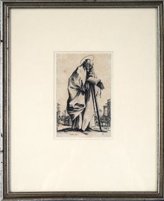
St. Simon from Les Grands Apôtres Debout Original 17th Century Etching
By Jacques Callot
Located in Soquel, CA
St. Simon from "Les Grands Apôtres Debout, Représentant Le Sauveur, La Bienheureuse Marie et Les Saints Apôtres" Original 17th Century Etching by Jacques Callot.
This portrait of St. Simon depicts him standing in a street, holding a book and leaning on a saw. The saw is typical of St. Simon's depictions as he was said to have been martyred by being sawed in half. Very good impression of this print, with bold lines and high contrast. This leaflet contains the words "Callot fec." in the bottom right, shorthand for the Latin fecit, meaning Callot made this. This edition contains no publishers mark or numbering on the piece, indicating that it is from the first printing state.
Jacques Callot was born in the Duchy of Lorraine around 1592 to an important family in the court. He started an apprenticeship as a goldsmith at the age of 15, but later began learning etching. He is known for his technical skill in etching and for developing the echoppe style etching needle. Callot's etchings featured religious figures as well as soldiers, common people, beggars, and court individuals. His series "The Miseries and Misfortunes of War," published while Lorraine was invaded during the Thirty Years War, later influenced Goya's "Los Desastres de la Guerra...
Category
17th Century Old Masters Figurative Prints
Materials
Ink, Laid Paper, Etching
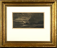
Antique British Steamship Signed Etching
Located in Soquel, CA
Antique British Steamship Etching
This moody etching by Joseph Kirkpatrick (British, b. 1874 d. 1936) features a steamboat in the midst of choppy w...
Category
1910s English School Landscape Prints
Materials
Paper, Ink, Etching
Late 19th Century Normandy French Market Engraving
By Charles John Watson
Located in Soquel, CA
Charming engraving of the market in Aumale, France in Normandy by Charles John Watson (British, 1846-1927), circa 1880. Signed within engraving and below by artist. Presented under g...
Category
1880s Impressionist Landscape Prints
Materials
Paper, India Ink
$1,480 Sale Price
20% Off
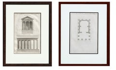
18th Century Pair of Du Temple de la Fortune Virile Facade and Floor Plan
By Antoine Babuty Desgodetz
Located in Soquel, CA
Pair of lithographs of The Temple of Portunus in Rome (Italian: Tempio di Portuno) facade and floor plan by Antoine Desgodetz (French, 1653-1728). These pag...
Category
1770s Prints and Multiples
Materials
Paper, Engraving, Ink
You May Also Like
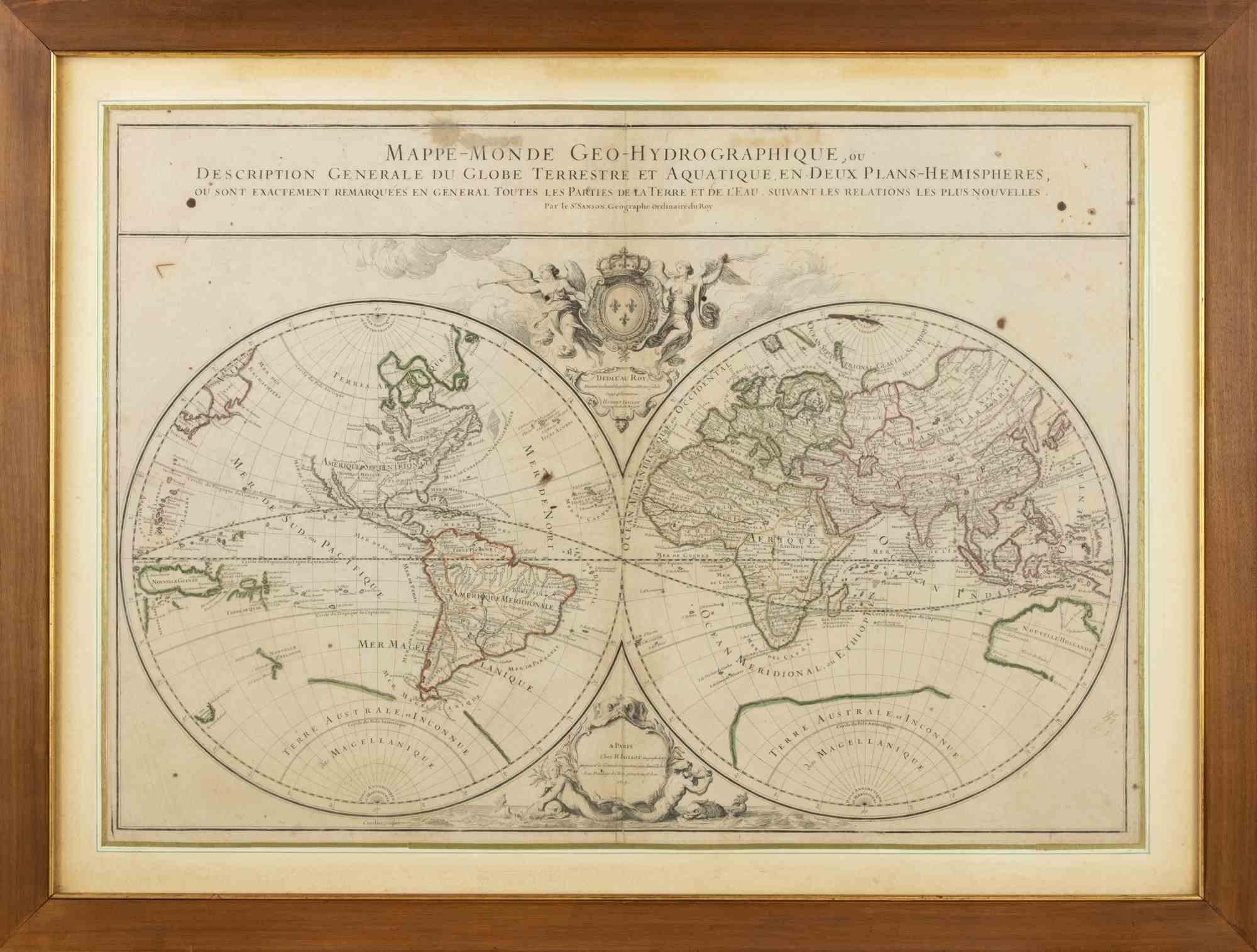
World Map - Etching by Hubert Nicholas-Jaillot - 1719
Located in Roma, IT
World map is an original modern artwork realized by Hubert Nicholas - Jaillot, printed by Louis Cordier in Paris 1719.
Etching on copper
The artwork depicts two hemispheres, conti...
Category
1710s Old Masters Figurative Prints
Materials
Etching

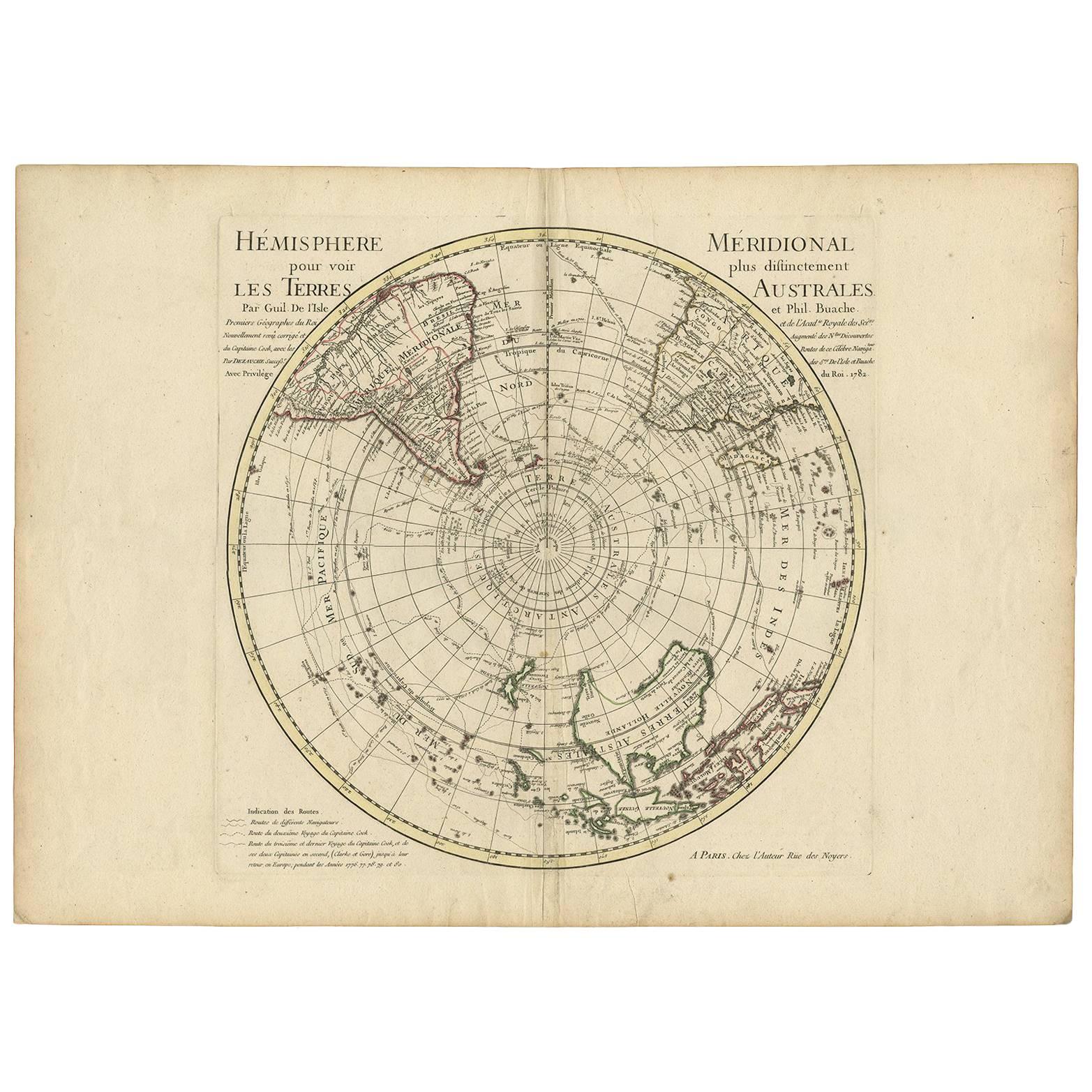
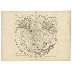
18th Century Antique Engraving of the Southern Hemisphere by G. de L'Isle
By Guillaume De L'Isle
Located in Langweer, NL
Antique map titled 'Hemisphere Meridional pour voir plus distinctement Les Terres Australes'. Hemispherical map of the southern hemisphere centered on ...
Category
Antique Late 18th Century Maps
Materials
Paper
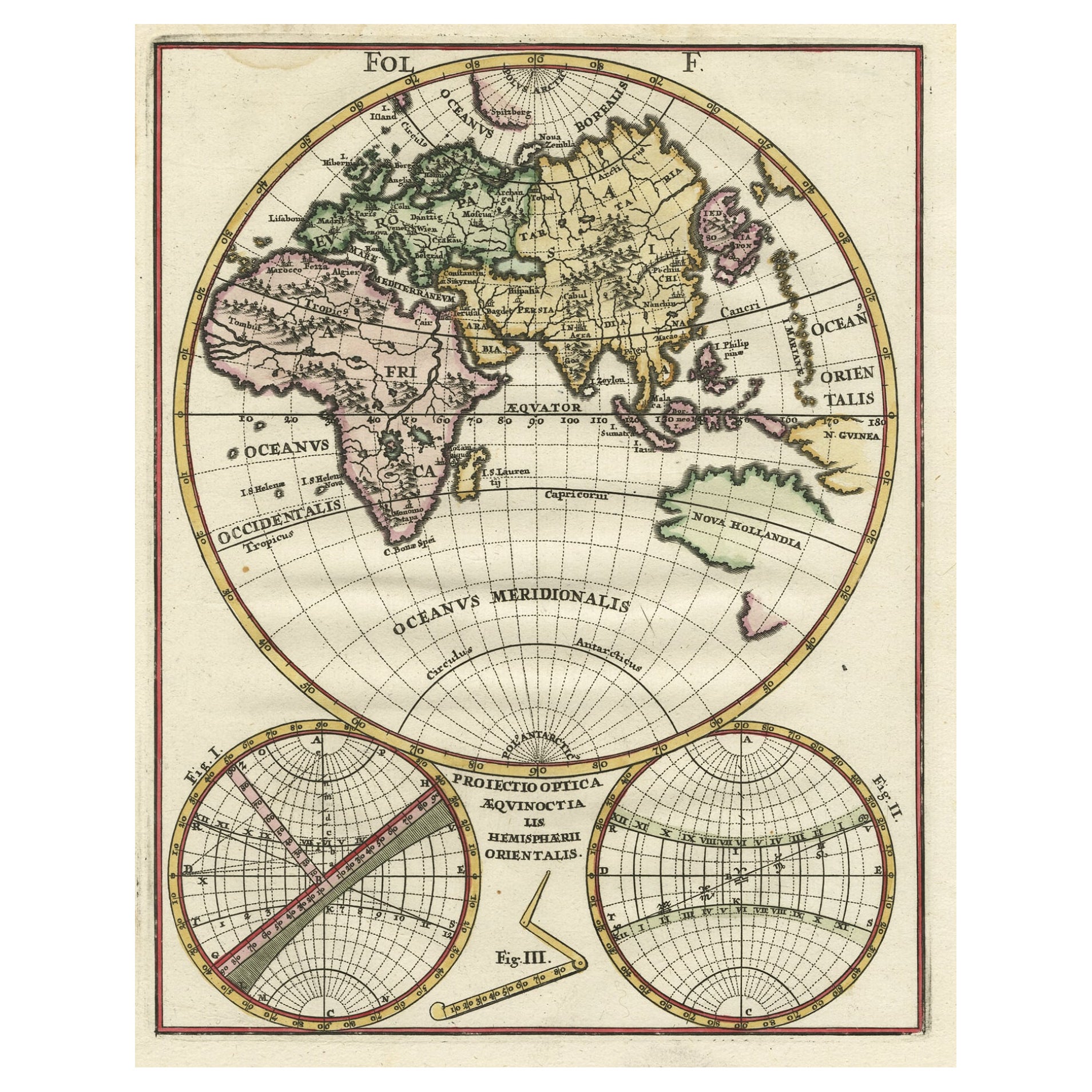
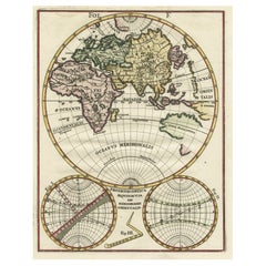
Original Antique Engraving of the Eastern Hemisphere, c.1700
Located in Langweer, NL
Antique map titled 'Proiectio Optica Aequinoctia lis Hemishaerii Orientalis' - Map of the Eastern Hemisphere with Africa, Europe, Asia and Nova Hollandia...
Category
Antique 17th Century Maps
Materials
Paper
$874 Sale Price
20% Off
Antique Map of the Eastern Hemisphere in Frame, 'circa 1683'
Located in Langweer, NL
Antique map titled 'Climats selon les Anciens'. Miniature map of the Eastern Hemisphere showing the climatic regions. This map originates from 'Description de l'Univers' by A.M. Mall...
Category
Antique Late 17th Century Maps
Materials
Paper

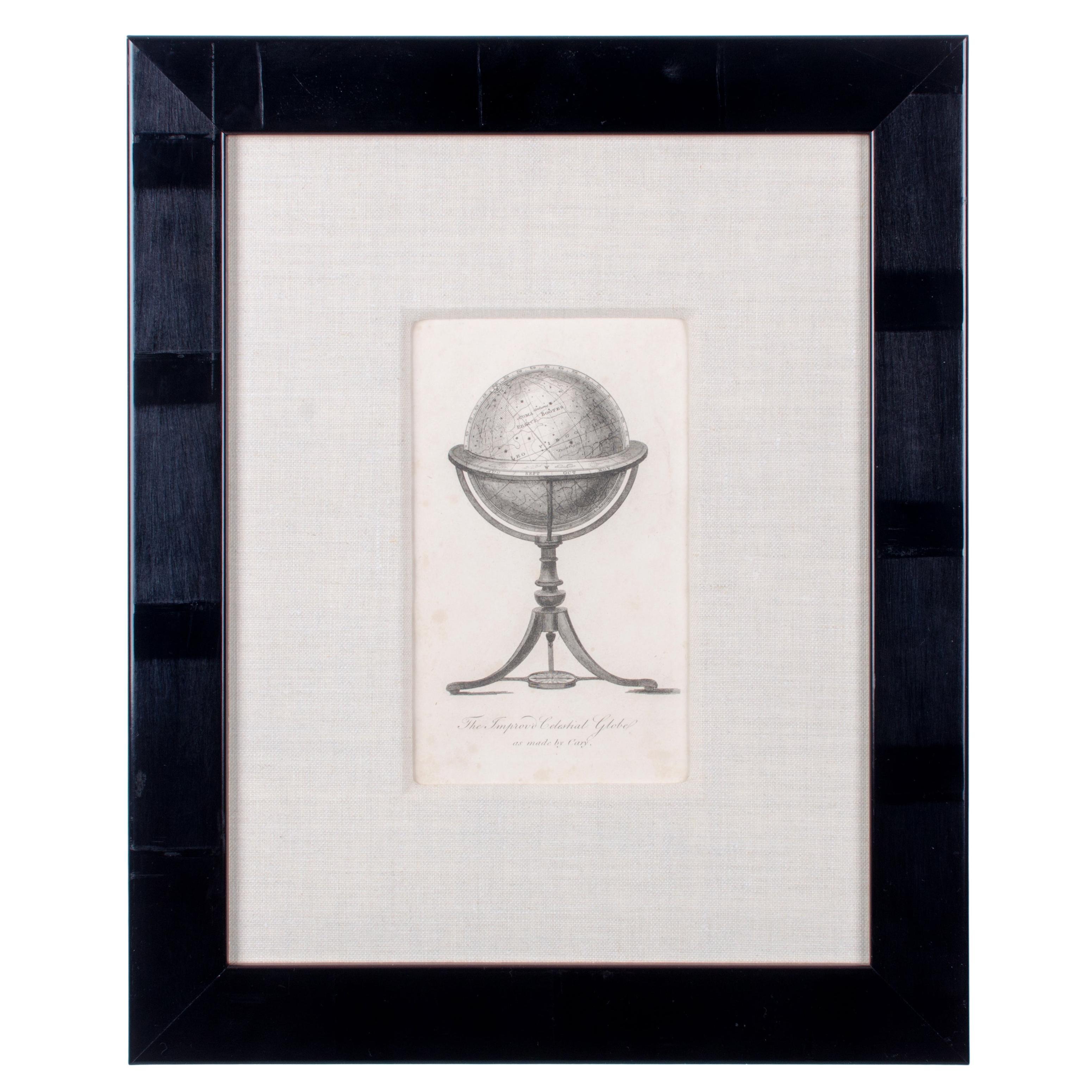
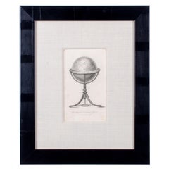
Cary Celestial Globe Antique Print
Located in Savannah, GA
Cary Celestial Globe Antique Print
Offered is a framed antique copperplate engraving entitled “The Improved Celestial Globe as made by Cary”.
Sight 5 ½ by 8 ½ inches
Frame 13...
Category
Antique 19th Century English Prints
Materials
Glass, Wood, Paper
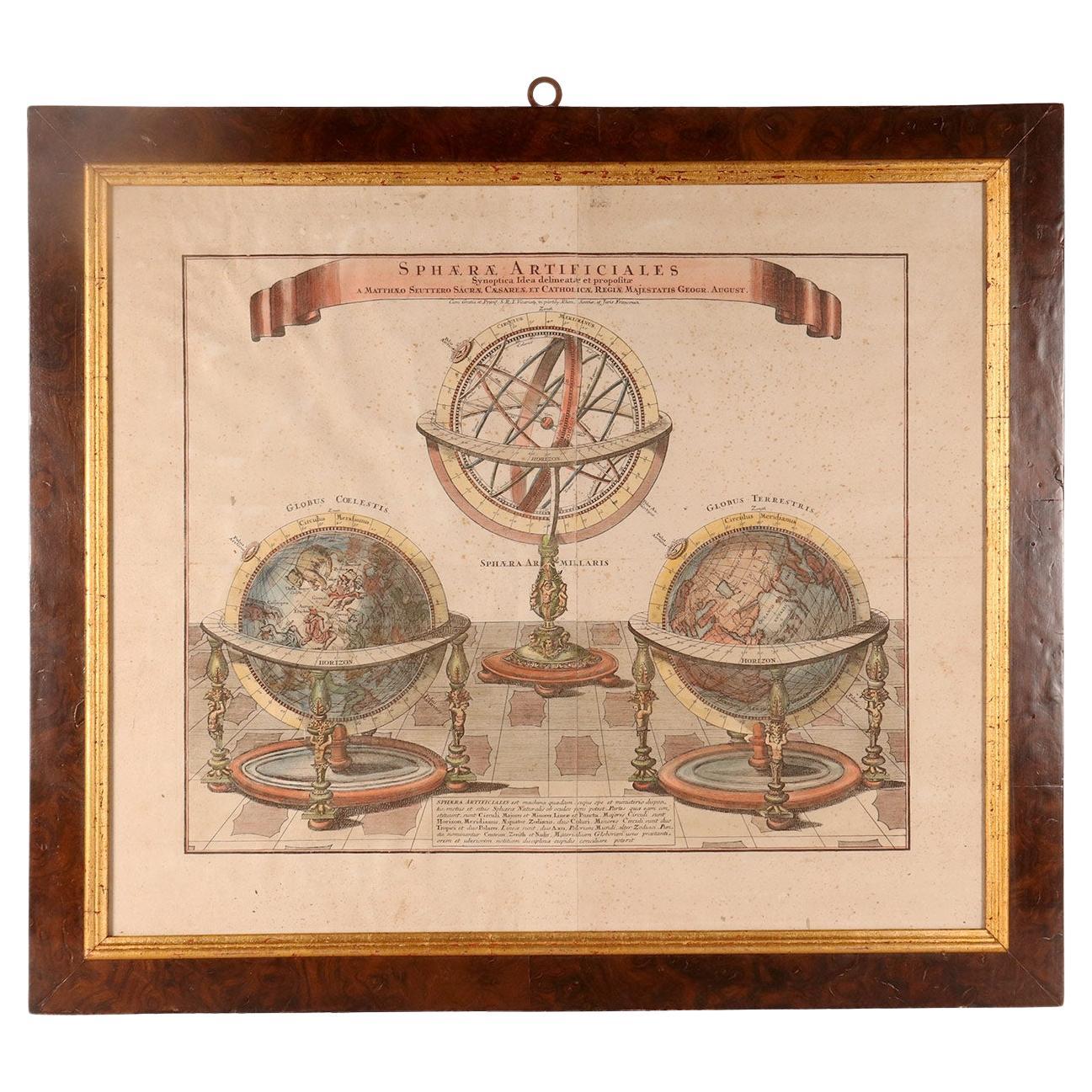
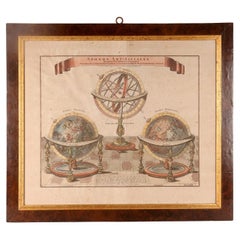
A watercolor engraving depicting an armillary sphere and globes, Germany 1740.
Located in Milan, IT
A watercolor engraving on paper, depicting a terrestrial globe, an armillary sphere and a celestial globe. Fir wood frame, walnut briar veneer, with gilded ramin wood edge. Mattäus S...
Category
Antique Mid-18th Century German Paintings
Materials
Wood, Walnut, Paper
More Ways To Browse
Steel Engraving
Steel Engravings Antique
Antique French Label
Engravings 1700
Acrylic Flower Sculpture
Bay Area California Artist
Celotto Afro
Charles Church
Charpentier Georges
Cycladic Art
Emperor Penguin
English Country House Painting
Expressionist Clay Sculpture
French Military Paintings
Frilli Gallery
Glass Cube Sculpture
Grinling And Gibbons
Helen Of Troy