Items Similar to Map of Cheapside, as it Appeared in the Year 1585
Want more images or videos?
Request additional images or videos from the seller
1 of 7
George VertueMap of Cheapside, as it Appeared in the Year 15851814
1814
$250
£195.27
€221.36
CA$358.40
A$393.15
CHF 205.70
MX$4,679.25
NOK 2,598.13
SEK 2,437.10
DKK 1,653.25
About the Item
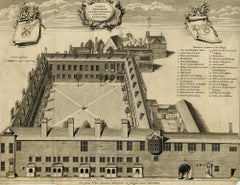
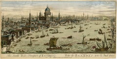
Bird's eye view of the old buildings in West Cheap (Cheapside) as they appeared in 1585, from Londina Illustrata.
London: Robert Wilkinson, 1814
Engraving on buff wove paper, 11 7/8 x 16 1/4 inches (300 x 411 mm), full margins. Central fold (as issued) with paper tape supports on the verso, along with some minor discoloration in the margins. Generally in good condition with issues being consistent with age.
St. Michael-le-Querne, also called St. Michael ad Bladum, was a parish church in the Farringdon Within Ward in the City of London. It was destroyed in the Great Fire of London of 1666 and not rebuilt. The name is apparently a reference to a quern-stone as there was a corn market in the churchyard.
- Creator:
- Creation Year:1814
- Dimensions:Height: 11.82 in (30 cm)Width: 16.19 in (41.1 cm)
- Medium:
- Movement & Style:
- Period:
- Condition:
- Gallery Location:Middletown, NY
- Reference Number:Seller: BH9491stDibs: LU1979213807132
George Vertue
George Vertue (1684-1756) was an English engraver, artist and publisher, as well as a researcher on the history of British art. He was a member of the Academy of Painting, as well as the Society of Antiquaries. He created around five hundred portraits and a similar number of published plates were devoted to antiquarian subjects. Jacobus Houbraken (1698-1780) was a Dutch engraver who devoted himself almost entirely to portraiture. He produced a published record of the lives of artists from the Dutch Golden Age. In many cases his portraits are the only likenesses left of these people. Houbraken He collaborated with the historian Thomas Birch and artist George Vertue, on the project entitled, "Heads of Illustrious Persons of Great Britain", published in parts in London from 1743 to 1752. From 1752 to 1759 he worked with the historian Jan Wagenaar (1709–1773) on his 21 part "Vaderlandsche Historie", published by Isaac Tirion in Amsterdam.
About the Seller
5.0
Vetted Professional Seller
Every seller passes strict standards for authenticity and reliability
Established in 2004
1stDibs seller since 2022
76 sales on 1stDibs
Typical response time: 6 hours
- ShippingRetrieving quote...Shipping from: Middletown, NY
- Return Policy
More From This Seller
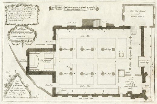
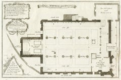
View AllThe plan of St. Martin's Church, St. Martin in the Fields
By George Vertue
Located in Middletown, NY
London: Society of Antiqauries London, 1744. Engraving on buff wove paper with a large heraldic watermark with Strasbourg lily with a crown and shied and the letters LVG, 9 1/2 x 14 ...
Category
Mid-18th Century English School Landscape Prints
Materials
Handmade Paper, Engraving
Gresham College
By George Vertue
Located in Middletown, NY
Etching with engraving on cream laid paper with a Garden of Holland or Maid of Dort Pro Patria watermark, 11 x 14 1/4 inches (278 x 361 mm), thread margins. Lettered with the title in a cartouche at the top-center sheet, continuing "a Latere Occidentali Prospeus AD MDCCXXXIX," with numbers over the image at right that correspond to a key 1 to 29, and with publication details: "Georgius Vertue Londini delineavit et Sculpsit anno MDCCXXXIX". Multiple expert repairs, notably a Y-shaped, expert paper tape repair on the verso. Handling creases, toning. All issues are consistent with age. An impression of this work may be viewed in the permanent collection of the British Museum, registration No. 1880,1113.3963.
A bird's eye view of the college in Broad Street, London, showing the courtyard, adjoining stable yard to the right, and the buildings at the back.
This work was included in Frederick Crace...
Category
Early 18th Century English School Landscape Prints
Materials
Handmade Paper, Engraving, Etching
View of the New Trinity House on Tower Hill
Located in Middletown, NY
London: Laurie & Whittle, 1799
Engraving on buff wove paper, 10 3/4 x 15 3/4 inches (271 x 338 mm), uneven narrow to wide margins. Soft vertical fold at the center sheet (as issued)...
Category
Late 18th Century English School Landscape Prints
Materials
Handmade Paper, Engraving
The Monument of London in Remembrance of the Dreadful Fire of 1666
Located in Middletown, NY
Bowles, Thomas III (after John Donowell)
John Bowles & Richard Wilkinson, 1751.
Steel engraving with extensive hand coloring in watercolor on cream wove paper, 10 1/4 x 16 inches (...
Category
Mid-18th Century English School Landscape Prints
Materials
Watercolor, Handmade Paper, Engraving
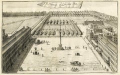
A Prospect of Lincoln's Inn; A Survey of the Cities of London and Westminster
By Johannes Kip
Located in Middletown, NY
A fine prospect image of gardens at Lincoln's Inn, London.
A Prospect of Lincoln's Inn; A Survey of the Cities of London and Westminster; The Fountain and Gardens in New Square, Lin...
Category
Early 18th Century English School Landscape Prints
Materials
Handmade Paper, Engraving
The South West Prospect of London – English School 18th century
Located in Middletown, NY
A stunning 18th century optical view of London from the Thames.
London: 1760.
Copper plate engraving with hand coloring in watercolor on cream laid paper with a large circular wate...
Category
Mid-18th Century English School Landscape Prints
Materials
Watercolor, Handmade Paper, Engraving
You May Also Like
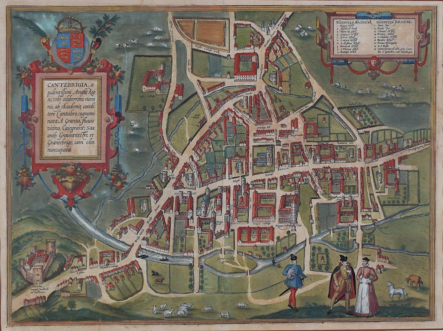
Map of Cambridge, c.1572 engraving by Braun & Hogenberg
Located in London, GB
To see our other views of Oxford and Cambridge, scroll down to "More from this Seller" and below it click on "See all from this Seller" - or send us a message if you cannot find the ...
Category
16th Century Realist Landscape Prints
Materials
Engraving

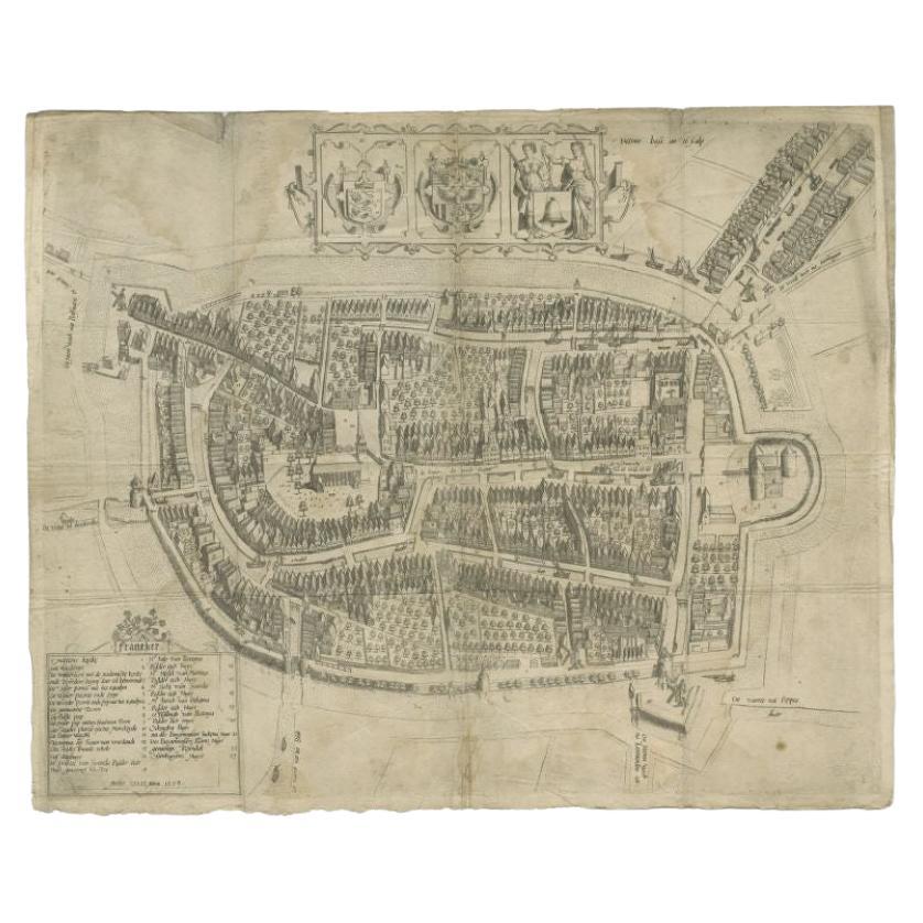
Antique Map of the City of Franeker by Bast, 1598
Located in Langweer, NL
Antique map titled 'Franeker'. Very rare and early map of the city of Franeker, Friesland. With decorative cartouche and Dutch legend. Artists and Engravers: Pieter Bast (1550-1605) ...
Category
Antique 16th Century Maps
Materials
Paper
$1,052 Sale Price
20% Off
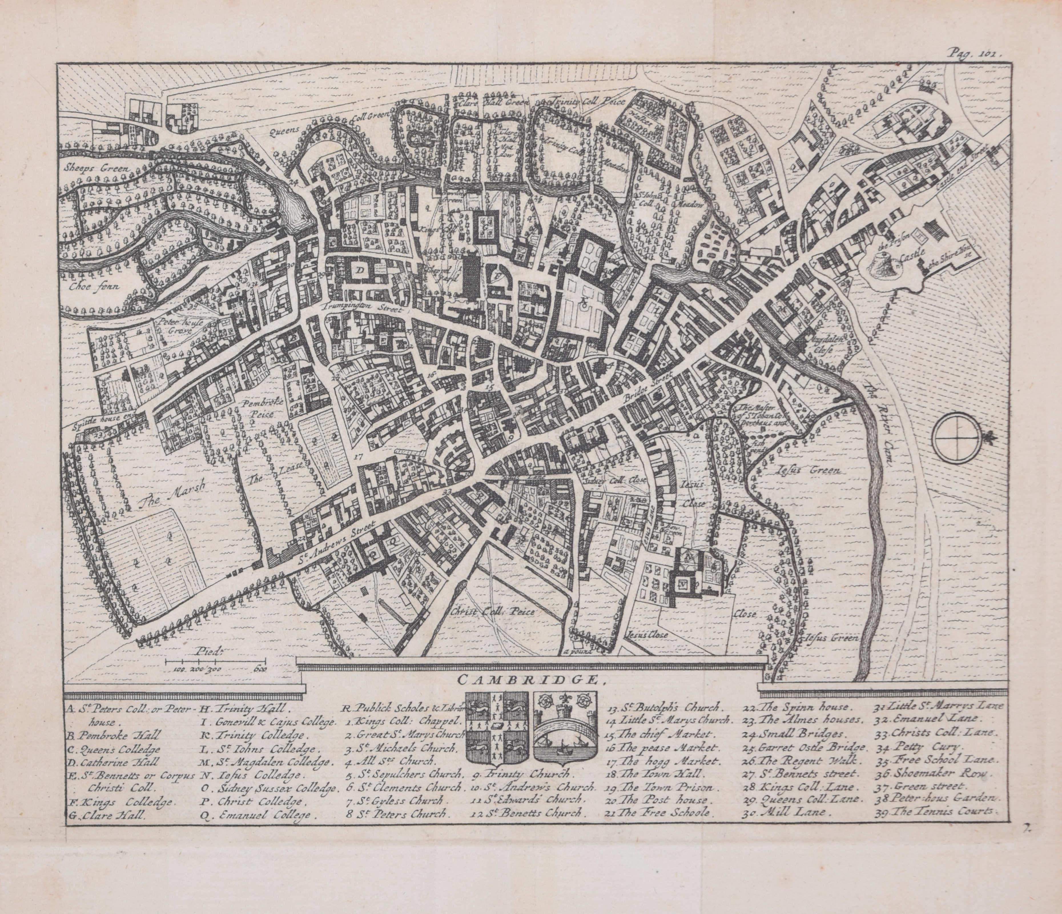
Pieter van der Aa: Map of Cambridge, after David Loggan
By Pieter Van Der Aa
Located in London, GB
Pieter van der Aa (1659-1733), after David Loggan (1634–1692)
Map of Cambridge
12 x 16 cm
Engraving (1727)
An eighteenth-century map of Cambridge eng...
Category
Early 18th Century Realist Prints and Multiples
Materials
Engraving

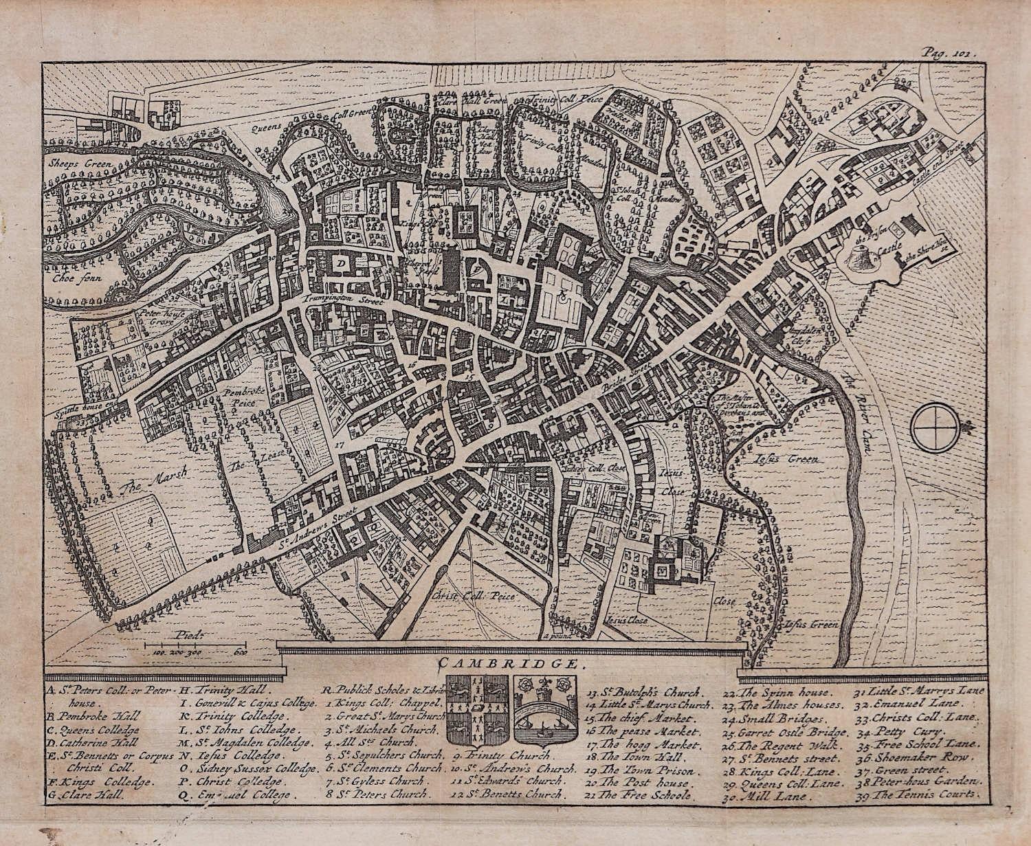
Map of Cambridge, engraving Pieter van der Aa after David Loggan
By Pieter Van Der Aa
Located in London, GB
Pieter van der Aa (1659 - 1733), after David Loggan (1634 - 1692)
Map of Cambridge
Engraving
12 x 16 cm
An eighteenth-century view of Cambridge, engraved by Pieter van der Aa after ...
Category
Early 18th Century Realist Prints and Multiples
Materials
Engraving

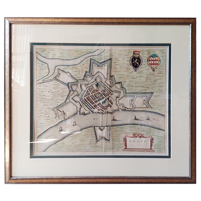
Antique Map of the City of Grave by Blaeu, 1649
Located in Langweer, NL
Antique map titled 'Grave'. Original antique map of the city of Grave, the Netherlands. Published by J. Blaeu, 1649.
Artists and Engravers: Joan Blaeu (23 September 1596 - 28 May...
Category
Antique 17th Century Maps
Materials
Paper

$658 Sale Price
20% Off
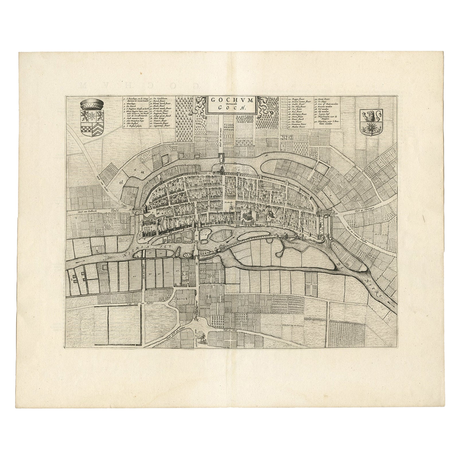
Antique Map of the City of Goch by Blaeu, 1649
Located in Langweer, NL
Antique map titled 'Gochum vernacule Goch'. Old map of the city of Goch, Germany. This map originates from 'Novum Ac Magnum Theatrum Urbium Belgicæ Liberæ ac Foederatæ' by J. Blaeu. ...
Category
Antique 17th Century Maps
Materials
Paper
More Ways To Browse
Antique St Michael
Hassam Etching
Joichi Hoshi Woodblock Prints
Joseph Friebert
Kahn Scott
Lahaina Harbor
Marco Pierre
Mark Coomer
Milwaukee Poster
Moran Chromolithograph
New Orleans Etching
Prince Charles Lithograph
Shepard Fairey Wave
Shokler Harry
Sir Muirhead Bone On Sale
Ski Signs Vintage
The Empire Of Light
Thomas Moran Grand Canyon