Corea Harbor
View Similar Items


Want more images or videos?
Request additional images or videos from the seller
1 of 5
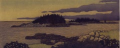
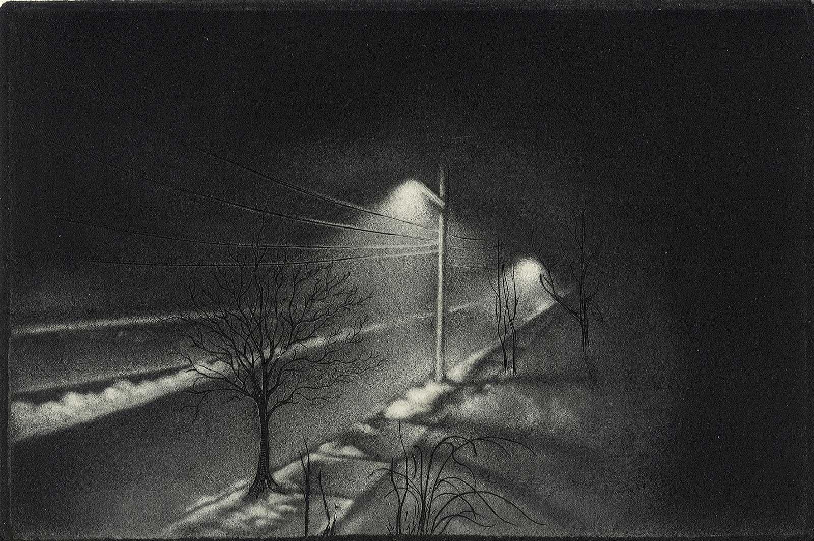
James GroleauCorea Harborcirca 2002
circa 2002
About the Item
- Creator:James Groleau (1953, American)
- Creation Year:circa 2002
- Dimensions:Height: 4.75 in (12.07 cm)Width: 11.75 in (29.85 cm)
- Medium:
- Movement & Style:
- Period:
- Condition:
- Gallery Location:New Orleans, LA
- Reference Number:1stDibs: LU84135424602
About the Seller
4.9
Platinum Seller
These expertly vetted sellers are 1stDibs' most experienced sellers and are rated highest by our customers.
Established in 1988
1stDibs seller since 2018
753 sales on 1stDibs
Typical response time: 3 hours
Associations
International Fine Print Dealers Association
More From This SellerView All
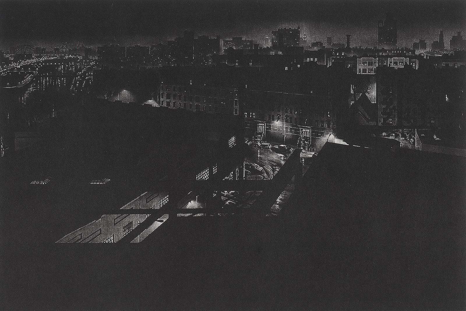
- Girders (rainy night view of artist's former studio in Washington HeightsBy Craig McPhersonLocated in New Orleans, LA"Griders" is Craig McPherson's rainy night scene showing the view from his former studio in Washington Heights in NYC. The image is the companion pi...Category
1980s Contemporary Landscape Prints
MaterialsMezzotint
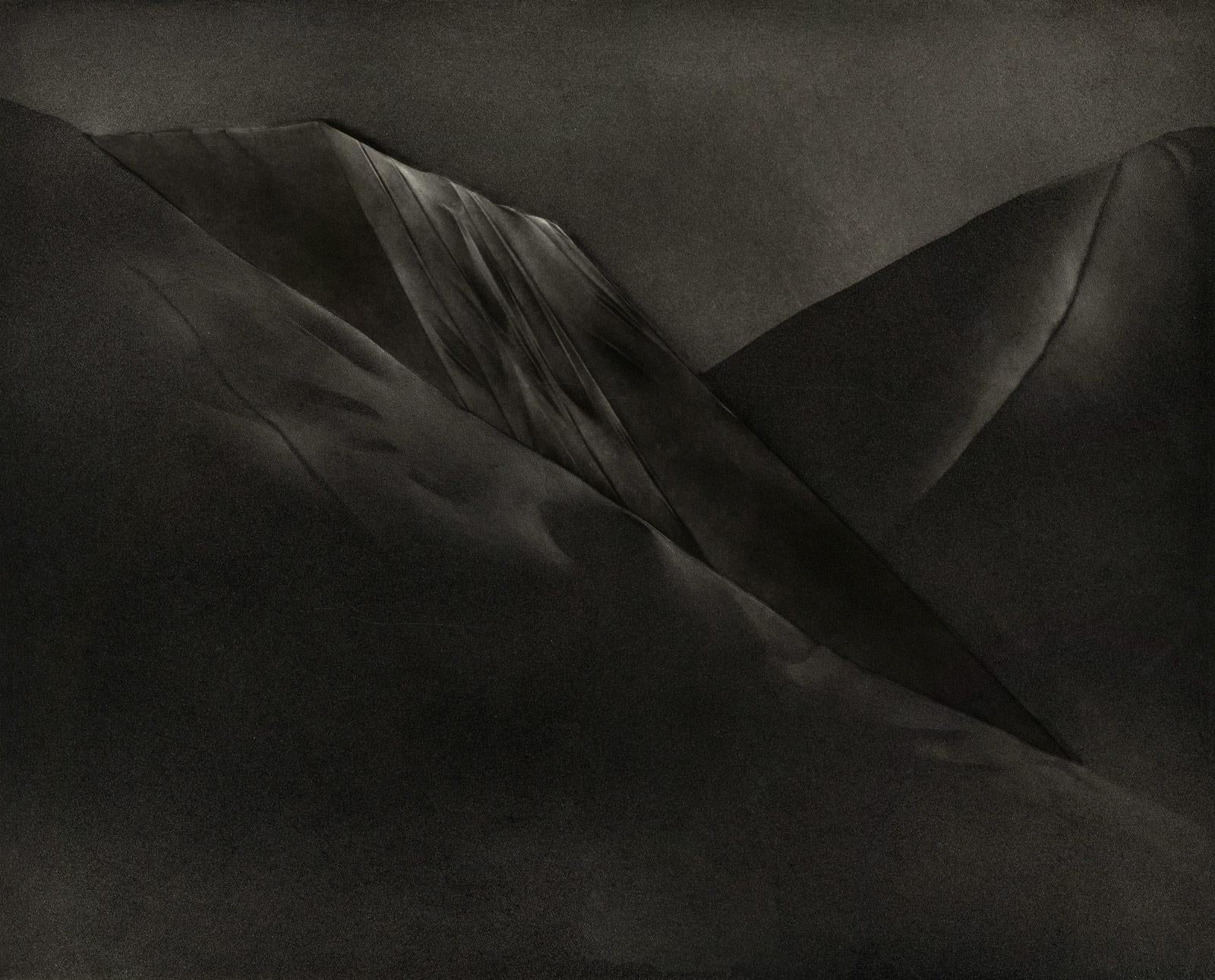
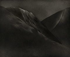
- Mont et Mervale (Mountains and Wonder)By Christine RavauxLocated in New Orleans, LABorn in Charleroi, Belgium, Christine Ravaux is an artist who mirrors her surroundings in the mezzotints she creates. She has portrayed the black hills that dot the landscape of the ...Category
1990s Contemporary Landscape Prints
MaterialsMezzotint, Aquatint
 $300 Sale Price33% Off
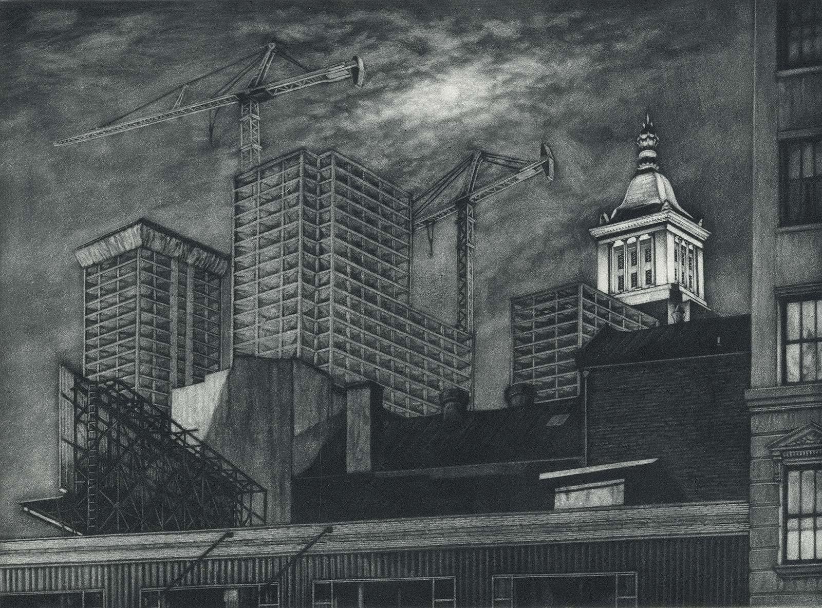
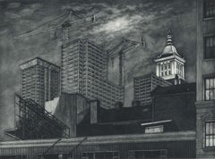
 - Cranes and Concrete (in the 80s, a boom saw buildings racing into the sky?By Frederick MershimerLocated in New Orleans, LA"Cranes and Concrete" is Frederick Mershimer's mezzotint of the construction scene on Broadway between 13th and 14th streets. Mershimer is no strang...Category
1980s Contemporary Landscape Prints
MaterialsMezzotint
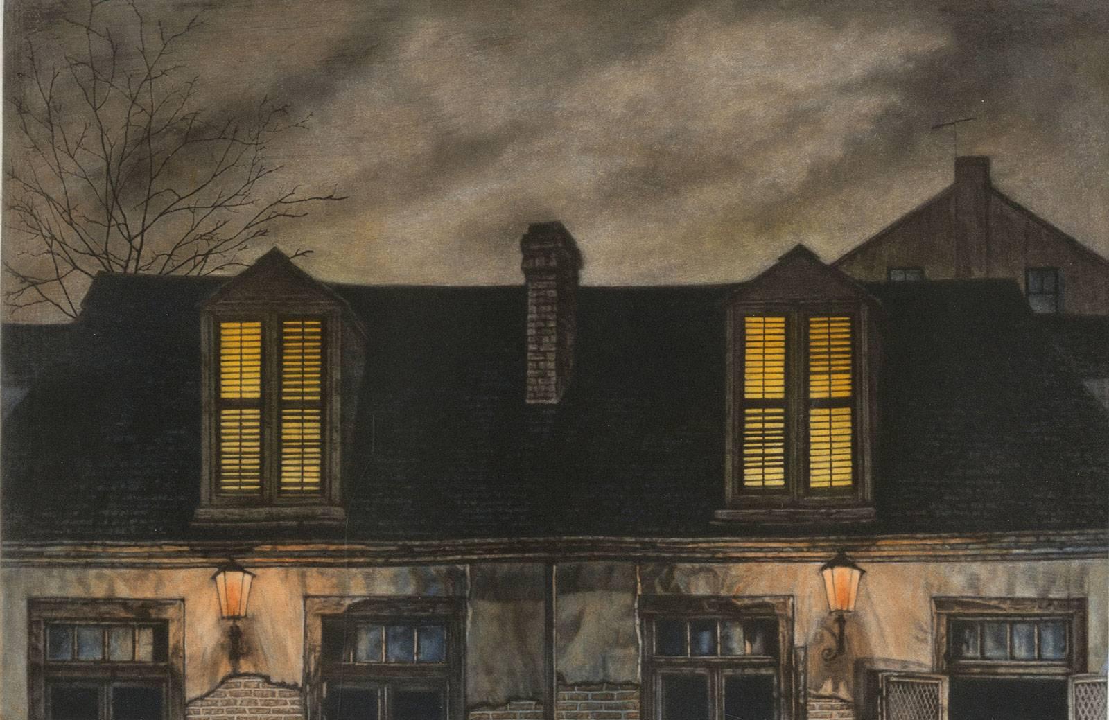
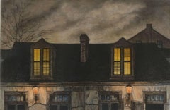
- Lafitte's Blacksmith House (a bar named for a pirate on Bourbon St, New Orleans)By Frederick MershimerLocated in New Orleans, LALafitte's Blacksmith Shop is a New Orleans landmark at 941 Bourbon St. Like most New Orleans legends, history of Lafitte's Blacksmith Shop is a gumbo of tru...Category
Early 2000s Contemporary Landscape Prints
MaterialsMezzotint, Aquatint
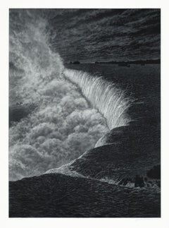
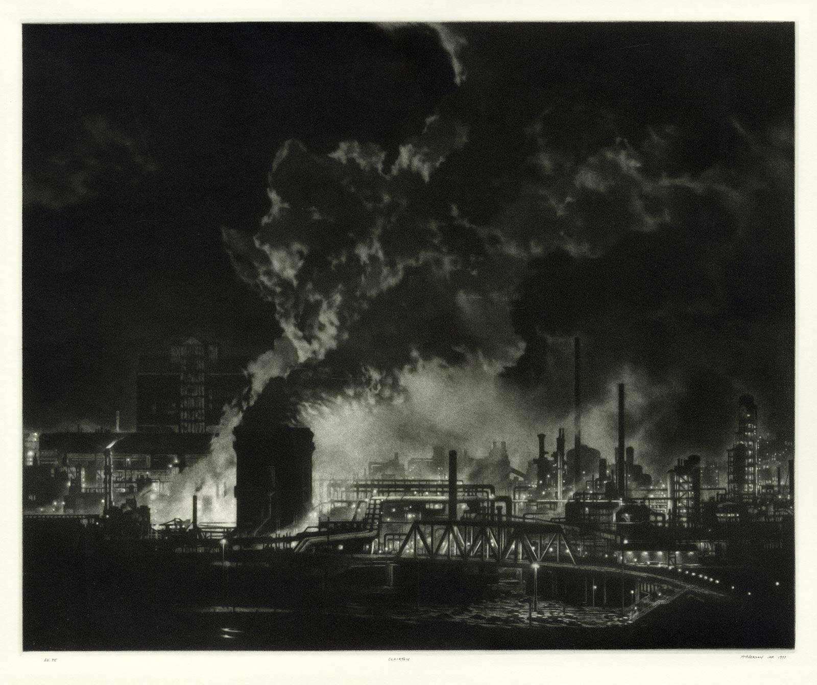
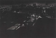
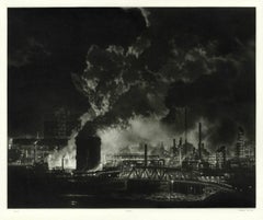
- Clairton (night view of US Steel Clairton coke plant, largest in America)By Craig McPhersonLocated in New Orleans, LAMcPherson's night view of the Clairton steelworks is printed on light green laid paper referenced as Hartley M1. It is signed, titled and dated in pencil. Marked ed 75 and "imp" in...Category
1990s American Modern Landscape Prints
MaterialsMezzotint
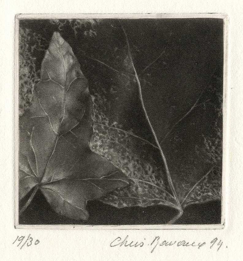
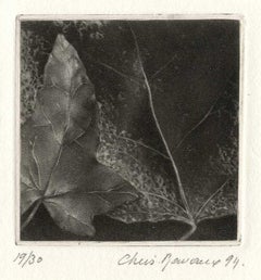
- LeavesBy Christine RavauxLocated in New Orleans, LAThis impression is #19 out of an edition 30 Born in 1961 in Charleroi, Belgium, Ravaux is an artist who mirrors her surroundings in the mezzotints she creates. She has portrayed see...Category
1990s American Modern Landscape Prints
MaterialsMezzotint
 $80 Sale Price20% Off
You May Also Like
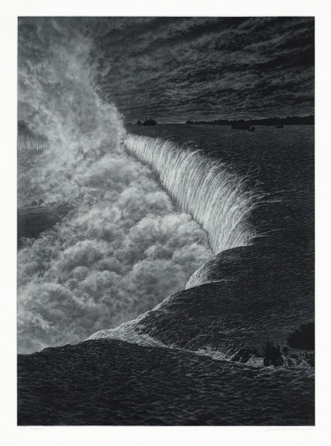
- NiagaraBy Frederick MershimerLocated in New York, NYNIAGARA Contemporary artist Frederick Mershimer created the mezzotint engraving entitled “Niagara” in 2021. This impression is signed, titled, dated, and inscribed “5/45”- the 5th ...Category
21st Century and Contemporary American Realist Landscape Prints
MaterialsMezzotint
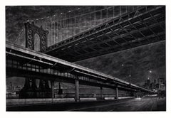
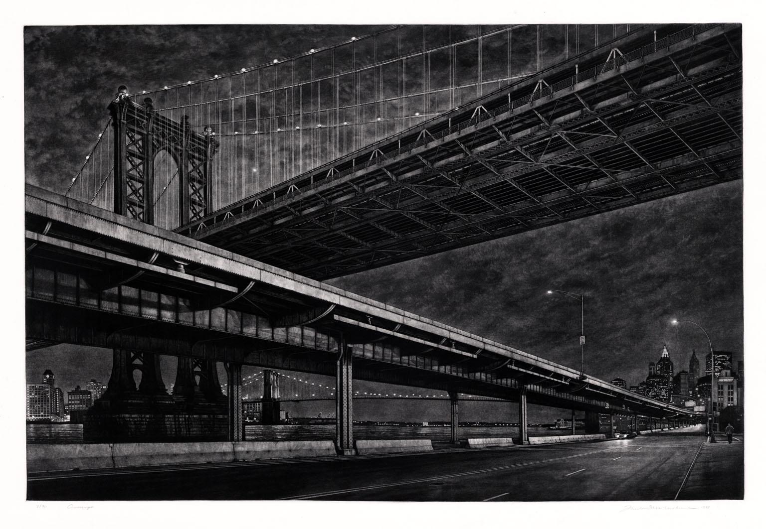
- CrossingsBy Frederick MershimerLocated in New York, NYCROSSINGS Contemporary artist Frederick Mershimer created the mezzotint engraving entitled "Crossings" in 1998. This impression is signed, titled, and dated in pencil. The printed ...Category
Late 20th Century American Realist Landscape Prints
MaterialsMezzotint
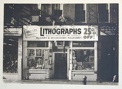
- LITHOGRAPHS Greenwich Village NYC, Signed Mezzotint, Art Gallery, PhotorealismBy John BaederLocated in Union City, NJLITHOGRAPHS Greenwich Village NYC by the American photorealist artist John Baeder is a limited edition mezzotint printed using hand printmaking techniques on archival, cream colored ...Category
1970s Photorealist Landscape Prints
MaterialsMezzotint
- Meissen, Germany : A Large Framed 18th Century Map by Petrus SchenkLocated in Alamo, CAThis is a hand-colored 18th century map of the Meissen region of Germany, entitled "Geographischer Entwurff Derer Aemmter Meissen als Creys-Procuratur-Schul-und Stiffts-Ammt benebst ...Category
Mid-18th Century Old Masters Landscape Prints
MaterialsEngraving
- Northern Italy: A 16th Century Hand-colored Map by Abraham OrteliusBy Abraham OrteliusLocated in Alamo, CAThis is a framed 16th century hand-colored copperplate map of northern Italy entitled "Veronae Urbis Territorium a Bernardo Bragnolo Descriptium" by Abraham Ortelius from his atlas "Theatrum Orbis Terrarum", which was the first modern atlas of the world, with the first volume published in 1570. This map was part of a subsequent volume, published in Antwerp in 1584. It was based on an earlier map by Bernardo Brognoli. This beautiful map of northern Italy is focussed on Verona and its environs, including Mantua. Lake Garda and the South Tyrol mountains are prominently depicted. There is a very large striking cartouche in the upper left and a decorative distance scale in the lower right. This striking hand-colored map of northern Italy is presented in a gold-colored wood frame and an olive green-colored mat. It is glazed with UV conservation glass. All mounting materials used are archival. The frame measures 21.5" high by 28" wide by 0.75" deep. There is a central vertical fold, as issued, with slight separation of the lower portion of the fold. There are faint spots in the upper and right margins, but the map is otherwise in very good condition. Abraham Ortelius (also known as Ortels, Orthellius, and Wortels) (1527-1598) was a Dutch cartographer, geographer, and cosmographer. He began his career as a map colorist. In 1547 he entered the Antwerp guild of St Luke as an "illuminator of maps". He had an affinity for business from an early age and most of his journeys before 1560, were for business. He was a dealer in antiques, coins, maps, and books. His business income allowed him to acquire an extensive collection of medals, coins, and antiques, as well as a large library of books...Category
16th Century Old Masters Landscape Prints
MaterialsEngraving
- Persia, Armenia & Adjacent Regions: A Hand-colored 17th Century Map by De WitBy Frederick de WitLocated in Alamo, CAThis colorful and detailed 17th century copperplate map by Frederick De Wit was published in Amsterdam between 1666 and 1690. It depicts the Caspian Se...Category
Late 17th Century Old Masters More Prints
MaterialsEngraving