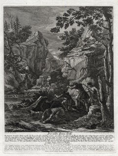
A hunting scene print with a wild duck trap by Ridinger - Engraving - 18th c
View Similar Items


1 of 9
Martin Elias RidingerA hunting scene print with a wild duck trap by Ridinger - Engraving - 18th c1768
1768
About the Item
- Creator:Martin Elias Ridinger (1730 - 1781, German)
- Creation Year:1768
- Dimensions:Height: 18.9 in (48 cm)Width: 15.36 in (39 cm)
- Medium:
- Movement & Style:
- Period:1760-1769
- Condition:Excellent, given age. Ample margins. Margin soiled. General age-related toning and/or occasional minor defects from handling. Please study scan carefully.
- Gallery Location:Zeeland, NL
- Reference Number:Seller: 499521stDibs: LU59235303301
You May Also Like
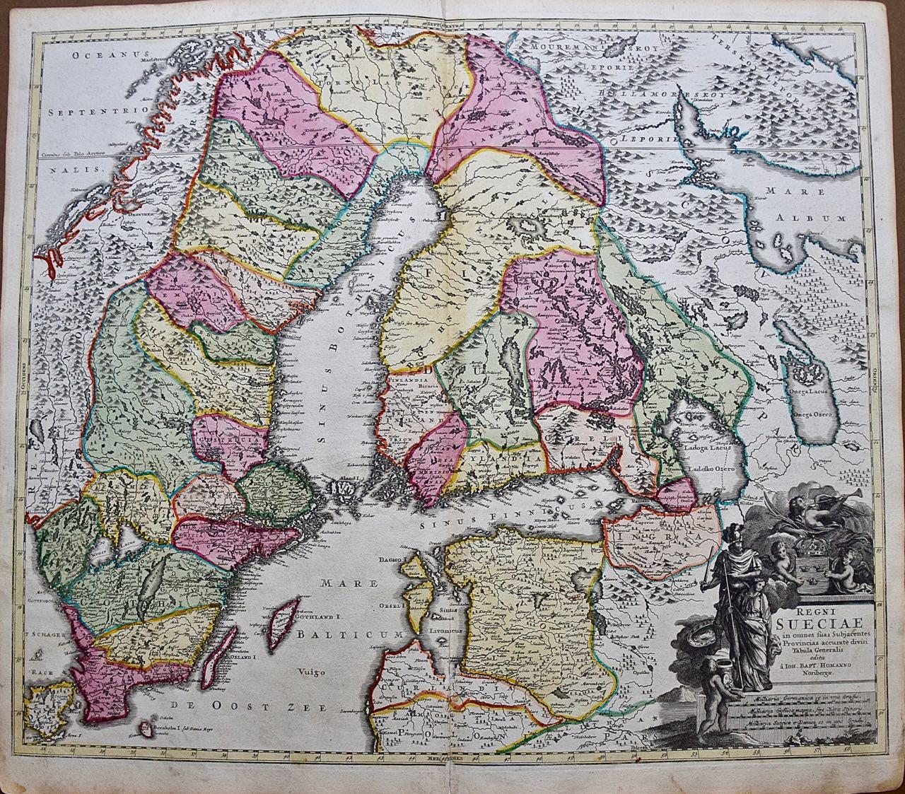
- Sweden and Adjacent Portions of Scandinavia: A Hand-colored 18th C. Homann MapBy Johann Baptist HomannLocated in Alamo, CAThis hand-colored copper-plate map of Sweden and adjacent portions of Scandinavia entitled "Regni Sueciae in Omnes suas Subjacentes Provincias accurate divisi Tabula Generalis" was c...Category
Early 18th Century Old Masters Landscape Prints
MaterialsEngraving
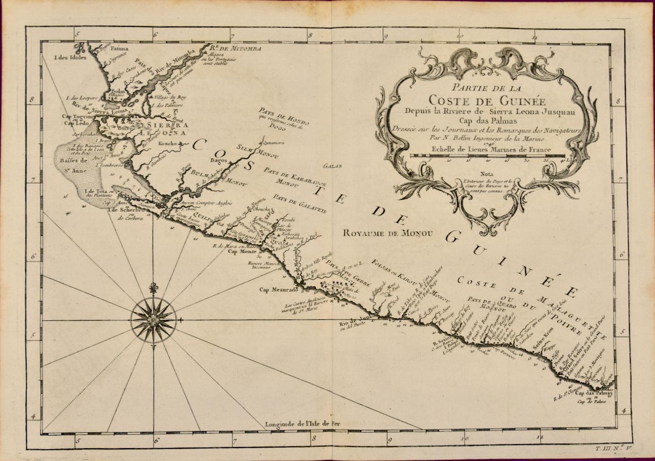
- West Coast of Africa; Guinea & Sierra Leone: Bellin 18th Century MapLocated in Alamo, CAThis is a Jacques Bellin copper-plate map entitled "Partie de la Coste de Guinee Dupuis la Riviere de Sierra Leona Jusquau Cap das Palmas", depicting the coast of Guinea and Sierra L...Category
1740s Old Masters Landscape Prints
MaterialsEngraving
- Danube River, Italy, Greece and Croatia: A Hand-colored 18th C. Homann MapBy Johann Baptist HomannLocated in Alamo, CA"Fluviorum in Europa principis Danubii" is a hand colored map of the region about the Danube river created by Johann Baptist Homann (1663-1724) in his 'Atlas Novus Terrarum', publish...Category
Early 18th Century Old Masters Landscape Prints
MaterialsEngraving
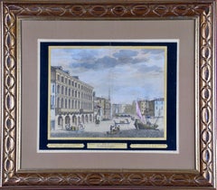
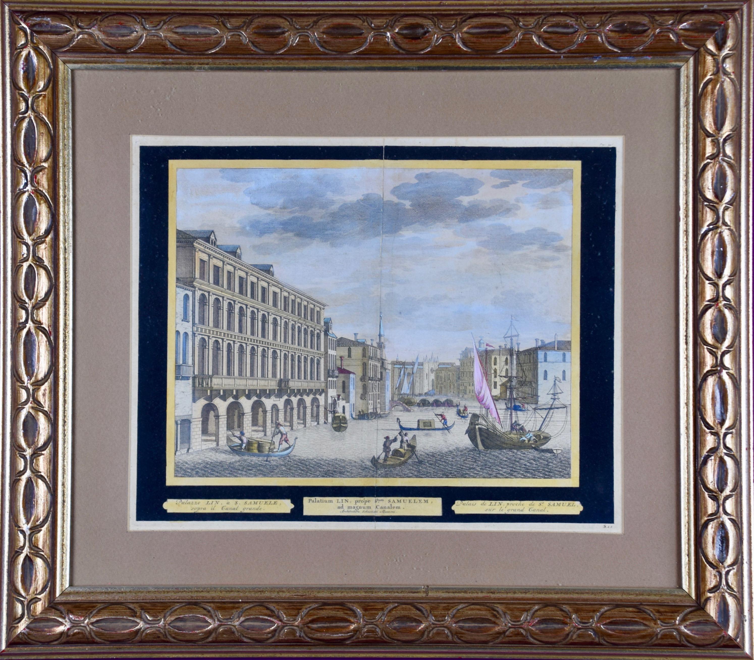
- View of Venice, including Gondolas, 18th Century Hand Colored EngravingBy Pieter Van Der AaLocated in Alamo, CAAn early 18th century hand colored engraving of a scene of the city of Venice, Italy entitled "Palazzo Lin, a. S. Samuele sopra il Canal Grande". It depicts Venetian architecture, wa...Category
1720s Old Masters Landscape Prints
MaterialsEngraving
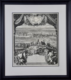
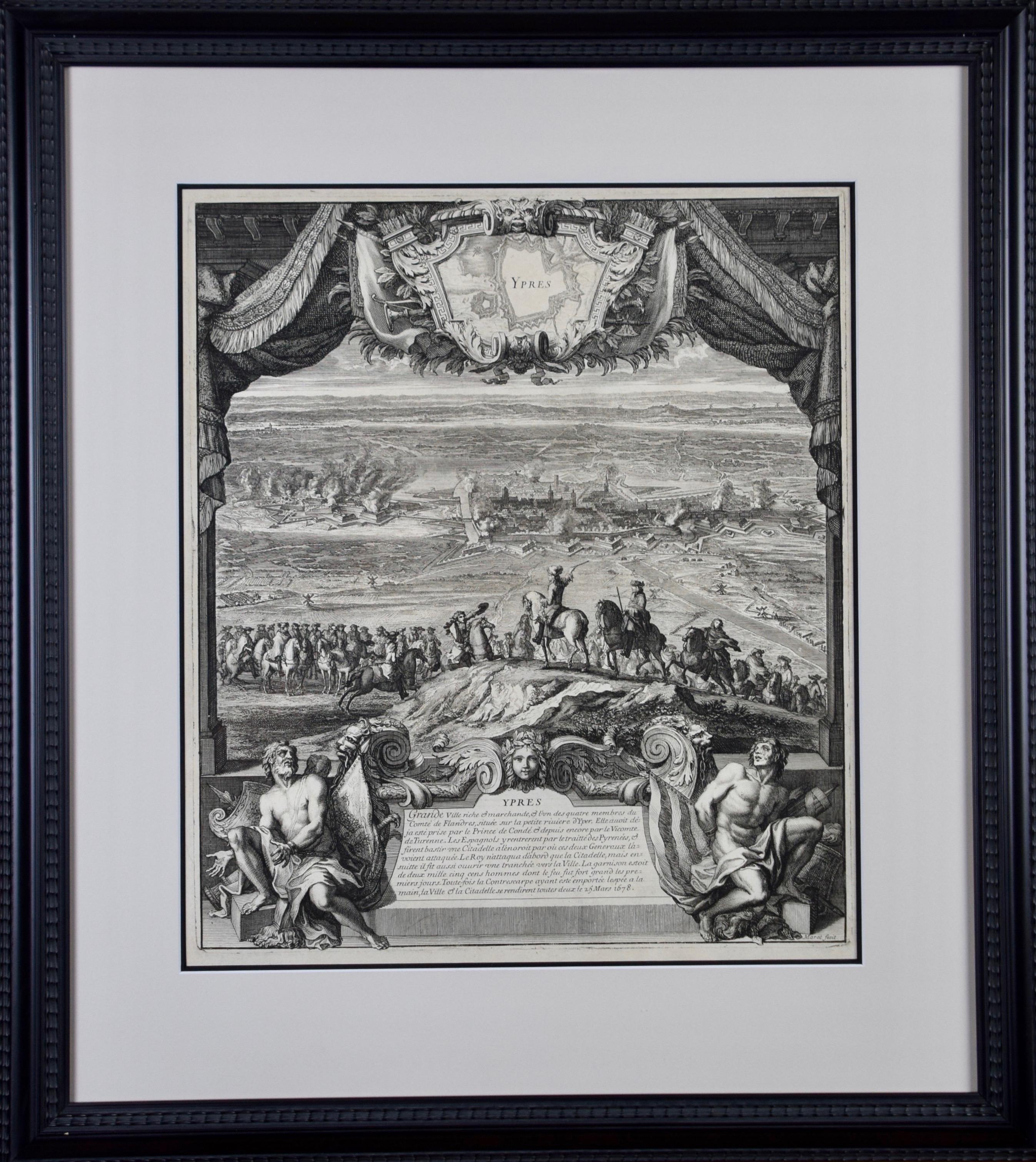
- Daniel Marot's The Siege of the Dutch Fortified City of Ypres by Louis XIVBy Daniel MarotLocated in Alamo, CA"Ypres, Grand Ville Riche & Marchande" is an engraving and etching by Daniel Marot (le Vieux) (1661–1752). It depicts a view of the siege of the city of Ypres and its citadel on the left in the Spanish Netherlands by Louis XIV's troops. This battle took place between March 18 and March 25, 1678, as part of the Franco-Dutch War. Marot illustrated in great detail (best appreciated with magnification) the French attack on the strong pentagonal citadel on the extreme left, which had been built recently in anticipation of a French attack. The trenches built by the French approaching the town are seen on the right. King Louis XIV can be seen in the foreground surveying the battle mounted on his white horse, surrounded by his officers and troops. The print is presented in an attractive ornate black wood frame with a cream-colored double mat with a black inner trim. It is glazed with plexiglas. The frame measures 25.38" x 22.63" x .88". The engraving, frame, mat and glazing are in excellent condition. Artist: Daniel Marot (1661–1752) was also called "Le Vieux". He was the son of the famous architect, Jean Marot. Marot had diverse interests and talents. In addition to his art, he designed garden projects, architectural ornaments, furniture, and even upholstery. Marot as a Huguenot protestant was forced to leave France in 1685 following the revocation of the Edict of Nantes. He emigrated to Holland, where he worked for William of Orange (an arch enemy of his former employer Louis XIV). Marot was largely responsible for the interiors of Williams palace at the Loo. In 1694 he went Britain as William had married Queen Mary and he had become King William III of England. He later returned to Holland in about 1698 and died in the Hague in 1752. He left a lasting legacy on the decorative arts in the Netherlands, where his grand version of the Louis XIV style remained popular into the 1730s. Historical Background: In October 1677, Mary Stuart, niece and possible successor of Charles II of England, married Louis XIV's arch enemy William III of Orange...Category
Late 17th Century Old Masters Landscape Prints
MaterialsEngraving, Etching
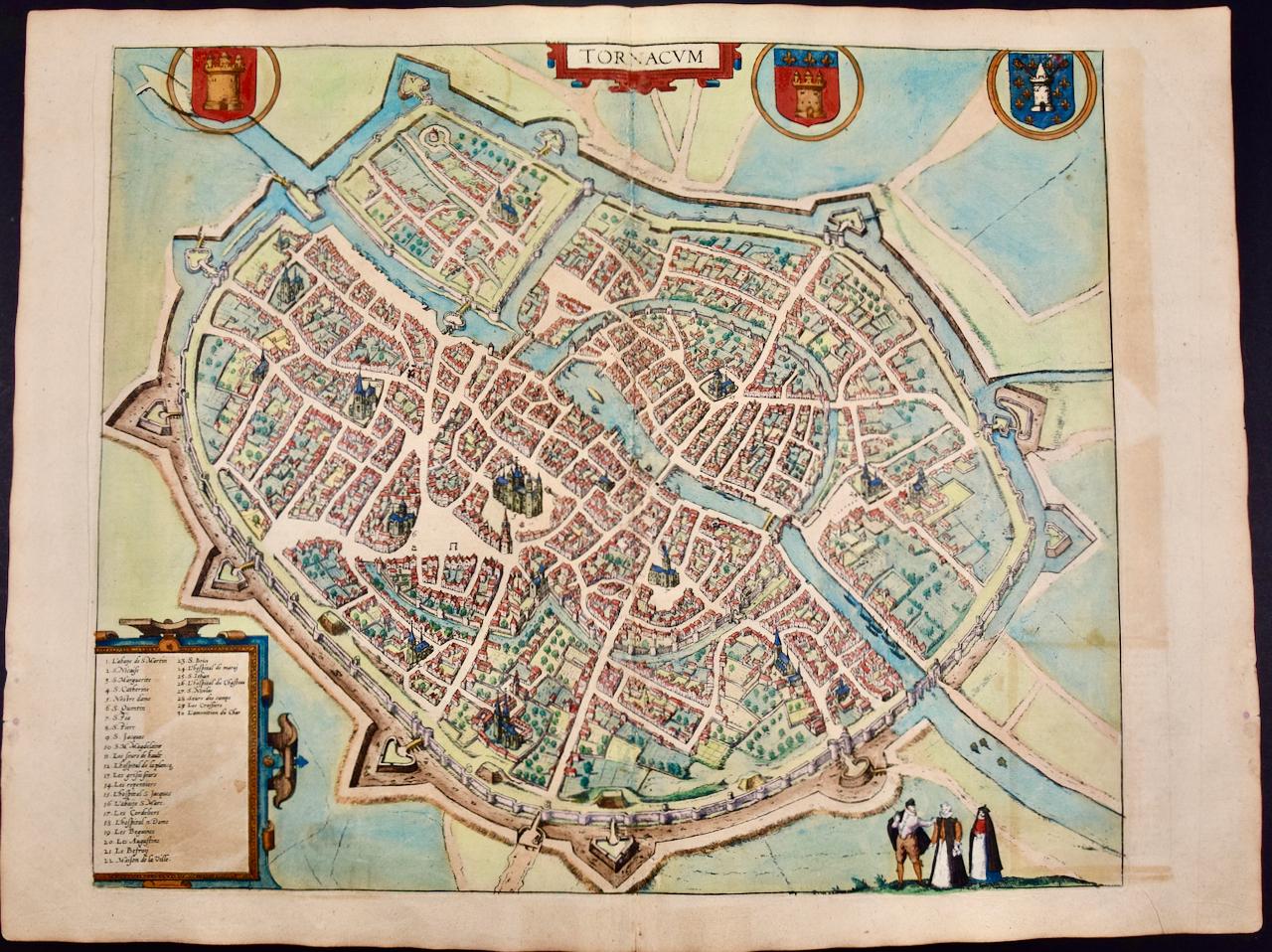
- Canterbury: An Original 16th C. Framed Hand-colored Map by Braun & HogenbergBy Franz HogenbergLocated in Alamo, CAThis is a framed 16th century map and city view of Canterbury, England entitled "Cantuarbury" by Braun & Hogenburg, from their famous landmark atlas of city views 'Civitates Orbis Terrarum' (Atlas of the Cities of the World), which was first published in Cologne, Germany in 1572. The map of Canterbury was first published in 1588. It depicts a detailed birdseye view of the completely walled and fortified city of Canterbury, with its cathedral the most prominent feature. The coat of arms of England, Canterbury, and the Archbishop of Canterbury are included. This beautifully hand-colored map is presented in a gold-colored wood frame with a beaded inner trim and a paprika-colored mat that highlights details in the map. The frame measures 18.75" high by 22.25" wide by 0.875" deep. There is a central vertical fold, as issued. The map is in excellent condition. Braun and Hogenberg's 'The Civitates Orbis Terrarum' was the second atlas of maps ever published and the first atlas of cities and towns of the world. It is one of the most important books published in the 16th century. Most of the maps in the atlas were engraved by Franz Hogenberg and the text, with its descriptions of the history and additional factual information of the cities, was written by a team of writers and edited by Georg Braun. The work contained 546 bird-eye views and map views of cities and towns from all over the world. It gave graphic representation of the main features of the illustrated cities and towns, including the buildings and streets. Although the ordinary buildings are stylized, the principal buildings are reproduced from actual drawings created on location. The principal landmarks and streets can still be recognized today. In addition, the maps often include the heraldic arms of the city, the nature of the surrounding countryside, the important rivers, streams and harbors, even depicting stone bridges, wooden pontoons, flat-bottomed ferries, ships and working boats, wharves and jetties, as well as land-based activities, including horsemen, pedestrians, wagons, coaches, and palanquins. Small vignettes are often included which illustrate the trade, occupations and habits of the local inhabitants, such as agriculture, paper-making and textiles, as well as local forms of punishment, such as gibbets, wheels, floggings etc. Large figures dressed in their local costume are often presented out of proportion in the foreground. The aim of the authors was to give as much information as possible in a pleasing visual form. They succeeded in creating maps that were both informative and decorative works of art. The atlas is a wonderful glimpse of life in medieval Europe. Georg Braun (1541-1622) was German Catholic...Category
16th Century Old Masters Landscape Prints
MaterialsEngraving