Items Similar to Framed Rubbing of 1550 Brass Monument in Grote Kerk Church, Breda, Netherlands
Want more images or videos?
Request additional images or videos from the seller
1 of 14
UnknownFramed Rubbing of 1550 Brass Monument in Grote Kerk Church, Breda, Netherlands Unknown
Unknown
About the Item
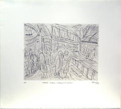
This is an engraving of a tomb monument rubbing that has been highlighted with gold color on a dark grey to black background. The rubbing is of a brass plaque on a stone slab. It has inscriptions along the edges and an angel with a halo holding a chalice and shield. The inscription reads "Hoc saxo tegitur corpus honorabilis viri domini Adriani Roelandi Bartholomei alias Heys, sacellani huius ecclesie, qui obiit Anno Domini 1550 Iulii die septima" (Covered by this stone is the body of the honorable man, Sir Adrianus son of Roelandt Bartholomeus, alias Heys, priest of this church, who died in the year of Our Lord 1550 on the seventh day of July). Along with images of the print in this listing, an image of the actual tomb with the brass plaque is included. The tomb is in the Grote Kerk or Onze-Lieve-Vrouwekerk (Church of Our Lady), which is a prominent landmark in Breda, in the southern portion of the Netherlands. The oldest record of a stone church in Breda is from 1269. The construction of this church was begun in 1410. It was completed in 1457 but the tower collapsed in 1468. The reconstruction of the tower was completed in 1509. Although in use, additional construction projects continued until 1547. The Reformation ended the church as a Catholic place of worship in 1566 and it transitioned to Protestant in 1637.
The print is presented in a distinctive ornate black wood frame with a scalloped gold inner edge or fillet. The deep dark mauve mat is highlighted with a marbled gold fillet. The frame measures 32.25" x 32.5" x 1.5". It can be hung in a square or diamond orientation. The latter orientation places the angel in an upright position and is the orientation of the plaque on the monument. The print is in excellent condition.
- Creation Year:Unknown
- Dimensions:Height: 32.25 in (81.92 cm)Width: 32.25 in (81.92 cm)Depth: 1.5 in (3.81 cm)
- Medium:
- Movement & Style:
- Period:
- Condition:
- Gallery Location:Alamo, CA
- Reference Number:
About the Seller
5.0
Vetted Seller
These experienced sellers undergo a comprehensive evaluation by our team of in-house experts.
Established in 2011
1stDibs seller since 2019
233 sales on 1stDibs
Typical response time: 1 hour
- ShippingRetrieving quote...Ships From: Alamo, CA
- Return PolicyA return for this item may be initiated within 7 days of delivery.
More From This SellerView All
- Cartusia Bruxellensis Monastery in Brussels: A 17th C. Hand-colored EngravingBy Lucas Vorsterman the YoungerLocated in Alamo, CAThis is a 17th century hand-colored copperplate engraving entitled "Cartusia Bruxellensis" by Lucas Vorsterman, the Younger, after a drawing by Jacob van Werden or Jacques van Weerden, published in 1659 in Antonius Sanderus' book 'Chorographia sacra Brabantiae sive celebrium aliquot in ea provincia ecclesiarum et coenobiorum descriptio . . . Brussel' (A sacred chorography of Brabant, or a description of several famous churches and convents in that province). It also appeared in other publications by Sanderus. In the 17th century, Brussels was within the Duchy of Brabant. This engraving depicts a bird's-eye view of the Scheut Carthusian Monastery in Brussels. Scheut is a district of Anderlecht, a municipality of Brussels, Belgium. The monastery housed monks, who took a vow of silence, in 20 rooms. There is a central courtyard with trees and shrubs. Monks are depicted strolling along its pathways. The cells for the friars are in the middle the cloister. There are people along the streets in the foreground and to the right of the large, imposing monastery. Some are on horseback, others are walking. In the lower right, what appears to be a dog pulls a small cart containing barrels, possibly of beer or wine. Districts and neighborhoods are labelled in the background, including Scheut, Anderlecht and Ransfort. A very ornate cartouche in the lower left contains Latin and the artist's attribution. Another decorative cartouche in the upper central area contains the title. This beautifully hand-colored and detailed engraving is printed on laid, chain-linked paper with wide, full margins. The sheet measures 17.25" high and 21.25" wide. It has Latin text on the verso. It has a central vertical fold, as issued, which is reinforced on the verso. Two small spots in the lower margin may actually represent drops of watercolor paint used to color the engraving. It is otherwise in very good condition. Antonius Sanderus (1586-1664) was a Flemish Catholic cleric and historian. He was born "Antoon Sanders", but Latinized his name like many writers and scholars of his time. He was the author of several books, including 'Chorographia Sacra Brabantiae', which was illustrated with this engraving. Lucas Vorsterman the Younger (1624-between 1666 & 1676) was a Flemish Baroque engraver and draughtsman. He produced engravings after the work of contemporary painters and for books by Antwerp publishers. Jacob van Werden or Jacques van Weerden (active 1643-1669), was a Flemish draughtsman, cartographer, military engineer and archer who was active in the Habsburg Netherlands. His drawings were used as designs for prints executed by various printmakers. He worked on maps, topographical views, historical scenes, portraits and book illustrations. He had a career as a military engineer and a member of the guard of the Spanish King. He advised on various military engineering projects and was an engineer of the Spanish army...Category
Mid-17th Century Old Masters Landscape Prints
MaterialsEngraving
- L'Isle de France: A Hand-colored 17th Century Map by De WitBy Frederick de WitLocated in Alamo, CAThis colorful and detailed 17th century hand-colored copperplate map by Frederick De Wit was published in Amsterdam between 1666 and 1760. The map depicts the Île-de-France, which is one of the ancient provinces of France. Paris is located in the center of the map, with Versailles to the southwest The map extends from Rouen in the west to Reims in the east. The area around Paris, the Véxin Français, was the original domain of the king of France. Other areas were ruled by French feudal lords. For example, the Véxin Normand area was the domain of the Duke of Normandy...Category
Early 18th Century Old Masters More Prints
MaterialsEngraving
- Map of the Russian Empire: An Original 18th Century Hand-colored Map by E. BowenLocated in Alamo, CAThis is an original 18th century hand-colored map entitled "A New & Accurate Map of The Whole Russian Empire, As Contain'd Both In Europe and Asia, Drawn from Authentic Journals, Sur...Category
Mid-18th Century Old Masters Landscape Prints
MaterialsEngraving
- Ulysses Deriding Polyphemus: A Framed 19th C. Engraving After J. M. W. TurnerBy J.M.W. TurnerLocated in Alamo, CAThis beautiful 19th century framed hand-colored engraving/etching entitled "Ullyses Deriding Polyphemus" by Edward Goodall is based on an original 1829 painting by the renowned Briti...Category
Mid-19th Century Romantic Landscape Prints
MaterialsEngraving, Etching
- View of Emden, Germany: A 16th Century Hand-colored Map by Braun & HogenbergBy Franz HogenbergLocated in Alamo, CAThis is a 16th century original hand-colored copperplate engraved map of a bird's-eye View of Embden, Germany entitled " Emuda, vulgo Embden vrbs Frisia orientalis primaria" by Georg Braun & Franz Hogenberg, in volume II of their famous city atlas "Civitates Orbis Terrarum", published in Cologne, Germany in 1575. This is a beautifully colored and detailed map of Emden, a seaport in northwestern Germany, along the Ems River and perhaps portions of over Dollart Bay, near the border with the Netherland. The map depicts a bird's-eye view of the city from the southwest, as well as a view of the harbor and an extensive system of canals. Numerous ships of various sizes, as well as two rowboats containing numerous occupants are seen in the main waterway in the foreground and additional boats line two canals in the center of the city. Two men and two women are shown on a hill in the foreground on the right, dressed in the 16th century style of nobility. Two ornate crests are included in each corner. A title strap-work cartouche is in the upper center with the title in Latin. The crest on the right including Engelke up de Muer (The Little Angel on the Wall) was granted by Emperor Maximilian I in 1495. This is an English translation of an excerpt of Braun's description of Embden: "In Emden, the capital of East Frisia, rich merchants live in very fine houses. The city has a broad and well-situated harbour, which in my opinion is unique in Holland. Frisia and the whole of the Netherlands, for the ships can anchor here right under the city walls. They have also extended the harbour as far as the New Town, so that up to 400 ships can now find shelter here when the sea is rough." The emphasis on the harbor and waterways within the city highlights the importance of Emden's place as a seaport at this time. Embden developed from a Dutch/Flemish trading settlement in the 7th-8th centuries into a city as late as late 14th century. In 1494 it was granted staple rights, and in 1536 the harbour was extended. In the mid-16th century Emden's port was thought to have the most ships in Europe. Its population then was about 5,000, rising to 15,000 by the end of the 16th century. The Ems River flowed directly under the city walls, but its course was changed in the 17th century by the construction of a canal. Emden has canals within its city limits, a typical feature of Dutch towns, which also enabled the extension of the harbor. In 1744 Emden was annexed by Prussia and is now part of Germany. It was captured by French forces in 1757 during the Seven Years' War, but recaptured by Anglo-German forces in 1758. During the Napoleonic French era, Emden and the surrounding lands of East Frisia were part of the short-lived Kingdom of Holland. References:Van der Krogt 4, 1230, State 2; Taschen, Braun and Hogenberg...Category
16th Century Old Masters Landscape Prints
MaterialsEngraving
- Ireland: A Framed 17th Century Hand-colored Map by Jan JannsonBy Johannes JanssoniusLocated in Alamo, CAThis is a 17th century hand-colored map entitled "Hibernia Regnum Vulgo Ireland" by Johannes Janssonius's (Jan Jansson), published in Amsterdam in 1640. This highly detailed map depicts the Emerald Isle with an extensive display of towns, roads, mountains, rivers, lakes and county borders, etc. It includes two decorative cartouches on the left. The title cartouche includes the Irish harp and the second, in the upper left, includes a lion wearing a crown on the left, a unicorn on the right and a coat-of-arms in the middle, which includes another Irish harp. A distance scale is seen in the lower right, augmented with two putti. The map is embellished with three sailing ships and a sea monster. Western portions of Scotland and England...Category
Mid-17th Century Old Masters Landscape Prints
MaterialsEngraving


You May Also Like
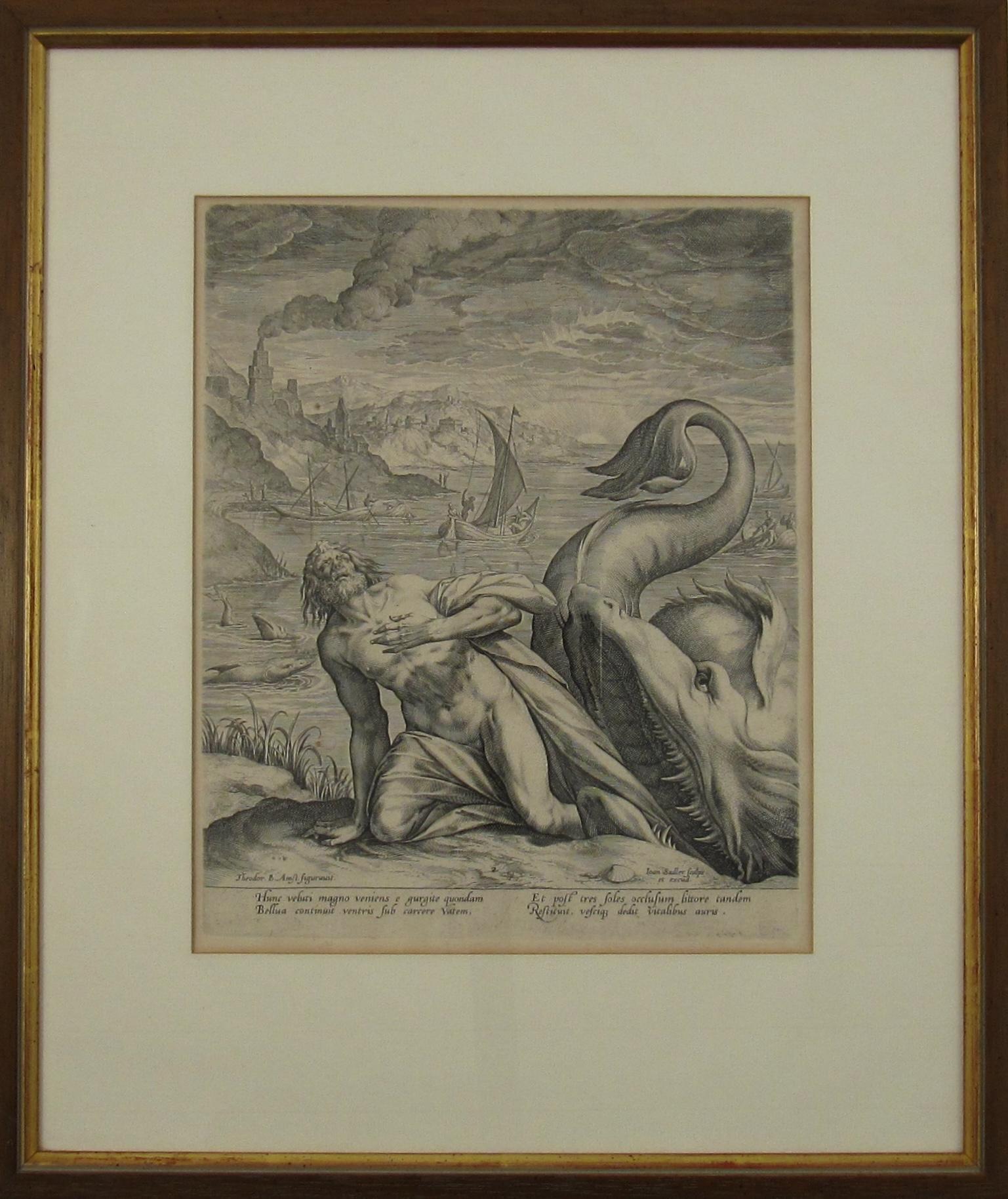
- Johannes Sadeler I (Flemish 1550-1600) – Engraving 1582 - Jonah and the Whale IIBy Johannes Sadeler ILocated in Meinisberg, CHJohannes Sadeler I (Flemish, ∗ 1550 in Brussels, Belgium – † 1600 Venice, Italy) Jonah Spat Up by the Whale (Sheet II) Engraved by Sadeler after an image created by Theodor Bernard...Category
16th Century Renaissance Figurative Prints
MaterialsLaid Paper, Engraving
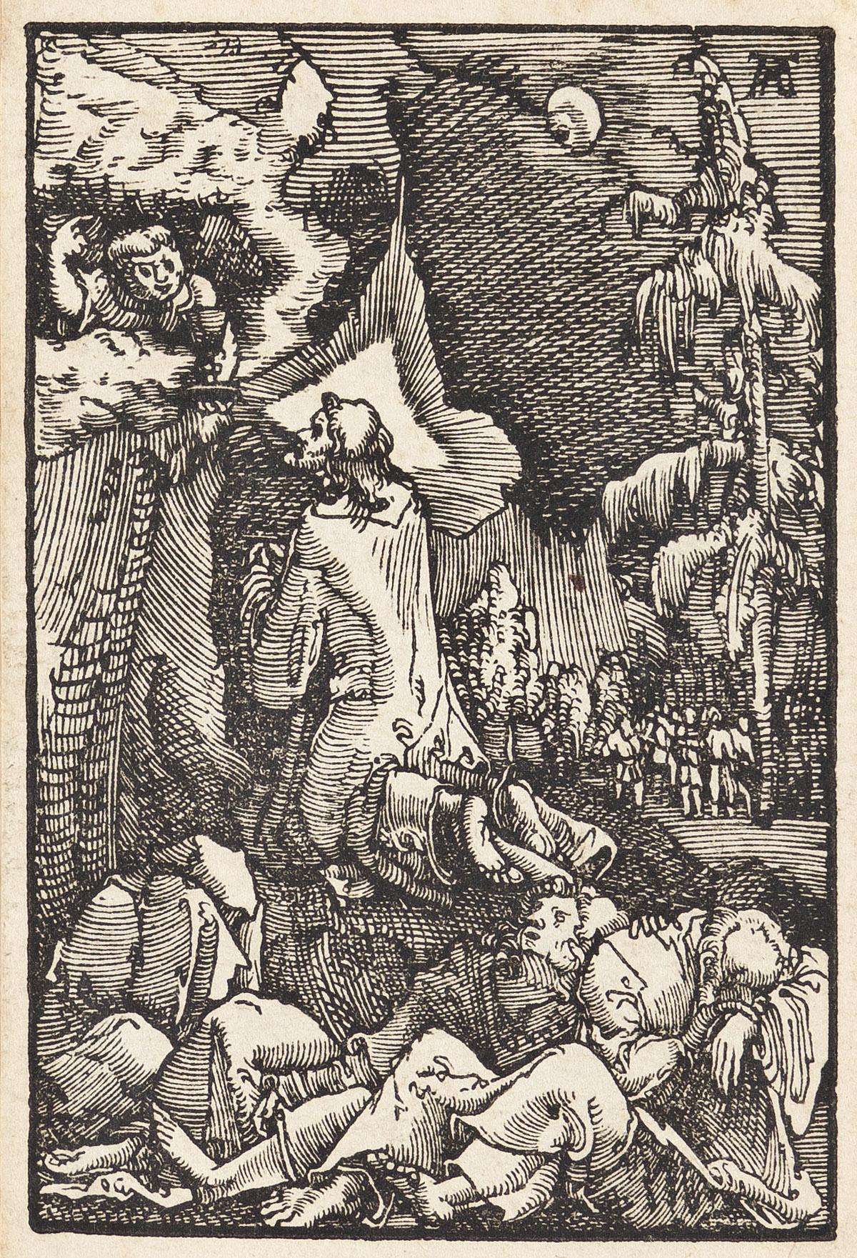
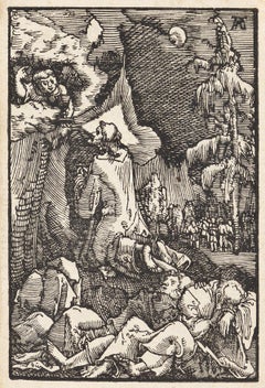
- Christ on the Mount of OlivesBy Albrecht AltdorferLocated in New York, NYA brilliant and early impression of this woodcut. Dark, well-inked, with strong contrasts and no sign of wear. From "The Fall and Salvation of Mankind Through the Life and Passion of Christ."Category
16th Century Renaissance Figurative Prints
MaterialsWoodcut
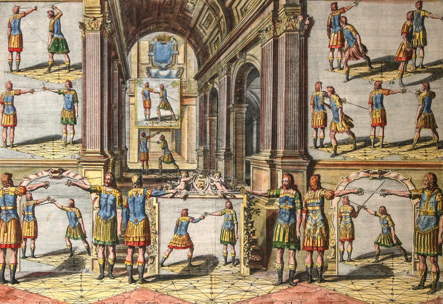
- Academie de l’Espee Tabula XXI by Girard Thibault 17thc fencing engravingBy Pierre ThibaultLocated in Paonia, COHand colored original engraving from the Academie de l’Espee ( full title can be translated as Academy of the Sword: wherein is demonstrated by mathematical rules on the foundation of a mysterious circle the theory and practice of the true and heretofore unknown secrets of handling arms on foot and horseback ) by Girard Thibault...Category
17th Century Other Art Style Figurative Prints
MaterialsEngraving
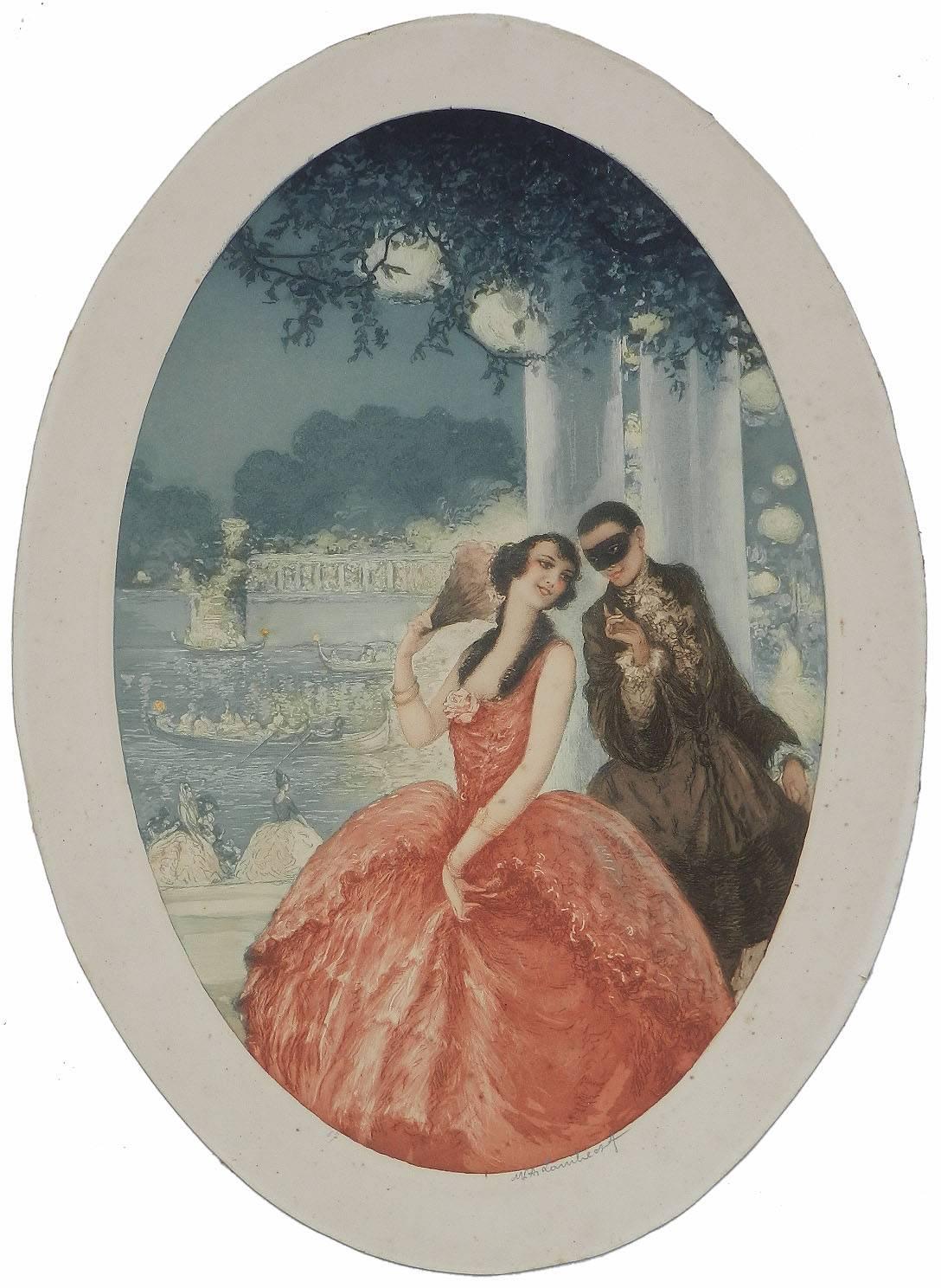
- Art Deco French signed Lithograph style of IcartLocated in FRArt Deco signed Print from the Louis Icart era of 'Les Elegantes' Signed in pencil by the artist and Numbered 67 Original print produced for the artist ...Category
1920s Art Deco Figurative Prints
MaterialsEngraving, Aquatint, Lithograph
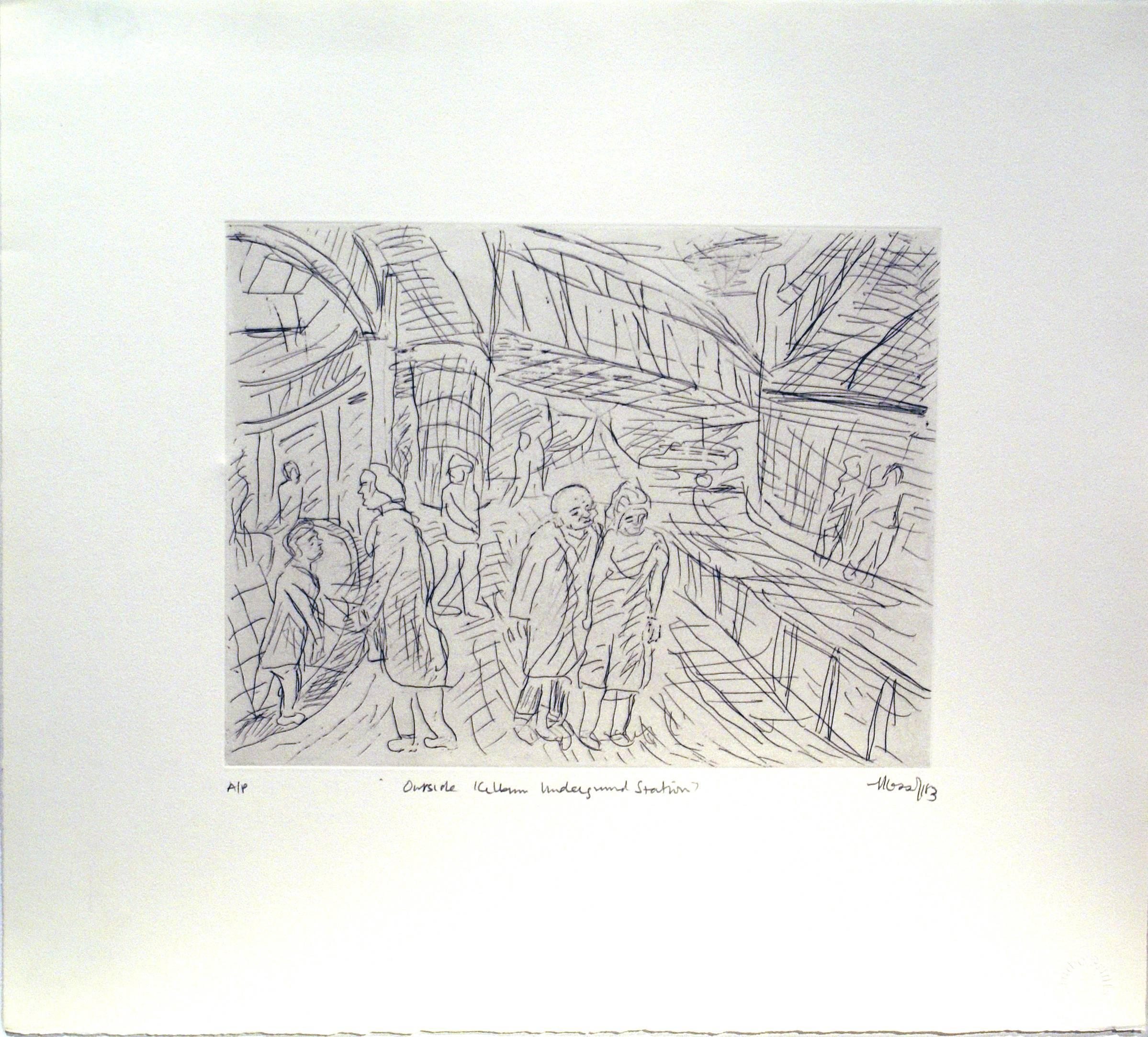
- Outside Kilburn Underground StationBy Leon KossoffLocated in London, GB58.42 x 66.04 cms (23 x 26 ins) Edition of 40 Published by Bernard Jacobson GalleryCategory
1980s Figurative Prints
MaterialsDrypoint, Etching
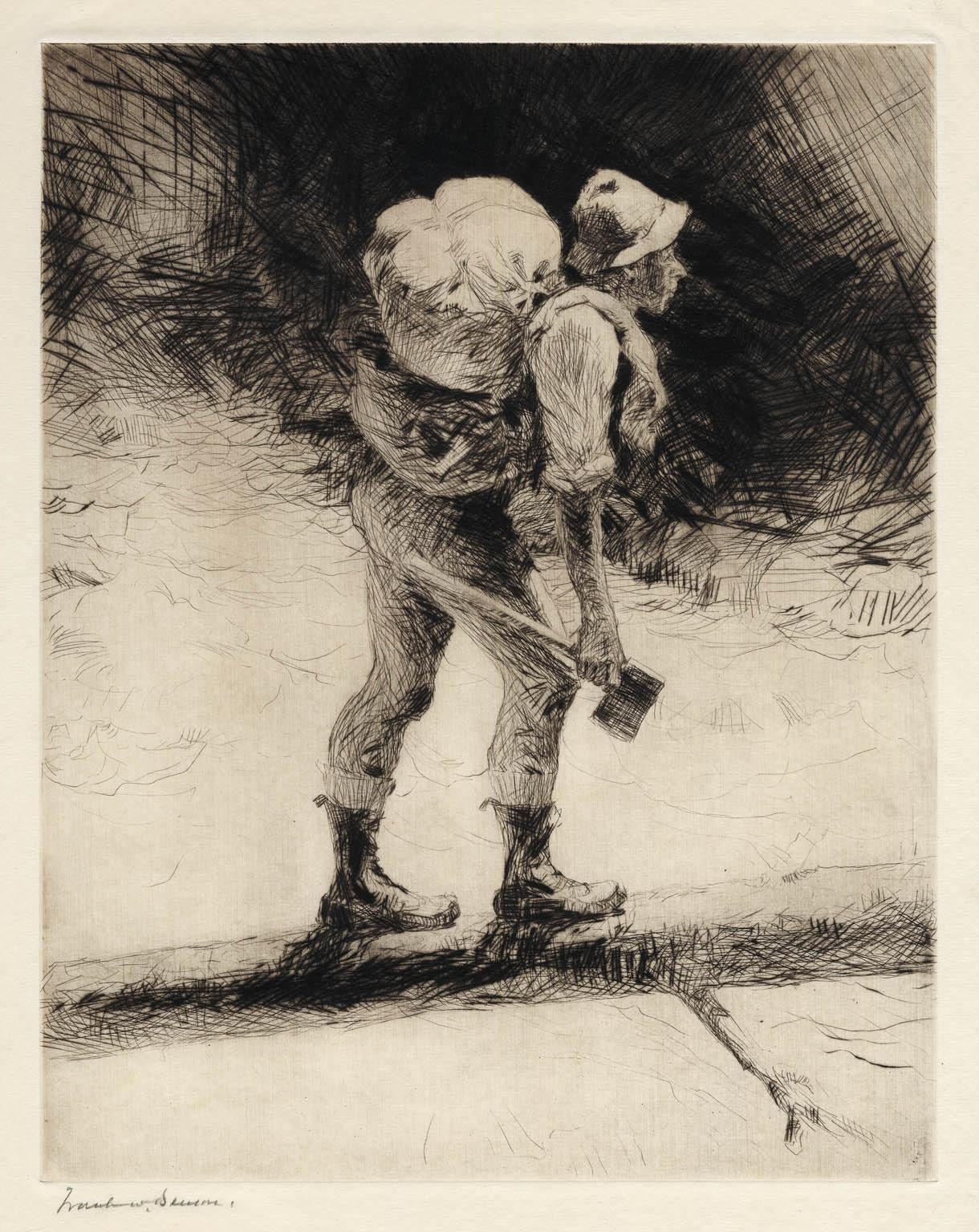
- The BridgeBy Frank BensonLocated in New York, NY"The Bridge" is a drypoint by Frank Benson created in 1923. Printed in an edition of 150 this impression is signed in pencil, lower left. The image size is 13 1/2 x 10 5/8" (34.2 x 26.8 cm) and sheet size 16 1/2 x 13 1/16" (41.8 x 33.3 cm). FRANK W. BENSON (1862-1951) Frank Weston Benson, well known for his American impressionist paintings, also produced an incredible body of prints - etchings, drypoints, and a few lithographs. Born and raised on the North Shore of Massachusetts, Benson, a natural outdoorsman, grew up sailing, fishing, and hunting. From a young age, he was fascinated with drawing and birding – this keen interest continued throughout his life. His first art instruction was with Otto Grundman at the Museum of Fine Arts in Boston, and then in 1883 in Paris at the Academie Julian where he studied the rigorous ‘ecole des beaux arts’ approach to drawing and painting for two years. During the early 1880’s Seymour Haden visited Boston giving a series of lectures on etching. This introduction to the European etching...Category
1920s American Impressionist Figurative Prints
MaterialsDrypoint


Recently Viewed
View AllMore Ways To Browse
Brass Framed Art
Antique Framing Square
Antique Brass Plaques
Brass Antique Plaques Brass Plaques
Brass Plaque Antique
Antique Brass Framed Art
Used Stone Slabs
Lady Dior In Black
Church Stone
Diamond Netherlands
Antique Ornate Gold Frame
Netherlands 16th Century
16th Century Brass
Antique Mauve
Church Angels
Brass Print Frame
Ornate Brass Frame
Lady Dior Gray