Items Similar to original poster of the Parisian public transportation system before 1854
Want more images or videos?
Request additional images or videos from the seller
1 of 8
Unknownoriginal poster of the Parisian public transportation system before 1854Circa 1850
Circa 1850
$2,350.30
£1,793.94
€2,000
CA$3,312.80
A$3,638.10
CHF 1,899.88
MX$43,422.20
NOK 24,069.69
SEK 22,433.90
DKK 15,236.14
About the Item
This remarkable original poster offers a snapshot of the Parisian public transportation system before 1854, capturing the intricate network of horse-drawn omnibuses that circulated throughout the capital. Titled “Tableau synoptique de la circulation des omnibus à correspondances de Paris,” it is one of the earliest known attempts to visually organize and standardize the routes of public vehicles within the rapidly expanding urban landscape of Haussmann-era Paris.
The poster presents a grid-style map of Paris, overlaid with fine green and red lines representing the omnibus routes and their interconnections. Along the edges are colorful illustrated depictions of various omnibus models, each labeled and numbered, helping passengers identify which vehicles served particular lines or destinations. The design is both functional and decorative, blending cartographic precision with early 19th-century artistic charm.
Each of the 117 interchange points is clearly marked, reflecting a system far more extensive and sophisticated than one might expect from a time before electric trams and the metro. This tableau served as a vital public information tool, allowing Parisians to navigate the growing city's transportation with clarity and ease.
Transportation - Advertising
167 correspondences of these cars
- Creation Year:Circa 1850
- Dimensions:Height: 21.26 in (54 cm)Width: 27.17 in (69 cm)
- Medium:
- Period:
- Condition:Good condition, traces of folds, on linen.
- Gallery Location:PARIS, FR
- Reference Number:1stDibs: LU1792216981302
About the Seller
5.0
Gold Seller
Premium sellers maintaining a 4.3+ rating and 24-hour response times
Established in 2021
1stDibs seller since 2022
192 sales on 1stDibs
Typical response time: 3 hours
- ShippingRetrieving quote...Shipping from: PARIS, France
- Return Policy
More From This Seller
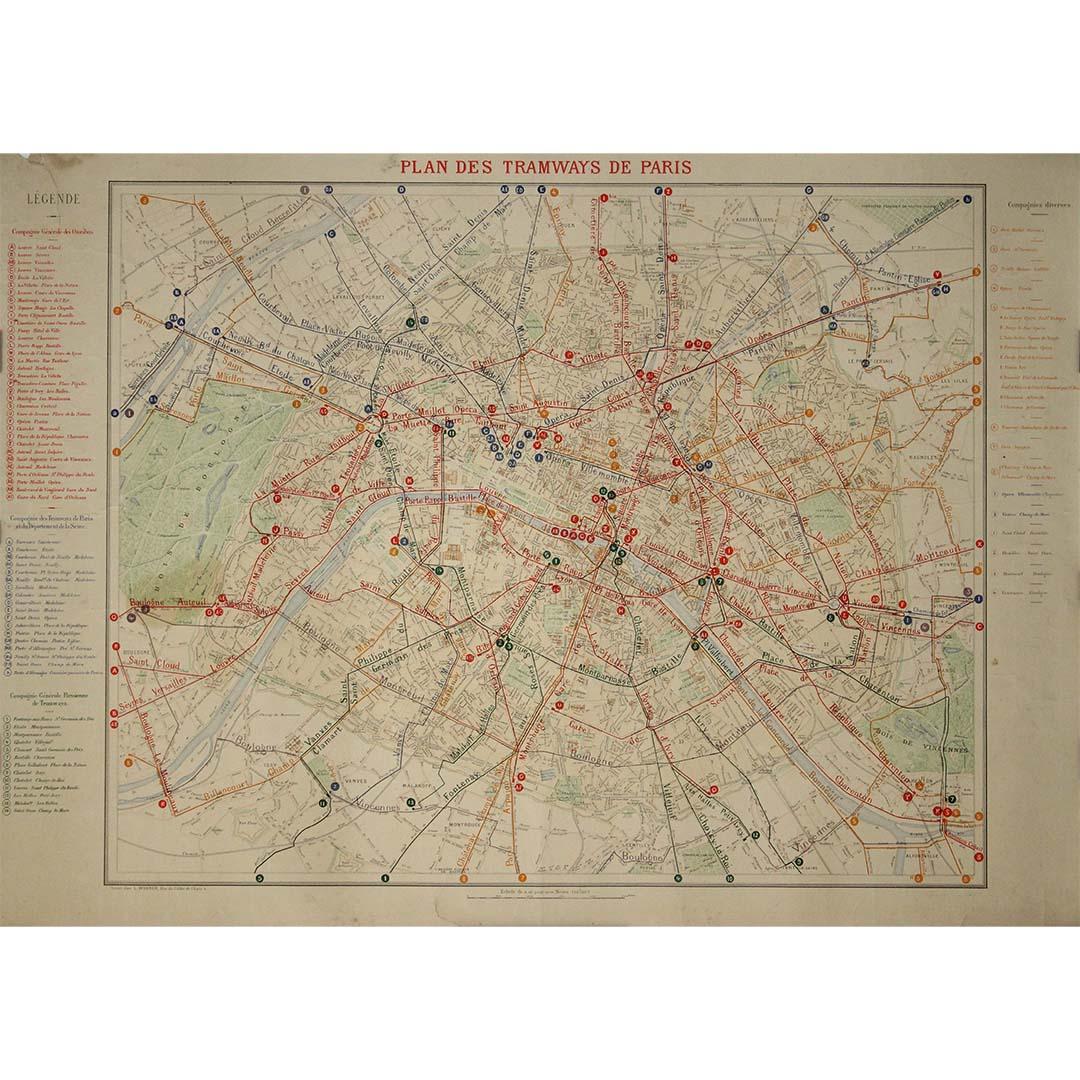
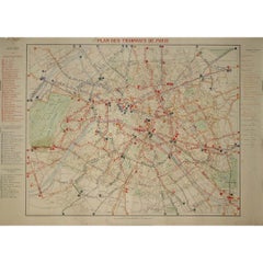
View All1899 "Plan des Tramways de Paris" by Wuhrer - Paris's public transportation
Located in PARIS, FR
The 1899 "Plan des Tramways de Paris" by Wuhrer is a fascinating snapshot of Paris's public transportation landscape at the dawn of the 20th century. This meticulously crafted map delineates the extensive network of tramway lines that crisscrossed the city, each route marked in detail to aid both residents and visitors in navigating the bustling metropolis.
The Belle Époque, during which this map was produced, was a period of significant growth and modernization in Paris. The city's population was expanding rapidly, and with it came the need for a more efficient means of urban transport. Tramways emerged as a vital solution, connecting neighborhoods and making the city's many attractions more accessible. These electric trams were a symbol of technological progress, replacing the horse-drawn carriages of earlier years and setting the stage for the future of public transit...
Category
1890s Prints and Multiples
Materials
Lithograph, Paper
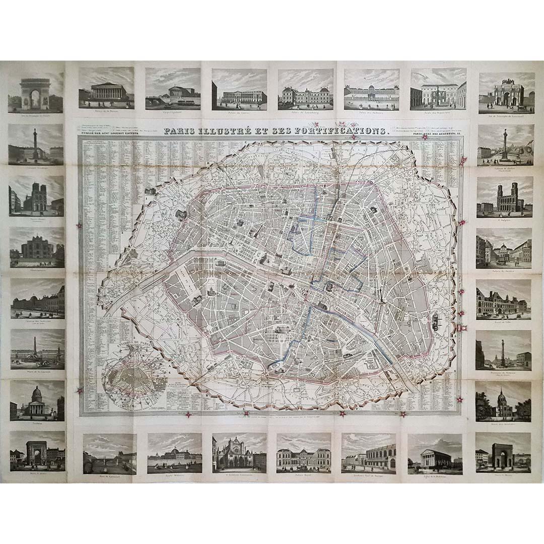
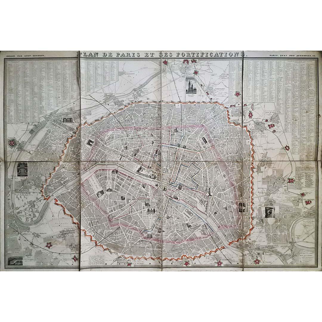
1851 Original map by Maillard - Plan de Paris et ses Fortifications
Located in PARIS, FR
In the world of cartography, maps transcend mere geography; they are historical records and works of art, encapsulating the essence of a place at a specific moment in time. The 1851 ...
Category
1850s Prints and Multiples
Materials
Paper, Lithograph, Linen

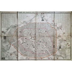
1848 Original map by Maillard - Plan de Paris et ses Fortifications
Located in PARIS, FR
In the realm of cartography, maps serve as both practical tools and artistic representations, encapsulating the essence of a place at a specific moment in time. The 1848 vintage map,...
Category
1840s Prints and Multiples
Materials
Paper, Linen, Lithograph
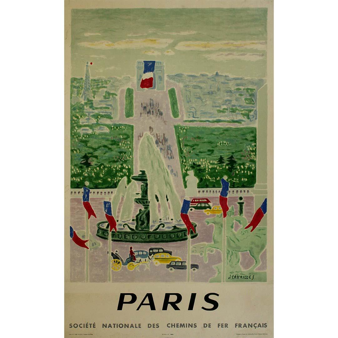
1957 original poster by Jules Cavaillès SNCF to Paris
By Jules Cavailles
Located in PARIS, FR
Jules Cavaillès' 1957 SNCF poster is a visual masterpiece that beckons travelers to embark on a colorful and artistic journey to Paris and explore the beauty of France by train. This...
Category
1950s Prints and Multiples
Materials
Paper, Linen, Lithograph

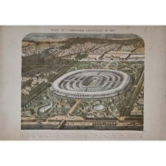
1867 original lithography for the Exposition Universelle in Paris
Located in PARIS, FR
The 1867 Exposition Universelle in Paris was one of the grandest World’s Fairs of the 19th century, showcasing industrial progress, cultural achievements, and artistic excellence. Th...
Category
1860s Prints and Multiples
Materials
Paper, Lithograph
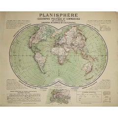
Circa 1900 original poster Planisphère de géographie politique et commercial
Located in PARIS, FR
This circa 1900 original poster, "Planisphère de Géographie Politique et Commerciale," is a fascinating artifact of early 20th-century cartography, created by H. Bouthillier de Beaum...
Category
Early 1900s Prints and Multiples
Materials
Lithograph, Paper
You May Also Like
Paris and Surroundings – Antique Map by Gall and Inglis, Published 1843
Located in Langweer, NL
Antique Map of Paris and Environs by Gall and Inglis, 1843
This finely detailed map titled "Gall & Inglis’ Plan of Paris and Environs" was published in 1843 and provides a fascinati...
Category
Antique Mid-19th Century English Maps
Materials
Paper

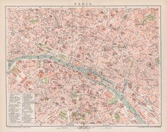
Paris, France. Antique Map City Plan Chromolithograph, circa 1895
Located in Melbourne, Victoria
'Paris'
Colour lithograph. 1895.
250mm by 305mm (sheet).
Late 19th century German lithograph plan of Paris, France.
Central vertical fold. Printed street index on the reverse o...
Category
Late 19th Century Victorian More Prints
Materials
Lithograph
France in Departments - Lithograph - 1872
Located in Roma, IT
France in Departments is a map realized by an artist of the 19th century.
Lithograph, printed in 1872 by Milliam Mackenzie, London.
Category
1870s Modern Figurative Prints
Materials
Lithograph
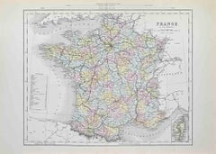
France in Departments - Lithograph - 1872
Located in Roma, IT
France in Departments is an artwork realized by an artist of the 19th century.
Lithograph, printed in 1872 by Milliam Mackenzie, London.
Good condition.
Category
1870s Modern Figurative Prints
Materials
Lithograph

Antique Map of France by Lapie, 1842
Located in Langweer, NL
Antique map titled 'Carte de France'. Map of France. This map originates from 'Atlas universel de géographie ancienne et moderne (..)' by Pierre M. Lapie and Alexandre E. Lapie. Pier...
Category
Antique Mid-19th Century Maps
Materials
Paper

Original Large Antique Map of Paris, France by John Dower, 1861
Located in St Annes, Lancashire
Fabulous monochrome map of Paris.
Vignettes of St Germain En Laye, Saint Cloud, Versailles and Fontainbleau.
Unframed.
Drawn by J.Dower.
Lithography by Weller. 4 sheets joined to...
Category
Antique 1860s English Victorian Maps
Materials
Paper
