Items Similar to 1899 "Plan des Tramways de Paris" by Wuhrer - Paris's public transportation

Want more images or videos?
Request additional images or videos from the seller
1 of 8
Wuhrer1899 "Plan des Tramways de Paris" by Wuhrer - Paris's public transportation1899
1899
$1,684.69
£1,247.26
€1,400
CA$2,332.56
A$2,546.60
CHF 1,335.08
MX$30,929.47
NOK 16,672.97
SEK 15,743.73
DKK 10,658.50
About the Item
The 1899 "Plan des Tramways de Paris" by Wuhrer is a fascinating snapshot of Paris's public transportation landscape at the dawn of the 20th century. This meticulously crafted map delineates the extensive network of tramway lines that crisscrossed the city, each route marked in detail to aid both residents and visitors in navigating the bustling metropolis.
The Belle Époque, during which this map was produced, was a period of significant growth and modernization in Paris. The city's population was expanding rapidly, and with it came the need for a more efficient means of urban transport. Tramways emerged as a vital solution, connecting neighborhoods and making the city's many attractions more accessible. These electric trams were a symbol of technological progress, replacing the horse-drawn carriages of earlier years and setting the stage for the future of public transit.
The visual design of Wuhrer's map reflects the elegance of the time, with carefully rendered street layouts, color-coded lines, and a detailed legend that provides information about each tramway route. The map not only served a practical purpose but also acted as a piece of visual art, capturing the intricate web of connectivity that defined Paris's transport system.
This historical artifact is more than just a transportation guide; it offers insight into the city's growth, the importance of public infrastructure, and the ways in which mobility shaped the social and economic fabric of Paris. The tramways were integral to everyday life, facilitating commerce, tourism, and the daily commute for thousands of Parisians.
In the context of today, the "Plan des Tramways de Paris" stands as a testament to the city's rich history of innovation in public transport, a legacy that continues with Paris's modern metro and bus systems. It serves as a reminder of how urban planning and transportation have evolved to meet the needs of a dynamic, ever-changing city.
- Creator:Wuhrer
- Creation Year:1899
- Dimensions:Height: 24.41 in (62 cm)Width: 33.86 in (86 cm)
- Medium:
- Period:
- Condition:Good condition, slight creases, tears.
- Gallery Location:PARIS, FR
- Reference Number:1stDibs: LU1792215653142
About the Seller
5.0
Gold Seller
Premium sellers maintaining a 4.3+ rating and 24-hour response times
Established in 2021
1stDibs seller since 2022
174 sales on 1stDibs
Typical response time: 2 hours
- ShippingRetrieving quote...Shipping from: PARIS, France
- Return Policy
Authenticity Guarantee
In the unlikely event there’s an issue with an item’s authenticity, contact us within 1 year for a full refund. DetailsMoney-Back Guarantee
If your item is not as described, is damaged in transit, or does not arrive, contact us within 7 days for a full refund. Details24-Hour Cancellation
You have a 24-hour grace period in which to reconsider your purchase, with no questions asked.Vetted Professional Sellers
Our world-class sellers must adhere to strict standards for service and quality, maintaining the integrity of our listings.Price-Match Guarantee
If you find that a seller listed the same item for a lower price elsewhere, we’ll match it.Trusted Global Delivery
Our best-in-class carrier network provides specialized shipping options worldwide, including custom delivery.More From This Seller
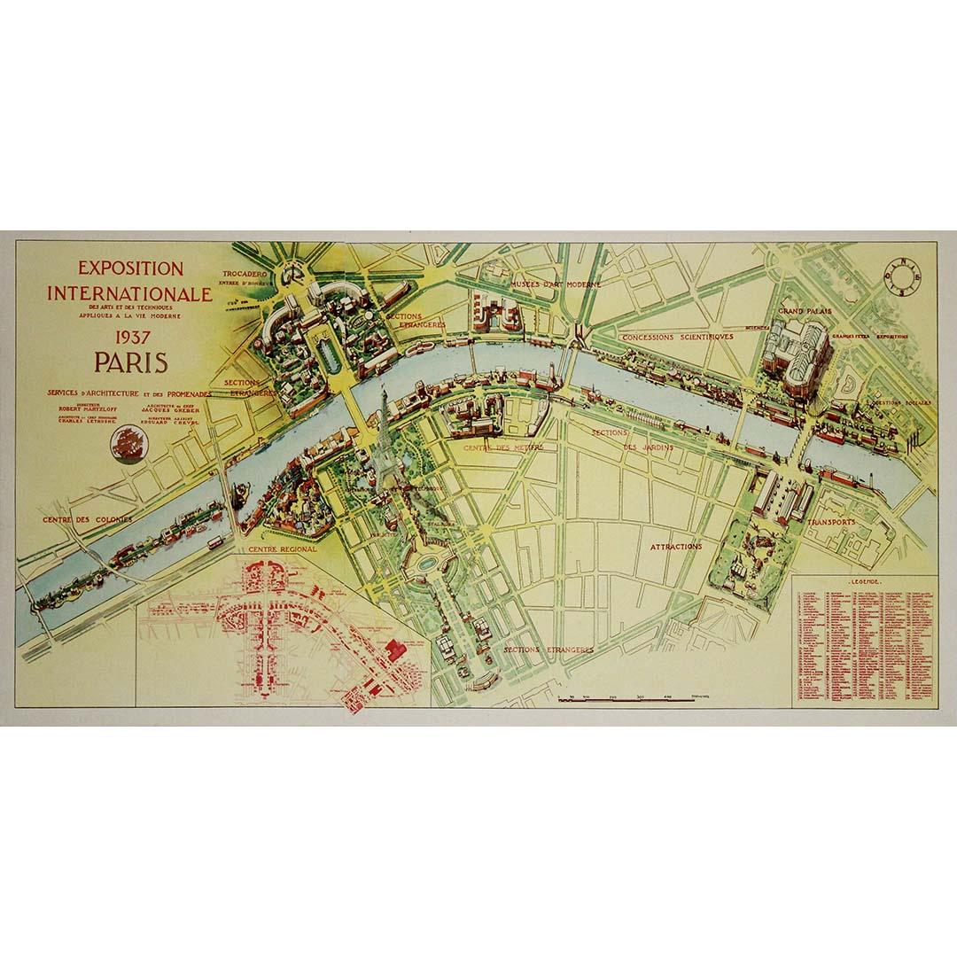
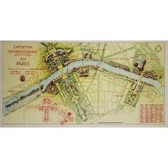
View All1937 original poster illustrated map of the Exposition Internationale
Located in PARIS, FR
This 1937 original poster presents a detailed illustrated map of the Exposition Internationale des Arts et Techniques dans la Vie Moderne, held in Paris. The International Exposition...
Category
1930s Prints and Multiples
Materials
Linen, Paper, Lithograph
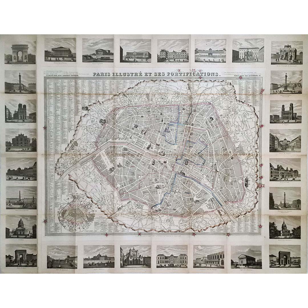
1851 Original map by Maillard - Plan de Paris et ses Fortifications
Located in PARIS, FR
In the world of cartography, maps transcend mere geography; they are historical records and works of art, encapsulating the essence of a place at a specific moment in time. The 1851 ...
Category
1850s Prints and Multiples
Materials
Paper, Lithograph, Linen

1848 Original map by Maillard - Plan de Paris et ses Fortifications
Located in PARIS, FR
In the realm of cartography, maps serve as both practical tools and artistic representations, encapsulating the essence of a place at a specific moment in time. The 1848 vintage map,...
Category
1840s Prints and Multiples
Materials
Paper, Linen, Lithograph
1957 original poster by Jules Cavaillès SNCF to Paris
By Jules Cavailles
Located in PARIS, FR
Jules Cavaillès' 1957 SNCF poster is a visual masterpiece that beckons travelers to embark on a colorful and artistic journey to Paris and explore the beauty of France by train. This...
Category
1950s Prints and Multiples
Materials
Paper, Linen, Lithograph
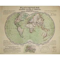
Circa 1900 original poster Planisphère de géographie politique et commercial
Located in PARIS, FR
This circa 1900 original poster, "Planisphère de Géographie Politique et Commerciale," is a fascinating artifact of early 20th-century cartography, created by H. Bouthillier de Beaum...
Category
Early 1900s Prints and Multiples
Materials
Lithograph, Paper
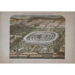
1867 original lithography for the Exposition Universelle in Paris
Located in PARIS, FR
The 1867 Exposition Universelle in Paris was one of the grandest World’s Fairs of the 19th century, showcasing industrial progress, cultural achievements, and artistic excellence. Th...
Category
1860s Prints and Multiples
Materials
Paper, Lithograph
You May Also Like
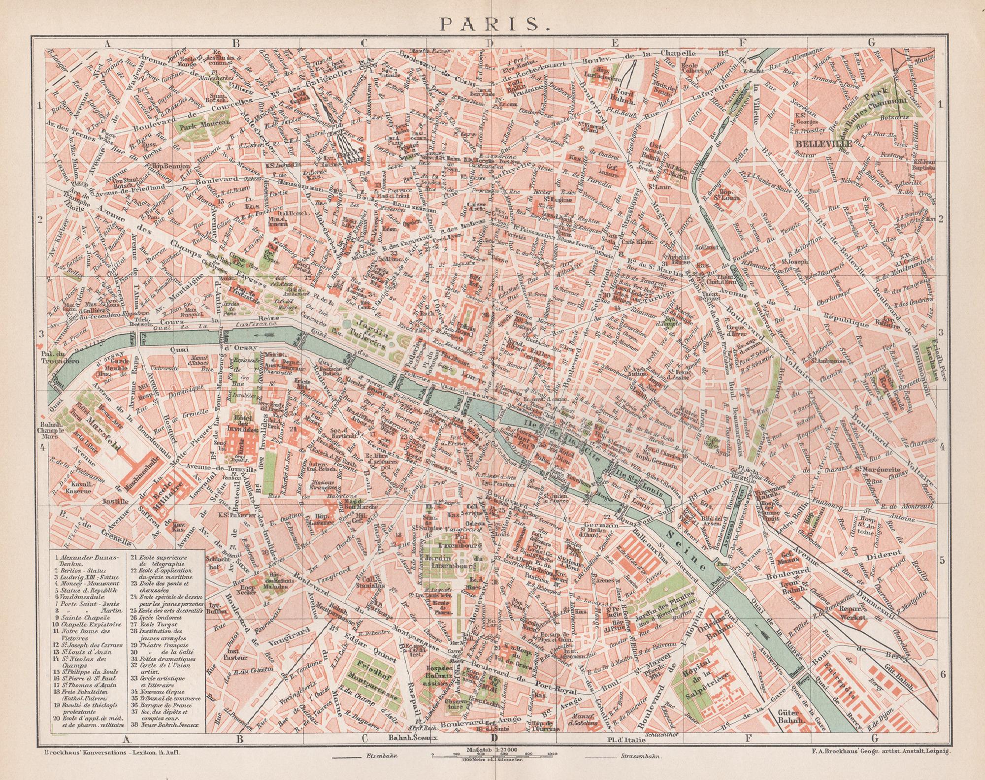
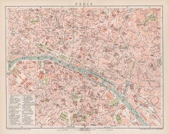
Paris, France. Antique Map City Plan Chromolithograph, circa 1895
Located in Melbourne, Victoria
'Paris'
Colour lithograph. 1895.
250mm by 305mm (sheet).
Late 19th century German lithograph plan of Paris, France.
Central vertical fold. Printed street index on the reverse o...
Category
Late 19th Century Victorian More Prints
Materials
Lithograph
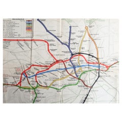
Original Antique Map of The London Underground. 1911
Located in St Annes, Lancashire
Superb map of The London Underground
Published by Ward Lock, 1911
Folding map. Printed on paper
Unframed.
Good condition/ Minor repair to an edge tear on right edge ( shown in ...
Category
Vintage 1910s English Maps
Materials
Canvas, Paper
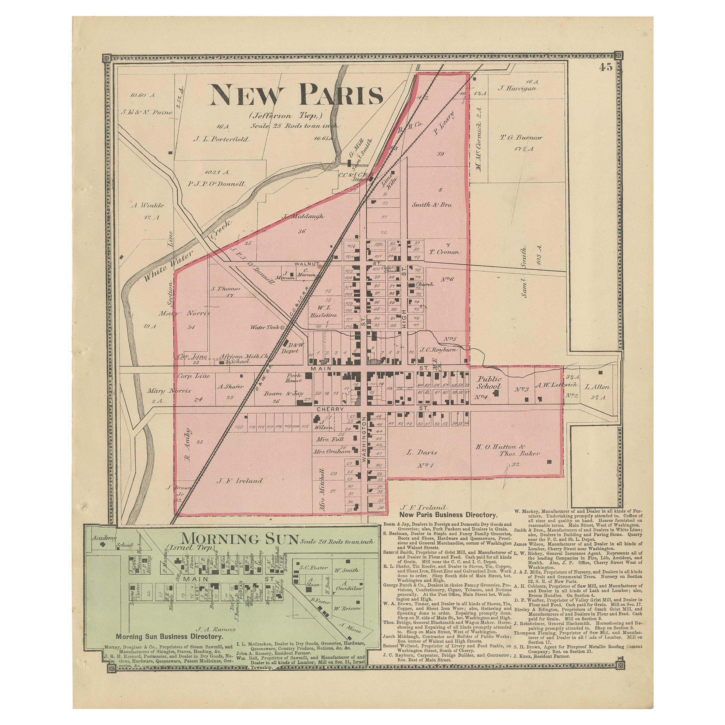
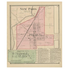
Antique Map of New Paris and Morning Sun, 1871
Located in Langweer, NL
Antique map titled 'New Paris, Morning Sun'. Original antique map of villages and communities of Ohio. This map originates from 'Atlas of Preble County Ohio' by C.O. Titus. Published...
Category
Antique Late 19th Century Maps
Materials
Paper
$240 Sale Price
20% Off
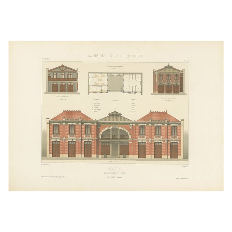
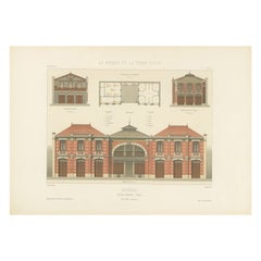
La Brique Architectural Print – Parisian Stables on Avenue Raphaël, c.1900
Located in Langweer, NL
La Brique Architectural Print – Parisian Stables on Avenue Raphaël, c.1900
This finely detailed architectural lithograph presents the elegant design of Écuries Avenue Raphaël Paris,...
Category
20th Century French Prints
Materials
Paper
Paris and Surroundings – Antique Map by Gall and Inglis, Published 1843
Located in Langweer, NL
Antique Map of Paris and Environs by Gall and Inglis, 1843
This finely detailed map titled "Gall & Inglis’ Plan of Paris and Environs" was published in 1843 and provides a fascinati...
Category
Antique Mid-19th Century English Maps
Materials
Paper

Large French Paris Metro Map 1960s
Located in Moreno Valley, CA
Large French Paris Metro Map 1960s.
A large Vintage French framed map of the Parisian Metro from the mid-20th century.
Featuring a Paris metro map from the midcentury period showing ...
Category
Mid-20th Century French Industrial Prints
Materials
Wood, Paper
More Ways To Browse
Antique Transits
Antique Tram
Men Of The Day
Midcentury Modern Architecture Print
Monte Carlo Poster
Nu Bleu
Picasso Vallauris Print
Retro Louis Vuitton Posters
Robert Kipniss Lithograph
Shepard Fairey Peace
Texas Lithograph
Valparaiso Chile
Vintage Safety Posters
Vintage Tomato Art
Yuri Gagarin
American Indian Lithographs
Andrea Vesalio
Automotive Design