Ifpda International Fine Print Dealers Association
International Fine Print Dealers Association (IFPDA)
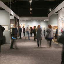
Launched in 1987, the International Fine Print Dealers Association has continually set the bar for quality and ethics while promoting prints as original works of art to generations of collectors, curators and art lovers. With over 160 members in 13 countries, the IFPDA is a worldwide community of leading dealers and editions publishers who represent the full spectrum of printmaking. Each year, the IFPDA hosts the IFPDA Print Fair in New York, the only major fair dedicated to fine-art prints.
to
5
2,635
947
883
782
721
361
333
323
318
299
229
208
206
186
163
161
149
136
133
84
83
78
60
54
39
35
27
26
23
20
17
16
12
11
10
10
9
7
6
5
5
5
5
4
4
3
3
3
3
2
2
1
1
1
1
1
2
1
1
1
Period: 1630s
The Infant Christ and St. John Playing with the Lamb, after Peter Paul Rubens
By Christoffel Jegher
Located in Fairlawn, OH
The Infant Christ and St. John Playing with the Lamb,
after Peter Paul Rubens (1577-1640)
Woodcut, trimmed and tipped to support
Initialed in the block bottom ...
Category
1630s Old Masters Ifpda International Fine Print Dealers Association
Materials
Woodcut

PERU
By Johannes Jansson
Located in Santa Monica, CA
JOHANNES JANSSON (1588 - 1664)
PERU, engraving with early coloring. Platemark 15 1/8 x 19 3/8 inches, sheet 17 x 20 1/2
A nice example of one of the earliest maps of Peru. From the ...
Category
1630s Old Masters Ifpda International Fine Print Dealers Association
Materials
Engraving

Scene II, Le Nozze Degli Dei
By Stefano Della Bella
Located in Fairlawn, OH
Scene II, Le Nozze Degli Dei
Etching, 1637
Signed in the plate lower left
The scene depicts the initial moment when Diana is revealed, surrounded by her nymphs, celebrating a success...
Category
1630s Old Masters Ifpda International Fine Print Dealers Association
Materials
Etching

Mysteries of the Passion
By Jacques Callot
Located in New York, NY
Jacques Callot (1592-1635), Mysteries of the Passion (Variae Tum Passionis Christi, Tum Vitiae Beatae Mariae Virginis), complete set of 20 etchings plus the frontispiece by Abraham Bosse (Reference Meaume 31). c. 1631. Reference: Lieure 679-698, second state (of 2). In very good condition, archival mounting.
A fine set of these small etchings, printed on 5 plates/sheets of laid paper, with margins, 3 of the plates with partial Crown watermarks (possibly Lieure 45).
The set of 20 etchings includes 7 in circular format, with a diameter of 1 1/4 inches; 7 larger ovals with a length of 1 7/8 inches, and 6 smaller ovals with a length of 1 1/2 inches. These are on 5 plates, with margins outside of the etchings of about 5/8 inches. The frontispiece is 3 1/2 x 3, the sheet 4 1/2 x 4 3/4 inches.
The 20 etchings of the series include:
Plate with 6 Scenes (Lieure 685-690): Ovals: Adoration of the Shepherds, Visitation, Adoration of the Magi; Circles: Descent into Limbo, Descent of the Holy Spirit, Entombment
2 Plate with 4 Scenes Each (Lieure 691-698): Ovals: Annunciation, Christ Among Teachers, Circumcision, Presentation; Circles: Resurrection, Crucifixion, Descent from the Cross, Transfiguration
2 Plates with 3 Oval Scenes Each (Lieure 679-684): Carrying of the Cross, Presentation to the People, Crowning with Thorns, Flagellation, Christ Before Pilate...
Category
1630s Old Masters Ifpda International Fine Print Dealers Association
Materials
Etching

Les Grandes Miseres de la Guerre
By Jacques Callot
Located in New York, NY
Jacques Callot (1592-1635), Les Grandes Miseres de la Guerre, etchings, 1633, the complete set of 18. Lieure 1339-56, the frontispiece third state (of 3), th...
Category
1630s Old Masters Ifpda International Fine Print Dealers Association
Materials
Etching

Related Items
Suite of 12 Views of Italy
By Franz Weirotter
Located in New York, NY
Franz Weirotter (1730-1771), Suite of 12 Views of Italy, etchings, 1759 [most signed in the plate by Weirotter]. Reference: Nagel 5. 10 printed in pairs on one sheet; one on a small...
Category
1750s Old Masters Ifpda International Fine Print Dealers Association
Materials
Etching

Frankfort, Germany: A 16th Century Hand-colored Map by Braun & Hogenberg
By Franz Hogenberg
Located in Alamo, CA
This is a 16th century original hand-colored copperplate engraved map of Frankfort, Germany entitled "Francenbergum, vel ut alij Francoburgum Hassiae Opp" by Georg Braun & Franz Hogenberg, from their famous city atlas "Civitates Orbis Terrarum", published in Cologne, Germany in 1595.
This is an English translation of an excerpt from the original text in the atlas:
"Frankenberg or, according to others, Francoburgum, a town in Hesse. Charlemagne vested the town of Frankenberg with many freedoms and privileges, which it still enjoys to this day, and on account of its valiant and victorious soldiers awarded a signet, upon which there formerly appeared a golden castle with a tower, together with the letter F and a golden crown.
Frankenberg, seen here from the northeast, lies on a hill above the River Eder. The hillside is covered with fields neatly separated by bushes and fences. Soaring above the town is the massive Liebfrauenkirche, which was modelled on St Elizabeth's church in Marburg. The New Town was founded in 1335 at the foot of the hill (right) and merged with the Old Town as late as 1556. Frankenberg was founded by Conrad of Thuringia in 1233/34 to prevent the archbishops of Mainz from expanding their sphere of influence...
Category
16th Century Old Masters Ifpda International Fine Print Dealers Association
Materials
Engraving

Fabricius (Ponte Cestio) Bridge : Framed 18th C. Piranesi Architectural Etching
By Giovanni Battista Piranesi
Located in Alamo, CA
This framed 18th century etching by Giovanni Battista Piranesi is entitled "Dimostransi nella Tav. presente la Pianta, ed Elevazione del Ponte, oggi detto Quattro Capi egli è antichissimo, e chiamavasi Fabrizio da L. Fabrizio Presid. delle Strade, che lo fabbrico' nel fine della Repubblica. "(The Plan and Elevation of the Bridge, today called Quattro Capi. The architect is very ancient, and was called Fabrizio da L. Fabrizio Presid. delle Strade, who built it at the end of the Republic). This is plate 18 in volume 4 of Piranesi's "Le antichita romane opera di Giambatista Piranesi architetto veneziano" (Roman antiquities by Giambatista Piranesi Venetian architect). It was published in Rome in 1756-1757.
This etching depicts the plan and elevation of the bridge now called the Ponte dei Quattoro Capi or Ponte Cestio (Bridge of the Four Heads), which in antiquity was called the Bridge of Fabricius after L. Fabricius, the Superintendant of the Streets who built it at the end of the Republic, around 62 BC. It was also been known in the Middle Ages as ‘Ponte Giudeo’ (Bridge of the Jews). The bridge crossed from the left bank or northeast side of the Tiber River to Tiber Island...
Category
1750s Old Masters Ifpda International Fine Print Dealers Association
Materials
Etching


H 25.63 in W 30.5 in D 0.36 in
St. Peter's Square in Basel: 17th Century Engraving by Matthäus Merian
By Matthäus Merian the Elder
Located in Alamo, CA
"Campus Divi Petri qui est Basileae" (St. Peter's Platz in Basel) is a 17th century engraving by the old master engraver Matthäus Merian the Elder...
Category
1650s Old Masters Ifpda International Fine Print Dealers Association
Materials
Engraving

H 15.25 in W 19.94 in D 0.63 in
The New Testament /// Old Masters Biblical Religious Engraving Dutch Angel Art
By Michael Burghers
Located in Saint Augustine, FL
Artist: Michael Burghers (Dutch, c.1647/1648-1727)
Title: "The New Testament"
Portfolio: Holy Bible
*Signed by Burghers in the plate (printed signature) lower left
Year: 1680
Medium: Original Etching and Engraving with recent Hand-Color on watermarked laid paper
Limited edition: Unknown
Printer: John Baskett, London?, UK
Publisher: Moses Pitt, Peter Parker, and Thomas Guy, London?, UK
Sheet size (irregular margins): 17.25" x 10.5"
Image size: 14.75" x 9.5"
Condition: Uneven trimming and light edgewear in margins. One small tear entering image lower right which has been skillfully repaired with added backing paper with archival tape from verso. It is otherwise a strong impression in very good condition with strong colors
Very rare
Notes:
Provenance: private collection - Cotswolds, UK. Comes from the 1685 "Holy Bible" portfolio. John Baskett was deemed printer to the King's most Excellent Majesty, for Great Britain and to the University of Oxford. Large unidentified watermark within center of sheet. There is an example of this work in the permanent collection of the British Museum in London, UK.
In the foreground, John the Evangelist, holding a pen and writing...
Category
1680s Old Masters Ifpda International Fine Print Dealers Association
Materials
Watercolor, Engraving, Etching, Laid Paper, Intaglio

Piquier Allemand (German Pikeman) /// Old Masters Figurative Man Soldier Antique
Located in Saint Augustine, FL
Artist: Armand Joseph Lallemand (French, 1810-1871)
Title: "Piquier Allemand (German Pikeman)"
Portfolio: Gazette des Beaux-Arts
Year: 1866
Medium: Original Etching on cream laid pap...
Category
1860s Old Masters Ifpda International Fine Print Dealers Association
Materials
Intaglio, Etching, Laid Paper

View of Emden, Germany: A 16th Century Hand-colored Map by Braun & Hogenberg
By Franz Hogenberg
Located in Alamo, CA
This is a 16th century original hand-colored copperplate engraved map of a bird's-eye View of Embden, Germany entitled " Emuda, vulgo Embden vrbs Frisia orientalis primaria" by Georg Braun & Franz Hogenberg, in volume II of their famous city atlas "Civitates Orbis Terrarum", published in Cologne, Germany in 1575.
This is a beautifully colored and detailed map of Emden, a seaport in northwestern Germany, along the Ems River and perhaps portions of over Dollart Bay, near the border with the Netherland. The map depicts a bird's-eye view of the city from the southwest, as well as a view of the harbor and an extensive system of canals. Numerous ships of various sizes, as well as two rowboats containing numerous occupants are seen in the main waterway in the foreground and additional boats line two canals in the center of the city. Two men and two women are shown on a hill in the foreground on the right, dressed in the 16th century style of nobility. Two ornate crests are included in each corner. A title strap-work cartouche is in the upper center with the title in Latin. The crest on the right including Engelke up de Muer (The Little Angel on the Wall) was granted by Emperor Maximilian I in 1495.
This is an English translation of an excerpt of Braun's description of Embden: "In Emden, the capital of East Frisia, rich merchants live in very fine houses. The city has a broad and well-situated harbour, which in my opinion is unique in Holland. Frisia and the whole of the Netherlands, for the ships can anchor here right under the city walls. They have also extended the harbour as far as the New Town, so that up to 400 ships can now find shelter here when the sea is rough."
The emphasis on the harbor and waterways within the city highlights the importance of Emden's place as a seaport at this time. Embden developed from a Dutch/Flemish trading settlement in the 7th-8th centuries into a city as late as late 14th century. In 1494 it was granted staple rights, and in 1536 the harbour was extended. In the mid-16th century Emden's port was thought to have the most ships in Europe. Its population then was about 5,000, rising to 15,000 by the end of the 16th century. The Ems River flowed directly under the city walls, but its course was changed in the 17th century by the construction of a canal. Emden has canals within its city limits, a typical feature of Dutch towns, which also enabled the extension of the harbor. In 1744 Emden was annexed by Prussia and is now part of Germany. It was captured by French forces in 1757 during the Seven Years' War, but recaptured by Anglo-German forces in 1758. During the Napoleonic French era, Emden and the surrounding lands of East Frisia were part of the short-lived Kingdom of Holland.
References:Van der Krogt 4, 1230, State 2; Taschen, Braun and Hogenberg...
Category
16th Century Old Masters Ifpda International Fine Print Dealers Association
Materials
Engraving

Tournai (Tournay), Belgium: A 16th Century Hand-colored Map by Braun & Hogenberg
By Franz Hogenberg
Located in Alamo, CA
This is a 16th century original hand-colored copperplate engraved map of Tournai, Belgium, entitled "Tornacum" by Georg Braun & Franz Hogenberg, in volume IV of their famous city atlas "Civitates Orbis Terrarum", published in Cologne or Augsberg, Germany in 1575. The map provides a bird's-eye view of the walled city of Tournai, the second oldest city in Belgium. It lies approximately one hour by car southwest of Brussels or from Ghent. The names of thirty of its streets, prominent buildings, churches and squares are listed in a key within a strap-work cartouche in the lower left. These locations are numbered in the key corresponding to their locations on the map.
This colorful map of Tournai (Tornacum or Tournay as it was called in the 16th century) includes the title in Latin in a cartouche in the upper center. Three crests are present across the upper map. A man and two woman are standing on a hill in the foreground in the lower right dressed in the style of 16th century upper class residents of the town.
This is an English translation of an excerpt of Braun's description of Tornai: “Tornacum or Turnacum is a city in Gallia Belgica, situated on the Schelde in the territory of the Nervii, called Tournai by its French inhabitants, but Dorneck by the Germans. Tournai has always been a large and powerful city, with an abundance of goods and commercial activities and wonderfully resourceful craftsmen, who invent new articles every day, and although some of these go out of use they constantly conceive of other new things, both useful and delightful, so that they have at all times something that provides work and a means of livelihood for the poor."
ReferencesVan der Krogt 4, 4435, State 1; Taschen, Braun and Hogenberg...
Category
16th Century Old Masters Ifpda International Fine Print Dealers Association
Materials
Engraving

Ireland: A Framed 17th Century Hand-colored Map by Jan Jannson
By Johannes Janssonius
Located in Alamo, CA
This is a 17th century hand-colored map entitled "Hibernia Regnum Vulgo Ireland" by Johannes Janssonius's (Jan Jansson), published in Amsterdam in 1640. This highly detailed map depicts the Emerald Isle with an extensive display of towns, roads, mountains, rivers, lakes and county borders, etc. It includes two decorative cartouches on the left. The title cartouche includes the Irish harp and the second, in the upper left, includes a lion wearing a crown on the left, a unicorn on the right and a coat-of-arms in the middle, which includes another Irish harp. A distance scale is seen in the lower right, augmented with two putti. The map is embellished with three sailing ships and a sea monster. Western portions of Scotland and England...
Category
Mid-17th Century Old Masters Ifpda International Fine Print Dealers Association
Materials
Engraving

H 17.88 in W 22 in D 0.75 in
Canterbury: An Original 16th C. Framed Hand-colored Map by Braun & Hogenberg
By Franz Hogenberg
Located in Alamo, CA
This is a framed 16th century map and city view of Canterbury, England entitled "Cantuarbury" by Braun & Hogenburg, from their famous landmark atlas of city views 'Civitates Orbis Terrarum' (Atlas of the Cities of the World), which was first published in Cologne, Germany in 1572. The map of Canterbury was first published in 1588. It depicts a detailed birdseye view of the completely walled and fortified city of Canterbury, with its cathedral the most prominent feature. The coat of arms of England, Canterbury, and the Archbishop of Canterbury are included.
This beautifully hand-colored map is presented in a gold-colored wood frame with a beaded inner trim and a paprika-colored mat that highlights details in the map. The frame measures 18.75" high by 22.25" wide by 0.875" deep. There is a central vertical fold, as issued. The map is in excellent condition.
Braun and Hogenberg's 'The Civitates Orbis Terrarum' was the second atlas of maps ever published and the first atlas of cities and towns of the world. It is one of the most important books published in the 16th century. Most of the maps in the atlas were engraved by Franz Hogenberg and the text, with its descriptions of the history and additional factual information of the cities, was written by a team of writers and edited by Georg Braun. The work contained 546 bird-eye views and map views of cities and towns from all over the world. It gave graphic representation of the main features of the illustrated cities and towns, including the buildings and streets. Although the ordinary buildings are stylized, the principal buildings are reproduced from actual drawings created on location. The principal landmarks and streets can still be recognized today. In addition, the maps often include the heraldic arms of the city, the nature of the surrounding countryside, the important rivers, streams and harbors, even depicting stone bridges, wooden pontoons, flat-bottomed ferries, ships and working boats, wharves and jetties, as well as land-based activities, including horsemen, pedestrians, wagons, coaches, and palanquins. Small vignettes are often included which illustrate the trade, occupations and habits of the local inhabitants, such as agriculture, paper-making and textiles, as well as local forms of punishment, such as gibbets, wheels, floggings etc. Large figures dressed in their local costume are often presented out of proportion in the foreground. The aim of the authors was to give as much information as possible in a pleasing visual form. They succeeded in creating maps that were both informative and decorative works of art. The atlas is a wonderful glimpse of life in medieval Europe.
Georg Braun (1541-1622) was German Catholic...
Category
16th Century Old Masters Ifpda International Fine Print Dealers Association
Materials
Engraving

H 18.75 in W 22.25 in D 0.88 in
Roman Hills, Aqueducts and Roads: An Early 18th Century Map by Jan Goeree
Located in Alamo, CA
This richly engraved map of Rome and its environs entitled "Urbis Cum Vicis Seu Pagis Adiacentibus Dissertationi III De Aq et Aqueaed Veteris Promae Praemissa Authore Raph Fabretto G...
Category
Early 18th Century Old Masters Ifpda International Fine Print Dealers Association
Materials
Engraving

Cartusia Bruxellensis Monastery in Brussels: A 17th C. Hand-colored Engraving
By Lucas Vorsterman the Younger
Located in Alamo, CA
This is a 17th century hand-colored copperplate engraving entitled "Cartusia Bruxellensis" by Lucas Vorsterman, the Younger, after a drawing by Jacob van Werden or Jacques van Weerden, published in 1659 in Antonius Sanderus' book 'Chorographia sacra Brabantiae sive celebrium aliquot in ea provincia ecclesiarum et coenobiorum descriptio . . . Brussel' (A sacred chorography of Brabant, or a description of several famous churches and convents in that province). It also appeared in other publications by Sanderus. In the 17th century, Brussels was within the Duchy of Brabant.
This engraving depicts a bird's-eye view of the Scheut Carthusian Monastery in Brussels. Scheut is a district of Anderlecht, a municipality of Brussels, Belgium. The monastery housed monks, who took a vow of silence, in 20 rooms. There is a central courtyard with trees and shrubs. Monks are depicted strolling along its pathways. The cells for the friars are in the middle the cloister. There are people along the streets in the foreground and to the right of the large, imposing monastery. Some are on horseback, others are walking. In the lower right, what appears to be a dog pulls a small cart containing barrels, possibly of beer or wine. Districts and neighborhoods are labelled in the background, including Scheut, Anderlecht and Ransfort. A very ornate cartouche in the lower left contains Latin and the artist's attribution. Another decorative cartouche in the upper central area contains the title.
This beautifully hand-colored and detailed engraving is printed on laid, chain-linked paper with wide, full margins. The sheet measures 17.25" high and 21.25" wide. It has Latin text on the verso. It has a central vertical fold, as issued, which is reinforced on the verso. Two small spots in the lower margin may actually represent drops of watercolor paint used to color the engraving. It is otherwise in very good condition.
Antonius Sanderus (1586-1664) was a Flemish Catholic cleric and historian. He was born "Antoon Sanders", but Latinized his name like many writers and scholars of his time. He was the author of several books, including 'Chorographia Sacra Brabantiae', which was illustrated with this engraving.
Lucas Vorsterman the Younger (1624-between 1666 & 1676) was a Flemish Baroque engraver and draughtsman. He produced engravings after the work of contemporary painters and for books by Antwerp publishers.
Jacob van Werden or Jacques van Weerden (active 1643-1669), was a Flemish draughtsman, cartographer, military engineer and archer who was active in the Habsburg Netherlands. His drawings were used as designs for prints executed by various printmakers. He worked on maps, topographical views, historical scenes, portraits and book illustrations. He had a career as a military engineer and a member of the guard of the Spanish King. He advised on various military engineering projects and was an engineer of the Spanish army...
Category
Mid-17th Century Old Masters Ifpda International Fine Print Dealers Association
Materials
Engraving
